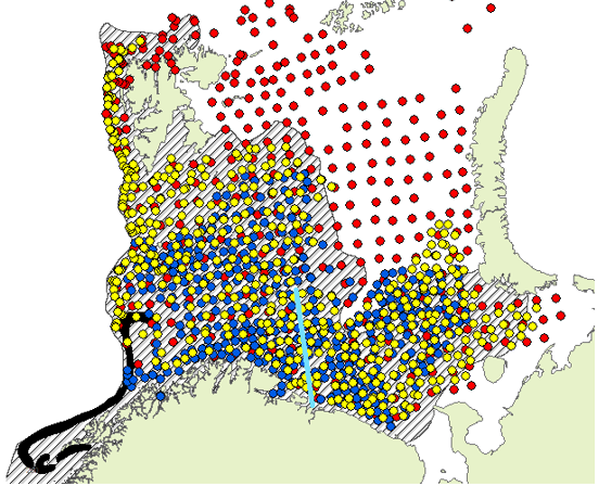
Figure 1. Map over the Barents Sea with the Kola oceanographic section (turquoise) and the distribution area (hatched) and main spawning ground (black) from the most recent official map from IMR. Circles: bottom trawl stations taken in 2011 by IMR and PINRO. Blue: Joint Norwegian Russian winter survey, note that the survey area was expanded in 2014. Red: ecosystem survey. Yellow: Russian winter survey, discontinued in 2019.