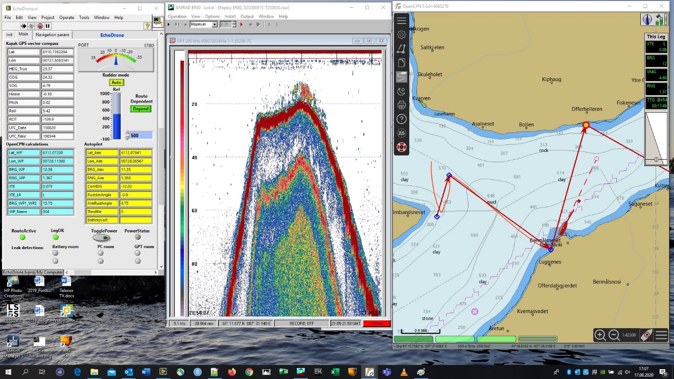
Figure
5
Screen dump of the kayak drone PC. To the left is the EchoDrone.exe
control software. In the middle EK60 software showing a school of
sprat in the current position close to the shore. To the right is the
OpenCPN chart program. The route is indicated by consecutive red
arrows. Next waypoint is indicated by a red circle with yellow fill.
The drone is shown as a red ship and the actual sailed track of the
drone is shown as a curved line.