Rapporten gir en oversikt over tokt i 2022 i regi av Havforskningsinstituttet, Universitetet i Bergen og Tromsø, og Norsk Polarinstitutt, med egne og mange av de innleide fartøyer. Den gir en kort beskrivelse av toktet og viser kurs- og stasjonskart – over CTD og trålstasjoner. Tabeller viser når de faste snittene er tatt og antall observasjoner per måned for de faste stasjonene. Toktene er innrapportert ICES (Det internasjonale råd for havforskning) i skjemaet ”Cruise Summary Report”: https://www.seadatanet.org/Metadata/CSR-Cruises. Data (og kart) fra toktene er tilgjengelig fra Norsk marint datasenter, Havforskningsinstituttet (https://www.nmdc.no). Kartene er generert av Silje Smith-Johnsen ved hjelp av ggOceanMaps av MikkoVihtakari (HI).
Report on cruises and data stations 2022
Report series:
Rapport fra havforskningen 2023-32
ISSN: 1893-4536
Published: 15.08.2023
Project No.: 4200
Research group(s):
Bentiske ressurser og prosesser
,
Bunnfisk
,
Bunnsamfunn
,
Bærekraftig utvikling
,
Norsk marint datasenter (NMD)
,
Oseanografi og klima
,
Pelagisk fisk
,
Plankton
,
Populasjonsgenetikk
,
Økosystemakustikk
,
Økosystemprosesser
Subject:
Hav, kyst og fjord ,
Klima i havet
Program:
Kystøkosystemer,
Norskehavet,
Barentshavet og Polhavet,
Nordsjøen,
Marine prosesser og menneskelig påvirkning,
Trygg og sunn sjømat ,
Miljøeffekter av akvakultur,
Fremtidens havbruk
Approved by:
Research Director(s):
Geir Huse
Program leader(s):
Bjørn Erik Axelsen, Henning Wehde, Jan Atle Knutsen og Maria Fossheim
Norsk sammendrag
Summary
The report gives an overview of cruises in 2022, by the Institute of Marine Research, University of Bergen and Tromsø and Norwegian Polar Institute, on board our research vessels and many of the hired commercial vessels. Each cruise has a short description and a track chart showing CTD and trawl stations. A table displaying the coverage of the oceanographic sections in addition to a table showing the number of observations per month for the fixed stations are included at the end of the report. Meta data about the cruises are reported to the International Council for the Exploration of the Sea (ICES) using the form “Cruise Summary Report”: https://www.seadatanet.org/Metadata/CSR-Cruises. Research data are available from the Norwegian Marine Data Centre at Institute of Marine Research (https://www.nmdc.no). Charts are generated by Silje Smith-Johnsen using ggOceanMaps by Mikko Vihtakari (IMR).
1 - Charts overview 2022 – CTD stations and trawl stations.


2 - "G. O. Sars" – Cruises 2022
| Cruise no | Period | Purpose | Area | CTD st.no | Trawl st.no |
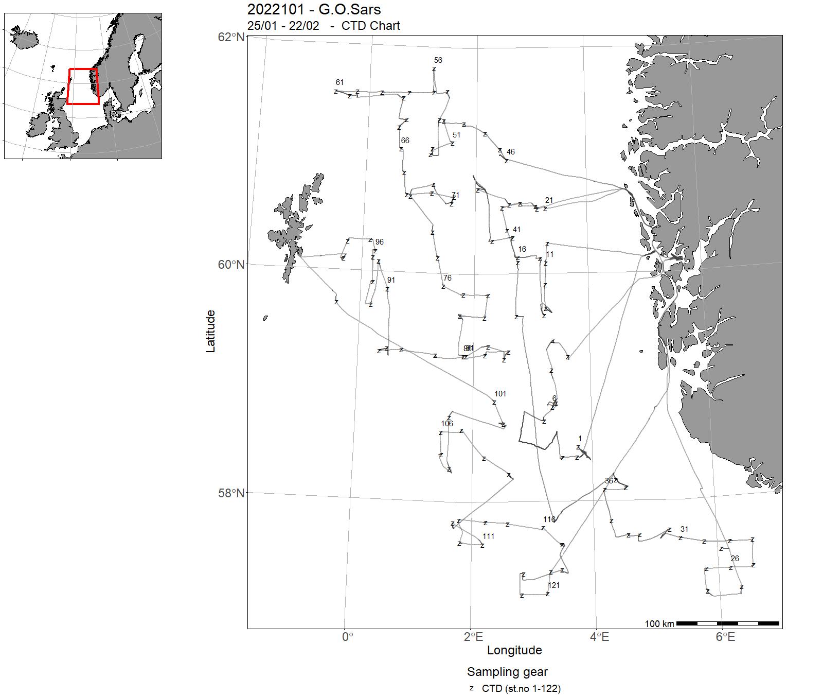
| 2022101 | 25/01 - 22/02 | The main objectives of the IBTS Q1 bottom trawl survey coordinated by ICES/IBTSWG are: to determine the distribution and relative abundance of prerecruits of the main commercial species with a view of deriving recruitment indicesto monitor changes in the stocks of commercial fish species independently of commercial fisheries datato monitor the distribution and relative abundance of all fish species and selected invertebratesto collect data for the determination of biological parameters for selected speciesto collect hydrographical and environmental informationto determine the abundance and distribution of herring and other fish larvae as well as fish eggs. Project name: Quarter 1 International Bottom Trawl Survey in the North Sea (IBTS-NS) Coordinating body: ICES/IBTSWG | North Sea | 1-122 | 1-52 |
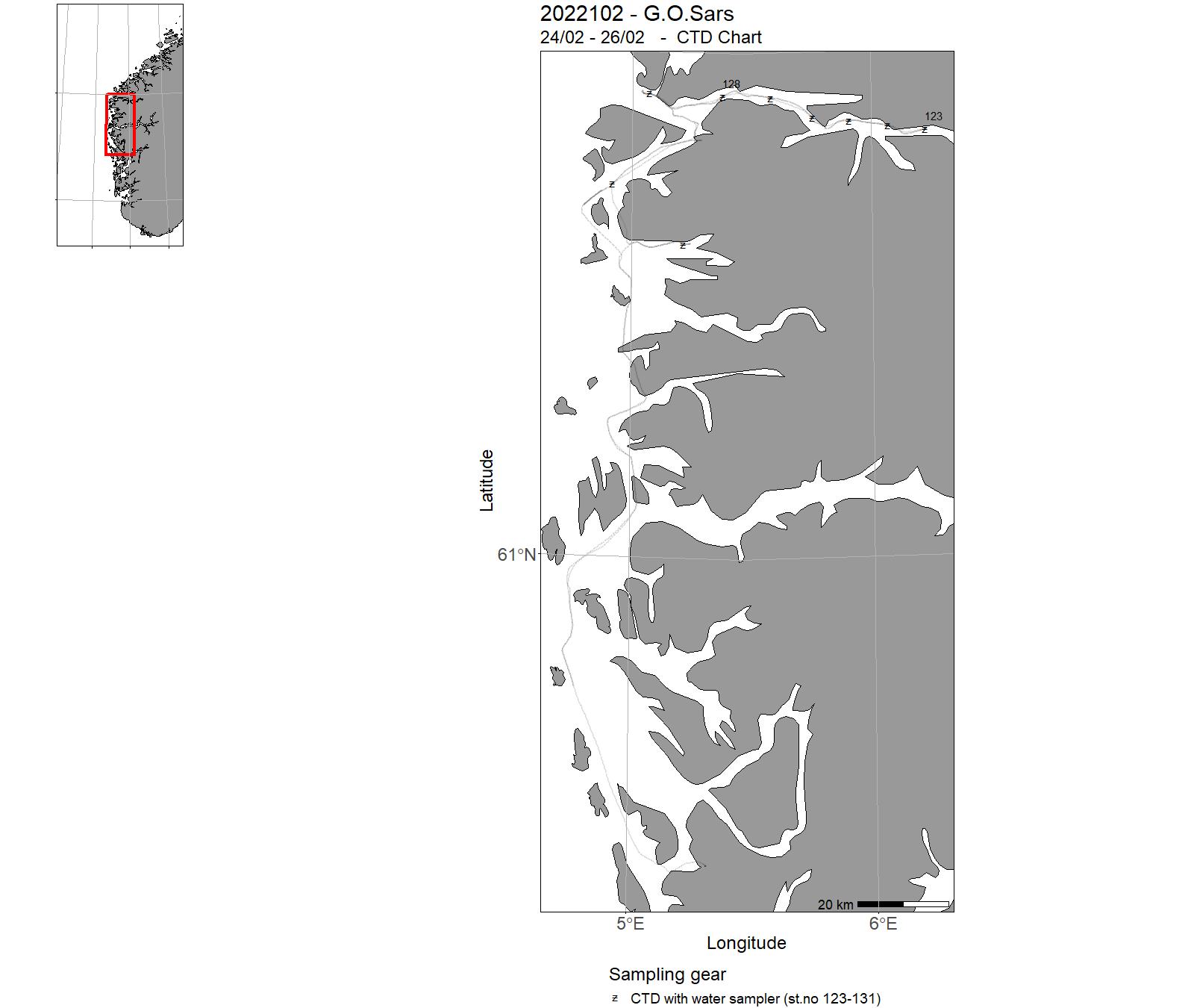
| 2022102 | 24/02 - 26/02 |
2022-GEO-004: Formålet med kurset er å gi studenter innenfor maringeologiske fagfelt opplæring i data innsamling og analysering av marine data.
|
North Sea | 123-131 | - |
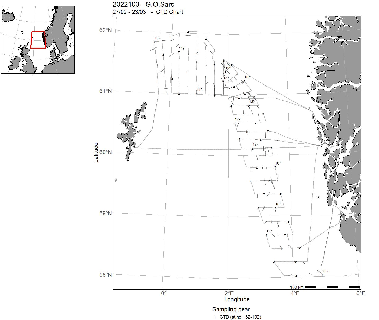
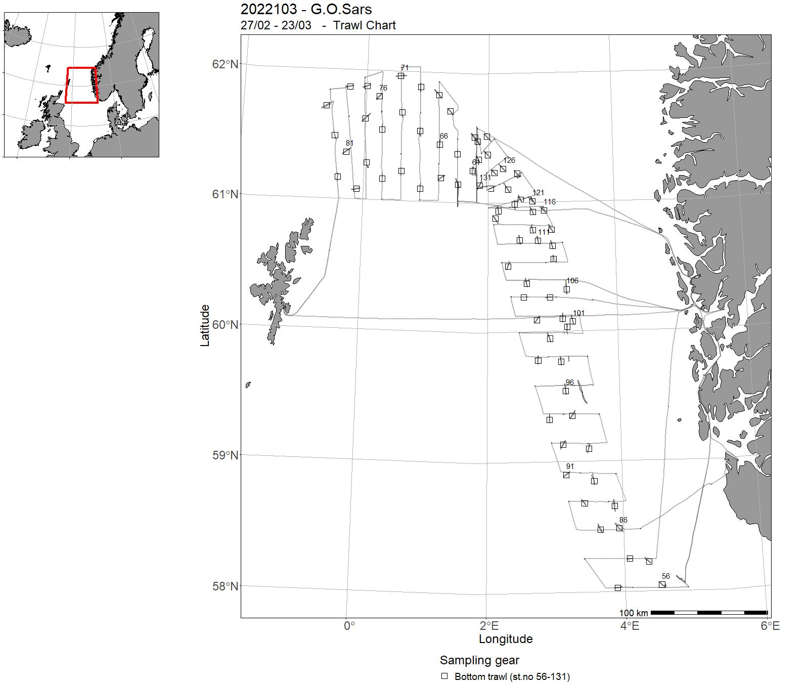
| 2022103 | 27/02 - 23/03 | 2022-NSJ-006: Acoustic survey of saithe during the spawning period. Joint international survey with Germany on saithe spawning stock (SSB), at time of year when fish are highly aggregated. Survey to be used in assessment after >5 years (ICES regulation). | North Sea | 132-192 | 56-131 |
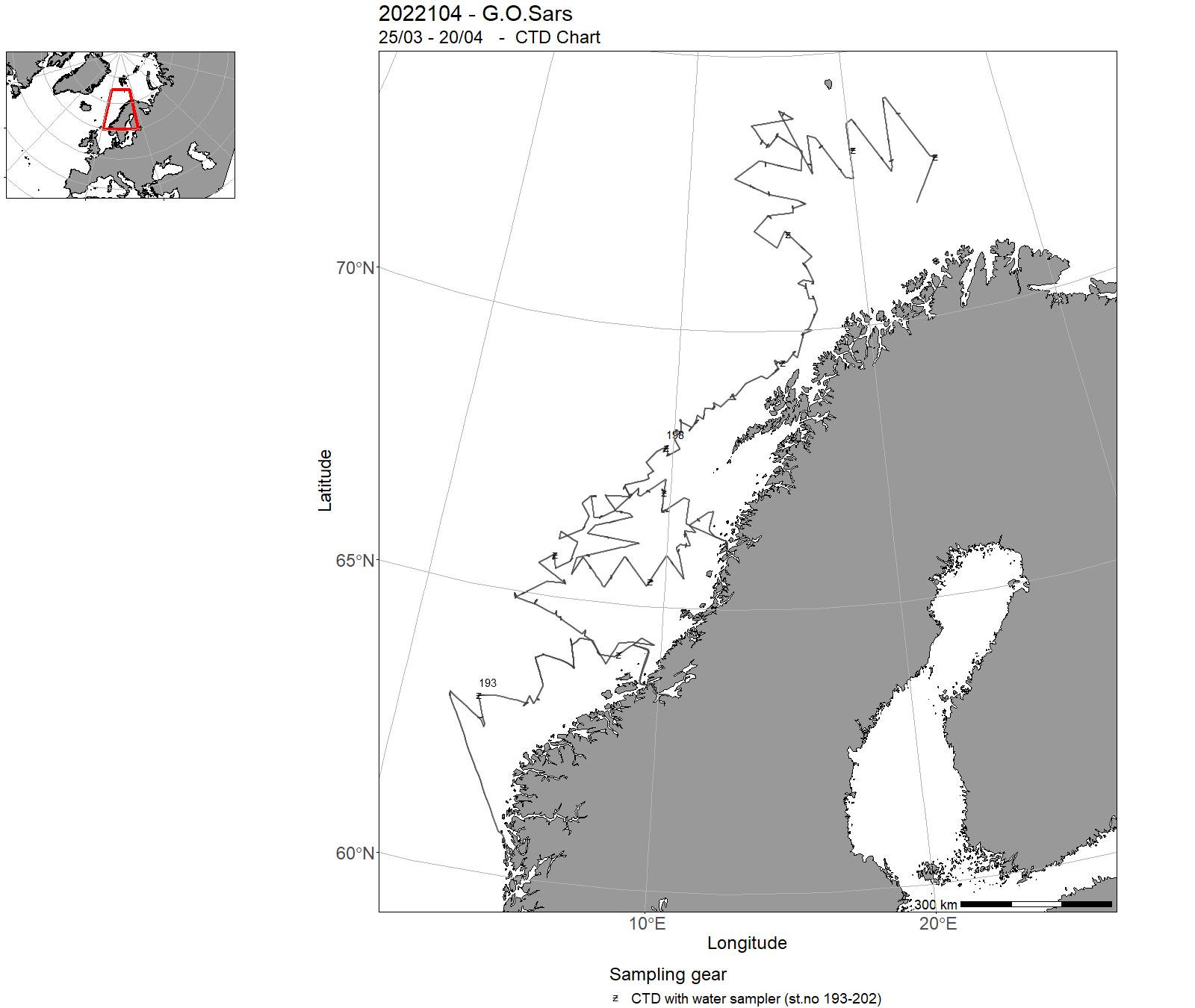
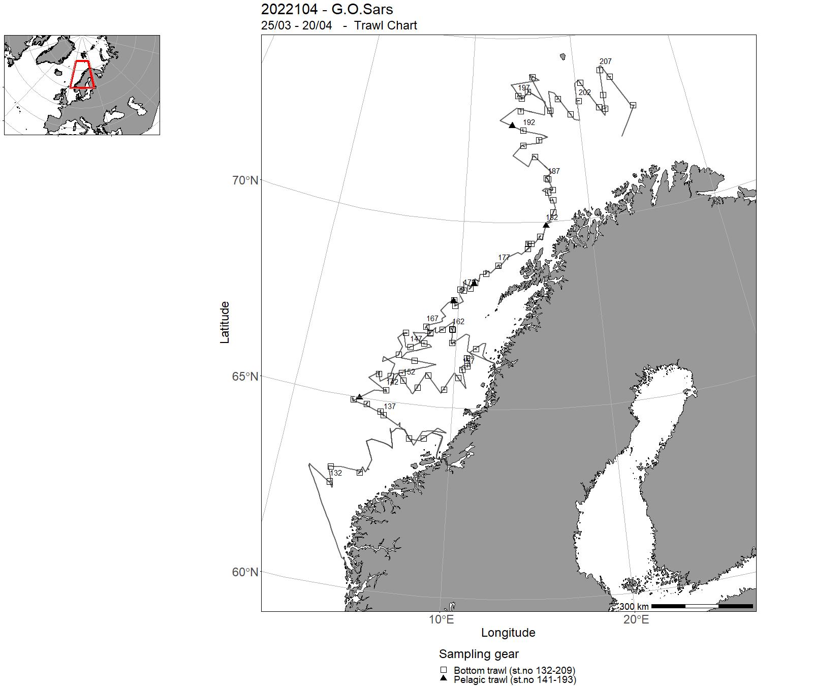
| 2022104 | 25/03 - 20/04 | Combined acoustic and bottom trawl survey along the continental shelf from 62°N to 74°N. Main target fish species are greenland halibut, redfish and greater silver smelt. Map the spatial distribution and acoustic biomass of Silver smelt.Map the spatial distribution and trawl index (biomass) of Greenland halibut.Map the spatial distribution of redfish. Collect biological data (lenght weight, sex maturation etc) of all fish species.Genetic samples of several species of fish and elasmobranchii. | Northeast Atlantic Ocean (40W) | 193-202 | 132 - 209 |
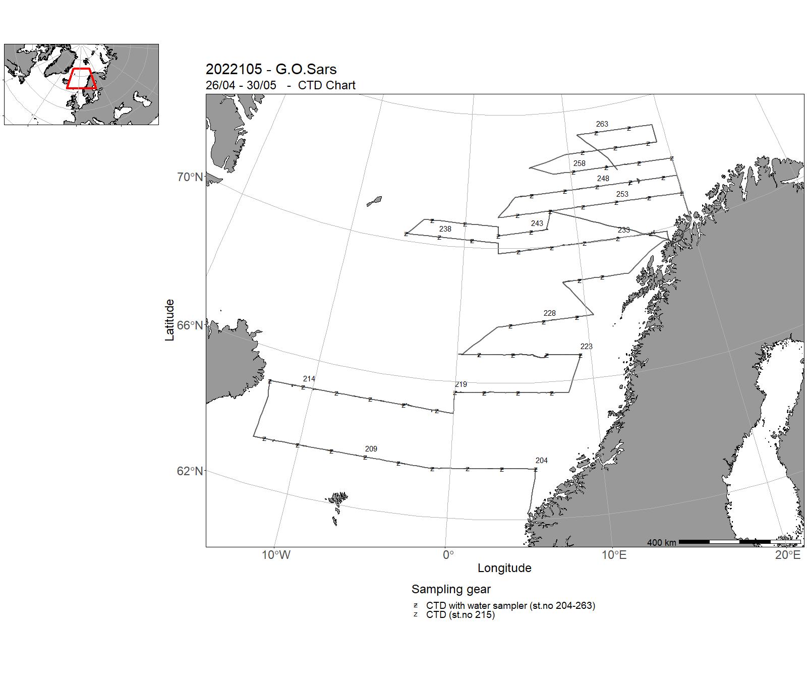
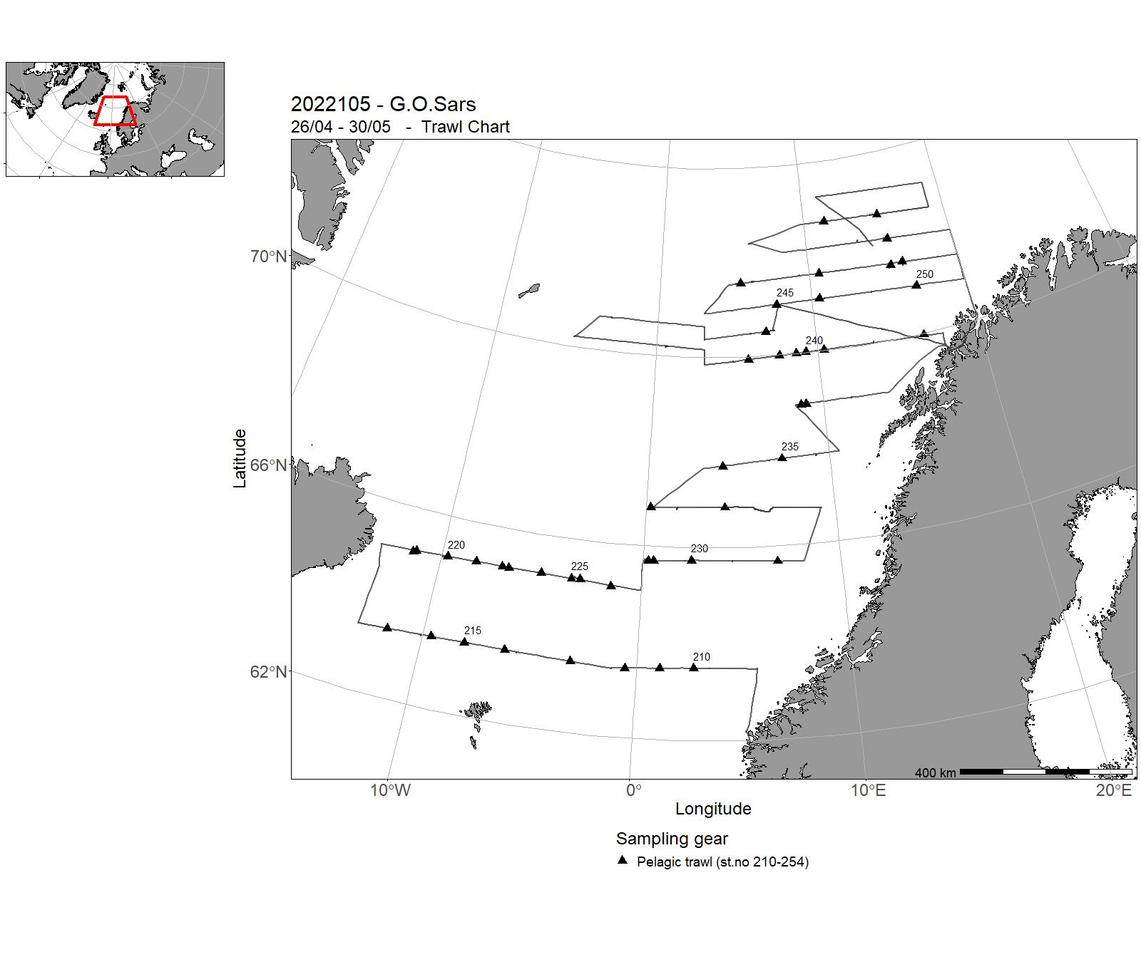
| 2022105 | 26/04 - 30/05 | Part of the International Ecosystem Survey of the Nordic Seas (IESNS) where the objectives are (1) to measure the abundance of Norwegian spring-spawing herring and blue whiting using acoustics, (2) collect data on zoo- and phytoplankton, (3) measure the hydrographical conditions. | Norwegian Sea | 204 - 263 | 210-254 |
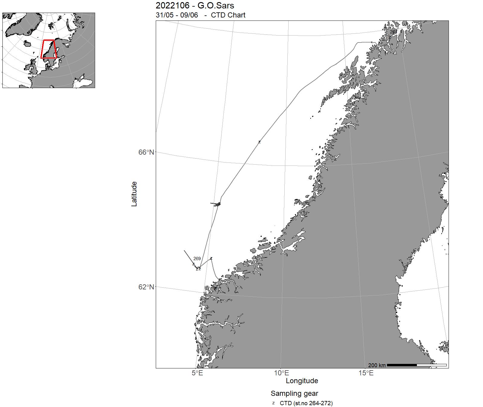
| 2022106 | 31/05 - 09/06 | A methods testing cruise intended to primarily explore the capabilities and potential standard operating procedures when using a Munin+ AUV for acousitc and photo mapping in deeper water (max 1500m). Additionally, the Kongsberg Simrad EC150-3C ADCP was being tested and compared to the R.D.I. ADCP. Unfortunately a number of technical and weather issues resulted in very little data being collected with the Munin+, allowing more extensive testing of the EC150-3C ADCP and some opportunistic collection of Topas PS18 subbottom profiler data in an area of known pockmarks. A methods testing cruise intended to primarily explore the capabilities and potential standard operating procedures when using a Munin+ AUV for acousitc and photo mapping in deeper water (max 1500m). Additionally, the Kongsberg Simrad EC150-3C ADCP was being tested and compared to the R.D.I. ADCP. Unfortunately a number of technical and weather issues resulted in very little data being collected with the Munin+, allowing more extensive testing of the EC150-3C ADCP and some opportunistic collection of Topas PS18 subbottom profiler data in an area of known pockmarks. | Norwegian Sea | 264-272 | - |
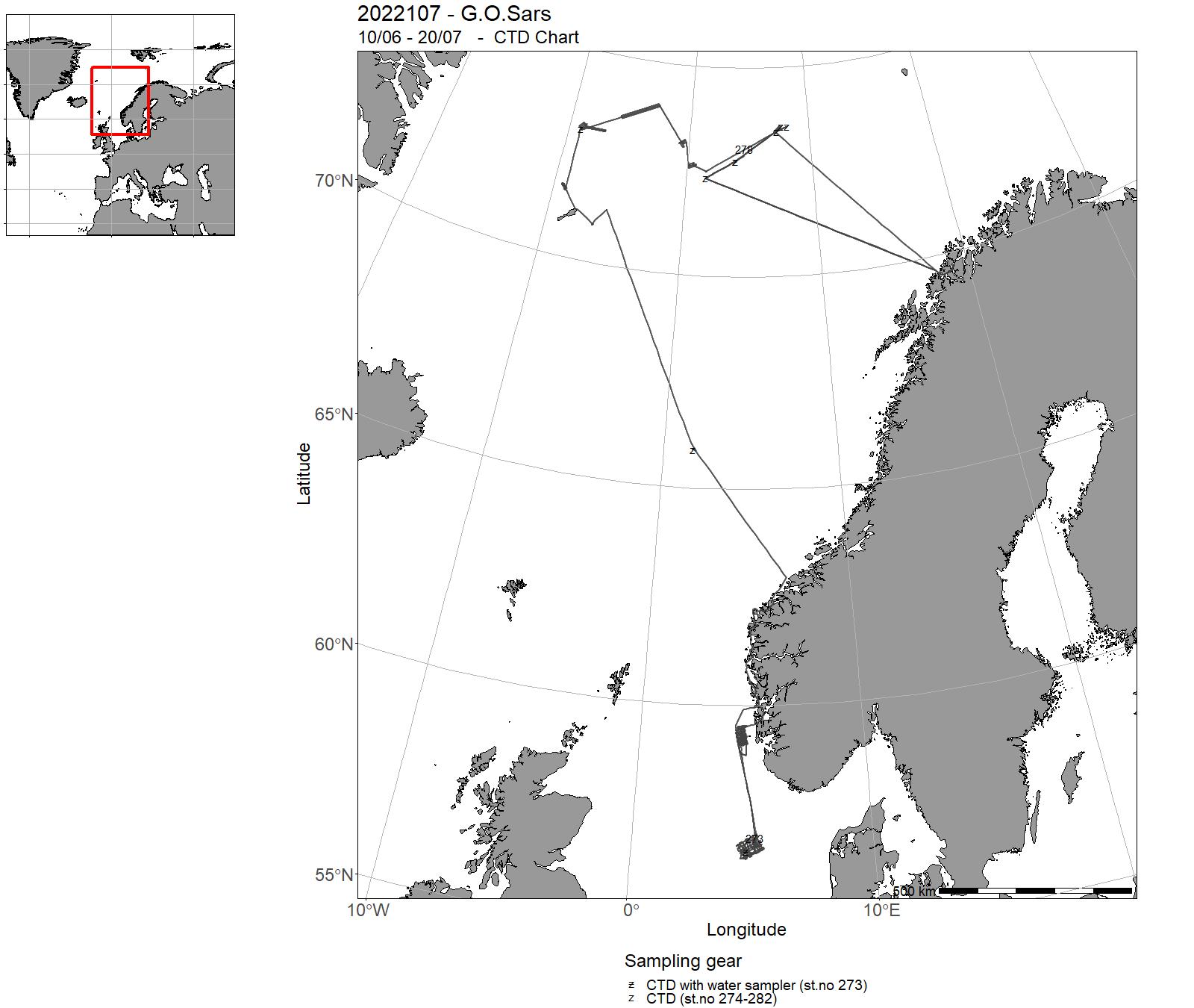
| 2022107 | 10/06 - 20/07 | 2022-JC-Deepsea-000: Dyphavsforskning ved midthavsryggene i Norske-Grønlandshavet: vulkansk aktivitet, hydrotermale systemer og deres påvirkning på vannsøylen, mikrobielt liv i ekstreme miljø, benthiske økosystemer, dypmarine ressurser og miljøspørsmål. 2022-GFI-006: Rigg- og gliderarbeid relatert til NorEMSO-aktivitet på Svinøy-snittet, Stasjon M, Gimsøy-snittet og Mohnryggen. | Norwegian Sea | 273 - 282 | - |
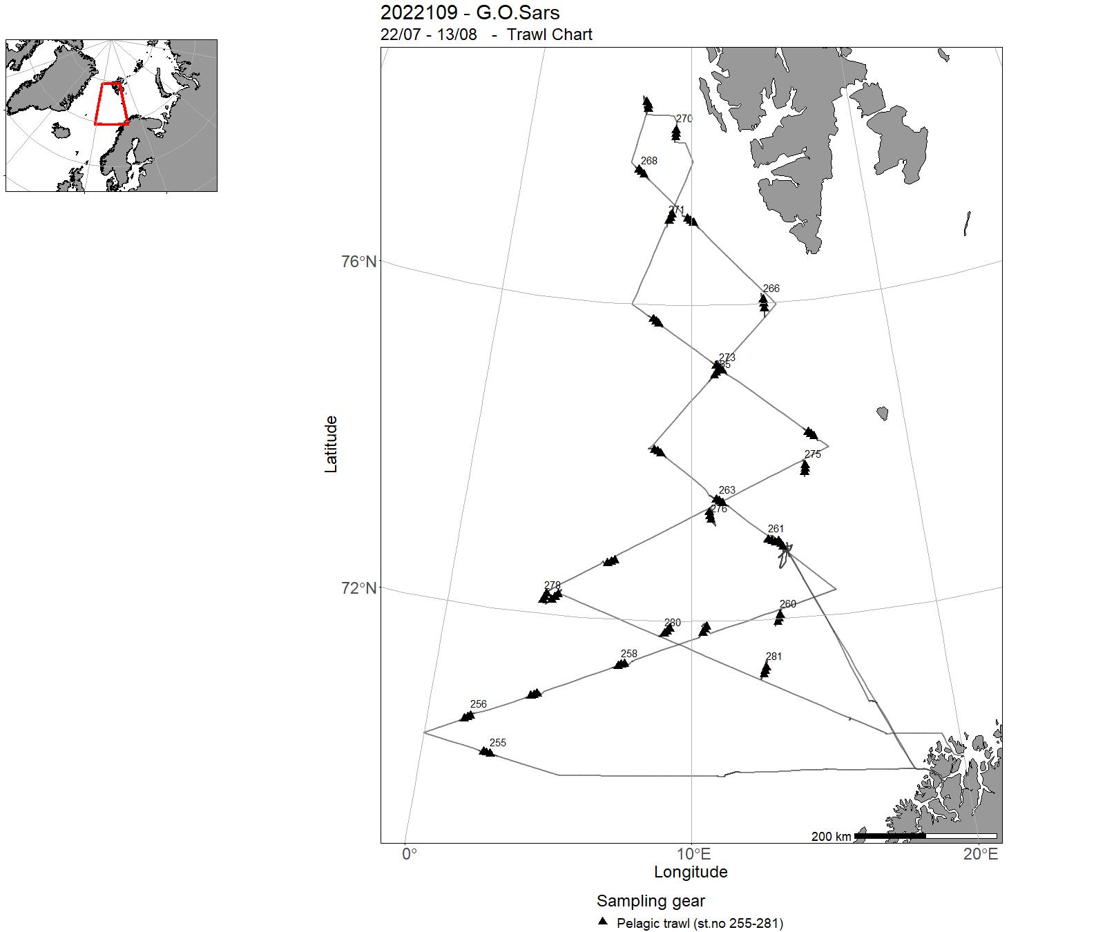
| 2022109 | 22/07 - 13/08 | 2022-NOR-025: To assess the stock of Sebastes mentella in the open Norwegian Sea. To collect data in support to integrated ecosystem in the openNorwegian Sea, as part of the international deep pelagic ecosystem surveys (ICES-WGIDEEPS). | Norwegian Sea | 283-284 | 255-281 |
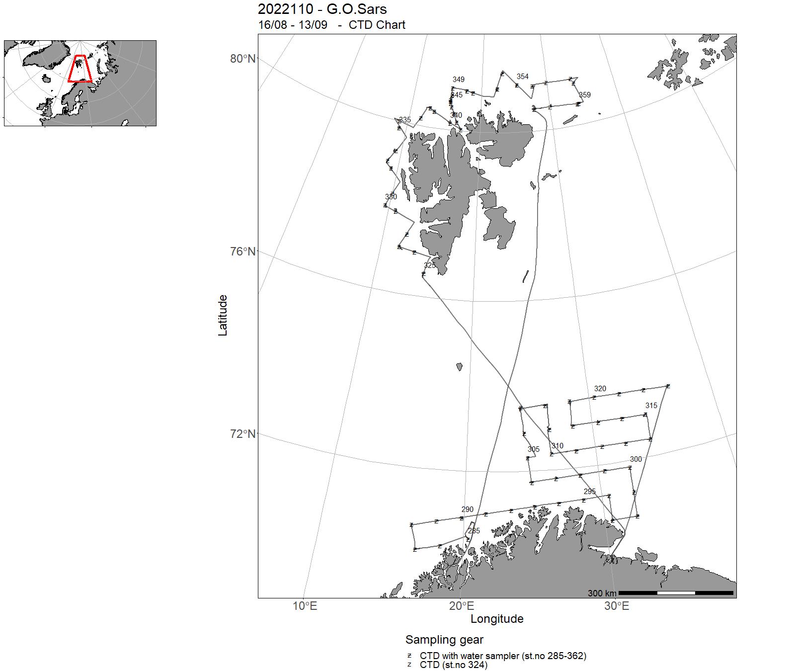
| 2022110 | 16/08 - 13/09 |
The cruise forms part of a multi-ship, multi-purpose ecosystem survey of the Barents Sea, carried out jointly by Norway and Russia. The objective of the cruise was to collect data related to stations and along cruise tracks, on water chemistry and physics, phytoplankton, zooplankton, fish (acoustics and trawl), benthic organisms, sea mammals, birds, and pollution. Project name: BESS (Barents Sea Ecosystem Survey)Coordinating body: Institute of Marine Research, Bergen (in cooperation with VNIRO, Moscow/Murmansk) |
Barents Sea | 285 - 362 | 282 - 426 |
| 2022111 | 15/09 - 19/09 | 2022-MP-023: Quantify impact of tidally forced, breaking internal waves on marine productivity, plankton distribution and coral reef distribution. On this cruise rigs with oceanographic instruments will be retrieved. | Norwegian Sea | - | - |
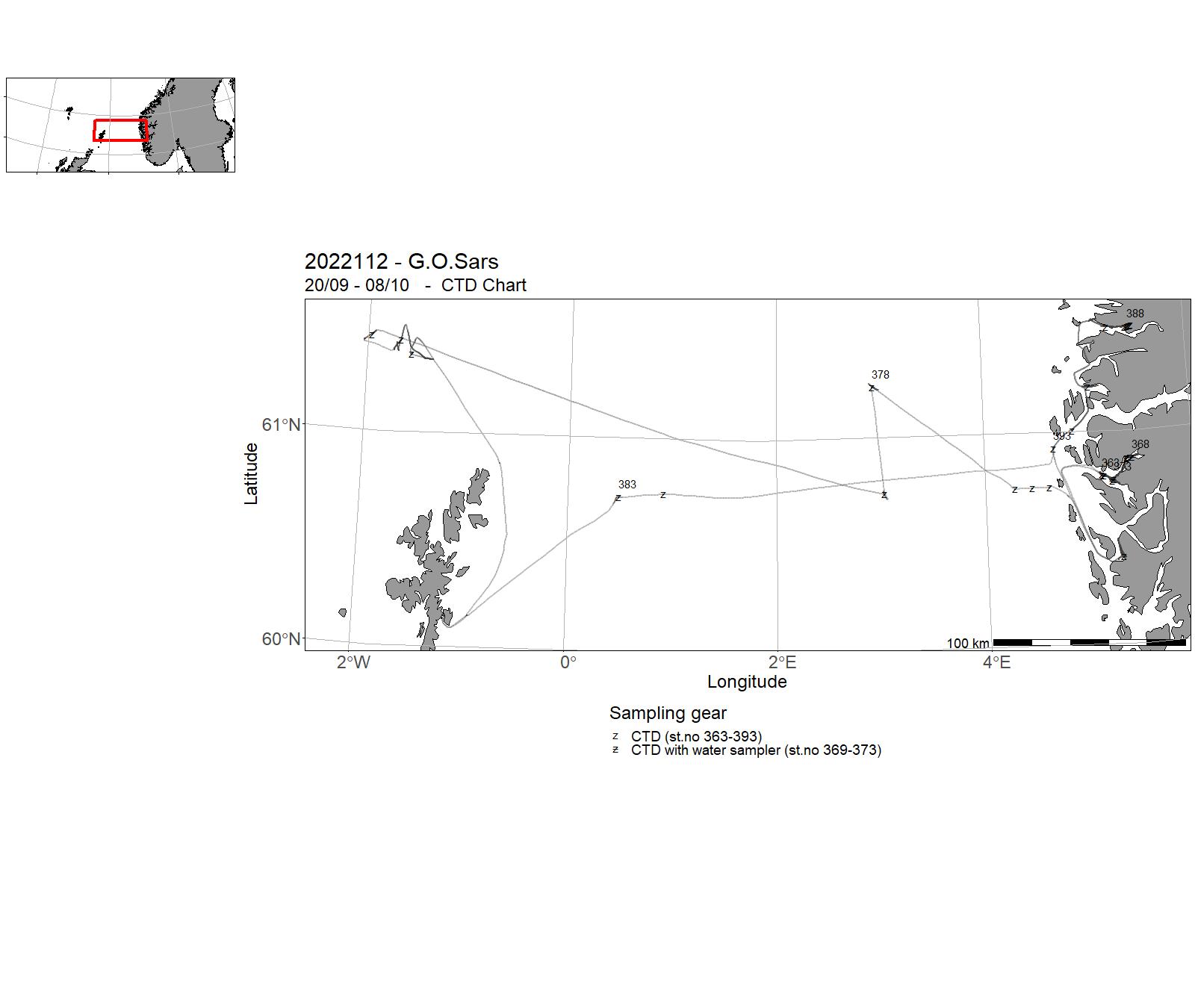
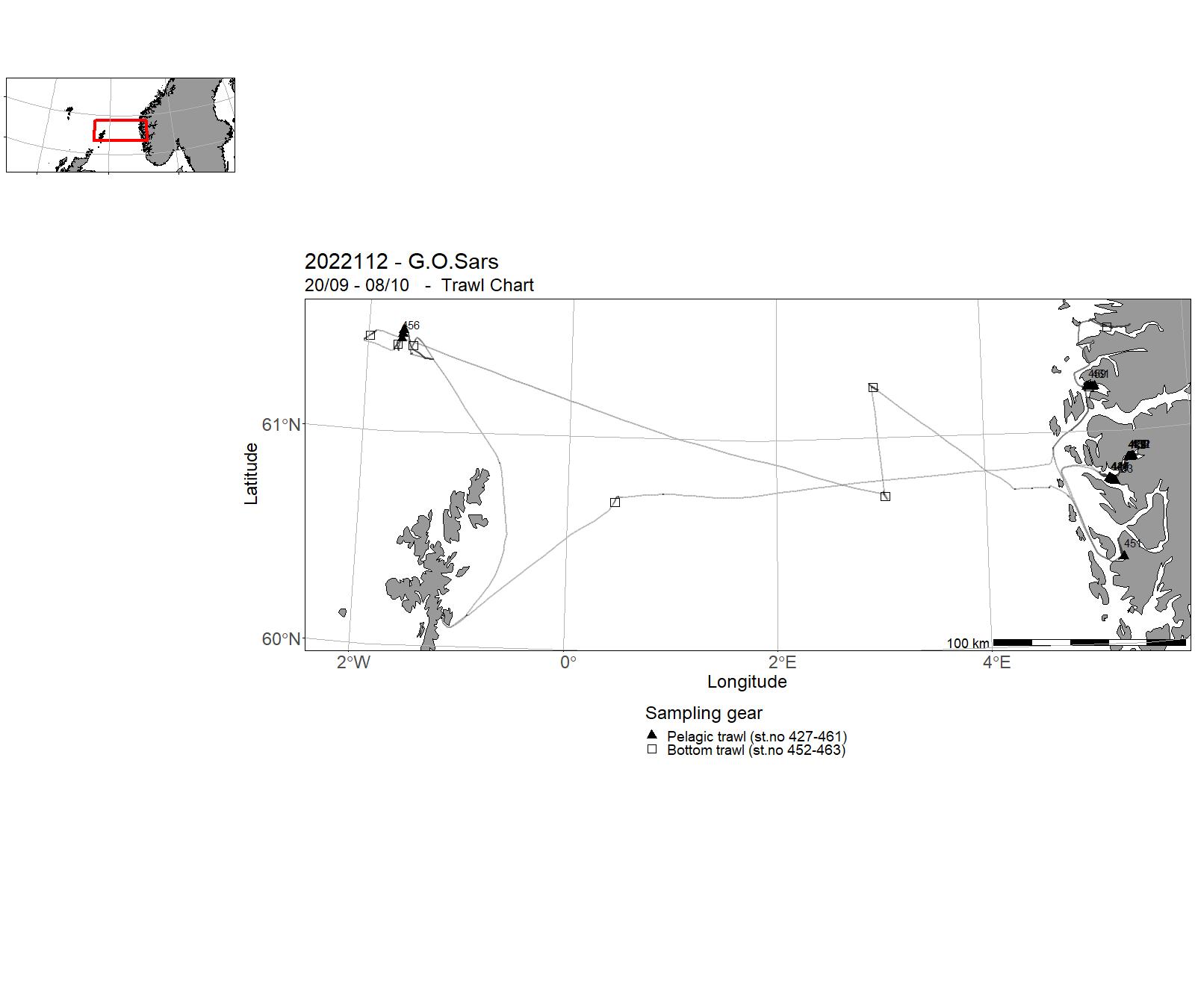
| 2022112 | 20/09 - 08/10 | Training course in Ocean Science (BIO325): The survey collected samples in West Norwegian fjords (Masfjord, Fensfjord, Åfjorden and Førdefjorden), in the Norwegian trench, on the North Sea plateau between Fedje and Shetland, and in the Faroe Trench. The equipment used was : Demersal Campelen 1800 trawl.Harstad Pelagic trawl 320 with MultiSampler (3 cod-ends) Harstad Pelagic trawl with one codend Multinet Acoustics CTD Longlines (other station) Deepwater traps (other station) PI A - Anne Gro Vea Salvanes (Fjord survey: Masfjord and Fensfjord) PI B - Tom Langbehn (North Sea survey: Norwegian trench, North Sea plateau, Faroe trench, Byfjorden, Åfjorden and Førdefjorden) Spectroradiometer (surface unit) | North Sea | 363 - 393 | 427 - 463 |
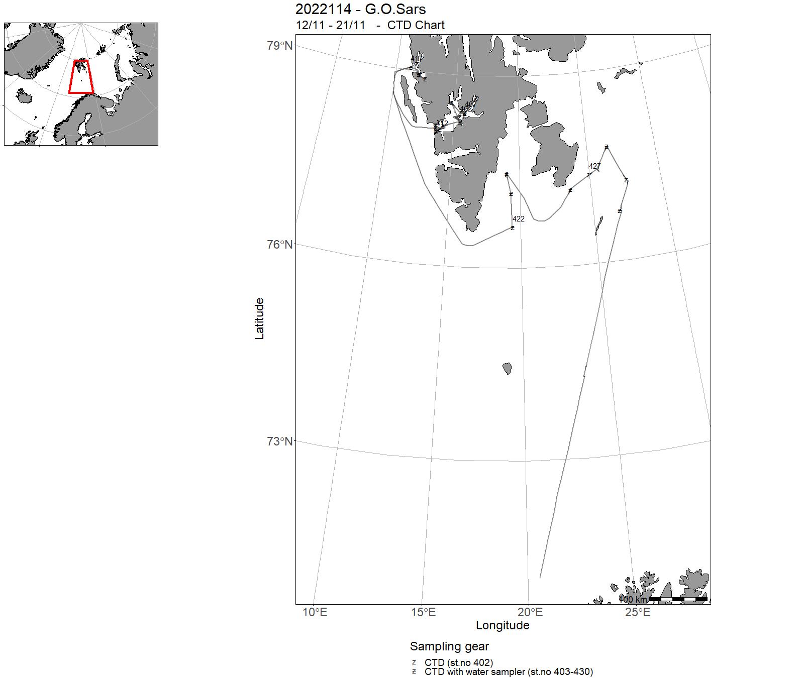
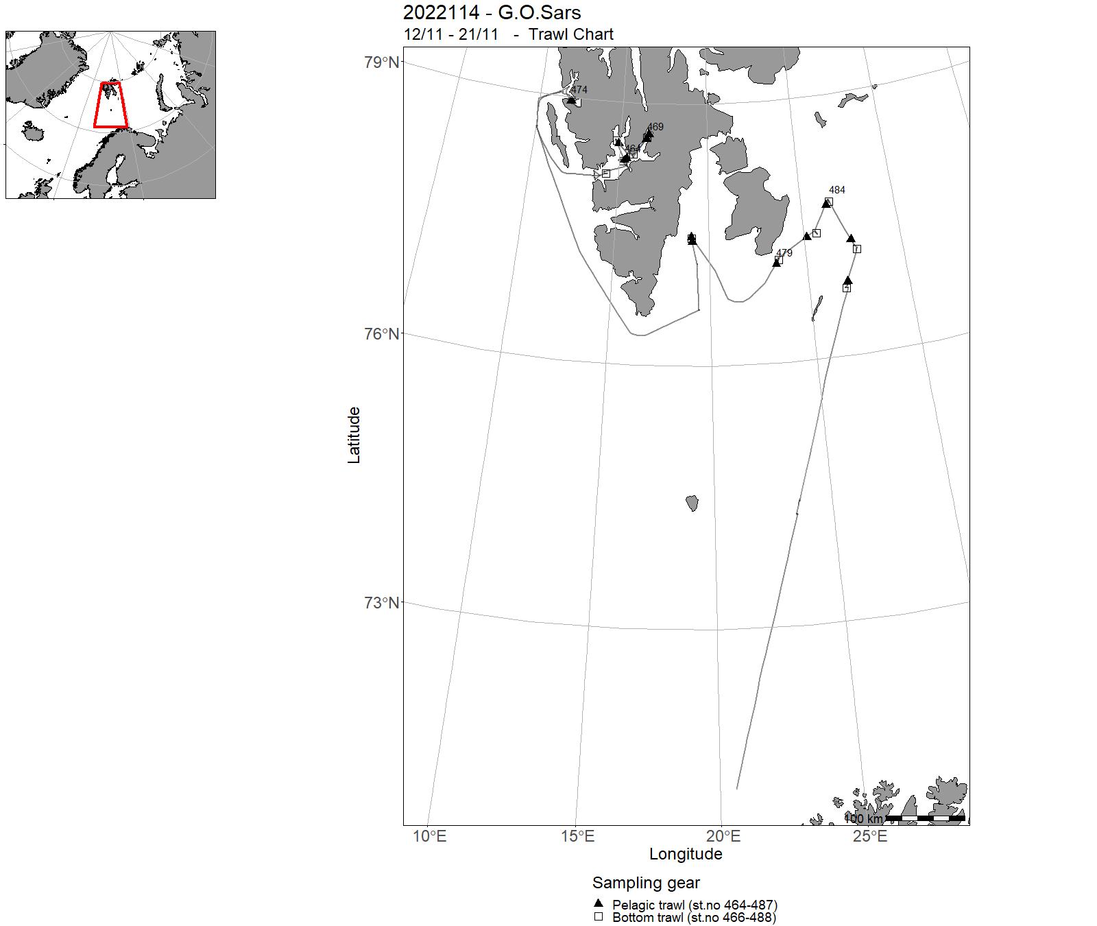
| 2022114 | 12/11 - 21/11 | 2022-BAR-017: Undersøke konnektivitet i polartorsk og loddebestandene i Barentshavet. Ønsker å undersøke i hvilken grad gyteprodukter fra disse bestandene når vestkysten av Svalbard. Ønsker å undersøke gyteklare polartorsk i november. | Barents Sea | 402 - 430 | 464 - 488 |
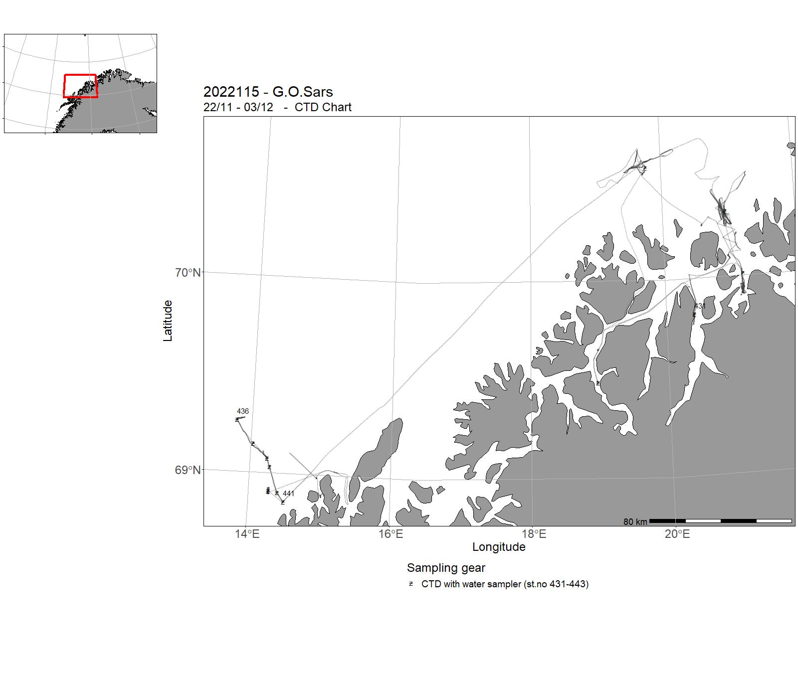
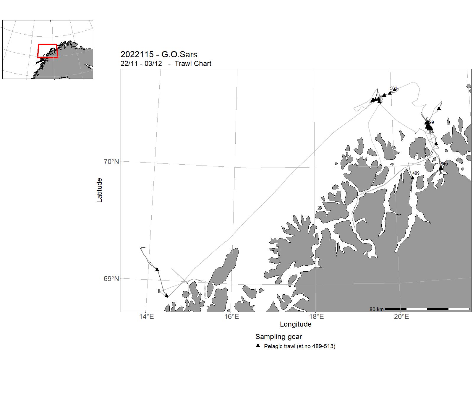
| 2022115 | 22/11 - 03/12 | 2022-MP-012: Utprøving og opplæring i bruk av breidbandsekkolodd knytt til CRIMAC prosjektet. Testing av nye sensorar (Kongsberg) og testing av Deep Vision (Scantrol Deep vision). Innsamling av breidbandsdata på sild med Sounder USV og Kayakdrone. Gjennomføring av transekt over LoVe etter fast oppsett. | Norwegian Sea | 431-443 | 489-513 |
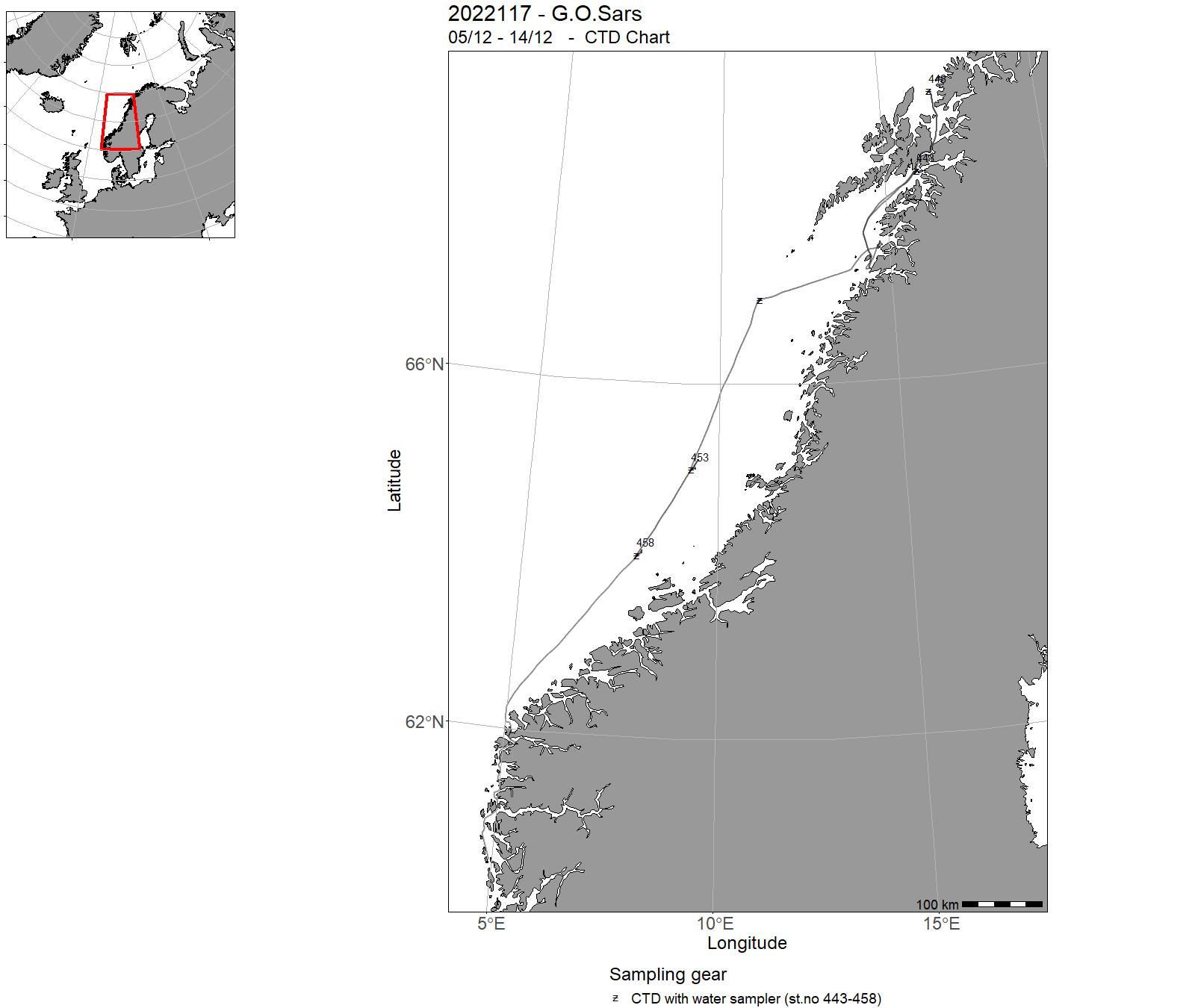
| 2022117 | 05/12 - 14/12 | 2022-NOR-010: Dokumentere ssmfunnsstruktur og biologisk/fysiologisk tilstand hos nøkkelarter samt måle miljøvariabler (pH, temperatur, seston og organiske partikler) som er blitt identifisert som særlig sterke drivere for helsetilstanden til korallrev | Norwegian Sea | 443-458 | - |
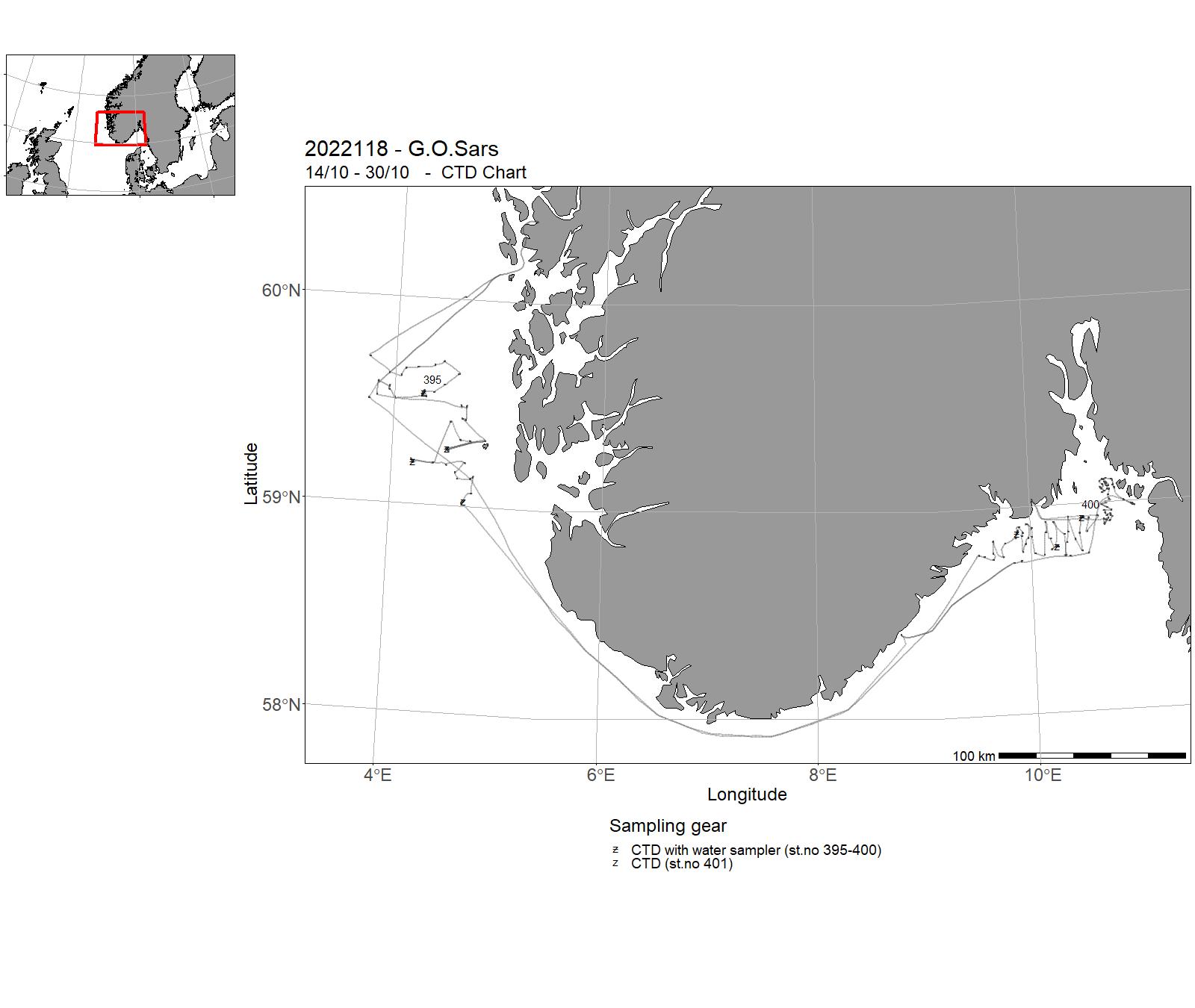
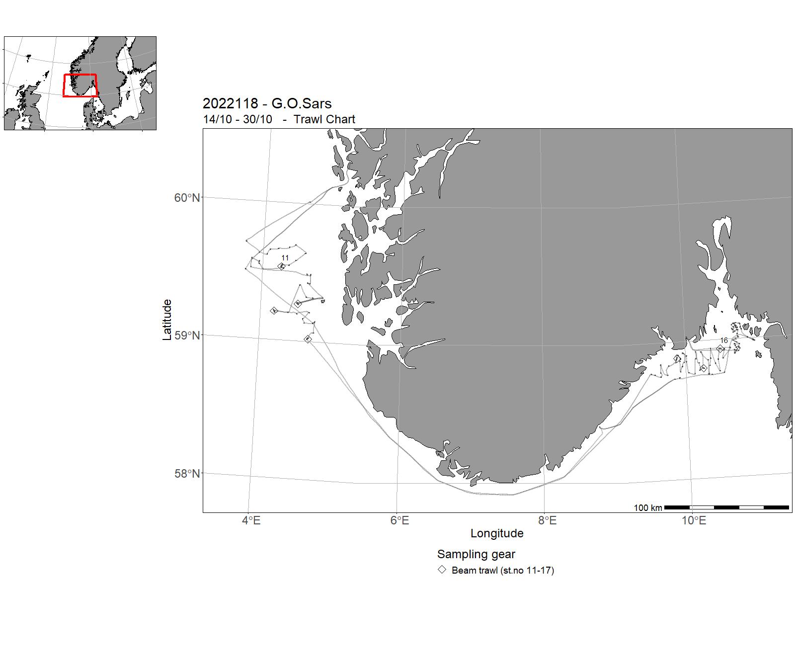
| 2022118 | 14/10 - 30/10 | The objectives of this cruise are : (1) to collect baseline data prior to construction of wind turbines outside Utsira Island, including data from the offshore wind area itself and an adjacent control area, (2) to provide evidence for the selection of Particularly Valuable Areas (SVO, in Norwegian), and to (3) document the occurrence of Vulnerable Marine Ecosystems (forvaltningsprioritert natur). These data were collected in four sampling areas : Utsira Nord Control, Utsira Nord, North Skagerrak (NS) 04, and Hvaler National Park. The data types included underwater footage (at all sampling stations), as well as collection of physical samples of both sediment and seabed fauna at six stations. Project name: MAREANO, Frisk OslofjordCoordinating body: Institute of Marine Research | North Sea | 395 - 401 | 11-17 |
3 - “ G.O. Sars” – Charts for cruises 2022


4 - "Johan Hjort" - Cruises 2022
| Cruise no | Period | Purpose | Area | CTD st.no | Trawl st.no |
|---|---|---|---|---|---|
| 2022201 | 01/01 - 02/01 | 2022-RED-003: Testing av installasjon, håndtering og bruk av AUV Munin+ på Johan Hjort når det er forenlig med andre toktaktiviteter. | - | - | |
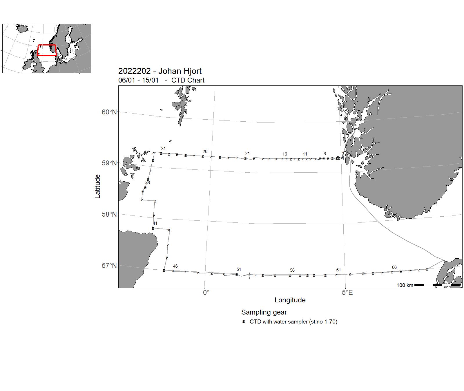
| 2022202 | 06/01 - 15/01 | Objectives: To collect data and samples on pre-selected stations. To sample standard transects for physical oceanographic parameters (CTD casts, nutrients and chlorphyll) and zooplankton in the North Sea. Cruise programme: 1. Utsira-V transect 2. Scotland East Coast transect 3. Hanstholm-Aberdeen transect 4. Fair Isle-Pentland transect (1/2 of the transect completed) | North Sea | 1-70 | - |
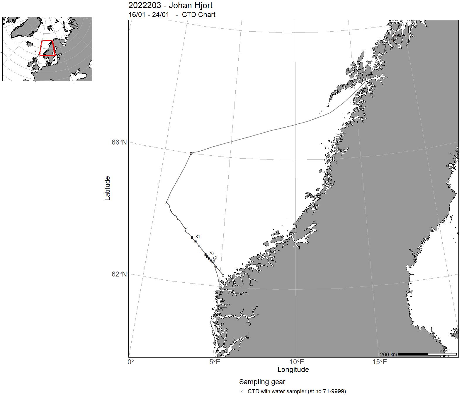
| 2022203 | 16/01 - 24/01 | The objective of the cruise was to collect data and samples on pre-selected stations as part of the IMR Monitoring of the environment and plankton on the Svinøy and Fugløya-Bjørnøya sections and at station M in January. Implementation of transect over LoVe. This has been done in the last five years as part of other activities in the area for a given period of time and with regular tasks. Sampling was undertaken on the following standard transects: Svinøy and and at station M. The cruise programme included sampling for physical-chemical oceanographic parameters (CTD casts, nutrients and chlorophyll), zooplankton with plankton net and Multinet Mammoth. Water samples of carbon at station M for NORCE. Water samples of carbon on the Svinøy section. 2022-GFI-006: Rigging and gliding work related to NorEMSO activity on the Svinøy sections. Multinet Mammoth was not used due to storm and high waves. Transect over LoVe was not taken due to lack of time and bad weather. Fugløya-Bjørnøya sections was not taken due to storm and 8 meter waves. | Norwegian Sea | 71-85 | - |
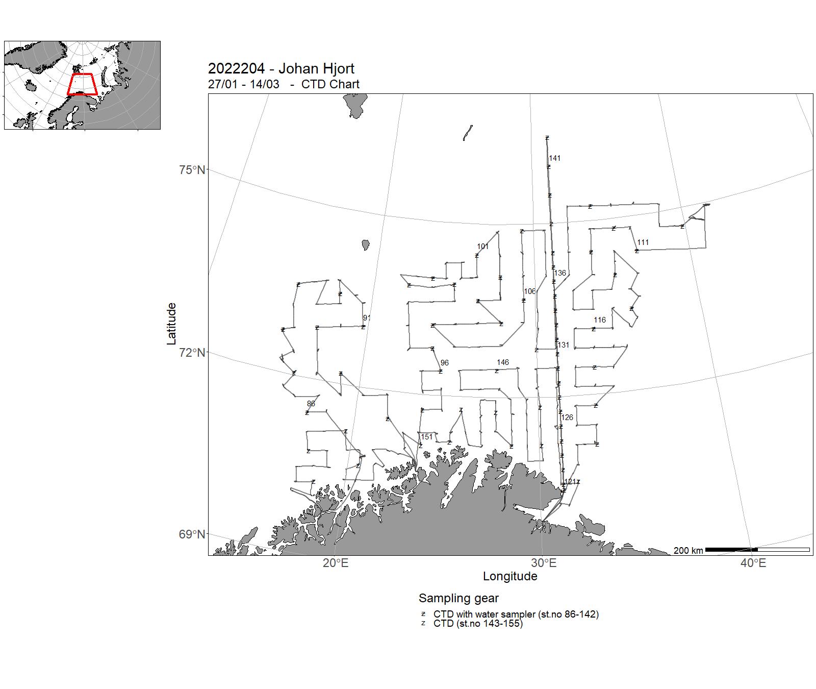
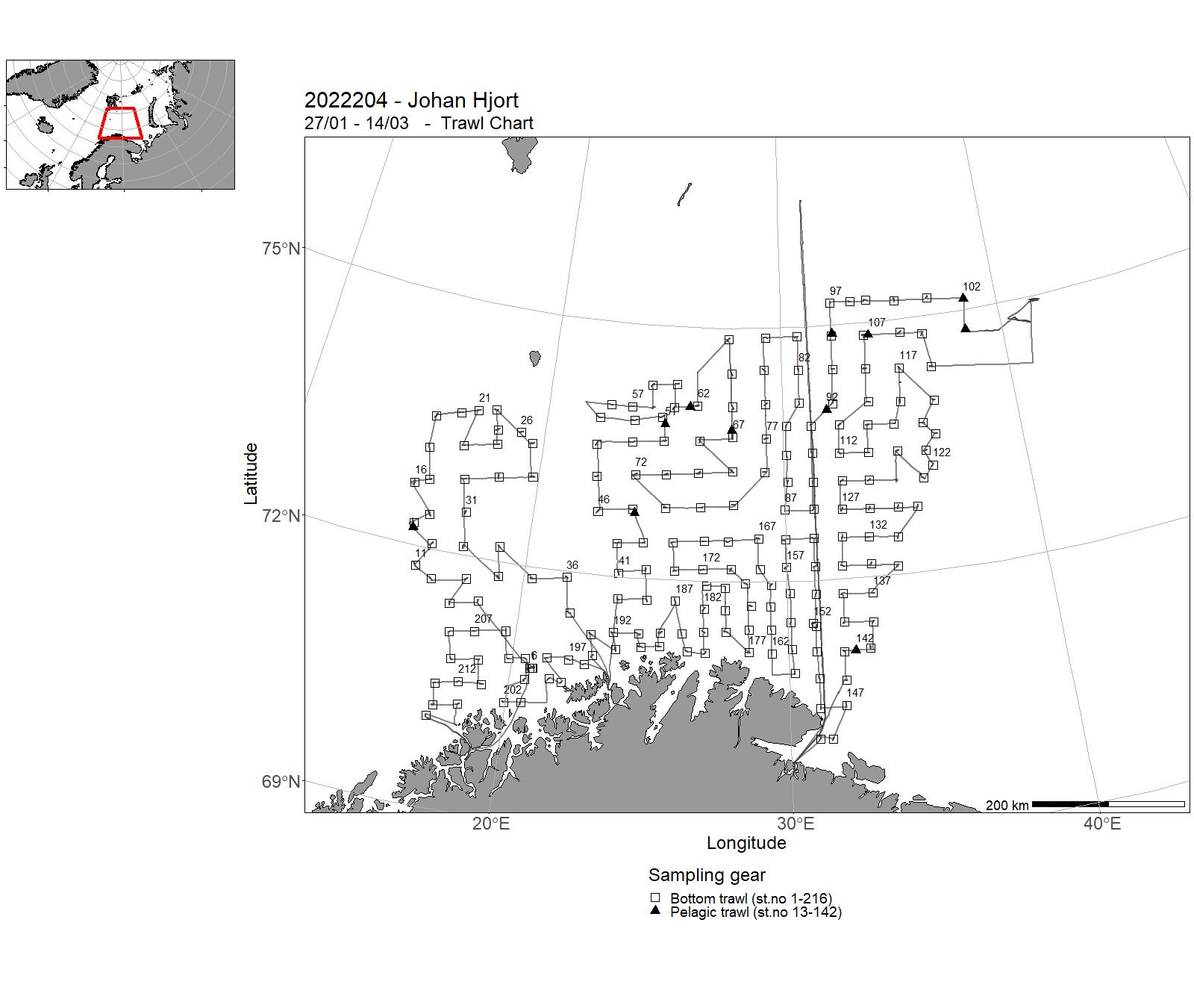
| 2022204 | 27/01 - 14/03 | Annual combined acoustic and bottom trawl survey in the Barents Sea in winter to: map the distribution and estimate acoustic and bottom trawl abundances indices, length, weight and maturity at age of cod and haddock. Map the acoustic distribution and do biological sampling of capelin, herring, polar cod and blue whiting. Map the general hydrographic regime by using a CTD-sonde to monitor the temperature and at about every second-third fixed bottom trawl stations (for about every 40 NM) stomach sampling of cod. Vardø North transect Project name: Barents Sea Winter Groundfish Survey Coordinating body: IMR (Bergen) and PINRO (Murmansk) | Barents Sea | 86 - 155 | 1 - 216 |
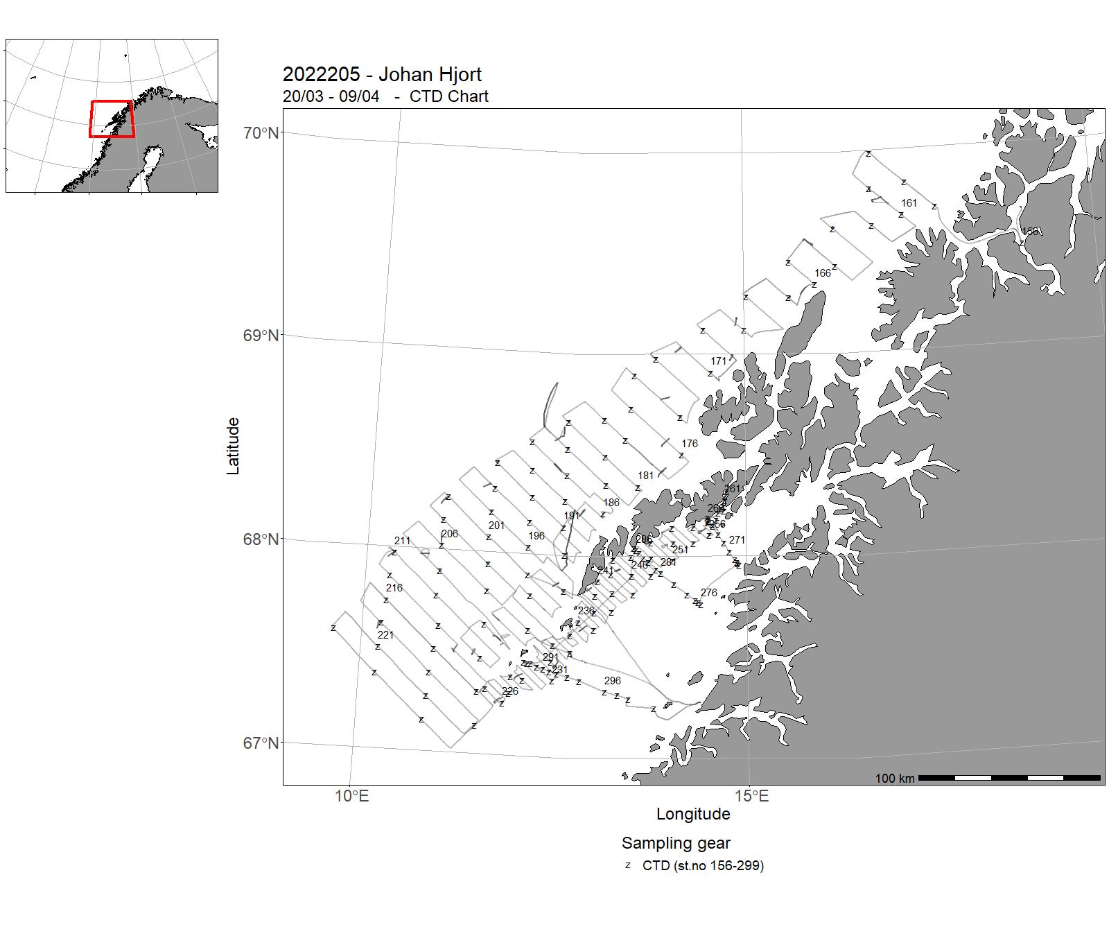
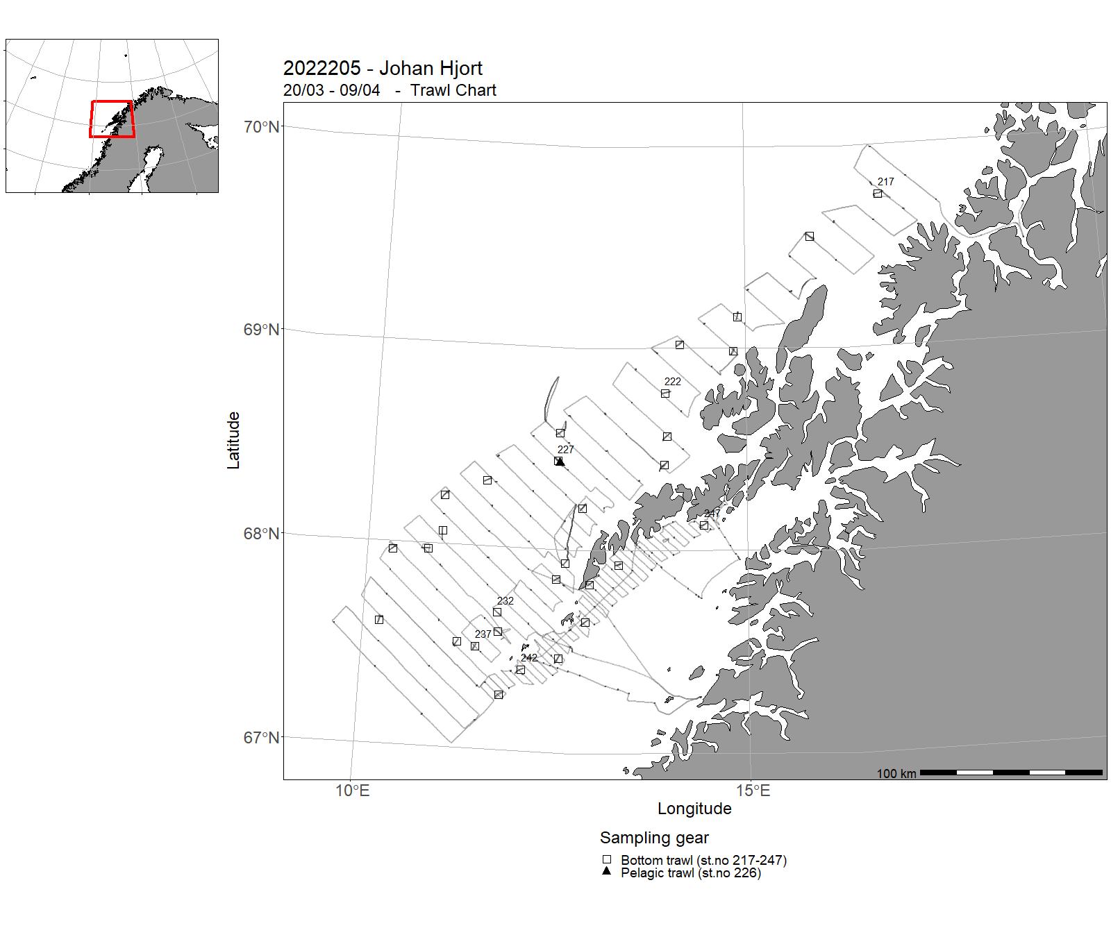
| 2022205 | 20/03 - 09/04 | Annually recurrant acoustic survey to monitor abundance of spawning North-East Arctic cod in the spawning area around Lofoten by systematic parallell transects and with systematic sampling of fish-egg concentrations by vertical nets in the upper 100 m of the water column. Lofoten is the main spawning location for the stock, and the acoustic survey index indicate spawning biomass and abundance of the mature stock. | Norwegian Sea | 156-299 | 217 - 247 |
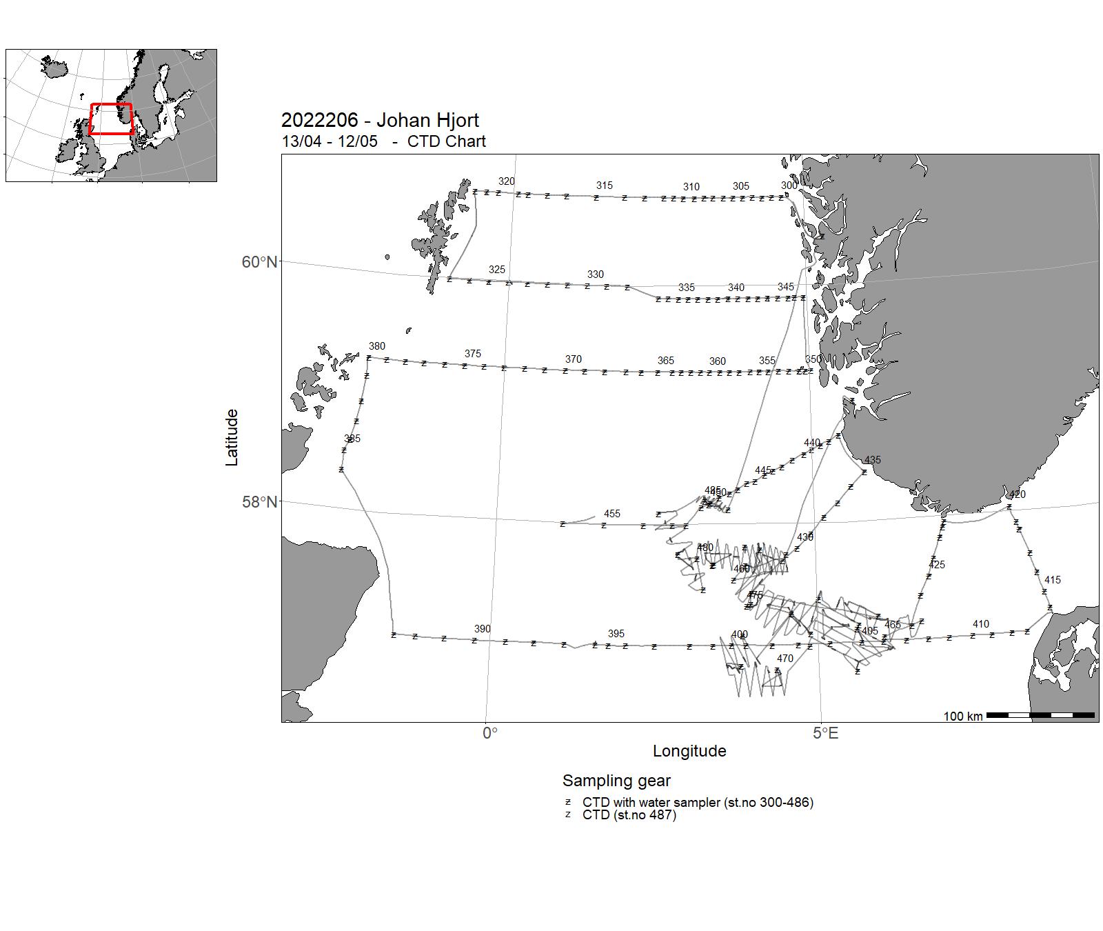
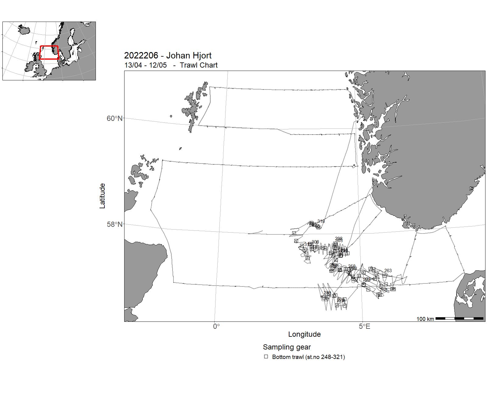
| 2022206 | 13/04 - 12/05 | Objectives : Part 1 : To collect data and samples on pre-selected stations. To sample standard transects for physical oceanographic parameters (CTD casts, nutrients and chlorphyll), zooplankton and fishlarvae / egg abundance in the North Sea. Cruise programme (following standard transects): Fedje-Shetland Slotterøy Utsira-Start point Fair Isle-Pentland Aberdeen-Hanstholm Oksøy-Hanstholm Lindesnes SWEgerøy SWJærens rev SW + W . Part 2: Measuring the abundance, distribution and age composition of lesser sandeel Dredge sampling for burrowed sandeels Bottom trawls Pelagic trawls Echo sounder sampling Zooplankton sampling Mapping of hydrographical conditions Project name: 14917 - Early life history dynamics of North Sea fishes14920 - Monitoring of climate and plankton in the North Sea14918 - Sandeel monitoring Coordinating body: Institute of Marine Research, Bergen | Norwegian Sea | 300 - 487 | 248-321 |
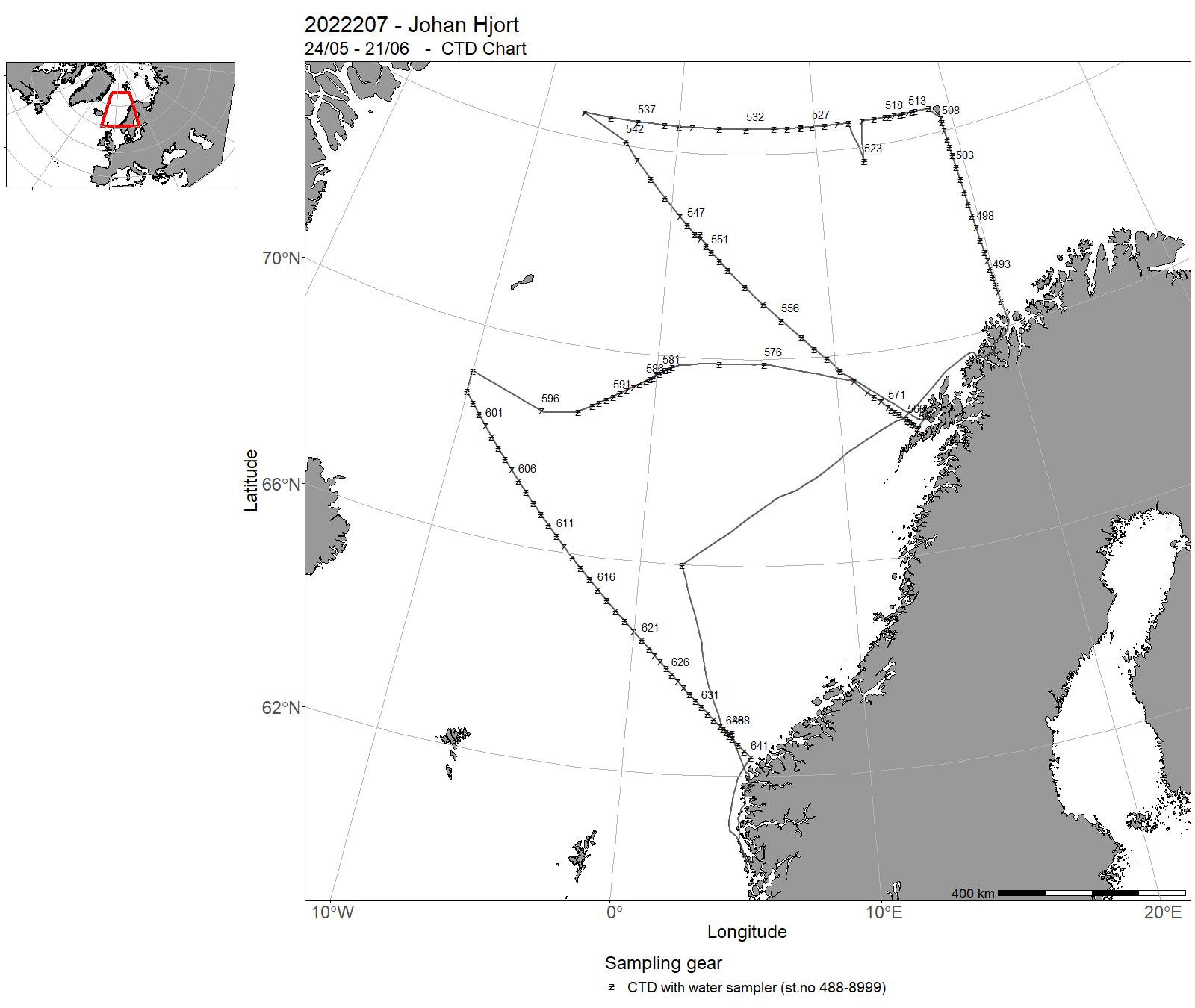
| 2022207 | 24/05 - 21/06 | The cruise objectives were to occupy the monitoring sections Fugløya-Bjørnøya in the Barents Sea, extended Bjørnøya vest and extended Gimsøy section in the northern Norwegian Sea and the Svinøy section in the southern Norwegian Sea and deploy Argo floats. The earlier weather ship station M was occupied. A synoptic survey was conducted of the Lofoten Basin Eddy (LBE) with a section extening into the Norwegian Basin. On the sections, at station M and in the LBE, CTD observations measueremenst were made from surface to bottom. Water samples were drawn for nutrients analysis, carbon system analysis and trace gas analysis. Chlorophyll was sampled for the top 100 m. WP2 plankton nets for the top 200 m was conducted along the sections. Qualitative plankton nets were sampled on selected stations. ADCP, Thermosalinograph and echo sounder data were collected underway. 2 Argo floats, one deep and one bio geochemical (BGC) were deployed in the Norwegian Basin. 3 Argo floats, one deep, one BCG and one standard with oxygen, were deployed in the Lofoten Basin. 3 Argo floats, one deep, one BCG and one standard, were deployed in the central Grenland Sea. 2 Argo floats, one BIO and one standard were deployed in the Iceland Sea. One Argo float was deplyed close to the continental slope at N 74 30. 1 (BIO) Argo float was deployed in the Barents Sea. To monitor the radioactivity close to the sunken nuclear submarine Komsomolet, water samples and sediments were collected close to the wreck at about 1900 m depth. | Norwegian Sea | 488-8999 | - |
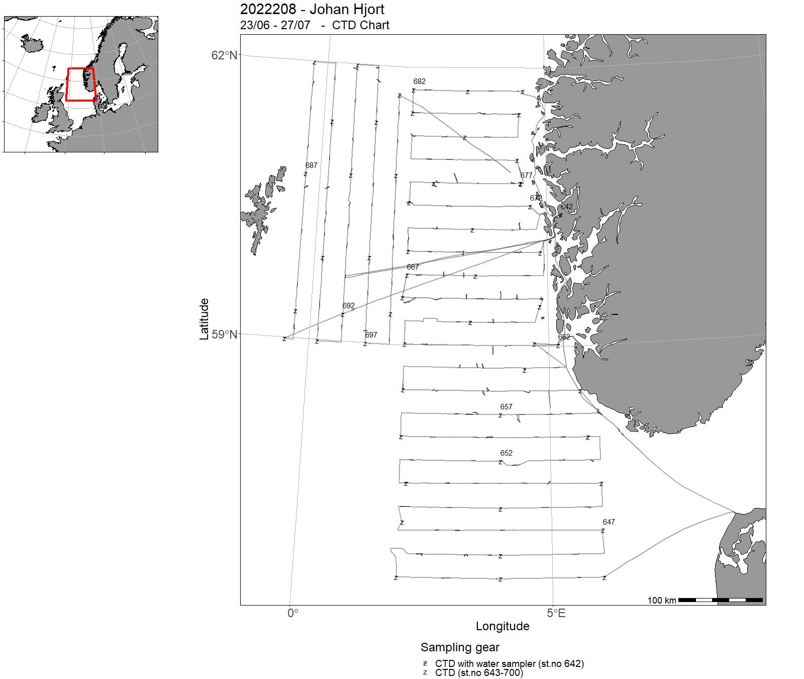
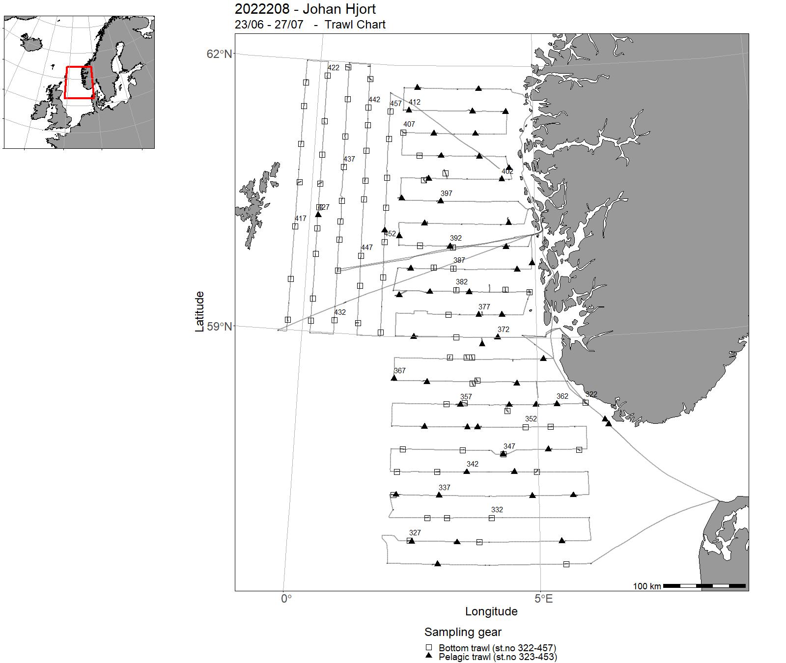
| 2022208 | 23/06 - 27/07 | Acoustic survey for herring and sprat (HERAS, leg 1) and saithe (NORACU, leg 2) in the North Sea to be used in asessement. Testing of equipment, stationary acoustics and blind zone investigations for improving survey and analyses. Calibration of echosounder and sonar before start of the survey. Take samples of seawater, sediments, fish and other species to analyze levels of toxic components (POPs, PAH, radioactivity) and measurements of biomarkers. Take samples for safe seafood. | North Sea | 642 - 700 | 322 - 457 |
| 2022209 | 28/07 - 12/08 | Monitoring of the environment and plankton on the Svinøy, station M, Gimsøy, Sørkapp V, Fugløya-Bjørnøya and Bjørnøya-V sections. Measuring physical, chemical and biological parameters important to follow changes in climate and environment at weather station M in the Norwegian Sea. Gliders and rigs. | Norwegian Sea | 701-779 | - |
| 2022210 | 18/08 - 06/10 | The cruise forms part of a multi-ship, multi-purpose `ecosystem survey` of the Barents Sea, carried out jointly by Norway and Russia. The objective of the cruise was to collect data related to stations and along cruise tracks, on water chemistry and physics, phytoplankton, zooplankton, fish (acoustics and trawl), benthic organisms, sea mammals, and birds. | Barents Sea | 780-938 | 458 - 705 |
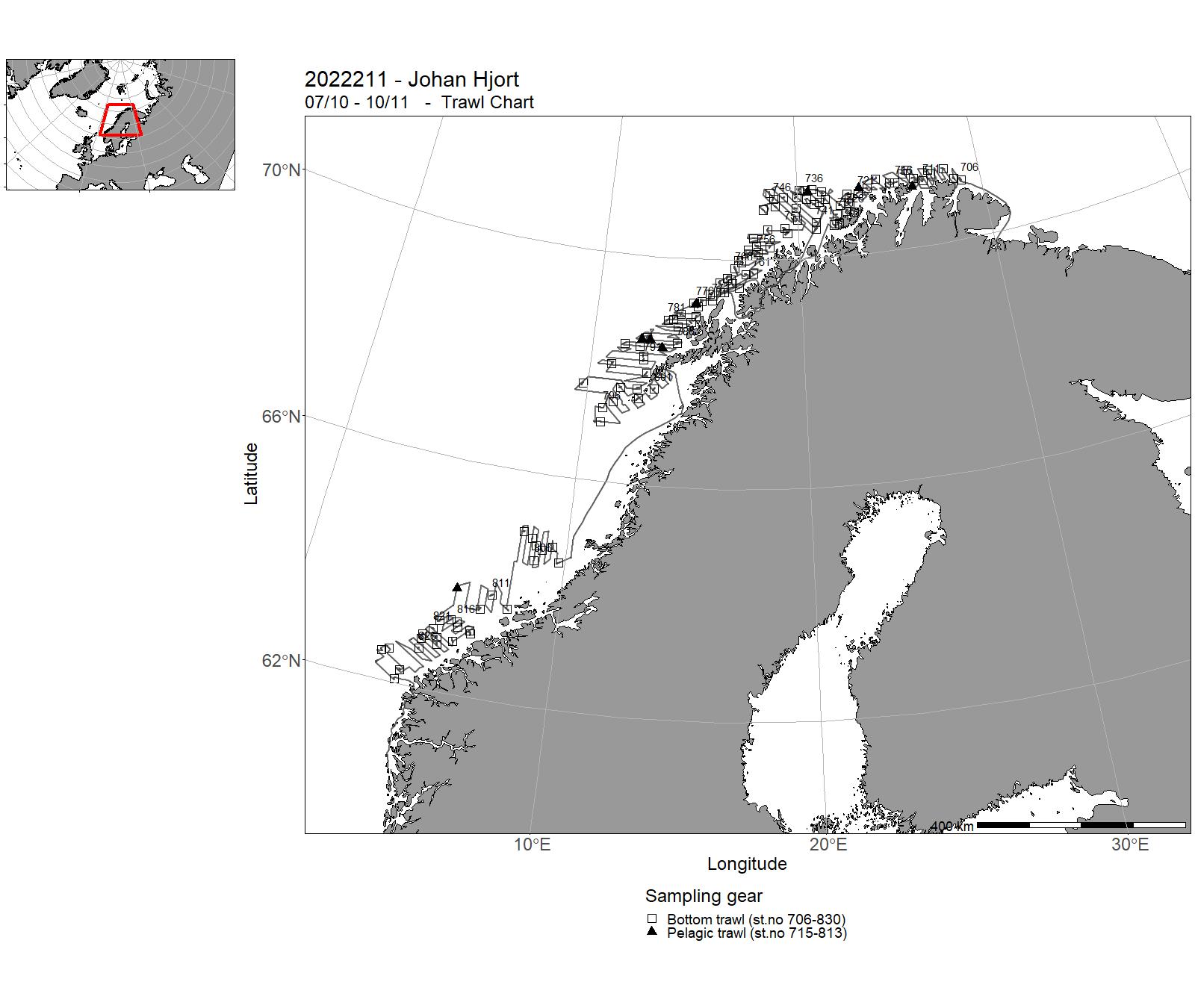
| 2022211 | 07/10 - 10/11 | Annual combined acoustic and bottom trawl survey along the Norwegian coast north of 62N. Map the distribution and calculate acoustic abundances indices, length, weight and maturity at age for coastal cod and saithe. Improve data basis for the assessment of golden redfish, by allocating additional bottom trawls map the general hydrographical regime by using a CTD-sonde to monitor the temperature and salinity at one at bottom trawl stations and/or at fixed intervals (about 30 NM). Collection of frozen samples of selected shark and skate species, and deep sea shrimps | Norwegian Sea | 939-992 | 706 - 830 |
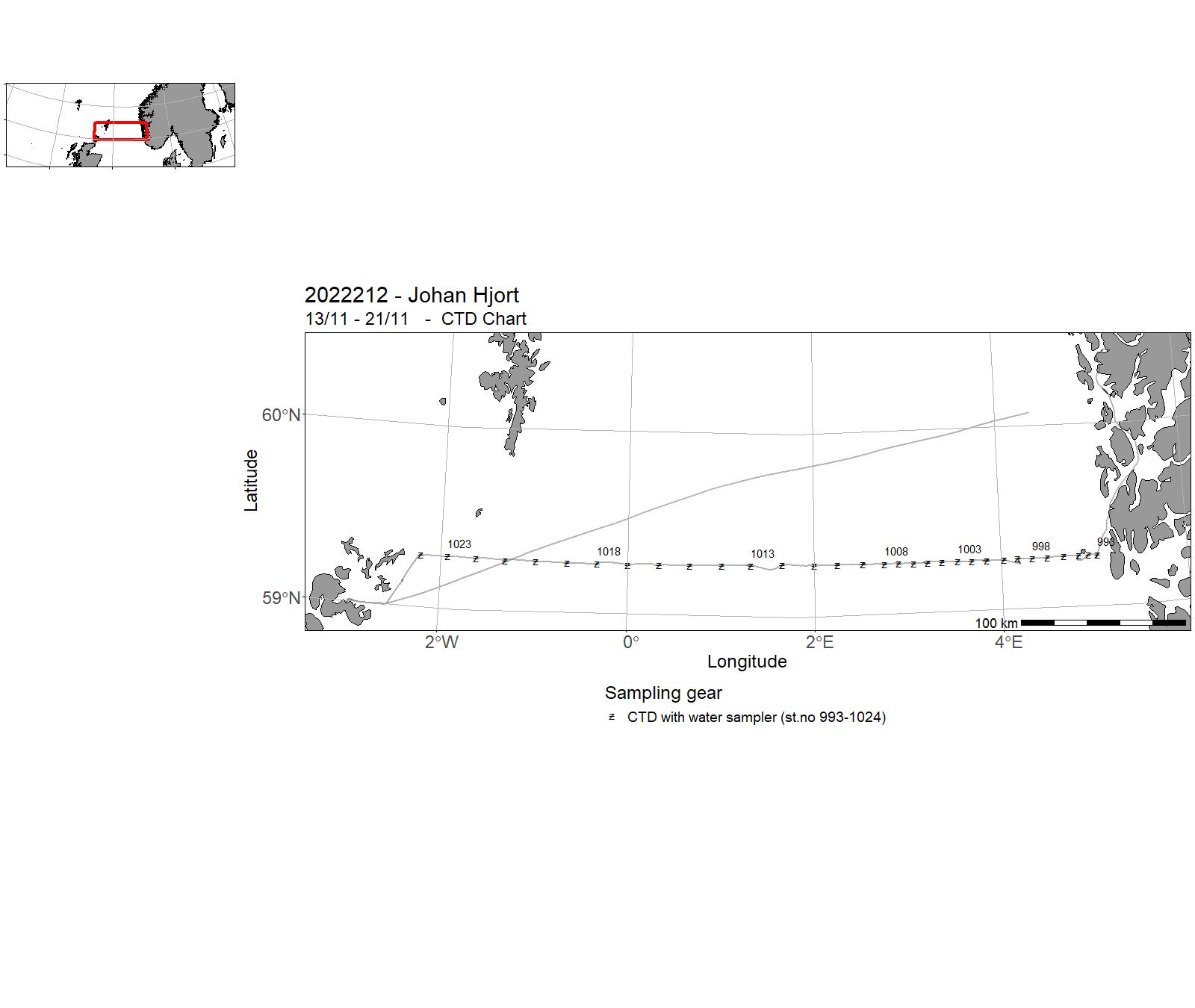
| 2022212 | 13/11 - 21/11 | Objectives : To collect data and samples on pre-selected stations. To sample standard transects for physical oceanographic parameters (CTD casts, nutrients and chlorphyll) and zooplankton in the North Sea. Cruise programme: Utsira-V transect | North Sea | 993-1024 | - |
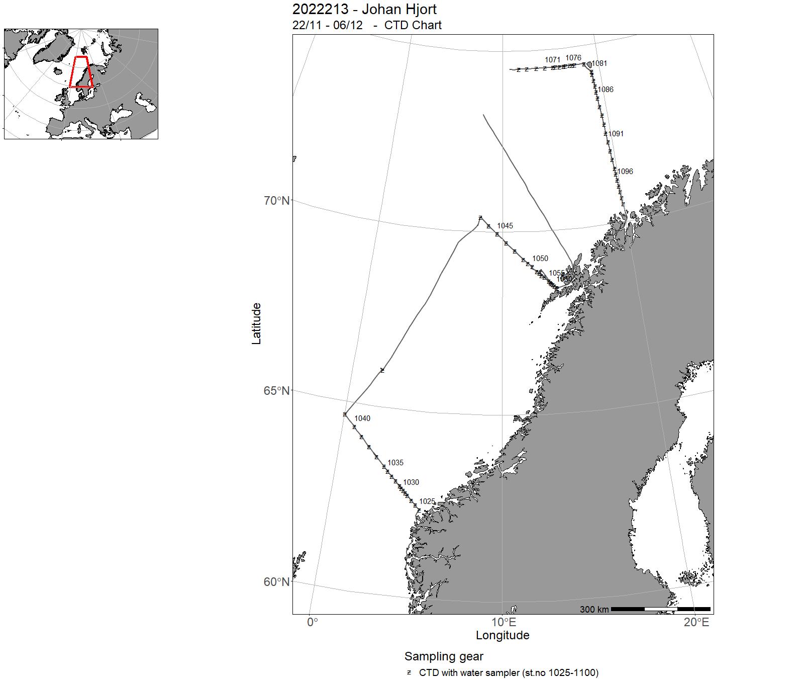
| 2022213 | 22/11 - 06/12 | The objective of the cruise was to collect data and samples on pre-selected stations as part of the IMR Monitoring of the environment and plankton on the Svinøy, Gimsøy, Bjørnøya-east and Fugløya-Bjørnøya sections and at station M in november/december. Sampling was undertaken on the following standard transects: Svinøy, Gimsøy, Bjørnøya-east and Fugløya-Bjørnøya sections and at station M. The cruise programme included sampling for physical-chemical oceanographic parameters (CTD casts, nutrients and chlorophyll), zooplankton with plankton net (WP2) and Multinet Mammoth.Water samples of carbon at station M for UiB-GFI2022-GFI-006: Rigging and gliding work related to NorEMSO activity on St.M and the Gimsøy section. Multinet Mammoth was used to collect vertically stratified samples of zooplankton on the Svinøy section. |
5 - “Johan Hjort” – Charts for cruises 2022
6 - "Kristine Bonnevie" – Cruises 2022
| Cruise no | Period | Purpose | Area | CTD st.no | Trawl st.no |
|---|---|---|---|---|---|
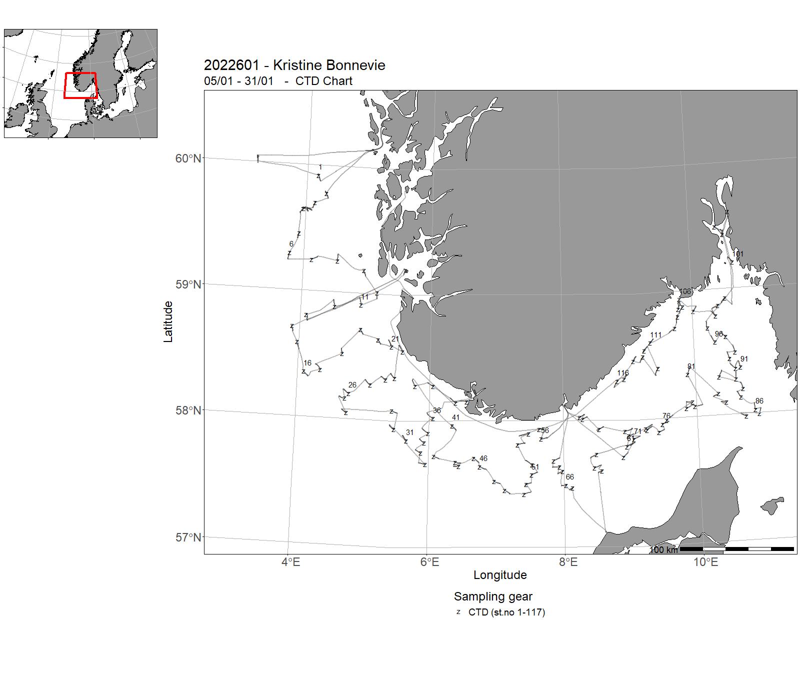
| 2022601 | 05/01 - 31/01 |
Annual shrimp survey conducted by the IMR : 1. Fixed trawl stations (bottom trawl) for northern shrimp (Pandalus borealis) and fish. Data on shrimp biomass, abundance, and recruitment: total weight, length, sex, maturity 2. CTD (temperature, salinity) on all trawl stations 3. Length and total weight of all fish species 4. Roundnose grenadier & greater/lesser argentine: individual weight, length, sex, maturity, age 5. Sharks & rays, except spiny dogfish: individual length, weight, sex 6. Spiny dogfish: individual length, weight, age, maturity, genetic sampling 7. Norway lobster (Nephrops): individual weight, length, sex, maturity 8. Atlantic halibut: individual length, weight, sex, maturity, age 9. Anglerfish: individual length, weight, sex, maturity, age 10. Blue ling: individual length, weight, sex, maturity, age, genetic sampling, gonad samples of females 11. Sea cucumber (Parastichopus): individual length, weight 12. For the Norwegian Defence Research Establishment (FFI): liver and muscle samples of roundnose grenadier, rabbit fish, skates, and flatfish: individual samples of pandalid shrimps and squat lobsters Chief of mission: Dr. Guldborg Søvik, IMR |
Skagerrak | 1-117 | 2-125 |
| 2022602 | 02/02 - 05/02 |
The cruise is part of the activity within the project FJO2Rd, financed by the Norwegian Research project. The primary objective of FJO2RD is to explore if, how, and why the renewal frequency has changed as a result of physical climate change, and to determine its link to the deoxygenation of Norwegian fjords and the potential anthropogenic contribution. During the cruise we 1) Made CTD sections and took water samples (O2, Alcalinity, nutrients, total carbon, isotopes and trace metals) from Lure and Masfjorden 2) Deployed and recovered oceanographic moorings in the fjords 3) Took sediment cores using a) Multi-corer and b) gravity corer. |
North Sea | 118-147 | - |
| 2022603 | 09/02 - 18/02 | Bottom trawling for demersal fish and northern shrimp. Pelagic trawling for krill and other pelagic species. Multinet macro plankton trawling. Sandeel dredging (beam trawl). CTD (temperature, salinity, water sampling). Deployment/retrieval of current profilers Project name: CoastRisk - Assessing cumulative impacts on the Norwegian coastal ecosystem and itsservices Coordinating body: Institute of Marine Research, Norway | Skagerrak | 148 - 227 | 21 - 161 |
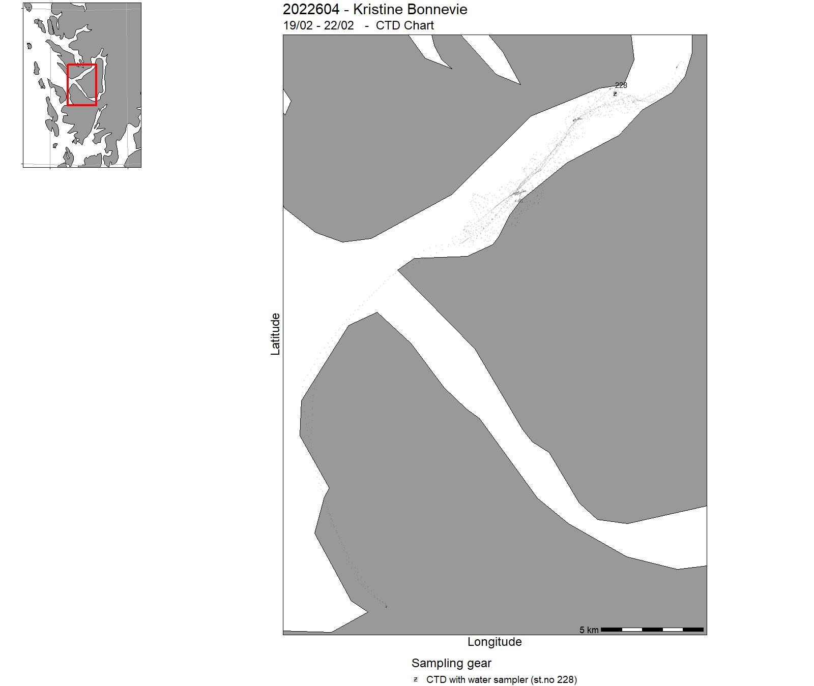
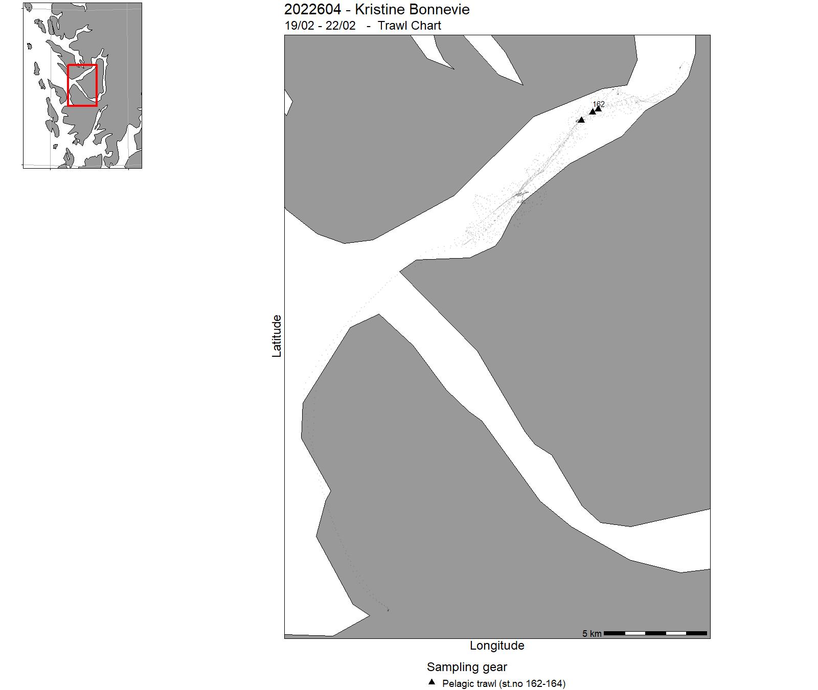
| 2022604 | 19/02 - 22/02 | Training of students at University of Bergen, Course BIO356, in fishery acoustic and trawl methods. Echo sounder sampling. Trawling with DeepVision camera system | North Sea | 228 | 162-164 |
| 2022605 | 23/02 - 01/03 |
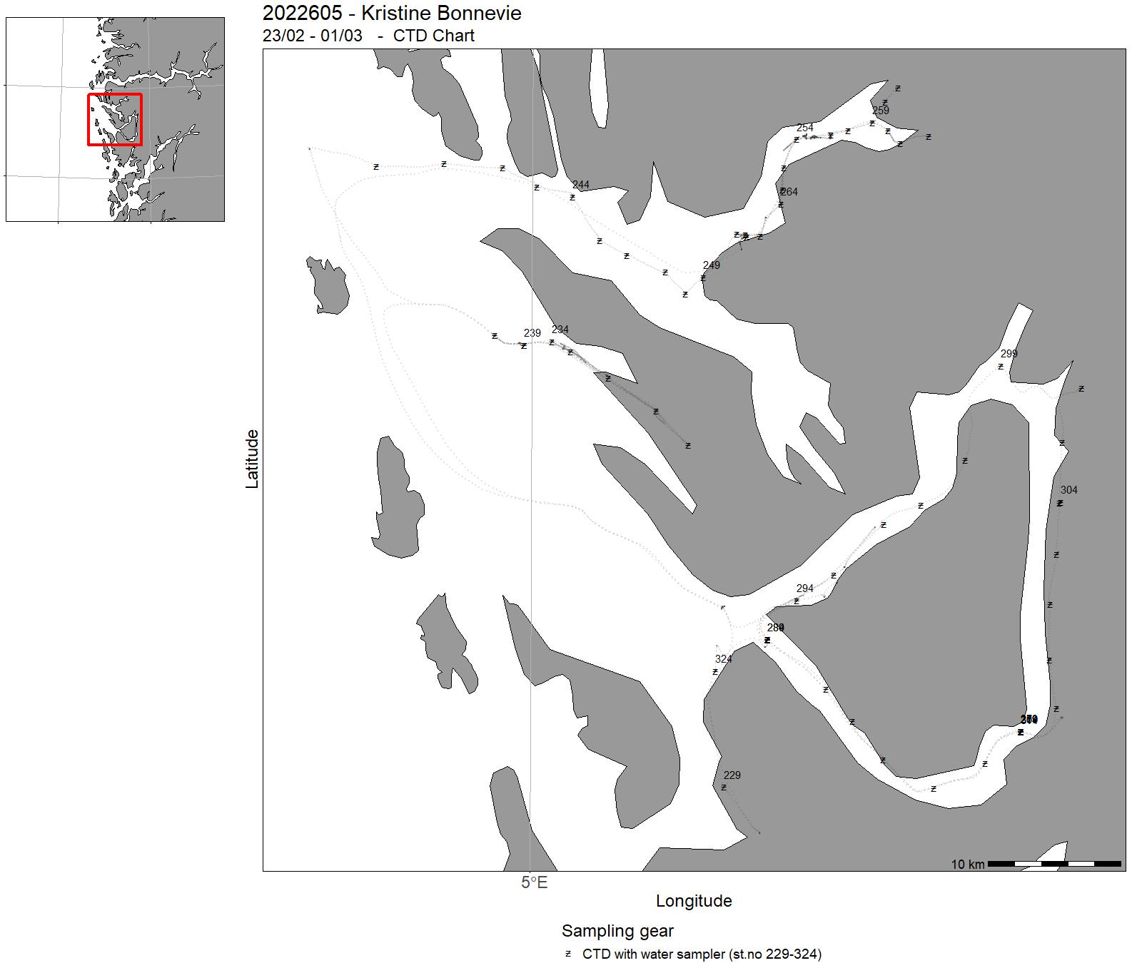
This aim of the cruise was to collect data for student projects and to give student practical experience from oceanographic data collection. During the cruise we 1) Made CTD sections and took water samples (O2, Alcalinity, nutrients, total carbon, isotopes, salinity) from Lurefjorden, Masfjorden and the fjords around Osterøy 2) Deployed and recovered oceanographic moorings in the fjords 3) Made time series and sections of turbulence / microstructure profiles 4) Deployed surface drifters Cruise coordinator: Elin Darelius, University of Bergen |
North Sea | 229-324 | - |
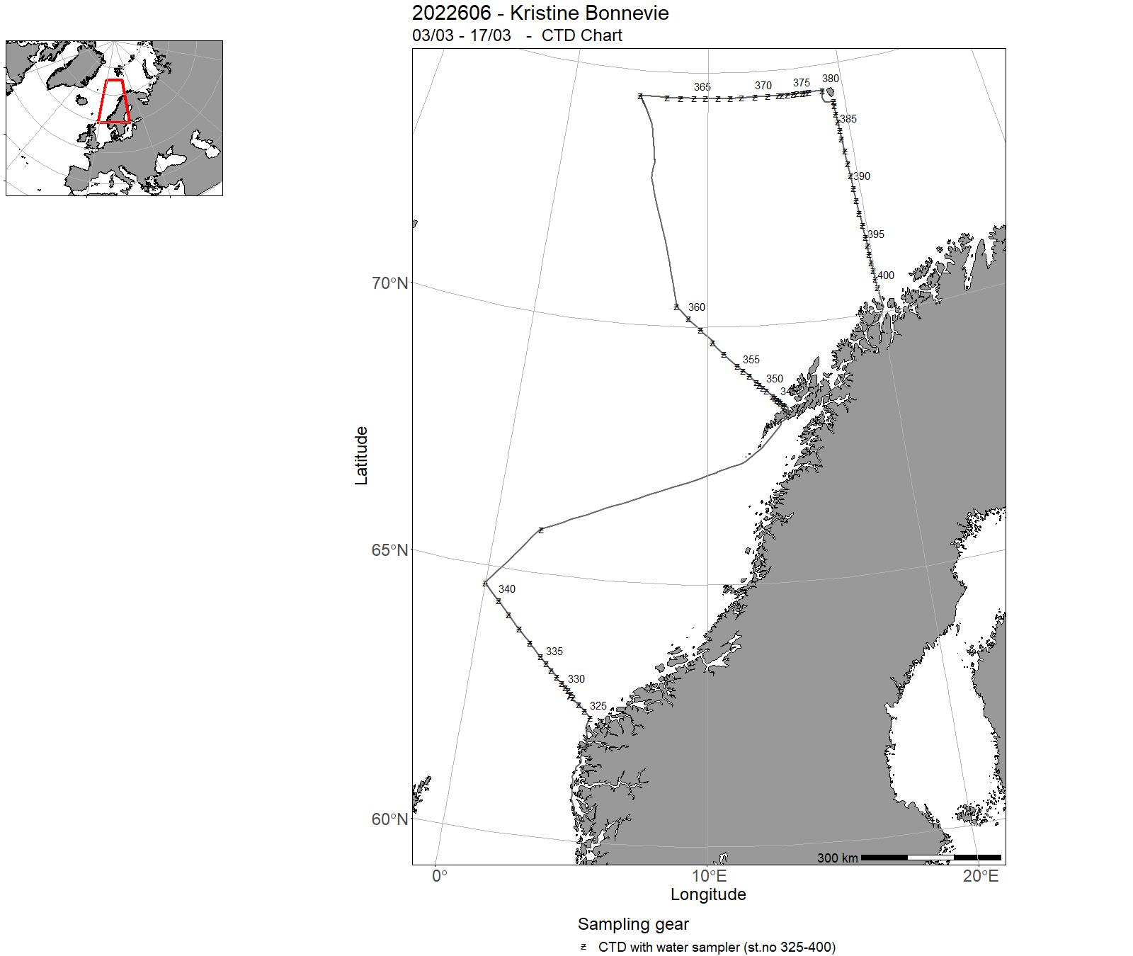
| 2022606 | 03/03 - 17/03 | The objective of the cruise was to collect data and samples on pre-selected stations as part of the IMR Monitoring of the environment and plankton on the Svinøy Gimsøy, Bjørnøya-vest and Fugløya-Bjørnøya sections and at station M in March. Sampling was undertaken on the following standard transects: Svinøy, Gimsøy, Bjørnøya-vest and Fugløya-Bjørnøya sections and at station M. The cruise programme included sampling for physical-chemical oceanographic parameters (CTD casts, nutrients and chlorophyll), zooplankton with plankton net and Multinet Mammoth. Water samples of carbon on the Gimsøy and Fugløys-Bjørnøya section. Rigging and gliding work related to NorEMSO activity on the Svinøy and Gimsøy, sections, UiB. | Norwegian Sea | 325-400 | - |
| 2022607 | 18/03 - 24/03 | CTD-survey of fjords and coast in Troms and western Finnmark (Malangen-Revsbotn). Water sampling for analysis of eDNA, nutrients and the carbonate system. Deploy current meter moorings in Ullsfjorden. Project name: Fjord oceanography and coastal climate (FOKK), FishDiv &: SalCodCoordinating body: Institute of Marine Research | Norwegian Sea | 401-508 | - |
| 2022608 | 29/03 - 07/04 | The goal of the cruise is to collect fish eggs for mapping spawning areas in the project «National program for mapping of marine nature types». The primary targets for the mapping are local stock of coastal cod. The secondary goal is to visually determine all eggs and preserve these for further genetic studies. All eggs are photographed. Stations are located primarily in the inner fjord areas, with less emphasis on the outer coastal areas. Project name: National program for mappings spawning and nursery areas for commercially important coastal speciesCoordinating body: Institute of Marine Research, Norway | Northeast Atlantic Ocean (40W) | 509-514 | - |
| 2022609 | 08/04 - 19/04 | Map the main spawning grounds of NEA haddock. Survey report available from: hi.no/hi/nettrapporter/toktrapport-2022-8. | Barents Sea | 515 - 555 | 165-196 |
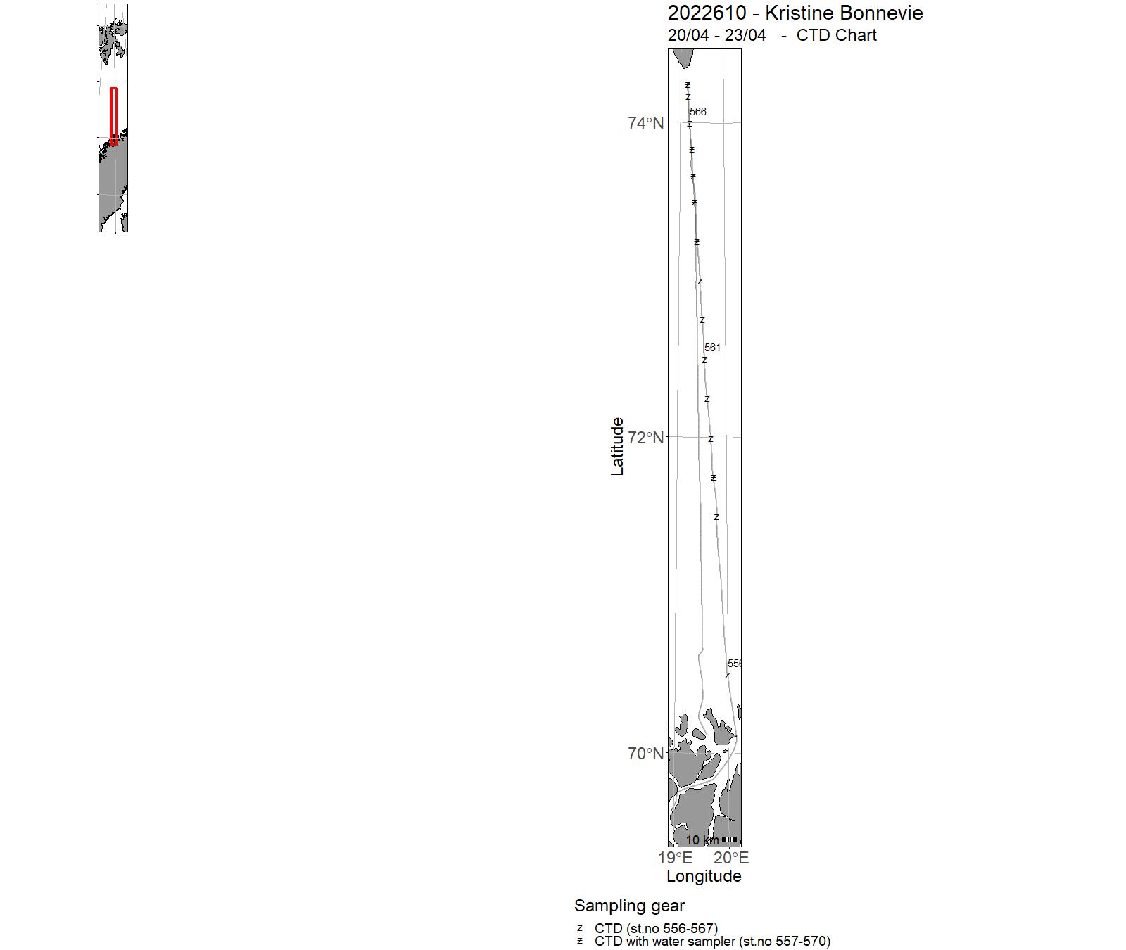
| 2022610 | 20/04 - 23/04 | Annual combined acoustic and bottom trawl survey in the Barents Sea in winter to: Fugløya-Bjørnøya transect Project name: Monitoring of plankton in Barents Sea Coordinating body: Institute of Marine Research (Bergen) | Barents Sea | 556 - 570 | - |
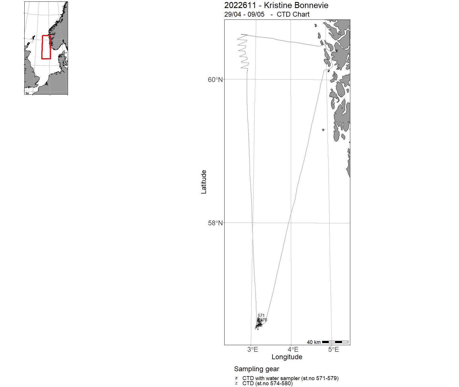
| 2022611 | 29/04 - 09/05 | Effects of seismic sound on zooplankton (ZoopSeis) is a project founded by the Norwegian Research Council, aiming at uncovering the effect of seismic on zooplankton. This cruise is part of the ZoopSeis project. The aim of the cruise was to find at what distance seismic airguns impact zooplankton in terms of immediate mortality, delayed mortality and any behaviours effects (i.e. swarming, sinking and so on). In addition to the zooplankton response to seismic we conducted an acoustic transect on Vikingbanken on our way back. The transect lasted 10 hour covering ~93 nm. The methods followed standard acoustic survey coverage. The acoustic data was scrutinised following sandeel protocol. | North Sea | 571 - 580 | - |
| 2022613 | 20/05 - 21/05 | Testing and training with one Slocum electric ocean glider. Testing of one surface drifter. | Norwegian Sea | - | - |
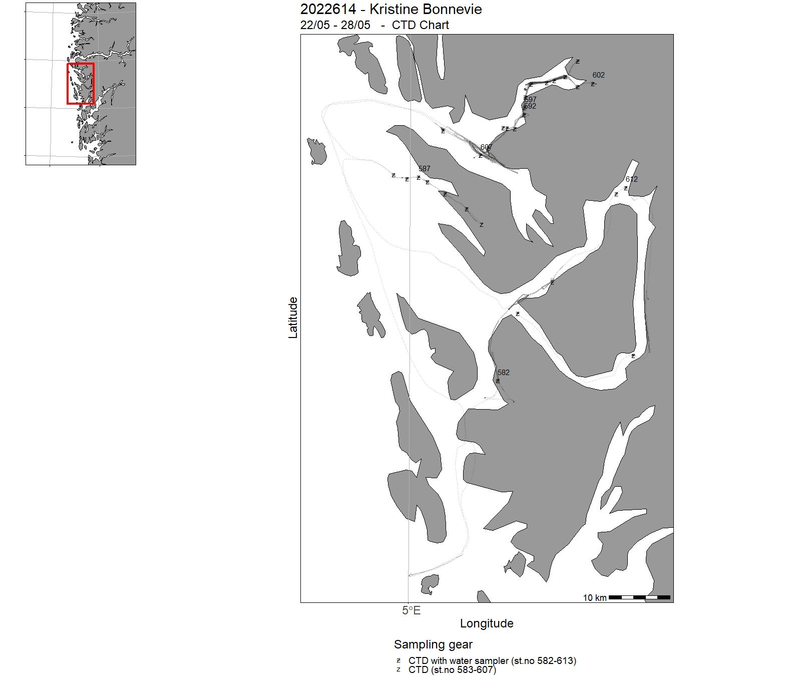
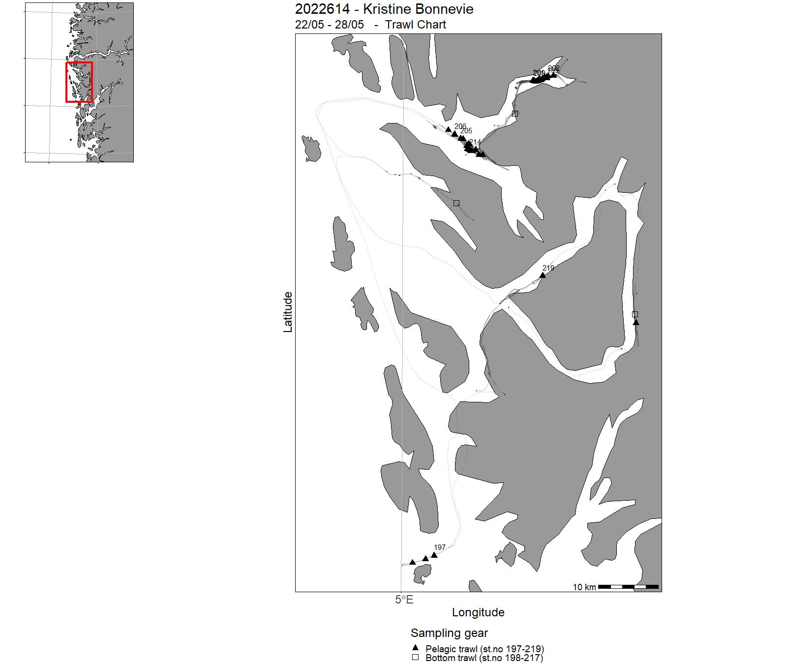
| 2022614 | 22/05 - 28/05 | The survey collected samples in West Norwegian fjord: (Fensfjord, Masfjord, Haugsværsfjord, Osterfjord and Sørfjord. The equipment used was : CTD Harstad Pelagic trawl 320 with Multi Sampler (3 cod-ends) Demersal campelen 1800 trawl. MIKWP2 Spectroradiometer Acoustics Picarro CWS stable water isotope analysis Niskin water bottles Project name: HypOnFjordFish/CLIFORD/FJO2RD Coordinating body: Department of Biological Sciences, University of Bergen | North Sea | 582 - 613 | 197 - 219 |
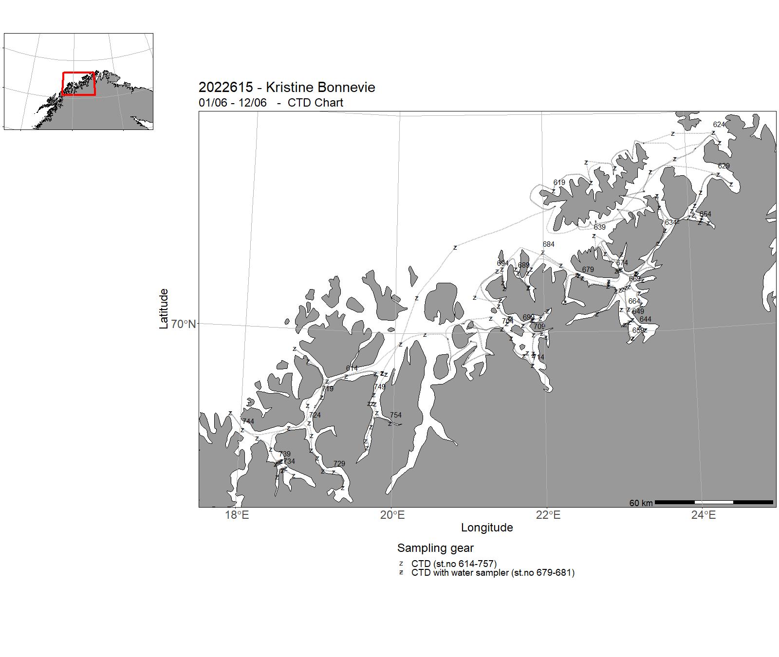
| 2022615 | 01/06 - 12/06 | CTD-survey of fjords and coast in Troms and western Finnmark (Malangen-Revsbotn). Water sampling for nutrients and the carbonate system. Monitor the spreading of red king crab in Troms and western Finnmark (Uløya-Revsbotn). Studying the area where the red king crab is freely fished, using traps, to estimate the stock in this area. Project name: Fjord oceanography and coastal climate (FOKK) and Bestandsrådgivning kongekrabbe Coordinating body: Institute of Marine Research | Norwegian Sea | 614 - 757 | - |
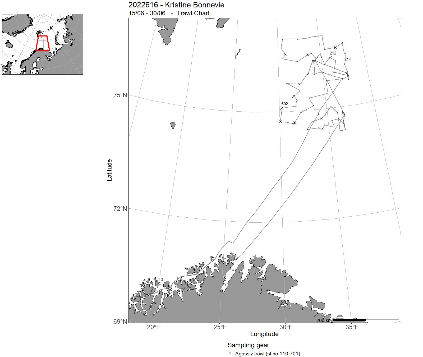
| 2022616 | 15/06 - 30/06 | The aim of the cruise was to study the spreading and collect density data on the snow crab in the Svalbard Fishery Protection Zone by using a research vessel. Our main study area was in the present area for commercial fishing. Also testing of different traps were performed during the cruise. Project name: 14422 Snøkrabbe and 15560 Fangstteknologi snøkrabbe | Barents Sea | - | 110-701 |
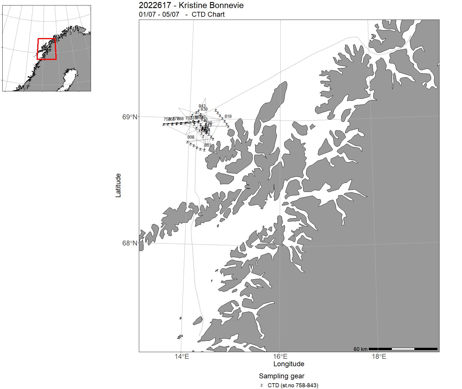
| 2022617 | 01/07 - 05/07 | 2022-MP-025: Elucidate the influence of CH4 seeps (i.e., acidification) on the physiology and functioning of benthic ecosystem engineers (foraminifera, CWC and sponges) at LoVe Node 7 compared to control Node 1. On this cruise we will collect fauna with ROV, prepare fauna for deployment on benthic landers for transplantation. On-board physiological measurements will be carried out. Eco-Pulse: Sette ut rigger for å studere generering av brytende indre bølger på sokkelkanten og dess effekt på transport av materiale innover sokkelen og mattilgang for korallrev. | Norwegian Sea | 758-843 | - |
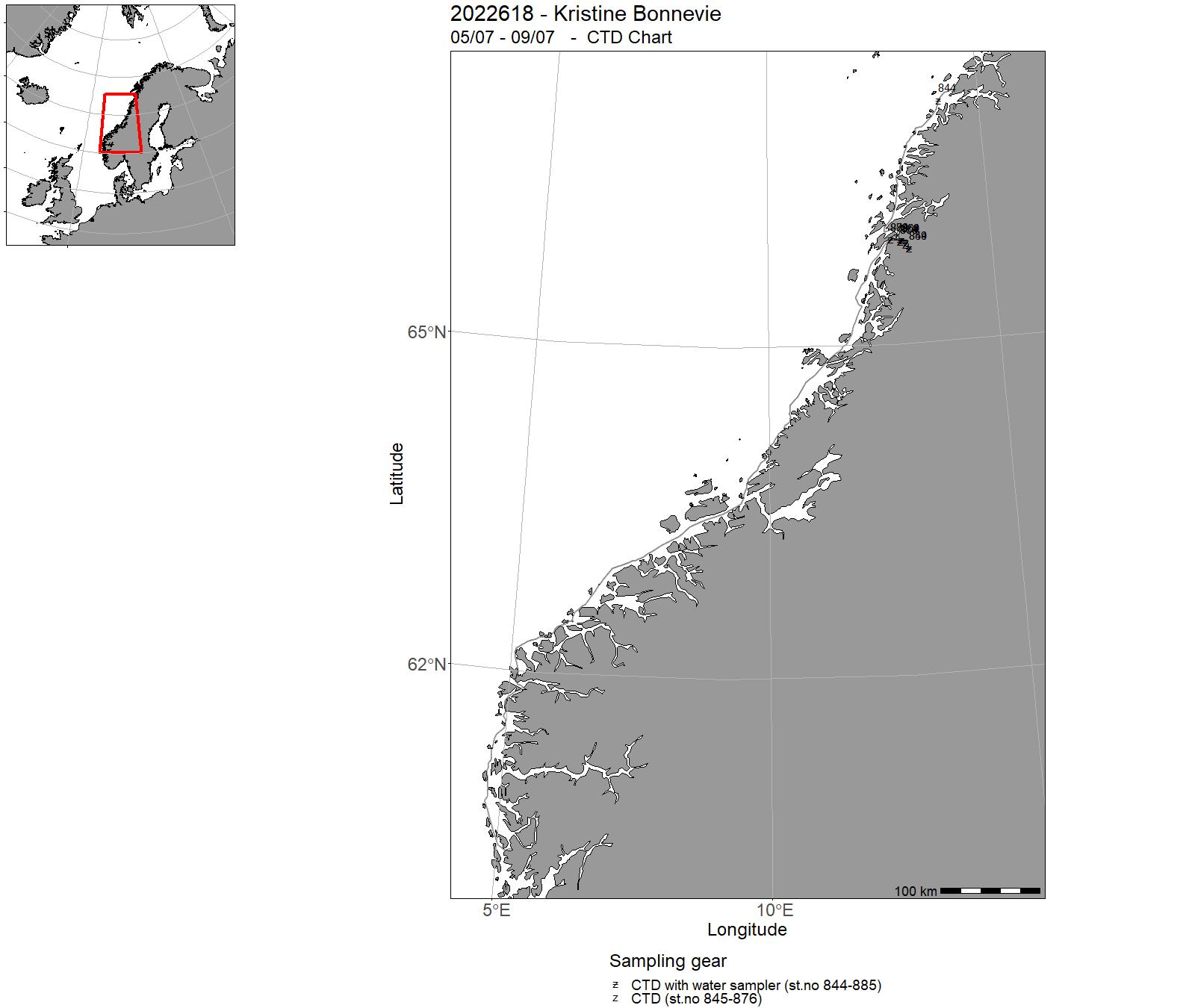
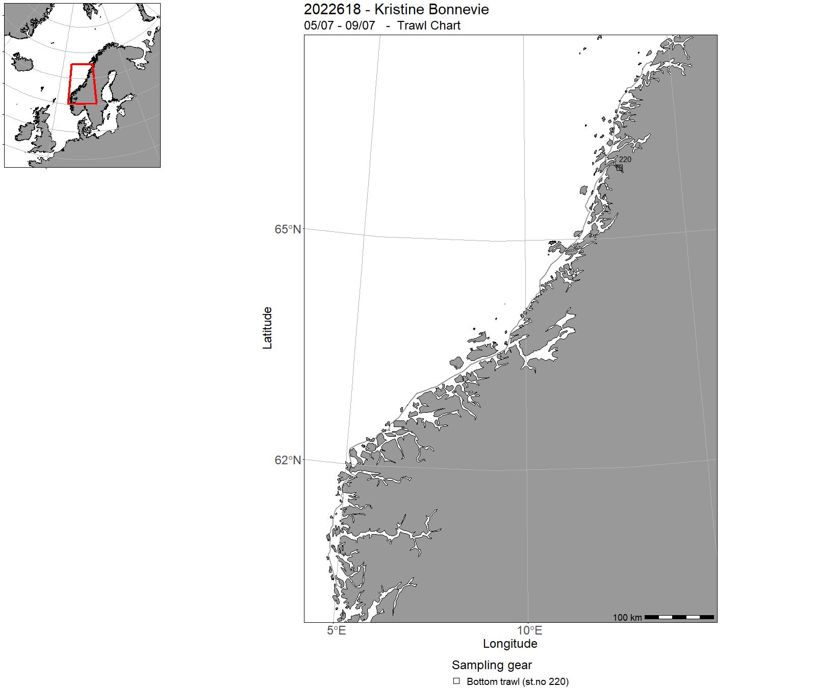
| 2022618 | 05/07 - 09/07 | Areas in central Norway were heavily contaminated with fallout from the Chernobyl accident in 1986. Due to rainfall during the first few days after the accident, some areas in Oppland, Hedmark, Trøndelag and Nordland counties, were particularly contaminated. Results from Norway's national monitoring programme Radioacitivity in the Marine Environment (RAME: www.dsa.no) show that Vefsnfjord is one of the Norwegian fjords with highest levels of radioactive cesium (137Cs) in surface sediments with activity concentrations up to 348 Bq kg-1 dry weight (d.w.) in the period 2002-2020. These levels are two orders of magnitude higher than in open Norwegian sea area sediments, and confirm that Vefsnfjord is heavily affected by 137Cs contamination, even more than 30 years after the Chernobyl accident. The aim of this cruise was To investigate in more detail how 137Cs is transported from land via rivers to the Vefsnfjord. To study how 137Cs is distributed in the fjord between seawater, particles in the seawater, sediments and various marine organisms living in the fjord. We collected samples of surface seawater, bottom seawater, seawater from 20 m depth, surface sediments, sediment cores and various marine organisms. The seawater samples were size fractionated. | Norwegian Sea | 844 - 885 | 220 |
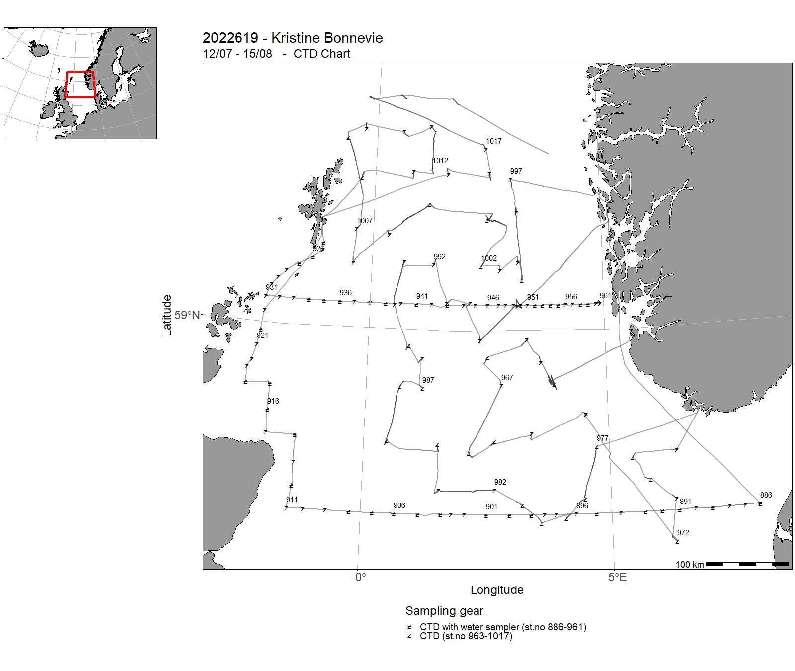
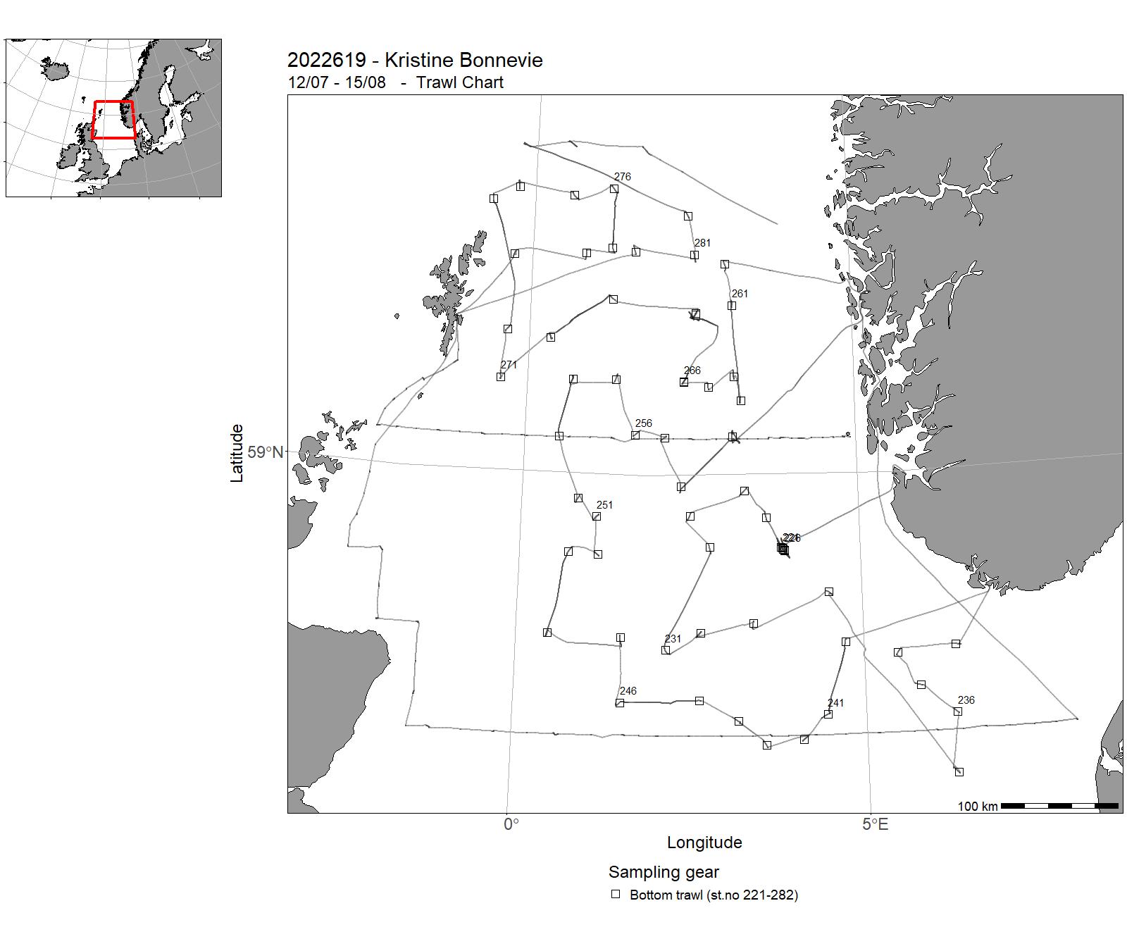
| 2022619 | 12/07 - 15/08 |
First part: sampling standard transects for hydrography (salinity and temperature), nutrients (phosphate, nitrate, nitrite and silicate), chlorophyll, zooplankton, and fish eggs and larvae, in the North Sea during summer. Cruise programme (following standard transects) : 1. Hanstholm - Aberdeen 2. Scotland East Coast 3. Fair Isle - Pentland 4. Utsira mot vest The second part of the cruise (21st of July to 13th August) corresponds to the International Bottom Trawl Survey (IBTS), coordinated by the ICES International Bottom Trawl Survey Working Group (IBTSWG). IBTS targets the following commercial fish species: herring, cod, haddock, whiting, saithe, Norway pout, mackerel, sprat. The main objective of the IBTS quarter 3 survey is to monitor changes in these stocks independently of commercial fisheries data, and to collect data for the determination of biological parameters relevant to stock assessments. Additionally, demersal and benthic community compositions are monitored, including size composition for all fish and commercial invertebrates. Hydrographic data (salinity, temperature) are also collected at each station. Part1:Project name: 14917 - Early life history dynamics of North Sea fishes 14920 - Monitoring of climate and plankton in the North Sea Coordinating body: Institute of Marine Research (IMR) Part 2:Coordinating bodyProject nameICESICES Coordinated 3rd Quarter International Bottom Trawl Survey (IBTS) in the North SeaIMR14915 - North sea herring and sprat14916 - Monitoring of demersal stocks in the North Sea |
North Sea | 886 - 1017 | 221-282 |
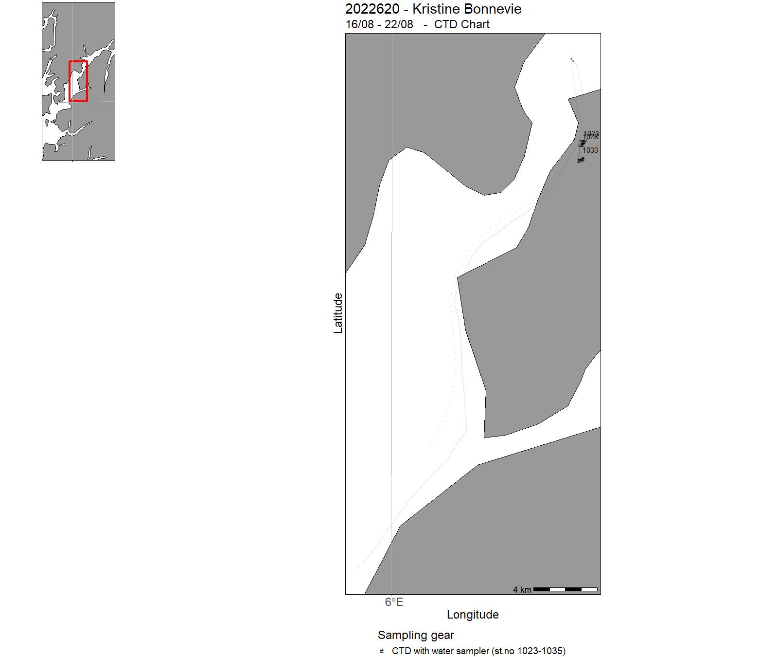
| 2022620 | 16/08 - 22/08 | 2022-AKV-019: Overvåkning av koraller ved anlegg i Hardangerfjorden | North Sea | 1023-1035 | - |
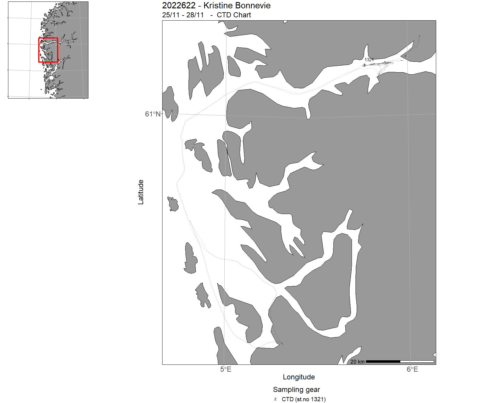
| 2022622 | 25/11 - 28/11 | 2022-RED-004: Testing av installasjon, håndtering og bruk av AUV Munin+ på Kristine Bonnevie når det er forenlig med andre toktaktiviteter. | North Sea | 1321 | - |
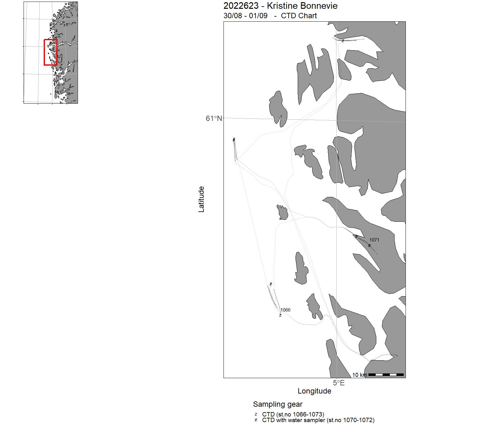
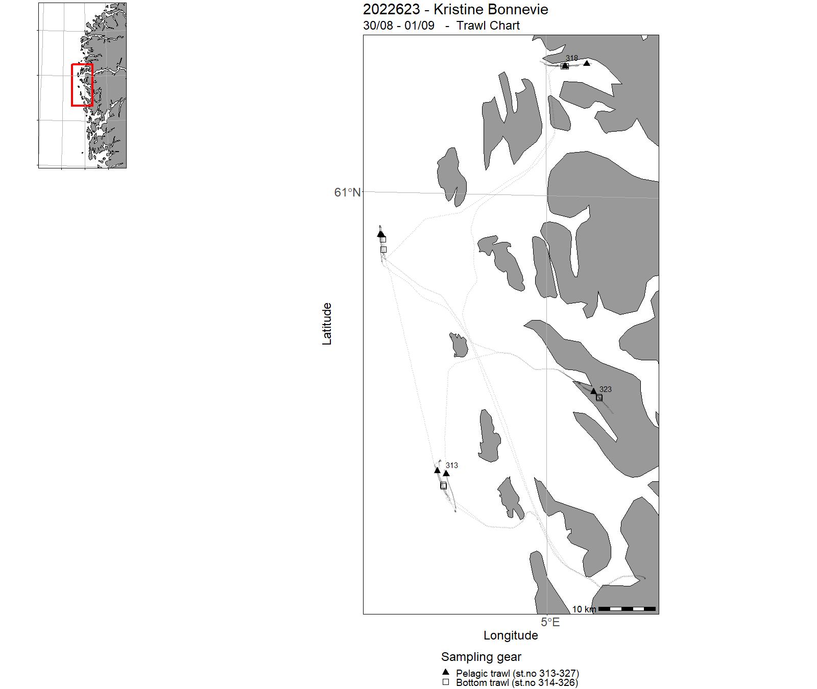
| 2022623 | 30/08 - 01/09 | Collection of marine materials and data for BIO 102 course at University of Bergen. | North Sea | 1066 - 1073 | 313 - 327 |
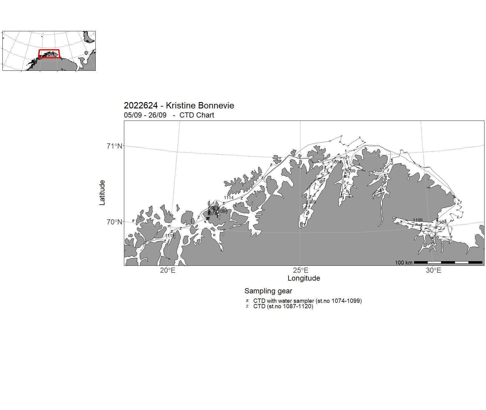
| 2022624 | 05/09 - 26/09 | Stock assessment study for red king crab in quota regulated area in East Finnmark, Norway Collecting CTD-stations Collecting data for e-DNA. Project name: 15594- Kongekrabbe Project name: 15691 Overvåking fjordoseanografi Project name:15602 Fishdiv | Norskekysten: Troms/Finnmark | 1074 - 1120 | 94-547 |
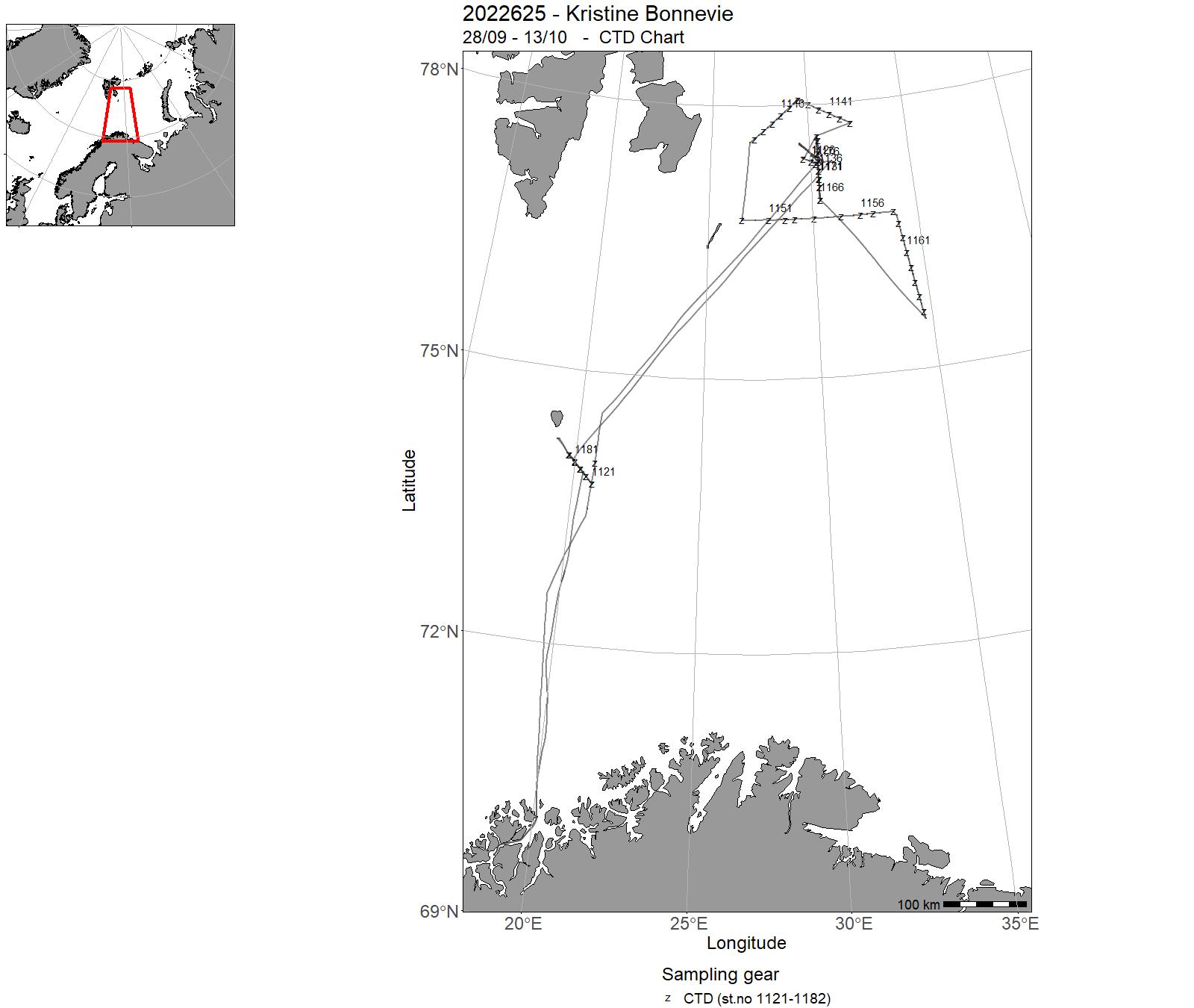
| 2022625 | 28/09 - 13/10 | The cruise KB2022625 (28. September 2022, Tromsø to 13. October 2022, Tromsø) aboard the Research Vessel Kristine Bonnevie is a Polar Front process studies cruise of the Nansen LEGACY project. The study region covered the steep topographic slope southeast of Bjørnøya and the Polar Front region between Hopen and Storebanken, all-in-all spreading 73.5°- 78°N and 19.5°-34.5°E. The objectives are to study frontal mixing processes using microstructure profilers, to deploy and recover a short-term mooring at the Polar Front and to deploy (and recover) an underwater glider equipped with turbulence sensors. The overarching goal is to collect data allowing for the analysis of physical processes at the Polar Front on sub-tidal to synoptic timescales. Combined with data from previous cruises, the timescales of investigation may be expanded to seasonal and inter-annual periods. We collected measurements of ocean stratification, currents, and microstructure from the vessel as well as from transects using ocean gliders. From the vessel we obtained 267 microstructure profiles down to 0-20 m above seabed, 64 CTD/LADCP profiles down to 5 m above seabed (all with salinity calibration samples taken at the deepest point), and 14 days of underway current profiles. From the glider we obtained 207 profiles (7 days) including using microstructure sensors in the Polar Front region north of Hopen Trench. Cruise coordinator: Dr. Ilker Fer, Geophysical Institute, University of Bergen, Norway Project name: The Nansen LEGACYCoordinating body: University of Tromsø, Norway | Barents Sea | 1121-1182 | - |
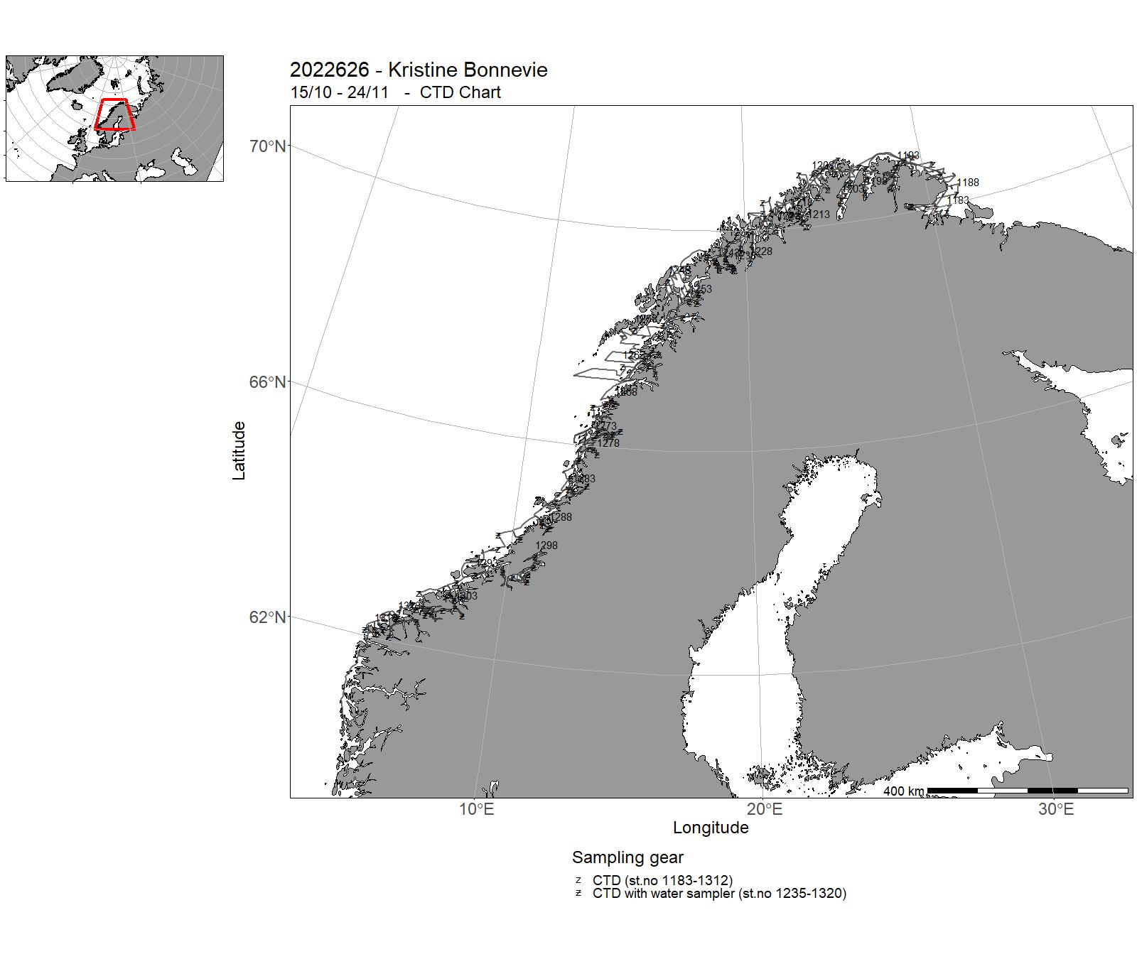
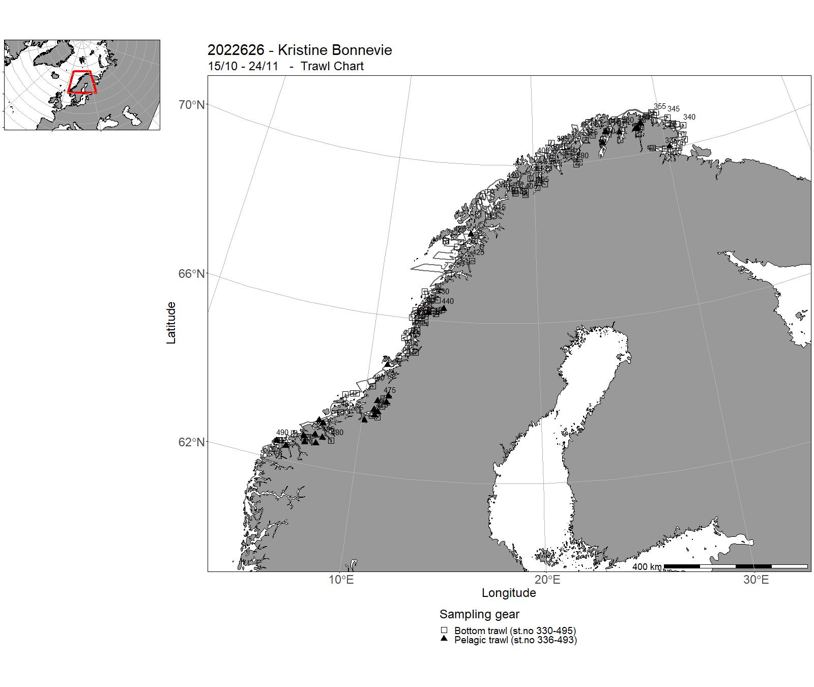
| 2022626 | 15/10 - 24/11 | Annual combined acoustic and bottom trawl survey along the Norwegian coast north of 62 N map the distribution and estimate acoustic abundances indices, length, weight and maturity at age of cod, saithe and haddockimprove data basis, by allocating additional bottom trawls, for the assessment of golden redfishmap the general hydrographical regime by using a CTD-sonde to monitor the temperature and salinity at bottom trawl stations and/or at fixed intervals (about 30 NM) in selected fjord systems Lyngen, Malangen, Ulsfjord, and Nordland - collect additional biological - and catch data for monitoring purposes and the establishment of a time series of deep water shrimpscollect zooplankton samples in selected fjords, as well as water for chemical analysiscollect sediment samples in Lakse-, Vefsn-, Namsen-, and Trondheimsfjordacoustic coverage of sprat in Trondheimsfjord and Romsdalsfjordsacoustic coverage of 0 and 1-group heering in Finmark fjordscollect eDNA samples on selected CTD stationscollect frozen fish for analysis of contaminants | Norwegian Sea | 1183 - 1320 | 330 - 495 |
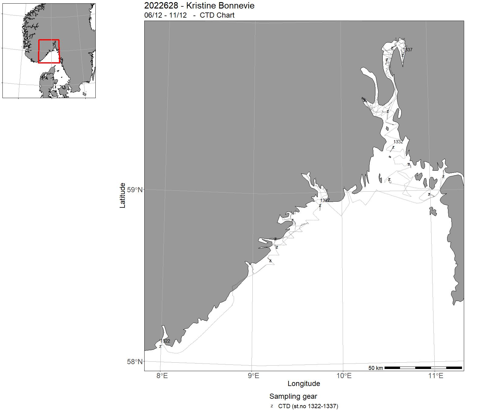
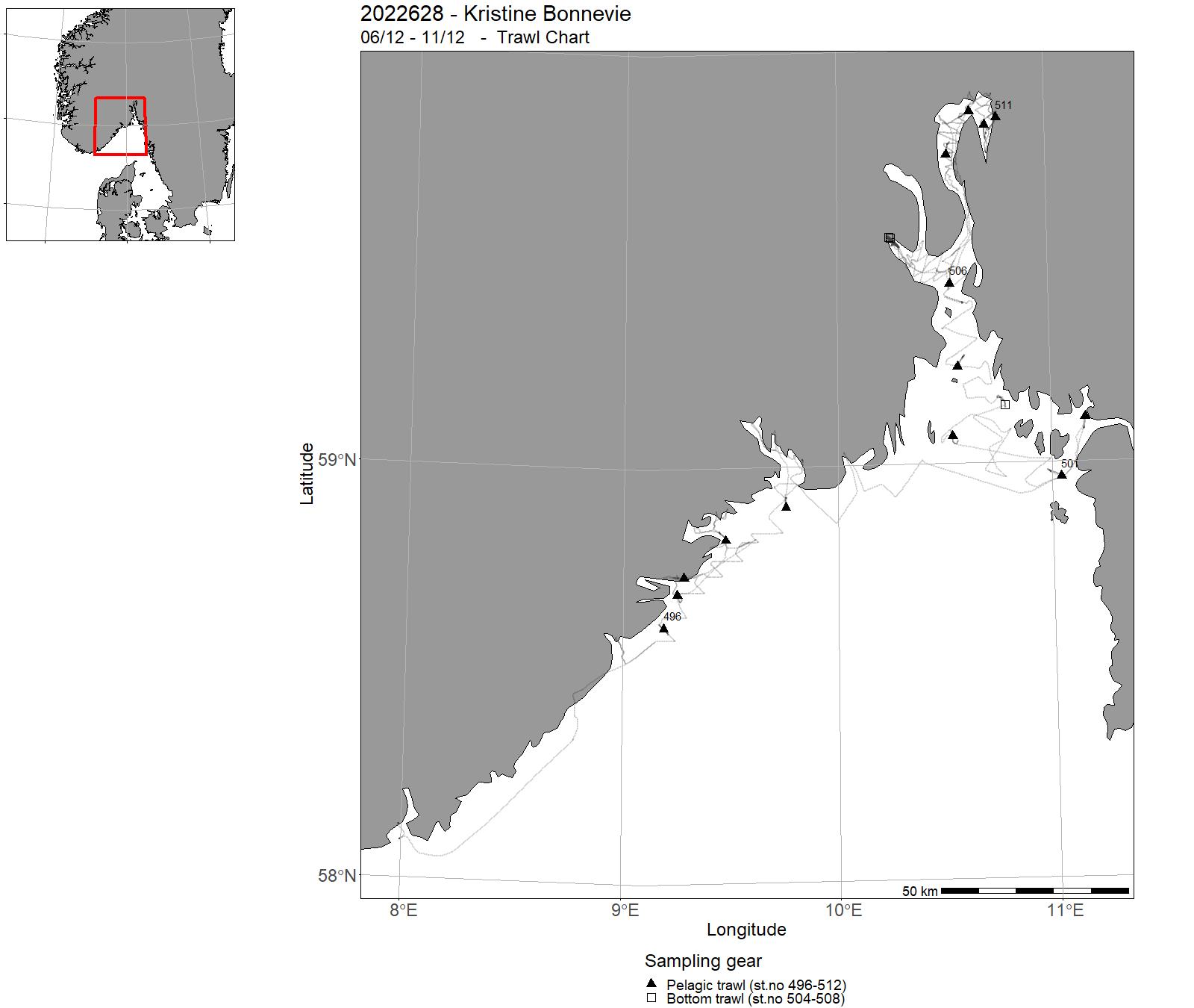
| 2022628 | 06/12 - 11/12 | Acoustic trawl survey for surveying sprat and herring, zooplankton and hydrography from Arendal to Oslo. Provide abundance indices for sprat for giving fishery advice. The survey covered the southern Norwegian coast and Oslofjorden. | North Sea | 1322-1337 | 496 - 512 |
| 2022629 | 07/02 - 07/02 | - | Norwegian Sea | - | - |
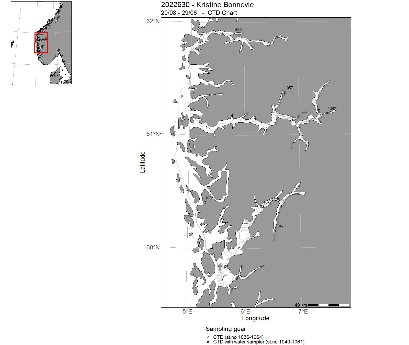
| 2022630 | 20/08 - 29/08 | Acoustic trawl survey for surveying sprat and herring, zooplankton and hydrography in western Norwegian fjords. Provide abundance indices for sprat for giving fishery advice. The survey covered Nordfjord, Sognefjorden and Hardangerfjord. | North Sea | 1036 - 1064 | 286-312 |
7 - "Kristine Bonnevie" – Charts for 2022

8 - "Kronprins Haakon" – Cruises 2022
| Cruise no | Period | Purpose | Area | CTD st.no | Trawl st.no |
|---|---|---|---|---|---|
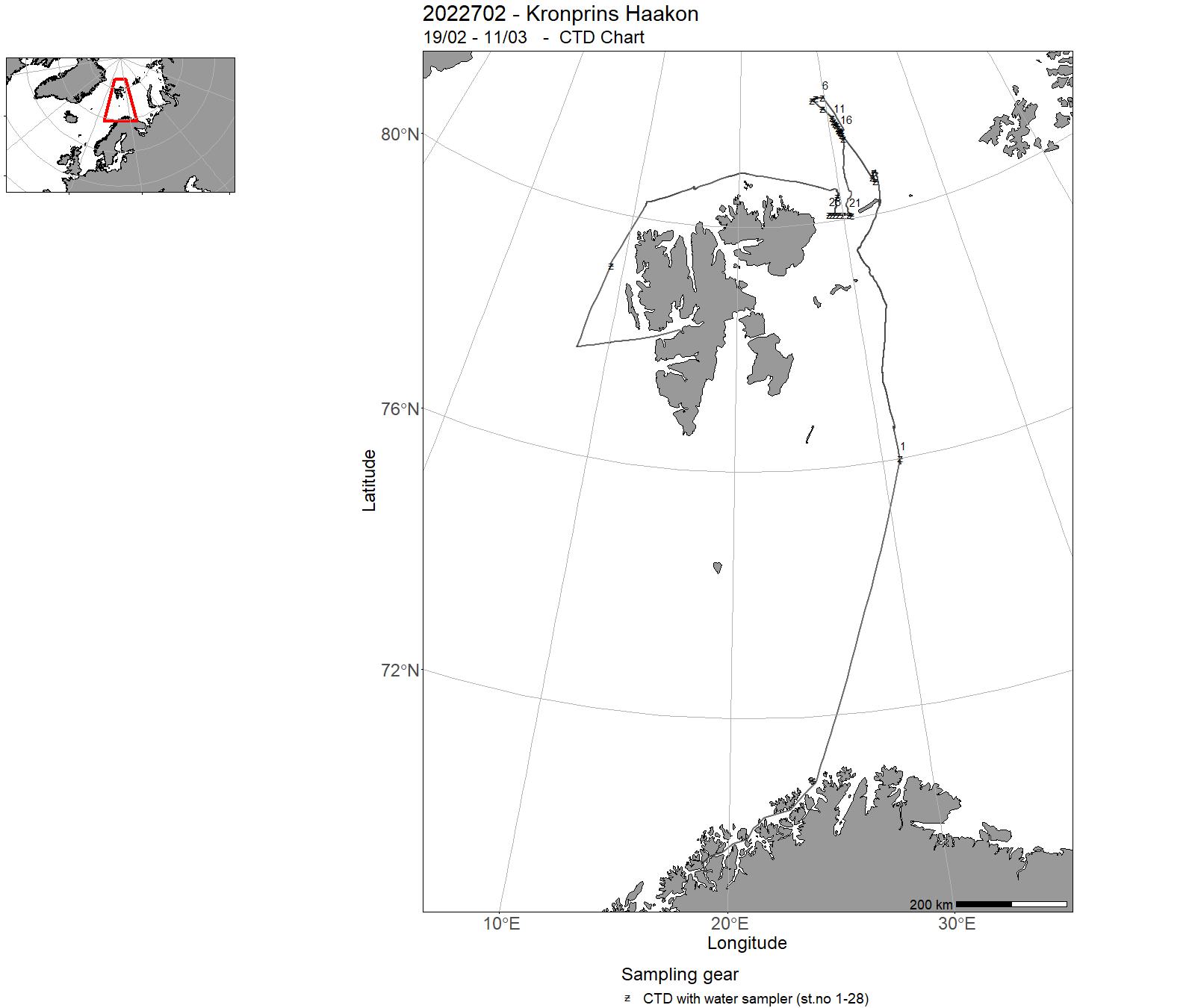
| 2022702 | 19/02 - 11/03 | The NL JC3 cruise was a joint cruise of RFs 1, 2, 3 and RA-C in the Nansen Legacy project. Chief scientists were Angelika Renner (IMR) and Rolf Gradinger (UiT). Main objective of the cruise was an interdisciplinary survey including physical, biological and chemical sampling as well as technological experiments to further our understanding of the connection between the northern Barents Sea and the continental shelf, slope and deep basin north of Svalbard during the transition time from winter to spring. To achieve this, sampling was conducted on five process stations, three of them in sea ice, and along two CTD transects. Ship-based sampling included CTD profiles including dual rosette-mounted LADCPs and water samples for biology and biogeochemistry, pelagic sampling for phyto-, zooplankton and fish, and benthic sampling. Sea ice work included sea ice physics, biology and biogeochemistry as well as ROV work for technology development.Underway sampling included surface T, S and pCO2 measurements, shipboard ADCP (38 and 150 kHz) and EK80, weather station data, and wind observations with new instrumentation. Additionally, three gliders were recovered in the central Barents Sea and west of Svalbard. Project name: The Nansen LegacyCoordinating body: UiT The Arctic University of Norway | Barents Sea | 1-28 | 1 - 5 |
| 2022703 | 16/03 - 11/04 |
The 2022 survey of harp and hooded seal pup production in the Greenland Sea was carried out to obtain updated estimates to be used to assess current status of these two seal stocks. Since a similar survey in 2018 indicated a 40% reduction in harp seal pup production since the 2012 survey, and the continued lack of increase in pup production of the severely depleted hooded seal stock despite its protection from hunting since 2007, a new survey after a period of only 4 years was urgent. The survey was carried out using well established methodologies for these species, including 1) reconnaissance of the drift ice breeding habitat from a helicopter based on the research icebreaker R/V Kronprins Haakon and a fixed-wing aircraft stationed at Constable Pynt in East Greenland, 2) deploying GPS beacons around the identified breeding areas to monitor its displacement in the East Greenland Current, 3) carrying out staging surveys to monitor the pup age structure and estimate the optimal day of pup counting as well as correction factors accounting for pups not present on the ice at the time of counting, and 4) conducting aerial photographic surveys using the fixed-wing aircraft. Project name: Ishavsselens bestandsstruktur (project no: 14391) Coordinating body: Institute of Marine research |
Greenland Sea | - | - |
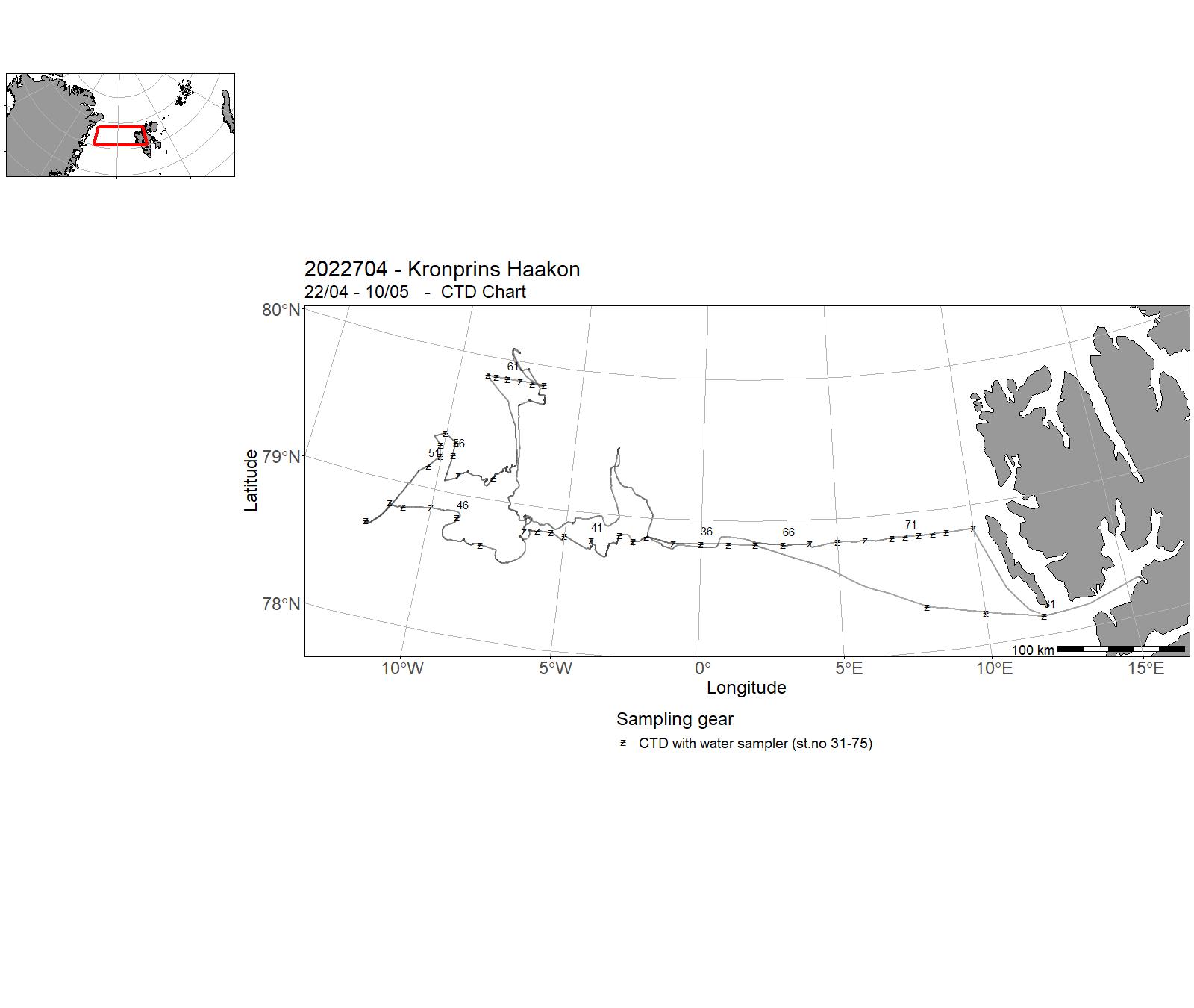
| 2022704 | 22/04 - 10/05 | 2022-UiT-004: The research cruise will go to The Fram Strait (Belgica Bank), and perform in-situ measurements and remote sensing observations for validation of remote sensing algorithms, forecast models and information products resulting from the CIRFA work. | Framstredet | 31-75 | - |
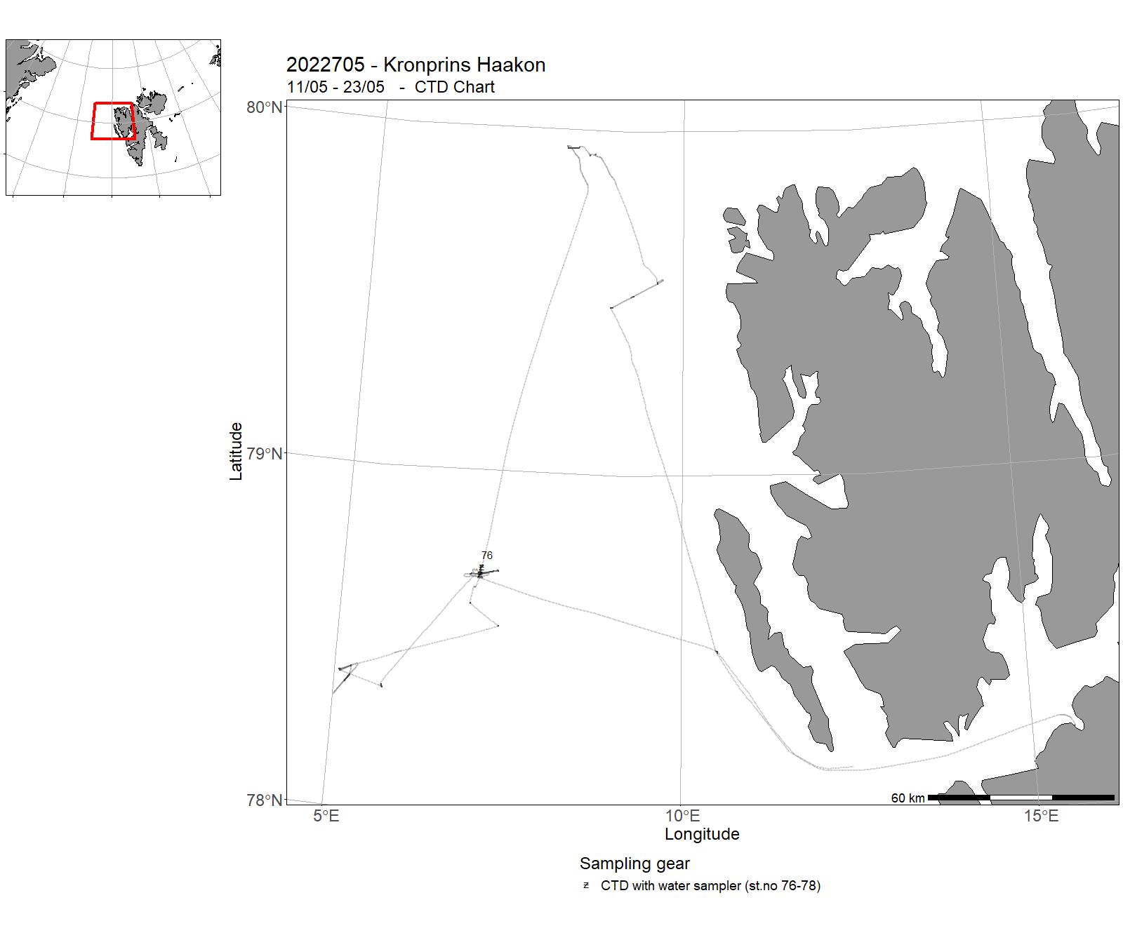
| 2022705 | 11/05 - 23/05 | AKMA-OceanSenses Research Expedition to the Arctic Ocean is focused on both science and education. Our science focuses on extreme environments such as cold seeps, places on the seafloor where methane and oil are emitted at the seafloor naturally and areas characterized by gas hydrate. In seep sites environmental stressors, such as chemistry of the emitting fluids and anoxic conditions at the seafloor, affect biological communities and produce peculiar seafloor features. Combining newly acquired data with the data already available to us we will increase our ability to understand the present and predict the future of these delicate and remote areas in the deep sea. Project name: AKMA, Advancing Knowledge of Methane in the Arctic, funded by NFRCoordinating body: UiT (Giuliana Panieri, PI) | Barents Sea | 76-78 | - |
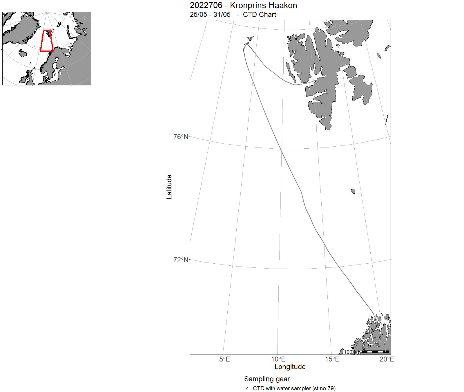
| 2022706 | 25/05 - 31/05 | The main aim of the cruise was to test the ROV Ægir6000 at depth greater than 4500m. The selection of dive stations allowed to look at the evolution of the Molloy deep. In parallel, sediment cores were taken for microbial ecology studies. | Barents Sea | 79 | - |
| 2022707 | 01/06 - 16/06 |
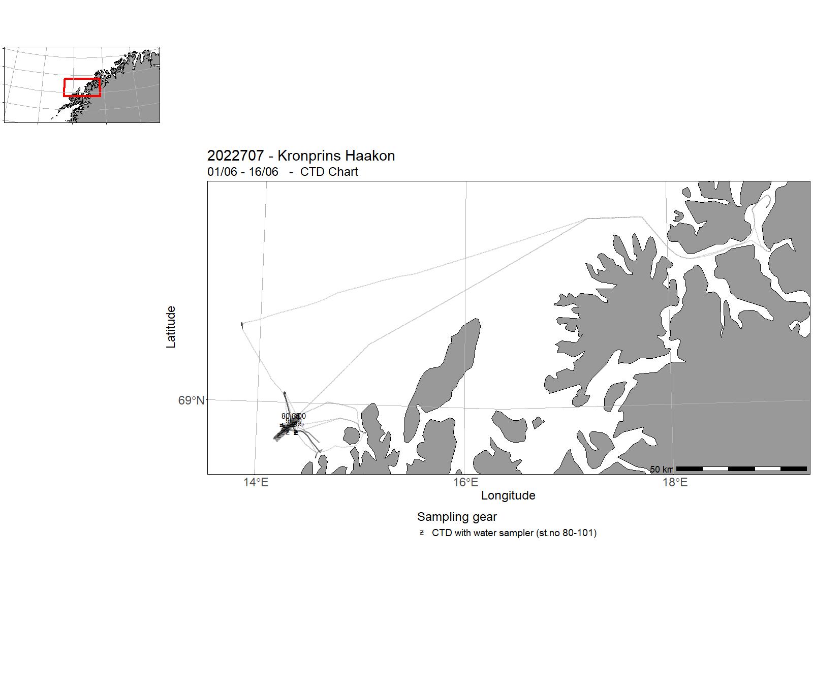
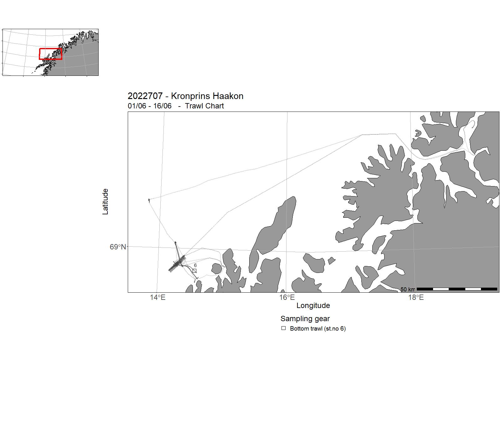
The cruise took place in the frame of the EMAN7 project (Environmental impact of Methane seepage and sub-seabed characterization at LoVe Node 7), aiming at shedding light on how oceanic parameters and climate change influence methane seepage from the seafloor, and the subsequent impacts on ecosystem health. We performed sediment coring, water sampling, coral collection and ROV operations. Main tasks: 1) Photomosaic (with ROV) 2) Microbathymetry (with ROV) 3) Installation of Piezometers and temperature probes (with and without ROV) 4) Coral collection 5) Water and sediment sampling 6) Hydroacoustic survey Project name: EMAN7 (Environmental impact of Methane seepage and sub-seabed characterization at LoVe Node 7)Coordinating body: Institute of Geosciences |
Norwegian Sea | 80-101 | 6 |
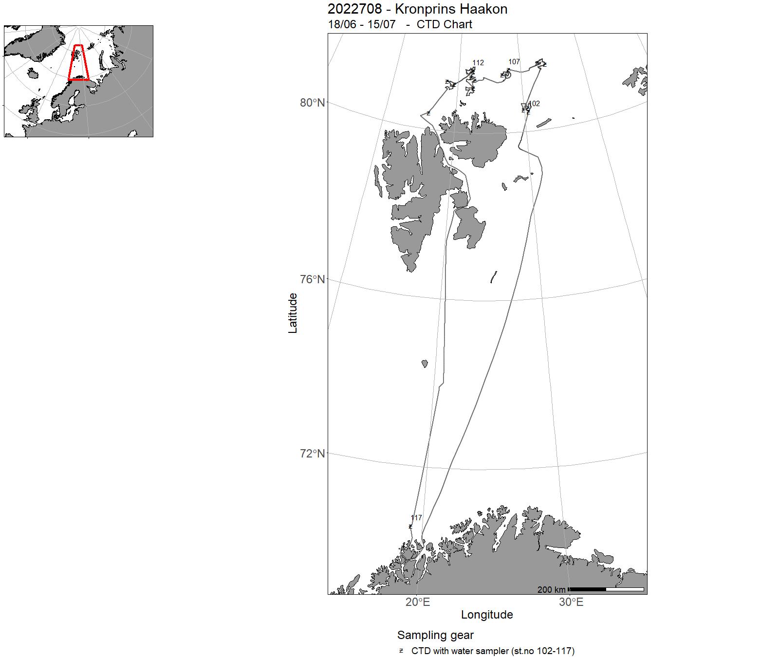
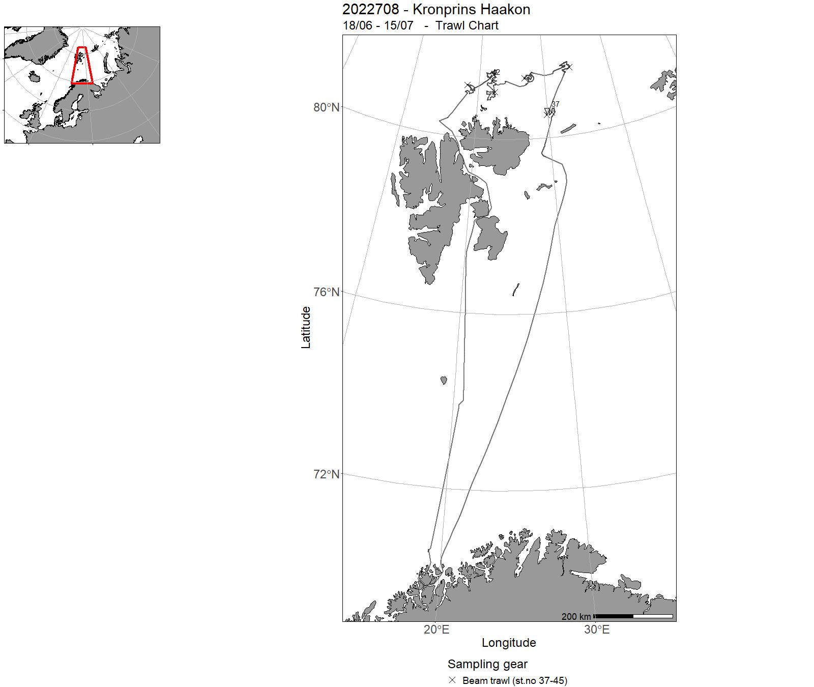
| 2022708 | 18/06 - 15/07 | Sea bottom mapping with video-filming and sampling of benthic fauna and sediments at selected stations in the Barents Sea (north off Svalbard). With the main aim off mapping benthic fauna, bio-diversity, habitat types, geological terrain-parameters and chemical pollution. The mapping was performed using visual seabed observation and sampling of sediments and organisms using a variety of sampling tools (video-rig, grab, box corer, multicorer, beam trawl and hyperbenthic sledge). Project name: MAREANO Coordinating body: Institute of Marine Research | Barents Sea | 102-117 | 37-45 |
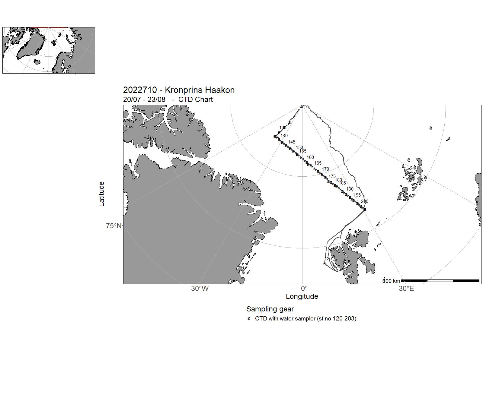
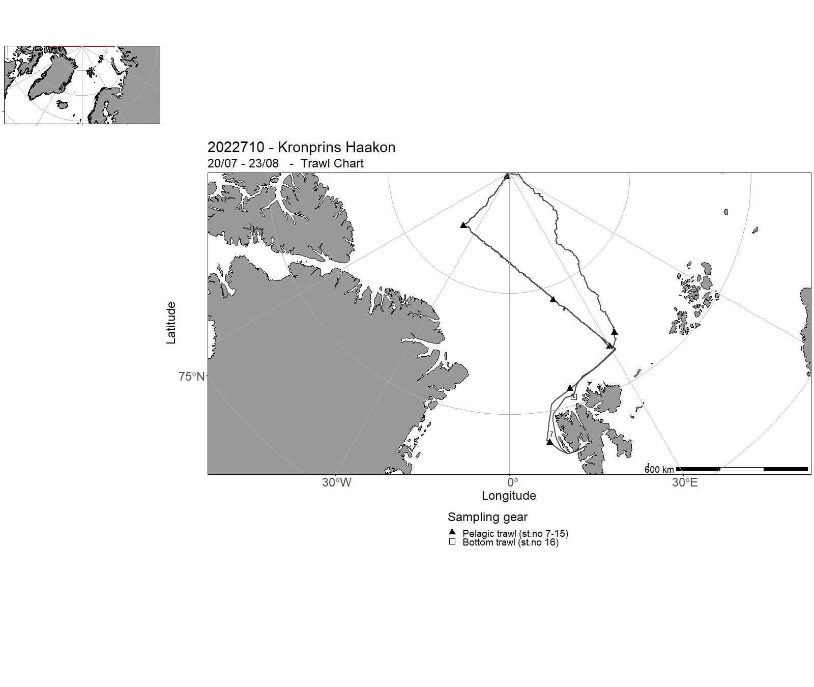
| 2022710 | 20/07 - 23/08 | To survey the Atlantic sector of the Polar Ocean from Longyearbyen to the North Pole, south along W41° to N87° 05, then south east along a hydrographic transect with CTD stations every 10 nm- Deployment of a mooring in the Amundsen basin and one in the Nansen basin- To conduct ice stations for monitoring of ice and hydrographic parameters, and sampling of primary production- To deploy drifting buoys- To conduct a hydroacoustic survey of the upper 500 m water column of the Atlantic sector of the Polar Ocean- To sample the zooplankton and pelagic species in the water column by plankton nets and pelagic trawls- To record marine mammals and polar bears along the survey track Ole Arve Misund, The Norwegian Polar InstitutePaul Dodd, The Norwegian Polar InstituteAnna Nikolopoulus, The Norwegian Polar InstituteHaakon Hop, The Norwegian Polar Institute | Arctic Ocean | 120-203 | 7 - 16 |
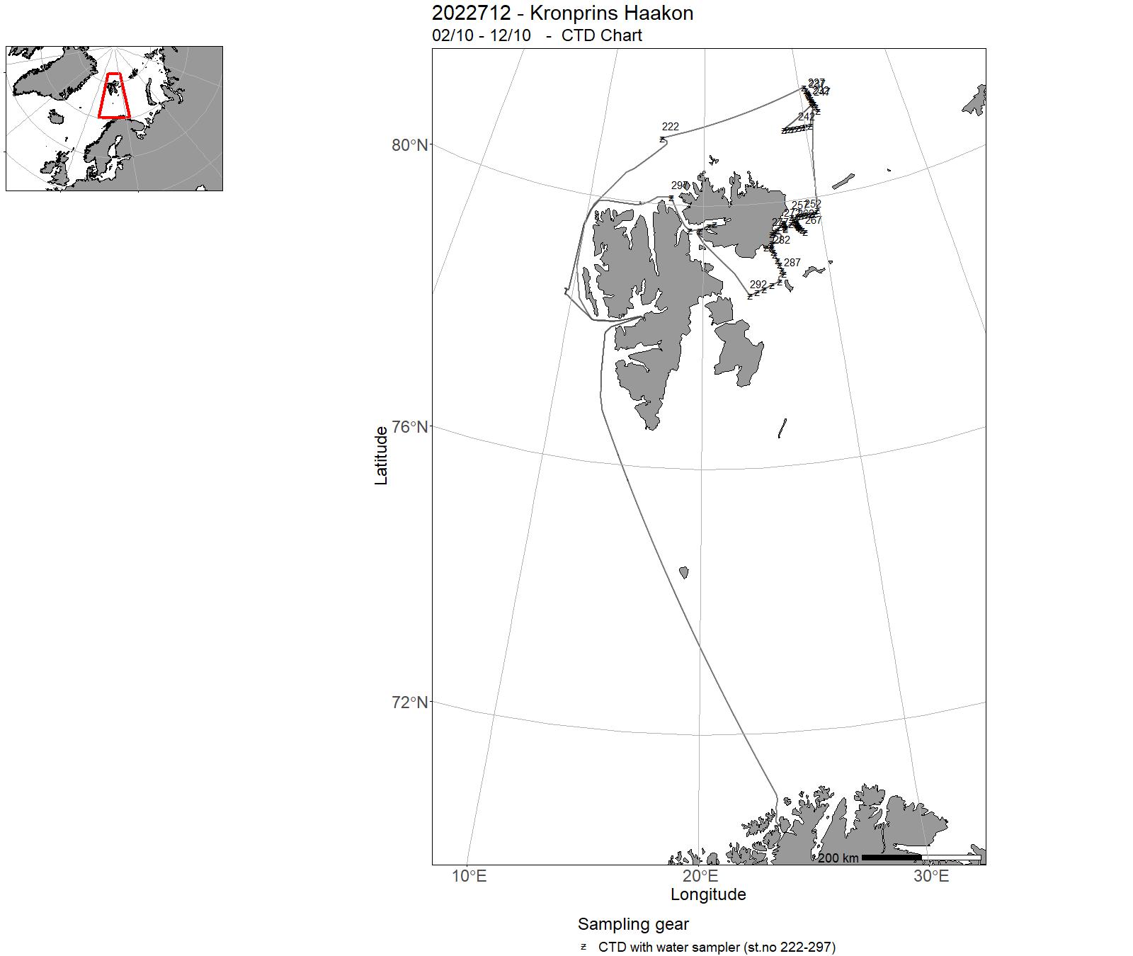
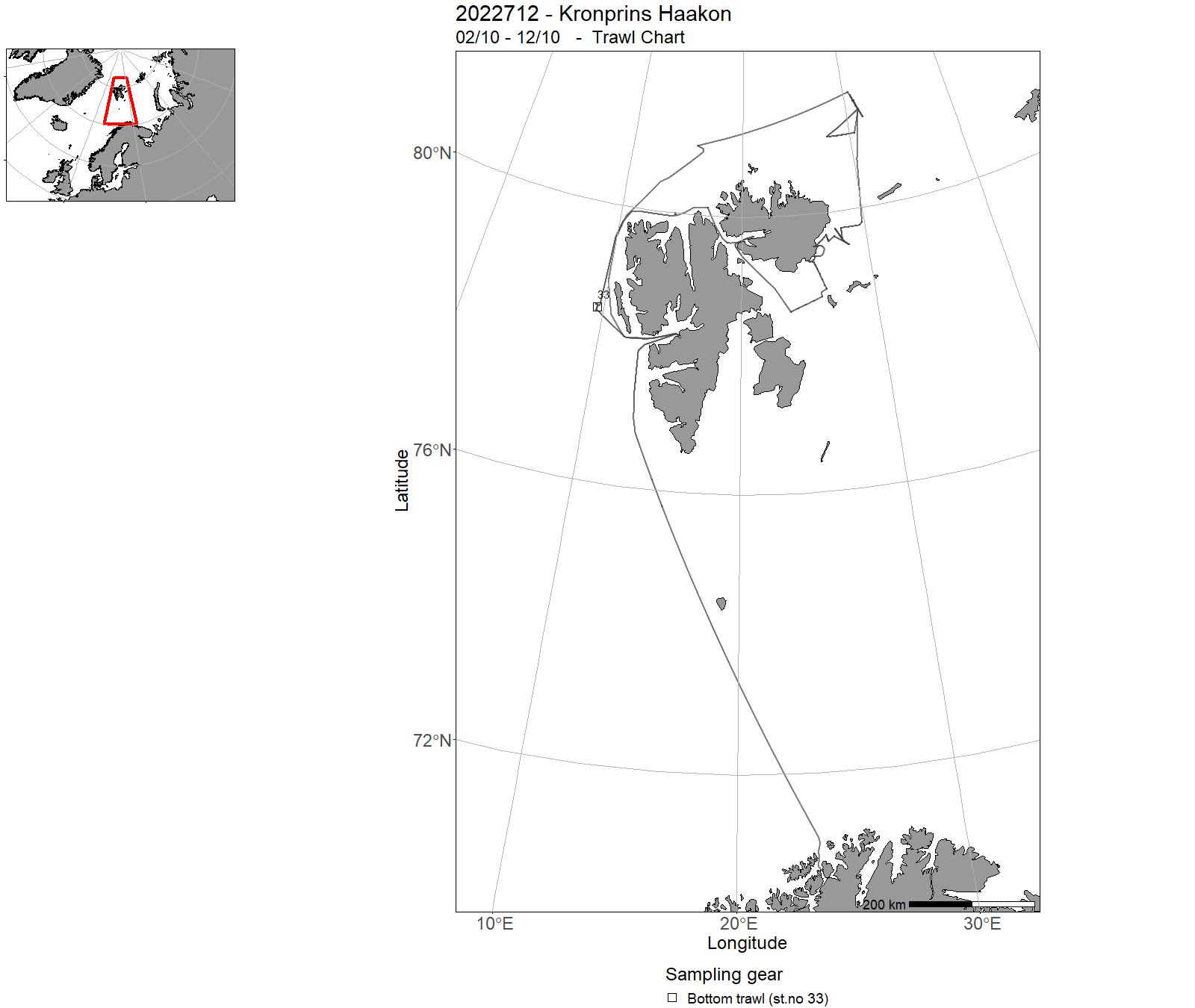
| 2022712 | 02/10 - 12/10 | The main objective of the cruise was to retrieve and deploy ocean moorings in the north-western Barents Sea and on the continental slope north of Kvitøya for the Nansen Legacy and A-TWAIN projects. An important secondary objective was to perform hydrographic surveys (CTD transects) in regions of Atlantic Water inflow and other regions of interest. Water mass sampling for nutrients were done on four locations. In addition, the cruise aided other research groups by deployment and recovery of minor equipment at sites along the cruise trajectory. Project name: NANSEN LEGACY RF-1 / A-TWAIN Coordinating body: NORWEGIAN POLAR INSTITUTE | Barents Sea | 222-297 | 33 |
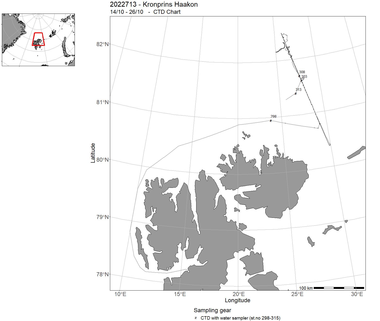
| 2022713 | 14/10 - 26/10 | The aim of Leg 1 of this first and multidisiplinary GoNorth cruise was to collect new geophysical, geological, biological, oceanographic, sea ice data on the continental margin north of Svalbard for the participating institutions UiT, UiO, UiB, NORCE, SINTEF, NTNU, Akvaplan-niva. | Arctic Ocean | 298-315 | - |
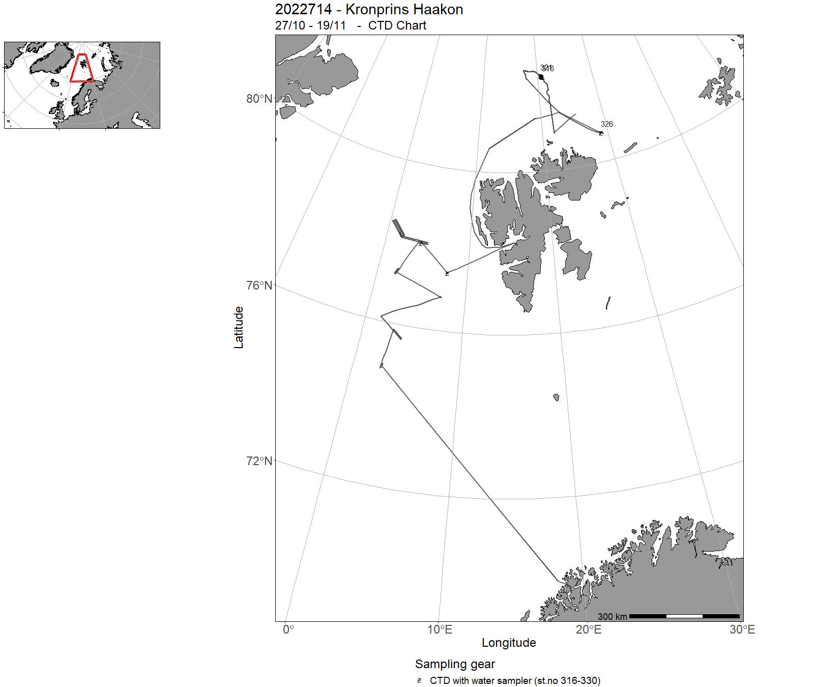
| 2022714 | 27/10 - 19/11 | The aim of Leg 2 of this first and multidisiplinary GoNorth cruise was to study deep sea deposits along selected parts of the midt-oceanic spreading ridge west of Svalbard by the Norwegian Petroleum Directorate and UiB. Project name: GoNorth (https://www.sintef.no/projectweb/gonorth/)Coordinating body: SINTEF, Contact person: Gunnar Sand (e-mail: Gunnar.Sand@sintef.no) | Arctic Ocean | 316-330 | - |
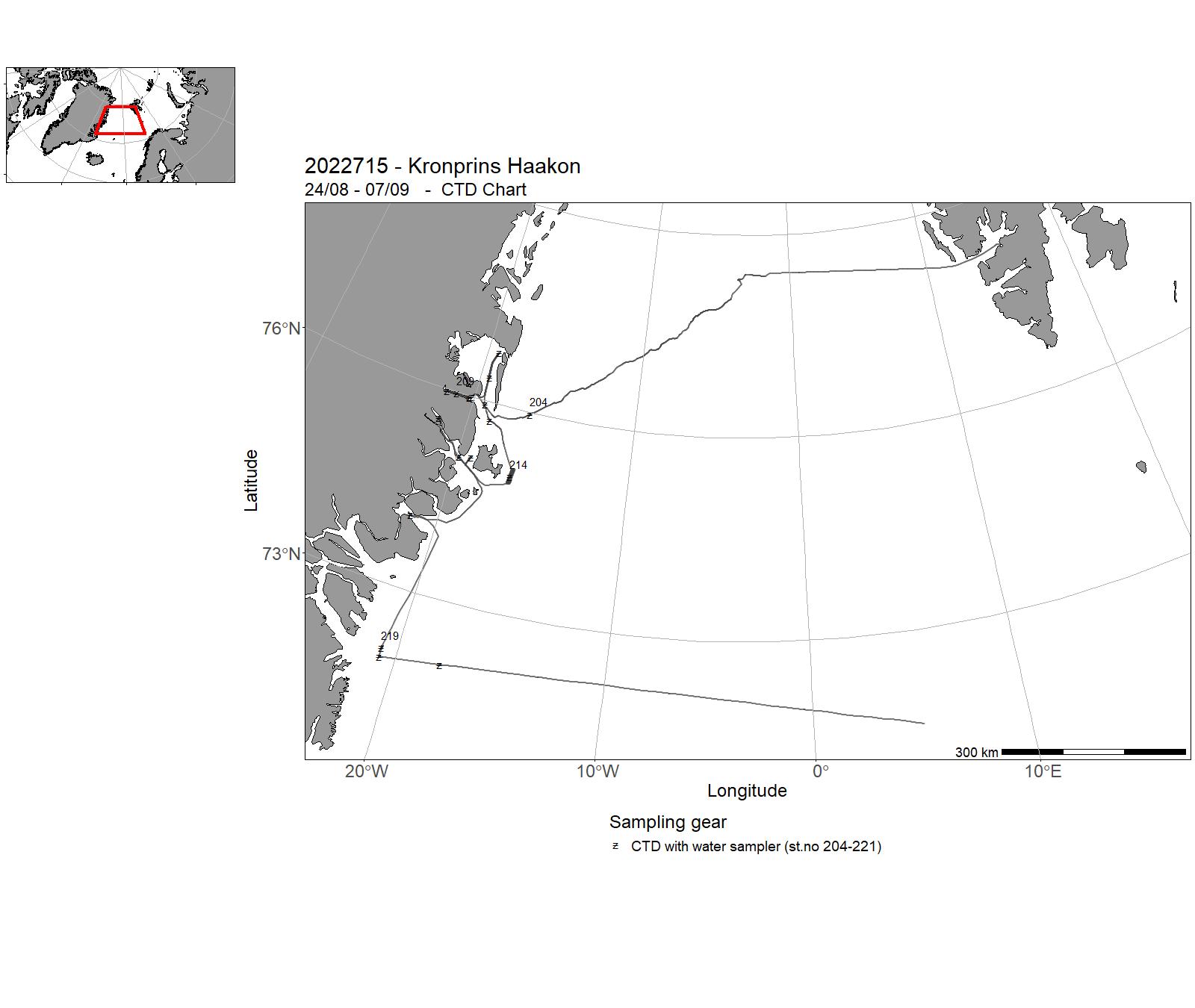
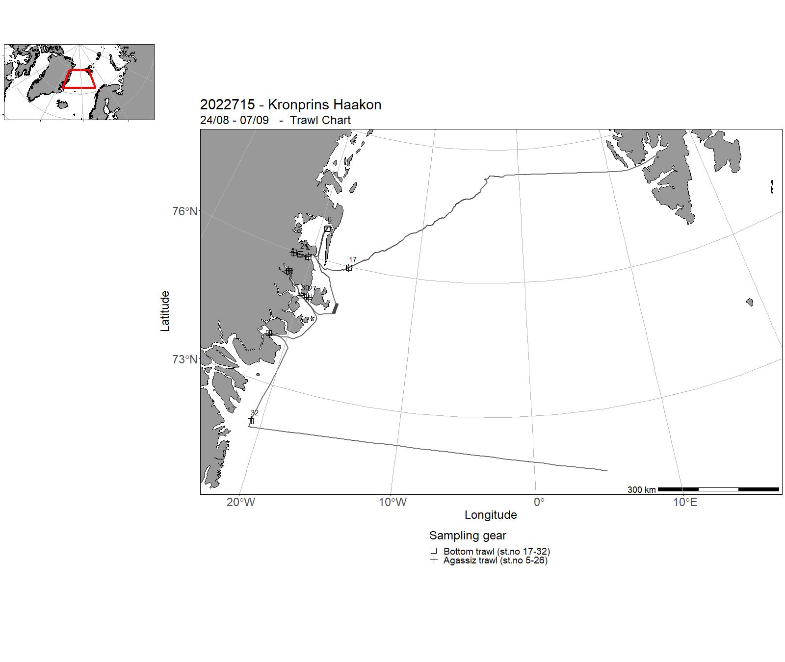
| 2022715 | 24/08 - 07/09 | The TUNU programme was established in 2002, aiming to describe marine fish diversity and function in the Atlantic Arctic. The core area has been NE Greenland, where a total of 9 expeditions has been carried out the past 20 years. All expeditions have been carried out with RV Helmer Hanssen, the present cruise is our first with RV Kronprins Haakon. In addition to marine fish diversity and function, benthic invertebrate diversity has been included since 2013. Besides collecting CTD data routinely, geologists has also been part of the TUNU programme since 2013, sampling the sea bottom to reconstruct the glacial history. The TUNU-VIII cruise continued the sampling in 2022, by mostly visiting previously sampled localities as well as some new stations. Results are communicated by peer reviewed papers and reports, and data (CTD, multibeam etc.) are shared with the Government of Greenland, Geodatatyrelsen in Denmark and ICES. Project name: TUNU ProgrammeCoordinating body: UiT The Arctic University of Norway | Norwegian Sea | 204-221 | 5 - 32 |
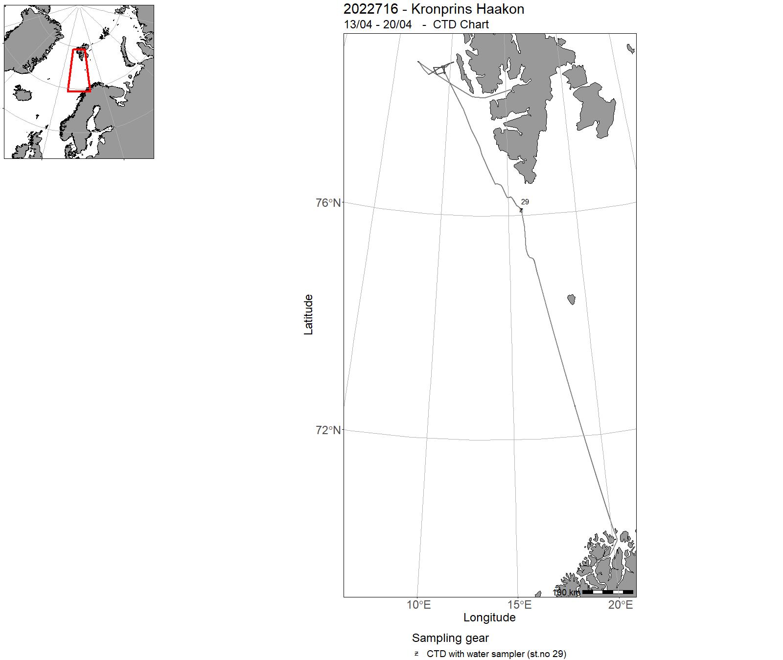
| 2022716 | 13/04 - 20/04 | - | Barents Sea | 29 | - |
9 - “ Kronprins Haakon” – Charts for cruises 2022

10 - "G. M. Dannevig" – Cruises 2022
| Cruise no | Period | Purpose | Area | CTD st.no | Trawl st.no |
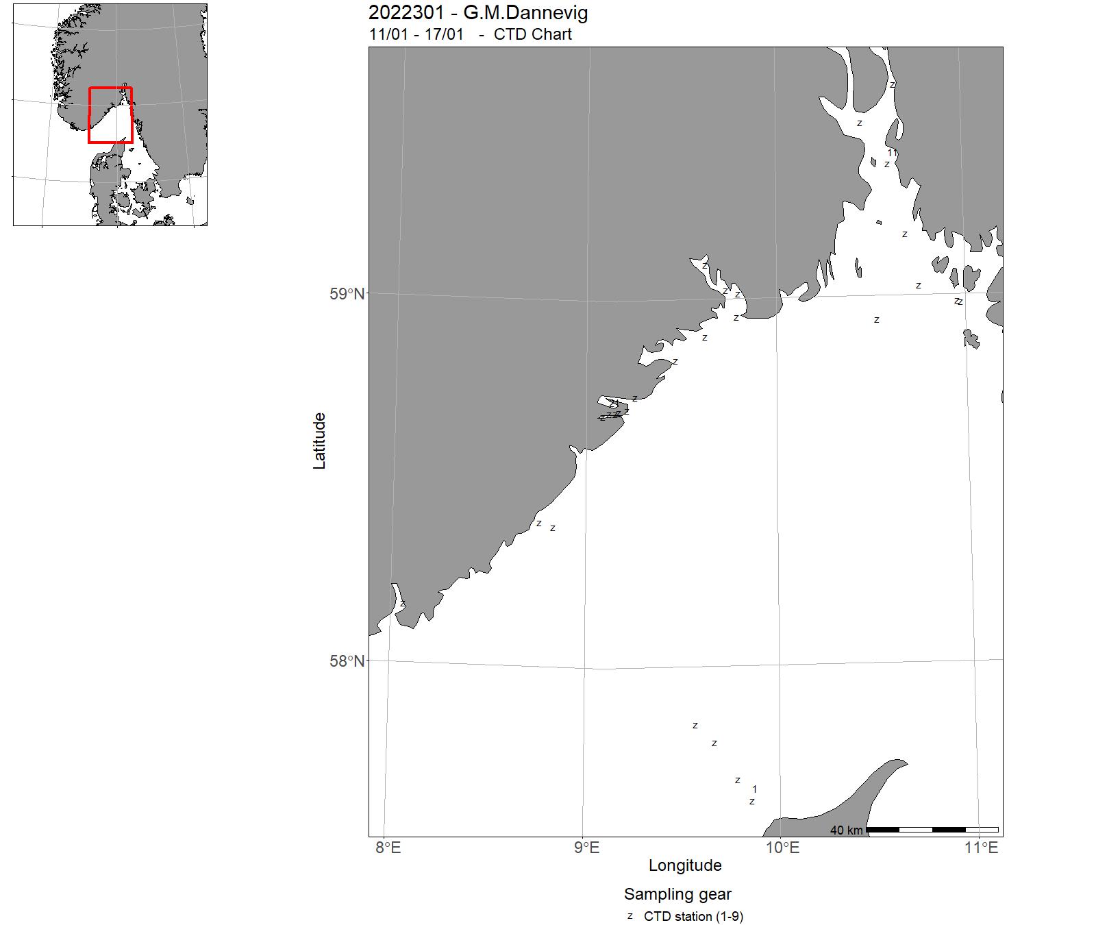
| 2022301 | 11/01 - 17/01 | 2022-KST-006: Miljøtilstandvurdering/rådgivning for Skagerrak: Havforsurning, oseanografi, HAB, mikroplast, miljø, klima lavere trofiske nivå langs Skagerrakkysten og fast snitt Torungen-Hirtshals. Videreføring av 4 tidsserier (Torungen, Oslofjord, Grenland, Arendal) | Skagerrak | 1 - 27 | - |
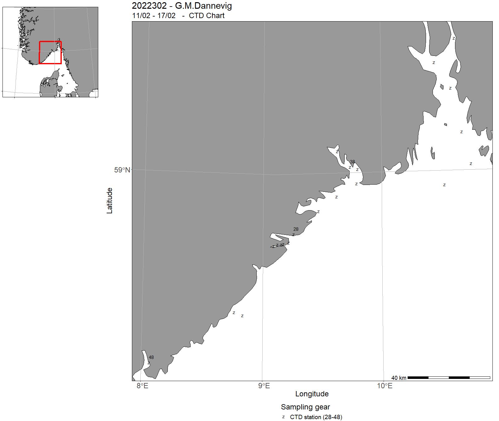
| 2022302 | 11/02 - 17/02 | 2022-KST-007: Miljøtilstandvurdering/rådgivning for Skagerrak: Havforsurning, oseanografi, HAB, mikroplast, miljø, klima lavere trofiske nivå langs Skagerrakkysten og fast snitt Torungen-Hirtshals. Videreføring av 4 tidsserier (Torungen, Oslofjord, Grenland, Arendal) | Skagerrak | 28 - 48 | - |
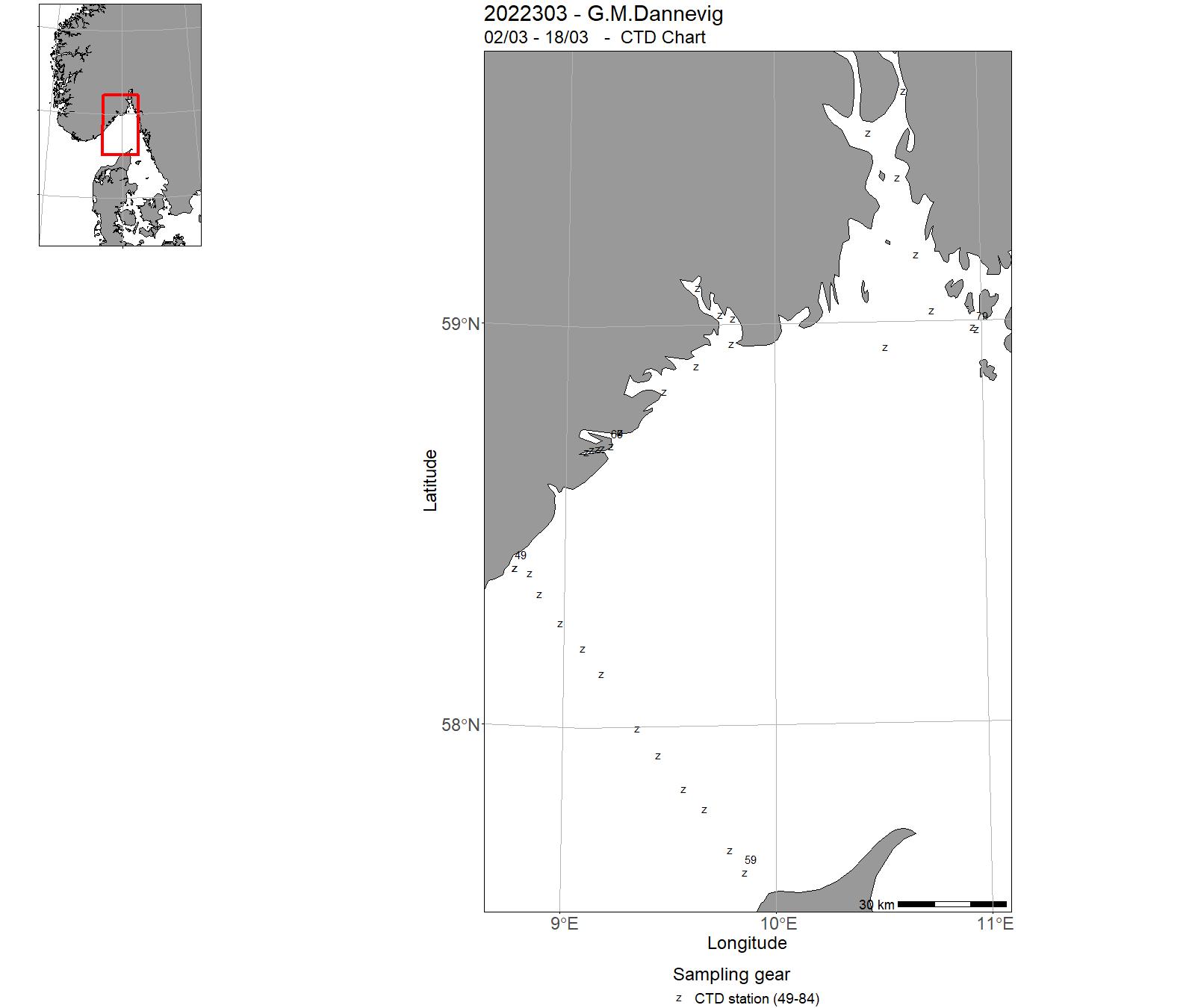
| 2022303 | 02/03 - 18/03 | 2022-KST-022: Toktet vil kartleggge og overvåke gytefelt for kystnære bestander gjennom innsamling av egg. Toktet betjener prosjektet: "Program for kartlegging av gyte- og oppvekstområder for kystnære kommersielle bestander". | Skagerrak | 49 - 84 | - |
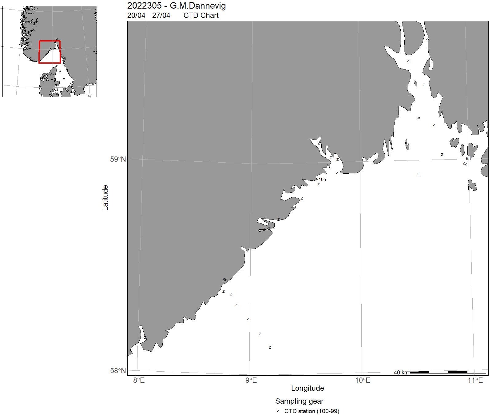
| 2022305 | 20/04 - 27/04 | 2022-KST-009: Miljøtilstandvurdering/rådgivning for Skagerrak: Havforsurning, oseanografi, HAB, mikroplast, miljø, klima lavere trofiske nivå langs Skagerrakkysten og fast snitt Torungen-Hirtshals. Videreføring av 4 tidsserier (Torungen, Oslofjord, Grenland, Arendal) | Skagerrak | 85 - 113 | - |
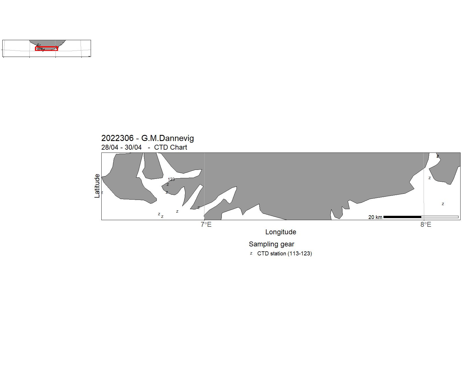
| 2022306 | 28/04 - 30/04 | 2022-UiA-003: Sesongundersøkelse av plankton og mikrober langs transekt i Lister området. Dette toktet er en del av et prosjekt som undersøker planktondynamikk i transektet fra Havika i Lyngdalsfjorden til ytre del av Skjærgården utenfor Farsund. | Skagerrak | 113 - 123 | - |
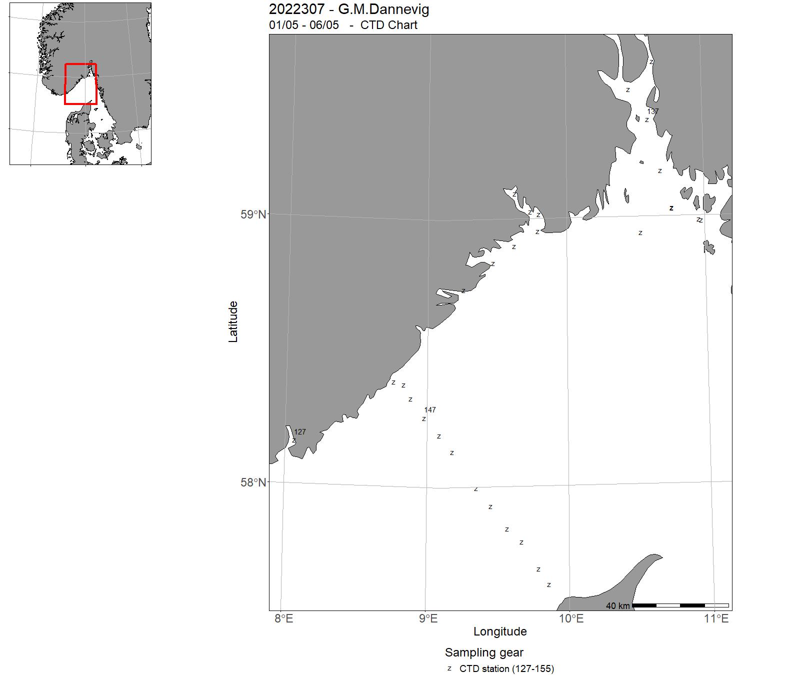
| 2022307 | 01/05 - 06/05 | 2022-KST-010: Miljøtilstandvurdering/rådgivning for Skagerrak: Havforsurning, oseanografi, HAB, mikroplast, miljø, klima lavere trofiske nivå langs Skagerrakkysten og fast snitt Torungen-Hirtshals. Videreføring av 4 tidsserier (Torungen, Oslofjord, Grenland, Arendal) | Skagerrak | 127 - 155 | - |
| 2022308 | 10/05 - 05/06 | 2022-AKV-021: Toktet har som hensikt å fange utvandrende vill laksesmolt som en del av den nasjonale overvåkningen på vill laksefisk. Laksesmolt fanges i ytre deler av utvalgte fjordsystem med en spesialbygget pelagisk trål | North Sea | - | - |
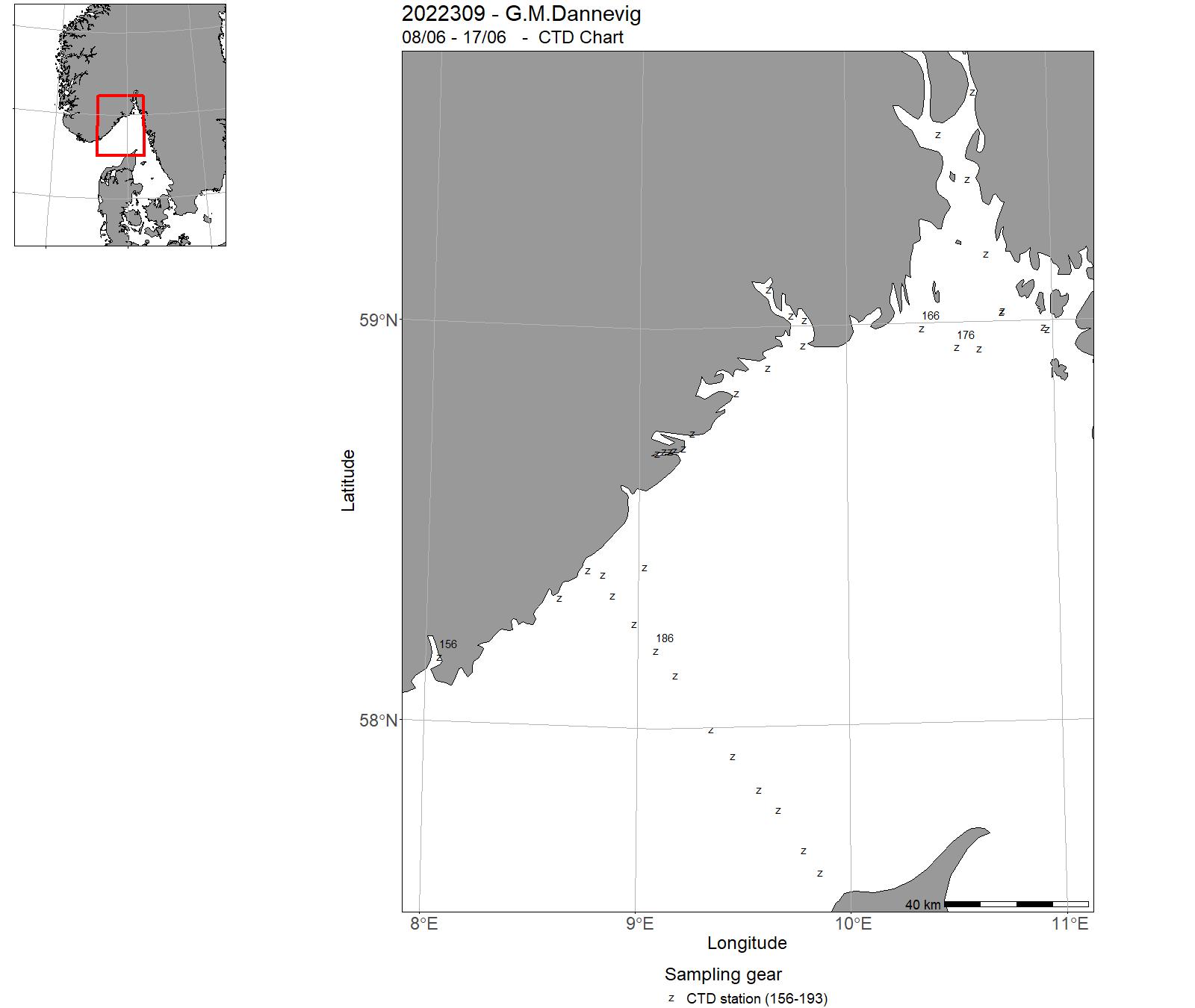
| 2022309 | 08/06 - 17/06 | 2022-KST-011: Miljøtilstandvurdering/rådgivning for Skagerrak: Havforsurning, oseanografi, HAB, mikroplast, miljø, klima lavere trofiske nivå langs Skagerrakkysten og fast snitt Torungen-Hirtshals. Videreføring av 4 tidsserier (Torungen, Oslofjord, Grenland, Arendal) | Skagerrak | 156 - 193 | - |
| 2022310 | 02/07 - 07/07 | 2022-KST-012: Miljøtilstandvurdering/rådgivning for Skagerrak: Havforsurning, oseanografi, HAB, mikroplast, miljø, klima lavere trofiske nivå langs Skagerrakkysten og fast snitt Torungen-Hirtshals. Videreføring av 4 tidsserier (Torungen, Oslofjord, Grenland, Arendal) | Skagerrak | 194 - 220 | - |
| 2022311 | 05/08 - 09/08 | Miljøtilstandvurdering/rådgivning for Skagerrak: Havforsurning, oseanografi, HAB, mikroplast, miljø, klima lavere trofiske nivå langs Skagerrakkysten og fast snitt Torungen-Hirtshals. Videreføring av 4 tidsserier (Torungen, Oslofjord, Grenland, Arendal) | Skagerrak | 221 - 247 | - |
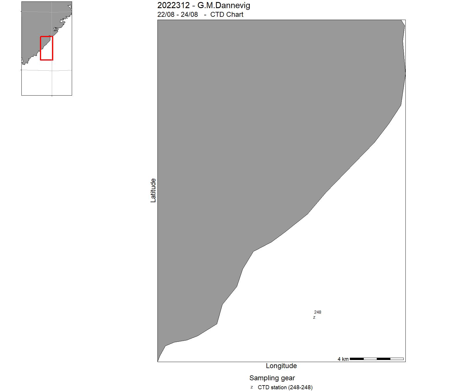
| 2022312 | 22/08 - 24/08 | 2022-KST-025: Havforskningsinstituttet og UiA samarbeider om et undervisningstokt. Formålet med toktet er å gi studenter (mastergrad) gjenskap med ulike innsamlingsmetoder for bentsike undersøkelser og planktoniske organismer (zoo-plant-plankton, maneter) | Skagerrak | 248 - 248 | - |
| 2022313 | 27/08 - 09/09 | To document nursery areas for commercially important species in inner and outer area of Stavanger municipality (Rogaland), using remote underwater video riggs, fish traps, and a small danish seine. This is part of a bigger, long-term programme on the mapping of spawning and nursery areas for commercially important fish species in Norway. Incorporating NiN-data into the sampling and selection of sampling-sites. Project name: Program for kartlegging av gytefelt og oppvekstområder for kommersielt viktige arter i kystsonenCoordinating body: Fiskeridynamikk, Institute of Marine Research, Norway | North Sea | - | - |
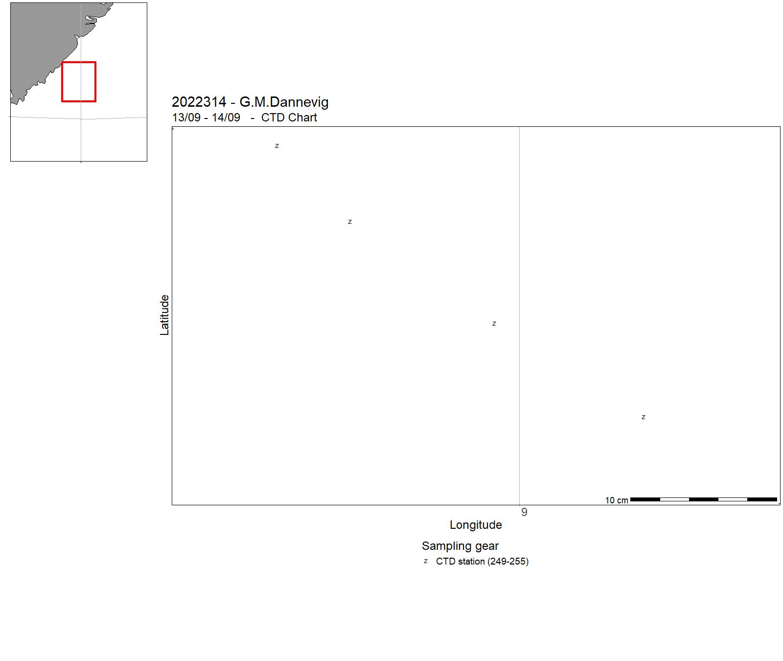
| 2022314 | 13/09 - 14/09 | 2022-KST-014: Miljøtilstandvurdering/rådgivning for Skagerrak: Havforsurning, oseanografi, HAB, mikroplast, miljø, klima lavere trofiske nivå langs Skagerrakkysten og fast snitt Torungen-Hirtshals. Videreføring av 4 tidsserier (Torungen, Oslofjord, Grenland, Arendal) | Skagerrak | 249 - 255 | - |
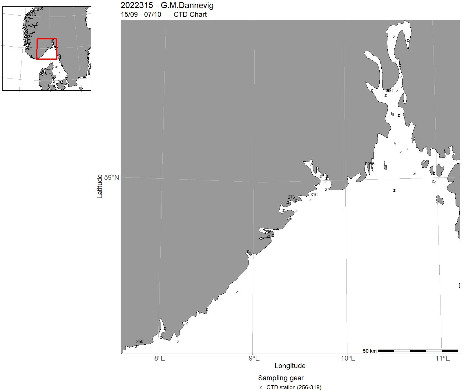
| 2022315 | 15/09 - 07/10 | 2022-KST-036: Strandnotundersøkelser for å måle rekrutteringen av torskefisk og annen fisk i strand/kystsonen. Videre formål er å kartlegge utbredelsen av fisk i strand/kystsonen. Data/arbeid fra toktet benyttes i flere eksterntfinansierte prosjekt. | - | 256 - 318 | - |
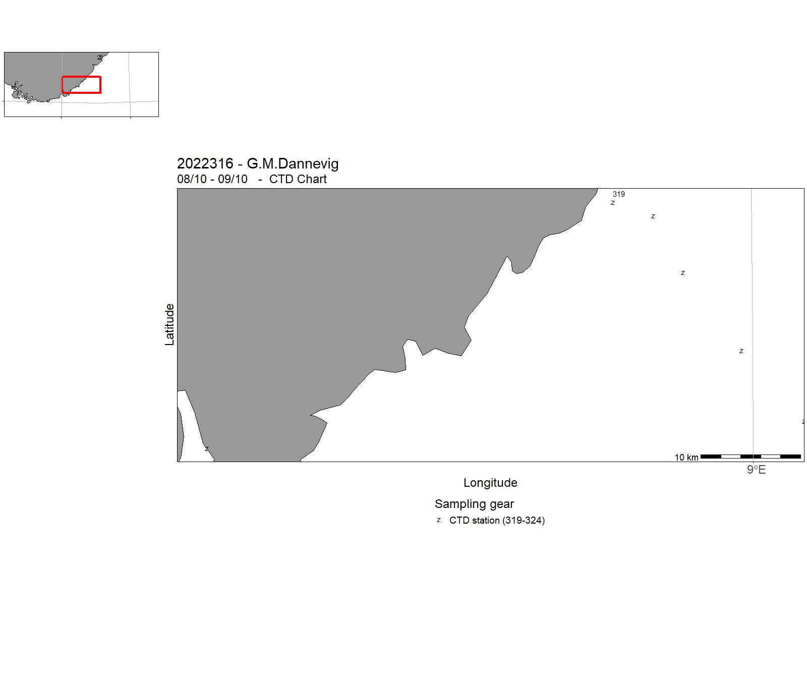
| 2022316 | 08/10 - 09/10 | 2022-KST-015: Miljøtilstandvurdering/rådgivning for Skagerrak: Havforsurning, oseanografi, HAB, mikroplast, miljø, klima lavere trofiske nivå langs Skagerrakkysten og fast snitt Torungen-Hirtshals. Videreføring av 4 tidsserier (Torungen, Oslofjord, Grenland, Arendal) | Skagerrak | 319 - 324 | - |
| 2022317 | 08/11 - 13/11 | 2022-KST-016: Miljøtilstandvurdering/rådgivning for Skagerrak: Havforsurning, oseanografi, HAB, mikroplast, miljø, klima lavere trofiske nivå langs Skagerrakkysten og fast snitt Torungen-Hirtshals. Videreføring av 4 tidsserier (Torungen, Oslofjord, Grenland, Arendal) | Skagerrak | 325 - 352 | - |
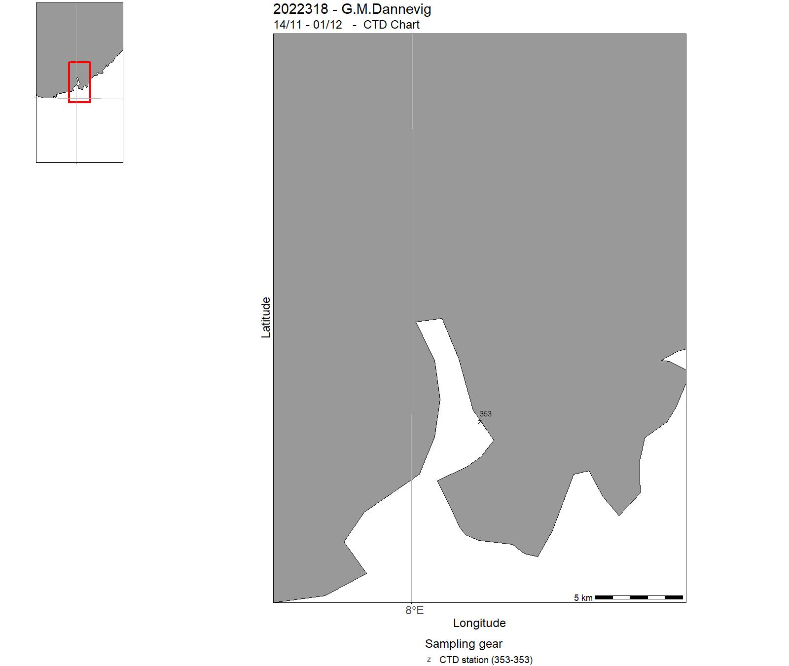
| 2022318 | 14/11 - 01/12 | 2022-KST-038: Overvåker bestander av kysttorsk og andre kystarter. Driver og forskning på data, da tokt inngår i eksterne prosjekt | Skagerrak | 353 - 353 | - |
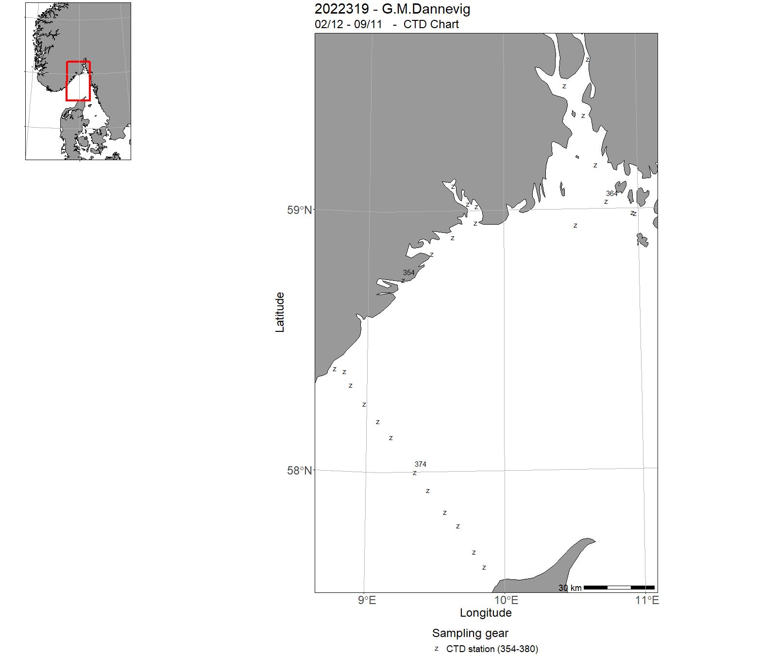
| 2022319 | 02/12 - 08/12 | 2022-KST-017: Miljøtilstandvurdering/rådgivning for Skagerrak: Havforsurning, oseanografi, HAB, mikroplast, miljø, klima lavere trofiske nivå langs Skagerrakkysten og fast snitt Torungen-Hirtshals. Videreføring av 4 tidsserier (Torungen, Oslofjord, Grenland, Arendal) | Skagerrak | 354 - 380 | - |
| 2022320 | 10/08 - 19/08 | 2022-KST-024: Overvåkingsfiske hummerreservater Bolærne og Kvernskjær, Ytre Oslofjord. Stereovideorigger på stasjonsnett Ytre Oslofjord. | Skagerrak | - | - |
11 - "G. M. Dannevig" – Charts for cruises 2022


12 - "Statsraad Lehmkuhl" - Cruises 2022
| Cruise no | Period | Purpose | Area | CTD st.no | Trawl st.no |
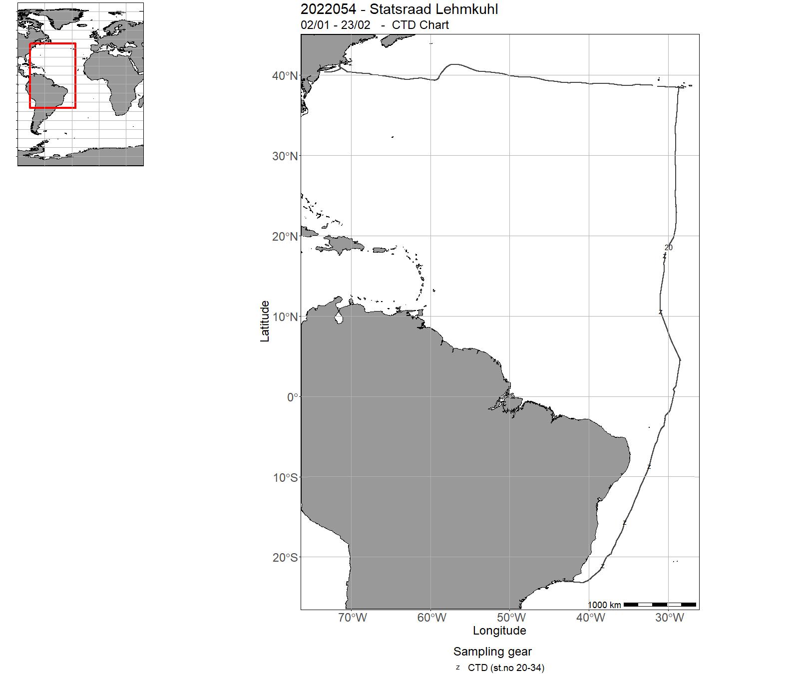
| 2022054 | 02/01 - 23/02 | One Ocean Expedition Leg 4 | Atlantic Ocean | 1-5 | - |
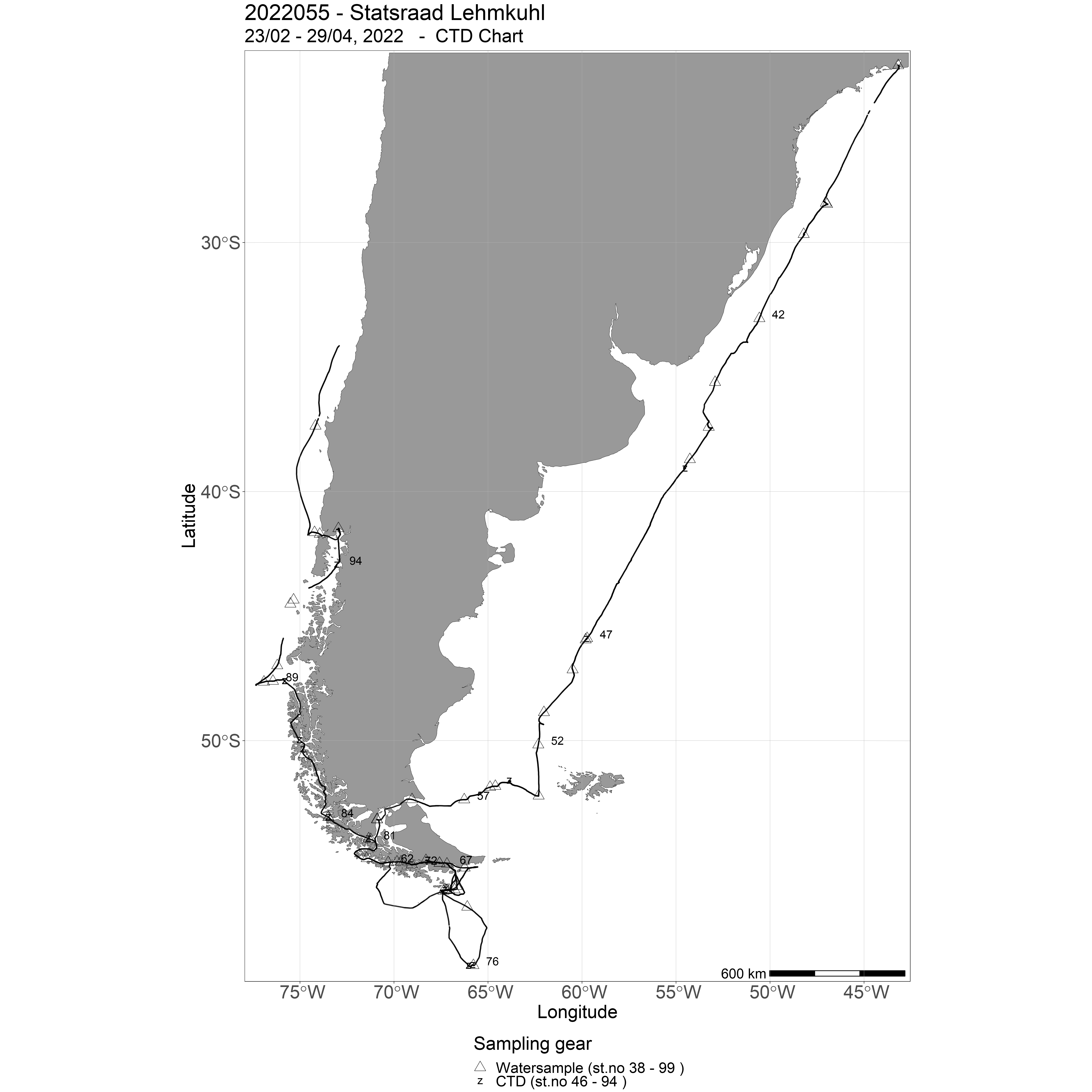
| 2022055 | 26/02 - 29/04 | One Ocean Expedition Leg 5 | Atlantic Ocean | 6-17 | - |
| 2022056 | 01/05 - 25/08 | One Ocean Expedition Leg 6 | Pacific Ocean | 18-28 | - |
| 2022057 | 27/08 - 29/10 | One Ocean Expedition Leg 7 | Pacific Ocean | 29-36 | - |
| 2022058 | 01/11 - 17/12 | One Ocean Expedition Leg 8 | Pacific Ocean | 37-43 | - |
13 - "Statsraad Lehmkuhl" Charts for 2022
14 - "Dr. Fridtjof Nansen" – Cruises 2022
| Cruise no | Period | Purpose | Area | CTD st.no | Trawl st.no |
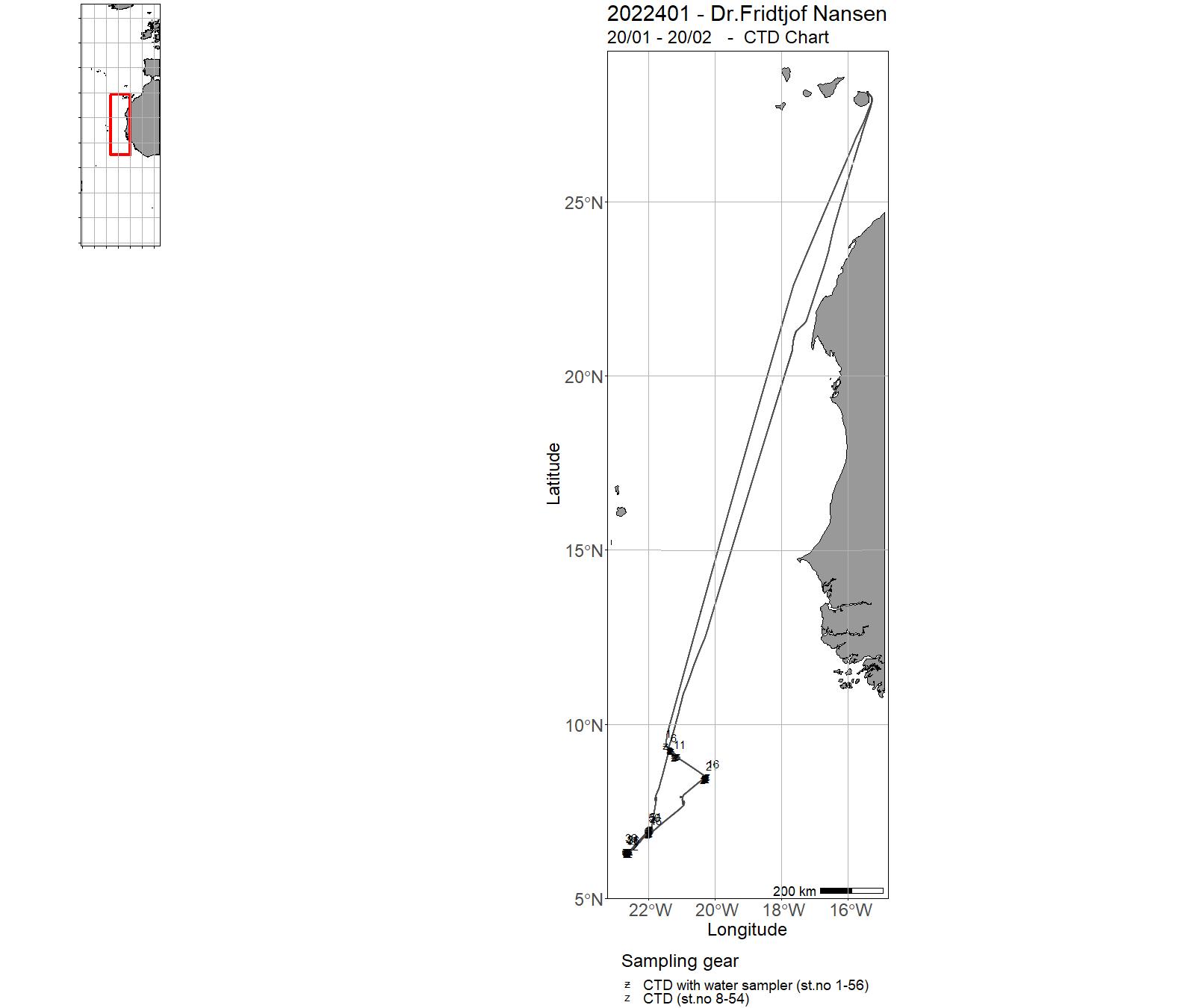
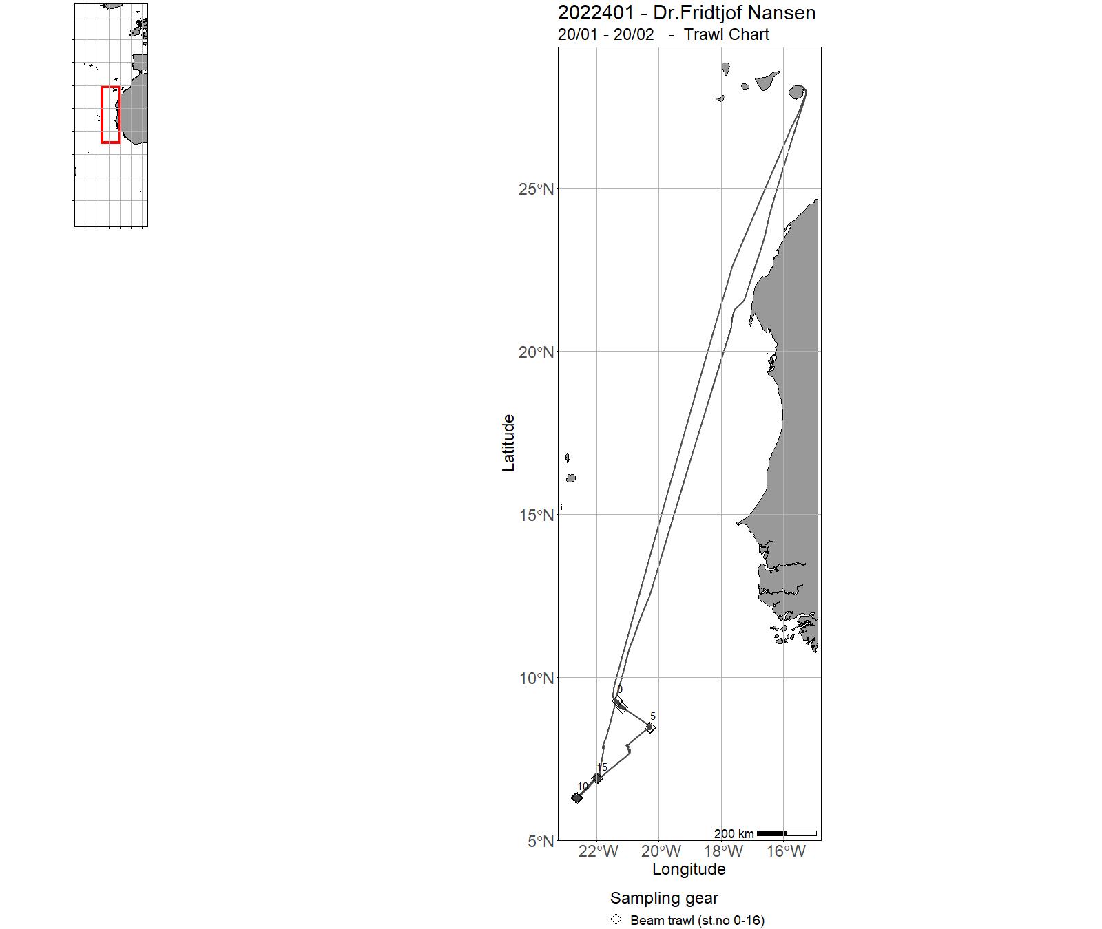
| 2022401 | 20/01 - 20/02 | This survey aimed to provide information of bottom habitats and in particular the distribution of vulnerable marine ecosystems (VMEs) such as sponge aggregations, cold-water coral reefs and coral gardens, at 5 seamounts (Annan, Falsos, Perdido 1, Rompetodo and La Meseta) of the Sierra Leone Rise, with reference to survey objectives specified by the CECAF Working Group for the Assessment of Demersal Resources. The survey characterized bottom habitats on the seamounts using: 1) multibeam mapping, 2) VAMS underwater video observations and 3) physical sampling of epibenthos and small demersal fish in selected areas using a beam trawl and/or a rock dredge. The water column characterization encompassed: 1) hydrographic sampling with CTDs (Nutrients, Chlorophyll a, POC, pH and alkalinity) and measurements of currents using a vessel mounted ADCP. Water was filtered eDNA samples were collected to assess is eDNA analysis could be used as a rapid tool for quick screening an area for presence of VME indicator species. Project name: EAF-Nansen Programme Theme 7 Bottom Habitat Mapping Coordinating body: EAF-Nansen Programme, FAO, Institute of Marine Research | Atlantic Ocean | 1-56 | 0-16 |
| 2022402 | 26/02 - 29/03 | Collect data on the status of demersal fish stocks, plankton ecology, benthos, ichtyoplankton, oceanographic conditions along and on the continental shelf from Guinea in the south to Mauritania in the north, specifically : * Obtain information on demersal fish abundance, species and size composition, and distribution. * Standard biological sampling of priority species (including length, weight, sex and maturity). * Standard sampling of environmental variables with CTD and water sampling (salinity, temperature, dissolved oxygen, fluorescence, dissolved nutrients, pH, total alkalinity, chlorophyll a). * Measuring currents with an ADCP. * Sampling of zooplankton and ichthyoplankton. * Sampling with manta trawl for the presence of microplastics in surface waters. * Sample epibenthic organisms occurring in the trawl. * Collect sediment cores in selected sites to reconstruct development in OMZ. Project name: Strengthening the Knowledge Base for and Implementing an Ecosystem Approach to Marine Fisheries in Developing Countries (EAF-Nansen GCP/INT/003/NOR) Coordinating body: Institute of Marine Research, Bergen, Norway | Atlantic Ocean | 57 - 242 | 1-125 |
| 2022403 | 02/04 - 03/05 | Survey of the demersal resources on the outer shelf and slope of North West Africa, Part two. Cape Blanc - Casablanca. For this cruise: Some data collected (until 07.04) was formally part of 2022402 Survey 402 and 403 are part of one coverage of the demersal resources in North West Africa Project name: EAF-Nansen projectCoordinating body: FAO, Rome / IMR, Norway | Atlantic Ocean | 265 - 456 | 146-308 |
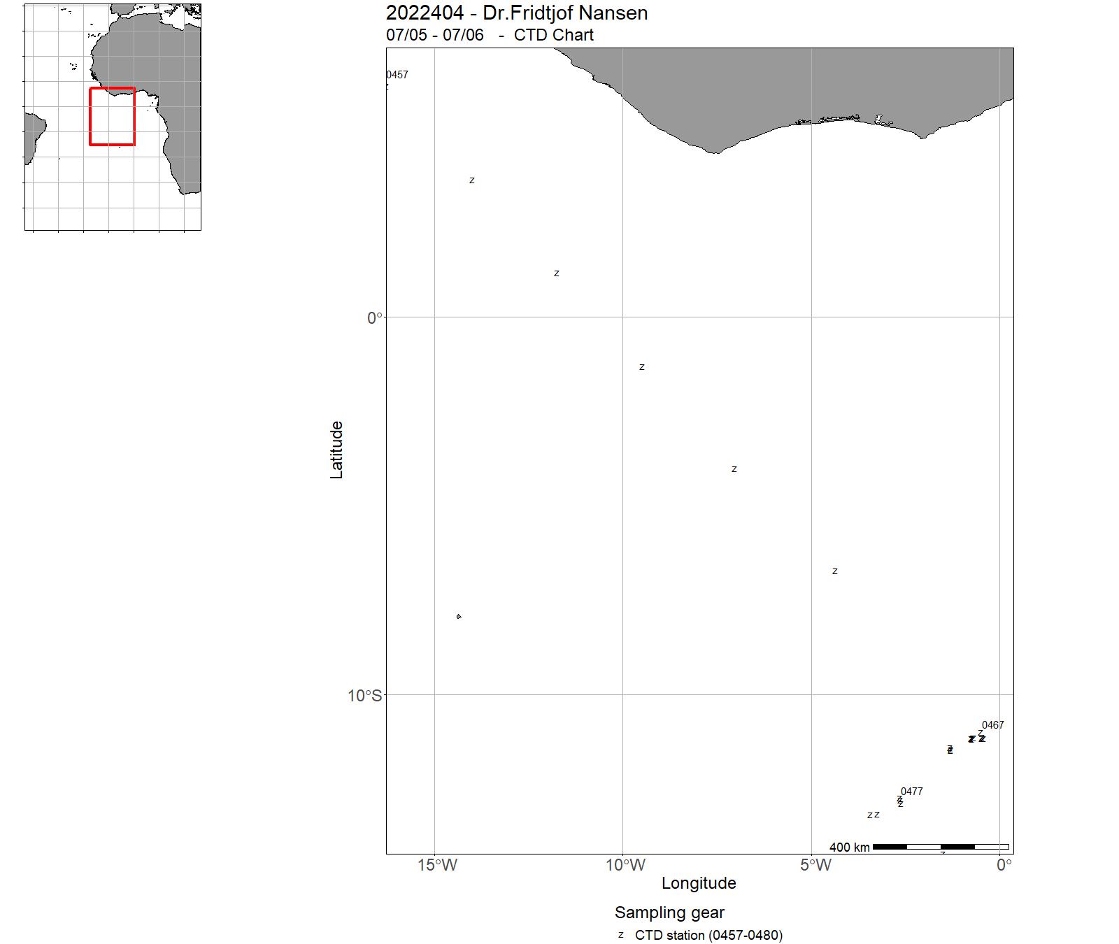
| 2022404 | 07/05 - 07/06 | The overall objective of the cruise was to conduct bathymetric mapping with multibeam echosounder, and basic mapping and identification of vulnerable marine ecosystems (VMEs) and fisheries resources on selected seamounts and seamount complexes in the SEAFO Convention Area. Oceanographic sampling was performed at selected stations en route tot he survey area part oft he Guinea Seamount chain. Project name: SEAFO-Nansen survey 2022 Coordinating body: EAF Nansen Programme, Institute of Marine Research, Norway | South Atlantic Ocean | 457 - 480 | - |
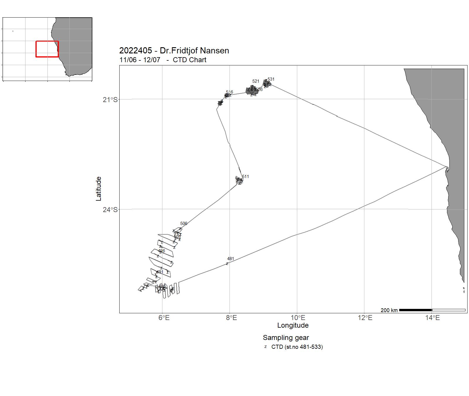
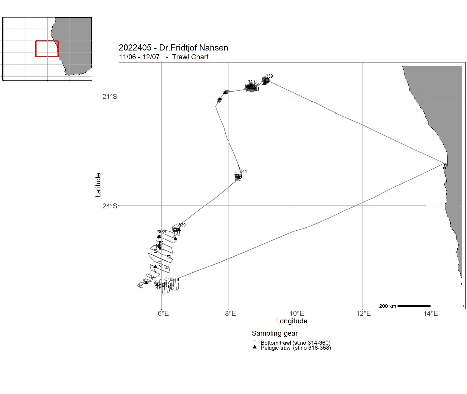
| 2022405 | 17/06 - 08/07 | Leg 4.1 Fisheries resources in the SEAFO Convention area The objective of SEAFOs Convention (The Convention on the Conservation and Management of Fisheries Resources in the South East Atlantic Ocean) is to ensure the long term conservation and sustainable use of the fishery resources in the Convention Area through the effective implementation of the Convention. The Convention Area excludes exclusive economic zones of the coastal states in the region. The study area were the seamounts along the Atlantic ridge from the Maldivia bank in the south through the central Ewing and the Dubow mounts in the north in international waters west of Namibia. The primary objective of the survey was to determine the distribution, density and abundance of aggregations of orange roughy and alfonsino in the survey area and, if possible, to obtain an index of their abundance. Secondary objectives included methodological studies such as acoustic dead zone correction and target strength (TS) measurements, biological description of key species, characterize the mesopelagic community, collect otoliths and tissue samples for stock identification purposes, map the oceanographic conditions at the survey area, and to provide hands-on-training of regional cruise participants. Project name: EAF-Nansen projectCoordinating body: FAO, Rome / IMR, Norway | South Atlantic Ocean | 481-533 | 314 - 360 |
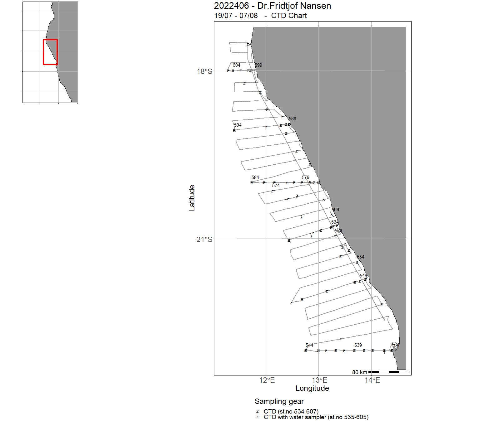
| 2022406 | 19/07 -14/08 | The overall objectives of this regional survey effort in Namibia and Angola were discussed in connection with the EAF-Nansen Programme Annual Forum in Benin in 2019 for surveys to take place in 2020. | South Atlantic Ocean | 534 - 607 | 361 - 394 |
| 2022407 | 20/08 - 19/09 | The general objectives of Leg 4.2 and 4.3 surveys are:Obtaining information on pelagic fish species abundance, their distribution and size structure, as well as the species composition of the pelagic fish assemblage.Standard biological sampling of prioritized pelagic species (length, weight, sex and maturity).Map the physical and chemical properties of the water column and the subsurface layer at the study area (temperature, salinity, dissolved O2, chlorophyll, nutrients, pH and total alkalinity), as well as the underwater currents and light penetration.Sampling of zooplankton and ichthyoplankton. Sampling for the presence of microplastic particles in surface waters. Sampling fish for microplastics, food safety and nutrition studies. Project name: Strengthening the Knowledge Base for and Implementing an Ecosystem Approach to Marine Fisheries in Developing Countries (EAF-Nansen GCP/INT/003/NOR) Coordinating body: Institute of Marine Research, Bergen, Norway | Atlantic Ocean | 608 - 734 | 395 - 453 |
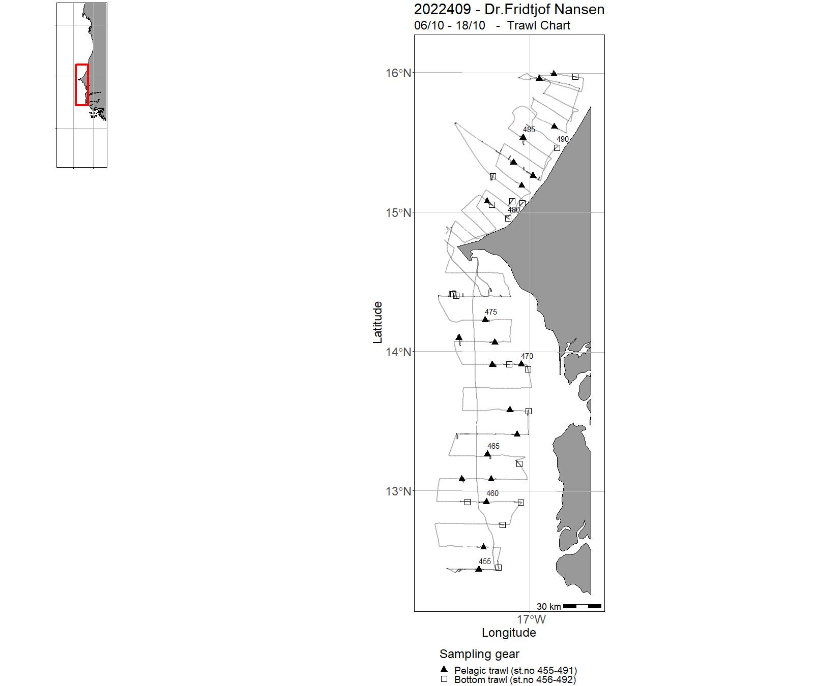
| 2022409 | 06/10 - 18/10 | The general objectives of Leg 4.2 and 4.3 surveys are: Obtaining information on pelagic fish species abundance, their distribution and size structure, as well as the species composition of the pelagic fish assemblage. Standard biological sampling of prioritized pelagic species (length, weight, sex and maturity). Specific biologic sampling (otolith extraction for microcemistry) of Atlantic chub mackerel (Scomber colias). Map the physical and chemical properties of the water column and the subsurface layer at the study area (temperature, salinity, dissolved O2, chlorophyll, nutrients, pH and total alkalinity), as well as the underwater currents and light penetration. Sampling of zooplankton and ichthyoplankton.Sampling for the presence of microplastic particles in surface waters. Project name: Strengthening the Knowledge Base for and Implementing an Ecosystem Approach to Marine Fisheries in Developing Countries (EAF-Nansen GCP/INT/003/NOR)Coordinating body: Institute of Marine Research, Bergen, Norway | Atlantic Ocean | 736 - 808 | 455 - 492 |
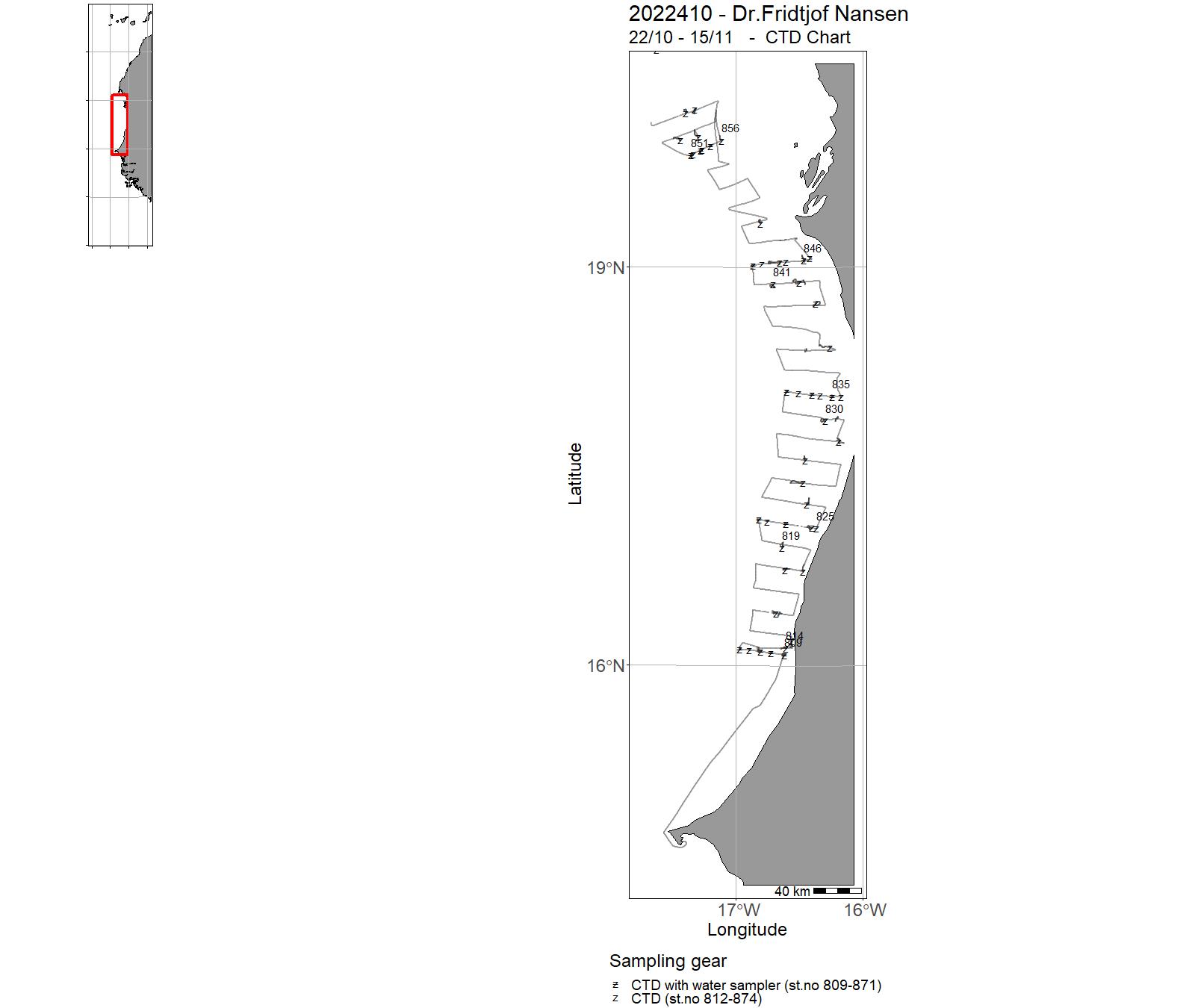
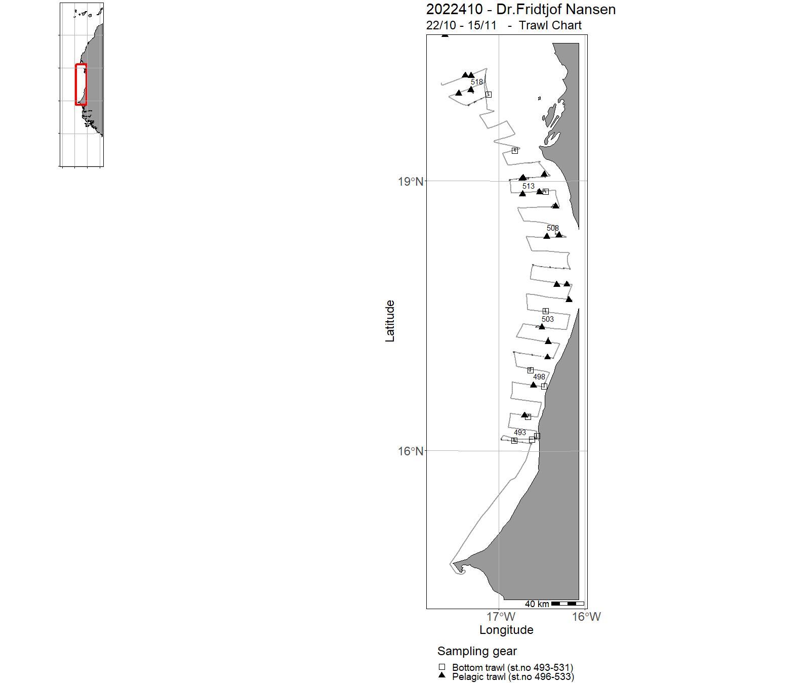
| 2022410 | 22/10 - 15/11 | The general objectives of Leg 4.2 and 4.3 surveys are: Obtaining information on pelagic fish species abundance, their distribution and size structure, as well as the species composition of the pelagic fish assemblage.Standard biological sampling of prioritized pelagic species (length, weight, sex and maturity). Specific biologic sampling (otolith extraction for microcemistry) of Atlantic chub mackerel (Scomber colias). Map the physical and chemical properties of the water column and the subsurface layer at the study area (temperature, salinity, dissolved O2, chlorophyll, nutrients, pH and total alkalinity), as well as the underwater currents and light penetration. Sampling of zooplankton and ichthyoplankton. Sampling for the presence of microplastic particles in surface waters. Project name: Strengthening the Knowledge Base for and Implementing an Ecosystem Approach to Marine Fisheries in Developing Countries (EAF-Nansen GCP/INT/003/NOR)Coordinating body: Institute of Marine Research, Bergen, Norway | Atlantic Ocean | 809 - 874 | 493 - 533 |
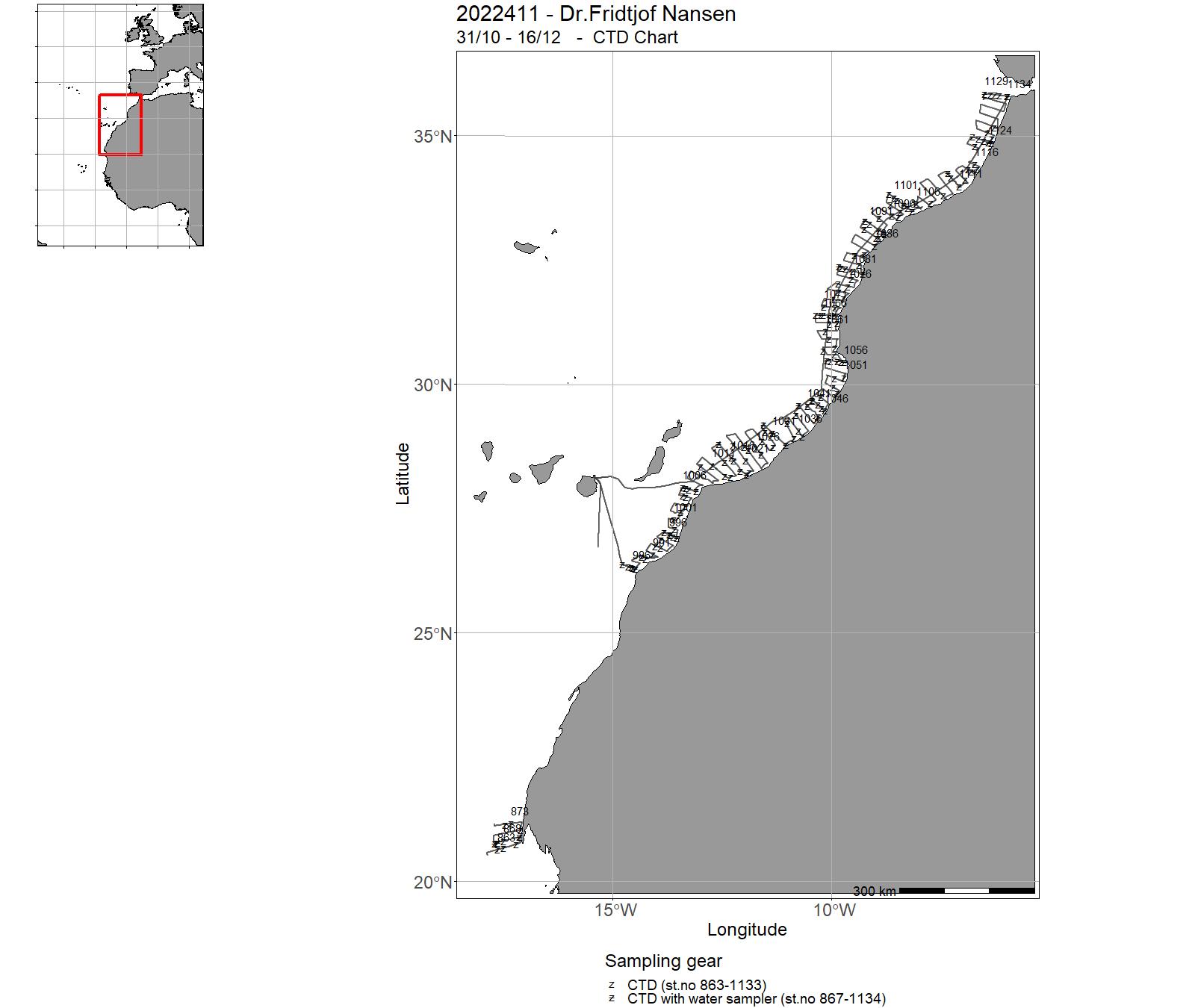
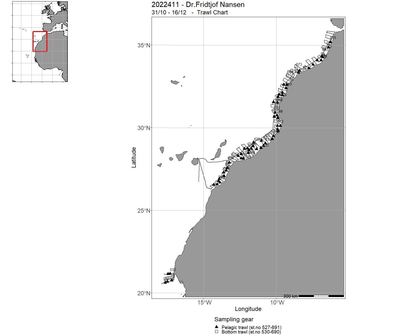
| 2022411 | 17/11 - 15/12 | The general objectives of Leg 4.2 and 4.3 surveys are:Obtaining information on pelagic fish species abundance, their distribution and size structure, as well as the species composition of the pelagic fish assemblage. Standard biological sampling of prioritized pelagic species (length, weight, sex and maturity). Specific biologic sampling (otolith extraction for microcemistry) of Atlantic chub mackerel (Scomber colias)Map the physical and chemical properties of the water column and the subsurface layer at the study area (temperature, salinity, dissolved O2, chlorophyll, nutrients, pH and total alkalinity), as well as the underwater currents and light penetration. Sampling of zooplankton and ichthyoplankton. Sampling for the presence of microplastic particles in surface waters. Project name: Strengthening the Knowledge Base for and Implementing an Ecosystem Approach to Marine Fisheries in Developing Countries (EAF-Nansen GCP/INT/003/NOR)Coordinating body: Institute of Marine Research, Bergen, Norway | North Atlantic Ocean | 863 - 1134 | 527 - 691 |
15 - "Dr. Fridtjof Nansen" Charts for 2022
16 - "Hans Brattstrøm" Cruises 2022
| Cruise no | Period | Purpose | Area | CTD st.no | Trawl st.no |
| 2022936 | 27/06 -06/07 | 2022-AKV-005: Overvåkning av det fysiske fjordmiljøet + opptak av smoltburforankringer |
Norskekysten: Vestlandet | 196-240 |
17 - "Hans Brattstrøm" Charts for 2022
18 - Hired vessels – Cruises 2022
|
Cruise no |
Period | Purpose | Area | CTD st.no | Trawl st.no |
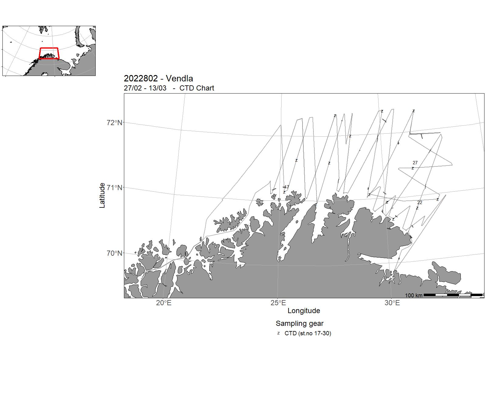
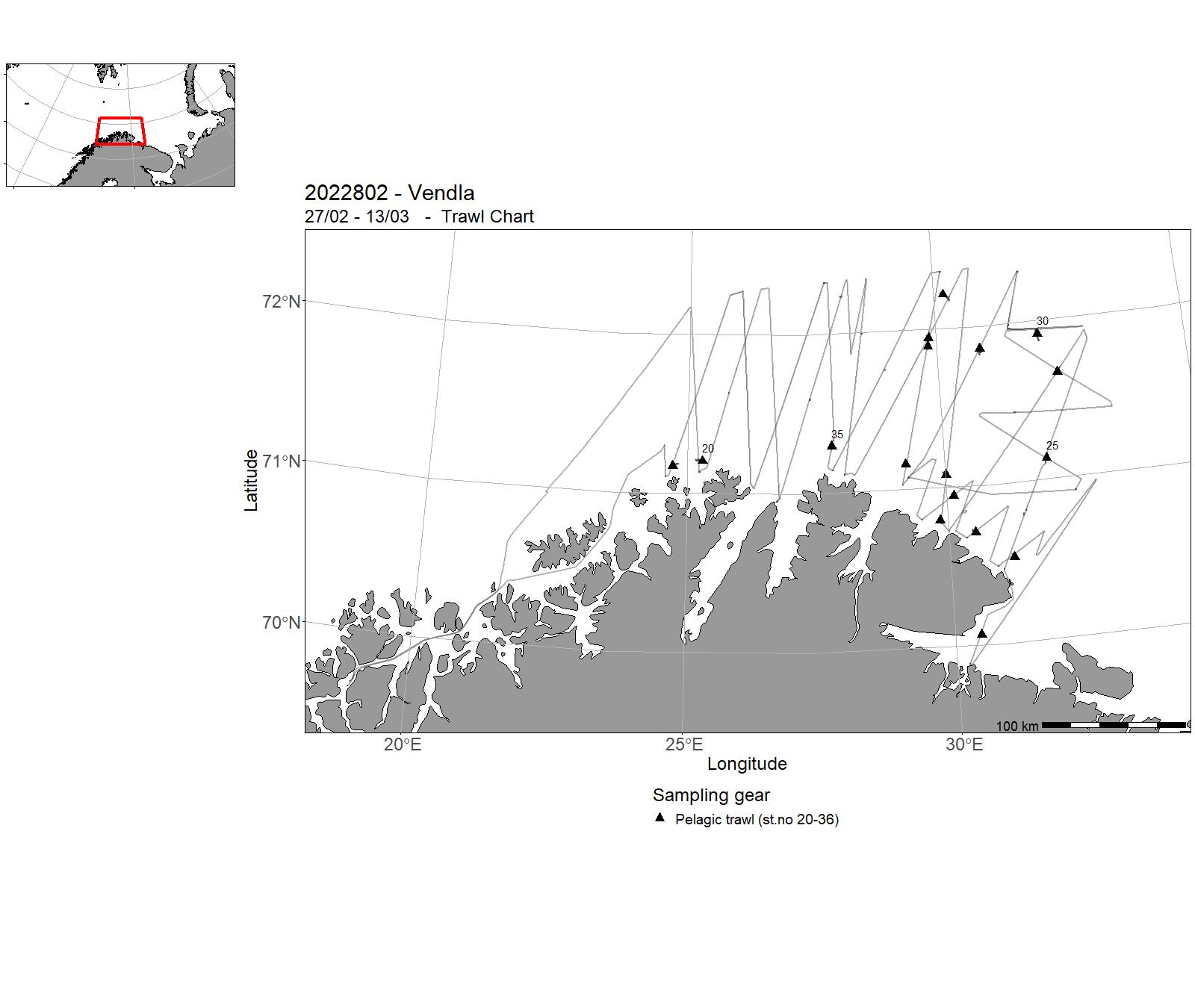
| 2022802 | 27/02 - 13/03 | Acoustic trawl monitoring survey for biomass estimation of the capelin spawning stock. | Norwegian Sea | 17-30 | 20-36 |
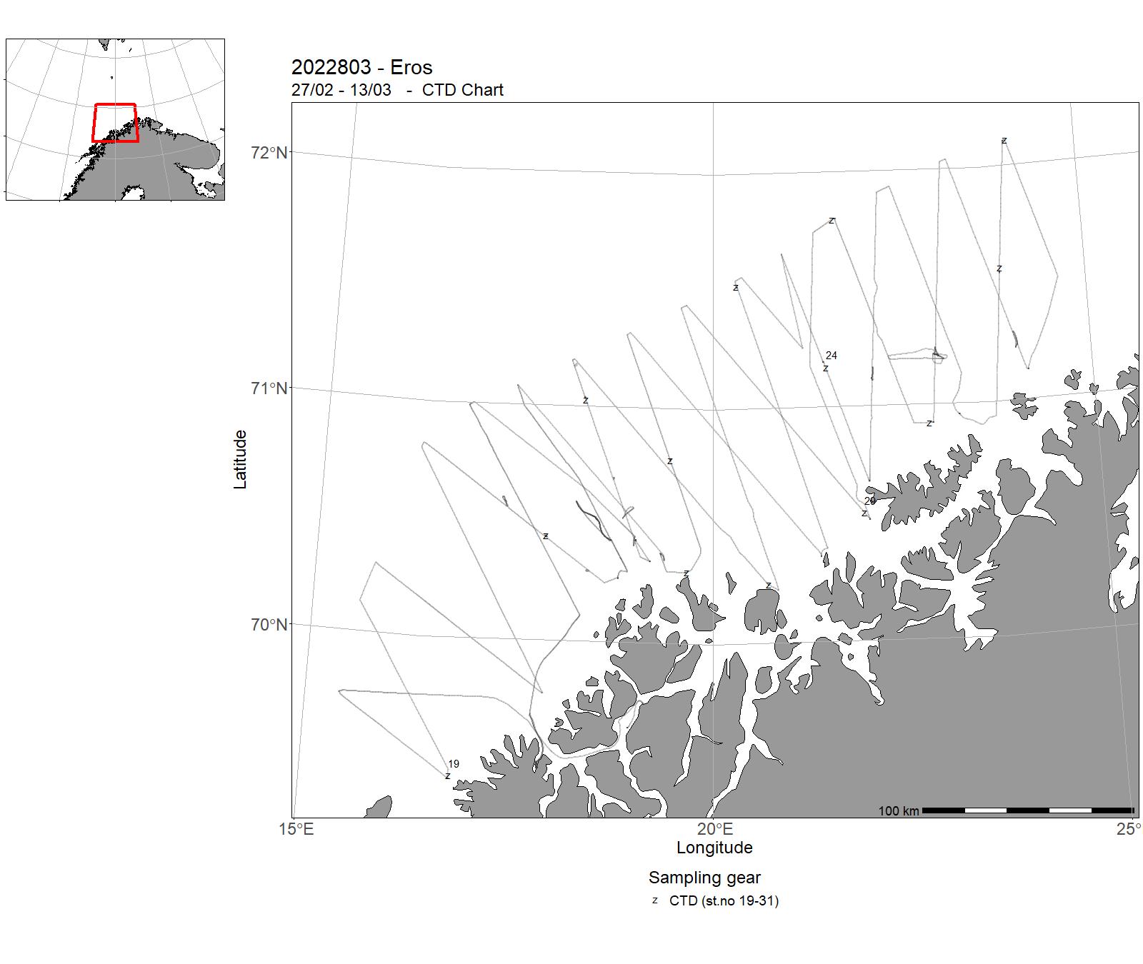
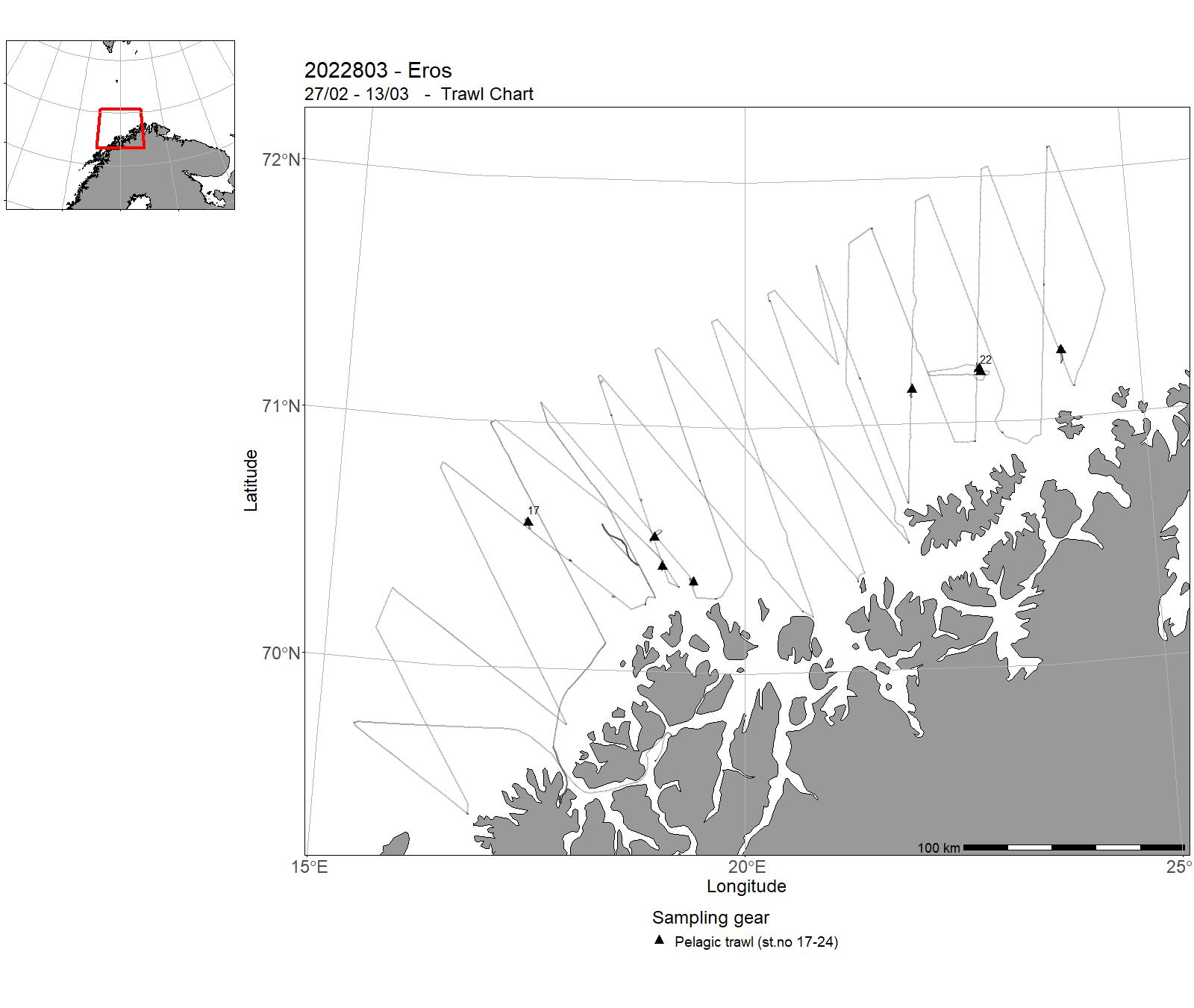
| 2022803 | 27/02 - 13/03 | Acoustic trawl survey on Capelin spawning stock. Methodological survey using a stratified survey design aiming to measure the abundance of Capelin during the spawning season. Project name: Managing strategies for the Barents SeaCoordinating body: Institute of Marine Research, Norway | Barents Sea | 19-31 | 17-24 |
| 2022807 | 25/01 - 25/02 | Conduct annual survey (since 2011) to collect acoustic and biological data on krill, other macrozooplankton and krill predator data from sector 48.2 in the Southern Ocean. The study uses the same design as surveys conducted by the US AMLR Program and the British Antarctic Survey in areas 48.1 and 48.3. Integrated monitoring links these three main areas where krill fishing is mainly conducted today. We depend on the logistics administration of Aker Biomarine AS that offers a vessel with crew free of charge for implementing this survey. Project name: Project KRILL (14246). Coordinating body: Institute of Marine Research, Bergen, Norway | Southern Ocean | - | - |
| 2022808 | 30/05 - 02/06 | Survey of potentially human pathogenic (i. e. anisakids nematodes) and other important parasites (i.e. Ichthyophonus) in North Sea herring intended for human consumption.In addition, a small sample of bycatch (i.e. mackerel) was studied. | Northeast Atlantic Ocean (40W) | - | - |
| 2022809 | 05/09 - 09/09 | Monitore parasites in Atlantic mackerel stocks fished for commercial purposes. Parasites examined in detail were Kudoa thyrsites, Ichthyophonus sp. And Anisakis in Atlantic mackerel. Project name: 15242 - Surveillance for biohazards of wild marine fish reflecting authentic fishing conditions. Coordinating body: Institute of Marine Research v/Arne Levsen | North Sea | - | - |
| 2022812 | 13/02 - 17/02 | The objective of the SpawnSeis MV project is to study effects of a new method of seismic imaging: by using a marine vibrator, using continuous sounds to get an image of the subsurface to explore oil and gas reserves. We would like to study whether this sound disrupt spawning behaviour of wild, free ranging, spawning cod using acoustic telemetry in Austevoll, Norway. The objective of the cruise is to deploy a marine vibrator from the vessel and expose the experimental area and to monitor the resulting noise patterns in the area where the cod is tagged. CTD stations were also taken in the area to characterise the propagation properties of the water column. The behavioural data will be downloaded from the listening buoys for the fish tags later and is not part of this survey. Project name: SpawnSeis MV Coordinating body: Institute of Marine Research | North Sea | - | - |
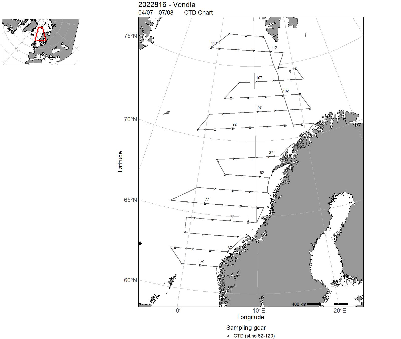
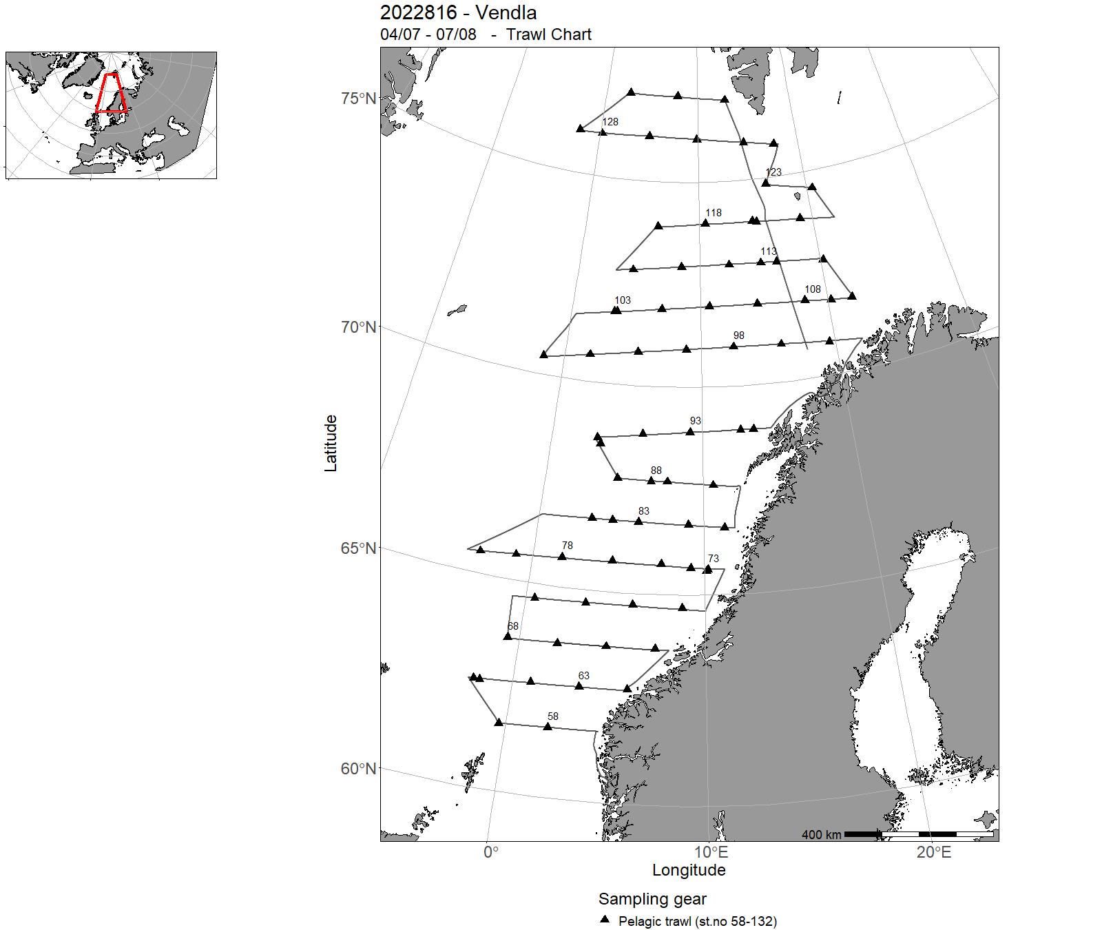
| 2022816 | 04/07 - 07/08 | 2022-NOR-029: Mengdemåling av makrellbestanden med swept area pelagisk tråling 0-35m dyp Akustisk mengdemåling nvg-sild 0-200 m Akustisk mengdemåling kolmule 0-500 m Laks og rognkjeks fokus. Økologiske studier (temp, plankton, hval) i forhold til pelagiske fisk | Norwegian Sea | 62-120 | 58-132 |
| 2022817 | 04/07 - 07/08 | Trawl survey to monitor the stock of Atlantic mackerel using swept area methodology. Acoustic survey to monitor the spawning stock of Norwegian spring spawning herring and the stock of blue whiting in the Nordic Seas. Ecological studies (temperature, plankton, whale observations) in relation to pelagic fish. Cruise coordinator: Leif Nøttestad, Institute of Marine Research Project name: International Ecosystem Summer Survey in the Nordic Seas (IESSNS). Coordinating body: ICES | Northeast Atlantic Ocean (40W) | 35-90 | 26-92 |
| 2022818 | 22/03 - 08/04 | 2022-NOR-005: Trålakustisk tokt for å måle gytebestanden av kolmule vest av de Britiske Øyer. Samarbeidstokt innen WGIPS, ICES (tidligere WGNAPES) | - | 31-61 | 37-57 |
| 2022819 | 19/11 - 07/12 | Catch and release tagging of Norwegian Spring Spawning herring with RFID tags on their wintering grounds. Herring are caught with a purse seine, pumped into holding tanks on the boat via a vacuum pump system. The fish are then measured for length and tagged with a RFID chip and released after tagging. A sample of fish is taken av 20 individuals per cm group to be used for age-length estimation. Cruise coordinator: Aril Slotte, Institute of Marine Research Norway. | Norwegian Sea | - | - |
| 2022820 | 27/04 - 27/05 | Tagging with RFID technology and biological sampling of mackerel in the spawning areas west of Shetland and the Hebrides and west of Ireland. Project name: Tagging and biological sampling of mackerel as part of studies on the European mackerel stocks. Coordinating body: Institute of Marine Research, Bergen, Norway. | Atlantic Ocean | - | - |
| 2022821 | 14/02 - 27/02 | Provide acoustic estimates of abundance and distribution of Norwegian spring spawning herring during the spawning migration along the Norwegian coast. | Norwegian Sea | 1-16 | 1-19 |
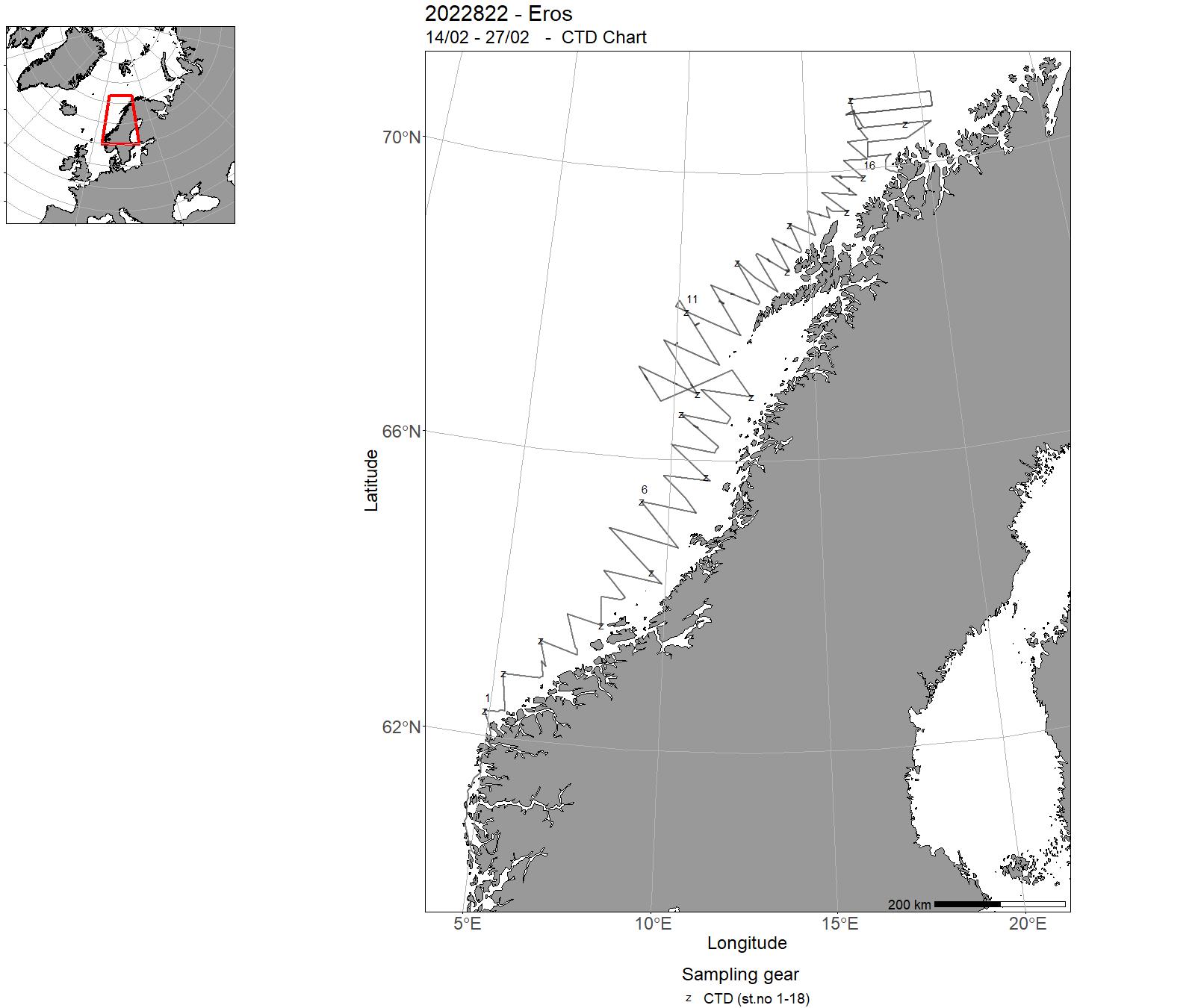
| 2022822 | 14/02 - 27/02 | Collection of acoustic data from echo sounder for biomass estimation of herring. Collection of biological samples for estimation of species and size composistion in the acoustic observations. Collection of hydrographic data (CTD) | Norwegian Sea | 1-18 | 1-16 |
| 2022824 | 08/06 - 02/08 | The objective of the cruise is to collect sightings information for estimating abundance of whales, especially minke whales, as part of a long-term survey program to cover the Northeast Atlantic over the years 2020-2025. The survey vessel has followed predetermined tracklines on which observations of whales have been recorded by dedicated observers. Data collected for each observation include: Species, position, position relative to vessel, weather data and other covariates. In total, around 3954 nautical miles were surveyed in the waters around Svalbard and the Barents Sea. Combined for the two platforms, 231 minke whale observations were recorded. Other species recorded were fin whale (119 observations), humpback whale (297 observations), blue whale (6 observations), sei whale (2 observations), harbor porpoise (188 observations), killer whales (10 observations), white-beaked dolphin (1522 observations), and sperm whale (21 observations). | Barents Sea | - | - |
| 2022825 | 22/03 - 04/04 |
This cruise was a collaboration between the Norwegian Directorate of Fisheries and the Institute of Marine Research. The aim of this research cruise was to further develop the catch control methods and technologies initially investigated in cruise Nos. 2019862 and 2021825 by addressing the following objectives: 1. Investigate the effectiveness of a catch control rigs to retain target catch during fishing operations and then release excess catch once the catch limited is reached. 2. Investigate the effectiveness of a catch limit release technology on the trawl codend (Prototype by Foss Tech). 3. Ground-truth fishing instrumentation (i.e. catch sensors and trawl-eye echosounders) for determining when the codend is full. 4. Monitor the geometry and dynamics of the trawl and codend, particularly during haul-back. 5. Investigate the effectiveness of a prototype technology for the rapid release of the pump from the trawl codend, as a countermeasure to sinking codends (Prototype by Foss Tech). 6. Investigate the effectiveness of a prototype bycatch reduction device for excluding large bycatch fauna (e.g. sharks and tuna) from the catch. Project Leader and Cruise Coordinator: Olafur Ingolfsson (Institute of Marine Research) Project name: Catch Control in Blue Whiting Pelagic Trawl Fishery Coordinating body: Institute of Marine Research |
Celtic Sea | - | - |
| 2022826 | 22/08 - 09/09 | The objective was to quantify the survival rate of shrimp (Pandalus borealis) that are selected out from a trawl bag at the sea surface under commerical fishing conditions. Shrimp escaping the codend at the surface were collected with one of two methods: either with a small meshed codend cover or with by manual «washing» of the codend in a tank, after bringing in onboard. Survival of shrimp was then monitored over the proceeding two days using onboard and laboratory based aquarium observations. Main tasks:Quantify differences in survival rates between short (~1 hour) and long (~7 hours) haul durationsQuantify differences in survival rates between different sampling methodologies (codend cover vs manual «washing»). Project name: Quantifying the survival of shrimp that are selected from a trawl bag at the fishing depth and at the sea surface (Project No.: 14785). Coordinating body: Institute of Marine Research | Skagerrak | - | - |
| 2022829 | 24/01 - 13/04 | 2022-BAR-027: Prøvetaking av kommersielle fangstar av bunnfisk (særleg torsk, sei, hyse, blåkveite, uer) landa på strekninga Helgeland-Varanger. Prøvetaking 180 døgn per år fordelt på alle kvartal, men med hovudvekt på 1 og 2 kvartal. | Norwegian Sea | - | - |
| 2022834 | 10/06 - 30/06 | Sampling of DNA from live harbor seal pups in breeding colonies in order to study population structure of the species in Norwegian coastal waters. | North Sea | - | - |
| 2022835 | 10/08 - 01/09 | 2022-KST-005: Oppstart ny landsdekkende telleperiode for steinkobbe langs norskekysten, som forventes å bli fullført i 2026. HI er ansvarlig for forvaltningsrådgivning av steinkobbe, herunder rådgivning om jaktkvoter langs hele kysten. | North Sea | - | - |
| 2022838 | 02/05 - 16/05 | There were conducted gear investigations to look at the effect of cod end extensions and twine thickness on relative selection of haddock at fishing depth, with a square mash codend to reduce accidental mortality of undersized fish in demersal seine fishing. 3 different setups were tried out. A black tunnel was mounted in one of the codend extensions to see if it could further contribute to increased sorting of haddock.Video observations were made with GoPro cameras.The catch was lenght measured and weighed. Project name: Selection in demersal seinesCoordinating body: Institute of Marine Research Bergen, Norway | Barents Sea | - | - |
| 2022839 | 20/09 - 26/09 | The goal of the IMR cruise no 2022839 was to survey the areas north of Moffen and on the Parryflaket where beds of Iceland scallops (Chlamys islandica) are known to occur based on survey and fisheries data from the late 1980ies. Especially Moffen was a key area in the former fishery for Iceland scallops and has been therefore selected for a mapping survey. The survey used a video sledge and dreding to collect data on the abundance of Iceland scallops and biological samples. The specific aim of cruise no 2022839 were as follows: 1. Map the distribution and density of Iceland scallops in the Moffen and Parryflaket areas using video transects and dredge stations.2. Estimate total abundance in the areas based on density information and potential explanatory variables such as bottom depth.3. Compare observed shell counts from dredge stations and video transects at the same locations to determine catchability coefficients and evaluate the representativeness of dredge catches for abundance estimation.4. Gather representative individual data to create size frequency distributions and age-size keys, as well as collect and tissue samples for population genetic and contaminants analyses.5. Investigate the spread of snow crab in inshore areas north(-west) of Svalbard. Project name: HaneskjellCoordinating body: Institute of Marine Research, Norway | Barents Sea | - | - |
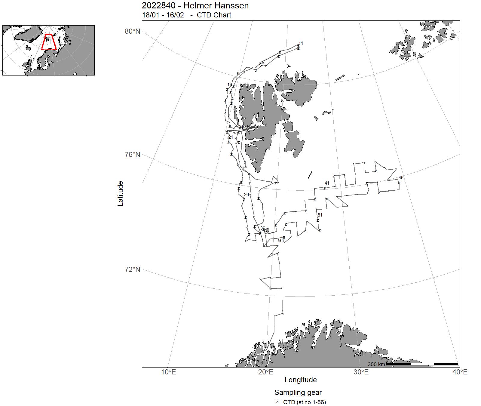
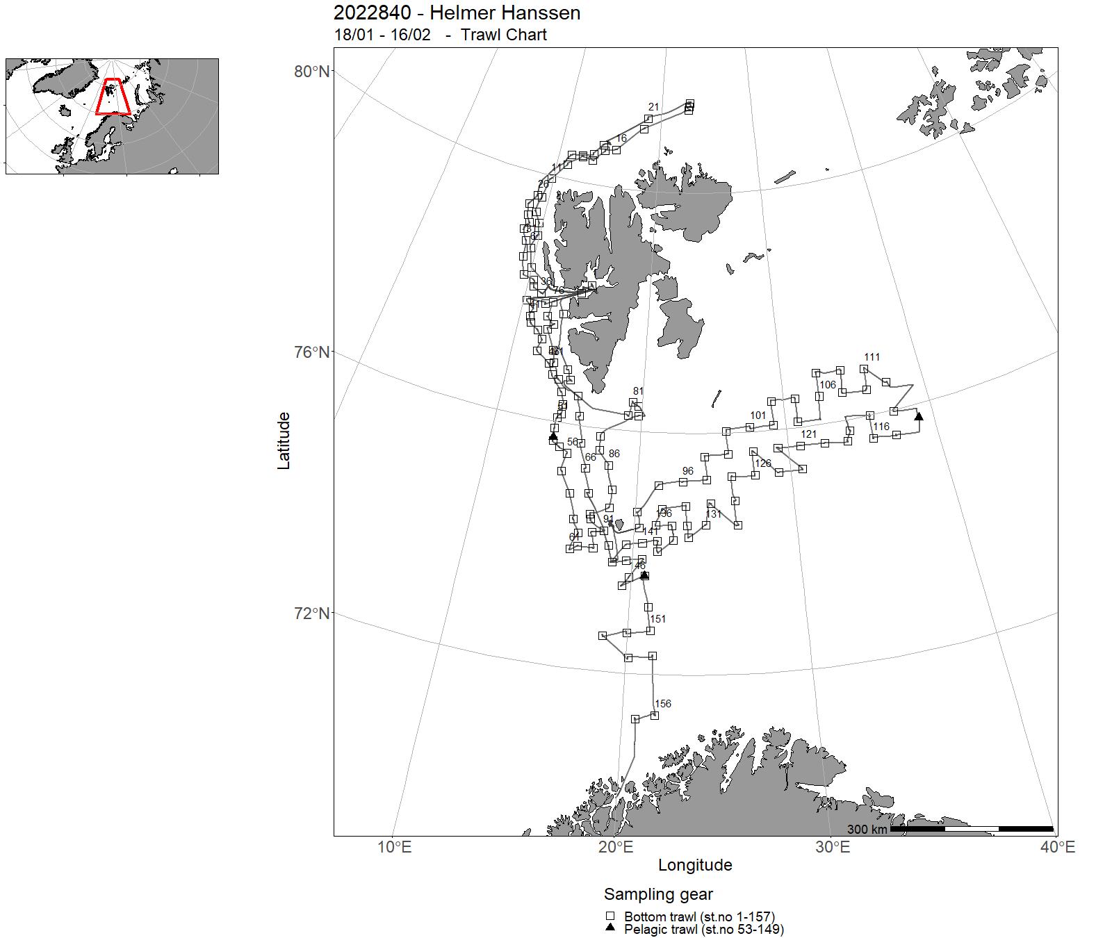
| 2022840 | 18/01 - 16/02 | Annual combined acoustic and bottom trawl survey of the Barents Sea: * map the distribution and calculate acoustic and swept area abundance indices, length, weight and maturity at age for cod and haddock * map the distribution of blue whiting, capelin, polar cod, redfish sp., and Greenland halibut * map the general hydrographical regime by using a CTD-sonde to monitor the temperature and salinity at one at bottom trawl stations and/or at fixed intervals (about 30 NM) | Norwegian Sea | 1-56 | 1 - 157 |
| 2022841 | 07/06 - 21/06 | This was a mackerel egg survey which gives important data for the estimation of the Mackerel spawning biomass. The data are used by ICES for assessment purposes. The survey was a part of a larger effort performed by the countries participating in the ICES WGMEGS group. The survey takes place every third year. Project name: Triannual Mackerel egg survey. Coordinating body: Working Group on Mackerel and Horse Mackerel Egg Surveys (WGMEGS), ICES | North Sea | - | - |
| 2022844 | 10/10 - 23/10 | 2022-KST-030: Undersøke forekomst av kysttorsk og andre arter på gruntvatn langs Norskekysten frå Nordland til Ryfylke. Vidareføring av tidsserie. Fisket foregår med finmaska trollgarn og åleruser. Er spesielt viktig for å kartlegga rekruttering av kysttorsk m.m. | North Sea | - | - |
| 2022845 | 17/10 - 27/10 | Investigate the potenial of fluorescent materials and LED as measures to increase catchrates of cod, tusk, haddock and saithe in commercial coastal longlining. During a 10 day cruise comparative fishing trials were conduced onboard a 10 meter commercial longliner. In addition behaviural studies were conducted using a low light camera system. | Barents Sea | - | - |
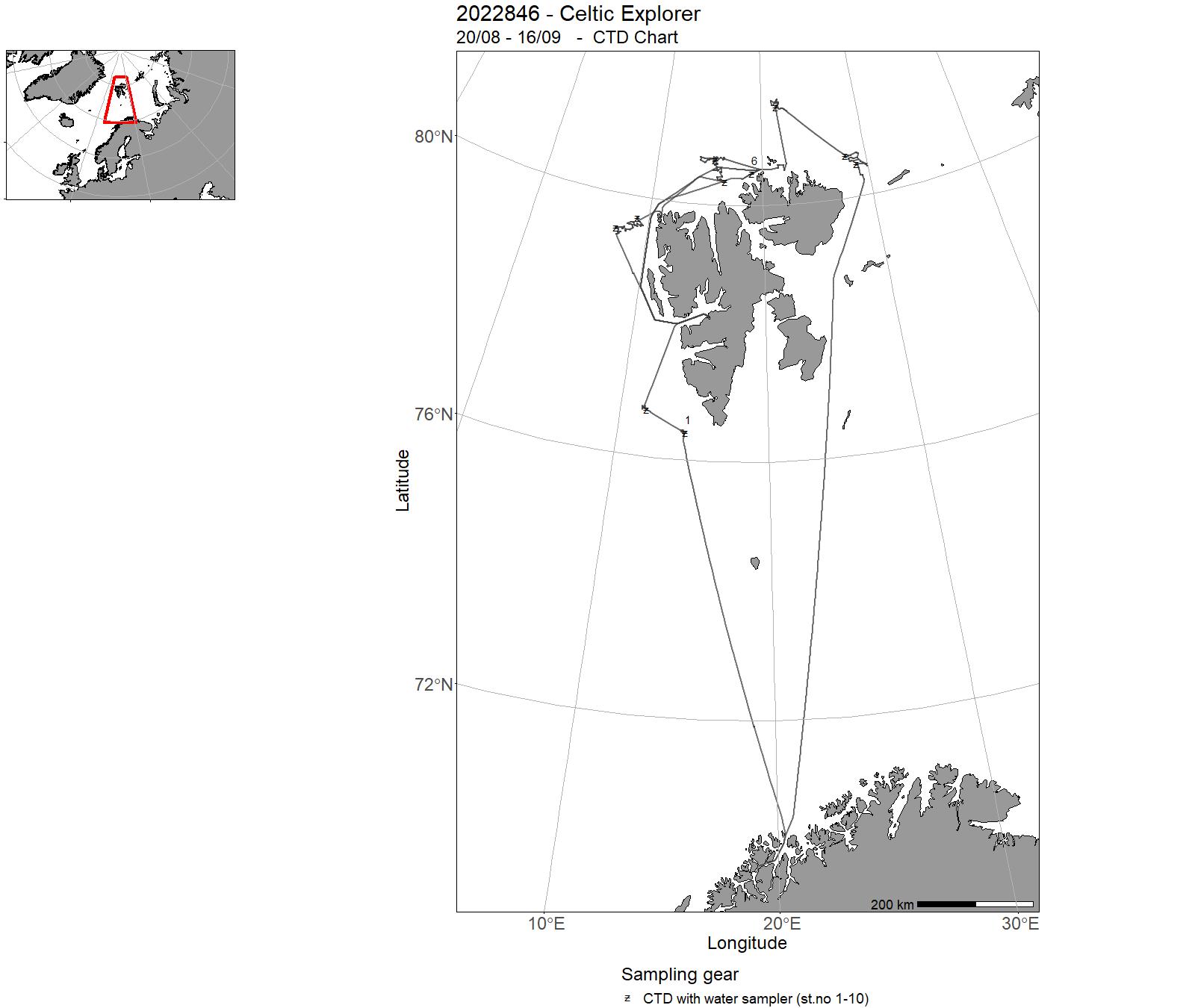
| 2022846 | 20/08 - 16/09 | 2022-MP-003: Levere kunnskap om biologisk mangfold, arters utbredelse, miljøkjemi og bunnsedimenter, i prioriterte områder nord av Svalbard til forvaltningsplaner for havområdet og grunnlag for overvåking. Innsamling av vann, bunnprøver og film av bunn. | Svalbardsonen | 1-10 | 1-7 |
| 2022847 | 10/08 - 23/08 | To document potential and/or verify known nursery areas in Vikna (the area around Nordøyan) with the use of remote underwater video riggs, fish traps, and snurrevad. This is part of a bigger, long-term program on the mapping of spawning and nursery areas for commercially important fish species in Norway. Project name: Program om gytefelt og oppvekst område kartlegging. Coordinating body: Fiskeridynamikk/Institute of Marine Research, Norway | Norwegian Sea | - | - |
| 2022849 | 05/09 - 02/10 | På lang sikt er formålet med toktserien å etablere en bestandsindeks for pigghå basert på fangstrater i standardiserte årlige survey. Toktet samler også inn informasjon om sammensetning av bestanden for å ytterligere underbygge bestandsanalysen | Norskekysten: Annet | - | - |
| 2022850 | 15/08 - 20/08 | Diving survey, flora and fauna hard bottom on set survey stations. The cruise is conducted by rental vessel Johan Ruud. | Skagerrak | - | - |
| 2022851 | 17/10 - 28/10 | Følge bestandsutviklingen til sjøkreps i et nullfiskeområde og et kontrollområde | Frohavet | - | - |
|
0155_2022_ UFJN_VILN |
21/01 - 22/02 | - | - | - | - |
|
0156_2022_ UFJN_VILN |
23/10 - 01/12 | - | - | - | - |
| 2022001 | 02/05 - 29/05 | 2022-AKV-018: Toktet har som hensikt å fange utvandrende vill laksesmolt som en del av den nasjonale overvåkningen av lakselus på vill laksefisk. Laksesmolt fanges i ytre deler av utvalgte fjordsystem med en spesialbygget pelagisk trål. | North Sea | - | - |
| 2022002 | 16/05 - 12/06 | 2022-AKV-022: Toktet har som hensikt å fange utvandrende vill laksesmolt som en del av den nasjonale overvåkningen på vill laksefisk. Laksesmolt fanges i ytre deler av utvalgte fjordsystem med en spesialbygget pelagisk trål | Norwegian Sea | - | - |
| 2022003 | 16/05 - 12/06 | 2022-AKV-023: Toktet har som hensikt å fange utvandrende vill laksesmolt som en del av den nasjonale overvåkningen på vill laksefisk. Laksesmolt fanges i ytre deler av utvalgte fjordsystem med en spesialbygget pelagisk trål | Norwegian Sea | - | - |
| 2022004 | 20/06 - 17/07 | 2022-AKV-024: Toktet har som hensikt å fange utvandrende vill laksesmolt som en del av den nasjonale overvåkningen på vill laksefisk. Laksesmolt fanges i ytre deler av utvalgte fjordsystem med en spesialbygget pelagisk trål | Barents Sea | - | - |
| 2022005 | 24/03 - 02/04 | Samle inn data om artssammensetning, mengde og utbredelse av fisk i Hywind Tampen området før utbygging av vindfarmen starter. | North Sea | - | - |
| 2022751 | 05/09-10/09 | 2022-AKV-012: Overvåkning av det fysiske fjordmiljøet, havforsuring. | Norskekysten: Troms/Finnmark | 1-88 | - |
| 2022753 | 08/10-12/10 | 2022-AKV-013: Overvåking av det fysiske fjordmiljøet. | Norskekysten: Troms/Finnmark | 89-170 | - |
19 - Hired vessels – Charts for 2022


20 - Oceanographic sections and Fixed oceanographic stations map
21 - Tables – Observations in 2022. Oceanographic sections and fixed oceanographic stations
| Oceanogr. sec. | Jan | Feb | Mar | Apr | May | Jun | Jul | Aug | Sep | Oct | Nov | Dec |
| North Sea | ||||||||||||
| Fedje–Shetland | 2022206 | |||||||||||
| Slotterøy-West | 2022206 | |||||||||||
| Utsira-West | 2022202 | 2022206 | 2022619 | 2022212 | ||||||||
| Jærens Rev-SW and W | 2022206 | |||||||||||
| Egerøya-SW | 2022206 | |||||||||||
| Lista-SW | ||||||||||||
| Lindesnes-SSW | 2022206 | |||||||||||
| Hanstholm–Aberdeen | 2022202 | 2022206 | 2022619 | |||||||||
| Harboør | ||||||||||||
| Hysby Klit | ||||||||||||
| Knude-Dyb | ||||||||||||
| Oceanogr. sec. | Jan | Feb | Mar | Apr | May | Jun | Jul | Aug | Sep | Oct | Nov | Dec |
| Skagerrak and Kattegat | ||||||||||||
| Torungen–Hirtshals | 2022301 | 2022302 | 2022303 | 2022305 | 2022307 | 2022309 | 2022310 | 2022311 | 2022314 | 2022316 | 2022317 | 2022319 |
| Oksøy–Hanstholm | 2022206 | |||||||||||
| Jomfruland–Skagen | ||||||||||||
| Jomfruland–Koster | ||||||||||||
| Torbjørnskjær | ||||||||||||
| Väderø | ||||||||||||
| Måseskjær | ||||||||||||
| Gøteborg–Fredrikshavn | ||||||||||||
| Kattegat | ||||||||||||
| Oceanogr. sec. | Jan | Feb | Mar | Apr | May | Jun | Jul | Aug | Sep | Oct | Nov | Dec |
| The Norwegian Sea and Vestfjorden | ||||||||||||
| Svinøy-North/West | 2022203 | 2022207 | 2022209 | 2022213 | ||||||||
| Gimsøy-North/West | 2022207 | 2022209 | 2022213 | |||||||||
| Bjørnøya-West | 2022209 | 2022213 | ||||||||||
| Sørkapp-West | ||||||||||||
| Færøyene–Shetland | ||||||||||||
| Skrova–Øksnesodden | ||||||||||||
| Kabelvåg–Steigen | ||||||||||||
| Ballstad– Måløy/Skarholmen | ||||||||||||
| Røst–Tennholmen | ||||||||||||
| Oceanogr. sec. | Jan | Feb | Mar | Apr | May | Jun | Jul | Aug | Sep | Oct | Nov | Dec |
| The Barents Sea | ||||||||||||
| Fugløya–Bjørnøya | 2022610 | 2022207 | 2022209 | 2022213 | ||||||||
| Vardø-North | 2022204 | 2022210 | ||||||||||
| Semøyene-North | ||||||||||||
| Bjørnøya–Sørkapp | ||||||||||||
| Nordkapp-North | ||||||||||||
| Polhavet–Kvitøya | ||||||||||||
| Kola | ||||||||||||
| Fair Isle-Pentland | ||||||||||||
| Fixed stations | Jan | Feb | Mar | Apr | May | Jun | Jul | Aug | Sep | Oct | Nov | Dec | Total |
| LISTA N58º 05,1' E06º 32,5' | 4 | 2 | 3 | 3 | 4 | 3 | 3 | 3 | 3 | 3 | 3 | 3 | 37 |
| UTSIRA Y N59º 19' E04º 44' | 3 | 2 | 5 | 4 | 4 | 4 | 5 | 4 | 4 | 3 | 3 | 3 | 44 |
| UTSIRA I N59º 19'E04º 59' | 3 | 2 | 5 | 4 | 4 | 4 | 4 | 4 | 4 | 2 | 3 | 3 | 42 |
| SOGNESJØEN N61º 01' E04º 50' | 1 | 2 | 2 | 3 | 2 | 3 | 2 | 2 | 2 | 1 | 2 | 22 | |
| BUD N62º 56' E06º 47' | 2 | 3 | 3 | 3 | 3 | 3 | 3 | 3 | 3 | 3 | 3 | 3 | 35 |
| SKROVA N68º 07' E14º 39' | 3 | 3 | 4 | 2 | 4 | 1 | 4 | 3 | 4 | 4 | 5 | 3 | 40 |
| EGGUM N68º 23' E13º 38' | 1 | 4 | 4 | 4 | 4 | 5 | 4 | 5 | 4 | 4 | 4 | 2 | 45 |
| INGØY N71º 08' E24º 01' | 2 | 2 | 2 | 2 | 2 | 1 | 1 | 1 | 2 | 1 | 16 |