Rapportserie:
Rapport fra havforskningen 2021-10
ISSN: 1893-4536
Publisert: 09.03.2021
Oppdatert: 05.01.2022
Prosjektnr: 14417
Oppdragsgiver(e): Havforskningsinstituttet
Forskningsgruppe(r):
Program:
Research group leader(s):
Helge Sagen (The Norwegian Marine Data Centre (NMD))
Approved by:
Research Director(s):
Geir Huse
English summary
Sammendrag
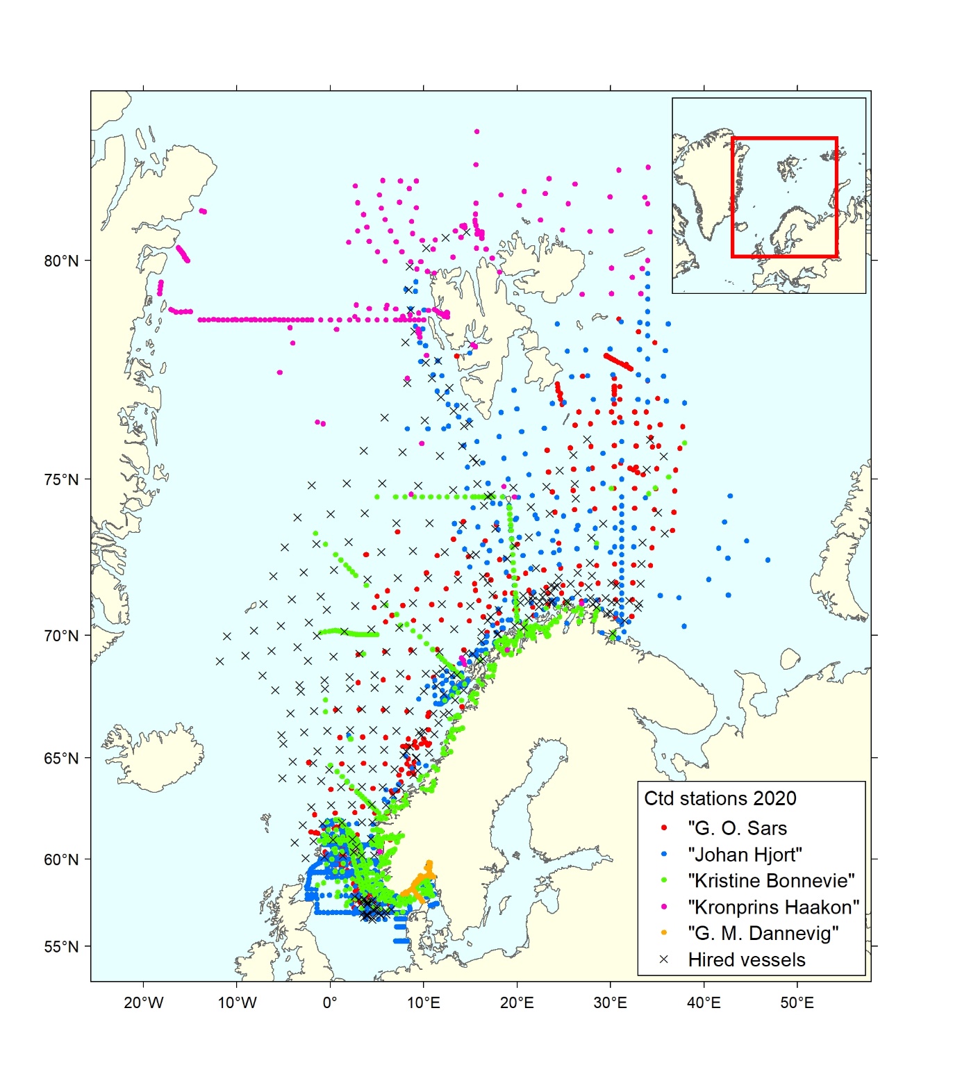
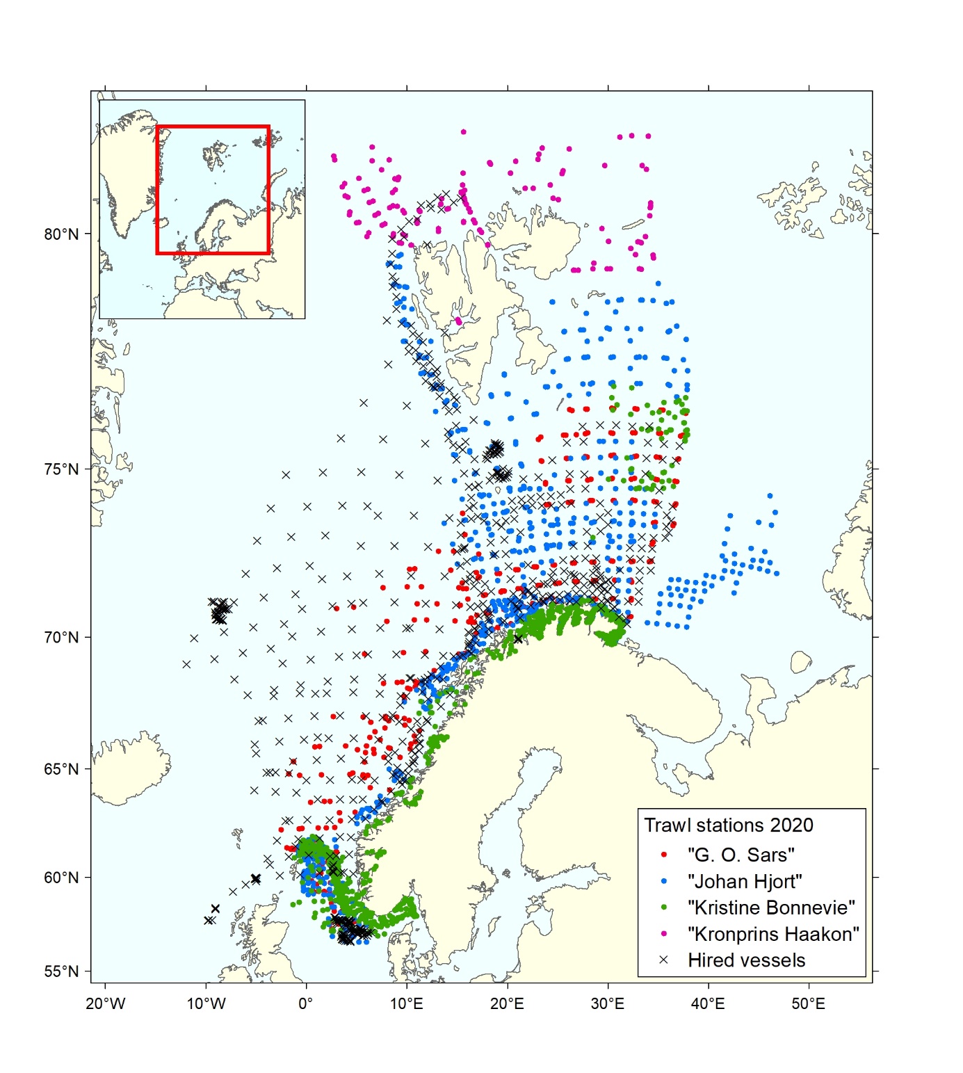
The report gives an overview of cruises in 2020, by the Institute of Marine Research, Universities of Bergen and Tromsø and Norwegian Polar Institute, on board our research vessels and many of the hired commercial vessels. Each cruise is described by a short description and a track chart mainly showing CTD, plankton and trawl stations.
The coverage of the oceanographic sections is listed in a table. Another table shows the number of observations per month for the fixed stations. Meta data about the cruises are reported to the International Council for the Exploration of the Sea (ICES) using the form “Cruise Summary Report”: http://www.seadatanet.org/Metadata/CSR. Research data (and chart) are available from the Norwegian Marine Data Centre at IMR. The charts can internally at IMR be downloaded from the Institute Intranet/Archive: http://hinnsiden.imr.no/ressurser/bilder/mediearkiv. Charts are made by Karen E. Gjertsen. Sebastian Bosgraaf made charts for “G.M. Dannevig”. There are no overview and maps for the cruises with our vessels "Fangst" and "Hans Brattström".
1 - Charts overview 2020 – Ctd stations and trawl stations.
Ctd stations 2020 “Dr. Fridtjof Nansen” 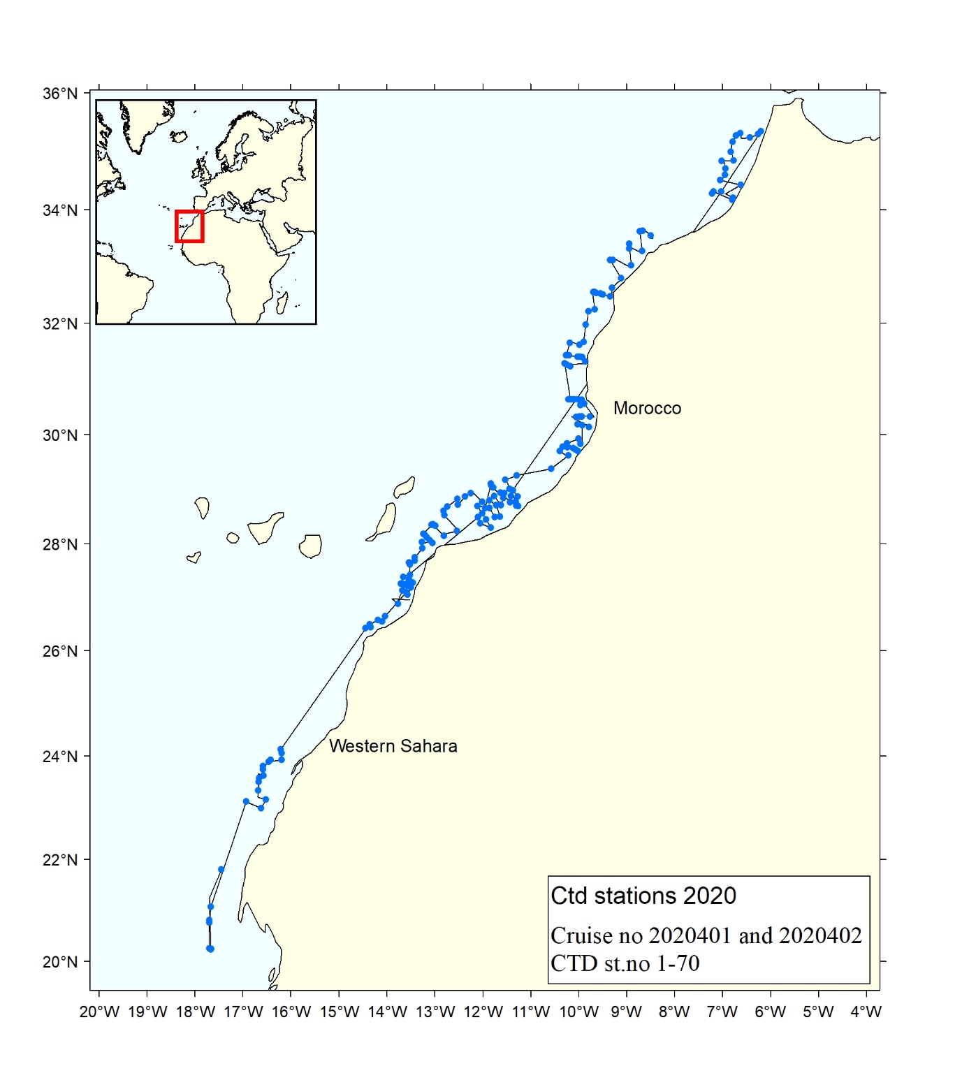
2 - "G. O. Sars" – Cruises 2020
| Cruise no |
Period |
Purpose |
Area |
CTD st.no |
Trawl st.no |
Fig. no |
| 2020101 |
1.2.-5.2. |
The marine geological survey is a UiBs training course for students within marine geology and marine geophysics. |
Norwegian fjords |
1-3 |
- |
1 |
| 2020102 |
6.2.-4.3. |
The main objectives of the IBTS Q1 bottom trawl survey coordinated by ICES/IBTSWG are: • to determine the distribution and relative abundance of pre ‐ recruits of the main commercial species with a view of deriving recruitment indices • to monitor changes in the stocks of commercial fish species independently of commercial fisheries data • to monitor the distribution and relative abundance of all fish species and selected invertebrates • to collect data for the determination of biological parameters for selected species • to collect hydrographical and environmental information • to determine the abundance and distribution of herring and other fish larvae as well as fish eggs. |
North Sea |
4-102 |
1-55 |
2-4 |
| 2020103 |
6.3.-7.4. |
Combined acoustic and bottom trawl survey along the continental shelf from 62⁰N to 74⁰N. Main target fish species are greenland halibut, redfish and greater silver smelt. |
Northeast Atlantic Ocean |
103-105 |
56-102 |
5-6 |
| 2020104 |
7.4.-27.4. |
To map depth, topography, sediment composition, biodiversity, habitats, biotopes, and pollution in the seabed of the Mid-Norwegian shelf area Frøyabanken, Sula region and Haltenbanken. The mapping was performed using visual seabed observation using hauled video rig. And sampling of sediments, chemical pollution and organisms by using a variety of sampling gears (water sampling bottles, grabs, boxcorer, multicorer, beam trawl and hyperbenthic sledge). Mocness and Multinet Mammoth, for collecting zooplankton. Both gears are multipel nets with open and close mechanisms. |
Northeast Atlantic Ocean, Norwegian Sea |
106-115 |
- |
7-8 |
| 2020105 |
|
Cancelled |
- |
- |
- |
|
| 2020106 |
1.5.- 2.6. |
Provide acoustic estimates of abundance and distribution of pelagic species in the Norwegian Sea. Collect data on hydrography and plankton in the Nowegian Sea. Collect samples for analyses of persistent organic pollutants (POPs), hydrocarbons (PAH, THC), metals (e.g. Hg, Cd, Pb, As), microplastic and radionuclides in seawater, sediments and pelagic fish. |
Norwegian Sea |
116-181 |
103-168 |
9-10 |
| 2020108 |
6.6.-13.6. |
The cruise to the Mid_Norwegian margin is organized and funded through the Geological Survey of Norway and focuses on studies of methane leakage at the seafloor on the Mid-Norwegian shelf and continental margin. Cruise 2020108 in June 2020 will be directed to the Mid-Norwegian shelf, where well inspect a recently discovered seep site close to outcropping volcanic structures. From previous cruise we have identified the exact sampling locations for the ROV Ægir 6000. However, depending on time and weather, we will define additional sampling stations. |
Norwegian Sea |
182-183 |
- |
11 |
| 2020107 |
18.6.-14.7. |
Part 1:The objective of the cruise was to perform marine geological and marine biological survey in selected coastal areas from Bergen to Bodø. The marine geological part of the cruise was dedicated to Vartdalsfjorden, Sulafjorden and Halsafjorden to aquire TOPAS profiles, gravity cores and conduct ROV dives and video mapping in cooperation with the Norwegian Public Roads Administration. The main objectives of the marine biolocal part of the cruise was to collect benthic fauna and videomapping the seafloor in selected fjord areas for environmental, habitat and DNA analyses. Part 2 : The objective of this part of the cruise was to collect samples of both geology and biology along the Mohns-Ridge. A large part of leg 2 was to collect high-resolution bathymetry, side-scan and sub-bottom profiler data for selected sub-areas. Two areas was also mapped using the multibeam onboard G.O.Sars. Several CTD were taken to investigate hydrothermal plumes. Gravity cores were collected to investigate the volcanic history of the ridge. |
Norwegian Sea |
184-203 |
- |
12-13 |
| 2020109 |
- |
Cancelled |
- |
- |
- |
- |
| 2020110 |
17.7.-3.8. |
Collecting video data, fauna and sediments from the seafloor on the shelf off mid Norway, aiming at mapping benthic biotopes, chemical pollution and testing of eDNA metods in benthic investigations.The mapping was performed using visual seabed observation using hauled video rig, sampling of sediments and organisms using a variety of sampling gears (grab, boxcorer, multicorer, beam trawl and hyperbenthic sled).The survey was collectecing data and samples at the Trænadjupet, Trænabanken off Nordland County; Sklinnabanken, Sklinnadjupet off Trøndelag. The survey was successful. |
Norwegian Sea |
204-216 |
- |
14 |
| 2020111 |
10.8.-8.9. |
The cruise forms part of a multipurpose, multiship ecosystem survey of the Barents Sea, a joint enterprise of IMR in Bergen, Norway and Northern Branch of VNIRO (PINRO) in Murmansk, Russia. Three Norwegian and two Russian research vessels participate. The aim is to conduct a full coverage of the Barents Sea and adjacent areas north of Svalbard, where all compartments of the ecosystem is studied ; physical and chemical oceanography, phytoplankton, zooplankton, pelagic fish, demersal fish, marine litter, sea birds and sea mammals. |
Barents Sea |
217-290 |
169-327 |
15-16 |
| 2020112 |
14.9.-28.9. |
Training course in Ocean Science. |
North Sea |
291-345 |
|
17-18 |
| 2020113 |
6.10.-27.10. |
The cruise is a mooring service/deployment and process studies cruise of the Nansen LEGACY project.The study region covered 24-35E and 75-79N, with objectives to deploy moorings for process studies (1 year duration), service and redeploy accessible gateway moorings (long term), deploy underwater gliders (cruise duration as well as 3-4 months missions), conduct ocean mixing and water transformation process studies in the Barents Sea Polar Front region east of Svalbard, and sample for biology, nutrients and the carbonate chemistry in the water column at selected stations. |
Barents Sea |
346-409 |
- |
19-20 |
| 2020114 |
- |
Cancelled |
- |
- |
- |
- |
| 2020115 |
6.11.-18.11. |
Investigations of sampling trawls. |
Barents Sea |
- |
328-481 |
21 |
| 2020116 |
19.11-30.11. |
Start collecting data for the CRIMAC SFI Center. Measure FM spectre for two sizes of NVG herring for creating a library for machine learning on several categories. Measured herring, blue whiting, krill and zooplankton (sea angel), kruttåte. Wideband settings and calibrations. Try out new ADCP, Simrad EC150-3C, with high resolution echo sounder. Measurements with Scantrol DEEPVIsion and sorting system on codend. Tral on avoidance and spectre changes on herring from KayakDrone and “G.O.Sars” on shallow herring layers. Trilas of new software in sonar SU90. Calibrations. |
Norwegian Sea |
410-412 |
548-558 |
22 |
| 2020117 |
- |
Cancelled |
- |
- |
- |
- |
4 - "Johan Hjort" - Cruises 2020
| Cruise no |
Period |
Purpose |
Area |
CTD st.no |
Trawl st.no |
Fig. no |
| 2020201 |
7.1.-16.1. |
The objective of the cruise was to collect data and samples on pre-selected stations as part of the IMR monitoring of physical and biological parametres in the North Sea. Sampling was undertaken on standard sections. The cruise programme included sampling for physical-chemical oceanographic parameters (CTD casts, nutrients and chlorphyll), zooplankton with plankton net and the Multinet Mammoth. A larger plankton net with an associated smaller and finer mesh net was used to sample the fish larvae and fish eggs. Due to inclement weather the stations along the west coast of Norway were not sampled. From the Utsira-Startpoint transect only the 10 first stations on the west were sampled, with CTD casts. |
North Sea |
1-59 |
- |
23-24 |
| 2020202 |
17.1.-25.1. |
Objectives: To collect data and samples on pre-selected stations. To sample standard sections for physical oceanographic parameters (CTD casts, nutrients and chlorophyll) and zooplankton. |
Barents Sea Norwegian Sea |
60-83 |
- |
25 |
| 2020203 |
27.1.-13.3. |
Bottom trawl survey to assess the biomass and geographical distribution of the target species cod and haddock. Acoustic survey to assess the biomass and distribution of the target species cod, haddock and capelin. Joint survey with PINRO, Russia. Two Norwegian vessels (Johan Hjort and Helmer Hanssen) and one Russian vessel (Vilnius) participated. |
Barents Sea |
84-140 |
1-205 |
26 |
| 2020204 |
25.3.- 11.4. |
The main survey objective is to estimate abundance indices at age of the spawning stock of North East Arctic cod using the trawl acoustic method. The survey area is the shelf area from Malangsgrunnen south to Røsttunga and the shelf are of Vestfjorden connected to the Lofoten islands. Additional observations included the use of CTD and T80 net for sampling density and stage distribution of spawned eggs. The survey is a part of a time series. |
Norwegian Sea |
141-196 |
206-238 |
27-29 |
| 2020205 |
14.4.- 12.5
|
The North Sea Ecosystem spring cruise has been run since 2010 by the Institute of Marine Research (IMR) as a multi-purpose survey. The cruise covers hydrography, chemistry, phytoplankton and zooplankton (IMR project “Monitoring of climate and plankton in the North Sea Skagerrak”) as well as fish eggs and fish larvae (IMR project “Early life history dynamics of North Sea Fishes”). The cruise also includes monitoring of radioactive contamination (IMR project “Monitoring of radioactivity in Norwegian waters” IMR 14379-01). |
North Sea |
197-453 |
- |
30-31 |
| 2020206 |
27.6.-27.7. |
Acoustic survey focusing on herring (HERAS, leg 1) and saithe in the northern North Sea. The herring survey, coordinated by ICES and WGIPS, is part of an international sampling effort (involving also Denmark, Netherlands, Germany and Scotland) and the index is used in the assessment of North Sea herring. NORACU: times series focusing on saithe (both legs) to be used in assessment of the NS saithe after 5 years of consistent sampling (ICES regulation). |
North Sea |
454-567 |
239-373 |
32-33 |
| 2020207 |
28.7.-5.8. |
The objective of the cruise was to collect data and samples on pre-selected stations as part of the IMR monitoring of physical and biological parametres in the North Sea. The cruise programme included sampling for physical-chemical oceanographic parameters (CTD casts, nutrients and chlorphyll), zooplankton with plankton net and the Multinet Mammoth. MIK a larger plankton was used to sample the fish larvae and fish eggs. |
North Sea |
568-648 |
- |
34-35 |
| 2020208 |
7.8.-19.8. |
Objectives: To collect data and samples on pre-selected stations. To sample standard sections for physical oceanographic parameters (CTD casts, nutrients and chlorophyll) and zooplankton in the Norwegian sea and the Barents Sea. |
Barents Sea Norwegian Sea |
649-715 |
- |
36 |
| 2020209 |
20.8.-2.10. |
This cruise is part of a multi-purpose ecosystem survey in the Barents Sea, done by several research vessels and carried out jointly by Norway and Russia. The objectives were to collect data at several trophic levels: phyto- and zooplankton, benthos, fish, marine mammals, and seabirds. In addition, hydrography, water chemistry and physics, and acoustics were monitored. Samples of seawater and sediments at the wreck of "Komsomolets" for investigations of Cs-137, Sr-90, Pu isotopes, and H-3 were taken. Two sections were covered. |
Barents Sea |
716-840 |
716-871 |
37-38 |
| 2020210 |
8.10.-15.11. |
Annual combined acoustic and bottom trawl survey along the Norwegian coast north of 62˚N. Map the distribution and calculate acoustic abundances indices, length, weight and maturity at age for coastal cod, saithe and haddock. Improve data basis for the assessment of golden redfish, by allocating additional bottom trawls. Map the general hydrographical regime by using a CTD-sonde to monitor the temperature and salinity at one at bottom trawl stations and/or at fixed intervals. Acoustic coverage of pelagic fish in Laksefjord, Tanafjord,and Porsangerfjord. Sampling of golden redfish, cod, saithe, haddock, tusk for analysis of contamination. Collection of frozen samples of selected shark and skate species, deep sea shrimps. |
Barents Sea Norwegian Sea |
841-890 |
872-1016 |
39-40 |
| 2020211 |
16.11-25.11. |
The aim of the cruise was to collect samples on 4 transects for physical oceanographic parameters (CTD casts, nutrients and chlorophyll), zooplankton and fish larvae for the IMR projects “Monitoring of climate and plankton in the North Sea Skagerrak”, and “Early life history dynamics of North Sea Fishes”. |
North Sea |
891-959 |
|
41-42 |
| 2020212 |
26.11.-9.12. |
Standard sections. |
Norwegian Sea Barents Sea |
960-1026 |
- |
43 |
6 - "Kristine Bonnevie" – Cruises 2020
| Cruise no |
Period |
Purpose |
Area |
CTD st.no |
Trawl st.no |
Fig. no |
| 2020601 |
8.1-31.1. |
Annual shrimp survey. |
North Sea, Skagerrak |
1-108 |
1-111 |
44-45 |
| 2020602 |
2.2.-1.3. |
Acoustic survey of saithe during the spawning period, at time of year when saithe spawning stock (SSB) are highly aggregated. Survey to be used in assessment after 5 years (ICES regulation). |
North Sea |
109-166 |
117-206 |
46-47 |
| 2020603 |
2.3-8.3. |
The cruise is part of the course work for students in GEOF337 (Fjord oceanography) and GEOF232 (Practical Meteorology and Oceanography) at GFI, UiB. The aim of the cruise is to make the students aquainted with oceanographic data collection, and to collect data for semester and Master projects. |
North Sea, Norwegian fjords |
167-273 |
- |
48 |
| 2020621 |
9.3-21.3. |
Study the ecology of the mesopelagic community. Explorative survey of Maurolicus. |
North Sea |
274-284 |
207-223 |
49-51 |
| 2020604 |
|
Cancelled |
|
- |
- |
|
| 2020605 |
|
Cancelled |
|
- |
- |
|
| 2020606 |
|
Cancelled |
|
- |
- |
|
| 2020607 |
|
Cancelled |
|
- |
- |
|
| 2020622 |
30.3.-6.4. |
Hydrography along regular transects in Hardangerfjord, Masfjord, Sognefjord and Førdefjord. Exchange of batteries on current meter moorings in Hardangerfjord and Sognefjord. Deployment of a current meter mooring in Austevoll. Standard measurements on the standard section Svinøysnittet. |
North Sea Norwegian Sea |
285-342 |
- |
52 |
| 2020608 |
25.4.-20.5. |
The cruise objectives were to occupy the monitoring sections Fugløya-Bjørnøya, extended Bjørnøya vest and extended Gimsøy section and the Svinøy section and deploy Argo floats. The earlier weather ship station M was occupied. On the sections, and at station M, CTD observations measurements were made from surface to bottom. Water samples were drawn for nutrients analysis, carbon system analysis and. Chlorophyll was sampled for the top 100 m. WP2 plankton nets for the top 200 m (100 m in the Barents Sea) was conducted along the sections. Qualitative plankton nets were sampled on selected stations. ADCP, Thermosalinograph and echo sounder data were collected underway, and Argo floats were deployed in selected locations. |
Barents Sea, Greenland Sea, Norwegian Sea |
343-435 |
- |
53 |
| 2020623 |
23.5.-25.5. |
Behaviour of mesopelagic towards trawl and towed platform. |
North Sea |
- |
224-236 |
54 |
| 2020609 |
29.5.-1.6. |
The objective of the cruise was to collect baseline data on major ecosystem components in Førdefjorden before the deposition of mine tailings starts. The amount and diversity of plankton, benthos and demersal fish will be estimated in the basins inside and outside of the basin where tailings will be deposited. Tissue samples for stable isotop analysis and heavy metals will be collected. ROV investigations will be performed to map hard bottom sensitive benthic habitats. The main objective is to gain basline information of the fjord so that possible future impacts of the deposit can be elucidated using a BACI design. |
Coastal areas of the North Sea |
436-446 |
- |
55-56 |
| 2020610 |
2.6.-8.6. |
The survey collected samples in West Norwegian fjords (Lysefjord, Fensfjord, Masfjord and Haugsværsfjord). |
Norwegian fjords |
447-472 |
247 |
57 |
| 2020611 |
12.6.-16.6. |
CTD-survey of fjords and coast in Troms and western Finnmark. Water sampling for eDNA analysis of the presence of fish species. Water sampling for chemical analysis over the coral reef at Stjernsundet. |
Norwegian fjords |
473-588 |
- |
58 |
| 2020612 |
18.6-24.6 |
Study the spreading area for red king crab in Vest Finnmark, Norway. This is the area for a free fishing for red king crab and the further spreading is monitored. |
Barents Sea |
- |
- |
59 |
| 2020613 |
25.6.-9.7. |
The aim of the cruise was to study the spreading and collect density data on the snow crab in the Svalbard Fishery Protection Zone by using a research vessel. Our main study area was in the present area for commercial fishing. Also testing of different traps were performed during the cruise. |
Barents Sea |
589-594 |
- |
60-61 |
| 2020614 |
16.7.- 8.8. |
The main objectives of the survey coordinated by ICES/IBTSWG are: • to determine the distribution and relative abundance of the main commercial species (cod, haddock, saithe, whiting, Norway pout, plaice, herring, mackerel and sprat). • to monitor changes in the stocks of commercial fish species independently of commercial fisheries data. • to monitor the distribution and relative abundance of all fish species and selected invertebrates. • to collect data for the determination of biological parameters for selected species. • to collect hydrographical and environmental information. |
North Sea |
595-650 |
255-316 |
62-63 |
| 2020618 |
11.8.-17.8. |
Acoustic trawl survey for surveying sprat and herring in zooplankton and hydrography in western Norwegian fjords. Provide abundance indices for sprat for giving fishery advice. Comparisons of acoustic observations with a research vessel and a kayak drone. |
North Sea |
651-669 |
317-330 |
64-65 |
| 2020615 |
18.8.-20.8. |
Training cruise in BIO 102 part 2 – Organismal Biology. |
Norwegian fjords |
670-677 |
331-344 |
66 |
| 2020616 |
21.8.-30.8. |
The cruise objectives were deploy monitoring buoy and mooring at the earlier weather ship station M position and deploy Argo floats. At station M, CTD observations were made from surface to bottom and samples for carbon system was sampled at standard depths. CTD observations were made from surface to 2000 m at Argo deployment positions. Oxgen samples were drawn in all these positions and carbon system and nutrient samples were drawn on one of the positions. |
Norwegian Sea |
678-715 |
- |
67 |
| 2020617 |
|
Cancelled |
|
- |
- |
- |
| 2020619 |
31.8.-20.9. |
Stock assessment of the red king crab in Eastern Finnmark (quota-regulated area). |
Barents Sea |
716-733 |
- |
68-69 |
| 2020620 |
2.10.-9.11. |
Annual combined acoustic and bottom trawl survey along the Norwegian coast |
Norwegian Coast |
735-842 |
1-137 |
70-72 |
8 - "Kronprins Haakon" – Cruises 2020
| Cruise no |
Period |
Purpose |
Area |
CTD st.no |
Trawl st.no |
Fig. no |
| 2020701 |
- |
Cancelled |
- |
- |
- |
- |
| 2020702 |
- |
Cancelled |
- |
- |
- |
- |
| 2020703 |
- |
Cancelled |
- |
- |
- |
- |
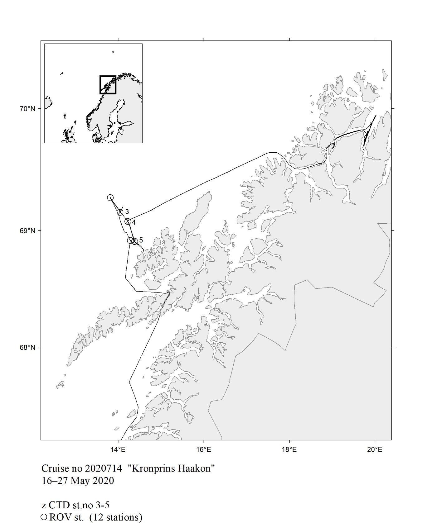
| 2020714 |
16.5.-27.5. |
Installation of LoVe observatory's node and mooring. |
- |
3-5 |
- |
73 |
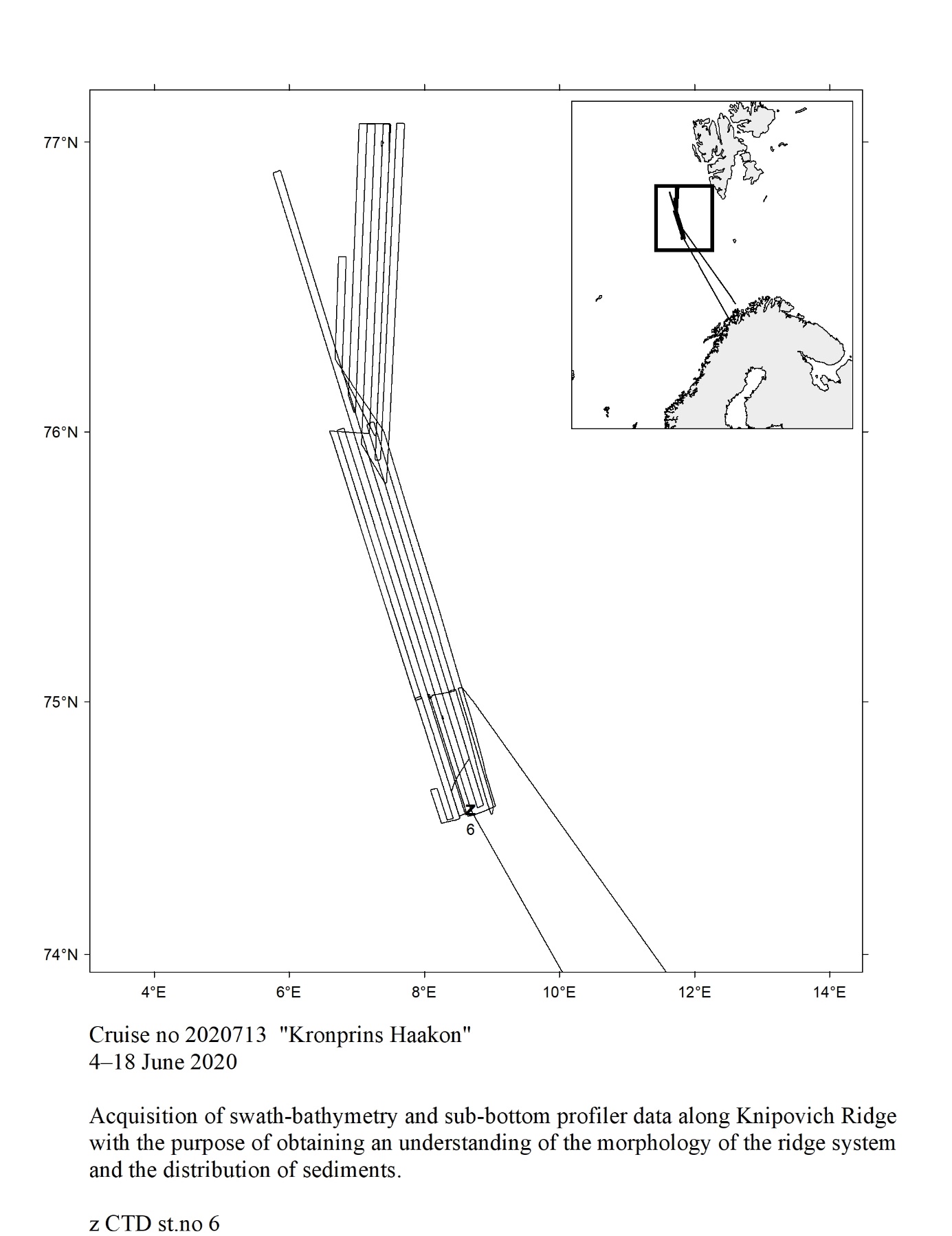
| 2020713 |
4.6.-18.6. |
Acquisition of swath-bathymetry and sub-bottom profiler data along Knipovich Ridge with the purpose of obtaining an understanding of the morphology of the ridge system and the distribution of sediments. Data were acquired along profiles in NNW-SSE and N-S directions. |
Greenland Sea |
6 |
- |
74 |
| 2020704 |
- |
Cancelled |
- |
- |
- |
- |
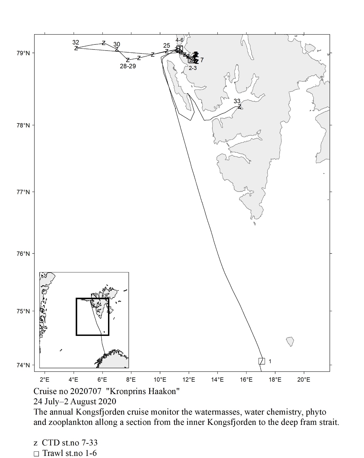
| 2020707 |
24.7.-2.8. |
The annual Kongsfjorden cruise monitor the watermasses, water chemistry, phyto and zooplankton allong a section from the inner Kongsfjorden to the deep fram strait. |
Barents Sea |
7-33 |
1-6 |
75 |
| 2020708 |
- |
Cancelled |
- |
- |
- |
- |
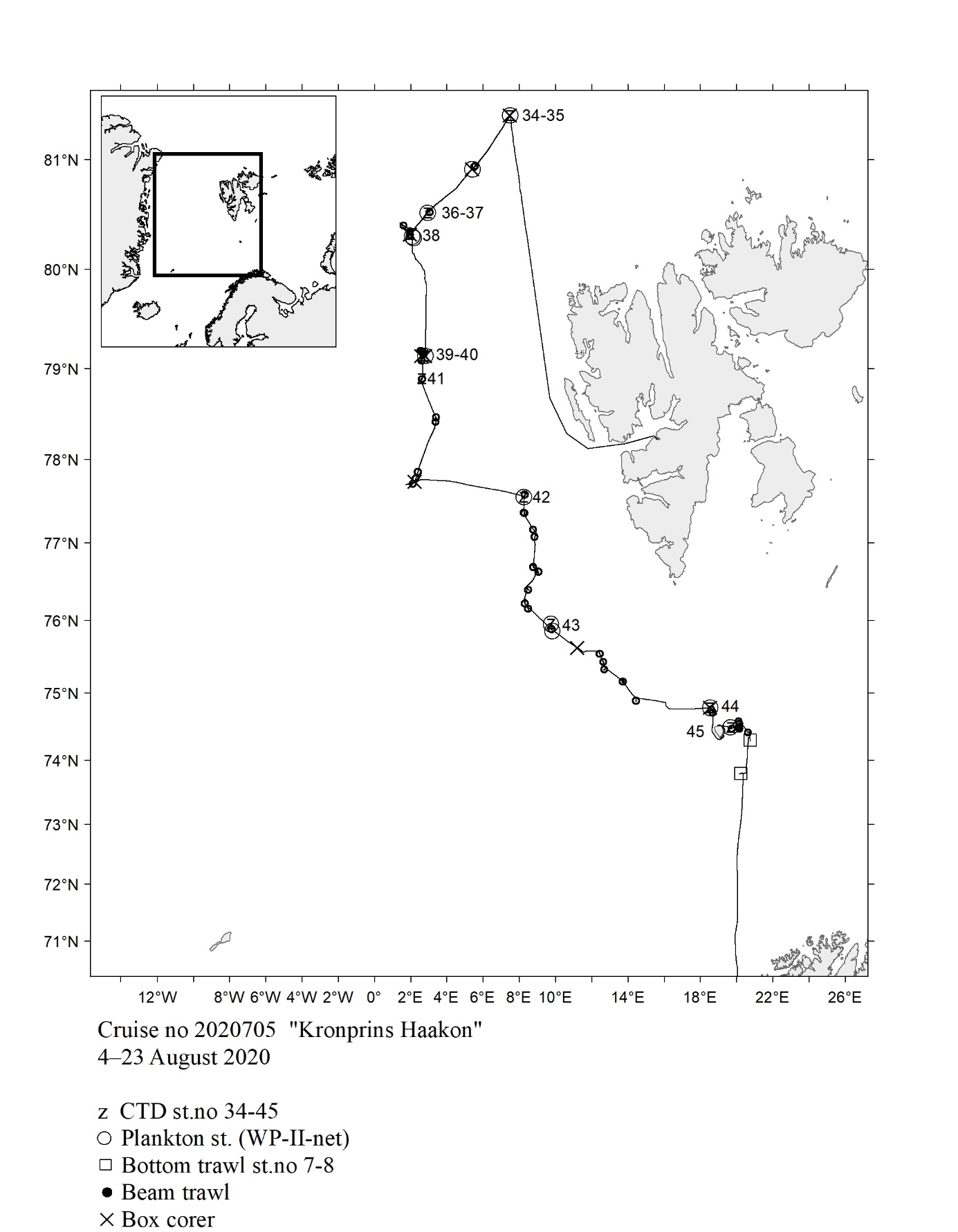
| 2020705 |
4.8.-23.8. |
Collection of water, bentic organisms and sediments for bioprospecting purposes. |
Arctic Ocean |
34-45 |
- |
76 |
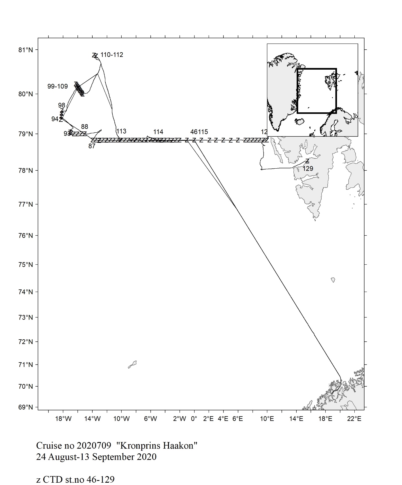
| 2020709 |
24.8.-13.9. |
Yearly service sea rigs. Ctd stations. |
Arctic Ocean Fram Strait |
46-129 |
- |
77 |
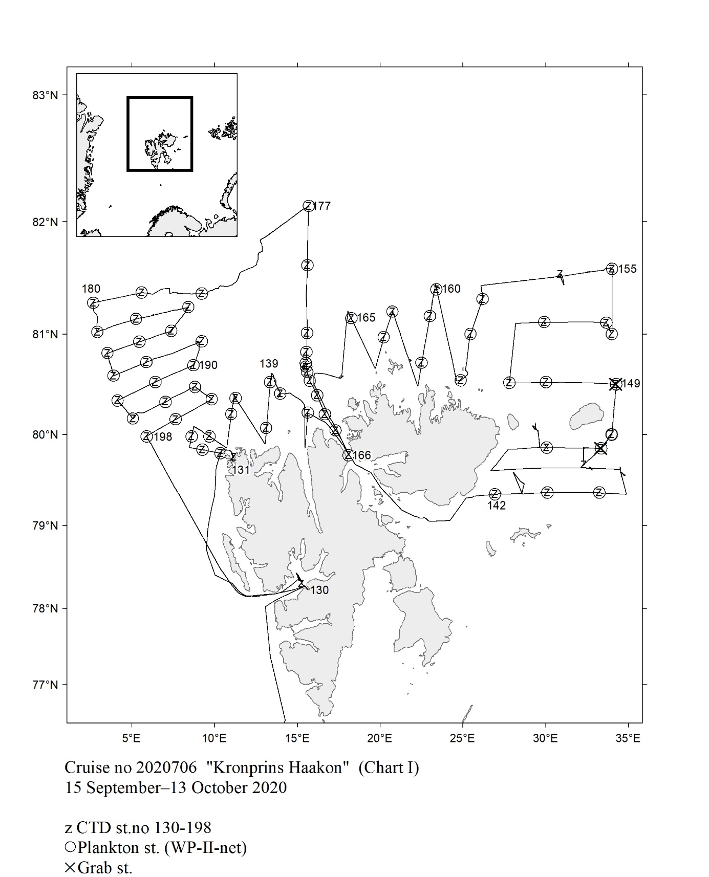
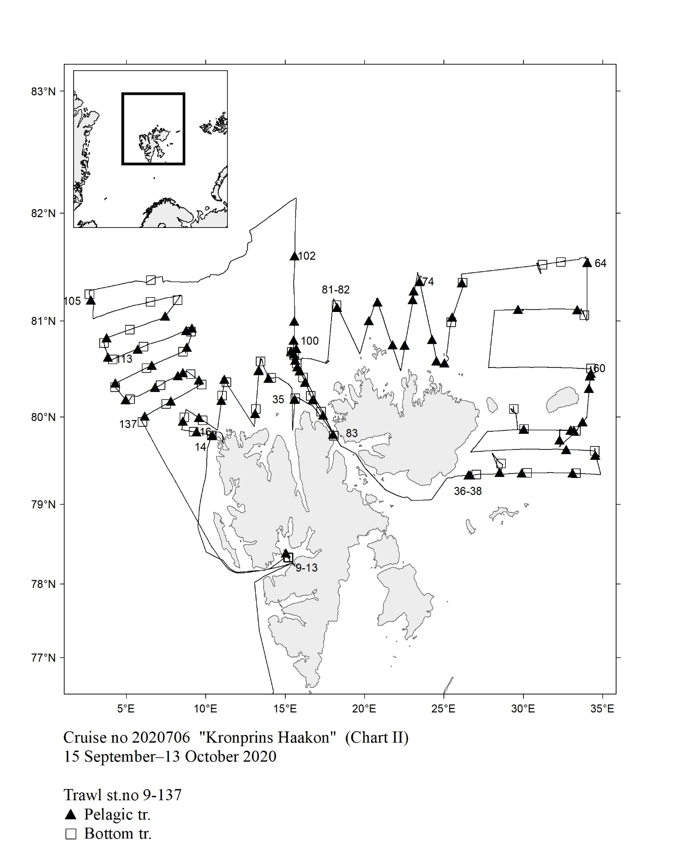
| 20206706 |
15.9.-13.10. |
Ecosystem survey, looking at several different trofic levels. |
Arctic Ocean, Barents Sea |
130-198 |
9-137 |
78-79 |
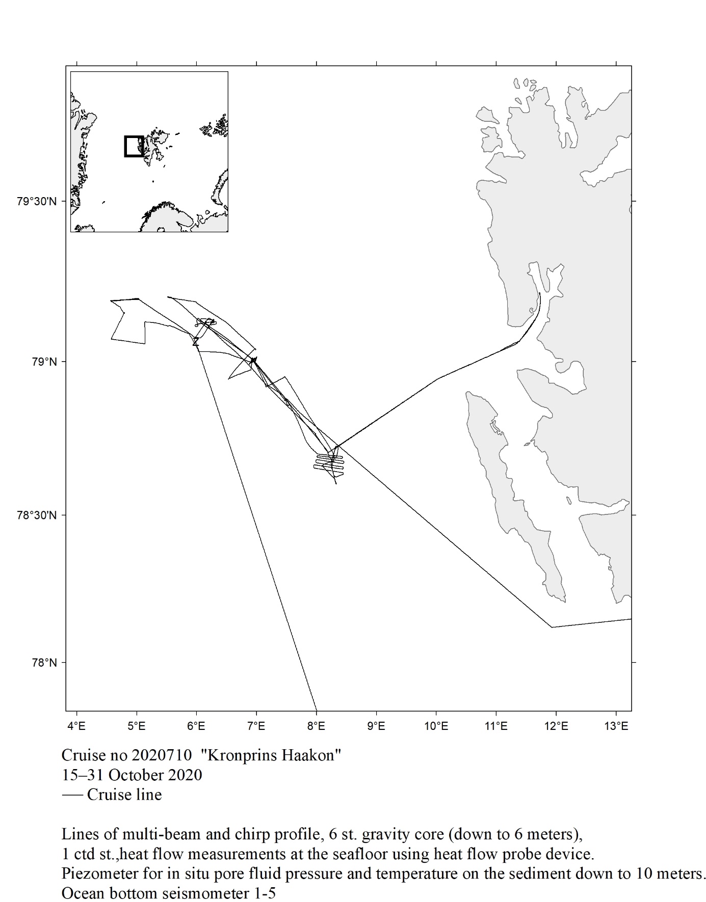
| 2020710 |
15.10.-31.10. |
The cruise main objective was to sample in-situ sediment pressure and temperatures to investigate the distribution of overpressure zones and high heat flow zones along the west-Svalbard continental margin. For this we had on board Ifremer’s piezometer (for in situ pressure and temperature meassurments) and the newly acquired UiT temperature and heat conductivity lance. |
Barents Sea |
- |
- |
80 |
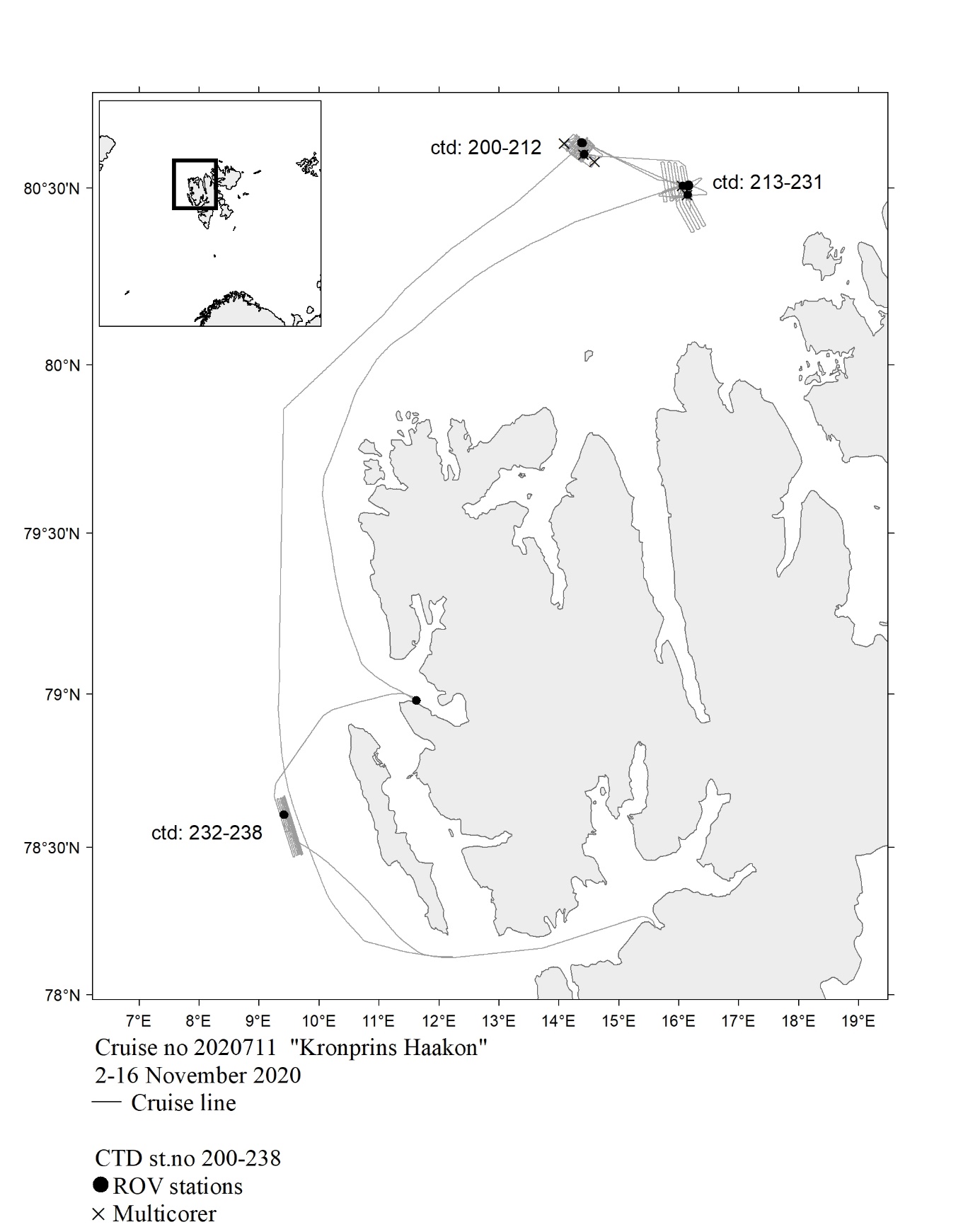
| 2020711 |
2.11.-16.11. |
We investigated 2 areas Northern Svalbard (Norskebanken and Hinlopen Trough) as well as the shelf edge offshore Prins Karls Forland. Norskebanken and offshore Prins Karls Forland are known for their numerous methane seepages, but we discovered many more flares in Hinlopen Trough. The main objective of the research cruise was to characterize the water column and the sediment near flares in Norskebanken (Geissler et al., 2016), as well as some targeted flares for gas composition, DNA and bubble size distribution. |
Arctic Ocean |
200-238 |
- |
81 |
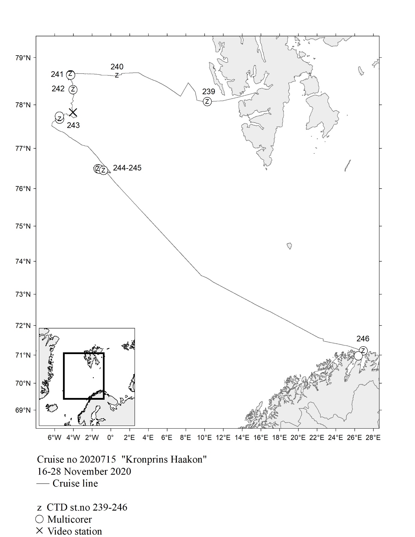
| 2020715 |
16.11.-28.11. |
Explore known and unknown methane sources on the northeast Greenland continental margin, and check if methane from methane seepage is reaching the atmosphere at this location. |
Greenland Sea |
239-246 |
- |
82 |
| 2020712 |
- |
Cancelled |
- |
- |
- |
- |
10 - "G. M. Dannevig" – Cruises 2020
| Cruise no |
Period |
Purpose |
Area |
CTD st.no |
Fig. no |
| 2020301 |
19.1.-25.1. |
Hydrographic standard section “Torungen-Hirtshals” environmental investigation. Long-term environmental monitoring on a near-shore station outside Arendal and in the fjords along the Norwegian Skagerrak coast. |
Skagerrak |
1-32 |
83 |
| 2020302 |
1.2.-7.2. |
Hydrographic standard section “Torungen-Hirtshals” environmental investigation. Long-term environmental monitoring on a near-shore station outside Arendal and in the fjords along the Norwegian Skagerrak coast. |
Skagerrak |
33--58 |
84 |
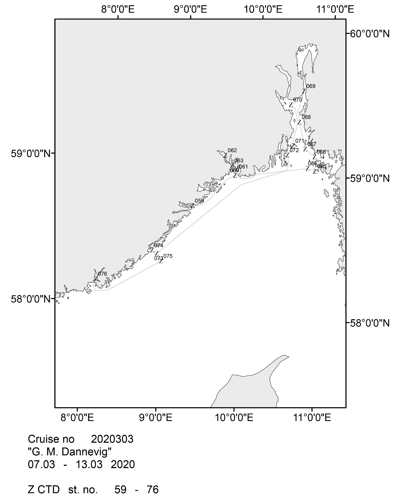
| 2020303 |
7.3.-13.3. |
Hydrographic standard section “Torungen-Hirtshals” environmental investigation. Long-term environmental monitoring on a near-shore station outside Arendal and in the fjords along the Norwegian Skagerrak coast. |
Skagerrak |
59-76 |
85 |
| 2020304 |
16.-28.3. |
Spawning ground mapping. |
Norwegian Coast |
- |
No chart |
| 2020305 |
|
Cancelled |
|
|
|
| 2020306 |
|
Cancelled |
|
|
|
| |
|
Stations taken with a small boat during lockdown. |
Skagerrak |
77-79 |
No chart |
| 2020307 |
1.6.-9.6. |
Long-term environmental monitoring on a near-shore station outside Arendal and in the fjords along the Norwegian Skagerrak coast. |
Skagerrak |
80-110 |
86 |
| 2020308 |
2.7.-8.7. |
Hydrographic standard section “Torungen-Hirtshals” environmental investigation. Long-term environmental monitoring on a near-shore station outside Arendal and in the fjords along the Norwegian Skagerrak coast. |
Skagerrak |
111-138 |
87 |
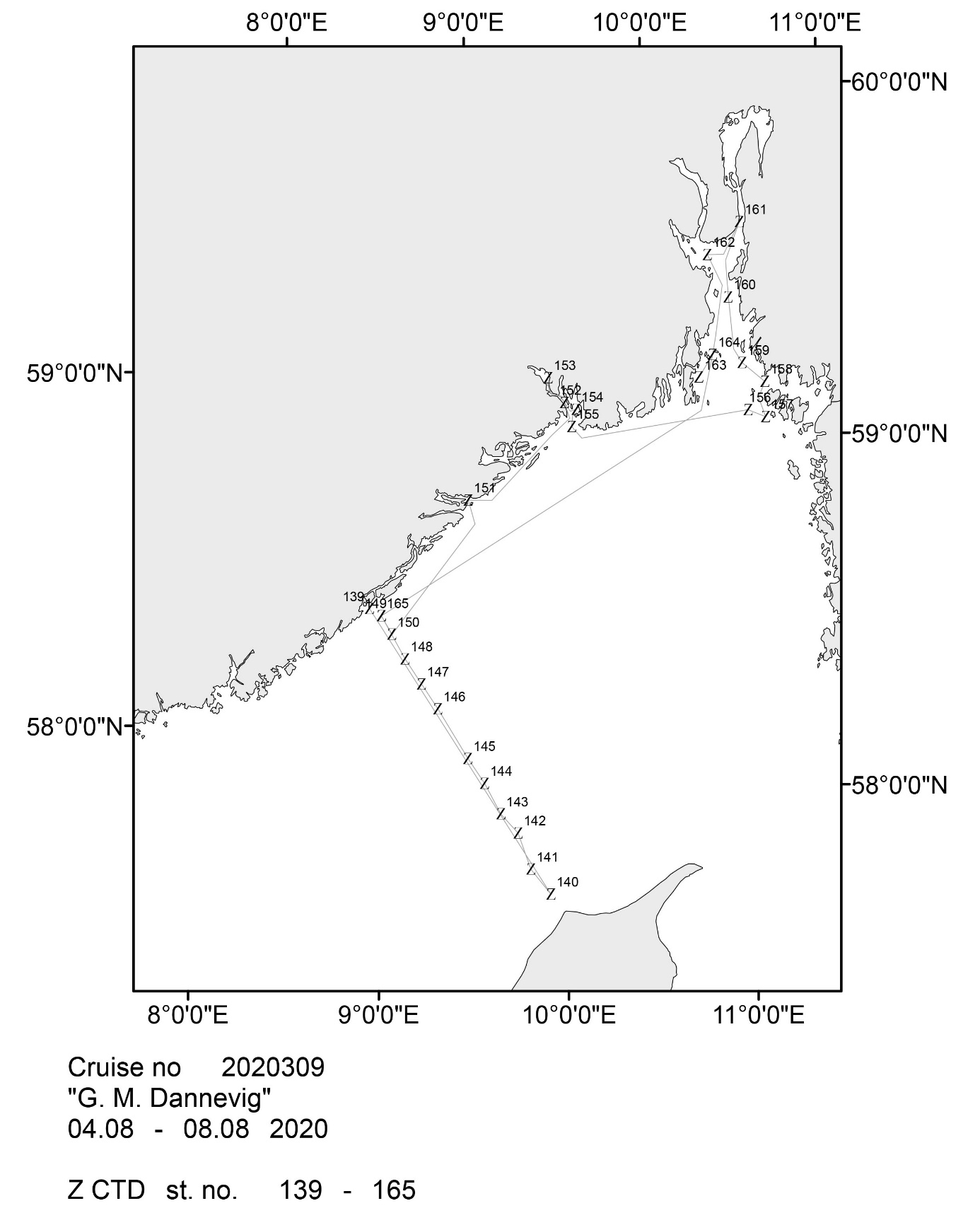
| 2020309 |
4.8.-8.8. |
Hydrographic standard section “Torungen-Hirtshals” environmental investigation. Long-term environmental monitoring on a near-shore station outside Arendal and in the fjords along the Norwegian Skagerrak coast. |
Skagerrak |
139-165 |
88 |
| 2020310 |
9.-15.8. |
Ecosystems Skagerrak coast – interactions between coast and ocean |
Skagerrak |
- |
No chart |
| 2020311 |
16.-23.8. |
Marine Protected Areas – lobster. |
Norwegian coast |
- |
No chart |
| 2020312 |
26.-28.8. |
Student cruise UiA. |
Norwegian coast |
- |
No chart |
| 2020313 |
13.9.-14.9. |
Hydrographic standard section “Torungen-Hirtshals” environmental investigation. Long-term environmental monitoring on a near-shore station outside Arendal and in the fjords along the Norwegian Skagerrak coast. |
Skagerrak |
166-168 |
89 |
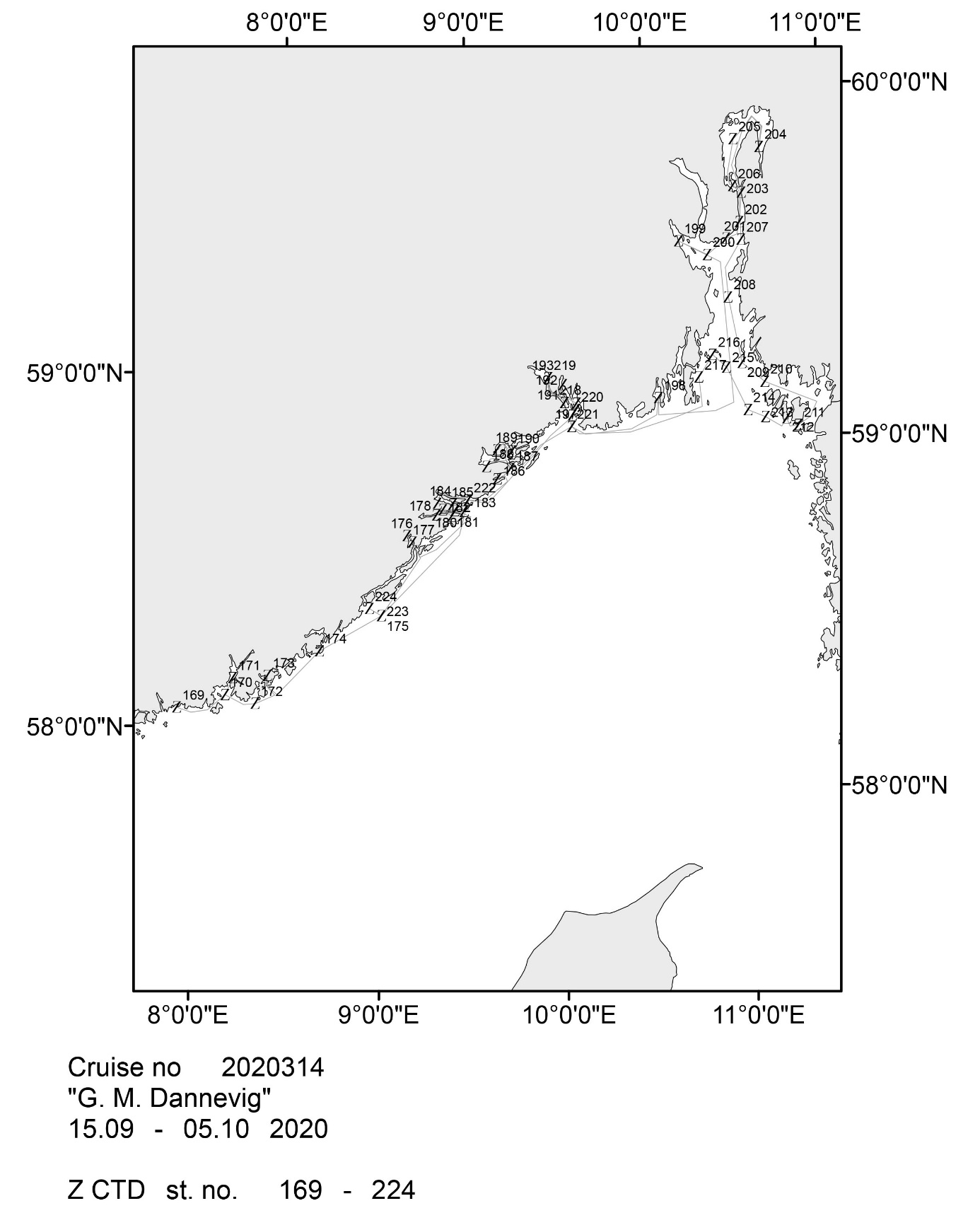
| 2020314 |
15.9.-5.10. |
Beach seine studies to measure recruitment of coastal fish-species. |
Skagerrak |
169-224 |
90 |
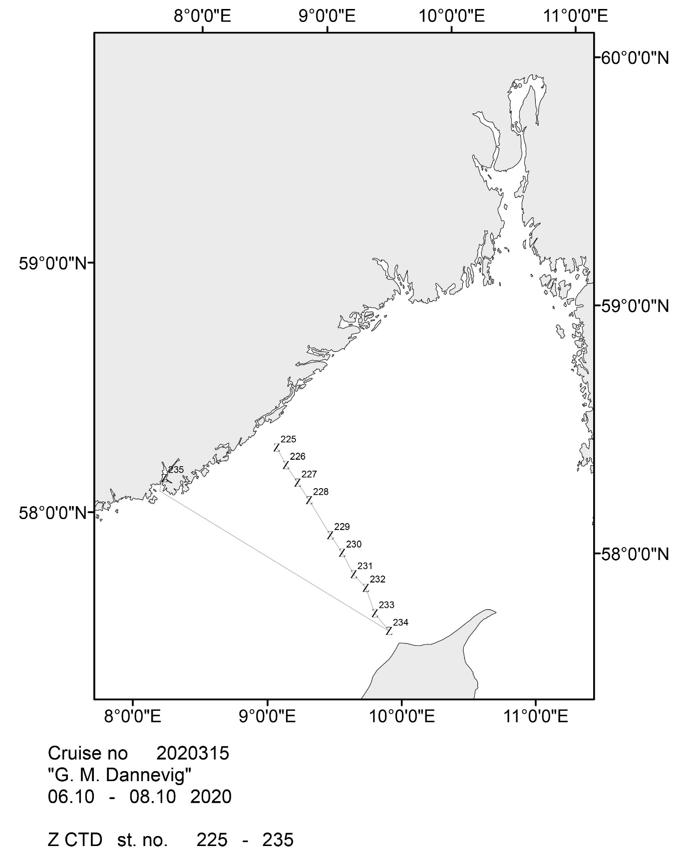
| 2020315 |
6.10.-8.10. |
Hydrographic standard section “Torungen-Hirtshals” environmental investigation. Long-term environmental monitoring on a near-shore station outside Arendal and in the fjords along the Norwegian Skagerrak coast. |
Skagerrak |
225-235 |
91 |
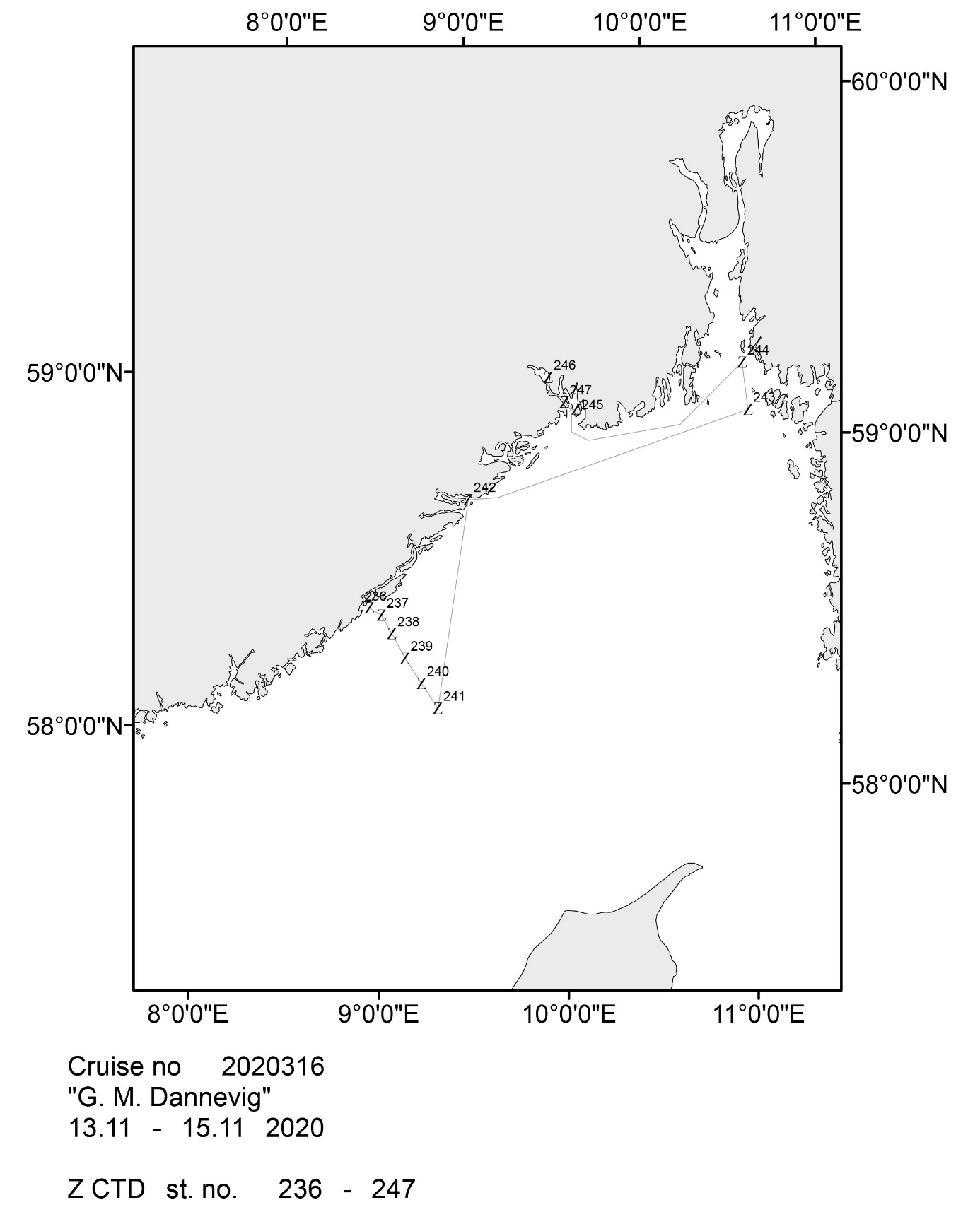
| 2020316 |
13.11.-15.11. |
Hydrographic standard section “Torungen-Hirtshals” environmental investigation. Long-term environmental monitoring on a near-shore station outside Arendal and in the fjords along the Norwegian Skagerrak coast. |
Skagerrak |
236-247 |
92 |
| 2020317 |
16.11.-3.12. |
Monitoring of the cod population, and other species in Skagerrak. |
Skagerrak |
248--249 |
93 |
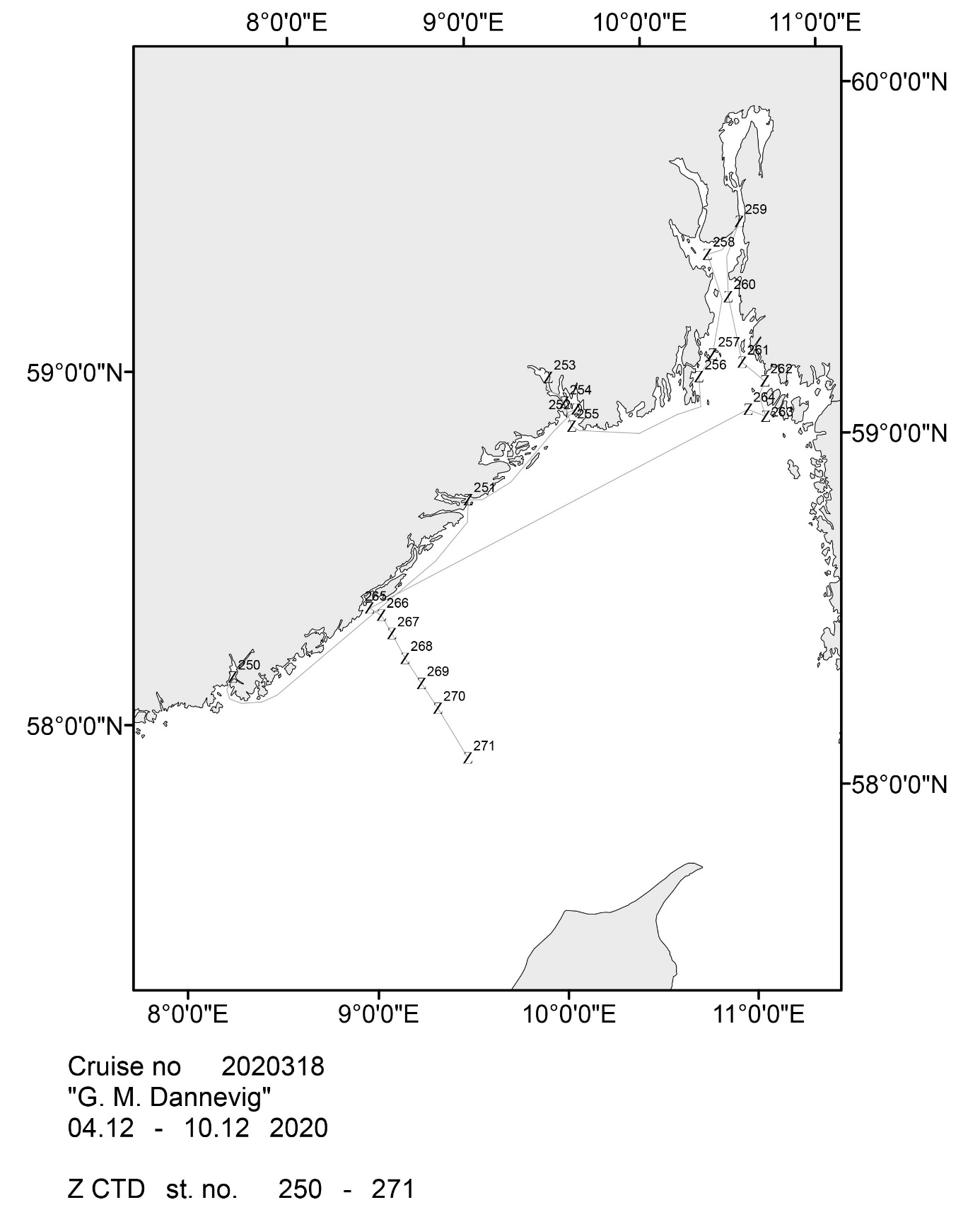
| 2020318 |
4.12-10.12. |
Hydrographic standard section “Torungen-Hirtshals” environmental investigation. Long-term environmental monitoring on a near-shore station outside Arendal and in the fjords along the Norwegian Skagerrak coast. |
Skagerrak |
250-271 |
94 |
12 - Hired vessels – Cruises 2020
| Cruise no |
Period |
Vessel |
Purpose |
Area |
CTD st.no |
Trawl st.no |
Fig. no |
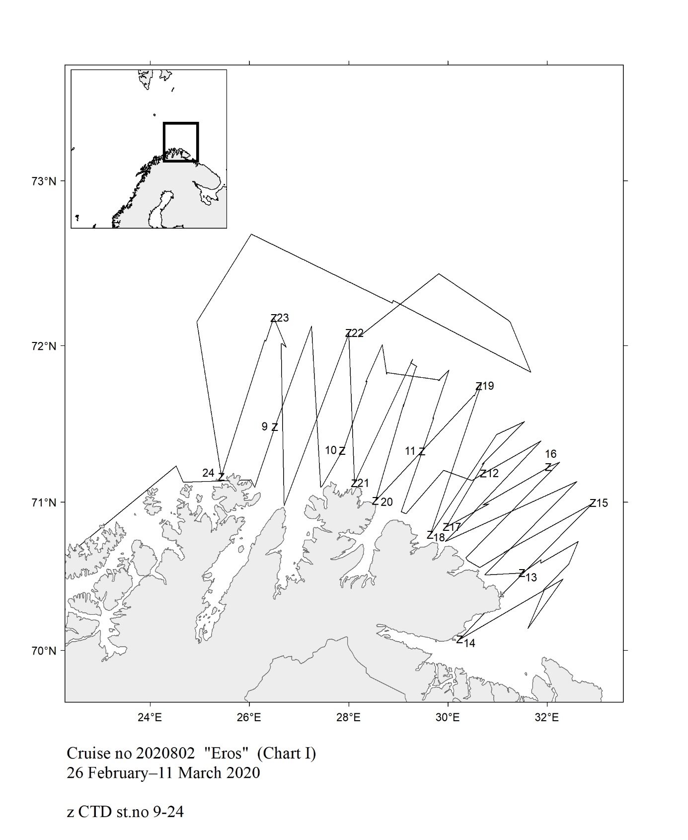
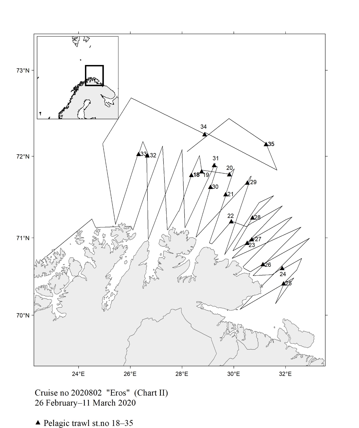
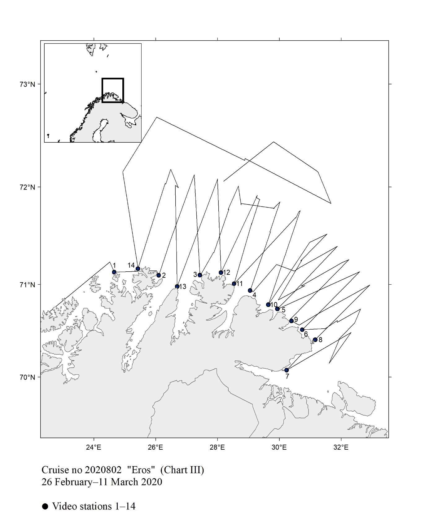
| 2020802 |
26.2.-11.3. |
«Eros» |
Acoustic trawl monitoring survey for biomass estimation of the capelin spawning stock. |
Barents Sea |
9-24 |
18-35 |
95-97 |
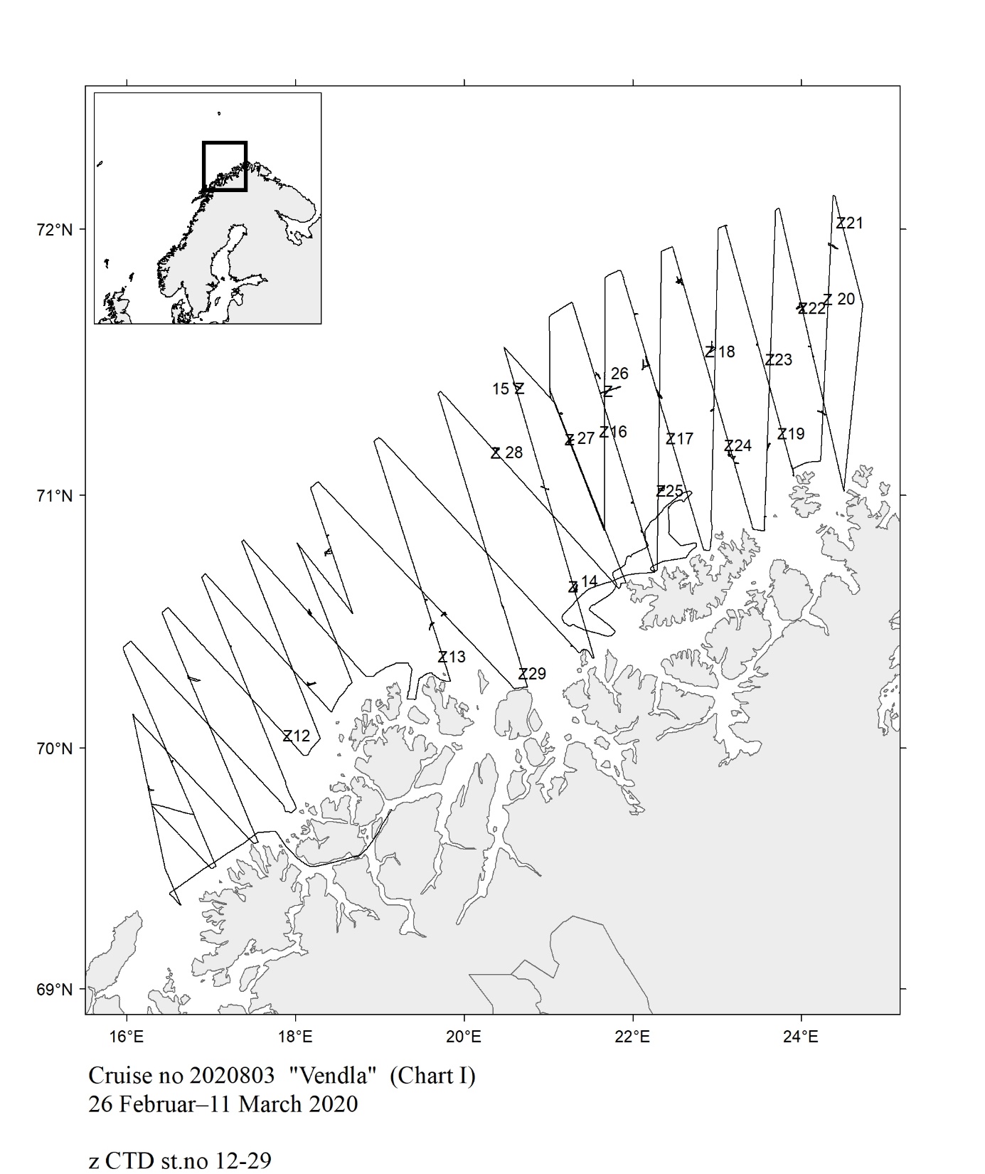
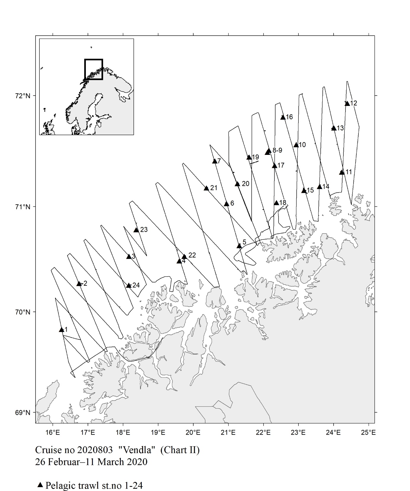
| 2020803 |
26.2.-11.3. |
«Vendla» |
Acoustic trawl survey on Capelin spawning stock. Methodological survey using a stratified survey design aiming to measure the abundance of Capelin during the spawning season. |
Norwegian Sea |
12-29 |
1-24 |
98-99 |
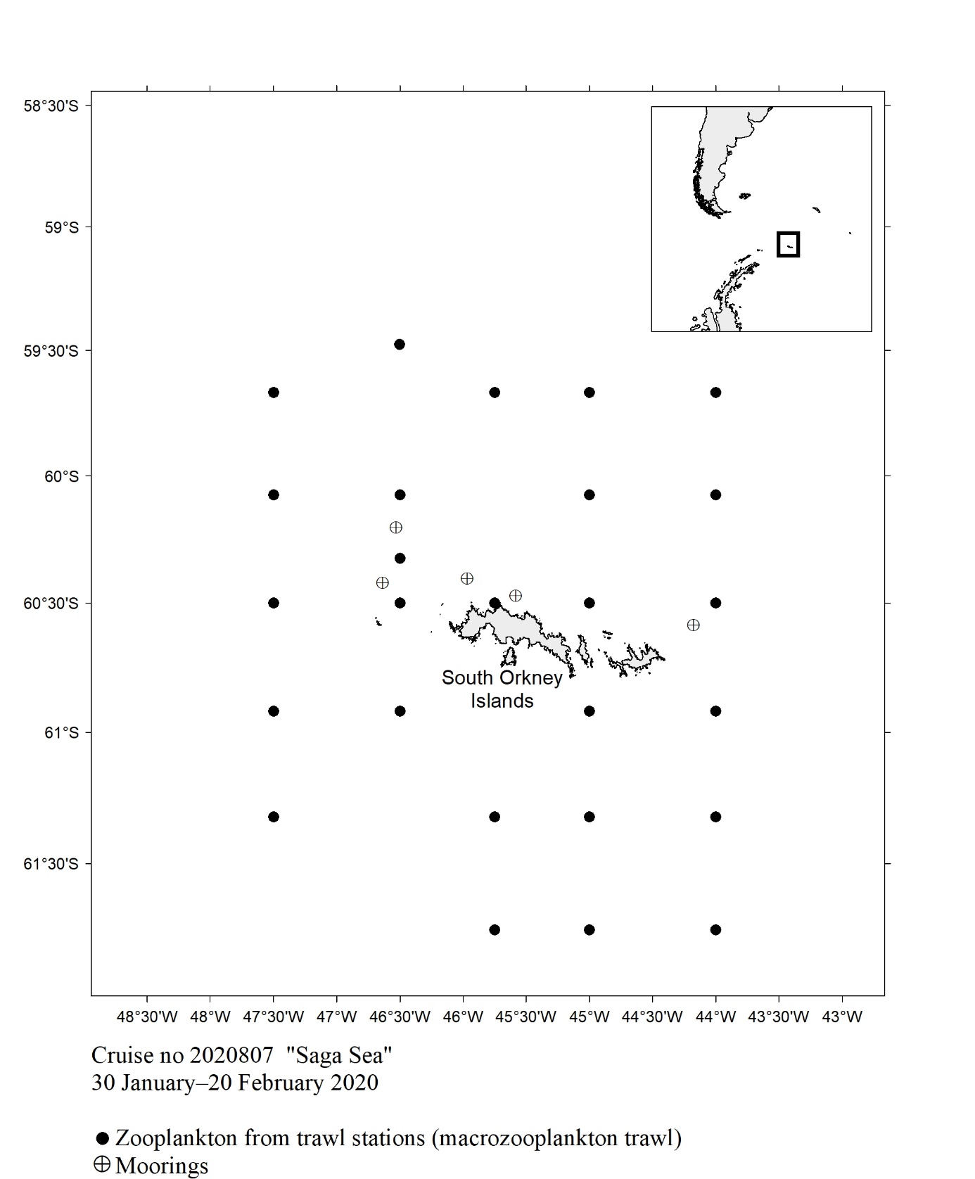
| 2020807 |
30.1.-20.2. |
“ Saga Sea” |
Conduct an annual survey (commenced in 2011) to collect acoustic and biological data on Antarctic krill, other macrozooplankton and krill predators from sector 48.2 in the Southern Ocean. The study uses the same design as surveys conducted by the US AMLR Program and the British Antarctic Survey in areas 48.1 and 48.3. Data is reported to the Commission for the Conservation of Antarctic Marine Living Resources (CCAMLR). Integrated monitoring links these three main areas where active krill fishing is conducted. IMR depend on the logistics offered by Aker Biomarine AS; a vessel with crew free of charge for implementing the survey on annual basis. |
Southern Ocean South Orkney Islands plateau, CCAMLR Subarea 48.2 |
- |
- |
100 |
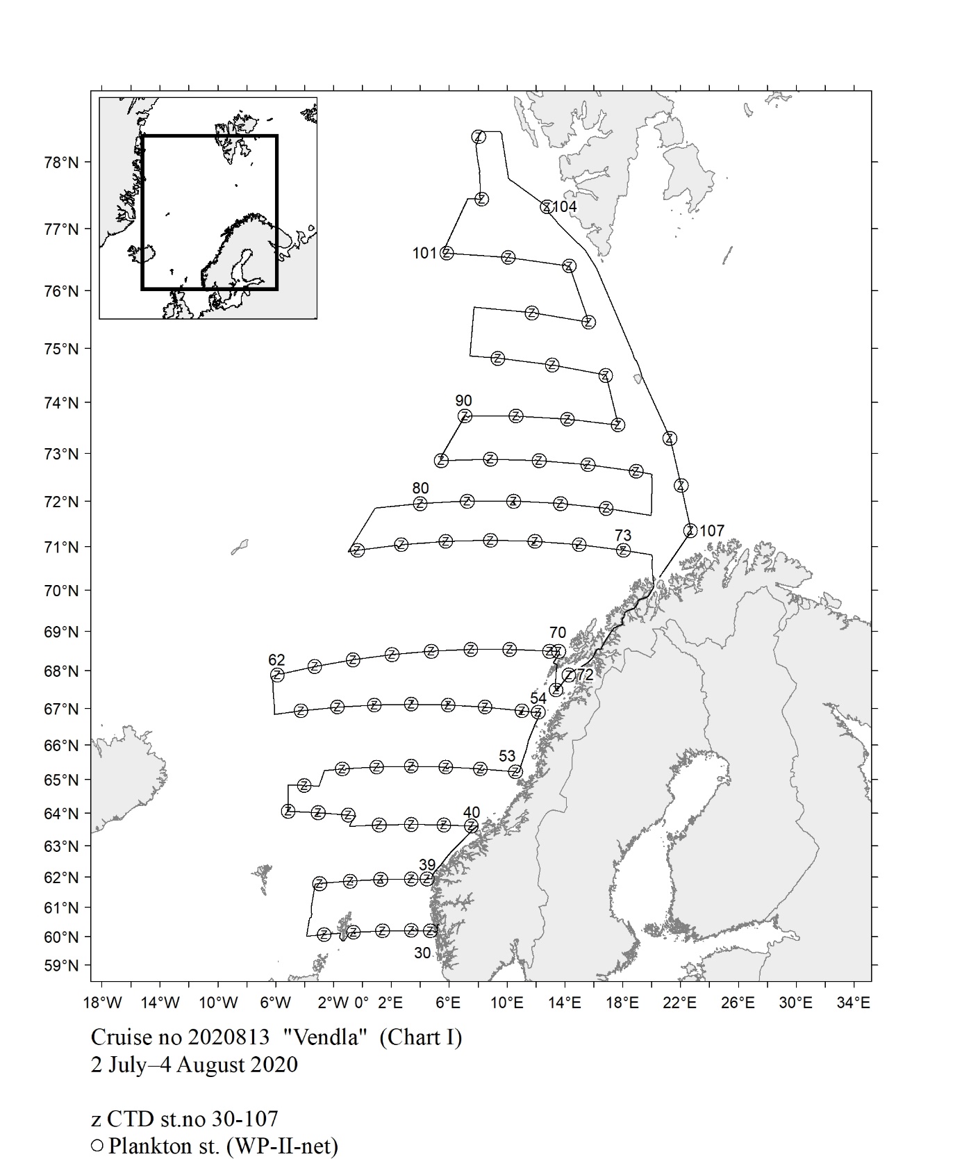
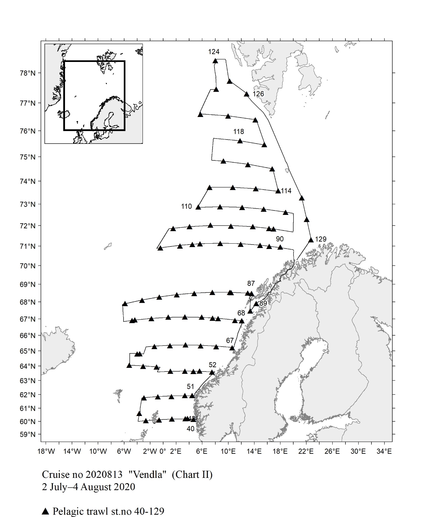
| 2020813 |
2.7.-4.8. |
“ Vendla” |
Trawl survey to monitor the stock of Atlantic mackerel using swept area methodology. Acoustic survey to monitor the spawning stock of Norwegian spring spawning herring and the stock of blue whiting in the Nordic Seas. Ecological studies (temperature, plankton, whale observations) in relation to pelagic fish. |
Northeast Atlantic Ocean Norwegian Sea |
30-107 |
40-129 |
101-102 |
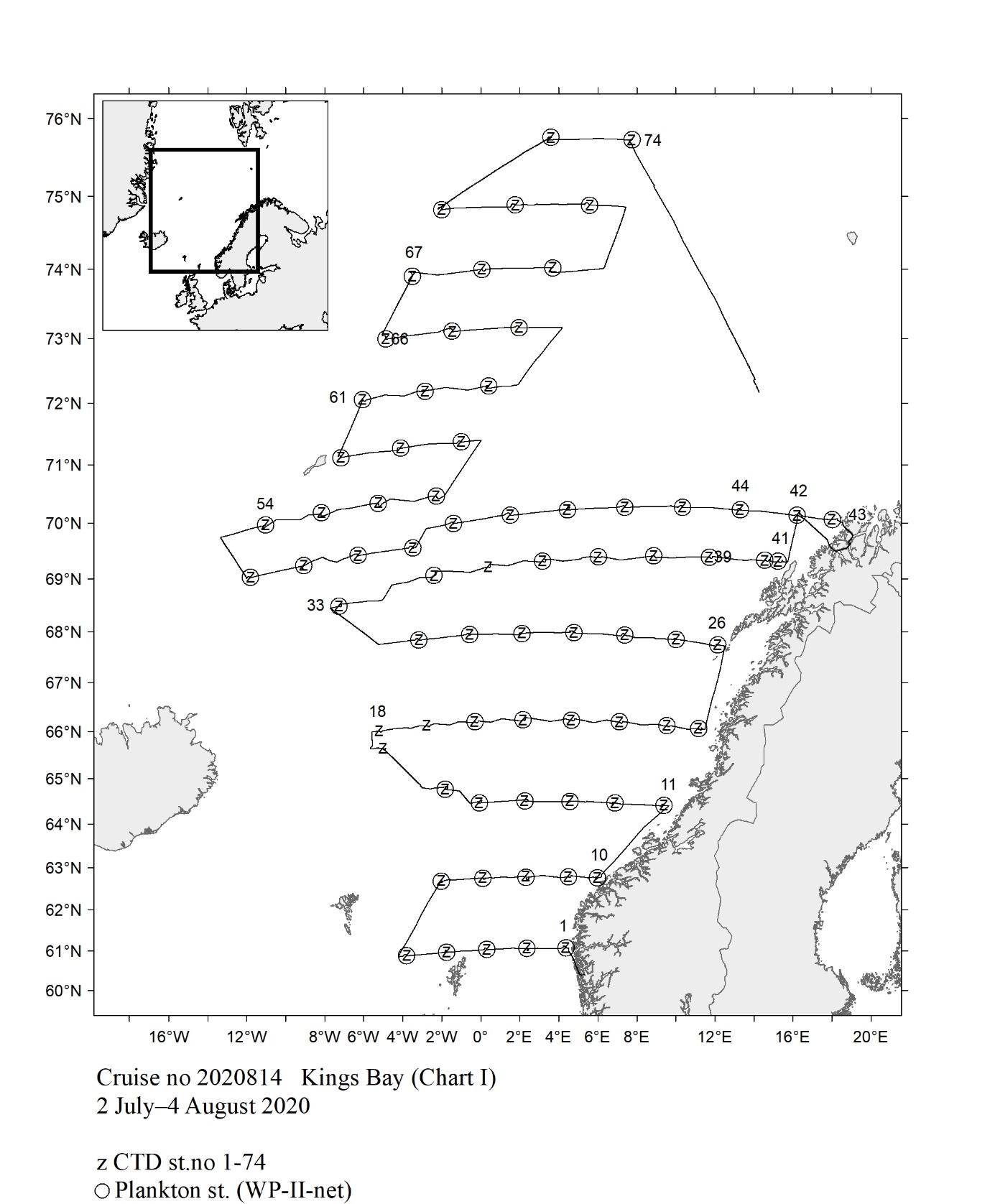
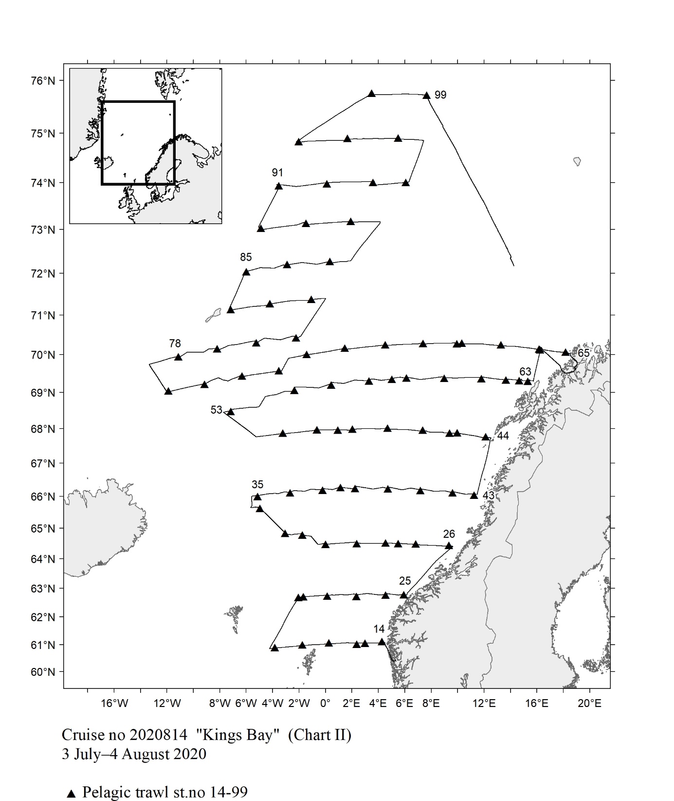
| 2020814 |
2.7.-4.8. |
«Kings Bay» |
Primary objectives:Large-scale mapping and abundance estimation of Northeast Atlantic (NEA) mackerel, Norwegian Spring-Spawning (NSS) herring and Atlantic blue whiting. Swept area trawling for mackerel and acoustic recordings and trawling for NSS herring and blue whiting. Secondary objectives: Mapping distribution of Atlantic salmon, lumpfish and other pelagic species. Sampling of zooplankton and water temperature/salinity profiles. Tagging of 100 lumpfish. Opportunistic marine mammals observations along the transects and survey lines. |
Greenland Sea Iceland Sea Norwegian Sea |
1-74 |
14-99 |
103-104 |
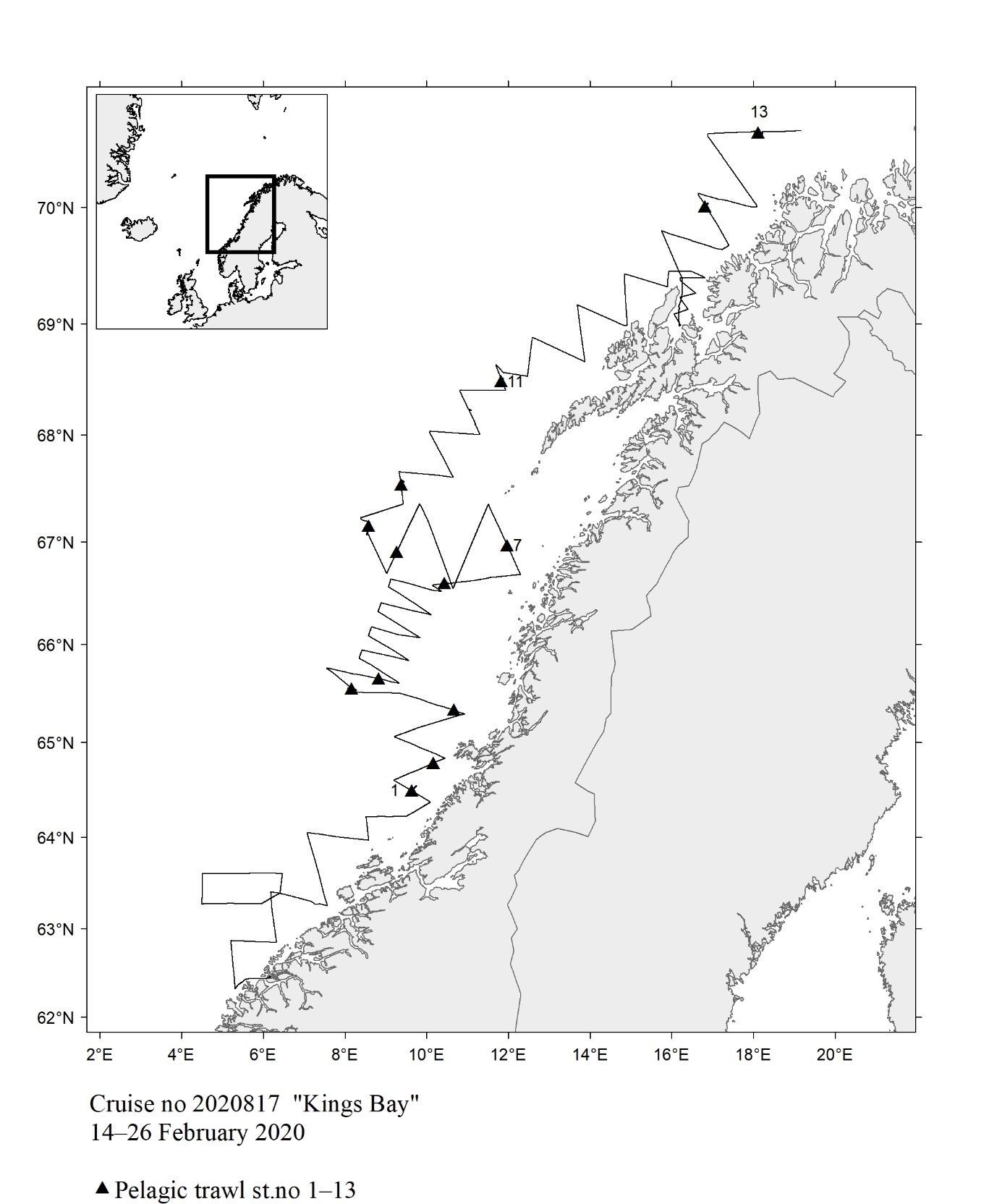
| 2020817 |
14.2.-26.6. |
«Kings Bay» |
Collection of acoustic data from fisheries sonar for study of herring schools. • Collection of acoustic data from echo sounder for biomass estimation of herring. • Collection of biological samples for estimation of species and size composistion in the acoustic observations. |
Norwegian Sea |
- |
1-13 |
105 |
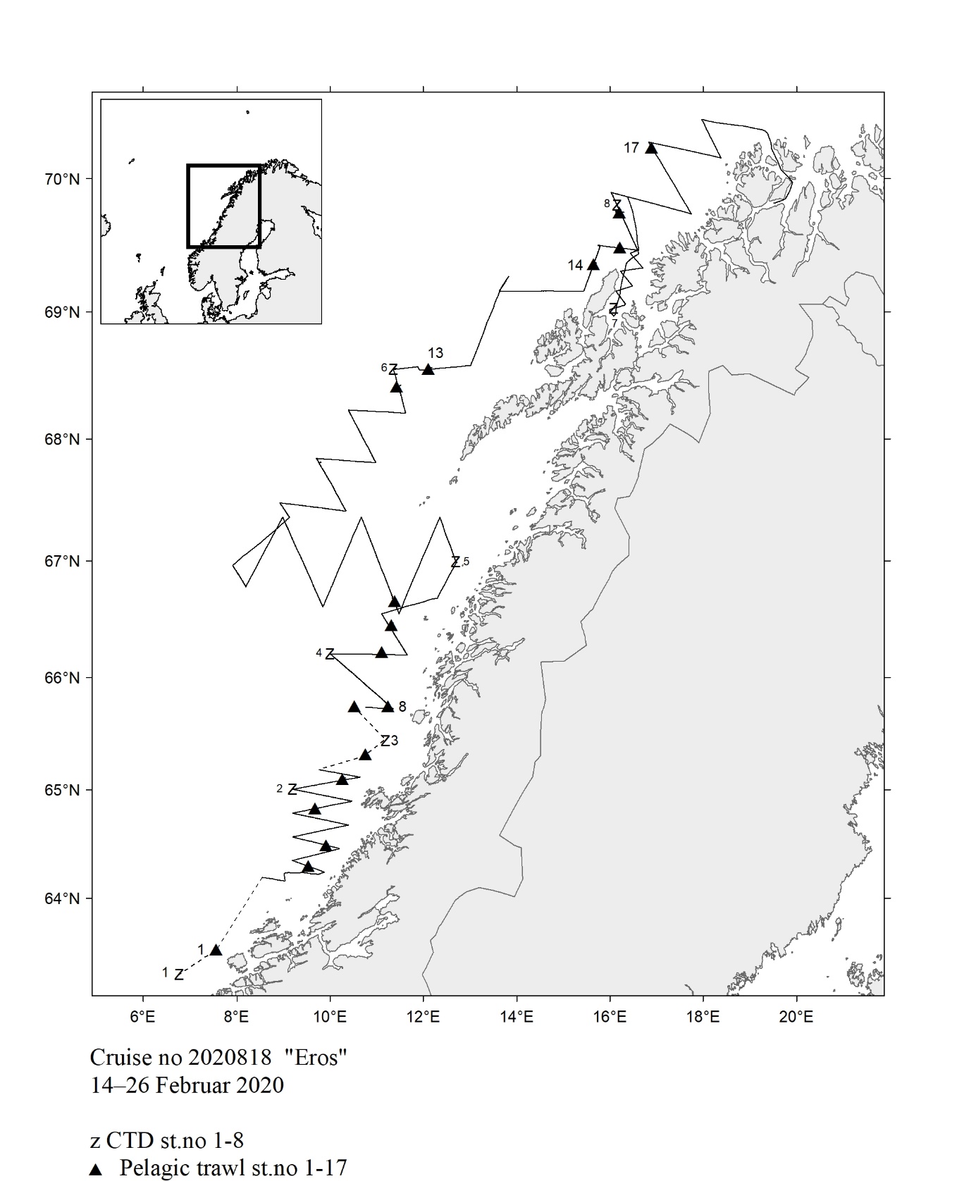
| 2020818 |
14.2.-26.2. |
«Eros» |
Provide acoustic estimates of abundance and distribution of Norwegian spring spawning herring during the spawning migration along the Norwegian coast. |
Norwegian Coast |
1-8 |
1-17 |
106 |
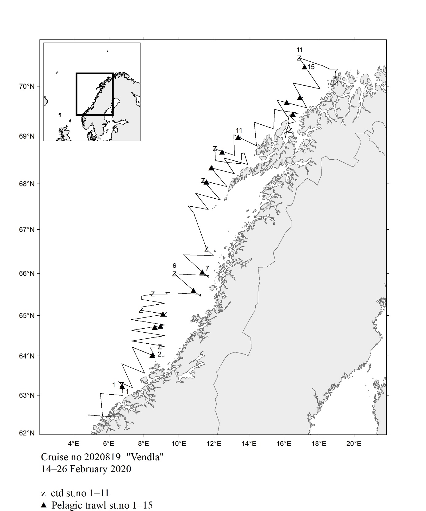
| 2020819 |
14.2.-26.2. |
«Vendla» |
Collection of acoustic data from fisheries sonar for study og herring schools. • Collection of acoustic data from echo sounder for biomass estimation of herring. • Collection of biological samples for estimation of species and size composistion in the acoustic observations. • Collection of hydrographic data (CTD). |
Norwegian Sea |
1-11 |
1-15 |
107 |
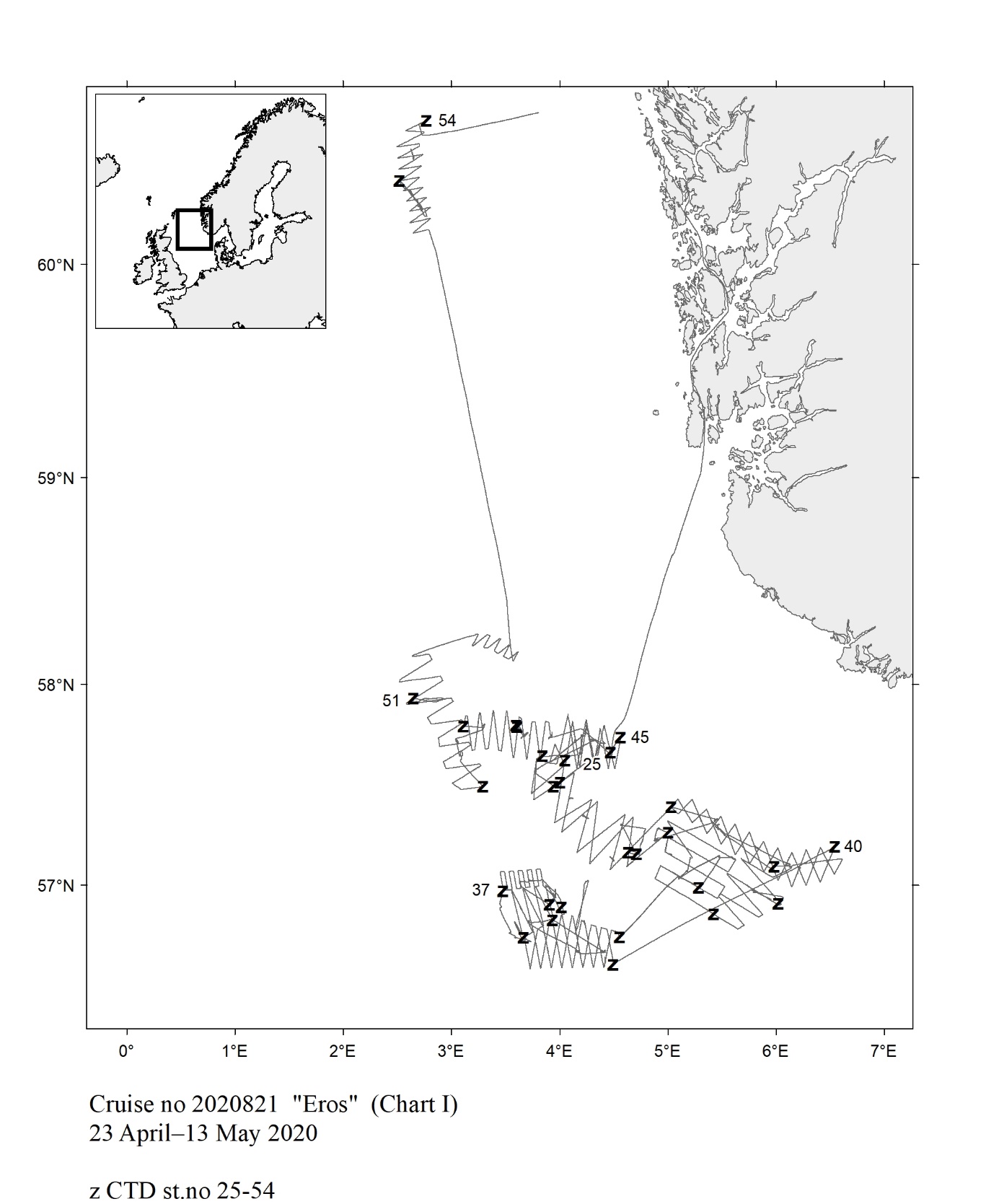
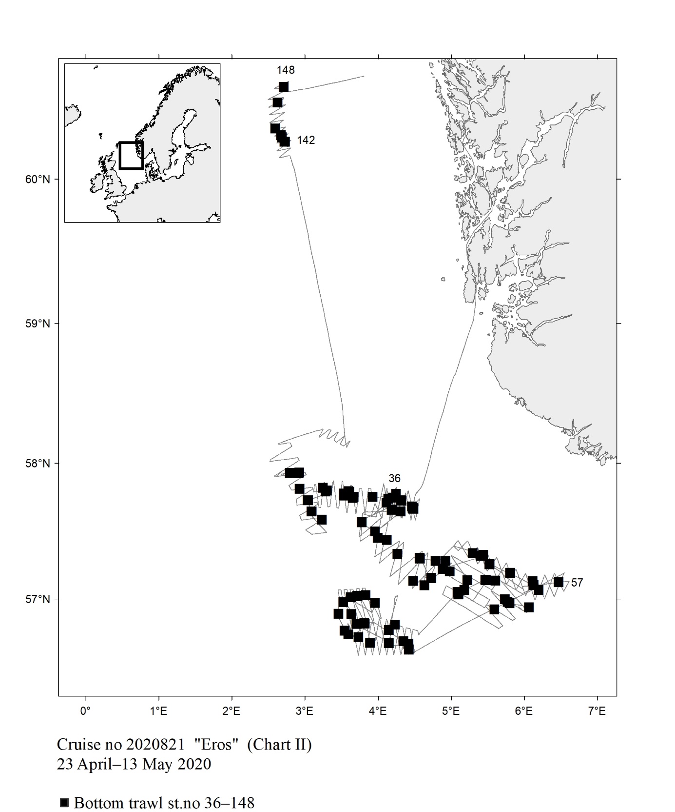
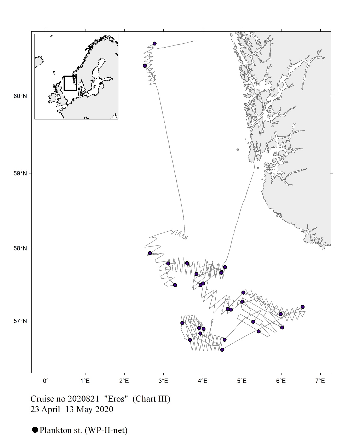
| 2020821 |
23.4.-13.5. |
«Eros» |
Measuring the abundance, distribution and age composition of lesser sandeel. • Dredge sampling for burrowed sandeels. • Bottom trawls. • Pelagic trawls. • Echo sounder sampling. • Zooplankton sampling. • Mapping of hydrographical conditions. |
North Sea |
25-54 |
36-148 |
108-110 |
| 2020822 |
24.2.-29.2. |
«Fiskebas» |
Develop and test methods for monitoring fish behaviour, catch composition and gear performance during purse seine capture. Investigate the effect of capture process on fish welfare and thereby quality and survival following slipping from purse seine. |
Norwegian Sea |
- |
- |
No chart |
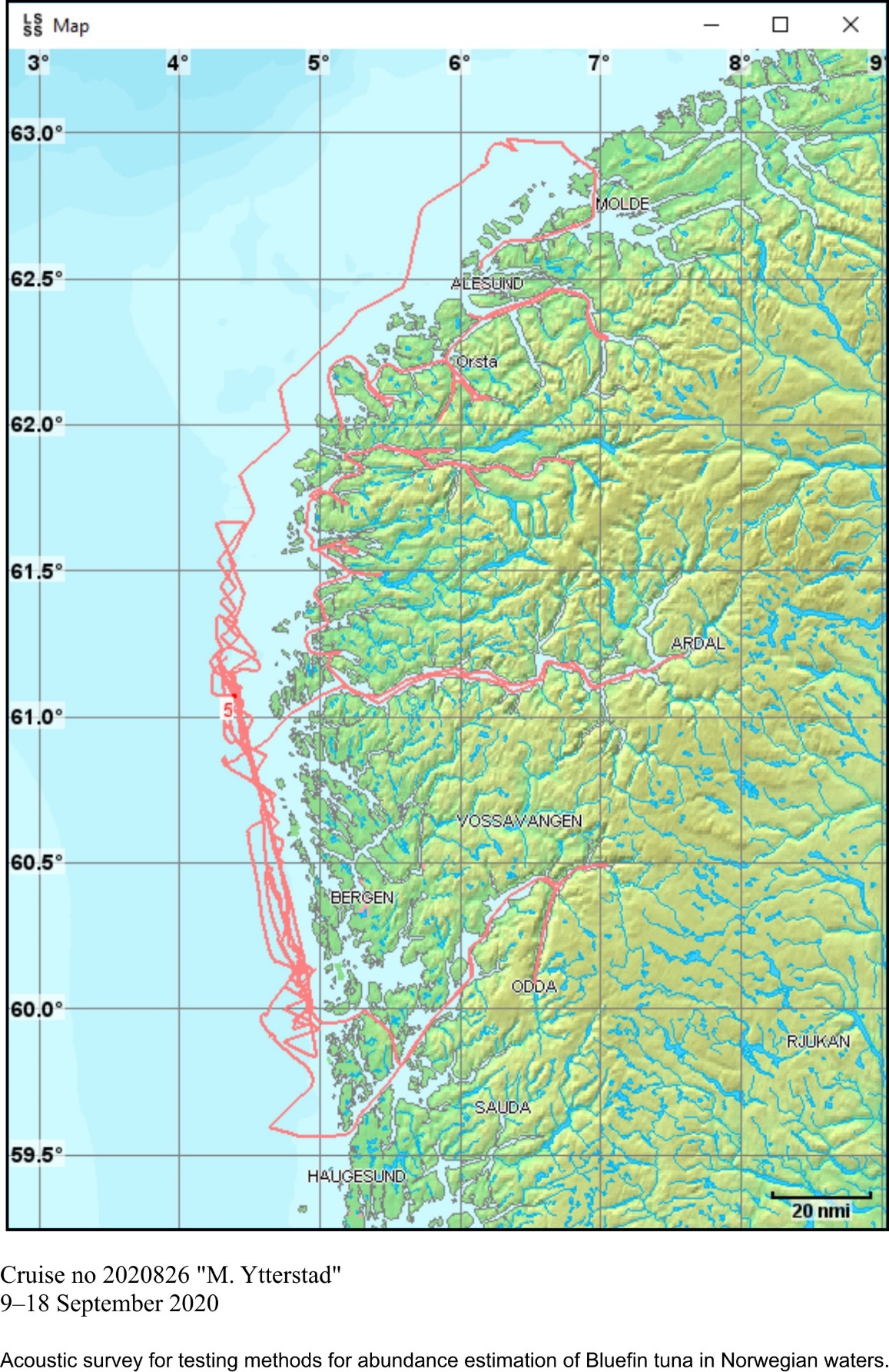
| 2020826 |
9.9.-18.9. |
«M. Ytterstad» |
Acoustic survey for testing methods for abundance estimation of Bluefin tuna in Norwegian waters. |
Norwegian Sea |
- |
- |
111 |
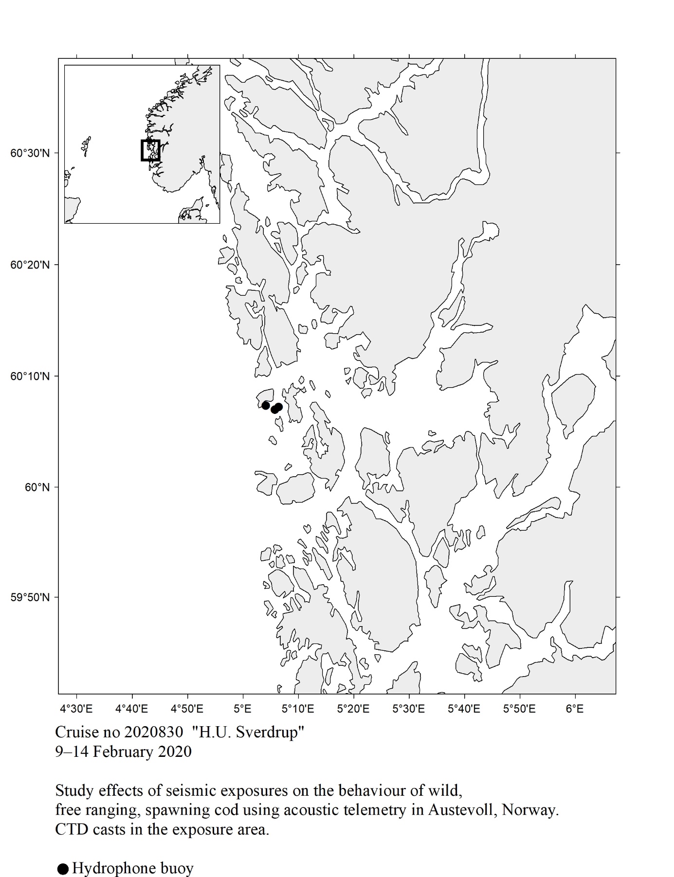
| 2020830 |
9.2.-14.2. |
“ H. U. Sverdrup II” |
The objective of the SpawnSeis project is to study effects of seismic exposures on the behaviour of wild, free ranging, spawning cod using acoustic telemetry in Austevoll, Norway. The objective of the cruise is to deploy airguns from the vessel and expose the experimental area and to monitor the resulting noise patterns in the area where the cod is tagged. CTD stations were also taken in the area to characterise the propagation properties of the water column. The behavioural data will be downloaded from the listening buoys for the fish tags later and is not part of this survey. |
Norwegian Sea |
- |
- |
112 |
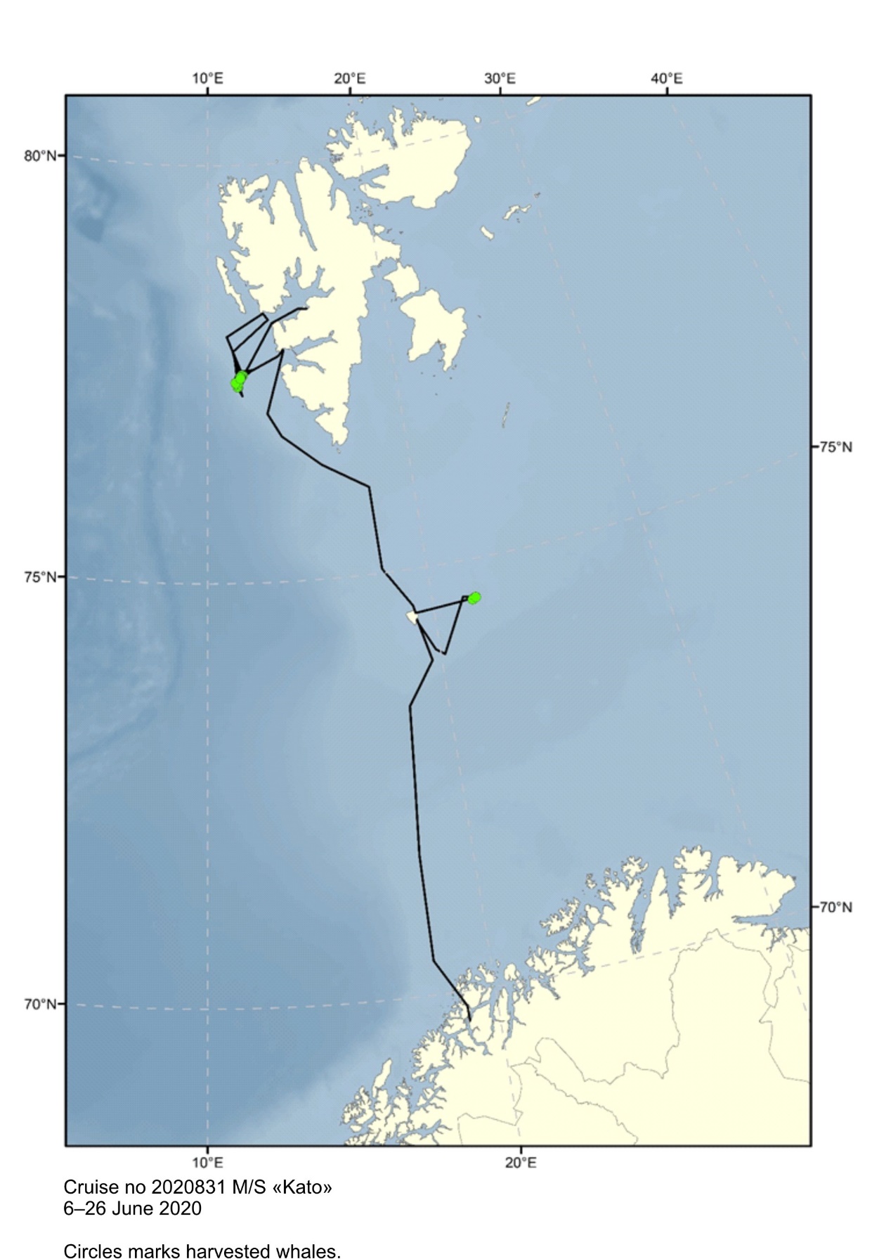
| 2020831 |
6.6.-26.6. |
“ Kato” |
The main purpose of the cruise was to obtain data for ecological monitoring of the minke whale stock. Samples were collected for the project “Arven etter Nansen”, with special focus on diet and dietary changes over time. Diets (stomach content); fatty acids (blubber, muscle, liver); stable isotopes (blubber, muscle, liver, eye, baleens); pollutants (blubber, muscle, liver), fertility (ovaries); age determination (eye and baleens); nutrients and micronutrients (faeces). There was a complete sampling from all whales. All material was frozen to be analysed later. |
Barents Sea |
- |
- |
113 |
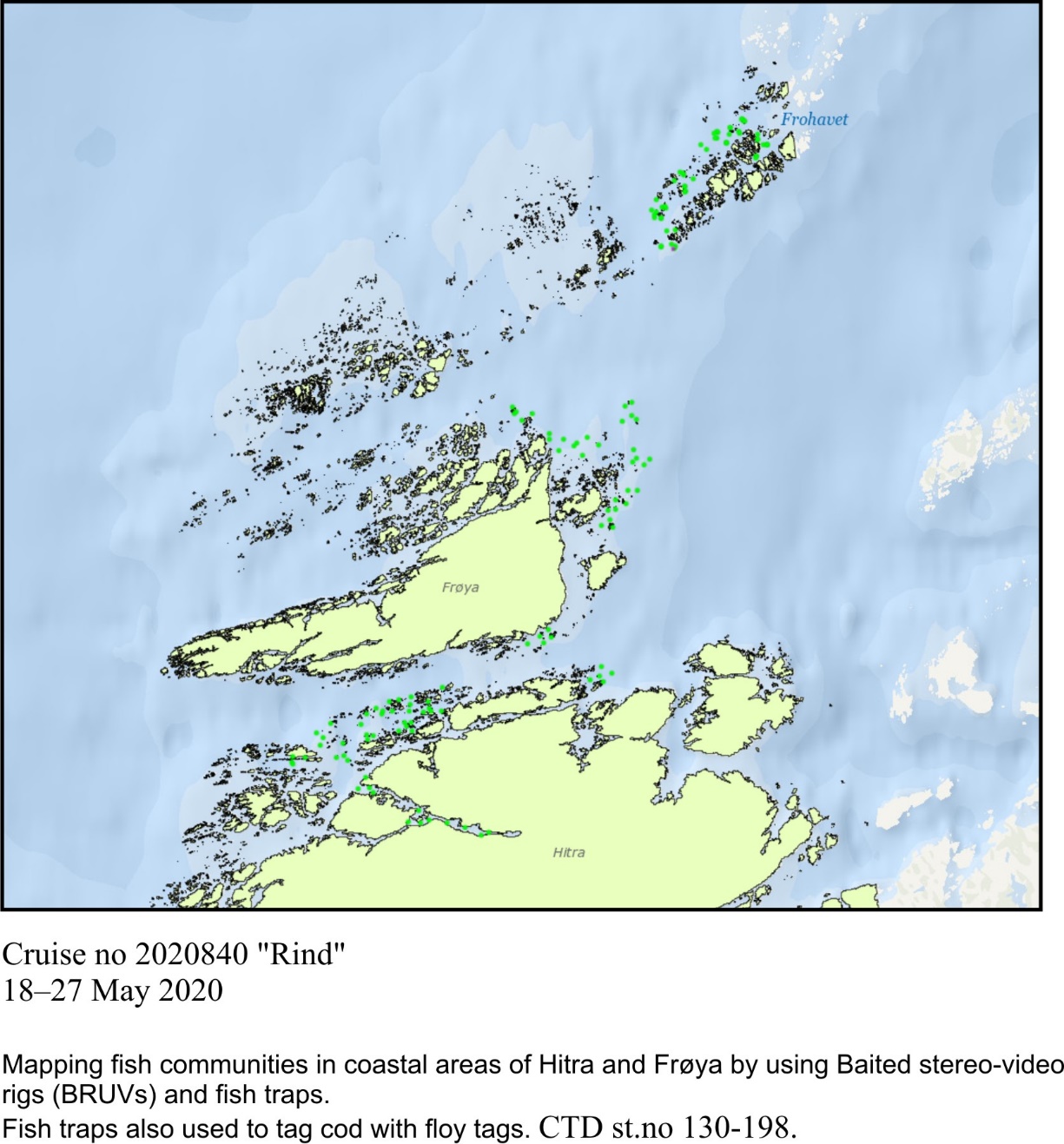
| 2020840 |
18.5.-27.5. |
“ Rind” |
Mapping fish communities in coastal areas of Hitra and Frøya by using Baited stereo-video rigs (BRUVs) and fish traps. Fish traps also used to tag cod with floy tags. |
Norwegian Sea |
130-198 |
- |
114 |
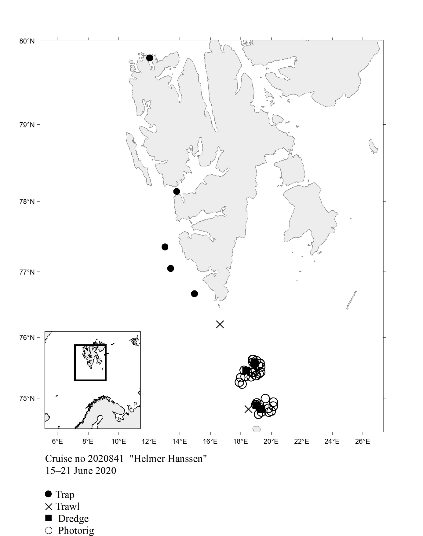
| 2020841 |
15.6.-21.6. |
“ Helmer Hanssen” |
Mapping of Iceland scallop stocks in the Svalbard Fishery Protection Zone. Monitoring spread of snow crab in coastal water in west and north of Spitsbergen. |
Barents Sea |
- |
- |
115 |
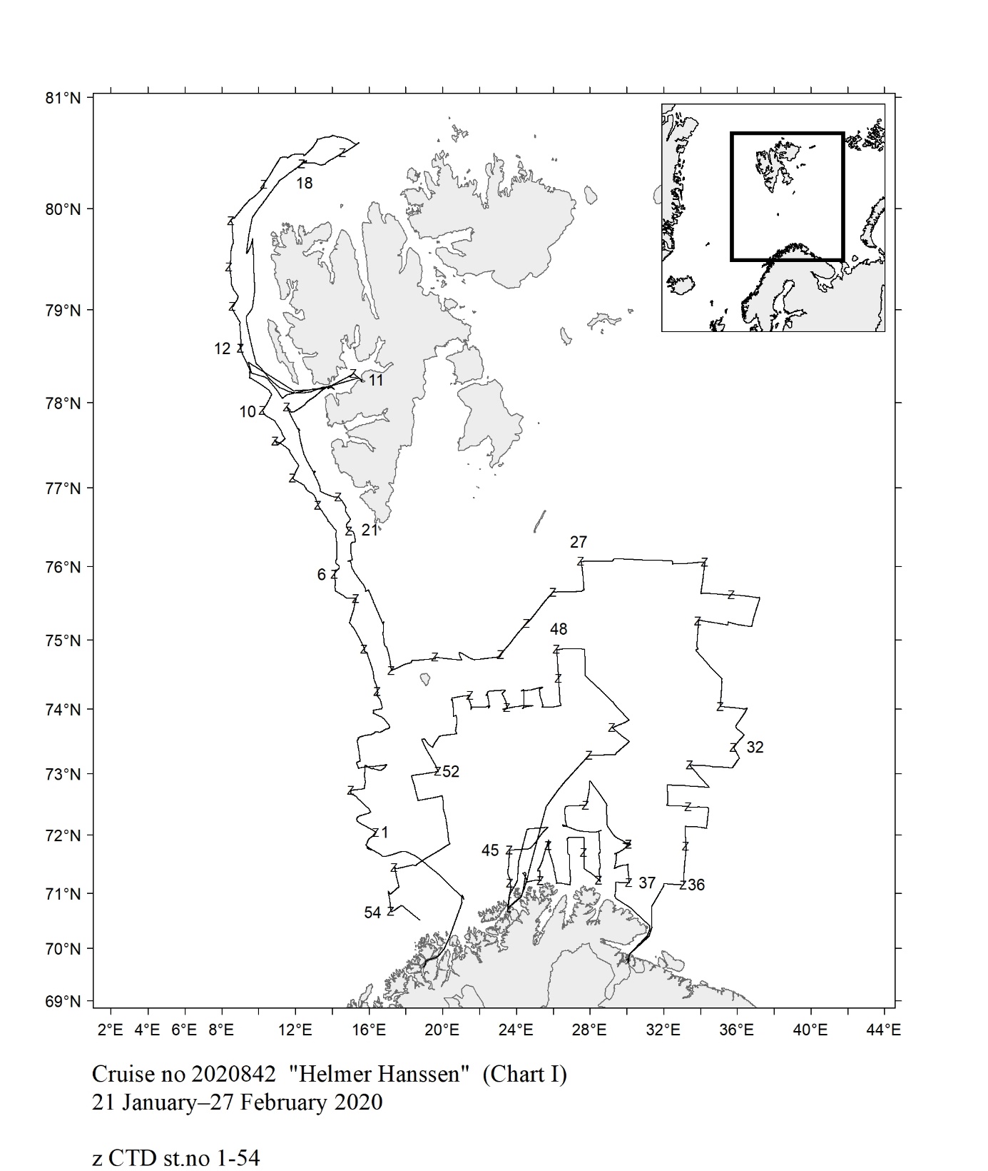
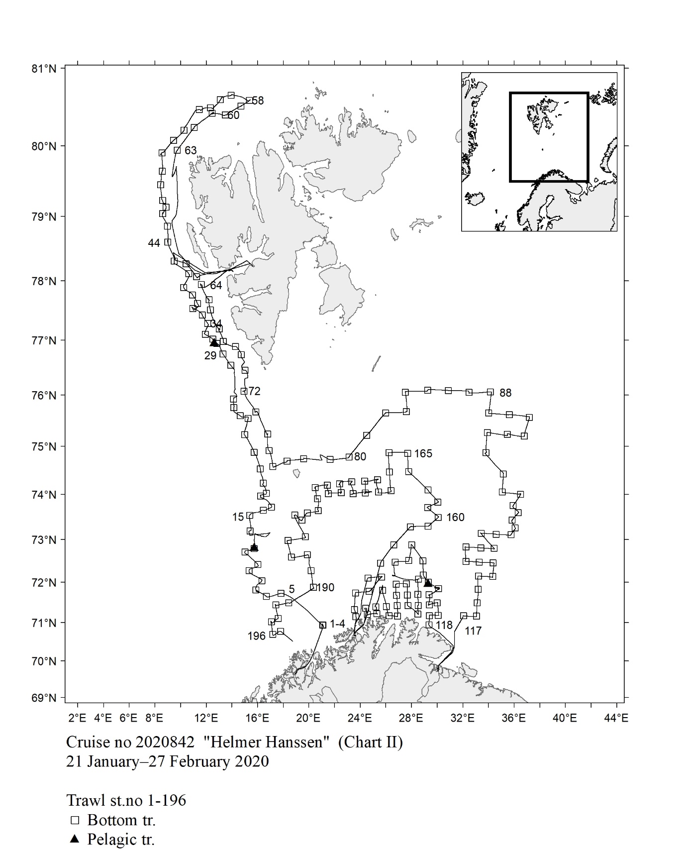
| 2020842 |
21.1.-27.2. |
“ Helmer Hanssen” |
Abundance and distribution of cod and haddock. |
Barents Sea Greenland Sea |
1-54 |
1-96 |
116-117 |
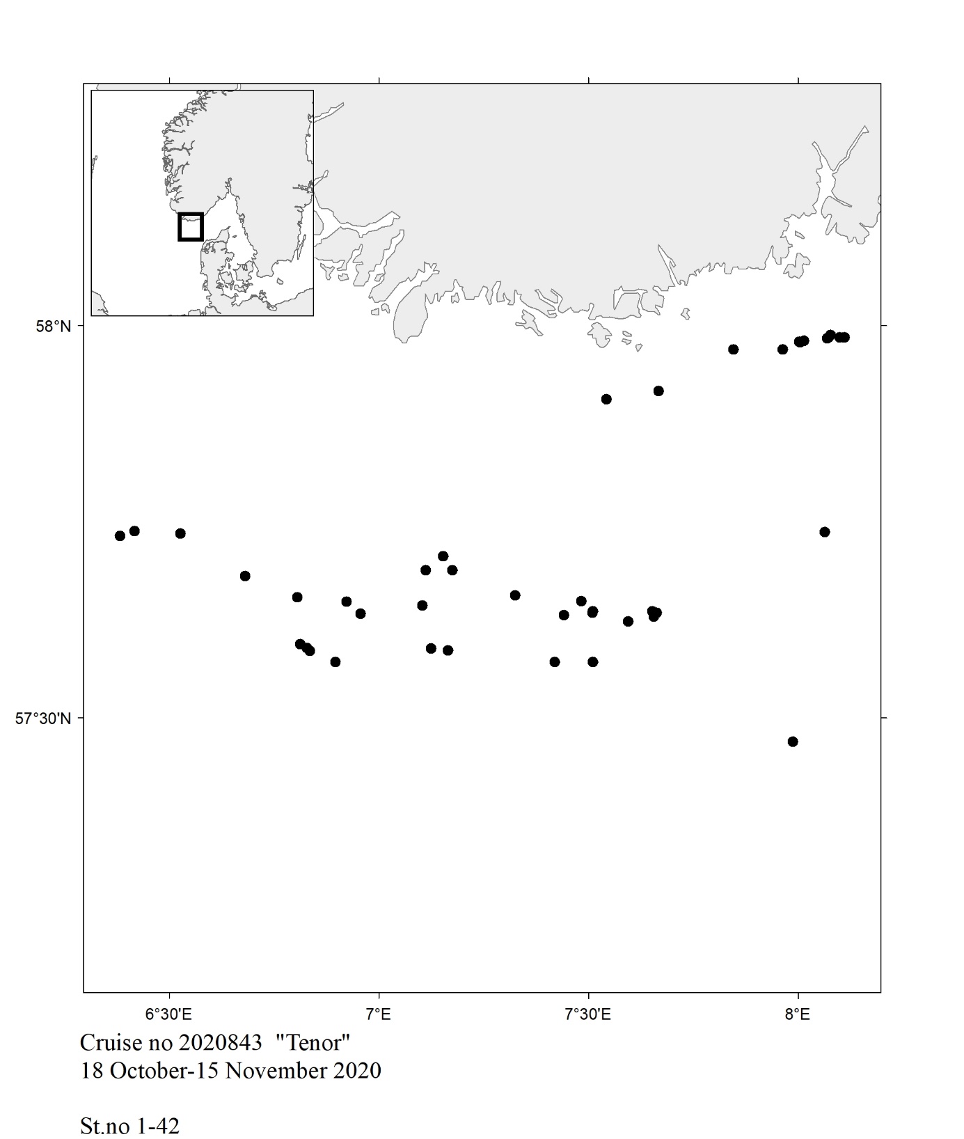
| 2020843 |
18.10.-15.11. |
«Tenor» |
Sorting of fish and shrimp in shrimp trawls. |
North Sea |
1-42 |
- |
118 |
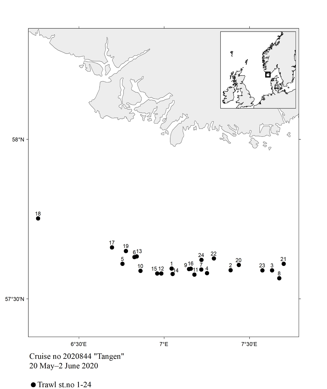
| 2020844 |
20.5.-2.6. |
«Tangen» |
The objective of the cruise was to obtain data on size selectivity of codends of two and four panel designs, 150 meshes in circumference. |
North Sea |
- |
1-24 |
119 |
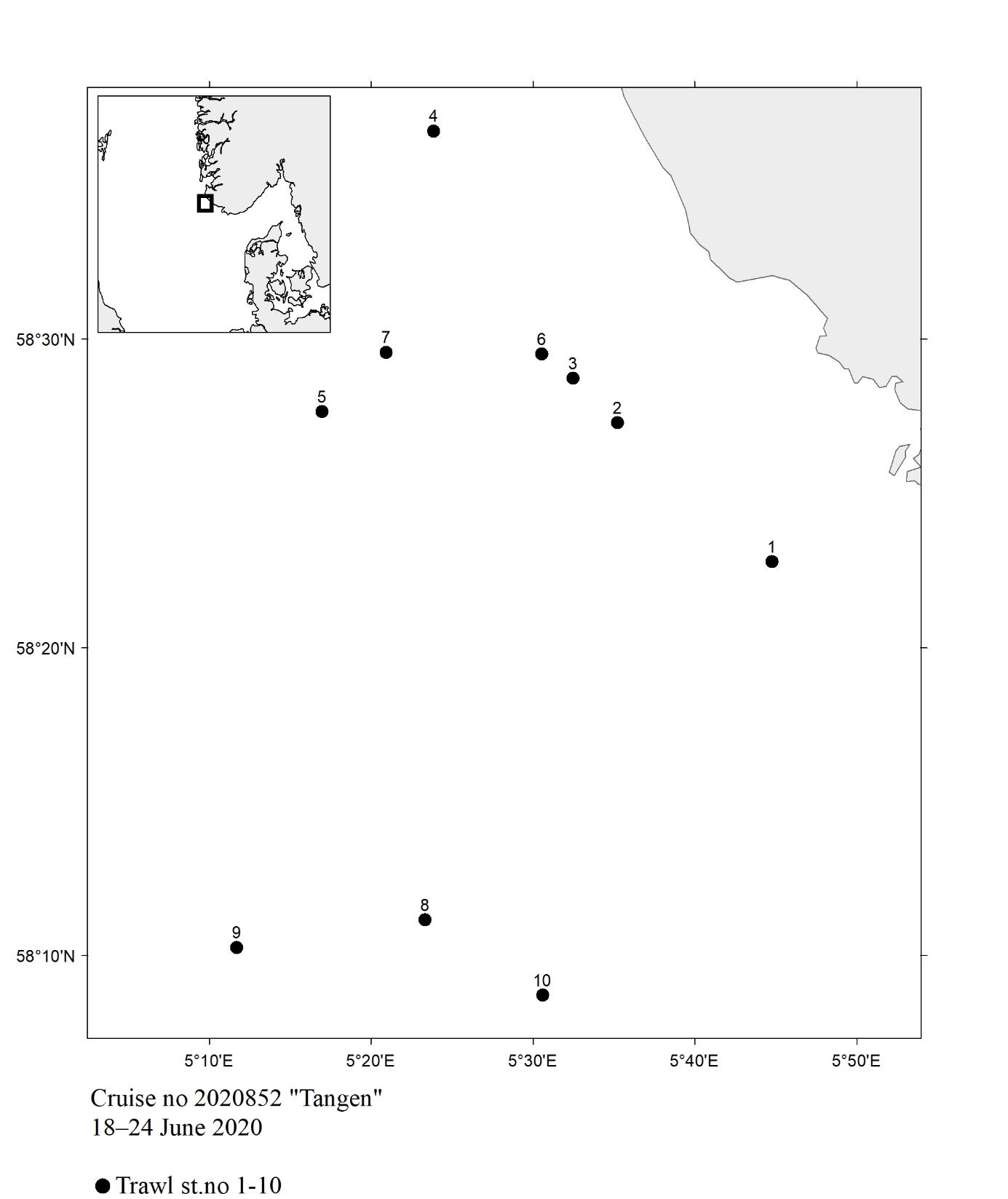
| 2020852 |
18.6.-24.6. |
«Tangen» |
The objective of the cruise was to obtain data on size selectivity of codend of four panel design, 150 meshes in circumference with 10% shorter lastridge ropes. This was done by pair-trawling with one trawl with codend of 6 mm mesh size (control) and one with the test codends of ~37 mm mesh sizes. The cruise was conducted without any serious interruptions. A sample of shrimp were measured from each codend, usually >400 specimen. Bycatches were separated and weighted, Norway pout, blue whiting, Silvery cod, silver belly, flatfish (dab and witch) were measured. Other species are accounted for; counted and weighed. Fishing depth and temperature were logged for every haul. |
North Sea |
- |
1-10 |
120 |
| 2020842 |
13.2.-25.2. |
«Vendla» |
|
Norwegian Sea |
1-11 |
1-13 |
142-143 |
| 2020843 |
19.11.-10.12. |
“ Nystrøm” |
|
Northeast Atlantic Ocean |
- |
- |
No Chart |
| 2020844 |
18.6.-12.8. |
“ ACC Mosby” |
|
Barents Sea, Greenland Sea, Norwegian Sea |
- |
- |
No Chart |
| 2020847 |
23.4.-13.5. |
“ Eros” |
|
North Sea |
11-35 |
15-48 |
144-145 |
| 2020849 |
28.4.-10.5. |
“ Tangen” |
. |
North Sea |
- |
1-17 |
146 |
14 - "Dr. Fridtjof Nansen" – Cruises 2020
| Cruise no |
Period |
Purpose |
Area |
CTD st.no |
Trawl st.no |
Fig. no |
| 2020401 |
29.1.-20.2. |
The survey is related to mapping bottom habitats and their ecology in six predefines areas off Northwest Africa to improve the habitat knowledge within protected areas and fishery management. The survey objectives for the selected areas include: a) Improve information on bathymetry using Multibeam echosounding b) Detailed study of the bottom by sub-bottom profiler c) Improve knowledge on associated macro- and mega epibenthic organisms by videos, photos and beam trawling. d) Genetic samples for cold water corals. e) Improve knowledge on sediment characteristics, including infauna, by collecting grab samples, as appropriate f) Study oceanographic conditions with CTD and currents by ADCP/LADCP, including nutrients and pH.. |
Atlantic Ocean |
1-70 |
- |
121-122 |
| 2020402 |
27.2.-15.3. |
TRANSBOUNDARY DEMERSAL SURVEY, NORTHWEST AFRICA (Leg 2.1 Casablanca to Cap Blanc) The survey was planned to last until 31 March, but was cancelled already on 13 March due to the Covid-19 pandemic. Therefore, the survey only covered the stretch between Casablance to 70 nautical miles south of Cap Juby (27°N). Leg 2.2 of the survey, from Cap Blanc to the southern border of Senegal, was also cancelled. The end of the survey was set to 15 March, upon the arrival of Agadir, Morocco, where the Moroccan scientists disembarked. “Dr. Fridtjof Nansen” arrived in Bergen, Norway, on 27 March. |
North Atlantic Ocean |
71-173 |
1-73 |
123-125 |
15 - "Dr. Fridtjof Nansen" Charts for 2020
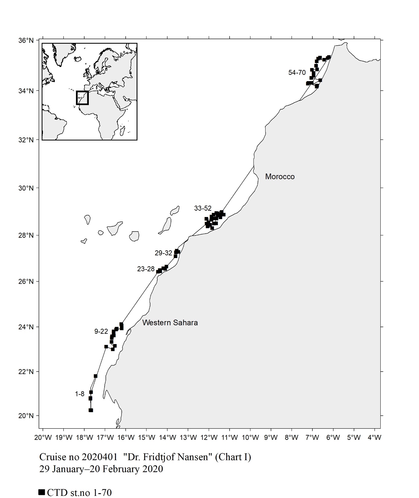 Fig. 121
 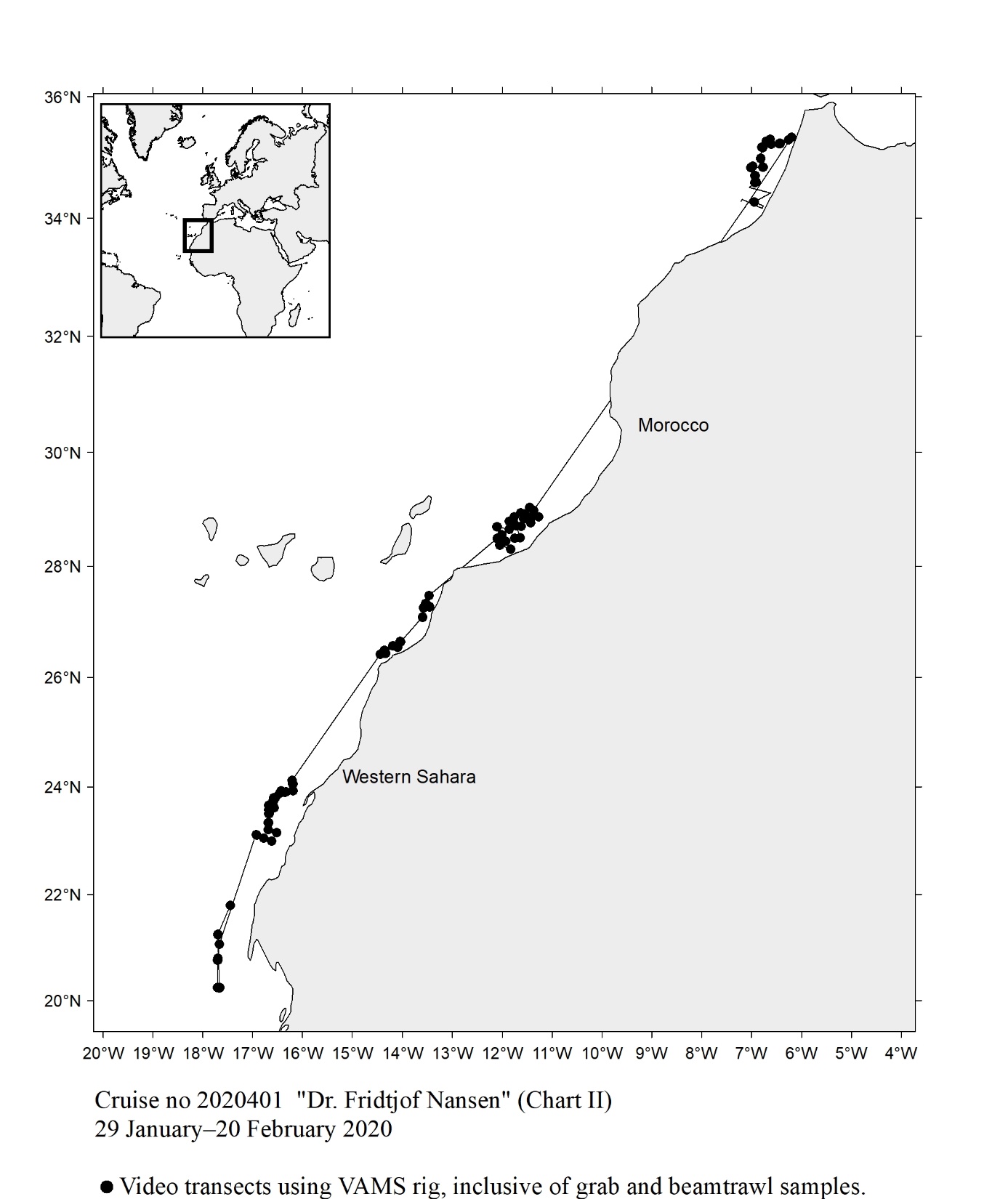 Fig. 122
 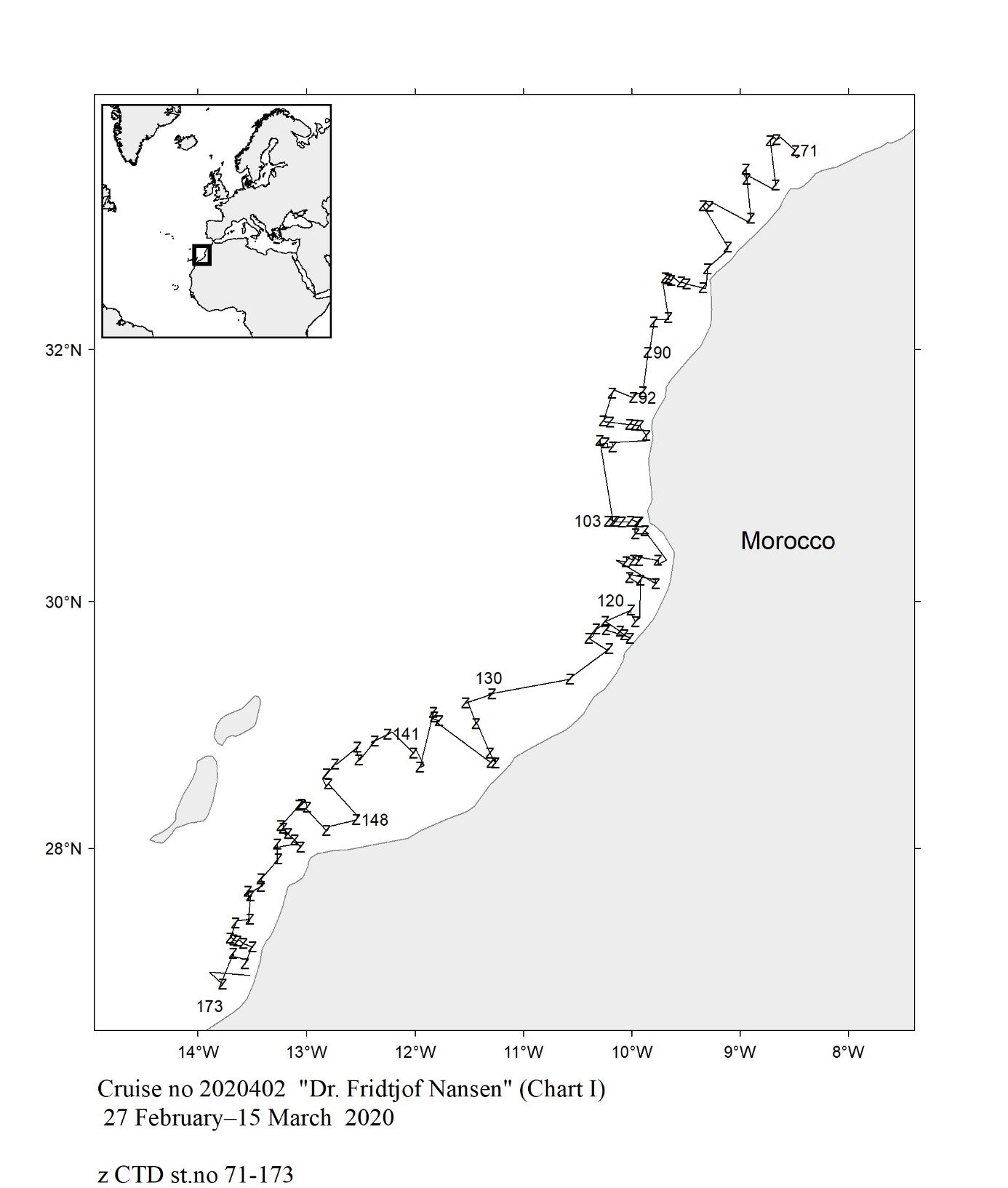 Fig. 123
 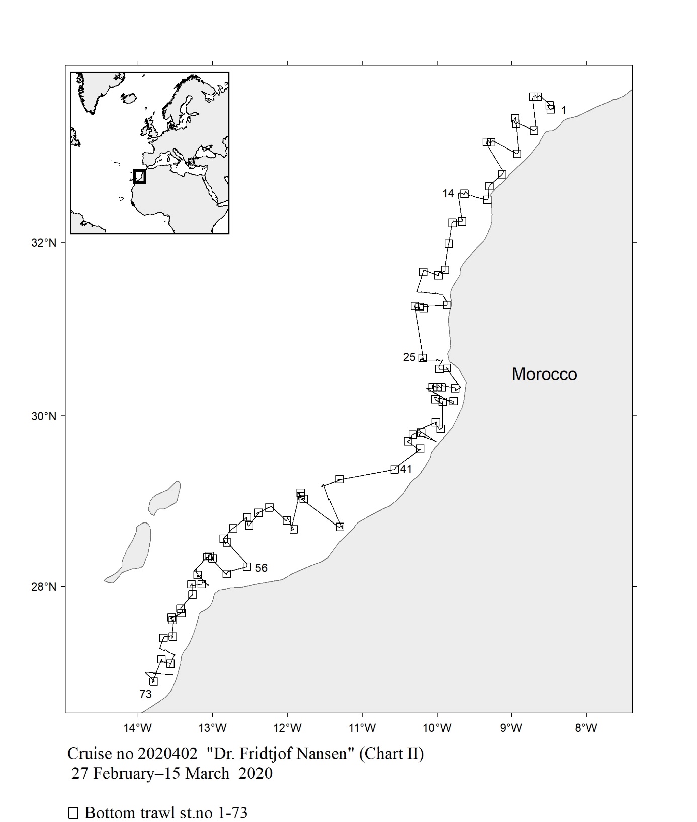 Fig. 124
 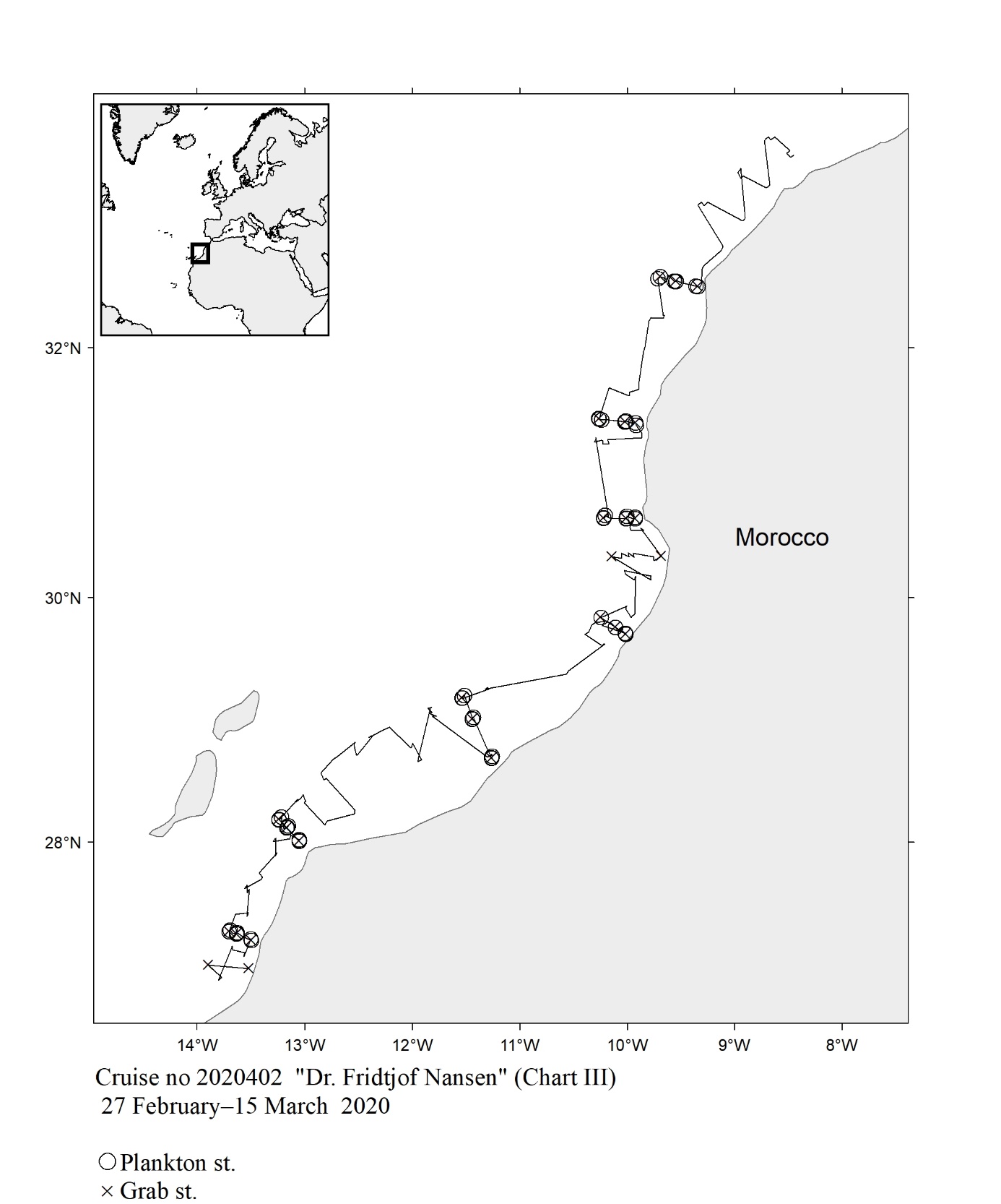 Fig. 125
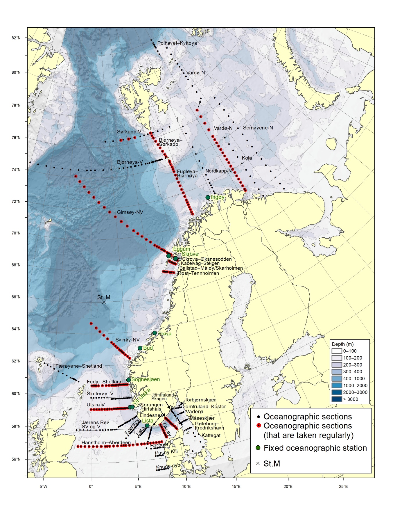
16 - Oceanographic sections and Fixed oceanographic stations – map.
17 - Tables – Observations in 2020. Oceanographic sections and fixed oceanographic stations.
Oceanographic sections 2020 (Cruise no)
| Area |
Oceanogr. sec. |
Jan |
Feb |
Mar |
Apr |
May |
Jun |
Jul |
Aug |
Sep |
Oct |
Nov |
Dec |
| North Sea |
Fedje–Shetland |
|
|
|
2020205 |
|
|
|
|
|
|
|
|
| Slotterøy-West |
|
|
|
2020205 |
|
|
|
|
|
|
|
|
| Utsira-West |
2020201 |
|
|
2020205 |
|
|
|
2020207 |
2020112 |
|
2020211 |
|
| Jærens Rev-SW and W |
|
|
|
|
|
|
|
|
|
|
|
|
| Egerøya-SW |
|
|
|
2020205 |
|
|
|
|
|
|
|
|
| Lista-SW |
|
|
|
2020205 |
|
|
|
|
|
|
|
|
| Lindesnes-SSW |
|
|
|
2020205 |
|
|
|
|
|
|
|
|
| Hanstholm–Aberdeen |
2020201 |
|
|
2020205 |
|
|
2020207 |
|
|
|
2020211 |
|
| Harboør |
|
|
|
2020205 |
|
|
|
|
|
|
|
|
| Hysby Klit |
|
|
|
2020205 |
|
|
|
|
|
|
|
|
| |
Knude-Dyb |
|
|
|
2020205 |
|
|
|
|
|
|
|
|
| Skagerrak and Kattegat |
Torungen–Hirtshals |
2020301 |
2020302 |
2020303 |
2020205 |
2020306 |
2020307 |
2020308 |
2020309 |
2020313 |
2020315 |
2020316 |
2020318 |
| Oksøy–Hanstholm |
|
|
|
2020205 |
|
|
|
|
|
|
|
|
| Jomfruland–Skagen |
|
|
|
|
|
|
|
|
|
|
|
|
| Jomfruland–Koster |
|
|
|
2020205 |
|
|
|
|
|
|
|
|
| Torbjørnskjær |
|
|
|
|
|
|
|
|
|
|
|
|
| Väderø |
|
|
|
2020205 |
|
|
|
|
|
|
|
|
| Måseskjær |
|
|
|
2020205 |
|
|
|
|
|
|
|
|
| Gøteborg–Fredrikshavn |
|
|
|
2020205 |
|
|
|
|
|
|
|
|
| Kattegat |
|
|
|
|
|
|
|
|
|
|
|
|
| Area |
Oceanogr. sec |
Jan |
Feb |
Mar |
Apr |
May |
Jun |
Jul |
Aug |
Sep |
Oct |
Nov |
Dec |
| The Norwegian Sea and Vestfjorden |
Svinøy-North/West |
2020202 |
|
|
2020622/608 |
|
|
|
2020208 |
|
|
2020212 |
|
| Gimsøy-North/West |
|
|
|
|
2020608 |
|
|
2020208 |
|
|
2020212 |
|
| Bjørnøya-West |
|
|
|
|
2020608 |
|
|
2020208 |
|
|
2020212 |
|
| Sørkapp-West |
|
|
|
|
|
|
|
|
|
|
|
|
| Færøyene–Shetland |
|
|
|
|
|
|
|
|
|
|
|
|
| Skrova–Øksnesodden |
|
|
|
|
|
|
|
|
|
|
|
|
| Kabelvåg–Steigen |
|
|
|
|
|
|
|
|
|
|
|
|
| Ballstad– Måløy/Skarholmen |
|
|
|
|
|
|
|
|
|
|
|
|
| Røst–Tennholmen |
|
|
|
|
|
|
|
|
|
|
|
|
| The Barents Sea |
Fugløya–Bjørnøya |
2020202 |
|
|
|
2020608 |
|
|
2020208 |
|
|
2020212 |
|
| Vardø-North |
|
2020203 |
|
|
|
|
|
|
2020209 |
|
|
|
| Semøyene-North |
|
|
|
|
|
|
|
|
|
|
|
|
| Bjørnøya–Sørkapp |
|
|
|
|
|
|
|
|
|
|
|
|
| Nordkapp-North |
|
|
|
|
|
|
|
|
|
|
|
|
| Polhavet–Kvitøya |
|
|
|
|
|
|
|
|
|
|
|
|
| |
Kola |
|
|
|
|
|
|
|
|
|
|
|
|
| |
Fair Isle-Pentland |
2020201 |
|
|
|
|
|
|
2020207 |
|
|
2020211 |
|
| Fixed stations |
Jan |
Feb |
Mar |
Apr |
May |
Jun |
Jul |
Aug |
Sep |
Oct |
Nov |
Dec |
Total |
| LISTA N58 05,1 E06 32,5 |
3 |
2 |
3 |
3 |
3 |
3 |
3 |
3 |
3 |
3 |
2 |
3 |
34 |
| UTSIRA Y N59 19 E04 44 |
1 |
2 |
3 |
3 |
3 |
4 |
1 |
4 |
3 |
4 |
3 |
3 |
34 |
| UTSIRA I N59 19 E04 59 |
1 |
2 |
3 |
3 |
3 |
4 |
1 |
4 |
3 |
4 |
3 |
4 |
35 |
| SOGNESJØEN N61 01 E04 50 |
1 |
1 |
2 |
1 |
3 |
4 |
2 |
3 |
3 |
3 |
2 |
2 |
27 |
| BUD N62 56 E06 47 |
2 |
1 |
3 |
2 |
1 |
2 |
2 |
2 |
3 |
3 |
2 |
3 |
26 |
| SKROVA N68 07 E14 39 |
3 |
2 |
4 |
3 |
4 |
4 |
3 |
4 |
4 |
3 |
2 |
3 |
39 |
| EGGUM N68 23 E13 38 |
3 |
2 |
3 |
5 |
4 |
4 |
5 |
4 |
4 |
5 |
3 |
4 |
46 |
| INGØY N71 08 E24 01 |
2 |
x |
2 |
3 |
2 |
3 |
2 |
2 |
2 |
3 |
3 |
2 |
26 |
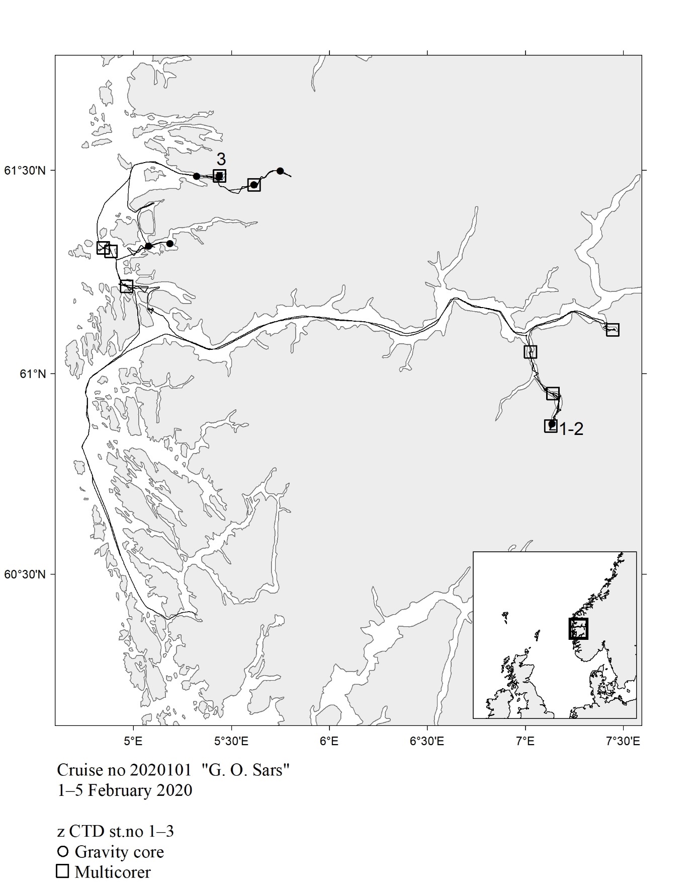
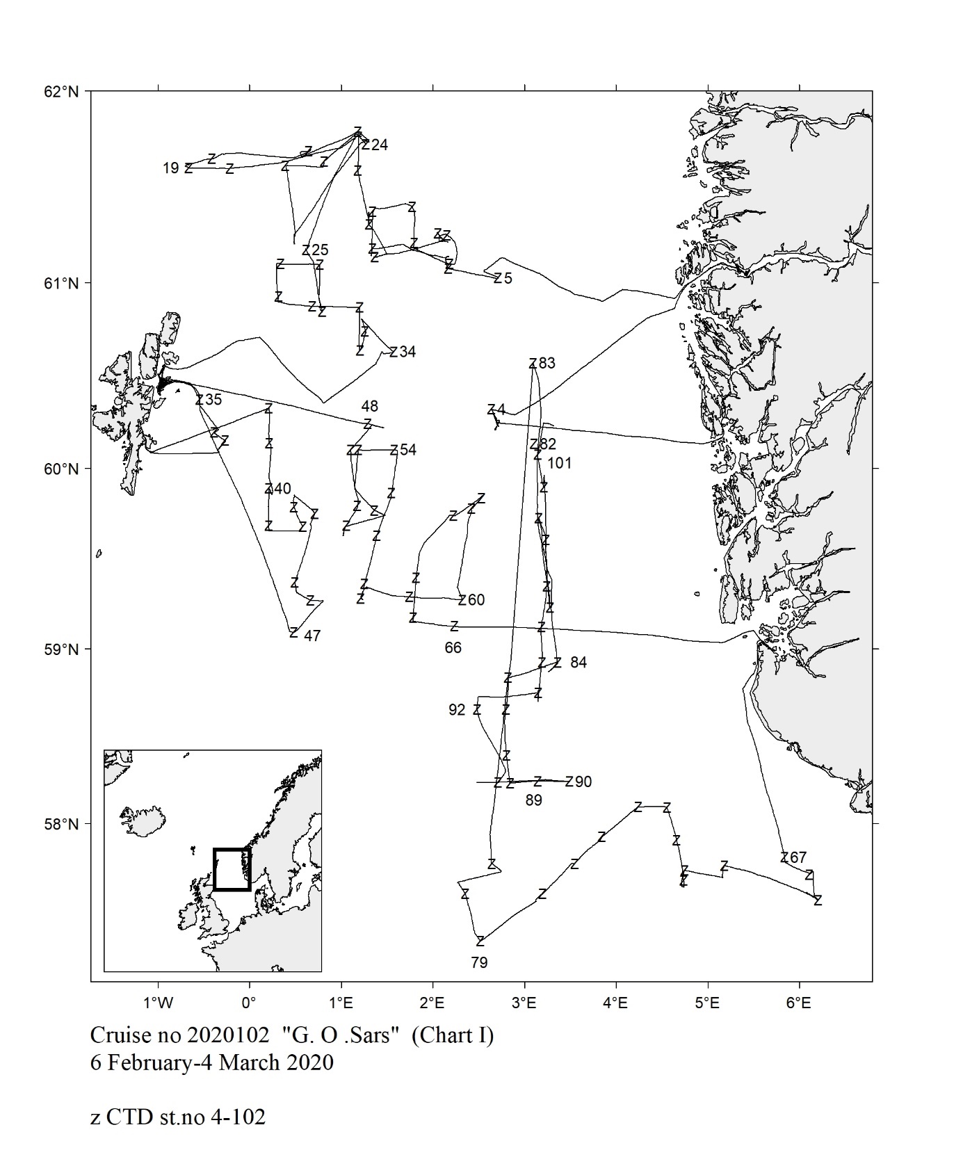

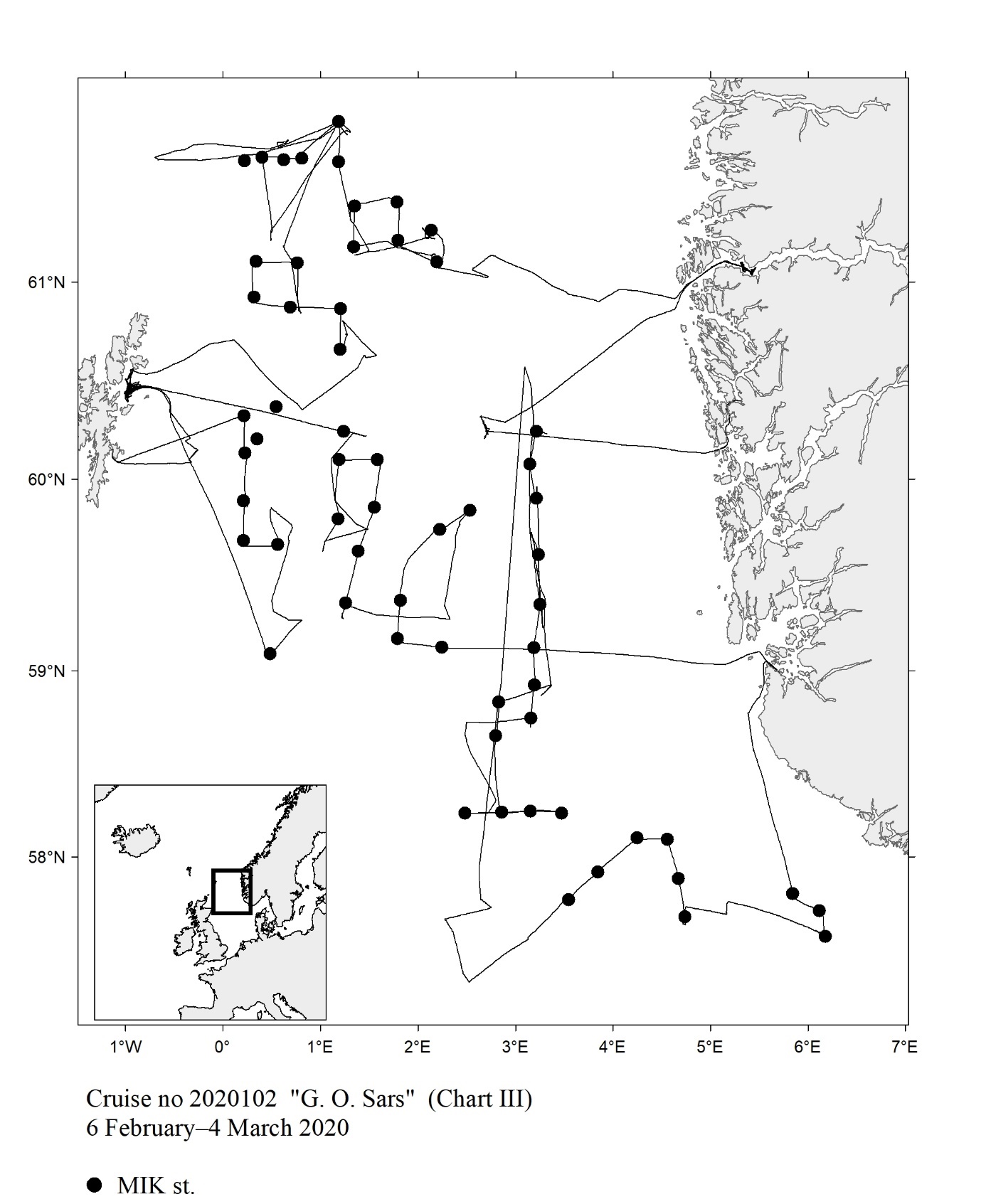 Fig.4
Fig.4 Fig. 5
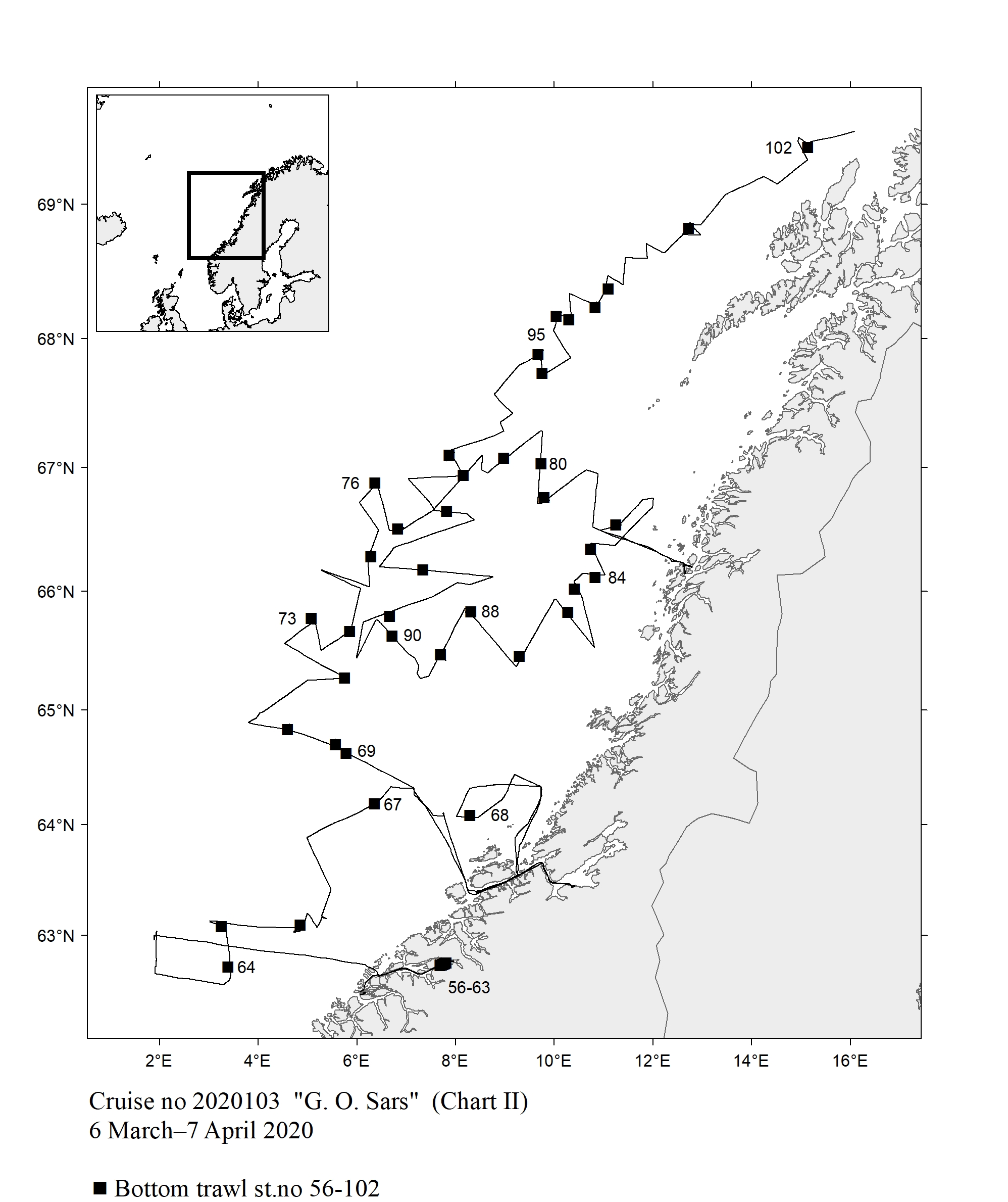 Fig.6
Fig.6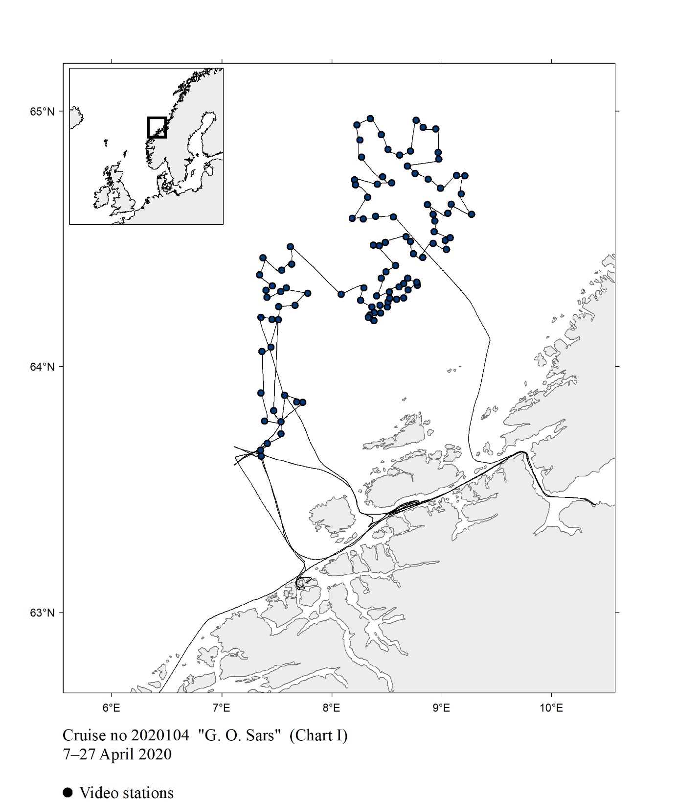 Fig.7
Fig.7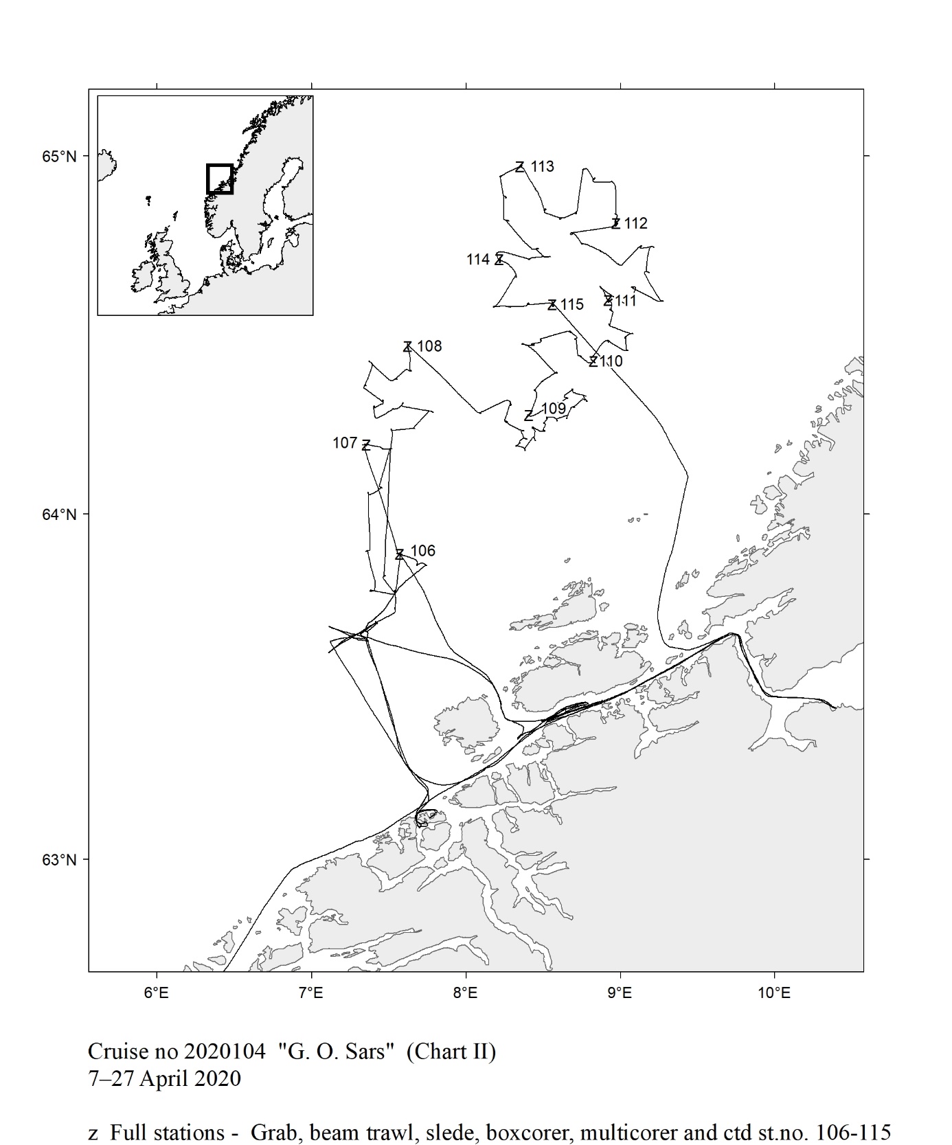 Fig. 8
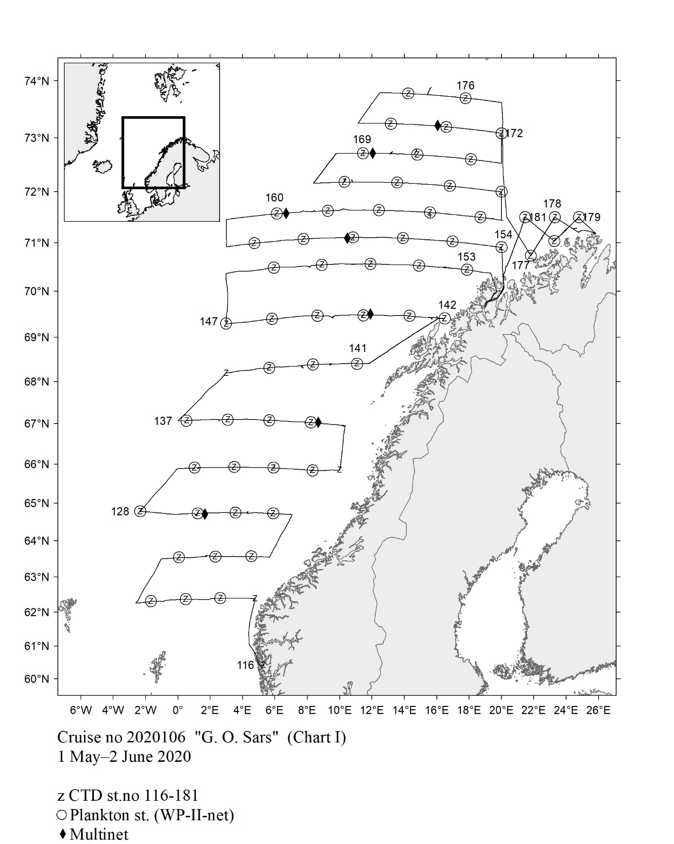 Fig. 9
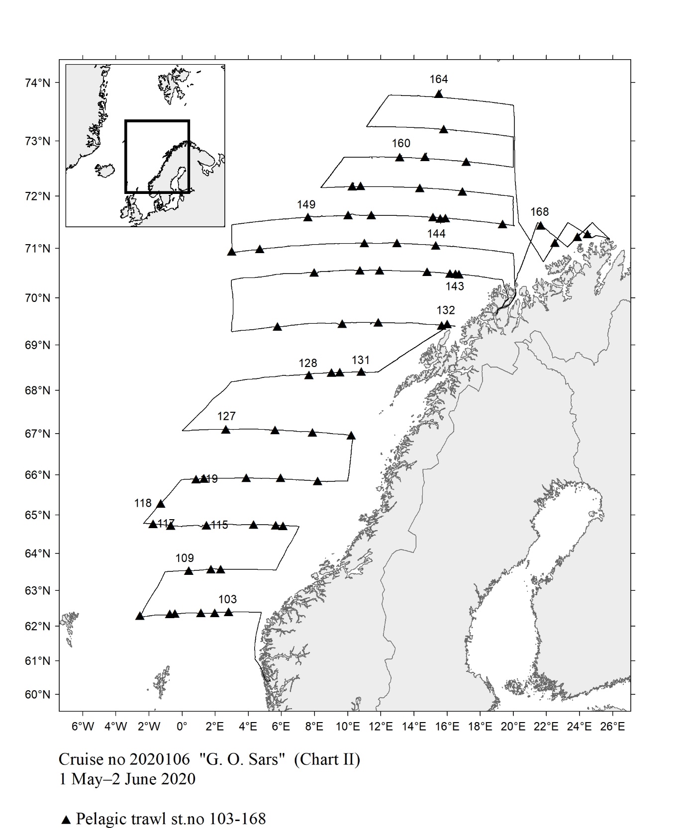 Fig. 10
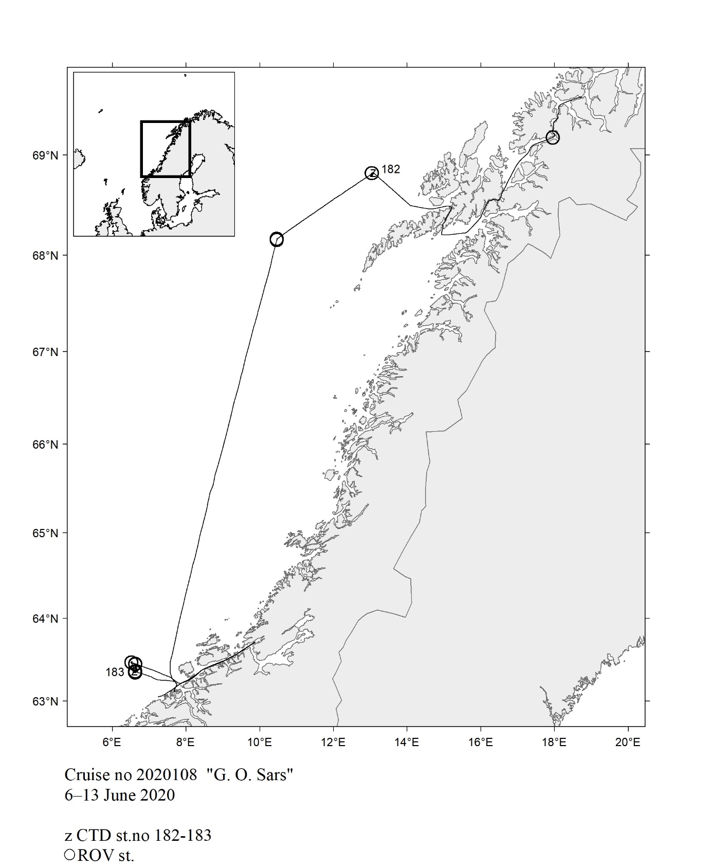 Fig.11
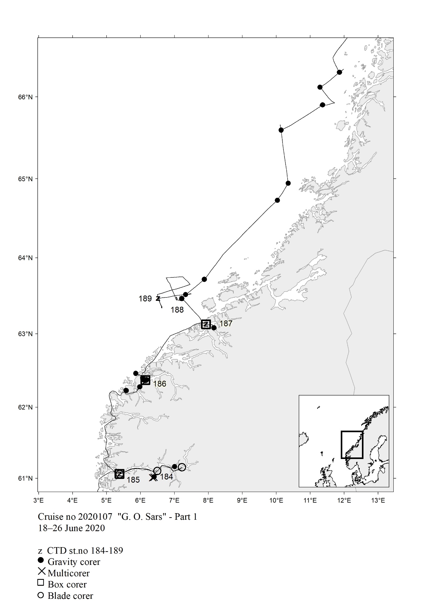 Fig.12
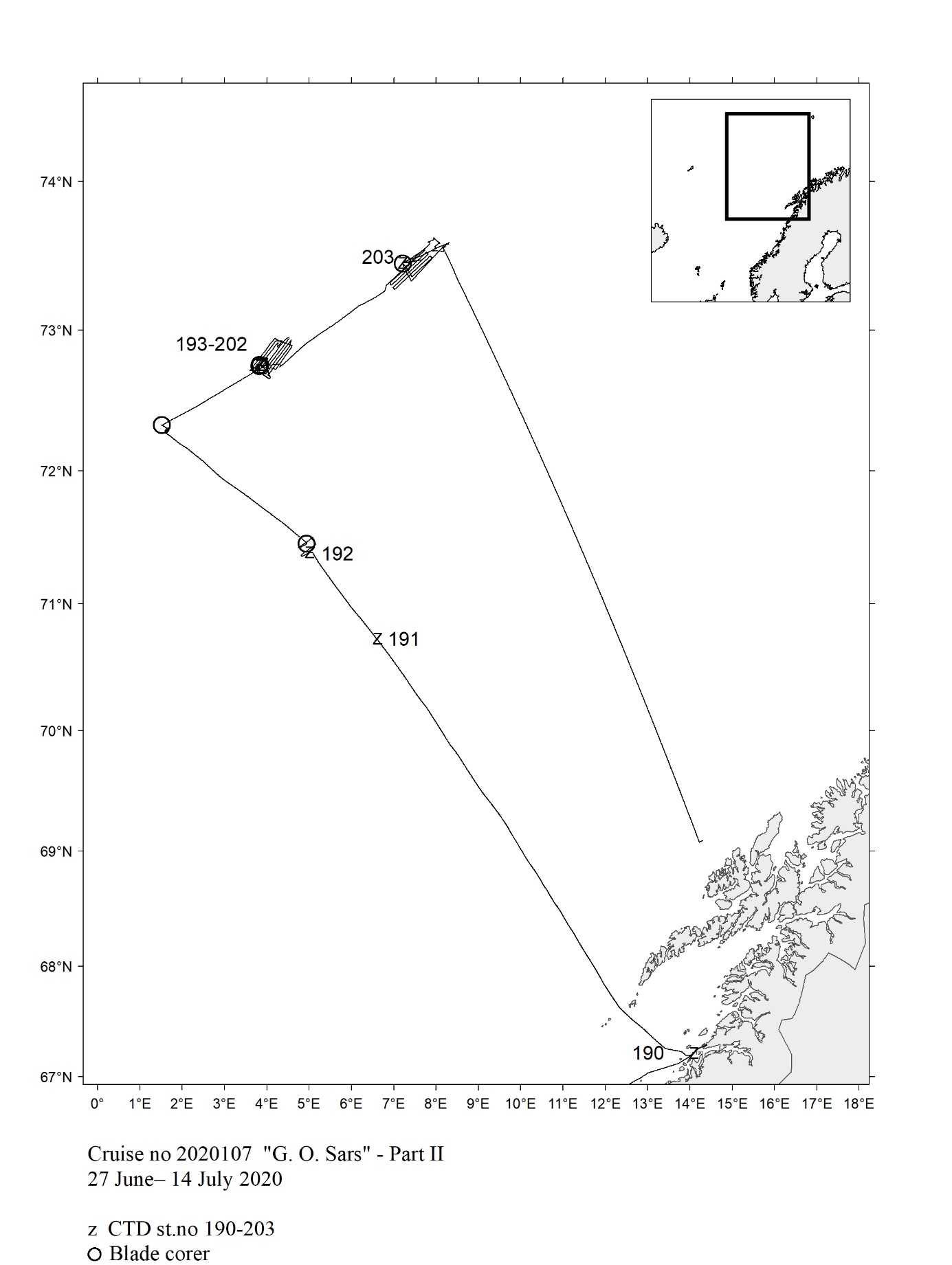 Fig.13
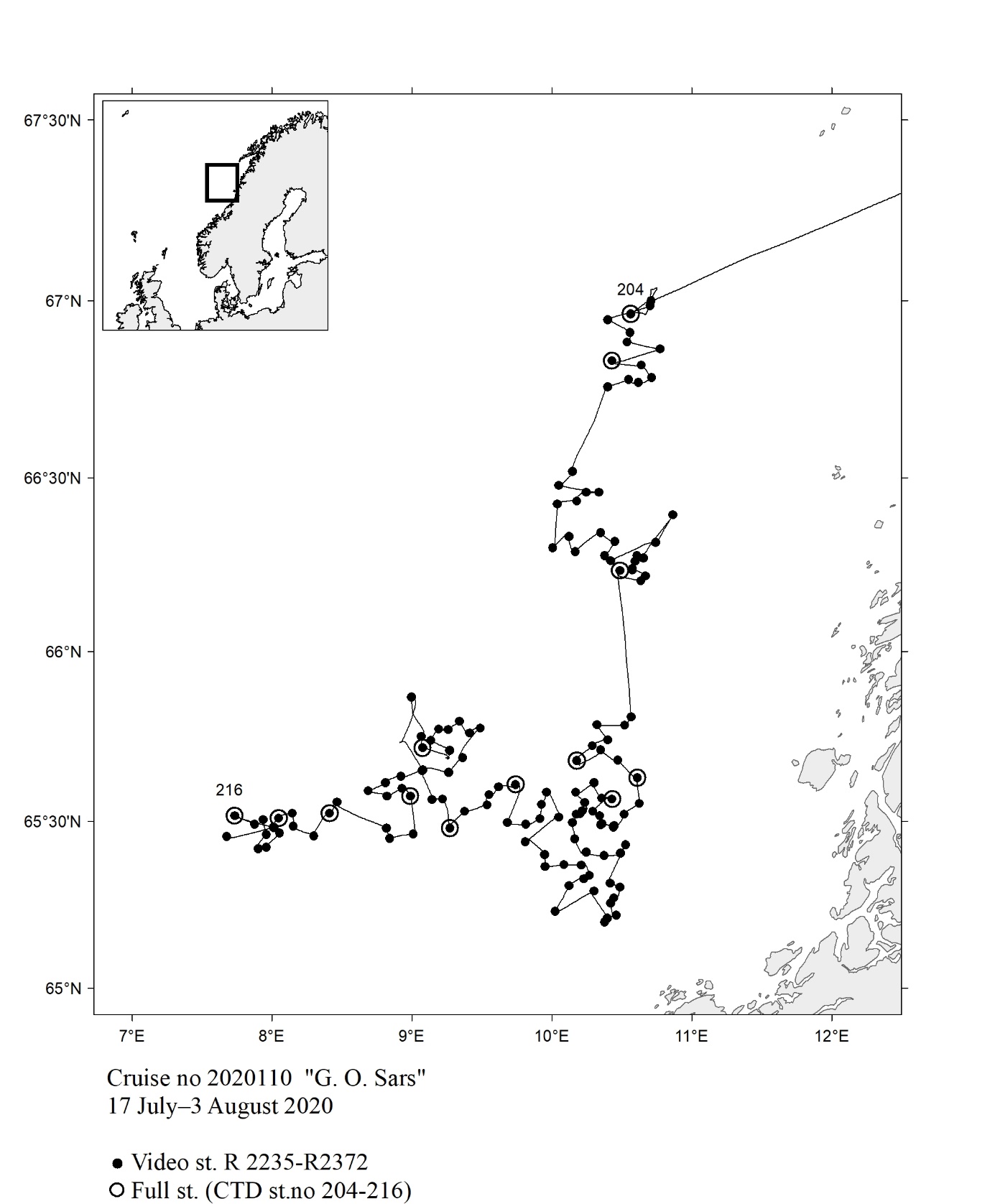 Fig. 14
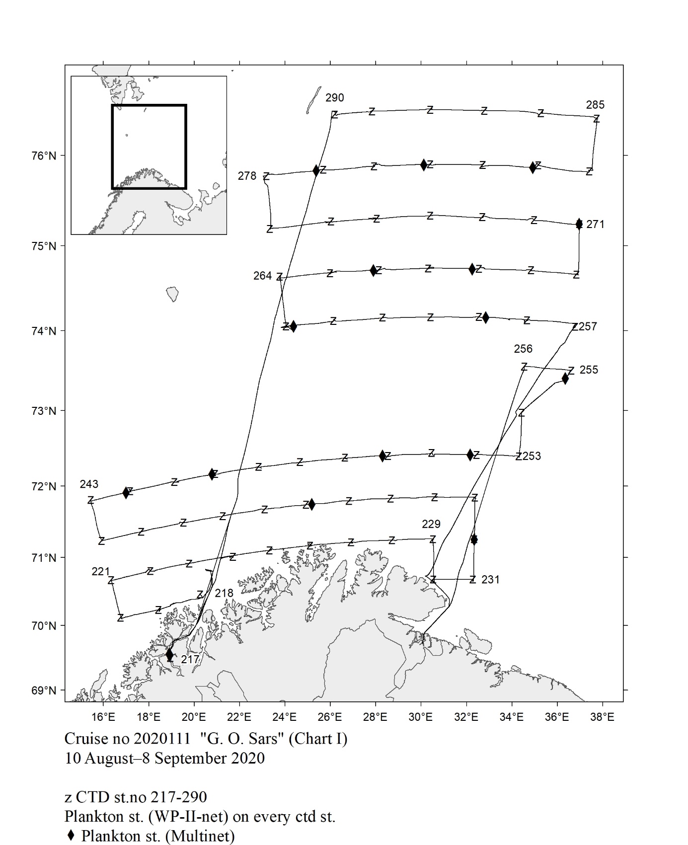 Fig. 15
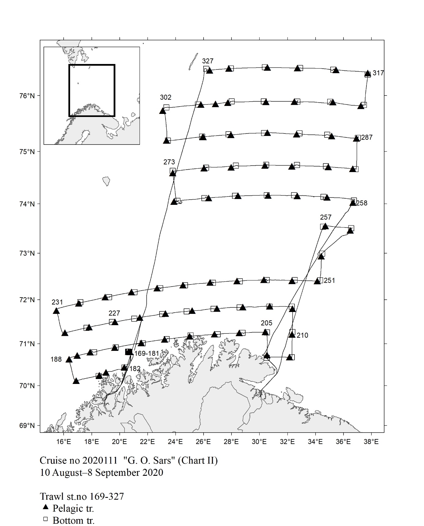 Fig.16
 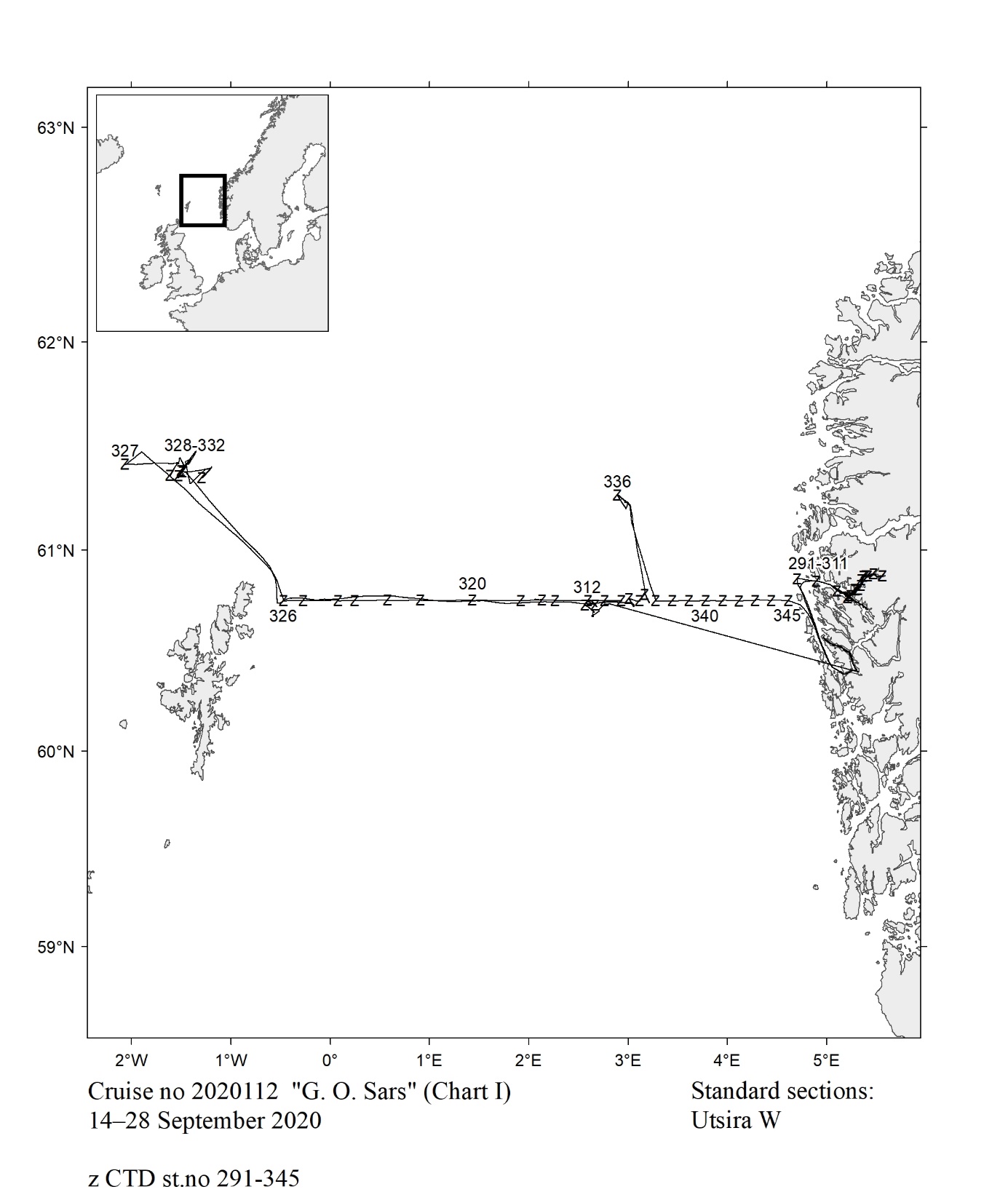 Fig.17
 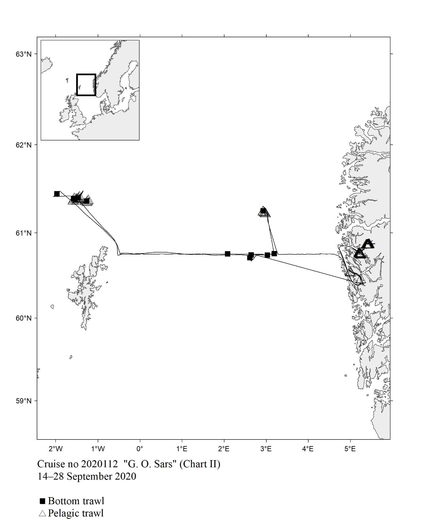 Fig.18
 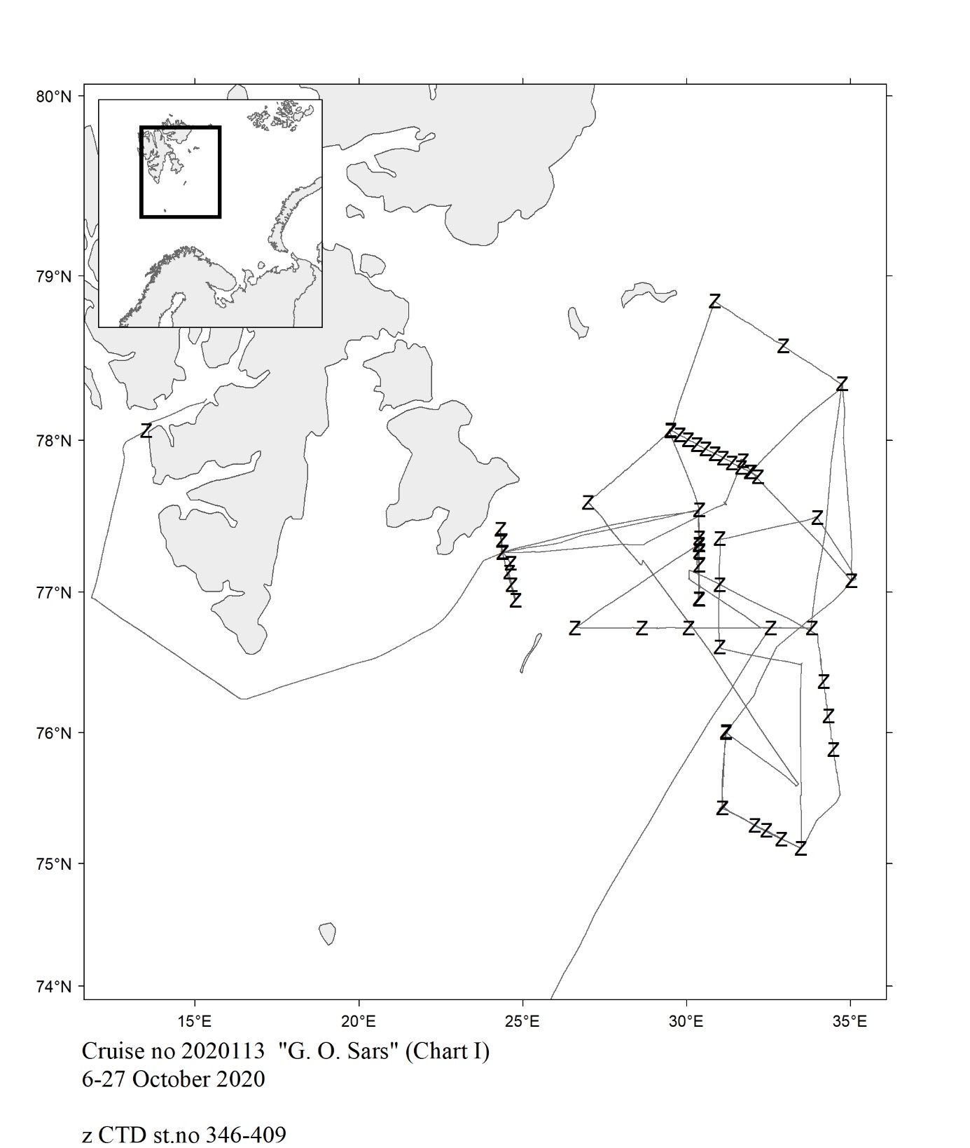 Fig.19
 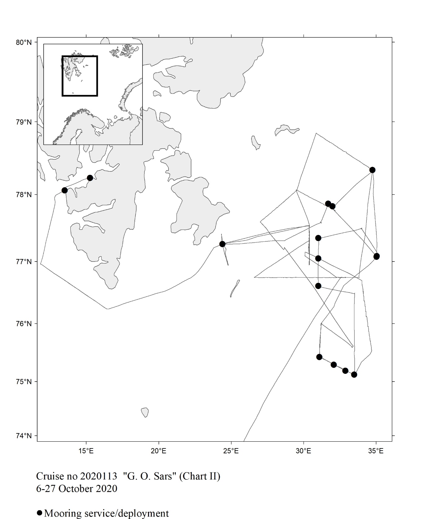 Fig.20
 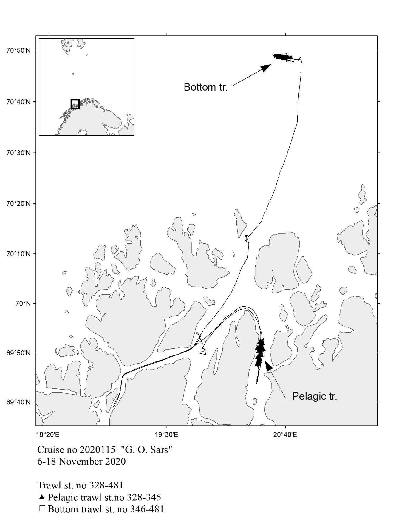 Fig.21
 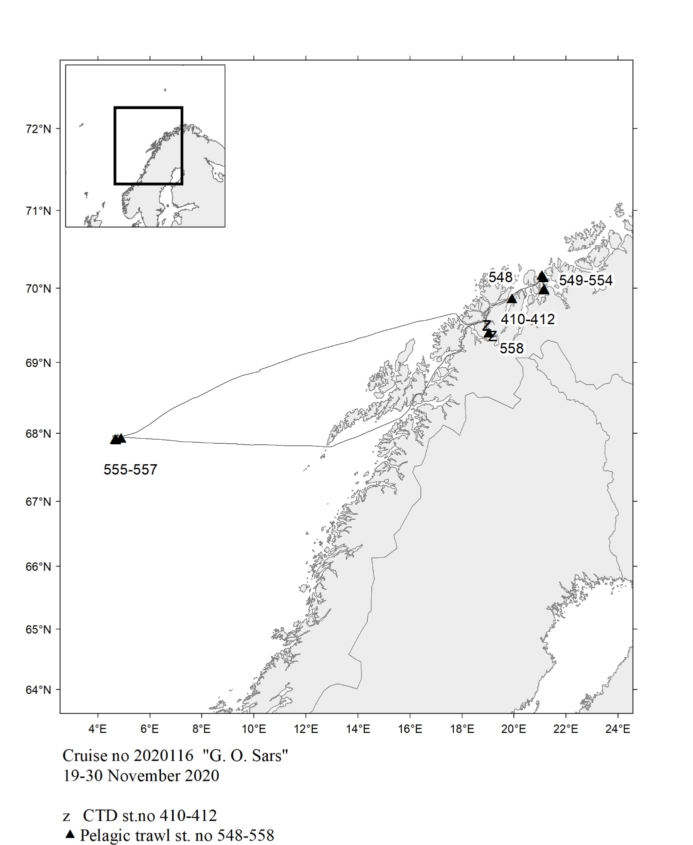 Fig. 22
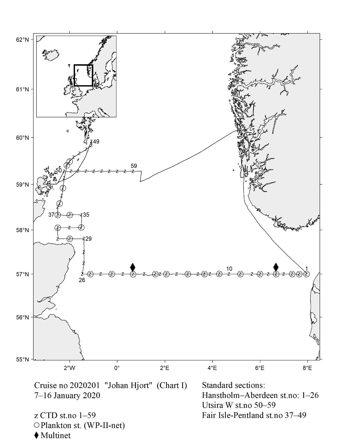 Fig.23
 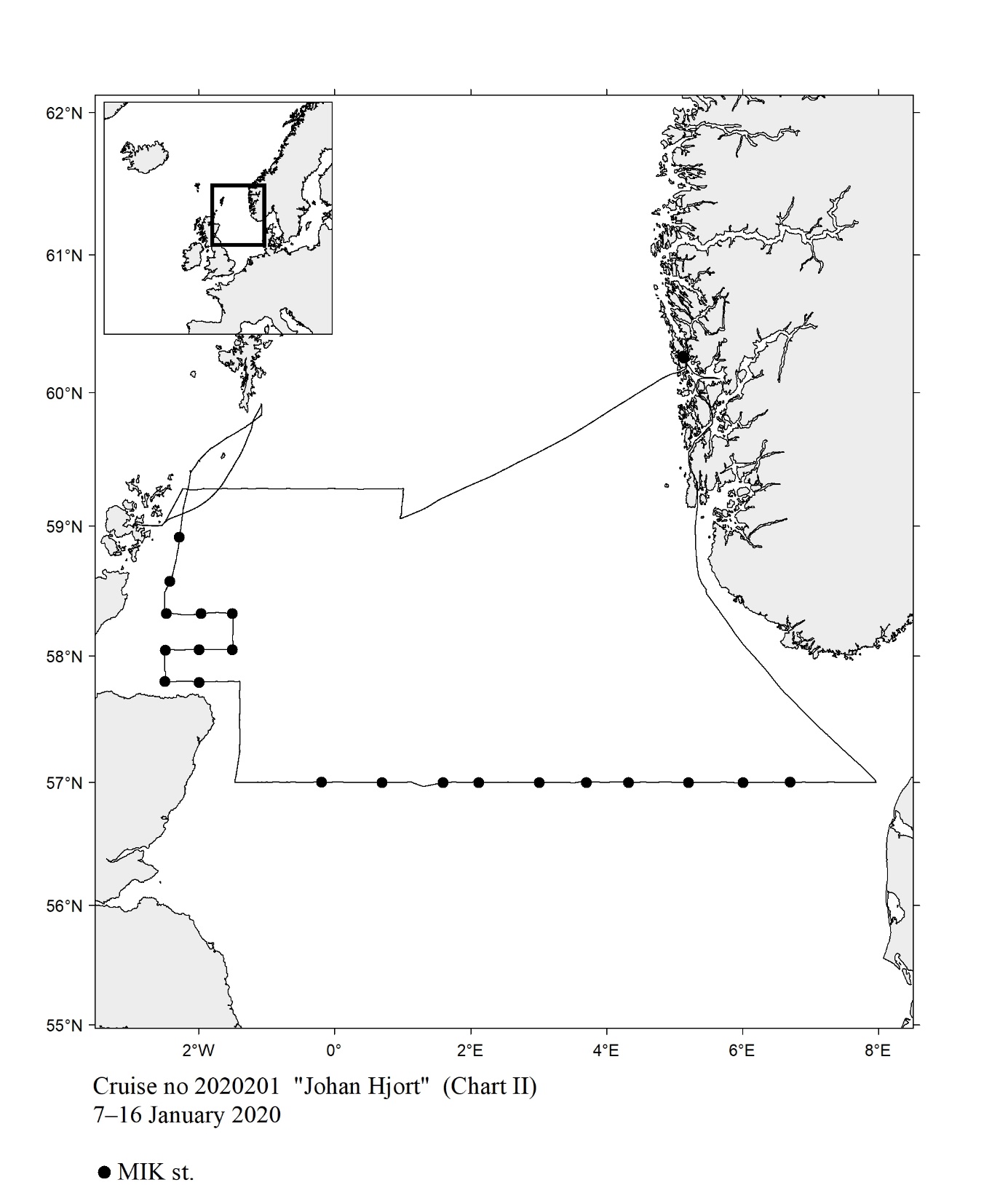 Fig.24
 Fig.25
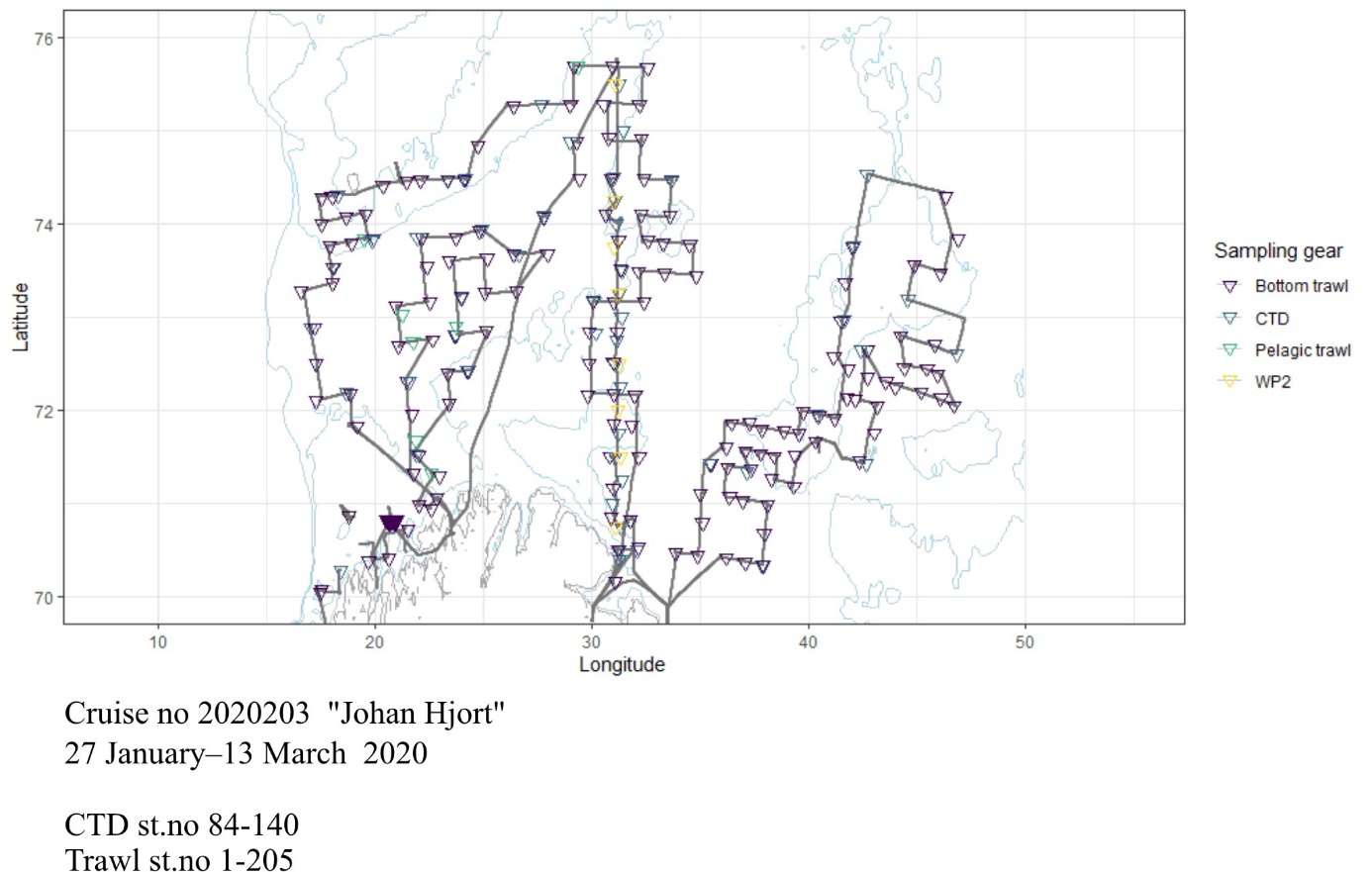 Fig.26
 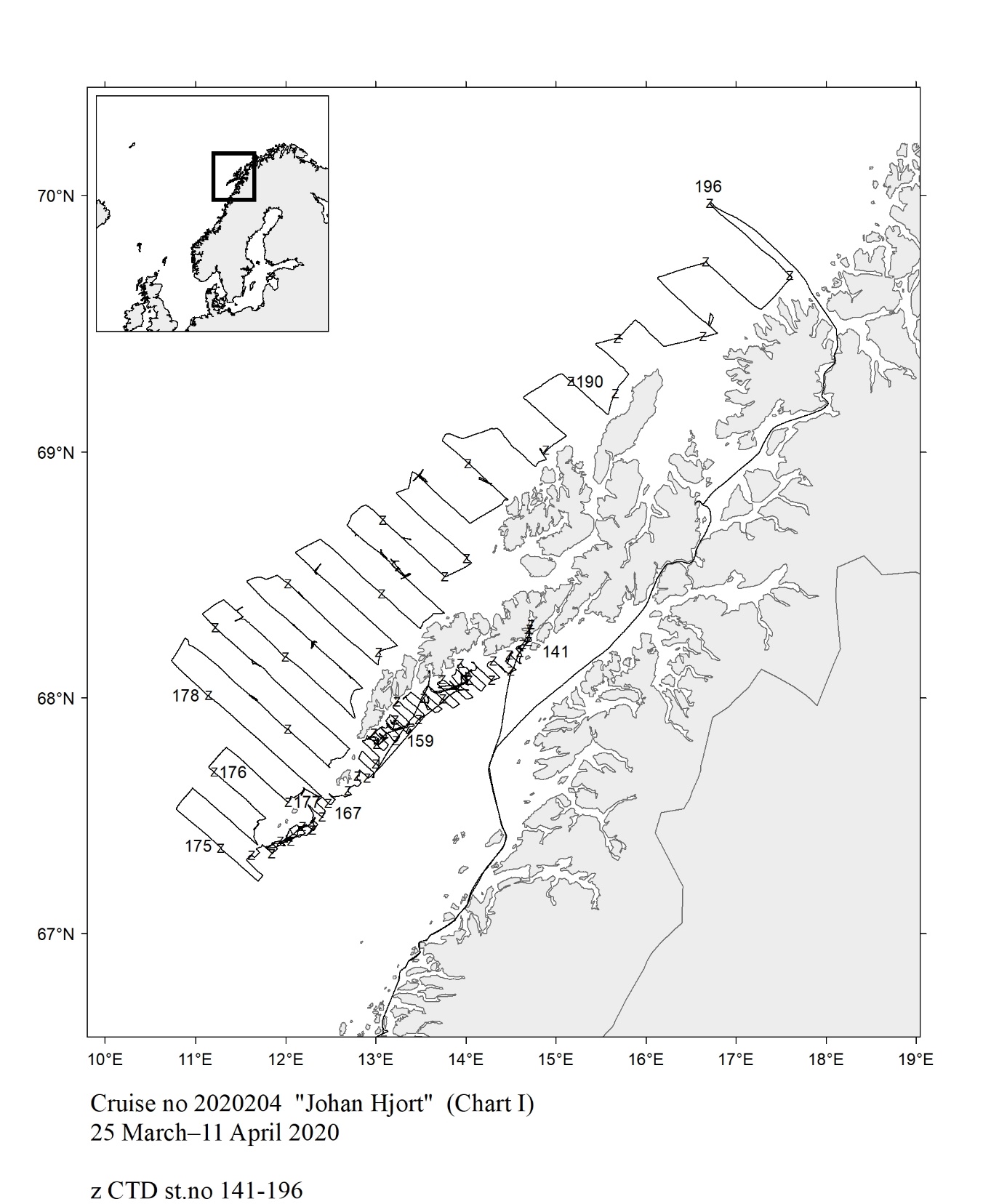 Fig. 27
 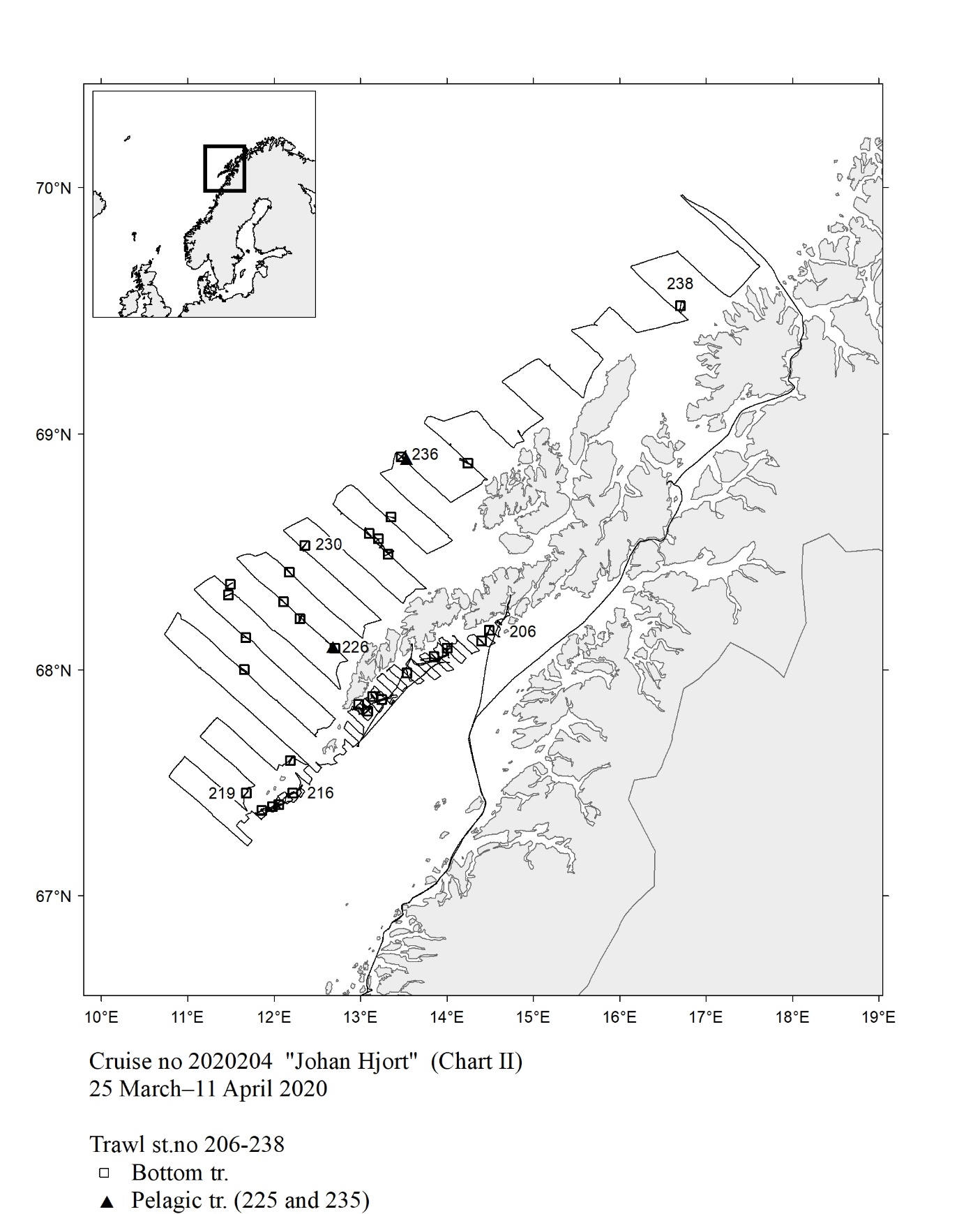 Fig.28
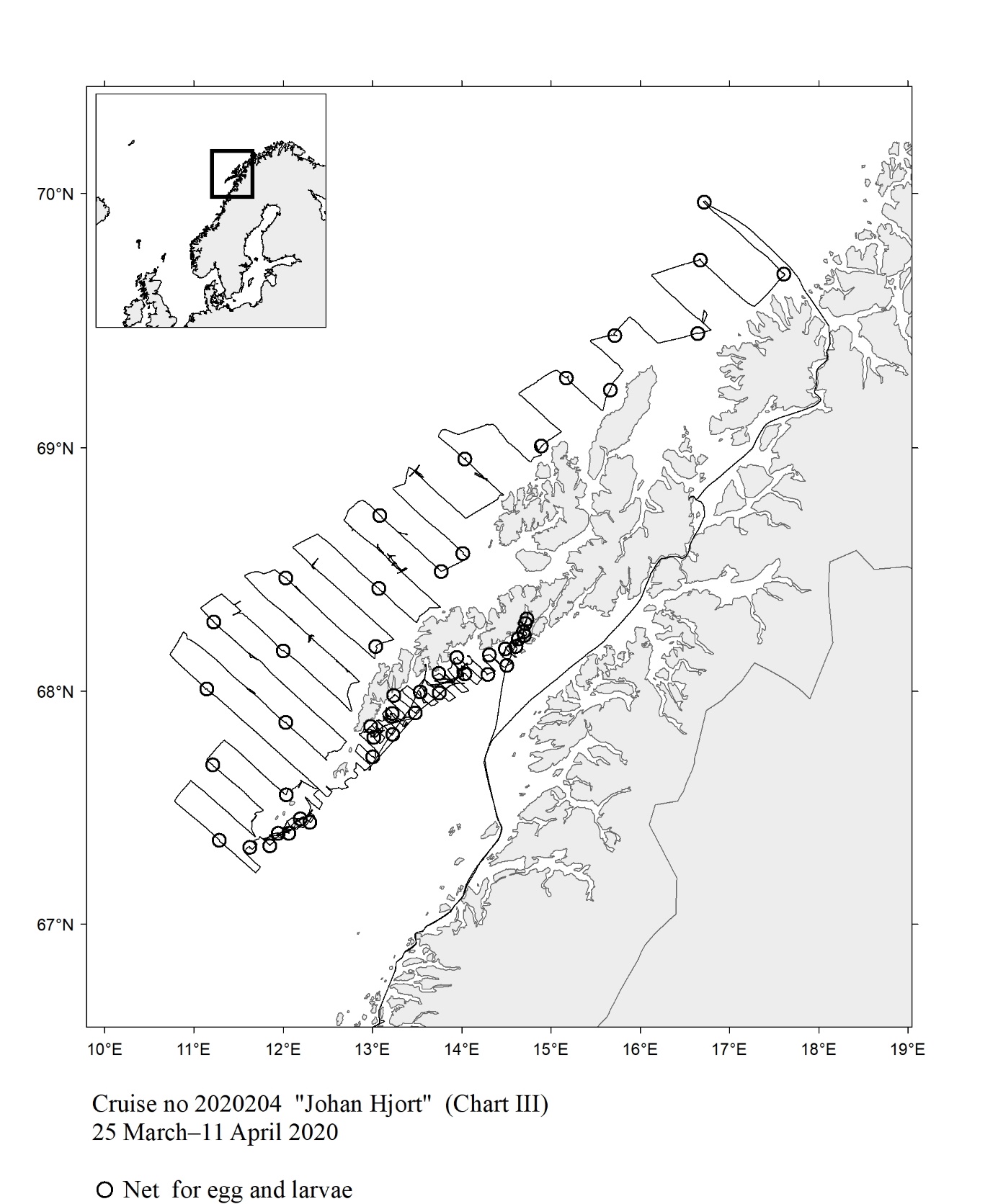 Fig.29
 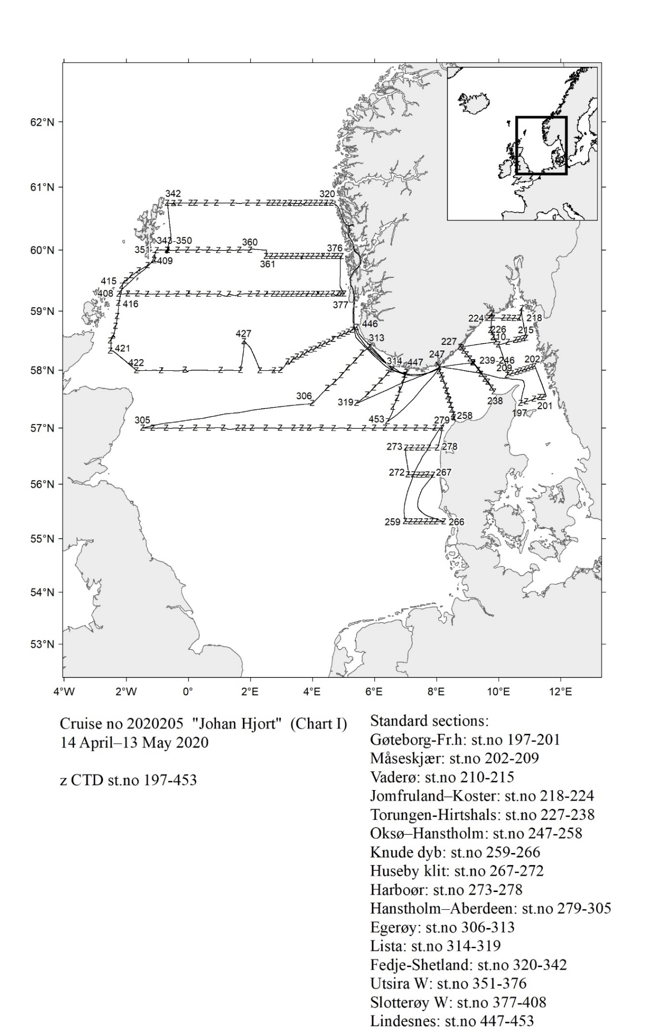 Fig.30
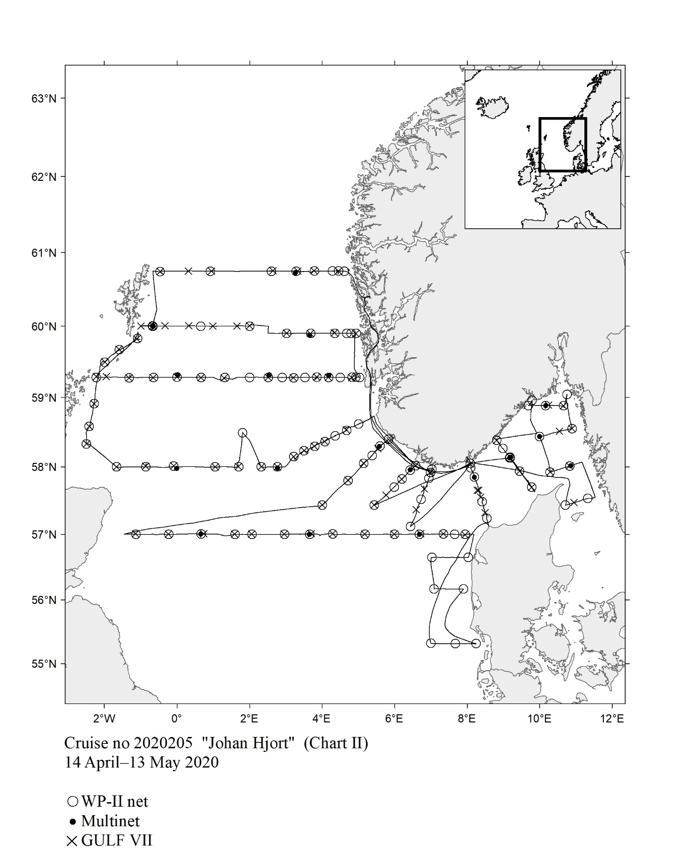 Fig.31
 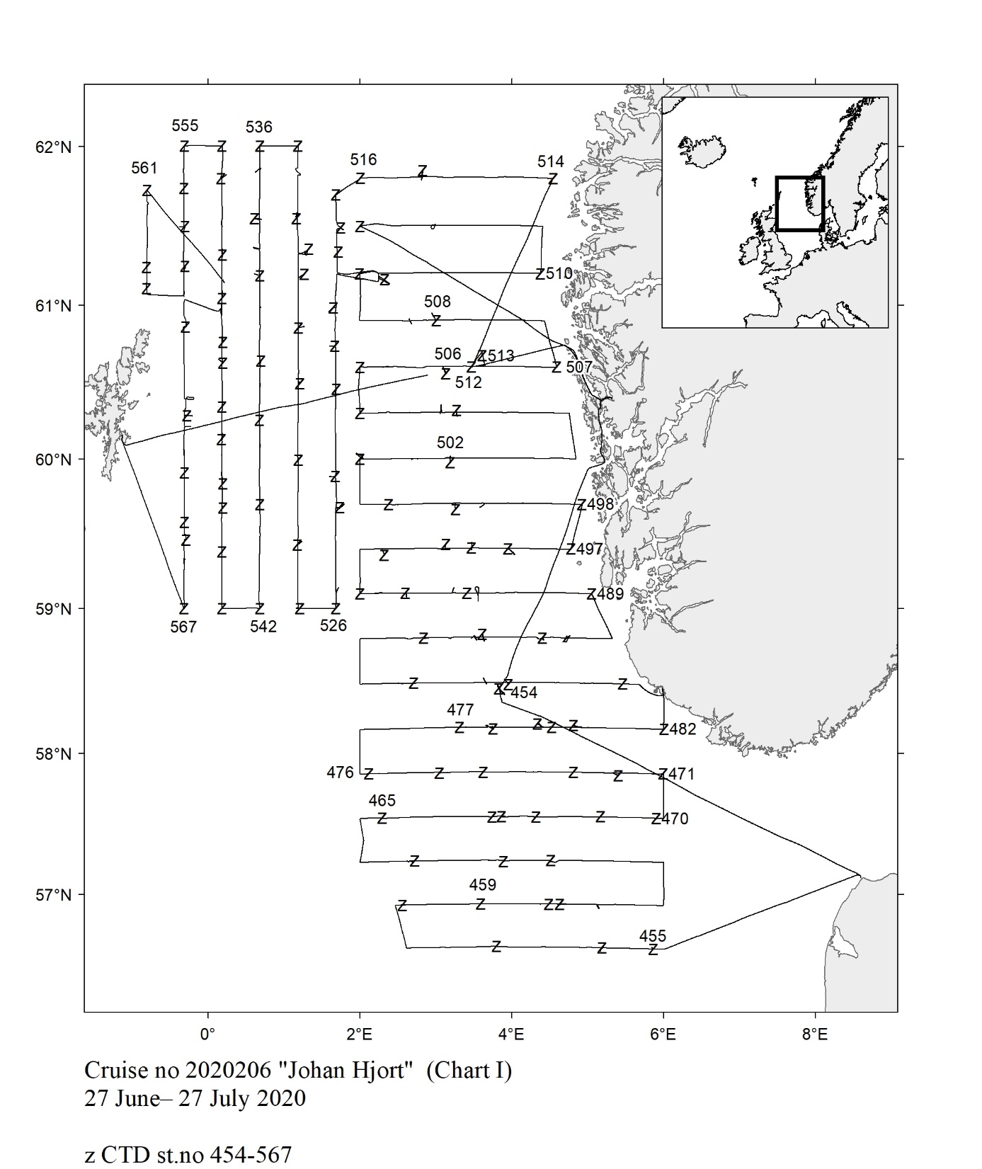 Fig. 32
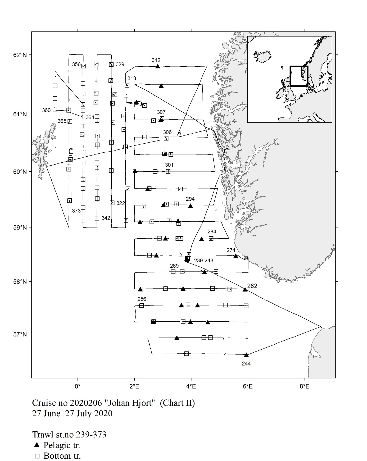 Fig.33
 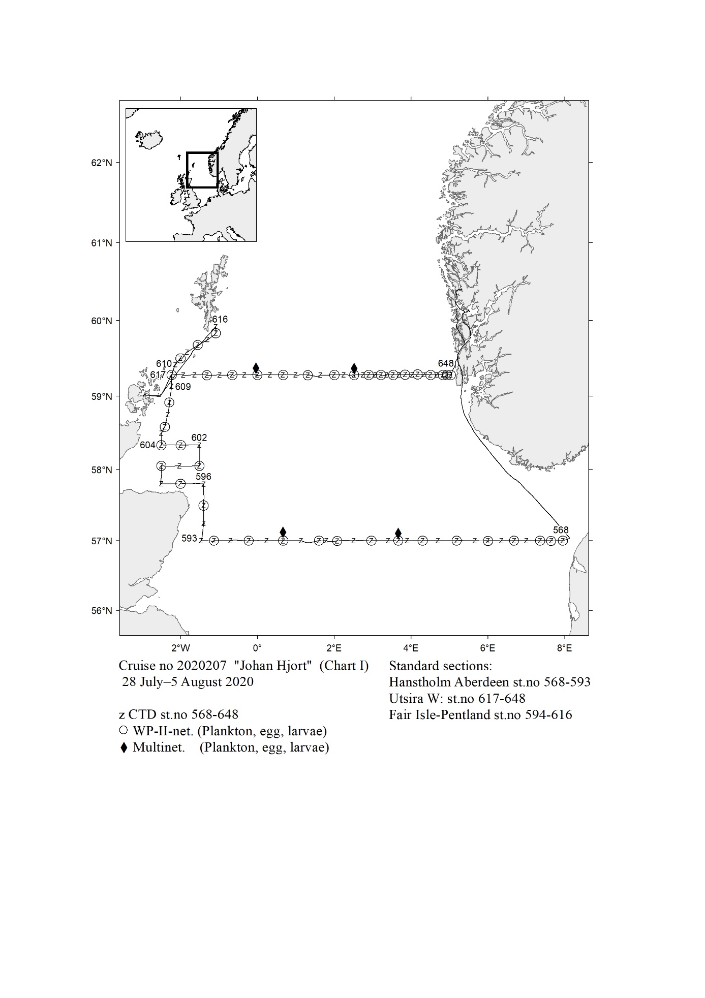 Fig.34
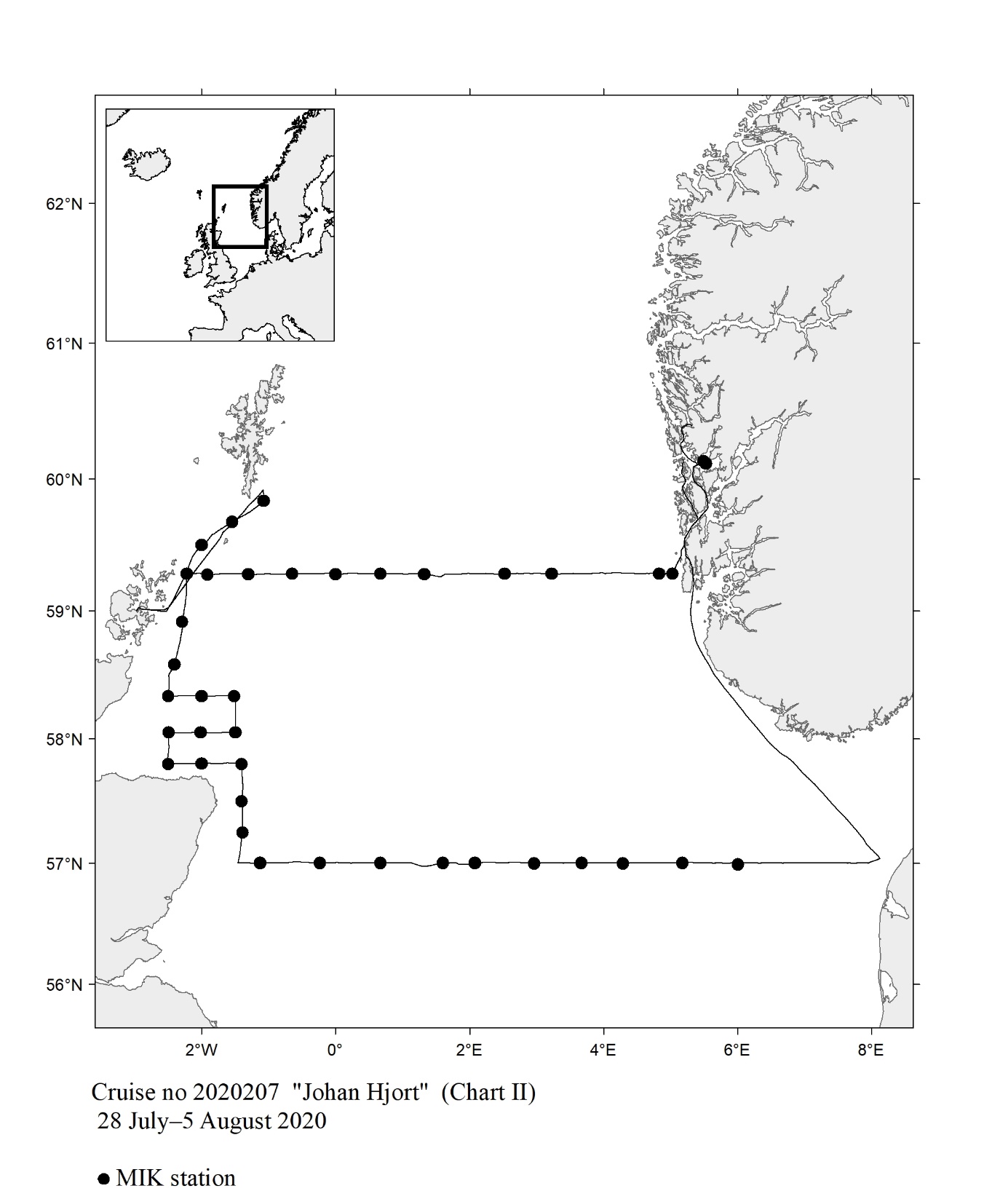 Fig.35
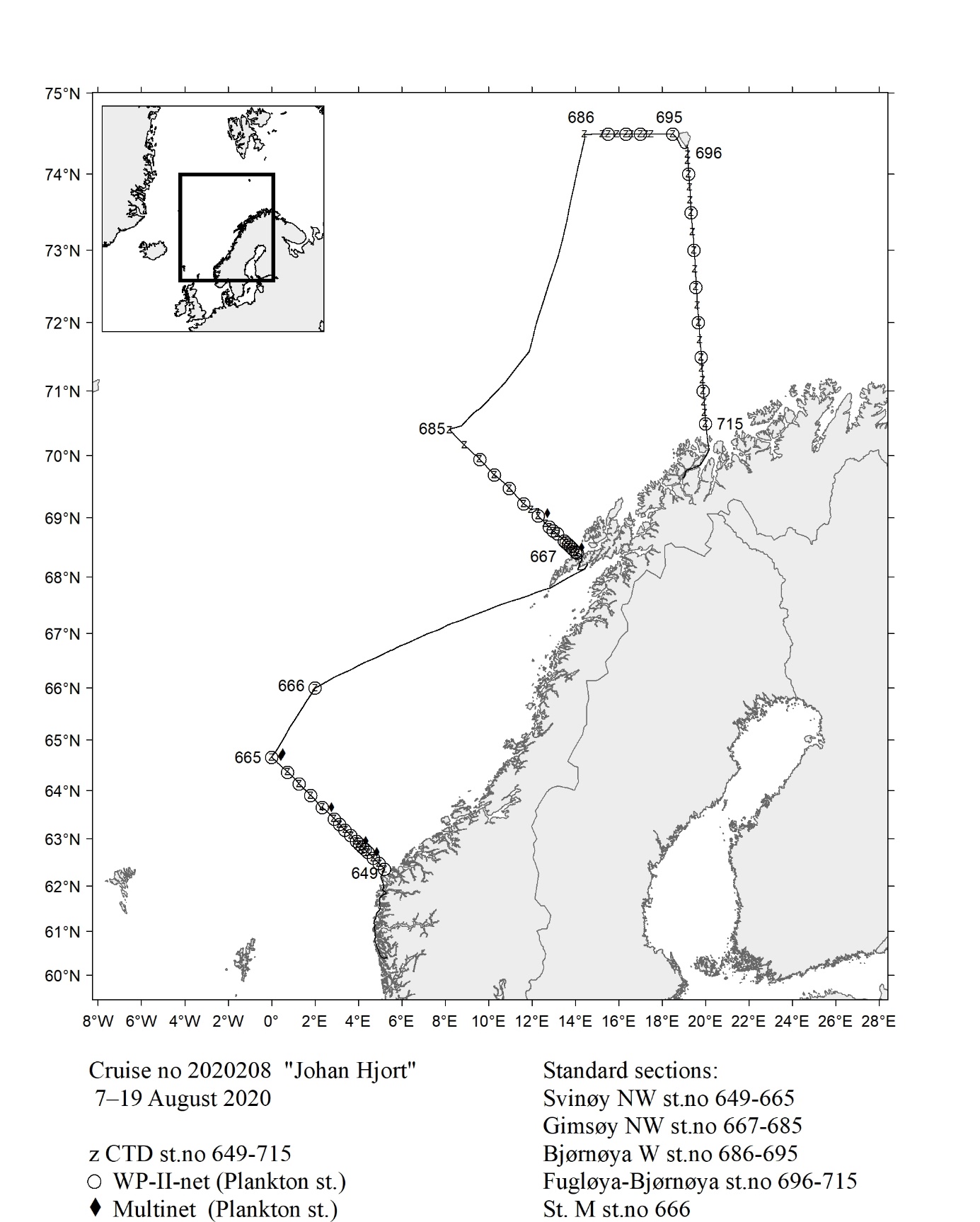 Fig.36
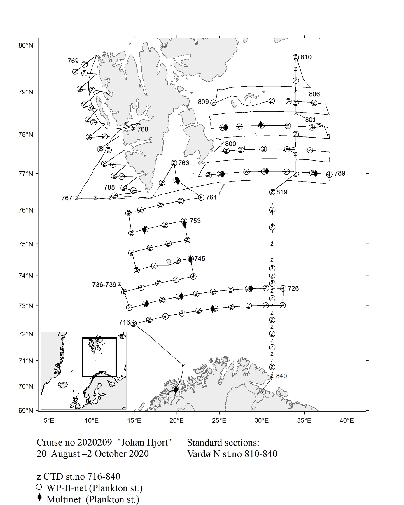 Fig.37
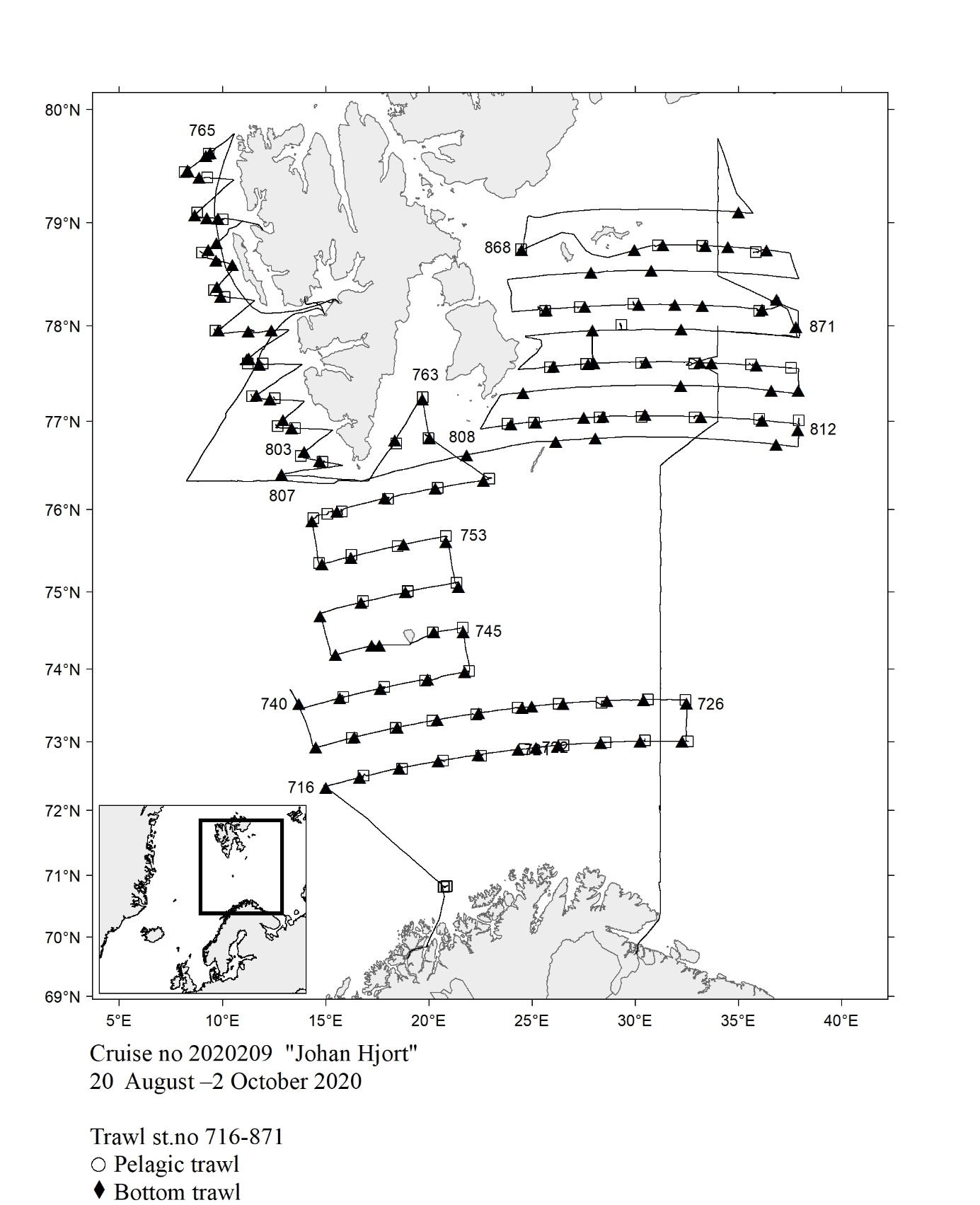 Fig. 38
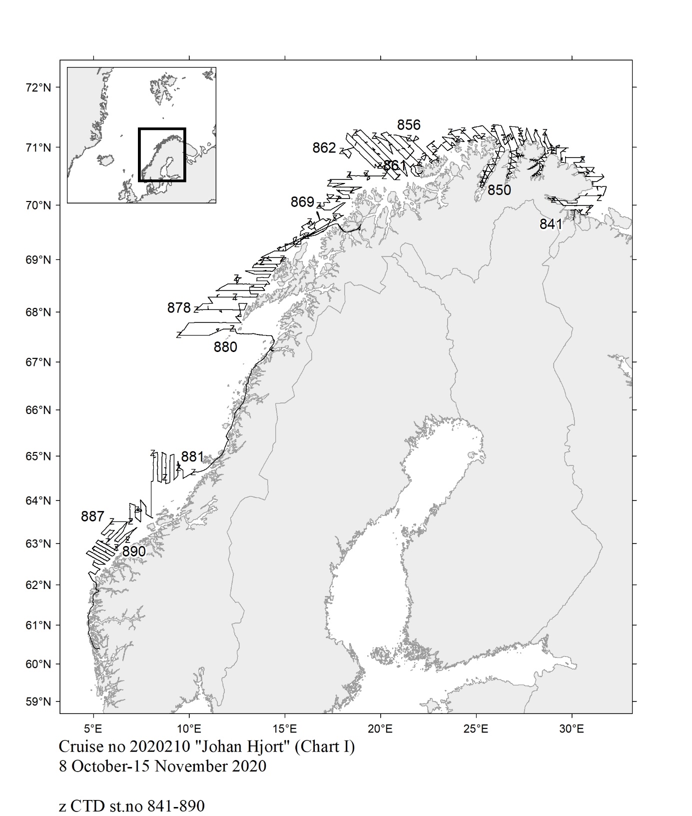 Fig.39
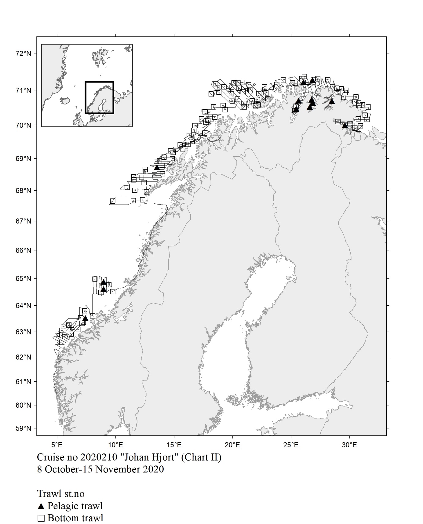 Fig.40
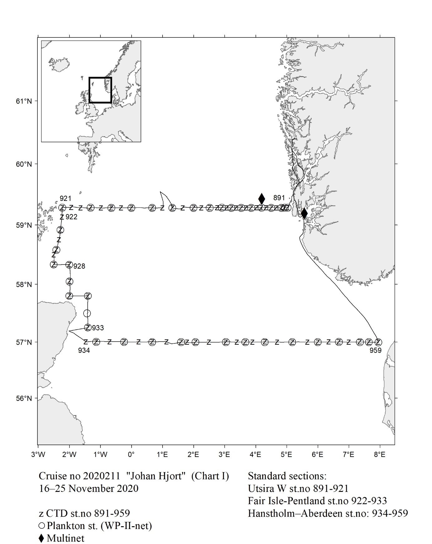 Fig.41
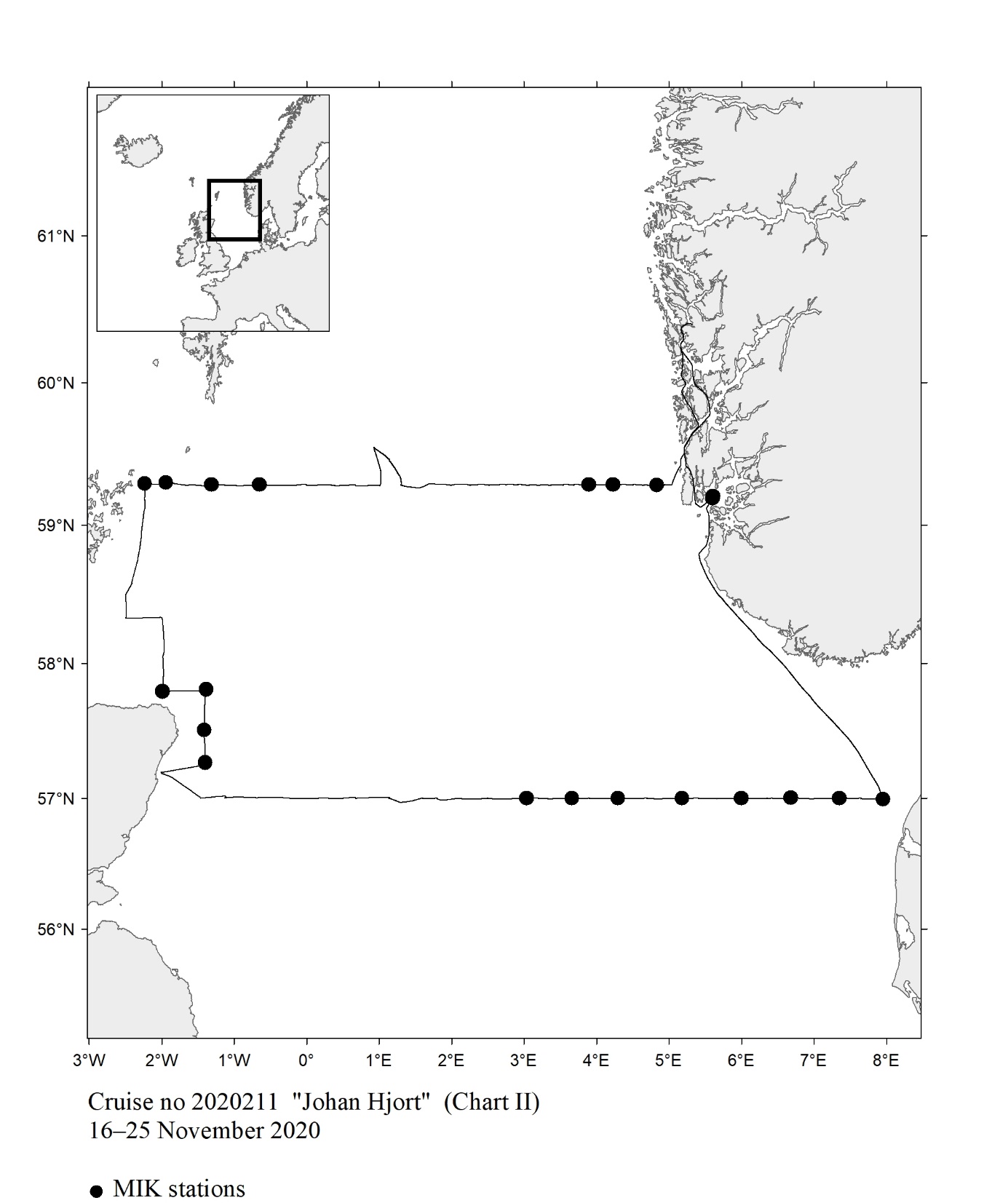 Fig.42
 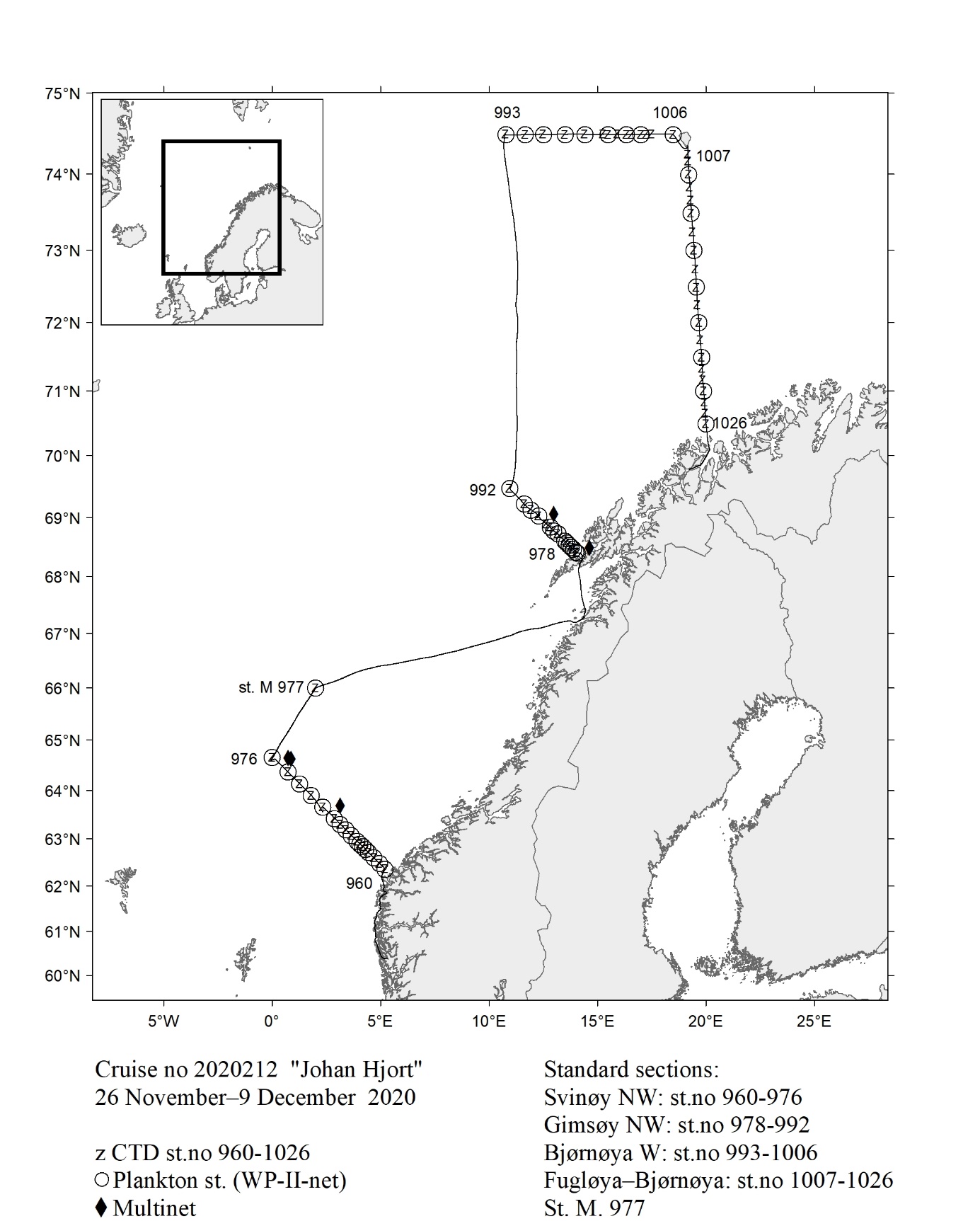 Fig.43
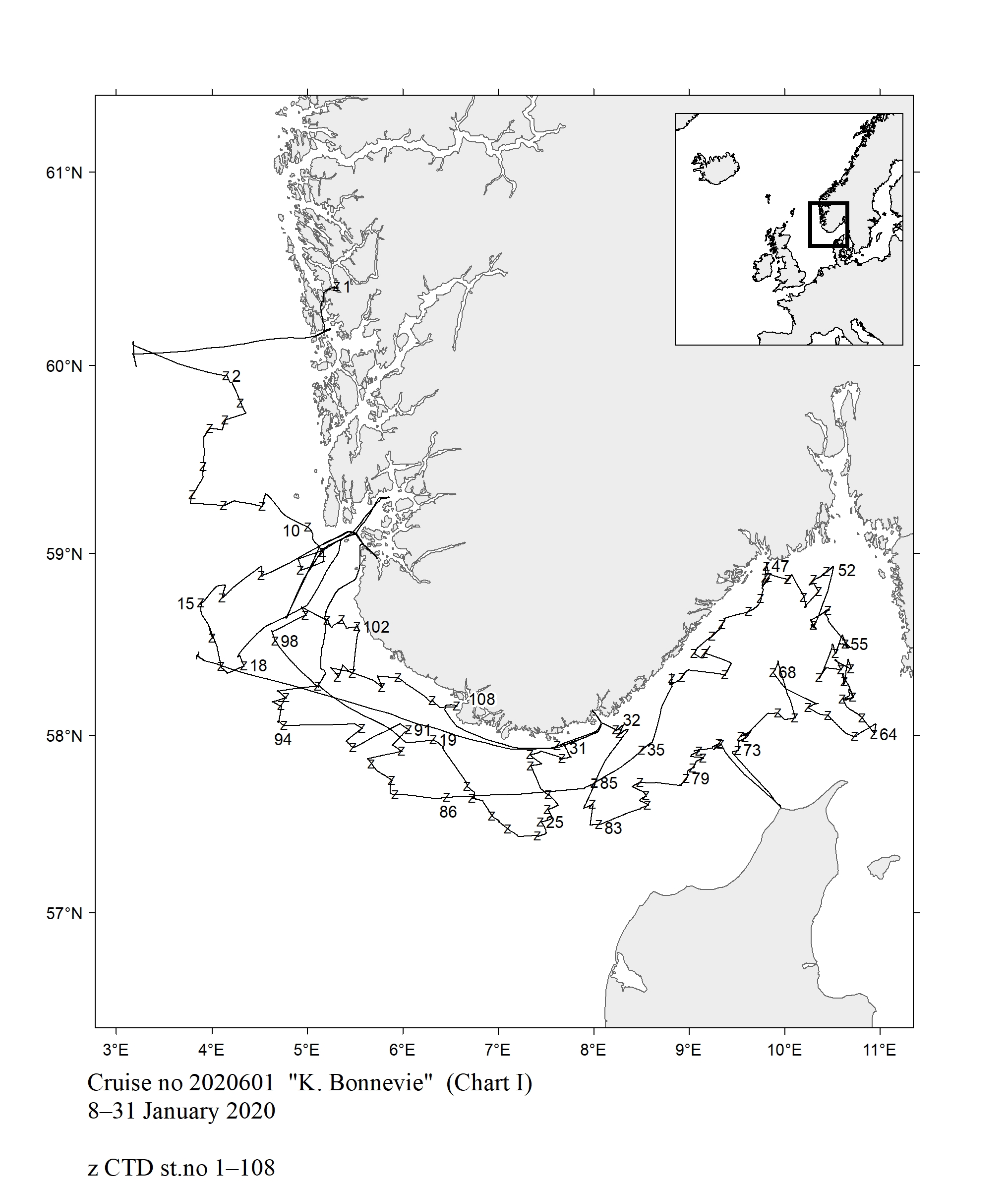 Fig.44
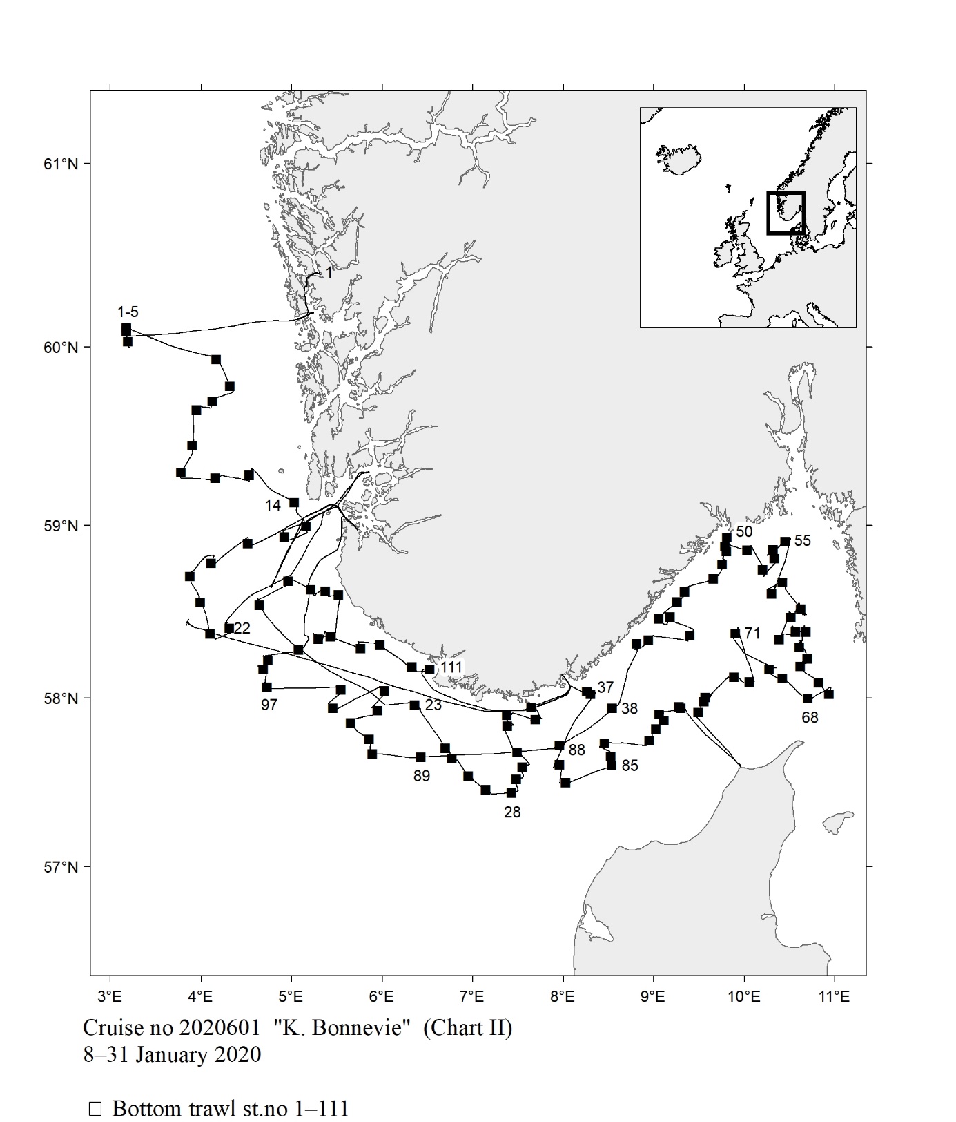 Fig. 45
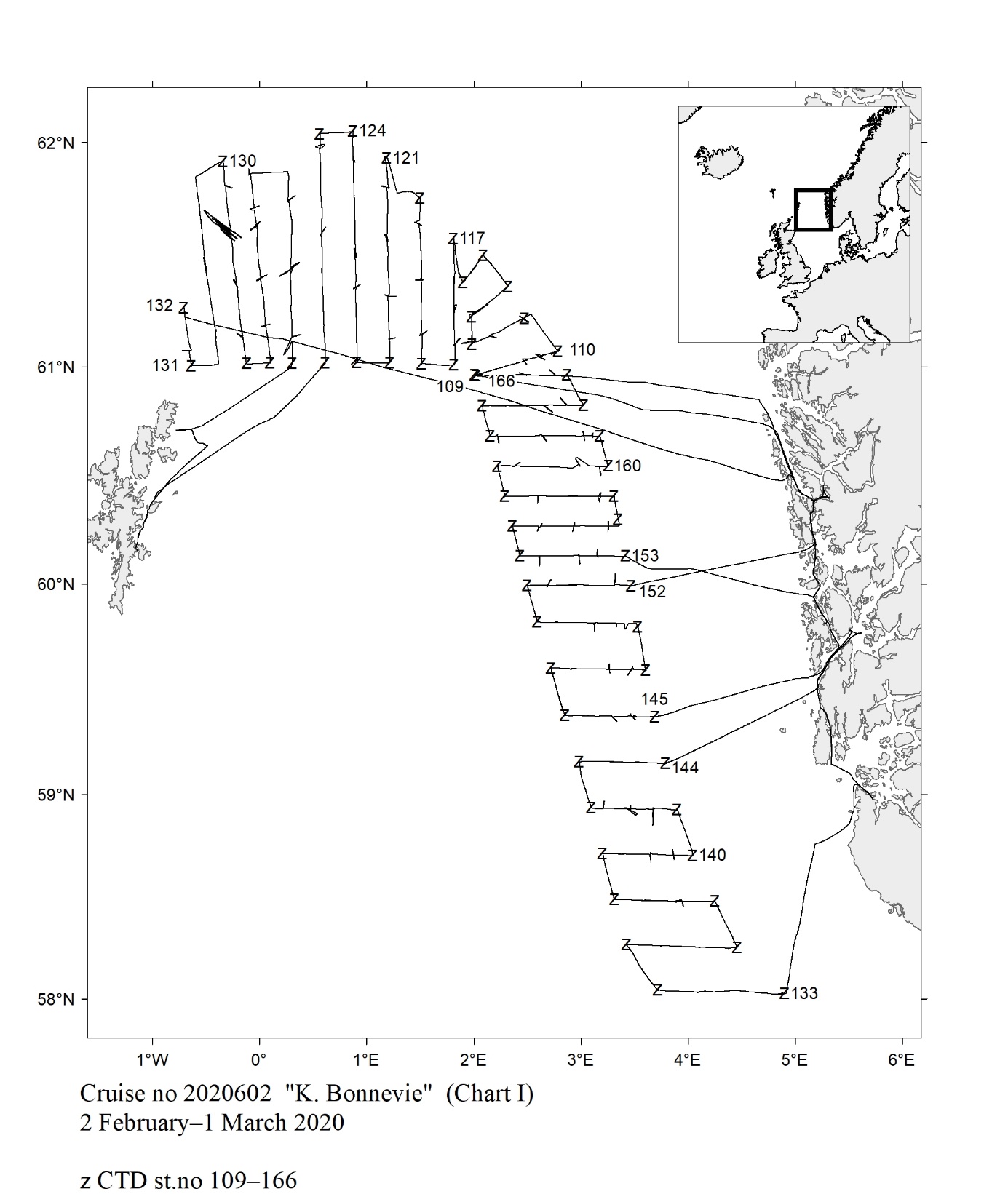 Fig. 46
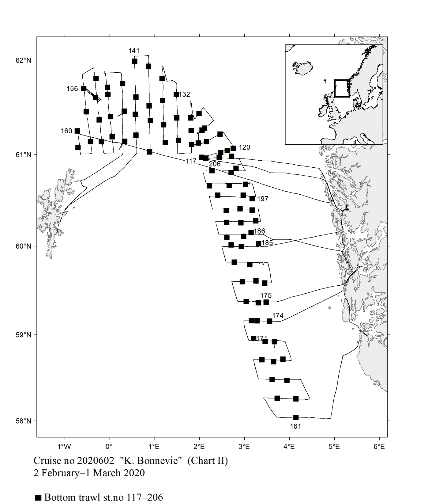 Fig. 47
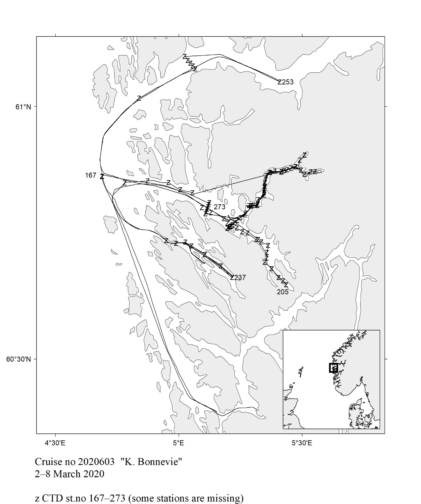 Fig. 48
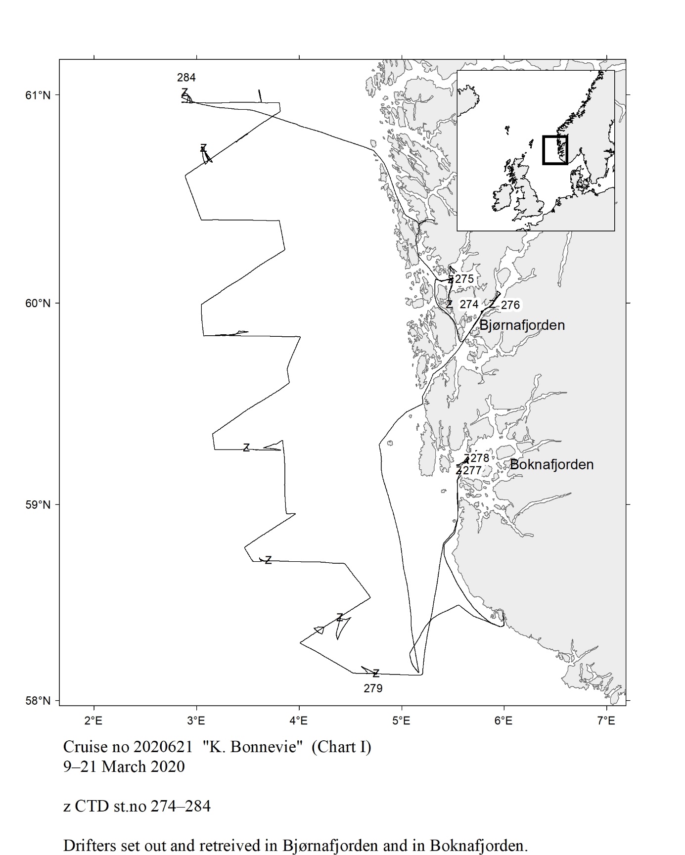 Fig. 49
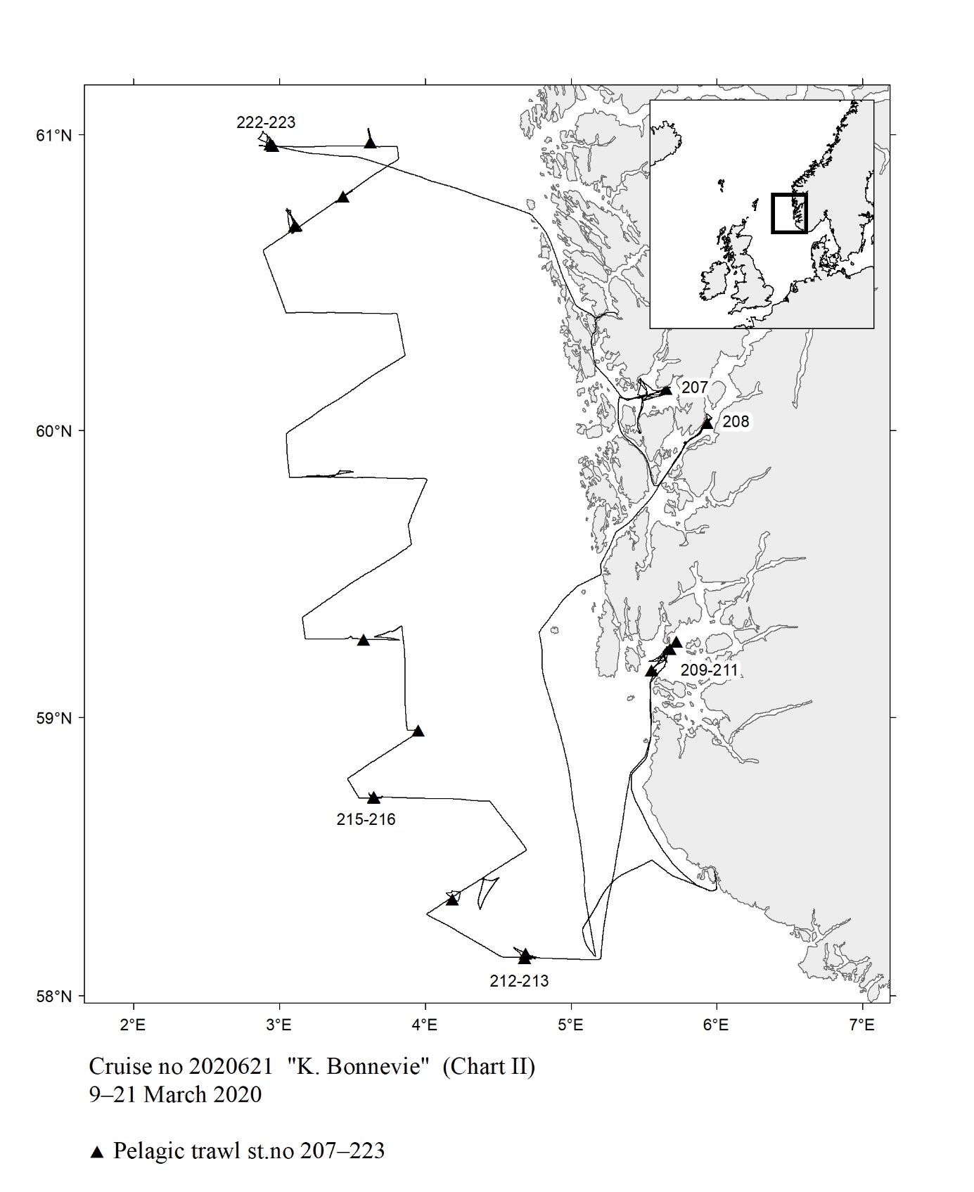 Fig. 50
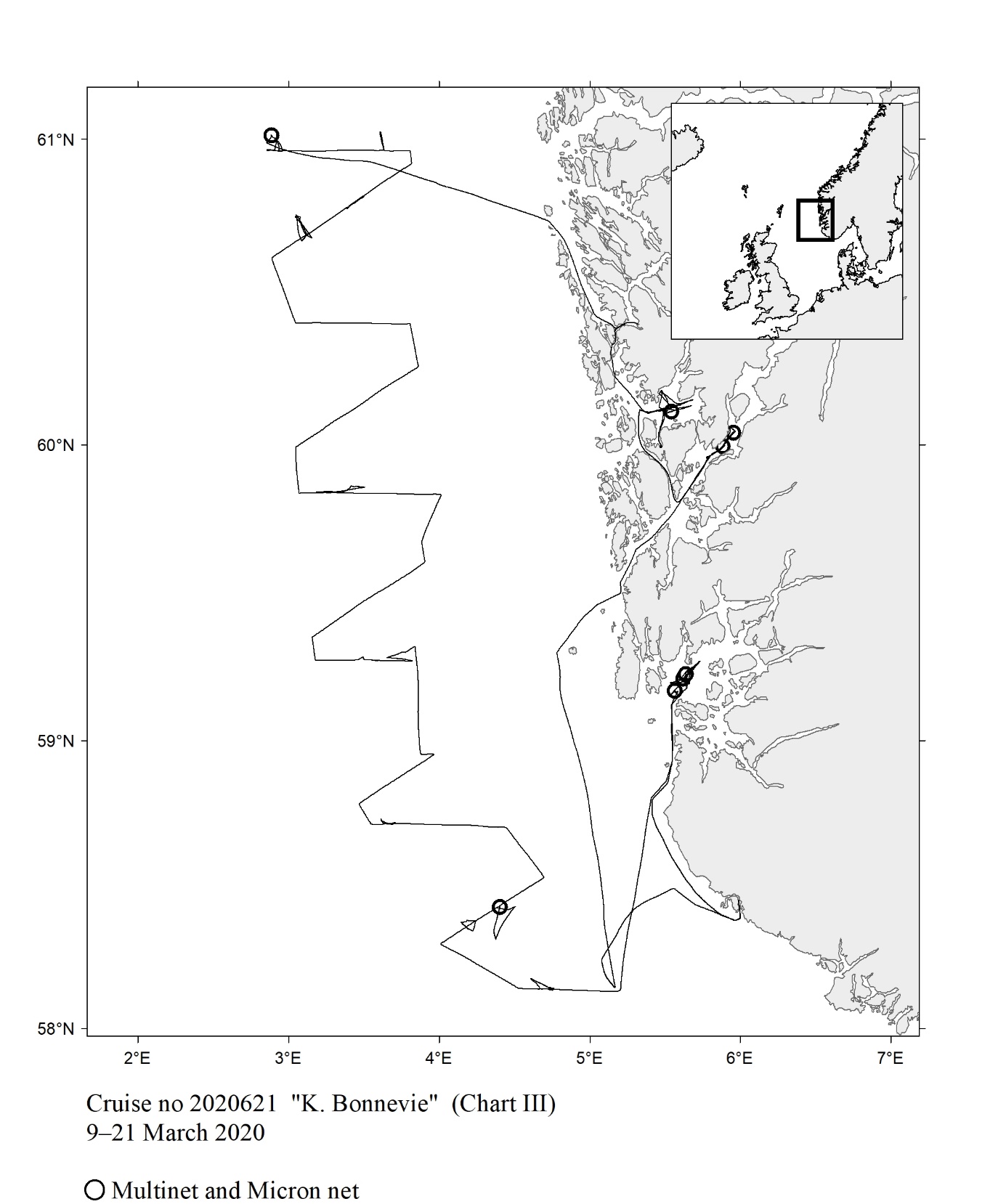 Fig. 51
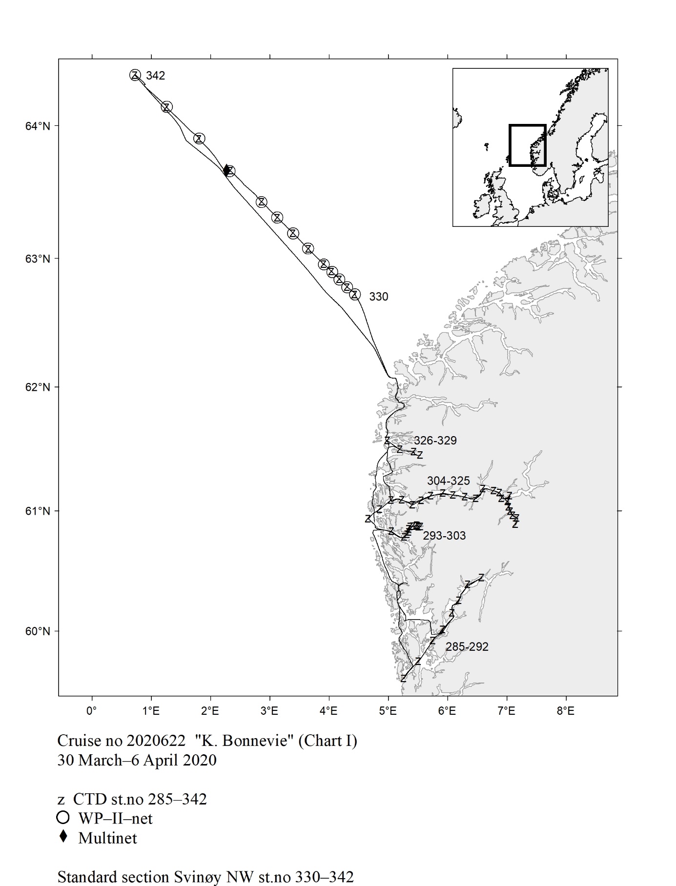 Fig. 52
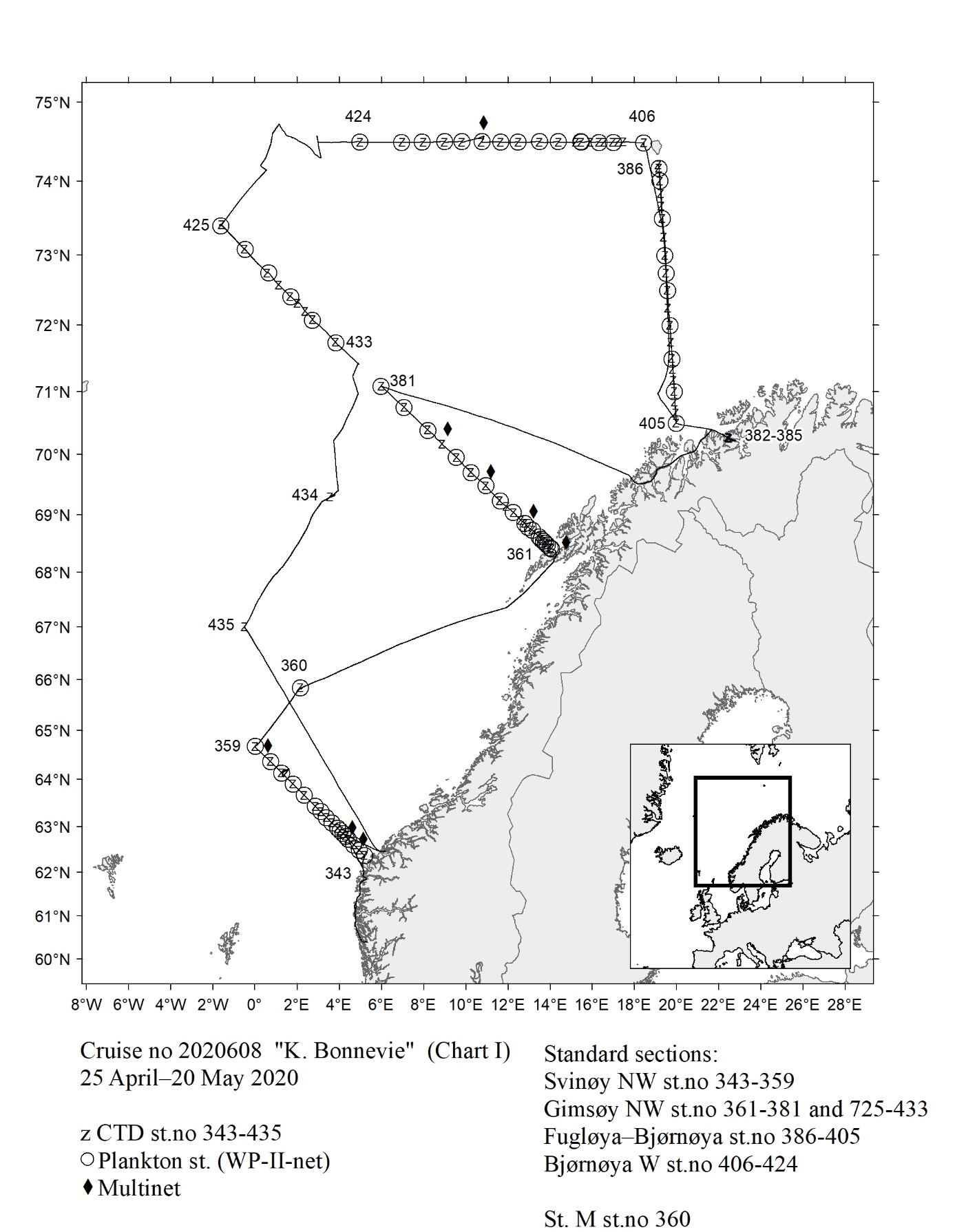 Fig. 53
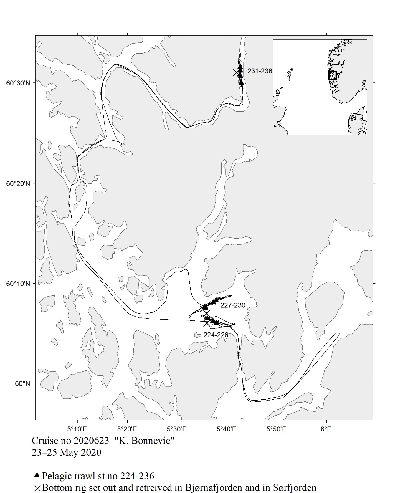 Fig. 54
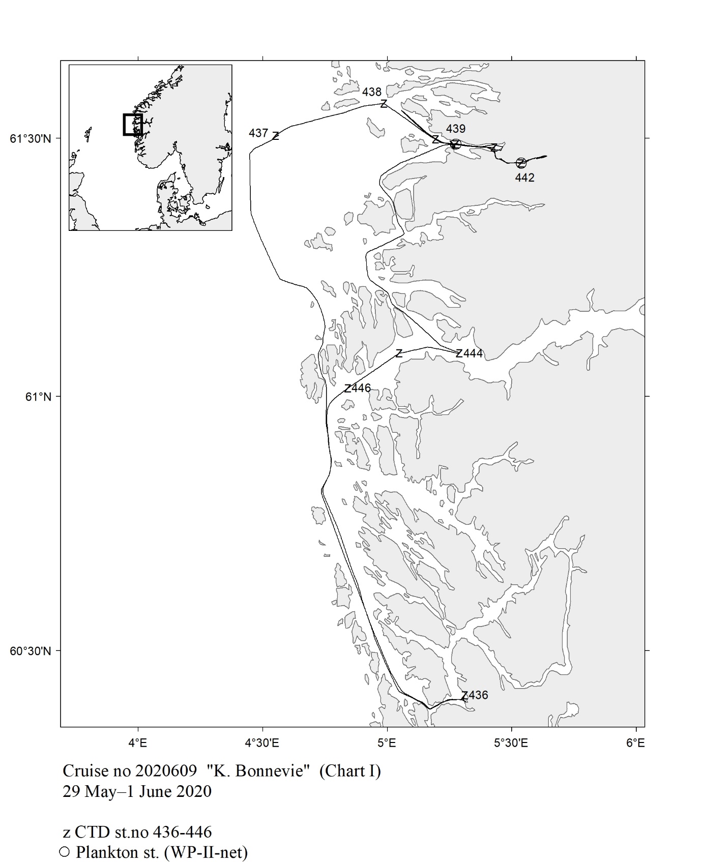 Fig. 55
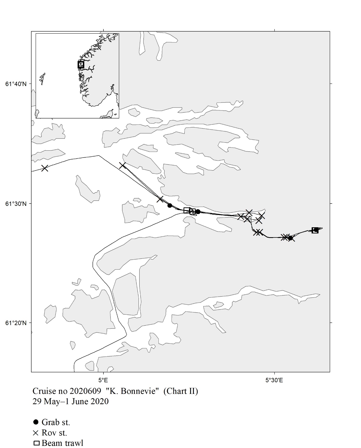 Fig. 56
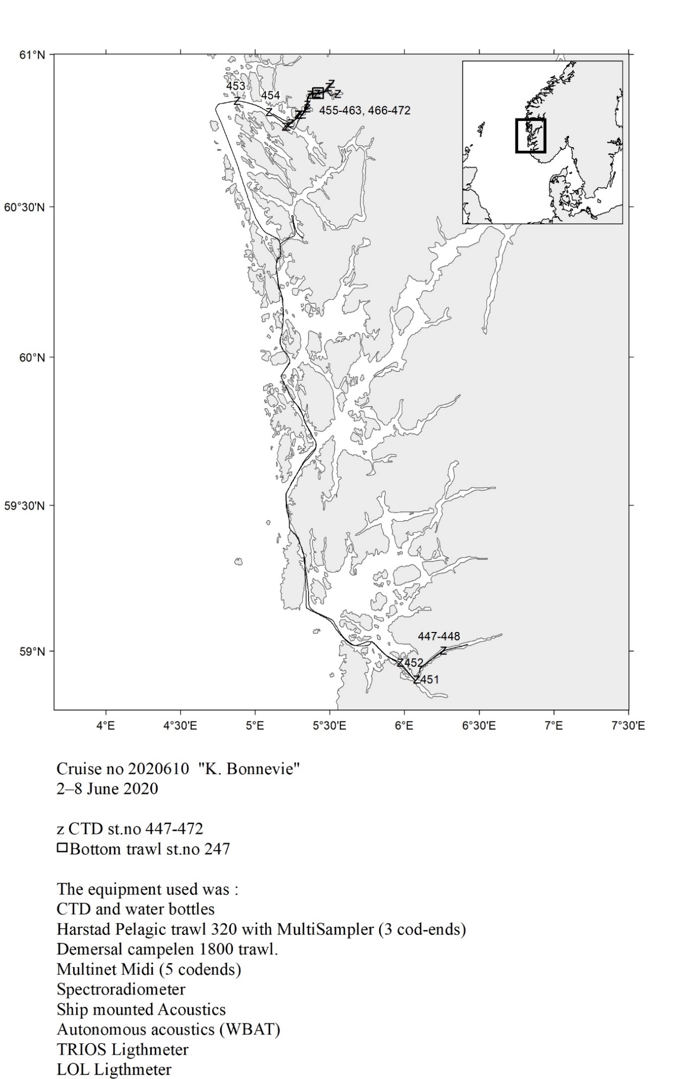
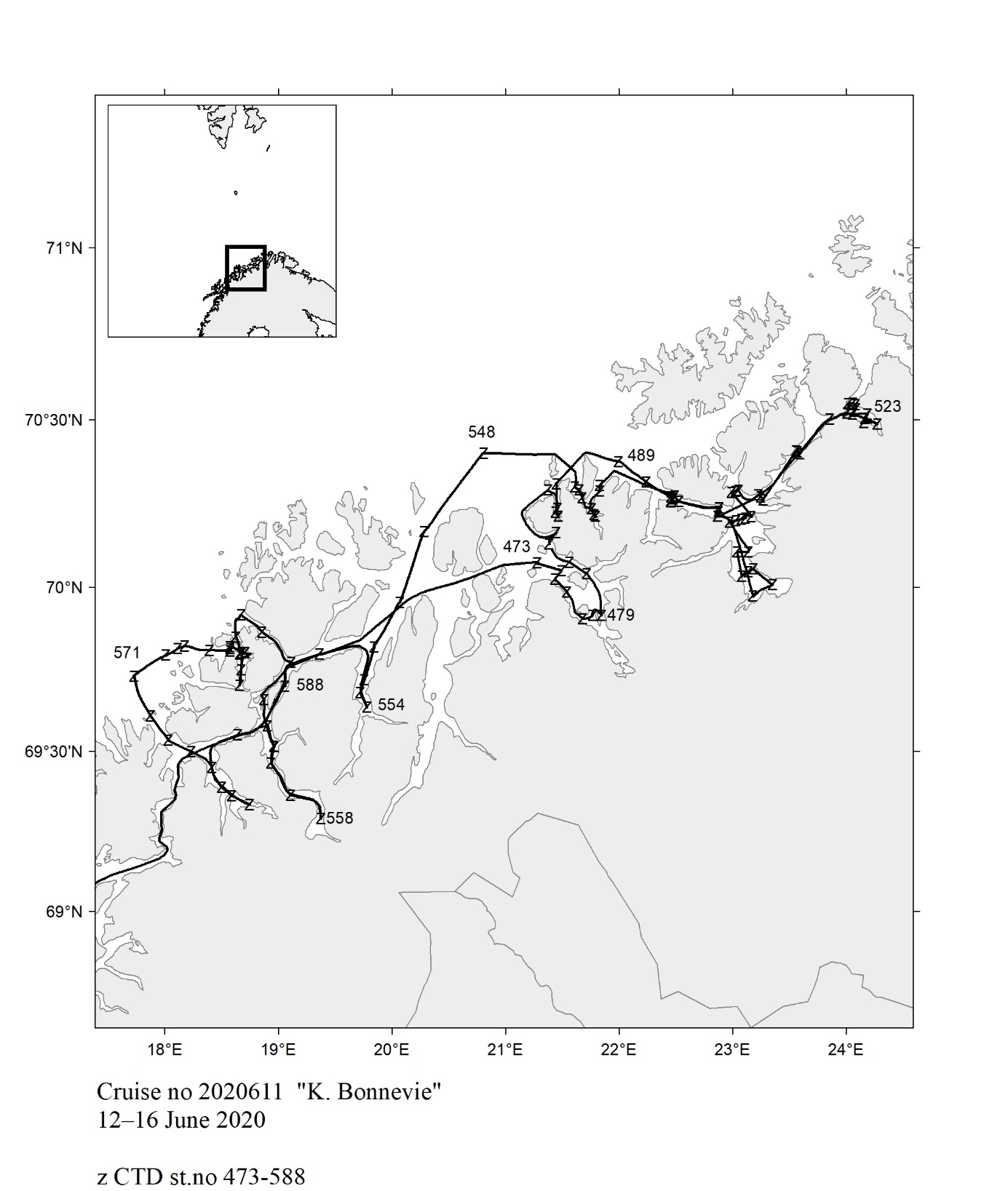 Fig. 58
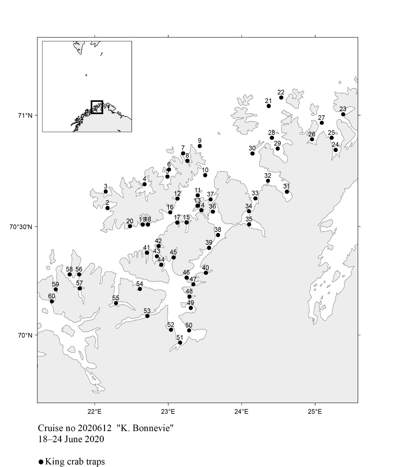 Fig. 59
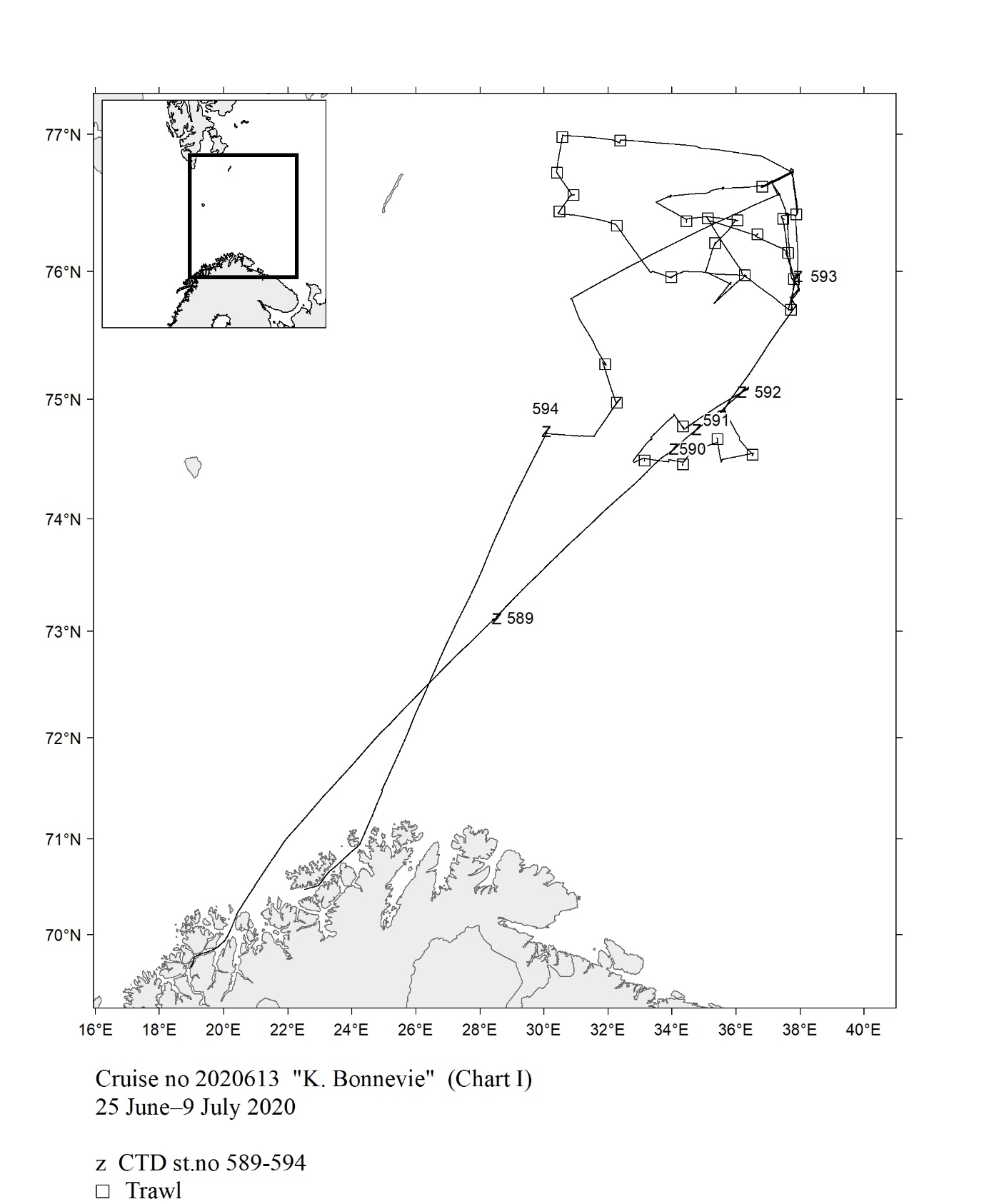 Fig. 60
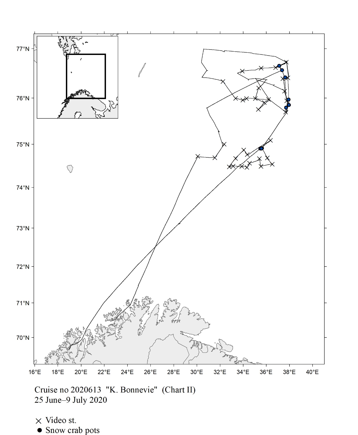 Fig 61
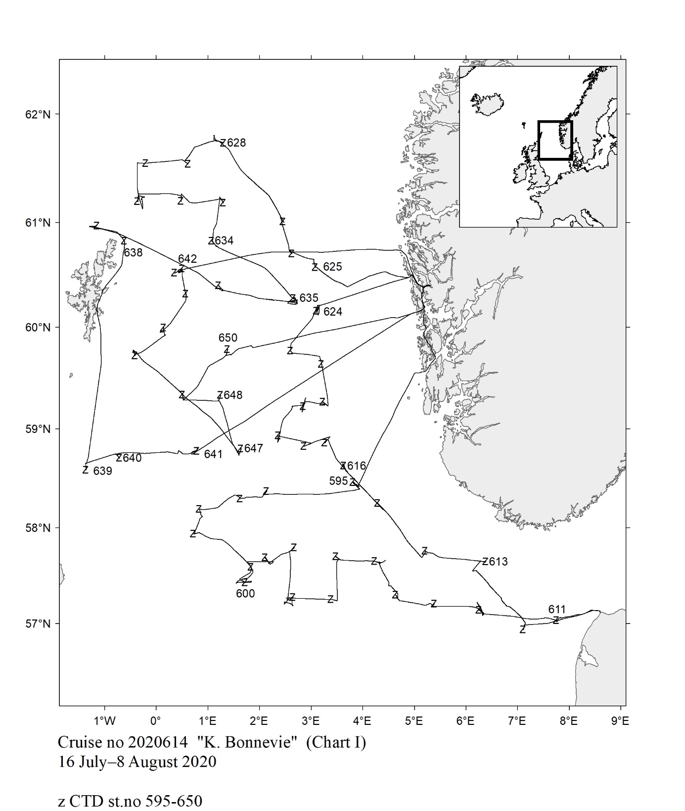 Fig. 62
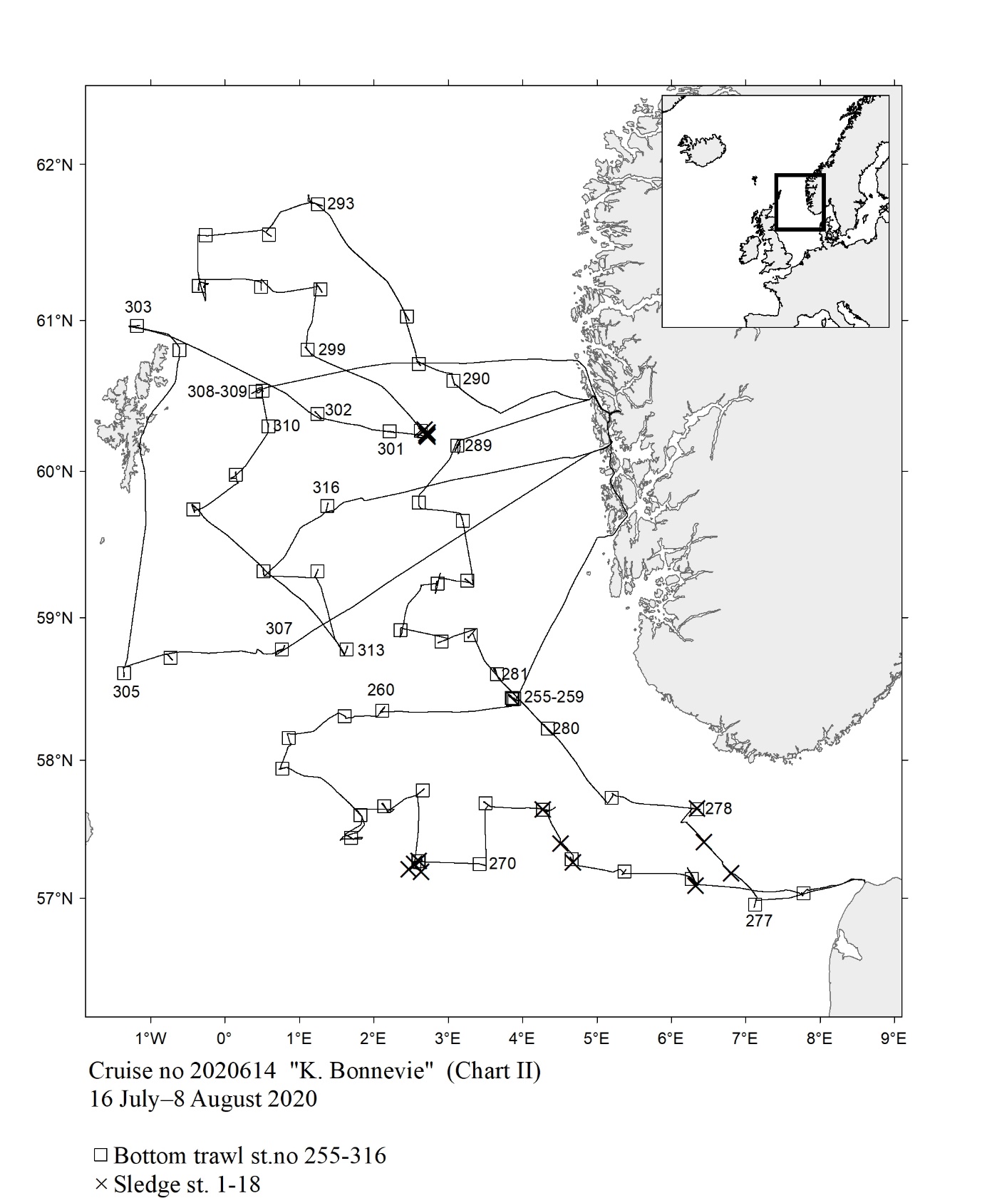 Fig. 63
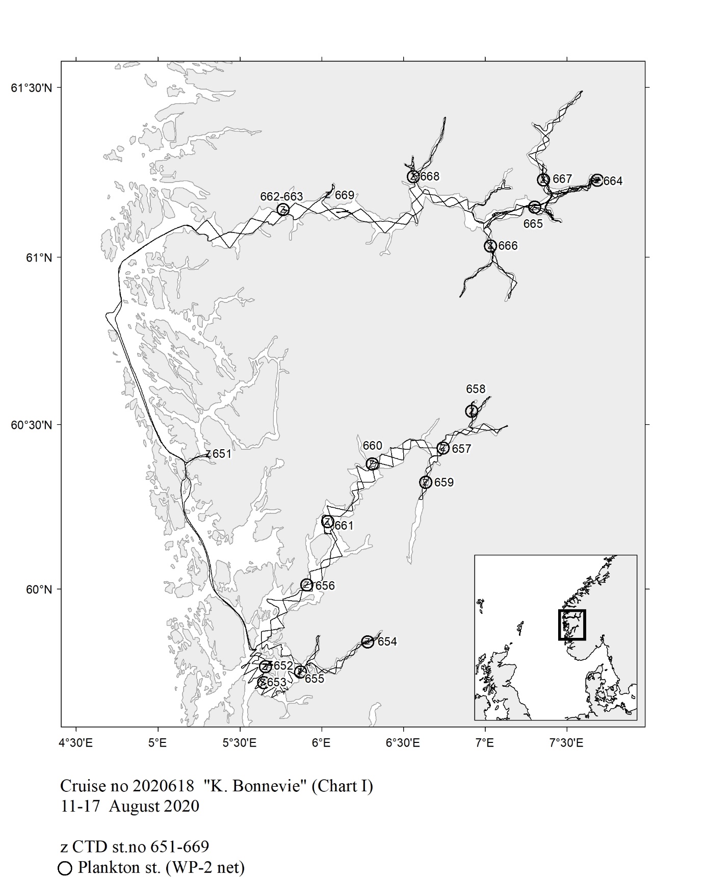 Fig. 64
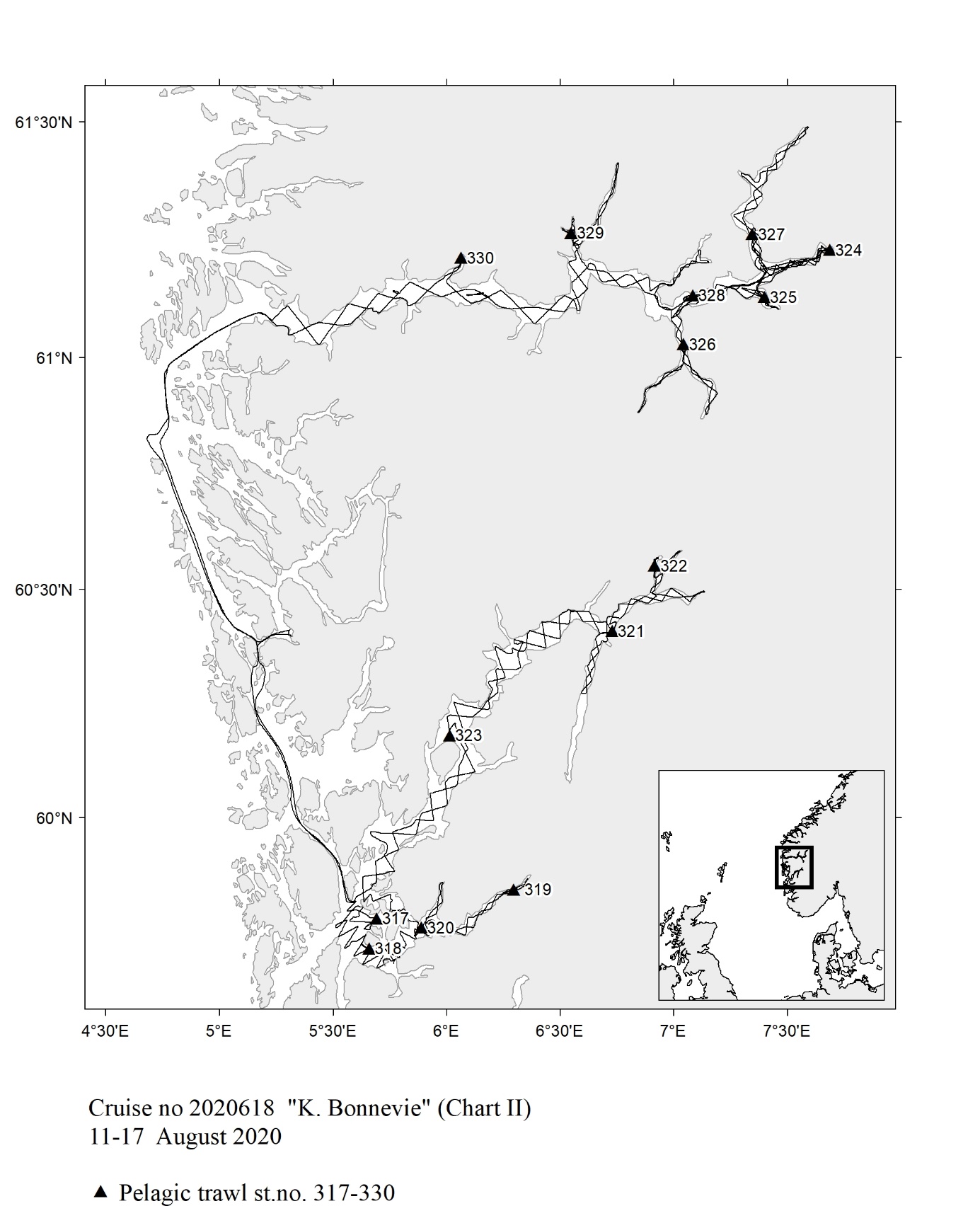 Fig. 65
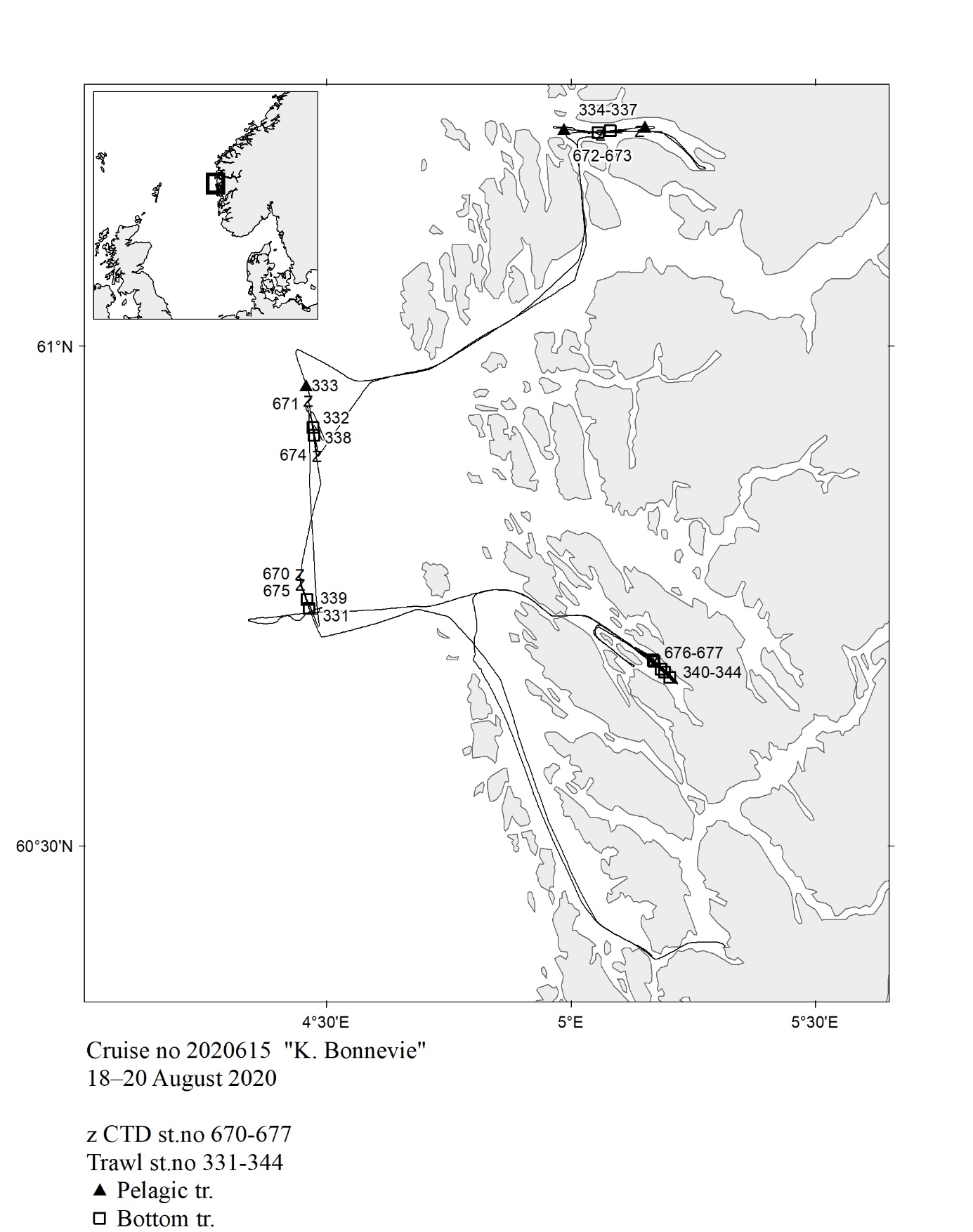 Fig. 66
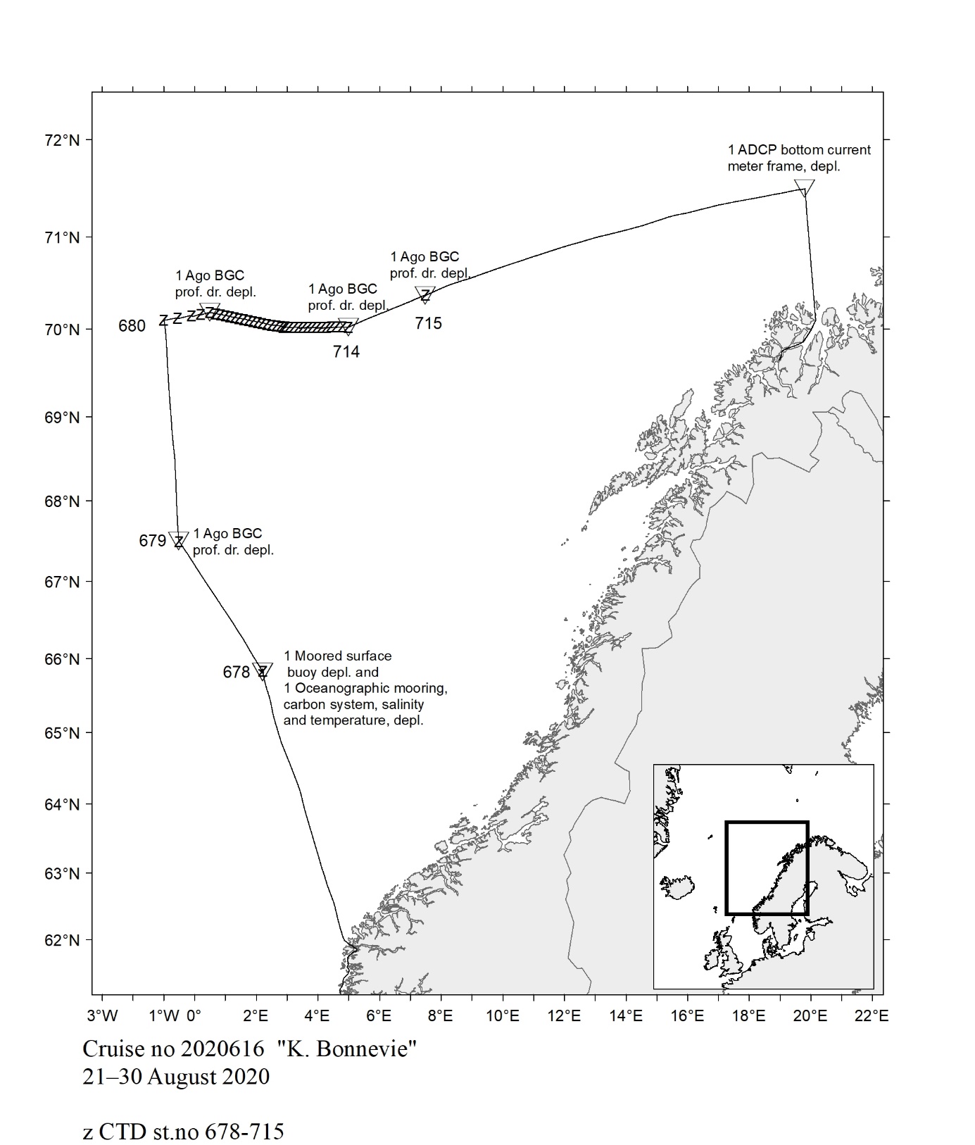 Fig. 67
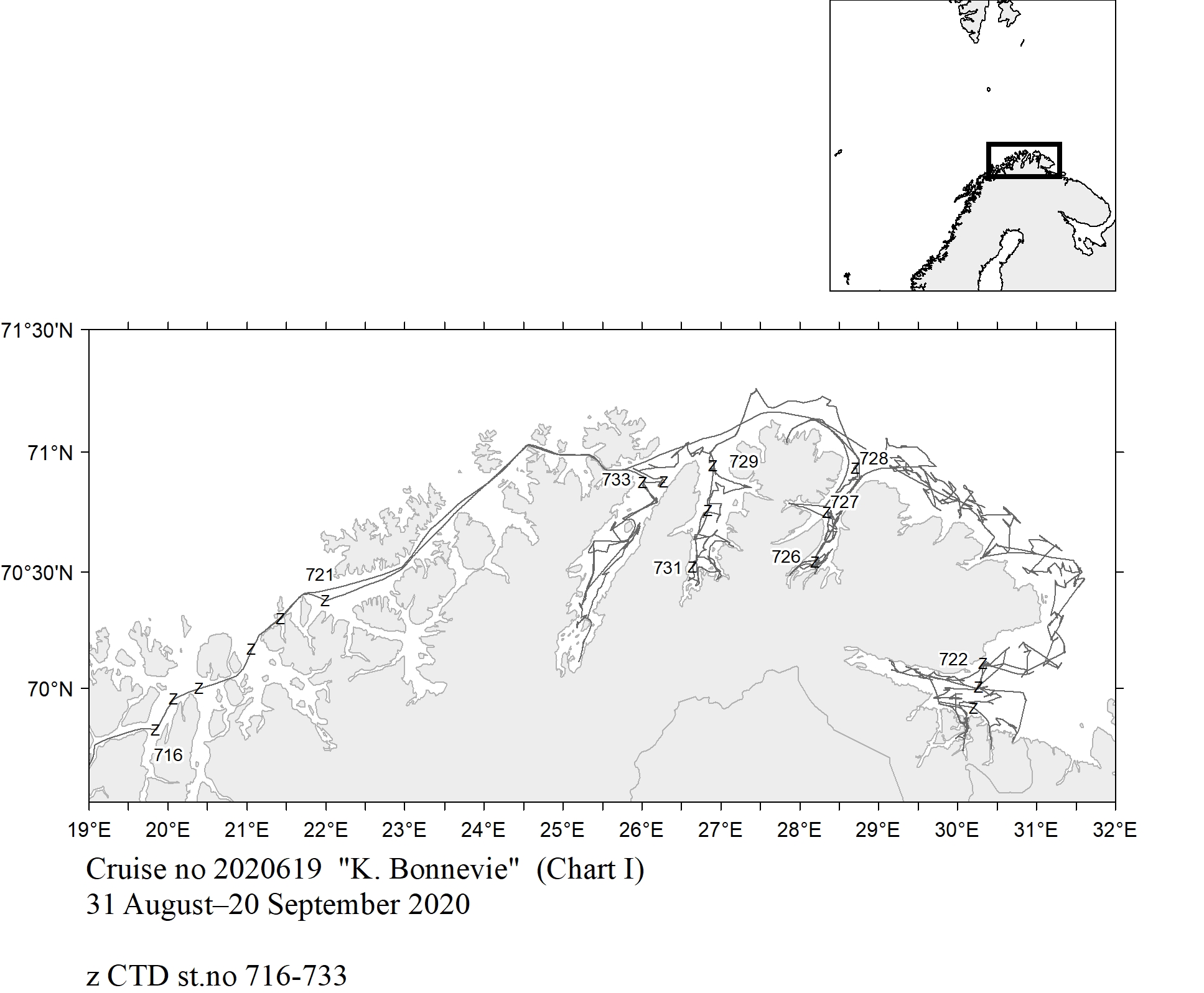 Fig. 68
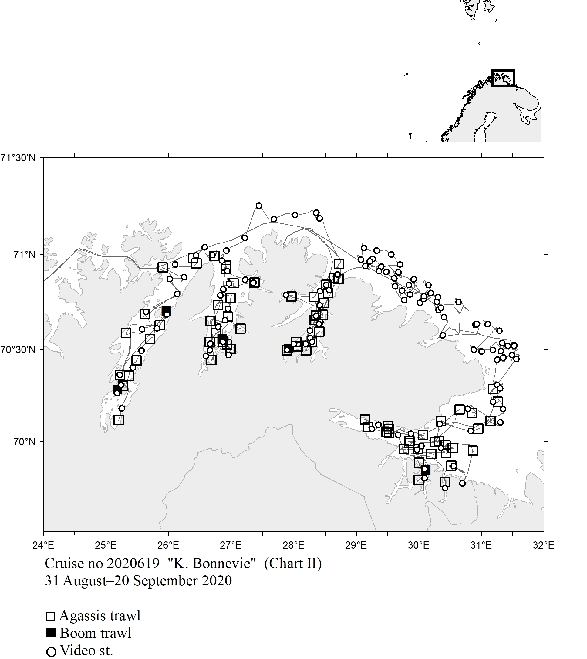 Fig. 69
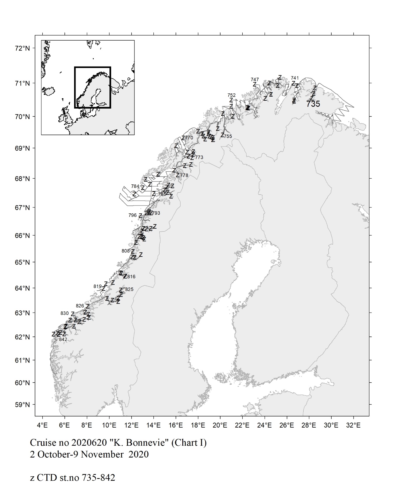 Fig. 70
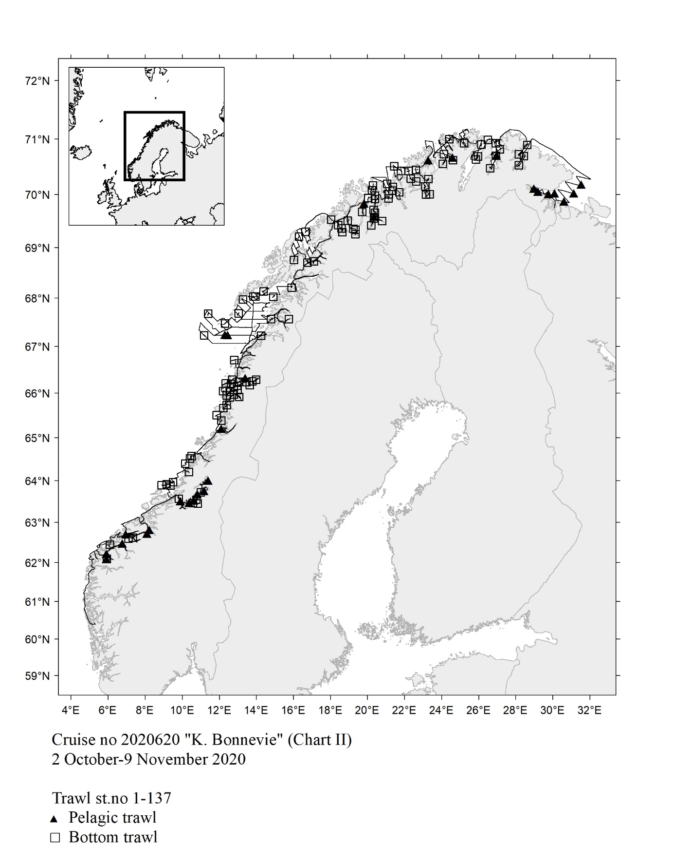 Fig. 71
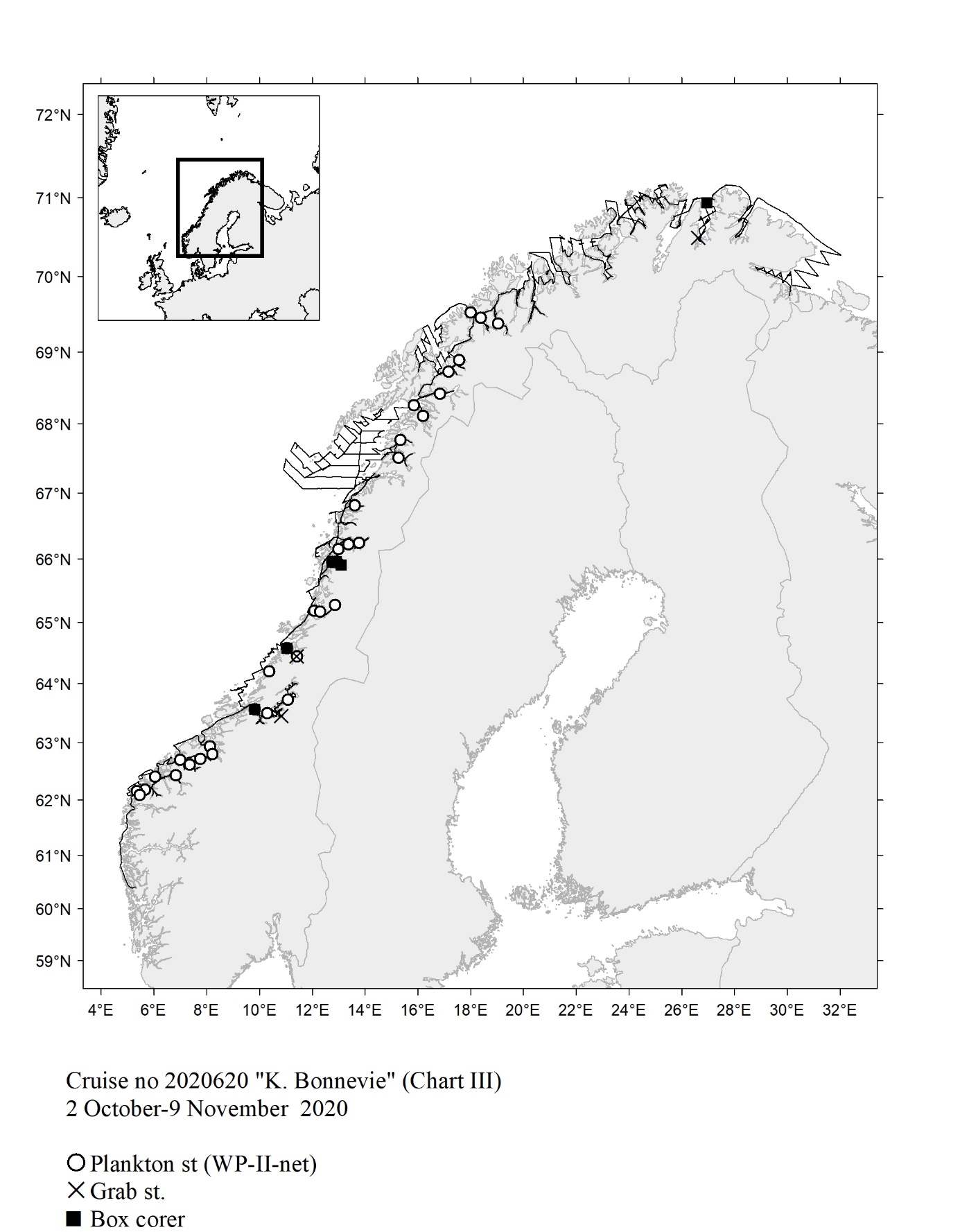 Fig. 72