Wild salmon’s wild journey in the ocean
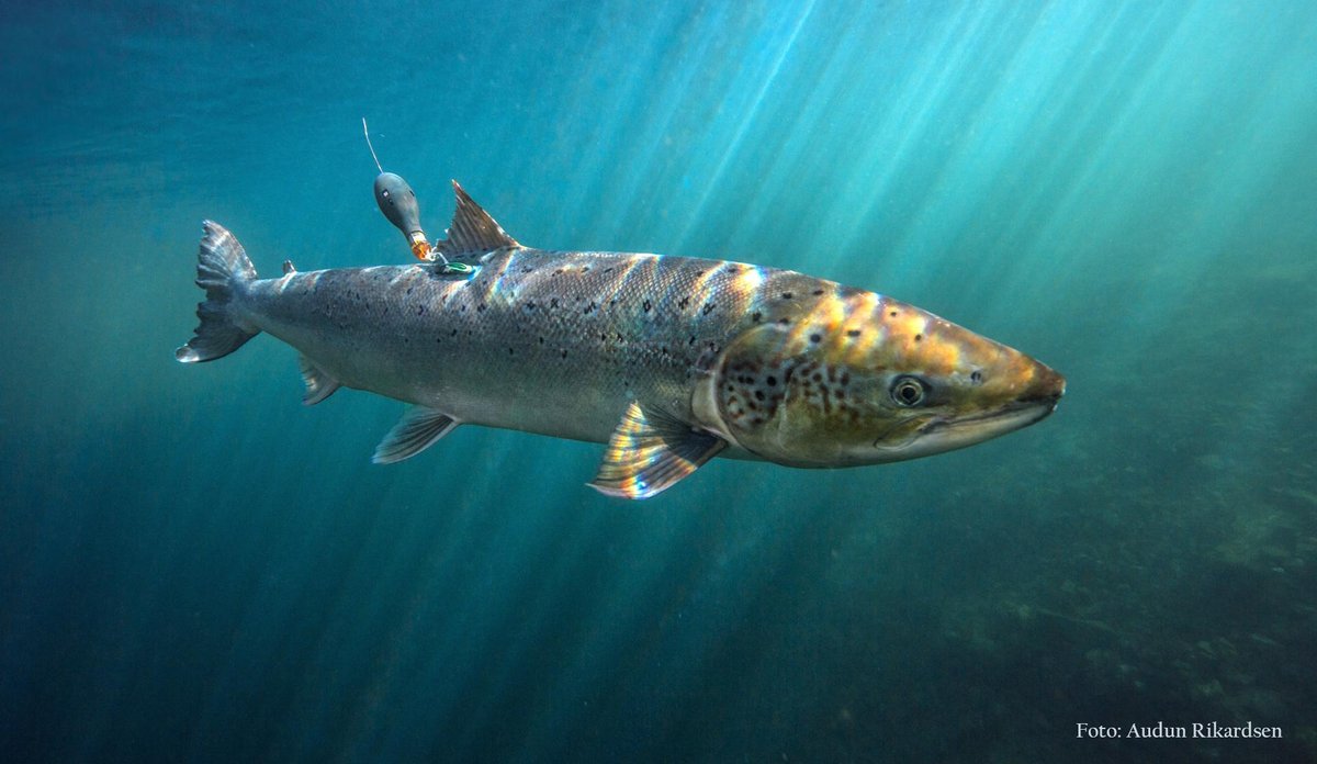
The pop-up-tag sits on the salmon until it is released by a timer. It then floats to the surface and transmits data via satellite.
Photo: Audun Rikardsen / UiTPublished: 26.05.2020 Updated: 06.08.2021
See the migration animation below!
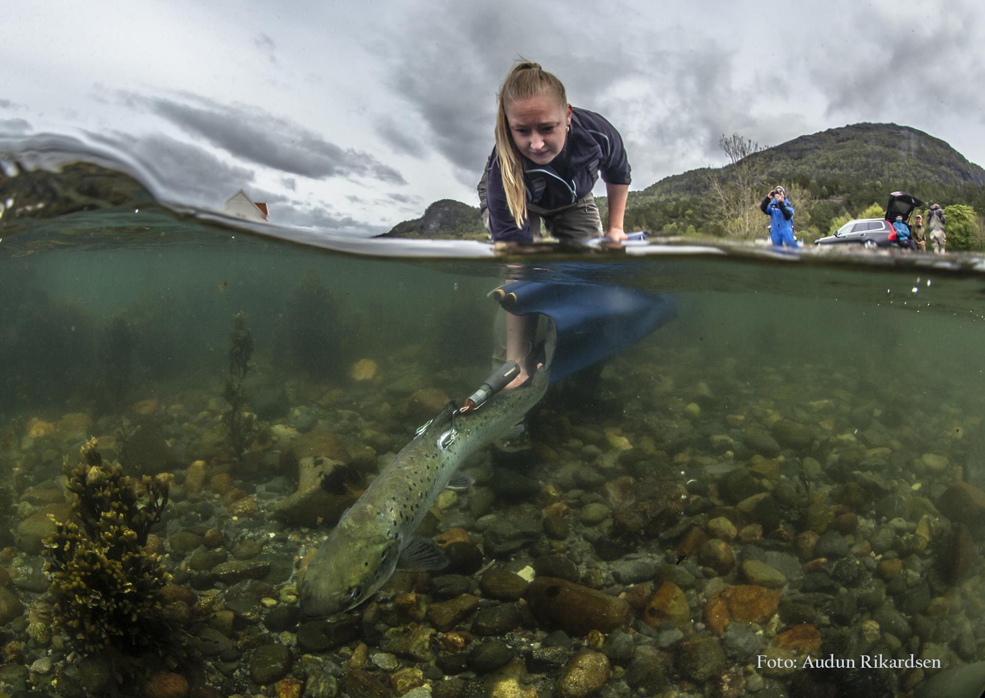
Scientists from UiT, NINA and IMR tagged 16 adult Atlantic salmon with satellite tags in the River Etne in Southern Norway. These were salmon kelts, which means they had spawned the autumn before, lived on meagre resources in the river during the winter, and at the time of tagging in the spring they were heading towards the ocean to feast on the richer food resources there.
– Earlier studies in Northern Norway have shown that Atlantic salmon migrate far in the Atlantic Ocean and Barents Sea, towards cold and Arctic waters. Now we wanted to compare and see what salmon from rivers in Southern Norway were doing, says UiT-scientist Audun Rikardsen.
Southern salmon with strong wanderlust
The salmon from southern Norway migrated far in the ocean, similar to salmon from northern Norway. They also proved to not be real southerners; these salmon also migrated quite far north, as shown in this animation of the migration pattern of eight individual fish.
Migration patterns of eight Atlantic salmon that retained their tags for more than 30 days (Illustration by John Strøm / UiT)
The salmon taking the northernmost route among the tagged fish was swimming an impressing distance of 1698 km in 140 days. The salmon with the deepest dive was down at 570 m depth.
The salmon kelts started their migration from Southwestern Norway in May, and then headed northwest past Shetland. In the beginning of July, some of them approached Iceland, before they continued northwards.
Late in the summer, three salmon still retained their tags, and they were moving back and forth between Greenland, Iceland and Jan Mayen.
The migration routes were calculated based on information collected by the tags on light, water temperature, and depth. (See facts on pop-up satellite tags.)
Unique knowledge
– The tags are expensive, and we could only tag a few fish. But the information they provide is extremely valuable. We know a lot about salmon in the river phase, but very little about what they experience in the ocean, says marine scientist Vidar Wennevik from the IMR.
The big question is what impacts the survival of Atlantic salmon in the ocean. Which predators are they exposed to, and what do they eat? These are the questions scientists want to answer, to be able to provide the best possible advice to the authorities on salmon management.
– To be able to answer these questions, we first need to know where in the ocean the salmon are migrating. We have also tagged 16 salmon in the River Nidelva at Arendal in southern Norway, and expect similar maps from these fish, says Eva B. Thorstad, scientist at NINA, and leader of the SeaSalar-project on Atlantic salmon at sea.
SeaSalar is a collaboration between NINA, IMR and UiT, with contributions also from a number of other research institutions.