Rapporten gir en oversikt over tokt i 2023 i regi av Havforskningsinstituttet, Universitetet i Bergen og Tromsø, og Norsk Polarinstitutt, med egne og mange av de innleide fartøyer. Den gir en kort beskrivelse av toktet og viser kurs- og stasjonskart – over CTD og trålstasjoner. Tabeller viser når de faste snittene er tatt og antall observasjoner per måned for de faste stasjonene. Toktene er innrapportert ICES (Det internasjonale råd for havforskning) i skjemaet ”Cruise Summary Report”: https://www.seadatanet.org/Metadata/CSR-Cruises. Data (og kart) fra toktene er tilgjengelig fra Norsk marint datasenter, Havforskningsinstituttet (https://www.nmdc.no). Kartene er generert av Silje Smith-Johnsen ved hjelp av ggOceanMaps av MikkoVihtakari (HI).
Report on cruises and data stations 2023
Report series:
Rapport fra havforskningen 2024-54
ISSN: 1893-4536
Published: 10.12.2024
Project No.: 4200
Research group(s):
Bentiske ressurser og prosesser
,
Bunnfisk
,
Bunnsamfunn
,
Bærekraftig utvikling
,
Oseanografi og klima
,
Pelagisk fisk
,
Plankton
,
Populasjonsgenetikk
,
Økosystemakustikk
,
Økosystemprosesser
Subject:
Hav, kyst og fjord ,
Klima i havet
Program:
Kystøkosystemer,
Norskehavet,
Barentshavet og Polhavet,
Nordsjøen,
Marine prosesser og menneskelig påvirkning,
Trygg og sunn sjømat ,
Miljøeffekter av akvakultur,
Fremtidens havbruk
Approved by:
Research Director(s):
Geir Huse
Program leader(s):
Bjørn Erik Axelsen, Henning Wehde, Jan Atle Knutsen og Maria Fossheim
Norsk sammendrag
Summary
The report gives an overview of cruises in 2023, by the Institute of Marine Research, University of Bergen and Tromsø and Norwegian Polar Institute, on board our research vessels and many of the hired commercial vessels. Each cruise has a short description and a track chart showing CTD and trawl stations. A table displaying the coverage of the oceanographic sections in addition to a table showing the number of observations per month for the fixed stations are included at the end of the report. Meta data about the cruises are reported to the International Council for the Exploration of the Sea (ICES) using the form “Cruise Summary Report”: https://www.seadatanet.org/Metadata/CSR-Cruises. Research data are available from the Norwegian Marine Data Centre at Institute of Marine Research (https://www.nmdc.no). Charts are generated by Silje Smith-Johnsen using ggOceanMaps by Mikko Vihtakari (IMR).
1 - Charts overview 2023 – CTD stations and trawl stations.


2 - "G. O. Sars" – Cruises 2023
| Cruise no | Period | Purpose | Area | CTD st.no | Trawl st.no |
| 2023001001 | 02/02 - 28/02 | The main objectives of the IBTS Q1 bottom trawl survey coordinated by ICES/IBTSWG are: 1) to determine the distribution and relative abundance of pre recruits of the main commercial species with a view of deriving recruitment indicesto monitor changes in the stocks of commercial fish species independently of commercial fisheries data 2) to monitor the distribution and relative abundance of all fish species and selected invertebratesto collect data for the determination of biological parameters for selected species 3) to collect hydrographical and environmental informationto determine the abundance and distribution of herring and other fish larvae as well as fish eggs | North Sea | 1 - 117 | 4-50 |
| 2023001002 | 02/03 - 05/03 | The main objective of the marine geological cruise was to train students for marine geological/geophysical fieldwork, and is part of UoB course GEOV231 at the Department of Earth Science. The scientific aim was to test how Atlantic Water has modulated Norwegian climate on decadal to millennial timescales since the last ice age. There additional objectives related to geohazards identifying slide history in western Norwegian fjords and potential point sources for pollution. | Norwegian Sea | 118-130 | - |
| 2023001003 | 06/03 - 09/03 | This was a student cruise, with the purpose of teaching students in meteorology and physical oceanography how oceanographic fieldwork is conducted. Data (physical and biogeochemical oceanography, meteorology) were collected within the Osterøy region (Osterfjord, Sørfjord) and on the coast west of Fedje. The data will be used by the students in semester reports. | North Sea | 131-174 | - |
| 2023001004 | 13/03 - 24/03 | The aim of the cruise was to investigate pelagic and demersal fish, bottom habitat, turbine noise and physical oceanography in and outside the Hywind Tampen floating wind farm. Hywind Tampen is the largest floating wind farm, with its current 7 wind turbines, and four to be added this year (11 in total). It is located between the two oil installations Gullfaks and Snorre to support them with green energy. To look at possible effects of the OWF on the fish distribution. | North Sea | 175 - 252 | 51-60 |
| 2023001005 | 30/03 - 12/04 | This cruise was focussed on surveying the coastal belt east of Utsira Nord (Utsira KB) and the two multibeam mapped areas close to Sørlige Nordsjø II (NSJ-1 and NSJ-2). These areas are of interest due to their proximity to the named offshore wind license areas and due to their overlap with særlig verdiful områder (SVO) which are areas of particular scientific and management interest. The MAREANO baseline mapping method was applied, but this cruise was focussed upon completing the video lines in these areas, and testing the munin+ AUV for data uses and the integration of AUVs into the Mareano method. | North Sea | 253-260 | - |
| 2023001006 | 27/04 - 01/06 | Part of the International Ecosystem Survey of the Nordic Seas (IESNS) where the objectives are (1) to measure the abundance of Norwegian spring-spawing herring and blue whiting using acoustics, (2) collect data on zoo- and phytoplankton, (3) measure the hydrographical conditions. | Norwegian Sea | 261-335 | 61-106 |
| 2023001007 | 02/06 - 03/06 | GOS - Kalibrering EM701/EM302 Må gjøres før ROV/AUV tokt | Ukjent | - | - |
| 2023001008 | 06/06 - 27/06 | This cruise aims to support research and training activities within the five strategic Thematic Areas of the Centre for Deep-Sea Research at UiB (CDeepSea), including commitments for externally funded projects under the CDeepSea project portfolio. Such projects include NFR funded NorEMSO, Eco-Safe, DeepSeaQuence, as well as Artsdatabanken Vent and Seep Fauna in Norwegian Waters, and ERC Horizon Infra 2022 Tech01. | Norskehavet | 336-343 | - |
| 2023001009 | 03/07 - 15/07 | Mareano samler og formidler kunnskap om miljø og naturverdier på havbunnen. Kartverket, NGU og HI har siden 2005 samarbeidet om kartlegging, rådgivning og spesielt levert kunnskapsgrunnlag til våre forvaltningsplaner for havområdene. Det søkes her om fartøytid til innsamling av vann og bunnprøver for ny kunnskap om biologisk mangfold og arters utbredelse, miljøkjemi og bunnsedimenter, i havområder prioritert på dep. nivå. | Nordsjøen | 344-356 | 1-13 |
| 2023001010 | 19/07 - 02/08 | The project 4SWIND (Advancing seismic seabed survey techniques and optimizing site-selection for offshore wind farms) will improve on methods for integrated surveys for offshore-wind sites both relevant for investigations in the recently glaciated, highly complicated areas off NW Europe, and worldwide. More specifically, 4SWIND will i) create workflows to cost-effectively generate geotechnical models from offshore- wind sites using core, high-resolution seismic data, P-and-S-wave tomography, and geological understanding: ii) generate new understanding of how to anchor offshore-wind sites in the challenging and heterogeneous soils: and iii) investigate how large-scale glacial dynamics influence anchoring conditions of offshore wind across the entire Norwegian Continental Shelf (NCS). | North Sea | 357 - 359 | - |
| 2023001011 | 03/08 - 14/08 | The project 4SWIND (Advancing seismic seabed survey techniques and optimizing site-selection for offshore wind farms) will improve on methods for integrated surveys for offshore-wind sites both relevant for investigations in the recently glaciated, highly complicated areas off NW Europe, and worldwide. More specifically, 4SWIND will i) create workflows to cost-effectively generate geotechnical models from offshore- wind sites using core, high-resolution seismic data, P-and-S-wave tomography, and geological understanding: ii) generate new understanding of how to anchor offshore-wind sites in the challenging and heterogeneous soils: and iii) investigate how large-scale glacial dynamics influence anchoring conditions of offshore wind across the entire Norwegian Continental Shelf (NCS). | North Sea | 360 | - |
| 2023001012 | 19/08 - 17/09 | The aim of the joint Norwegian/Russian Ecosystem survey in the Barents Sea and adjacent waters, August-October (BESS) is to monitor the status of abiotic and biotic factors and changes of these in the Barents Sea ecosystem. The survey has since 2004 been conducted annually in the autumn, as a collaboration between the Institute of Marine Research (IMR) in Norway and Polar branch of the VNIRO (PINRO) in Russia. | Barents Sea | 361-444 | 107 - 264 |
| 2023001013 | 22/09 - 06/10 | 2023-BIO-003: Obligatorisk feltkurs i fjordane og Nordsjøen/britisk sone for masterstudentar på BIO325 Havforsking. Kurset går kvart år i september/oktober. | Norskekysten: Vestlandet | 445 - 471 | 265 - 301 |
| 2023001014 | 07/10 - 16/10 | Mareano collects and disseminates knowledge about the environment and natural values on the seabed. Since 2005, the Norwegian Mapping Authority (Kartverket), the Geological Survey of Norway (NGU), and the Institute of Marine Research (HI) have collaborated on mapping, advising, and providing essential knowledge for our marine management plans. | Skagerrak | 472-474 | 14-15 |
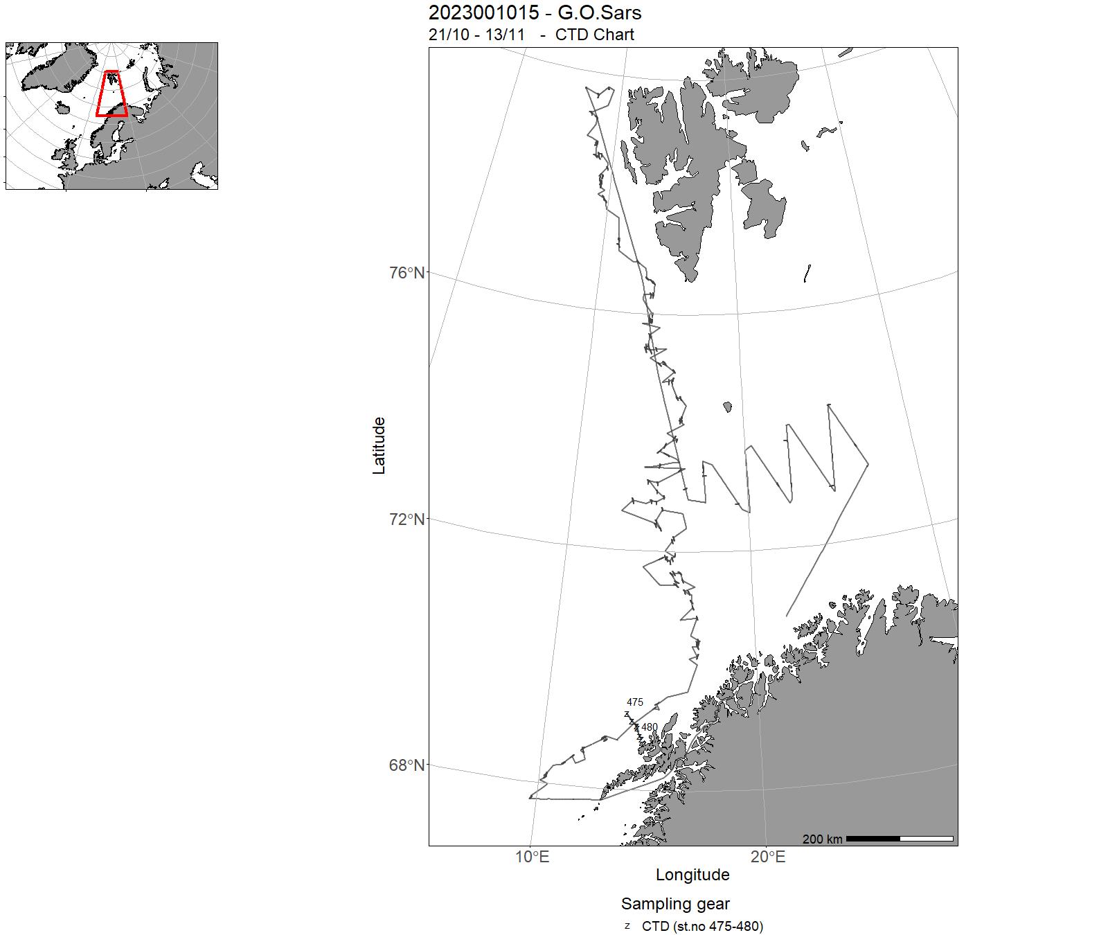
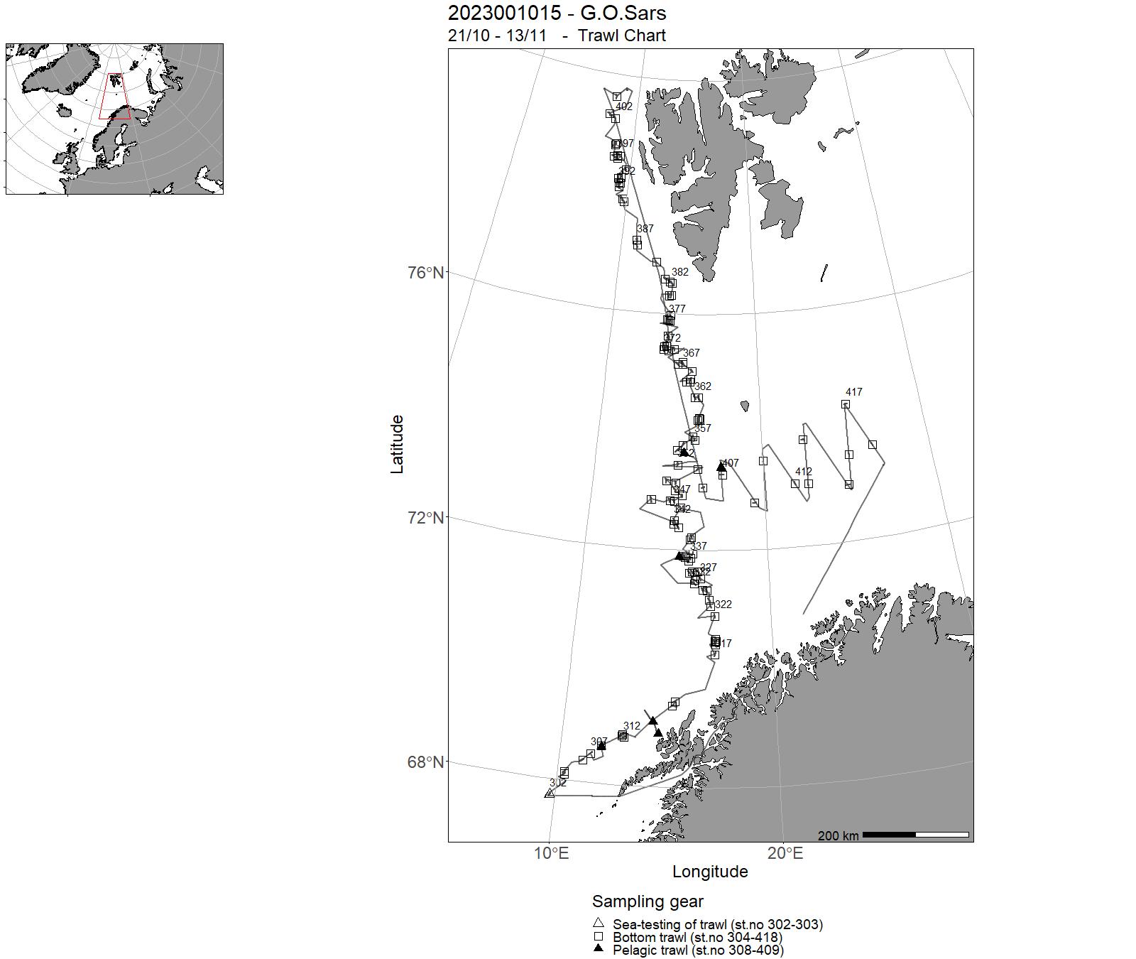
| 2023001015 | 21/10 - 13/11 | Name of survey series: Norwegian Sea continental slope NOR deep-sea fish cruise in autumn . Bottom trawl survey for deep sea resources on depths 400-1500 along the eastern continental slope of the Norwegian Sea between 68°N and 80°N, included Bear Island trench. Bottom trawl stations primarily for biomass estimation of Greenland halibut (Reinhardtius hippoglossoides), along with registrations on beaked redfish (Sebastes mentella) and other deep-sea fish species. | Norwegian Sea | 475-480 | 302 - 418 |
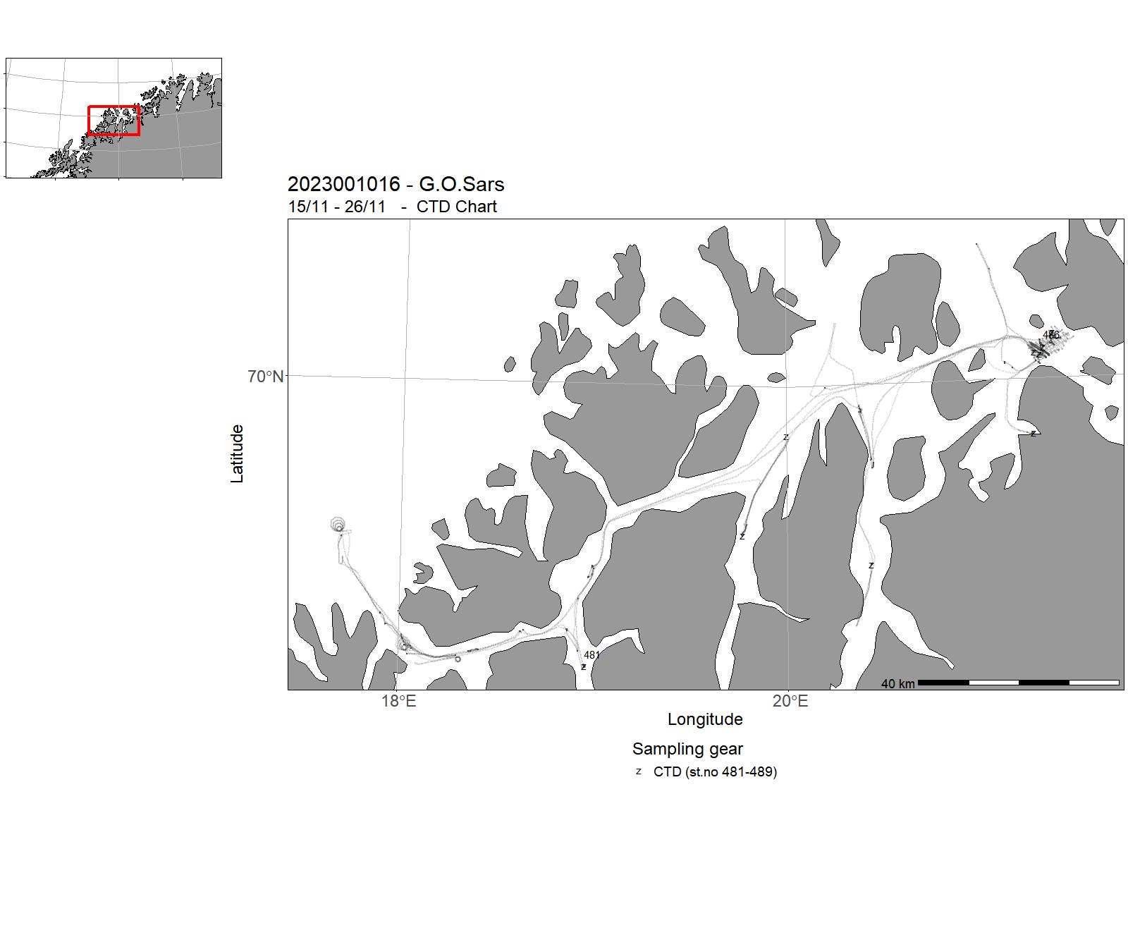
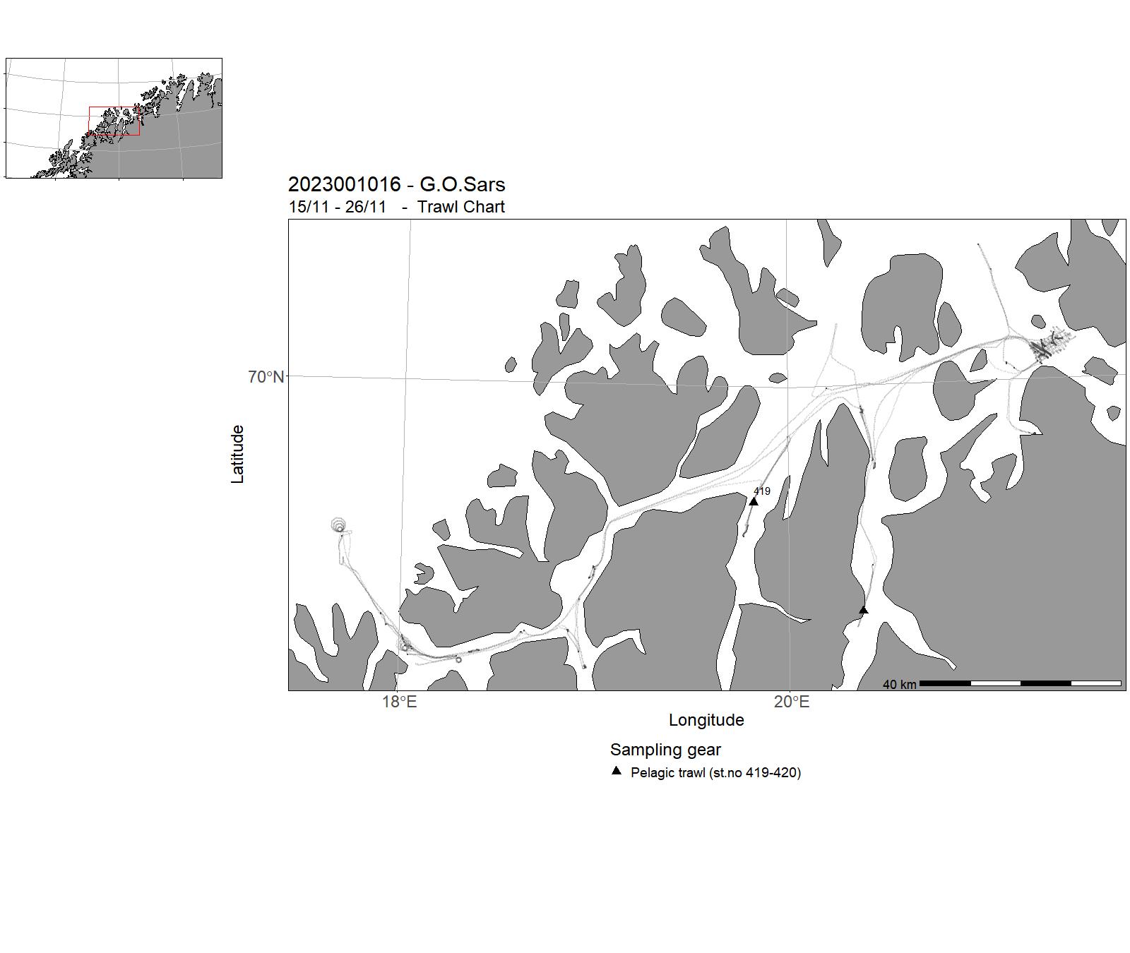
| 2023001016 | 15/11 - 26/11 | This survey supports the following CRIMAC tasks: Survey designs for autonomous platforms, The fine scale frequency spectrum from of fish for the purpose of identification, as well as testing the data quality from the sounder platform . In addition, the survey supports the CRIMAC industry partners for equipment testing, including Simrad sensor testing, Develop active selection system for scientific purposes and DV for commercial fishery and Improved trawl steering and control. | Norskekysten: Troms og Finnmark, Norskekysten: Nordland | 481-489 | 419-420 |
| 2023001017 | 02/12 - 03/12 | I tidsrommet 2018-2021 har FG Fangst i samarbeid med Rederiavdelingen gjennomført et årlig «metode- og redskapstokt» i slutten av året. Toktet ble utført som eget tokt 2018-2020 og som en del av CRIMAC toktet i 2021. Ingen metode- og redskapstokt ble/blir utført i 2022. For 2023 foreslås det 4 x 2 dagers tokt om bord instituttets fire fartøyer som driver med tråling (G.O. Sars, Johan Hjort, Kristine Bonnevie, Kronprins Haakon). | Atlanterhavet NØ | - | - |
| 2023001018 | 08/12 - 17/12 | Naturtypekartlegging i Færder og Hvaler nasjonalparker. Målsetningen er helhetlig kunnskap om den marine naturen i nasjonalparkene. Leveransen er bidrag til kunnskapsgrunnlaget for Tiltaksplan for Oslofjorden. Formål er overvåking av korallforekomstene i Oslofjorden/Skagerrak, med utgangspunkt i nasjonalparkene. | Nordsjøen | - | - |
3 - “ G.O. Sars” – Charts for cruises 2023
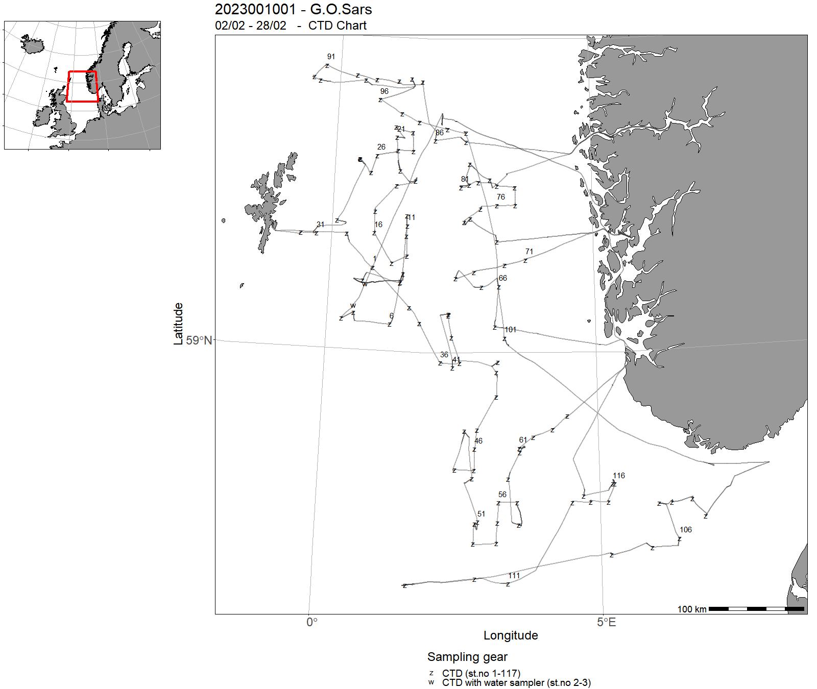
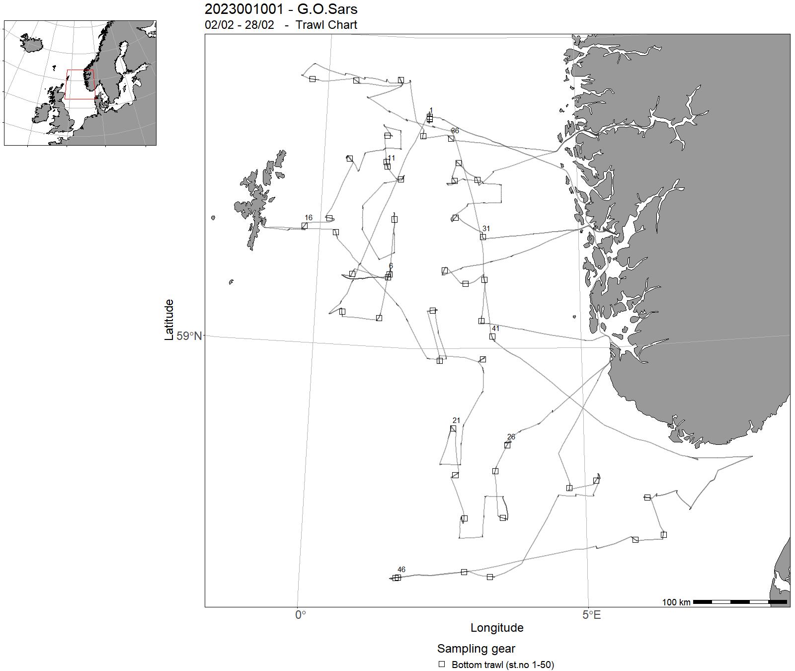
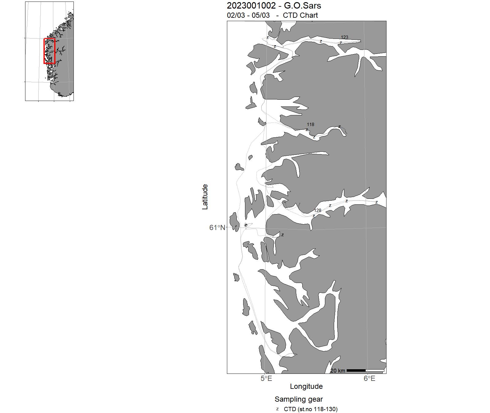
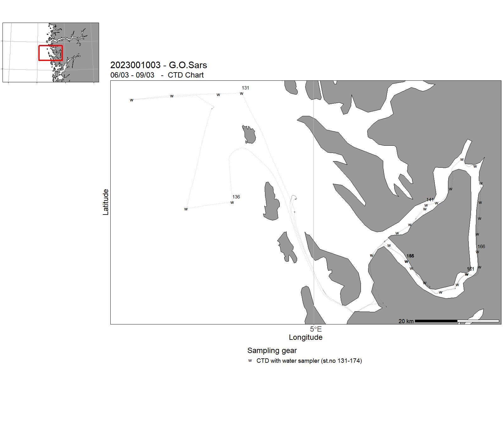
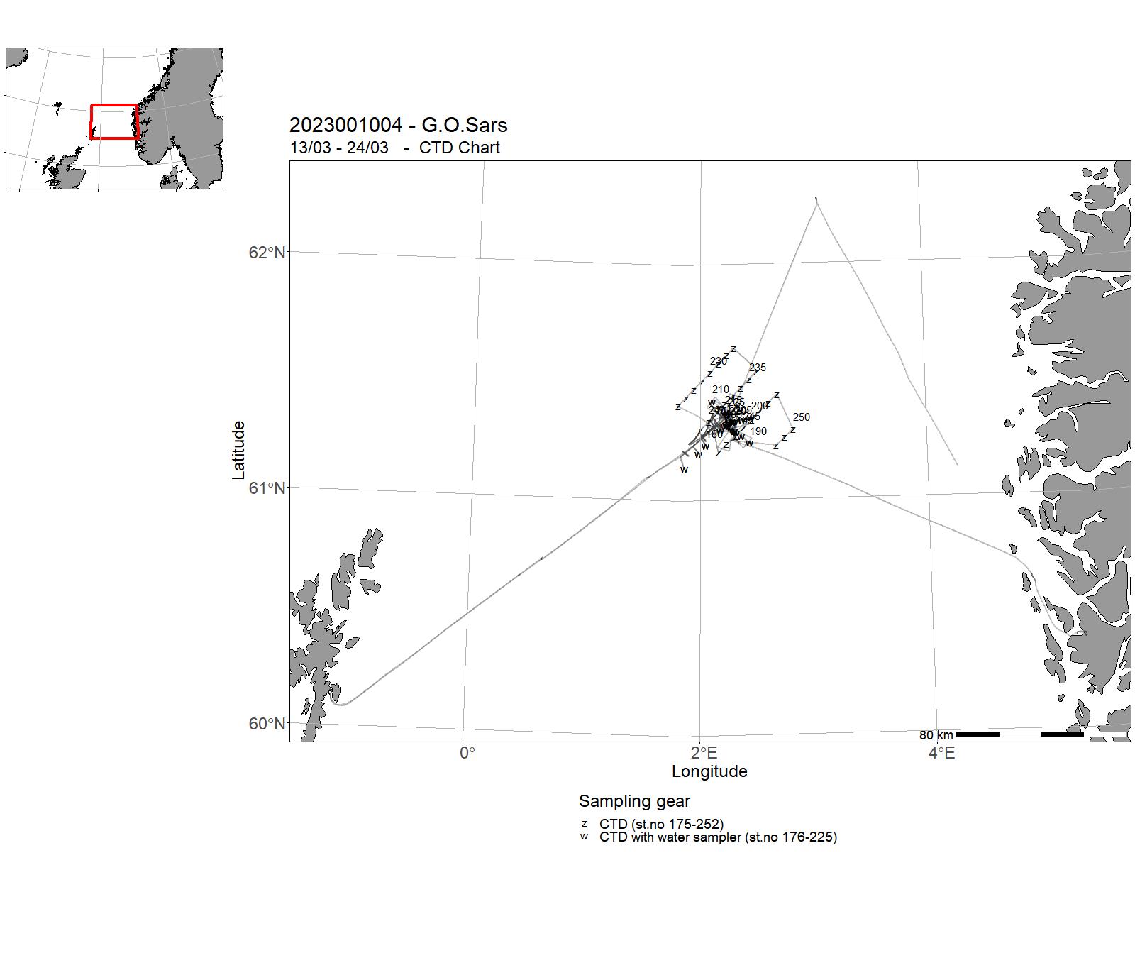
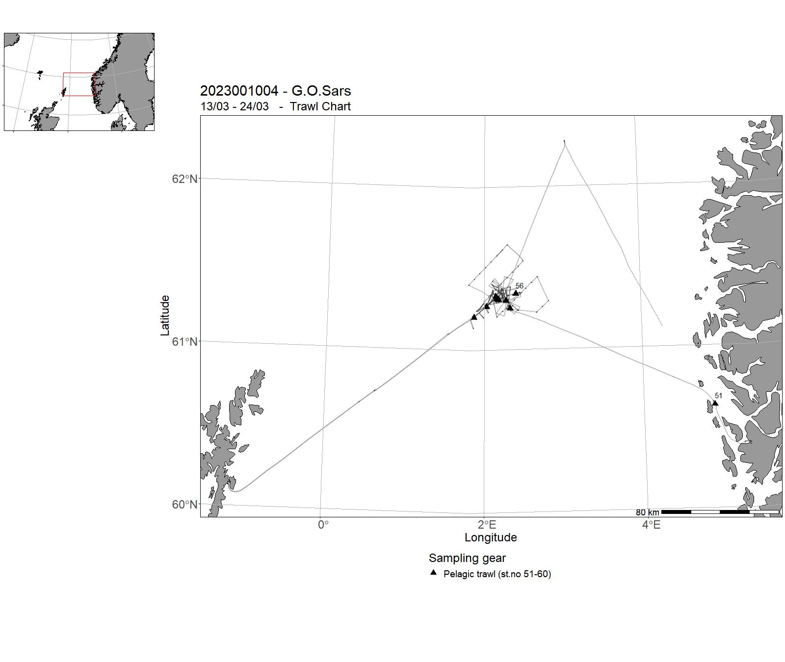
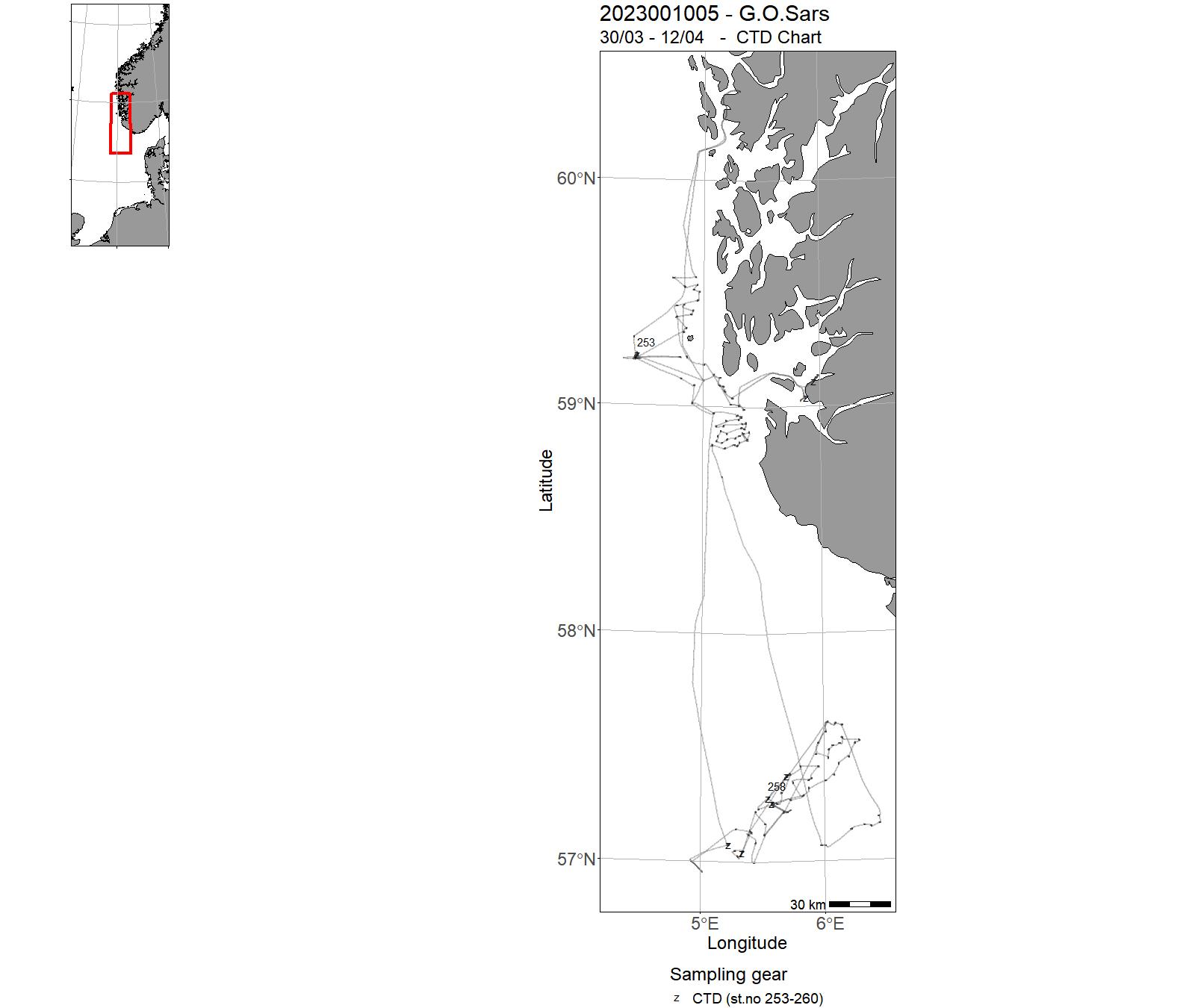
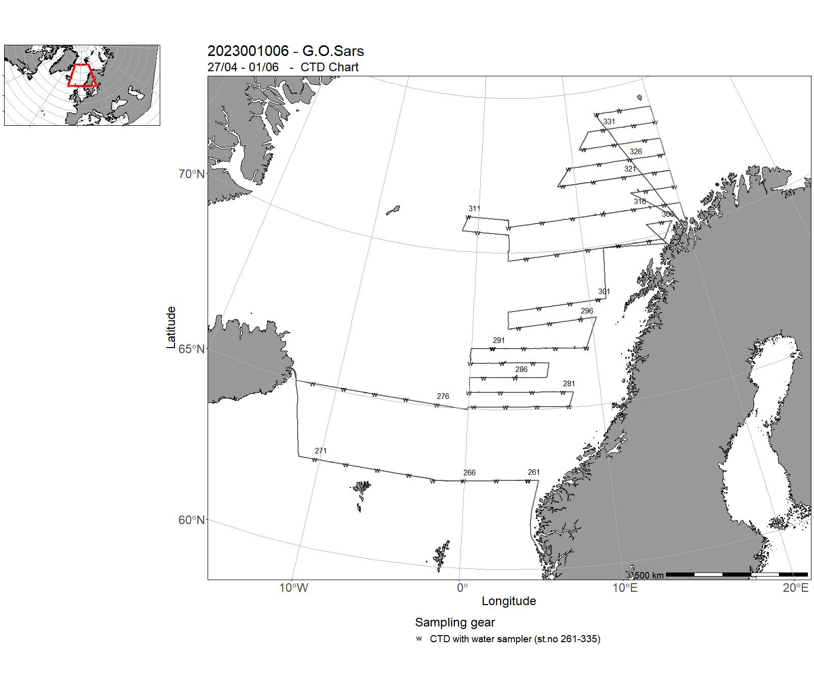
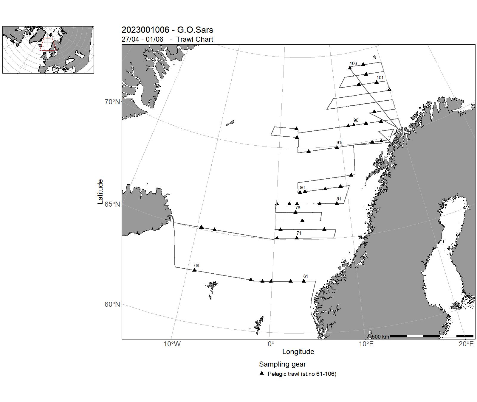
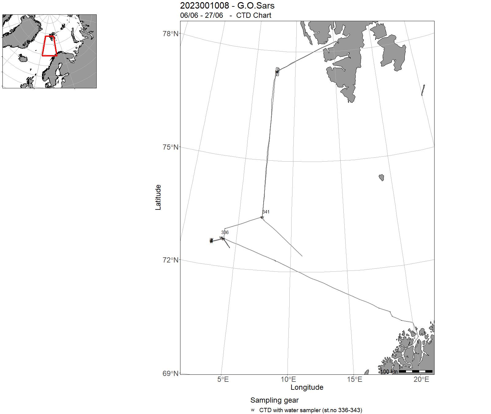
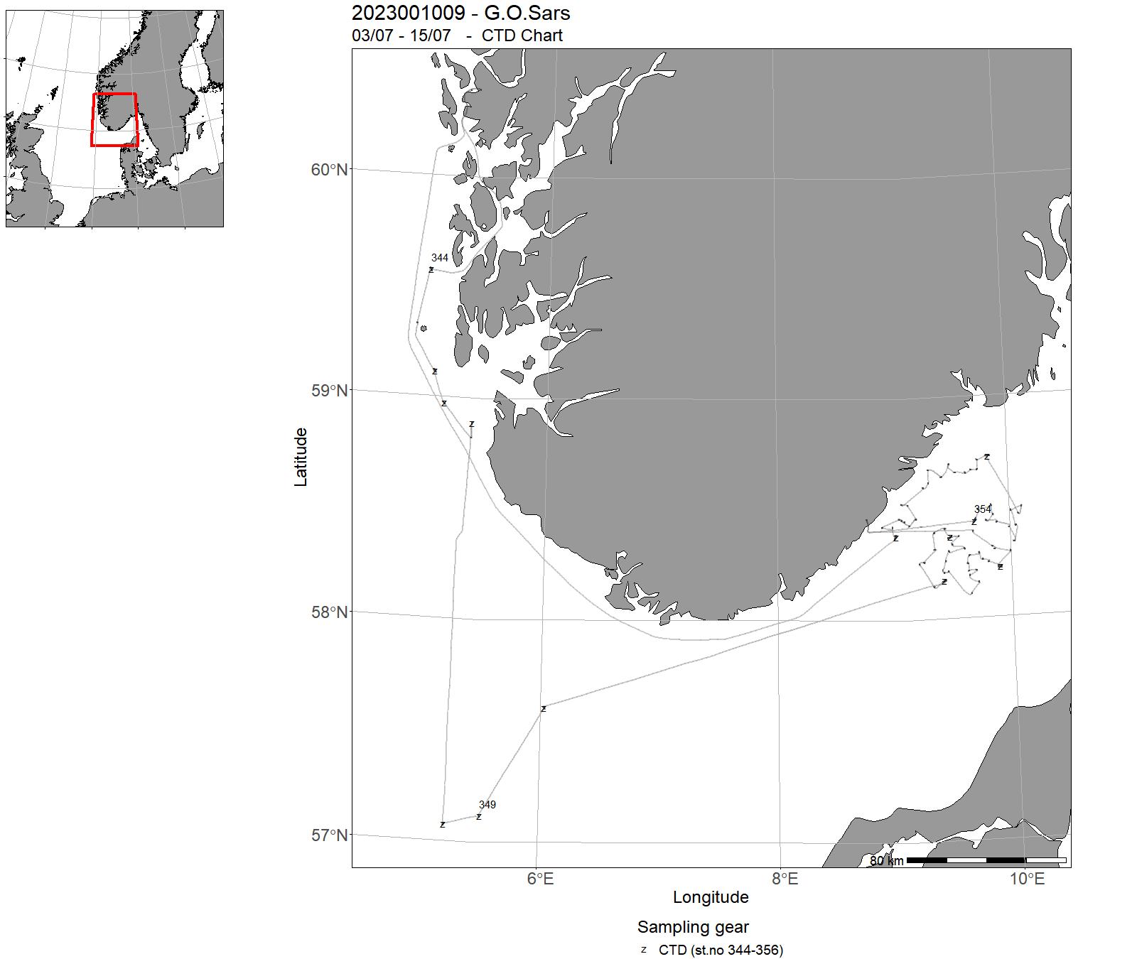
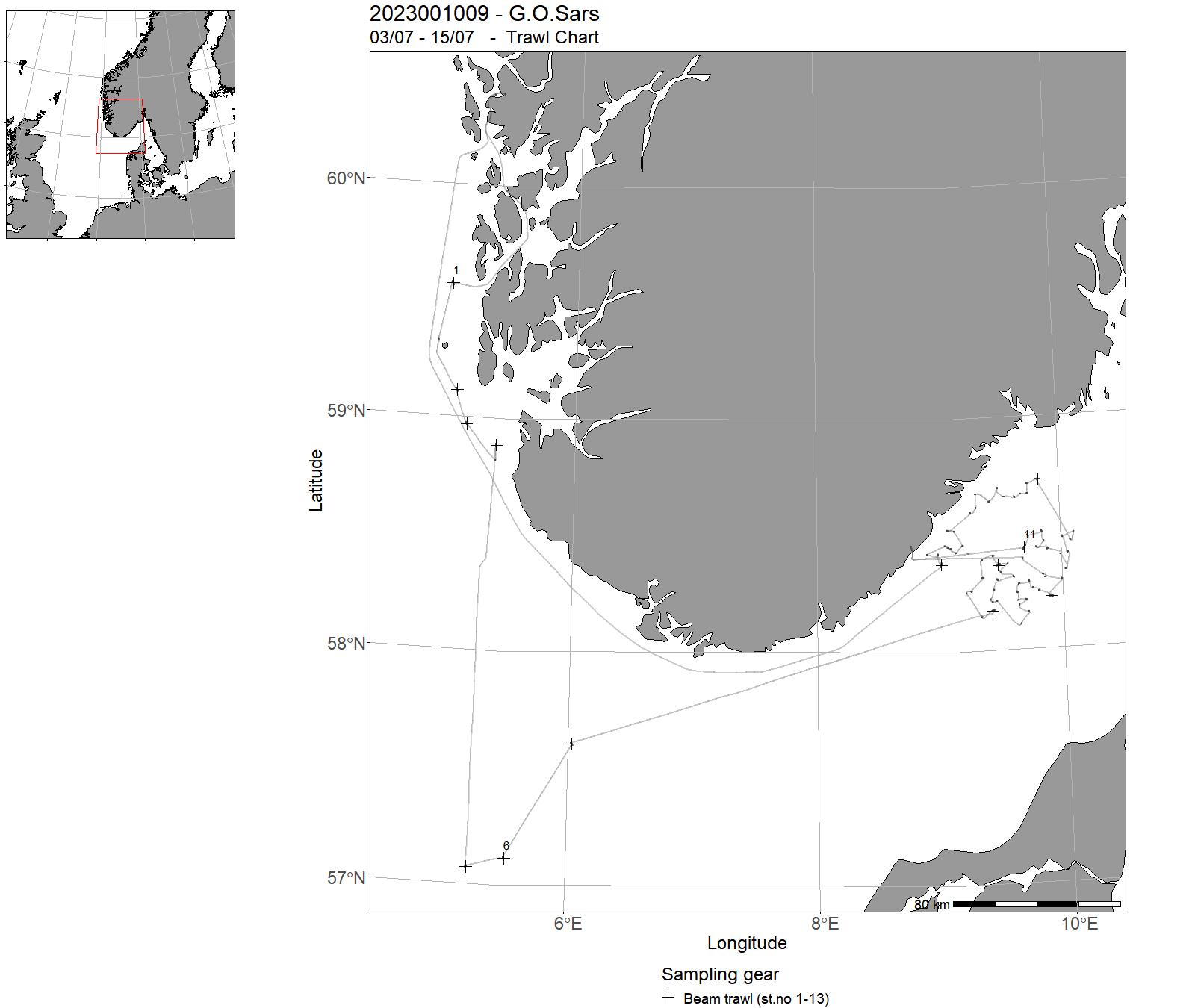
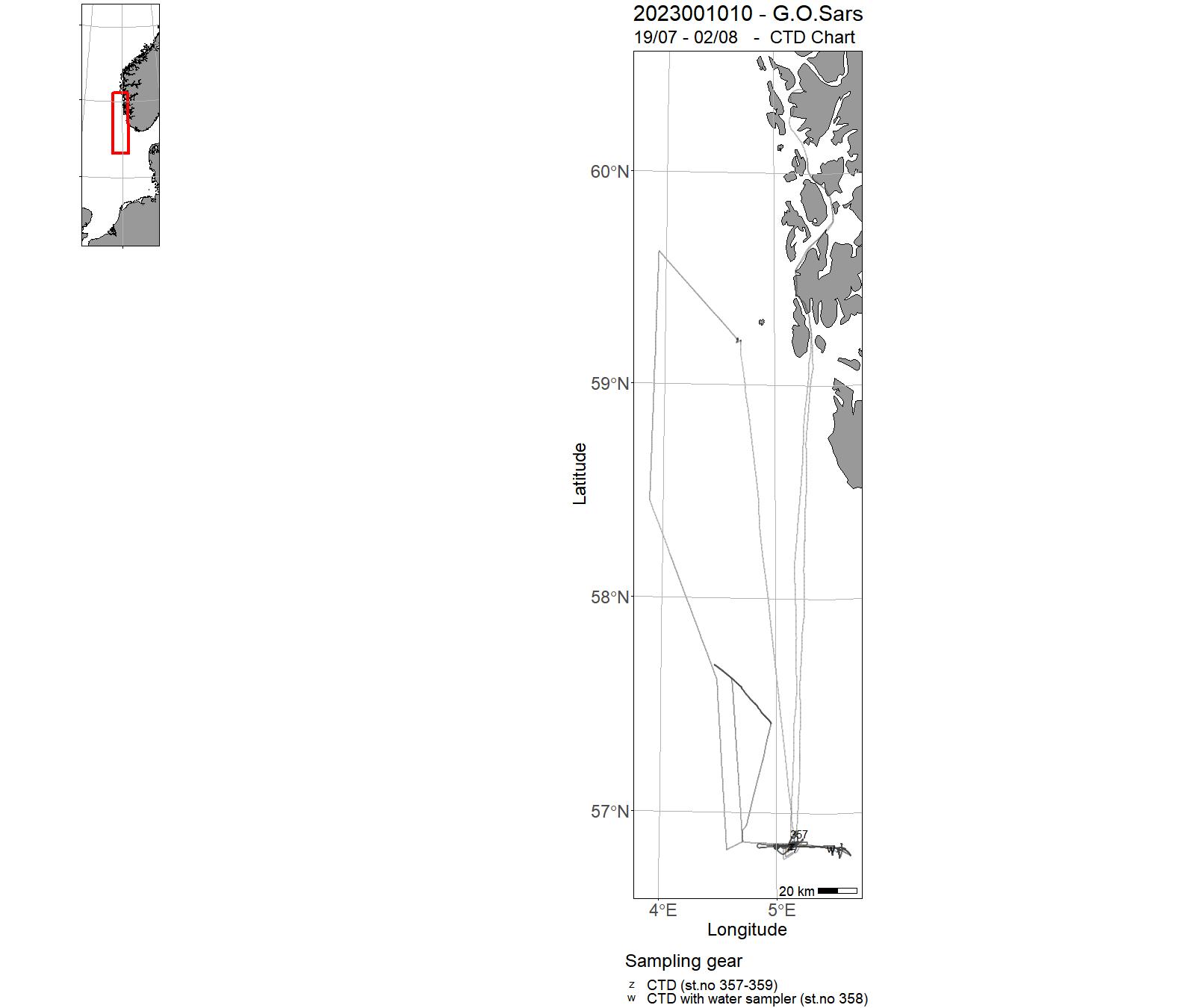
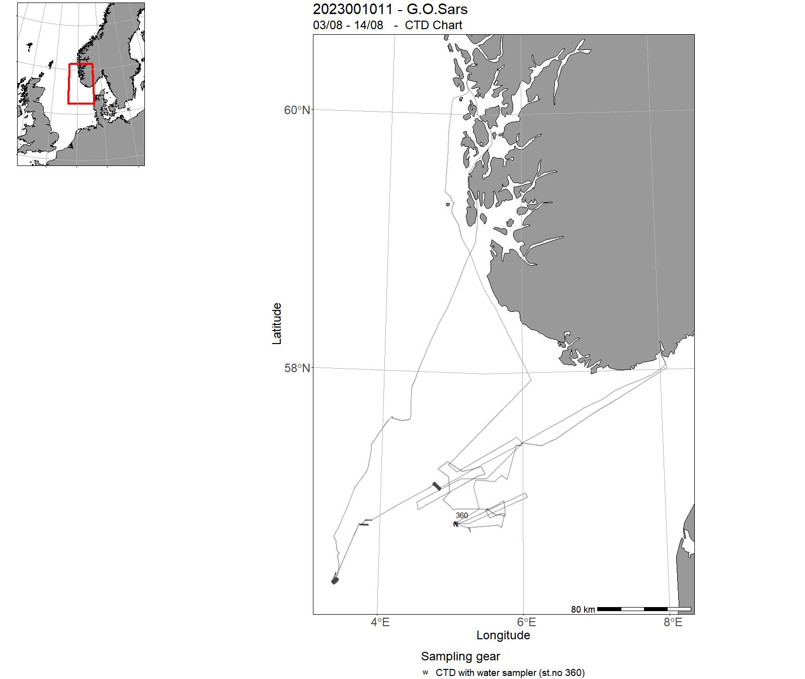
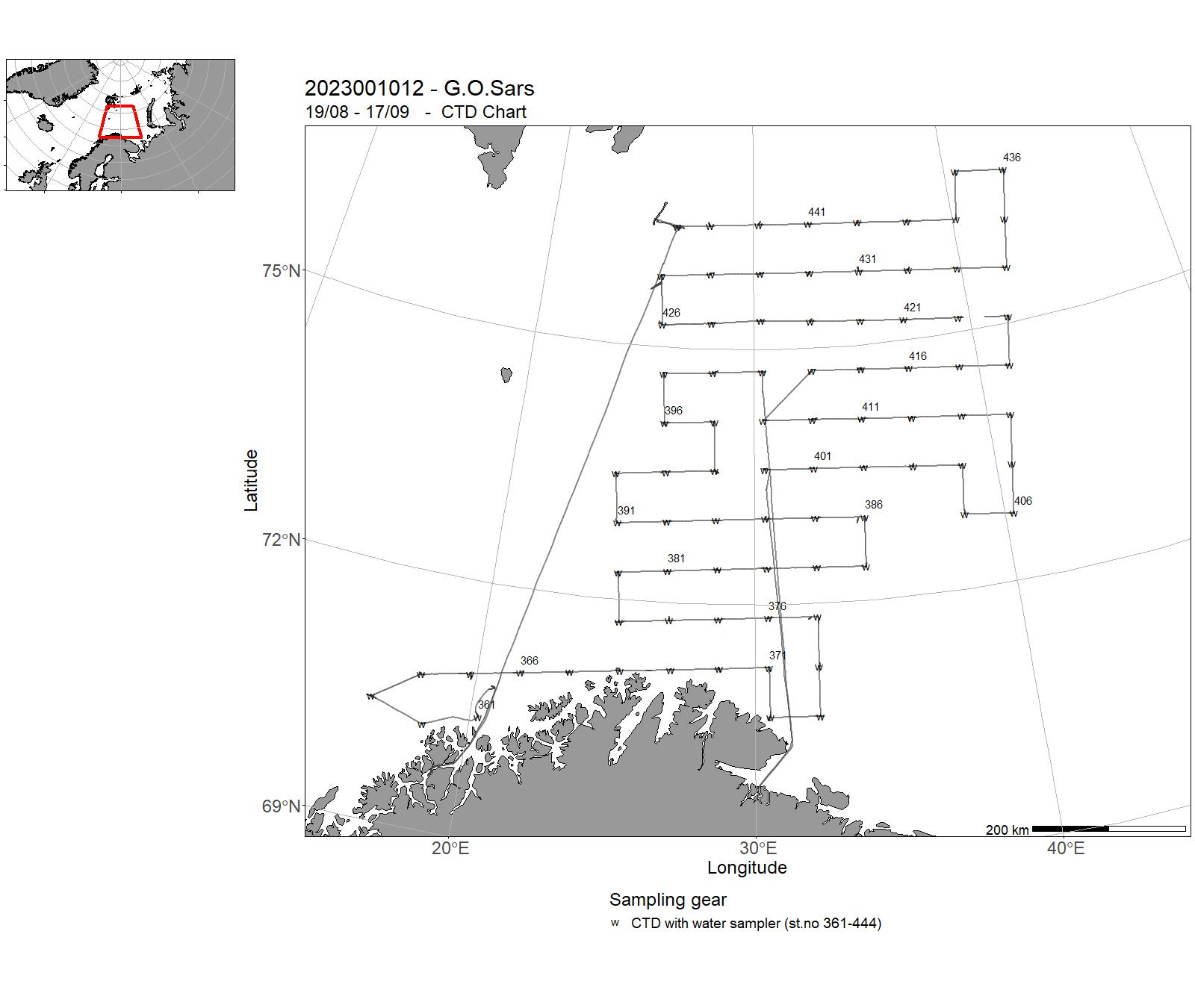
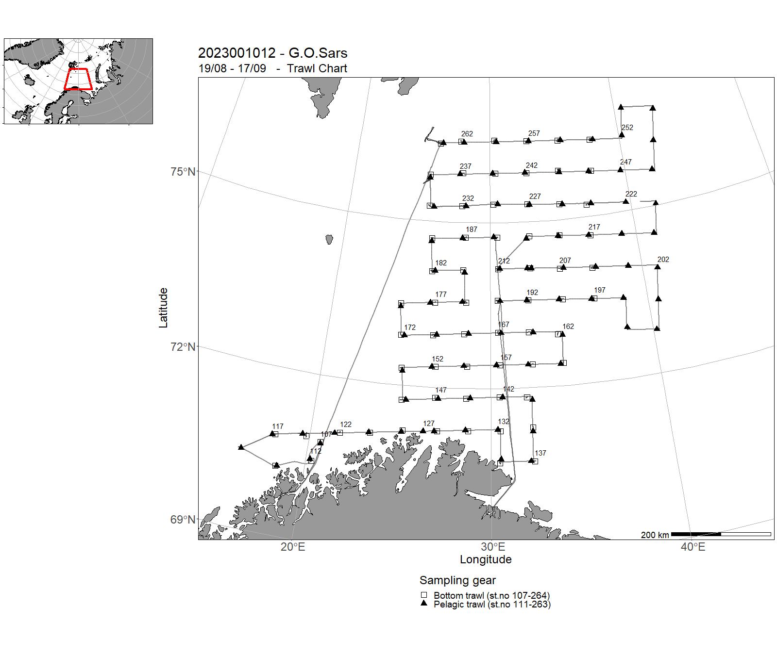
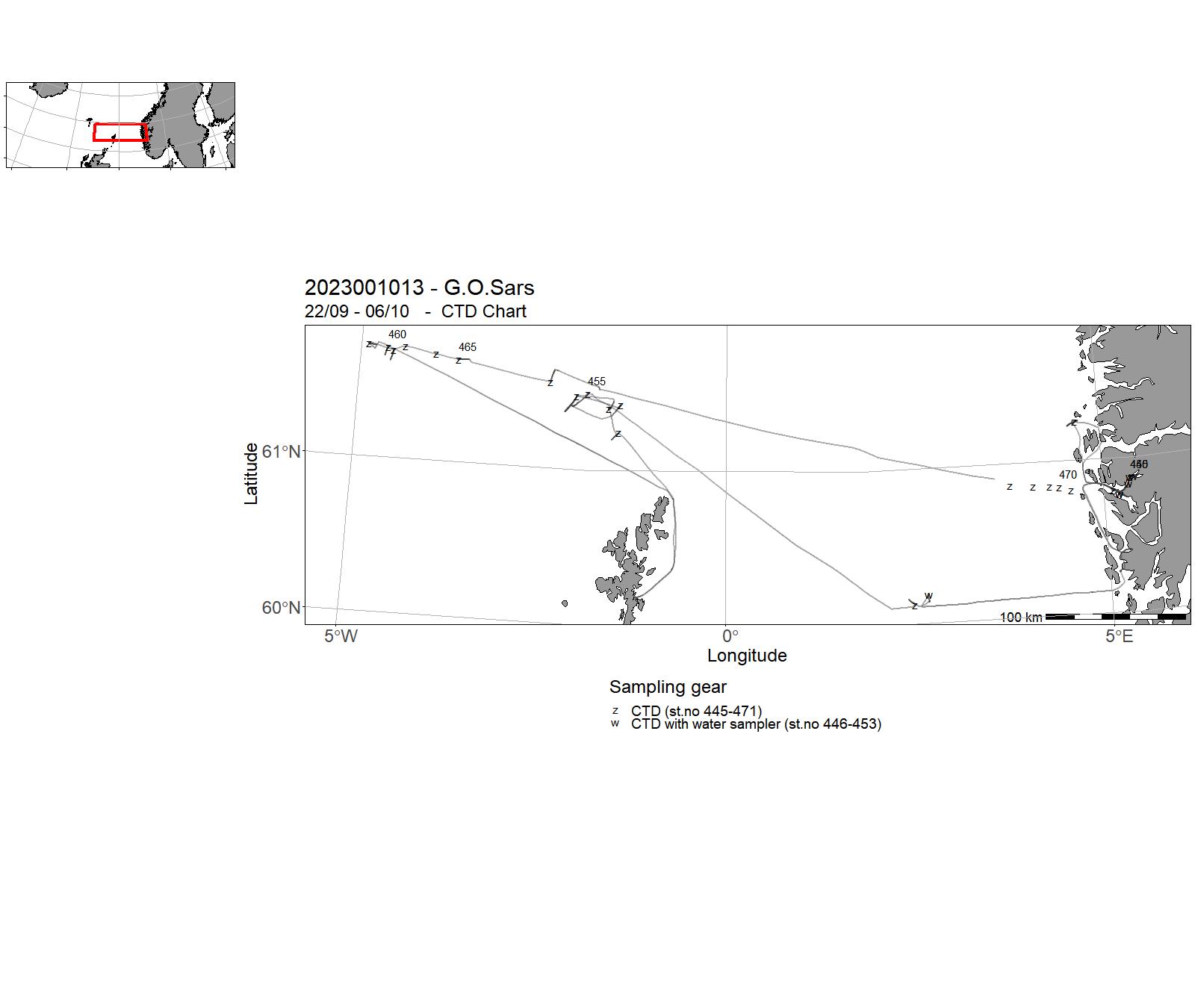
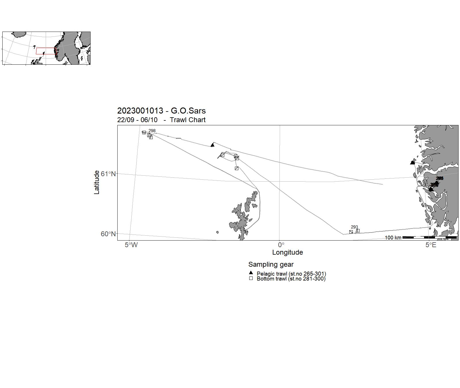
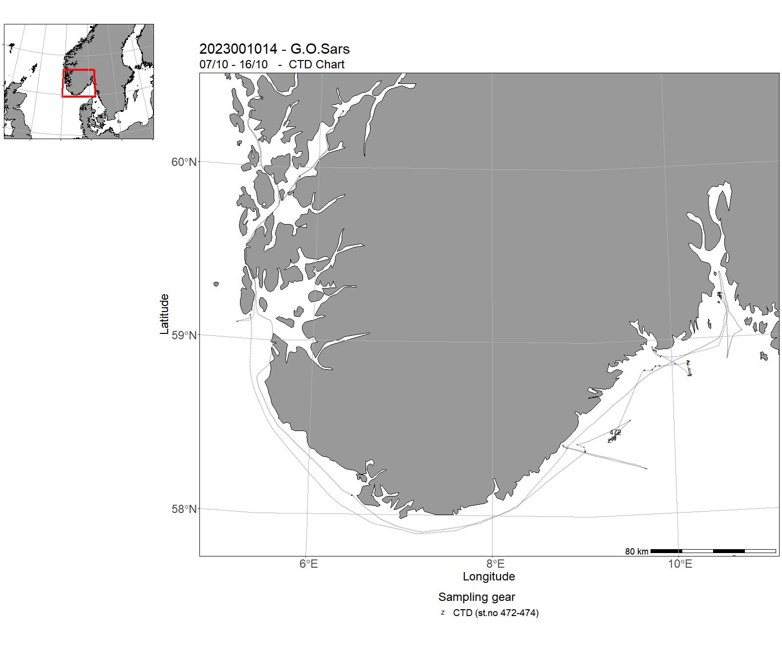
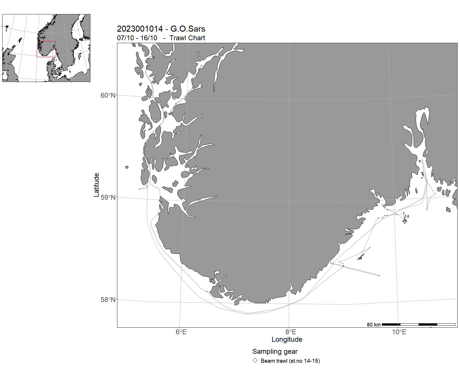
4 - "Johan Hjort" - Cruises 2023
| Cruise no | Period | Purpose | Area | CTD st.no | Trawl st.no |
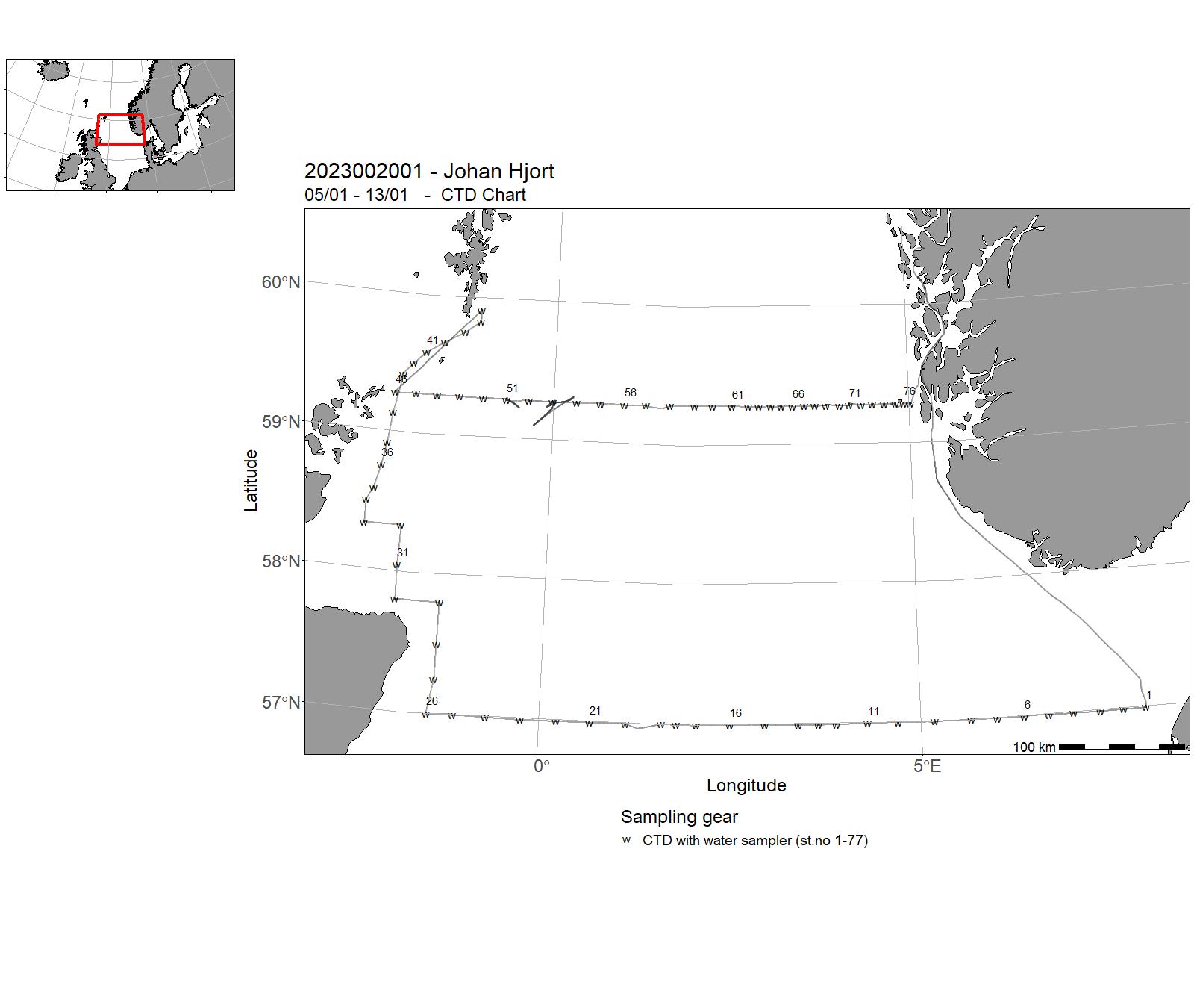
| 2023002001 | 05/01 - 13/01 | Objectives : To collect data and samples on pre-selected stations. To sample standard transects for physical oceanographic parameters (CTD casts, nutrients and chlorophyll), fish eggs and larvae, and zooplankton in the North Sea. Cruise programme: Utsira-V transect, Scotland East Coast Pentland : Fair Isle Utsira : Start Point. | North Sea | 1-77 | - |
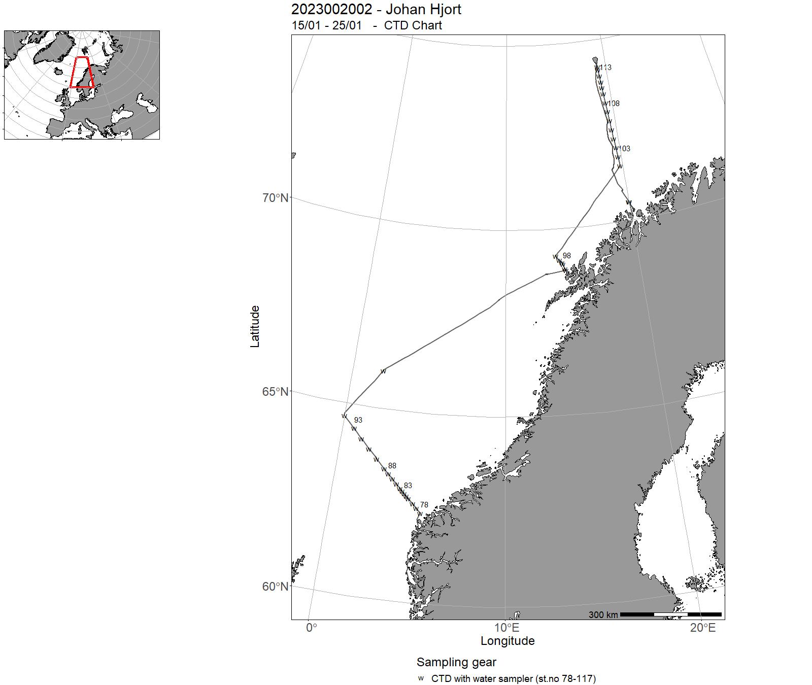
| 2023002002 | 15/01 - 25/01 | Monitoring of the environment and plankton at the Svinøy-NV, LoVe and Fugløya-Bjørnøya sections and station M in January. Measuring physical, chemical and biological parameters.Ocean acidification samples (UiB) at station M in the Norwegian Sea. Deploy a buoy (Metrologisk institutt) at Svinøy section nr. 17.Deploy a glider (UiB) at Gimsøy section nr.9. | Norwegian Sea | 78-117 | - |
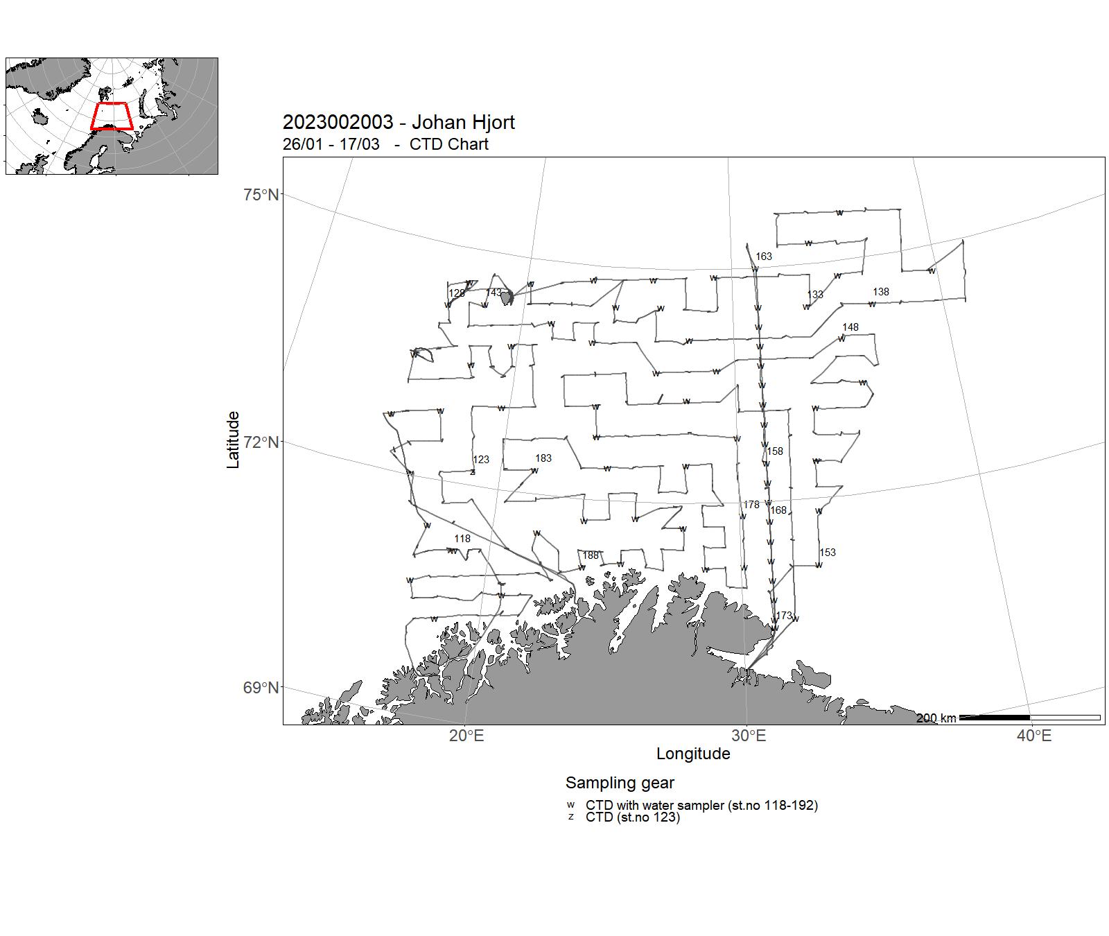
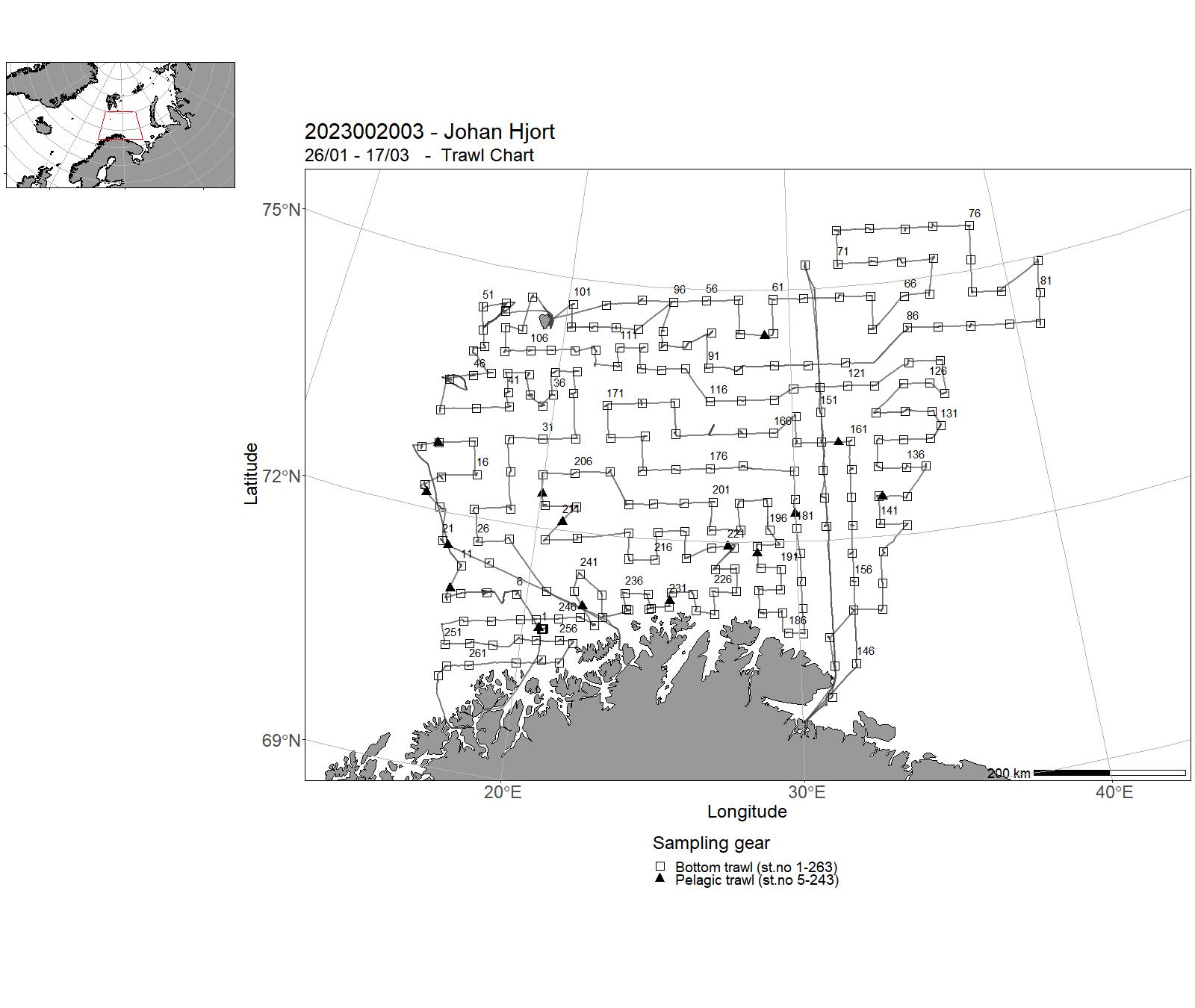
| 2023002003 | 26/01 - 17/03 | Collect catch and biological data at fixed bottom trawl stations, as well as record acoustic data continuouslySample standard transects on Vardø-N section for physical oceanographic parameters (CTD casts, nutrients and chlorphyll) and zooplankton in the Barents Sea. Ocean Acidification Monitoring sampling. Cruise: Vintertokt | Barents Sea | 118 - 192 | 1 - 263 |
| 2023002004 | 18/03 - 23/03 | CTD-survey of fjords and coast in Troms and western Finnmark (Malangen-Revsbotn).Water sampling for nutrients and the carbonate system. Project name: Fjord oceanography and coastal climate (FOKK)Coordinating body: Institute of Marine Research | Norwegian Sea | 193-303 | - |
| 2023002005 | 24/03 - 11/04 | Annually recurrant acoustic survey to monitor abundance of spawning North-East Arctic cod in the spawning area around Lofoten by systematic parallell transects and with systematic sampling of fish-egg concentrations by vertical nets in the upper 100 m of the water column. Lofoten is the main spawning location for the stock, and the acoustic survey index indicate spawning biomass and abundance of the mature stock. | Norwegian Sea | 304-447 | 264 - 294 |
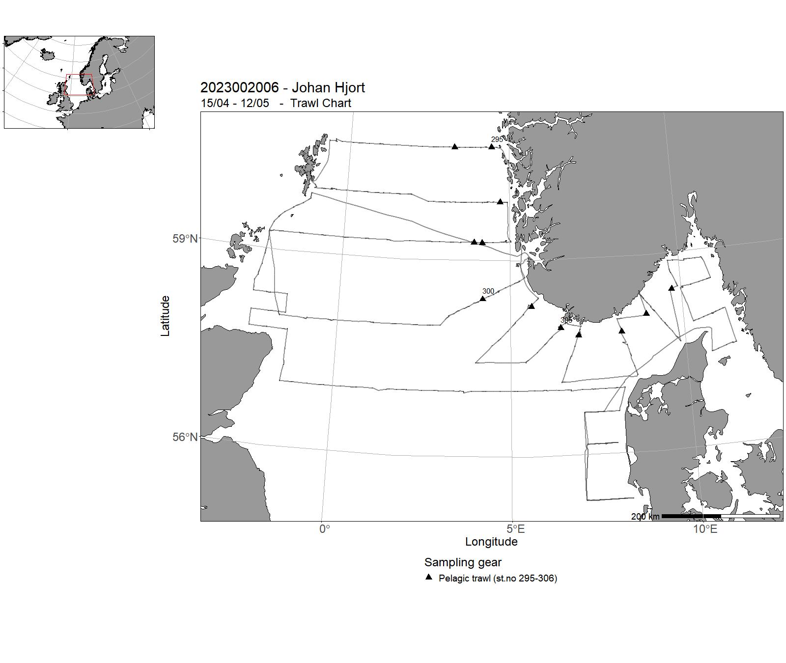
| 2023002006 | 15/04 - 12/05 | The North Sea Ecosystem spring cruise has been run since 2010 by the Institute of Marine Research (IMR) as a multi-purpose survey. The cruise covers hydrography, chemistry, phytoplankton and zooplankton (IMR project Monitoring of climate and plankton in the North Sea Skagerrak) as well as fish eggs and fish larvae (IMR project Early life history dynamics of North Sea Fishes). The cruise also includes monitoring of radioactive contamination (IMR project Monitoring of radioactivity in Norwegian waters IMR 14379-01). | Skagerrak | 448-674 | 295-306 |
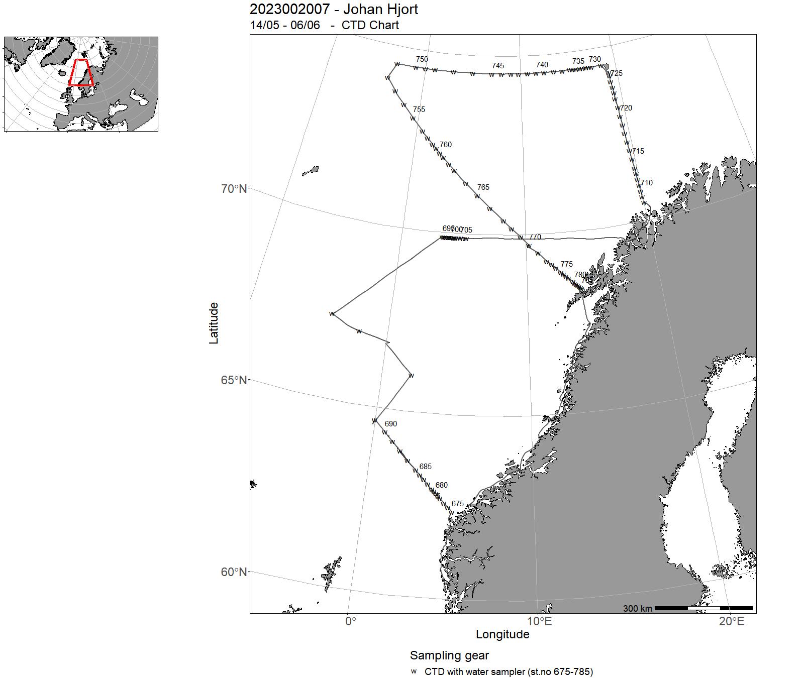
| 2023002007 | 14/05 - 06/06 | The cruise objectives were to occupy monitoring sections and deploy Argo floats. The monitoring sections Fugløya-Bjørnøya in the Barents Sea, extended Bjørnøya vest and extended Gimsøy section in the northern Norwegian Sea and the Svinøy section in the southern Norwegian Sea were occupied. In addition to the sections, the monitoring station in the position of the earlier weather ship M was occupied . A synoptic hydrographic survey was conducted of the Lofoten Basin Eddy (LBE). | Norwegian Sea | 675-785 | - |
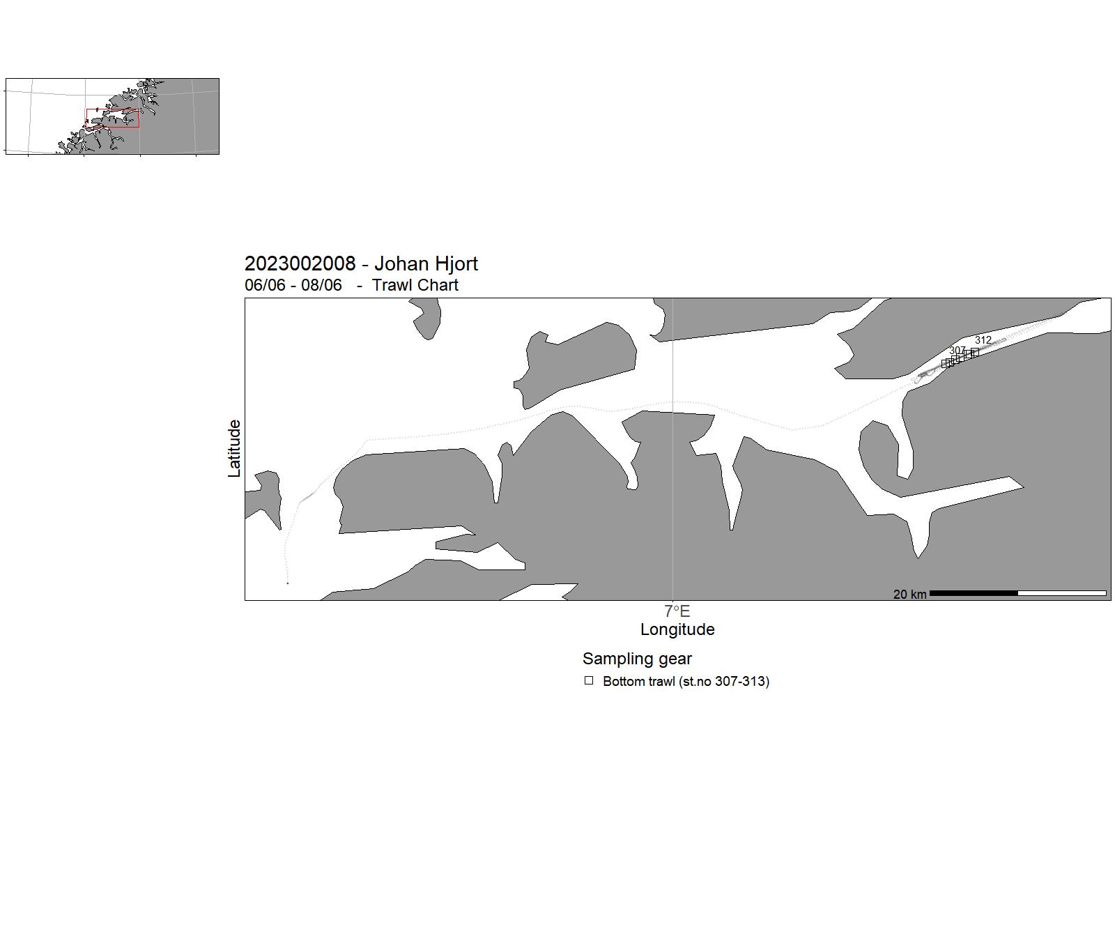
| 2023002008 | 06/06 - 08/06 | A Campelen 1800 trawl was tested with deep water floats (2000 m) and regular floats (1200 m) to see if there would be any difference in opening hight of the trawl. The fjord we were in, Langfjorden, was also looked at as a potential sea testing area.Video observations were made with GoPro cameras. | Norwegian Sea | - | 307-313 |
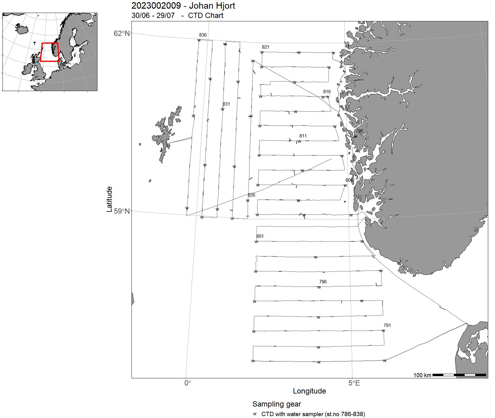
| 2023002009 | 30/06 - 29/07 | Acoustic survey on herring, sprout (HERAS) and saithe (NORACU) in the North Sea during summer (July). Aim purpose of survey is to provide an index of herring, sprat and saithe. HERAS is a part of an international survey coordinated by ICES with participants from Norway, UK, the Netherlands, Denmark and Germany. | North Sea | 786-838 | 314 - 439 |
| 2023002010 | 31/07 - 16/08 | The purpose of the cruise was to collect data and samples on pre-selected stations as part of the IMR Monitoring of the environment and plankton on the Svinøy, Gimsøy, LoVe, Bjørnøya-east and Fugløya-Bjørnøya sections and at station M in August. Sampling was undertaken on the following standard transects: Svinøy, Gimsøy, LoVe, Bjørnøya-east and Fugløya-Bjørnøya sections and at station M. | Norwegian Sea | 839-926 | - |
| 2023002011 | 24/08 - 07/10 | The cruise forms part of a multi-ship, multi-purpose ecosystem survey of the Barents Sea, carried out jointly by Norway and Russia. The objective of the cruise was to collect data related to stations and along cruise tracks, on water chemistry and physics, phytoplankton, zooplankton, fish (acoustics and trawl), benthic organisms, sea mammals, and birds. | Barents Sea | 927 - 1039 | 440 - 635 |
| 2023002012 | 11/10 - 19/11 | Distribution and acoustic index for NEA saithe and coastal cod incoatsl/fjordic areas and shelf banks. Swept area index for redfish spp. Monitoring of deepwater shrimps, analysis of radioactivity from sediment samples, analysis of benthic bycatch. | Norskekysten | 1040-1109 | 636 - 782 |
| 2023002013 | 20/11 - 29/11 | The objective of the cruise is to sample two standard transects Utsira-StartPoint", "Hanstholm-Aberdeen" and two additional transects along on west side of the North Sea: the "Scotland East Coast" and the Fair Isle-Pentland for hydrography, nutrients, chlorophyll a, phyto- and zooplankton and fish eggs and larvae. The cruise is part of the long term monitoring program of the North Sea and is the fourth of 4 yearly cruises. | Nordsjøen | - | - |
| 2023002014 | 30/11 - 05/12 | Acoustic trawl survey mapping coastal sprat and herring in Oslofjorden. The fjord will be covered acoustically with zigzag transects, with blind trawl in the surface at night and targeted trawl hauls when potential sprat or herring echoes are observed on the echosounder. CTD and plankton hauls at all trawl stations. In addition fixed stations for plankton and water chemistry will be taken. Acoustic and trawl data are used for estimating a survey index that will be used for giving advice when the time series is sufficiently long (usually 5 years). | Norskekysten: Sør- og Østlandet | - | - |
5 - “Johan Hjort” – Charts for cruises 2023
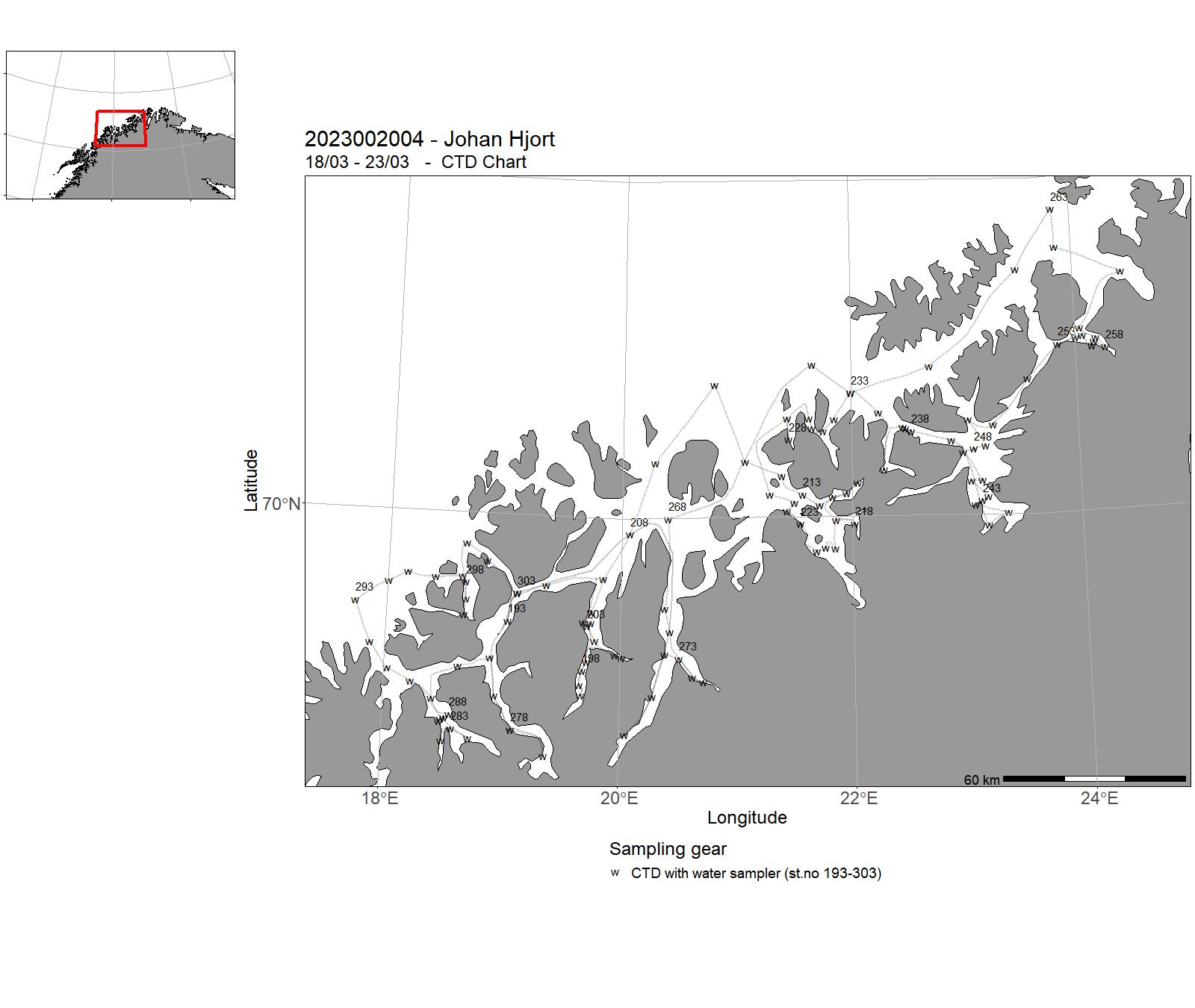
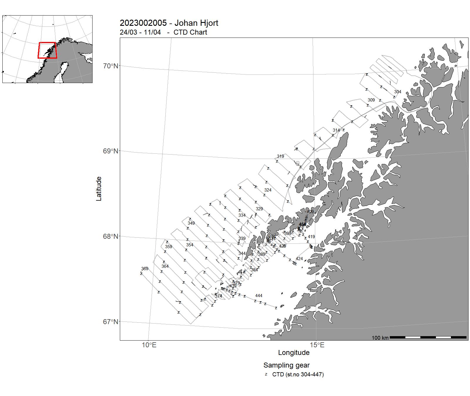
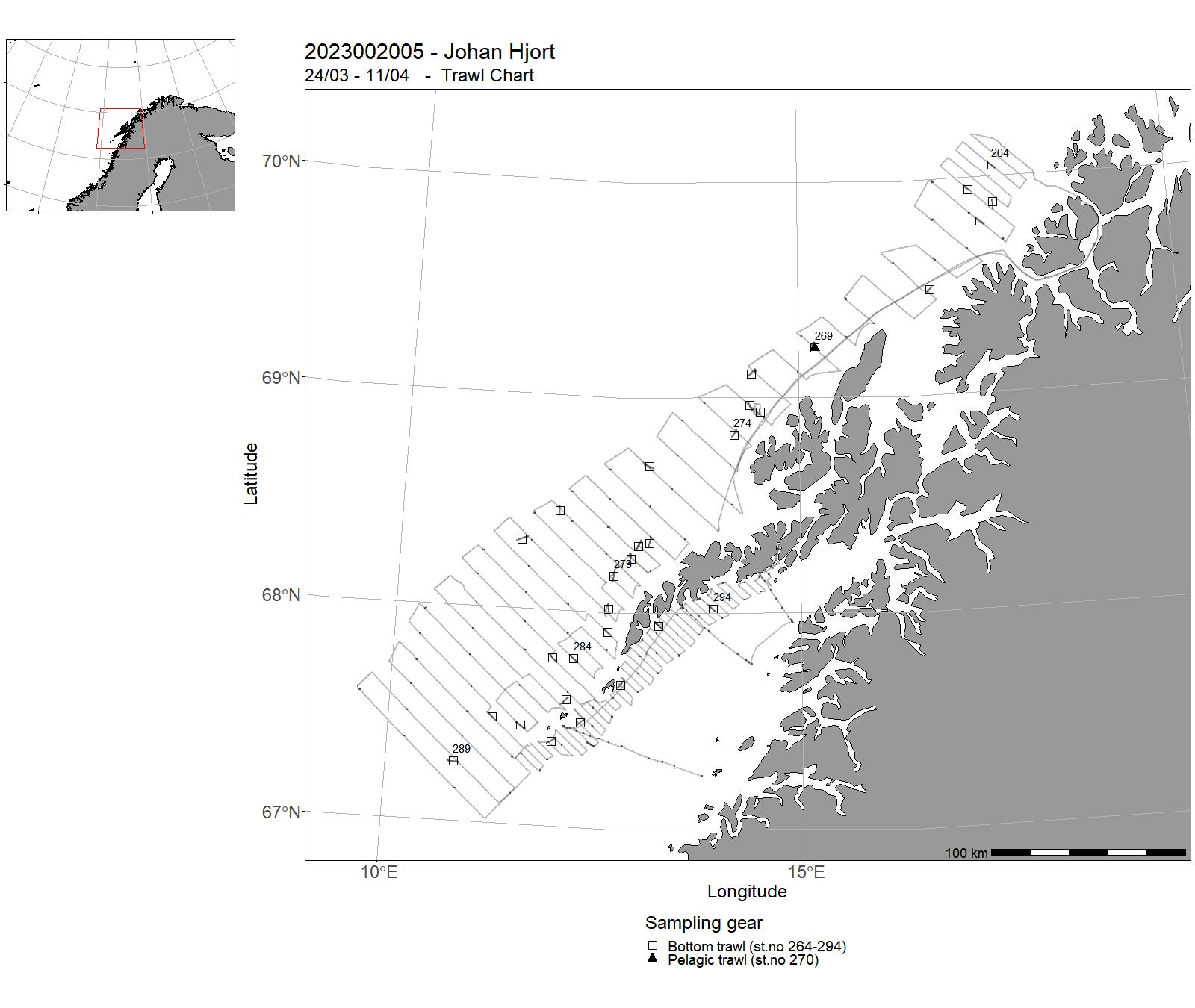
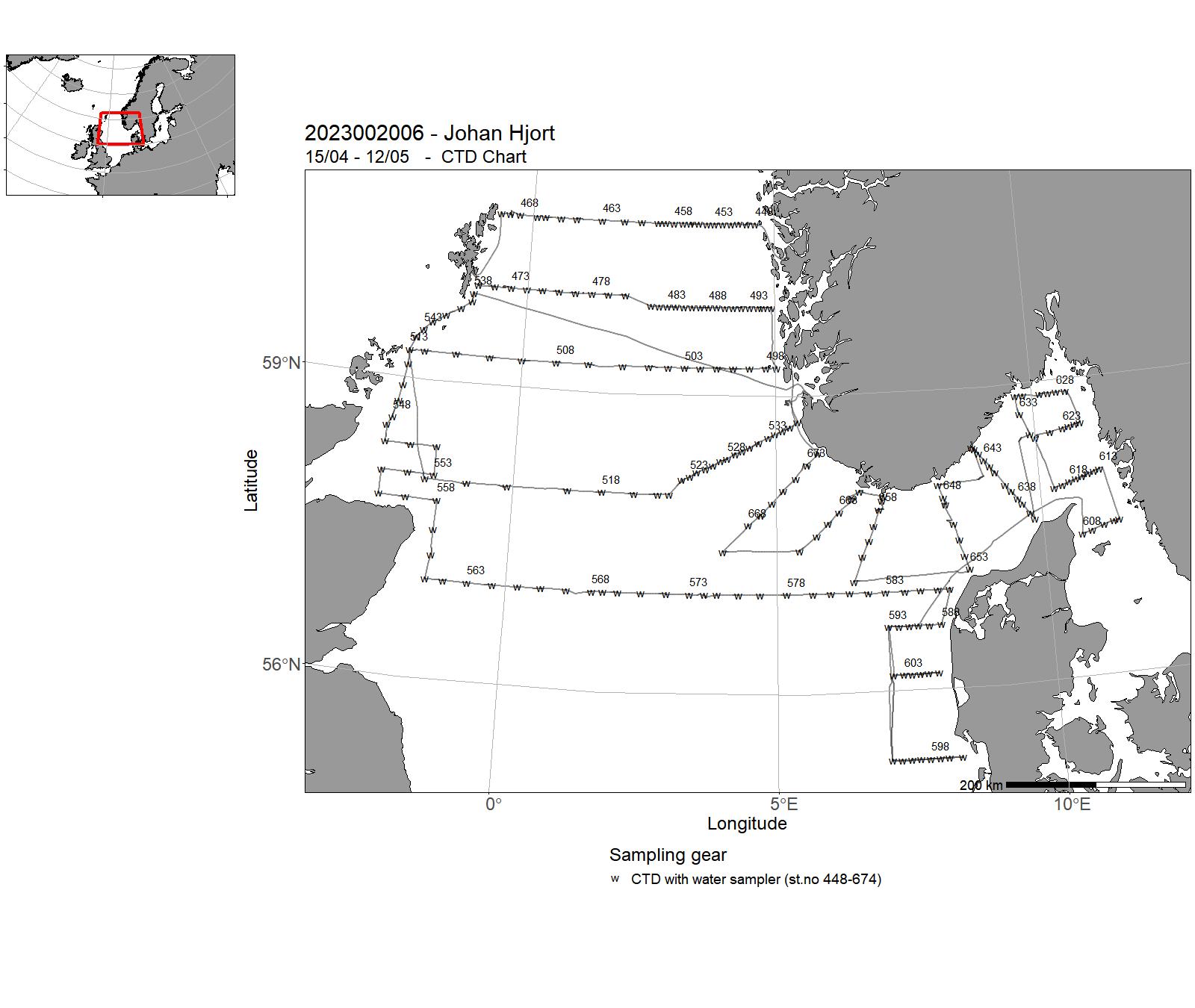
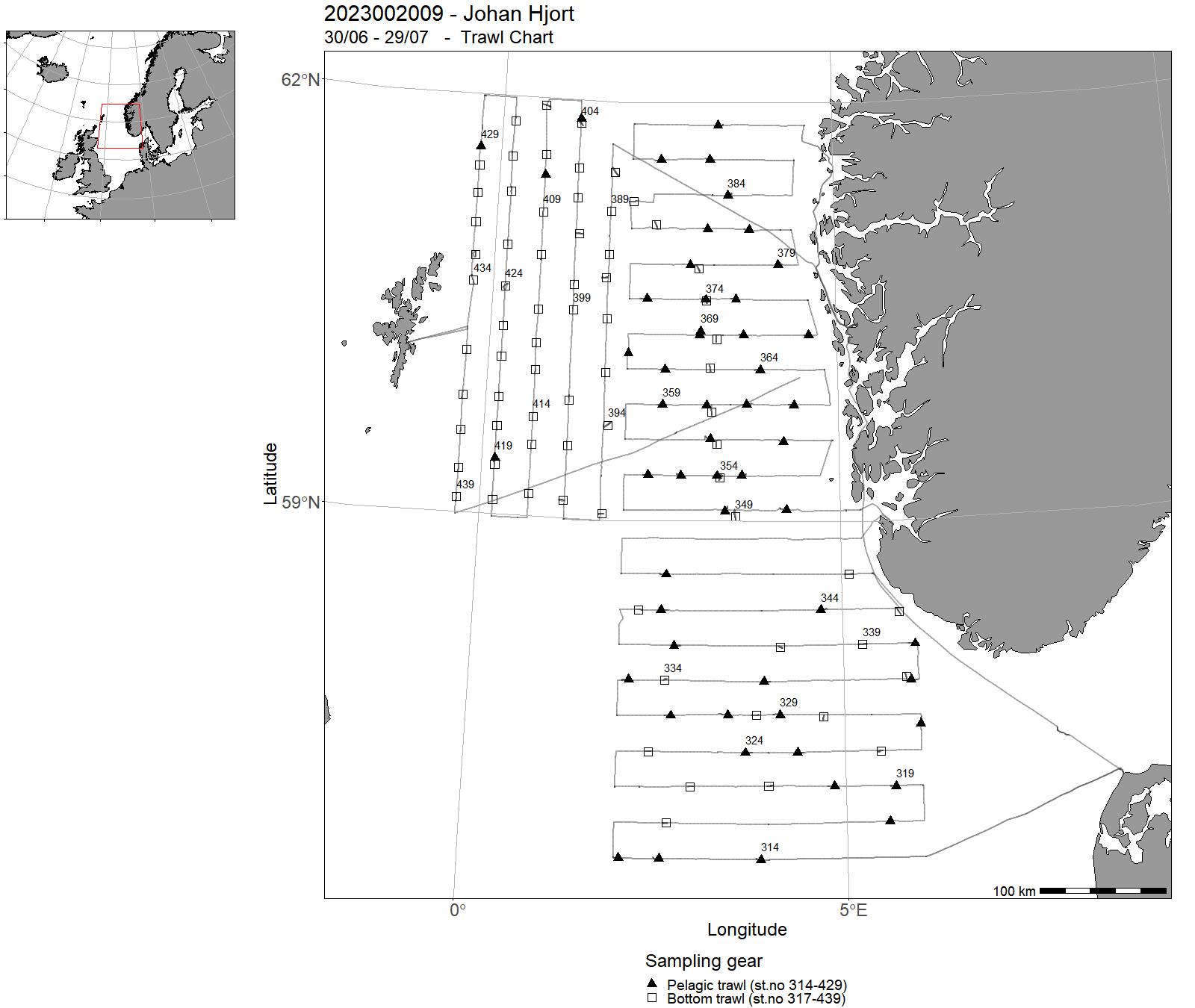
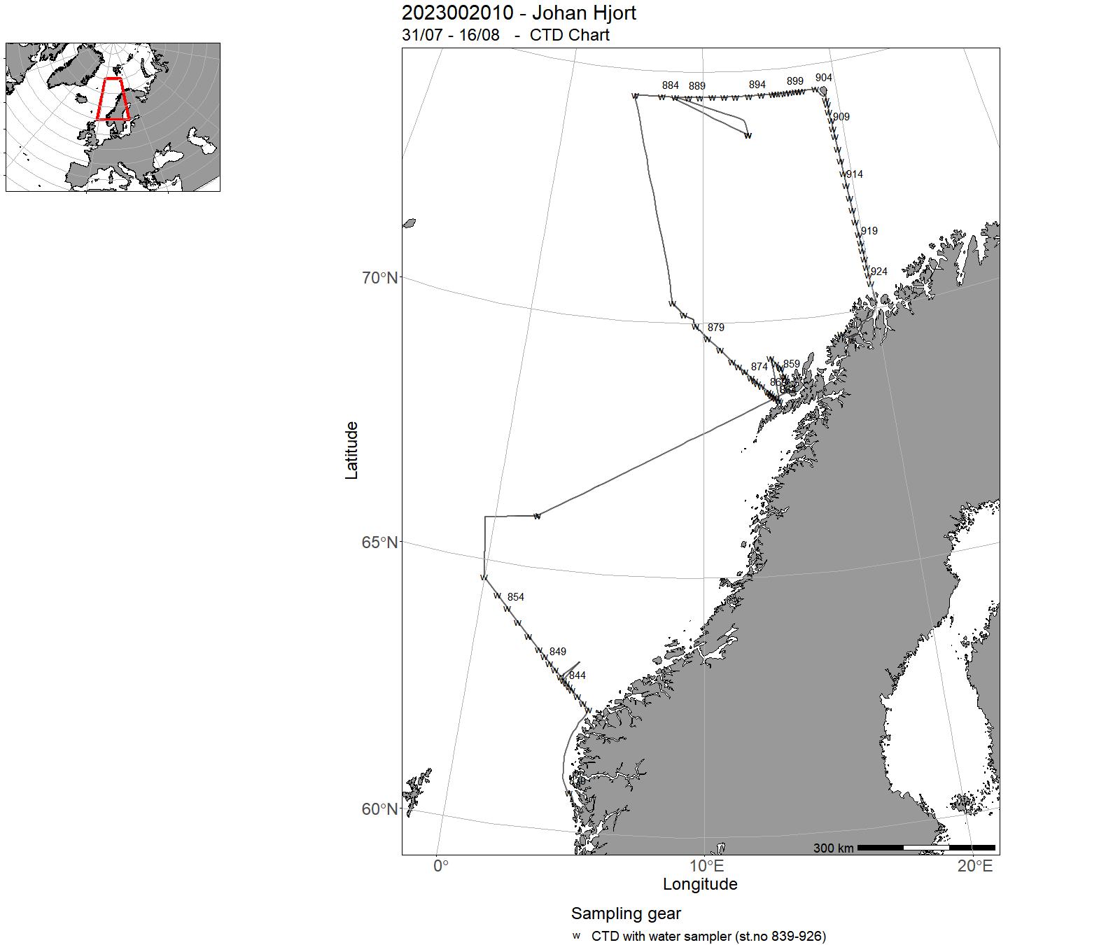
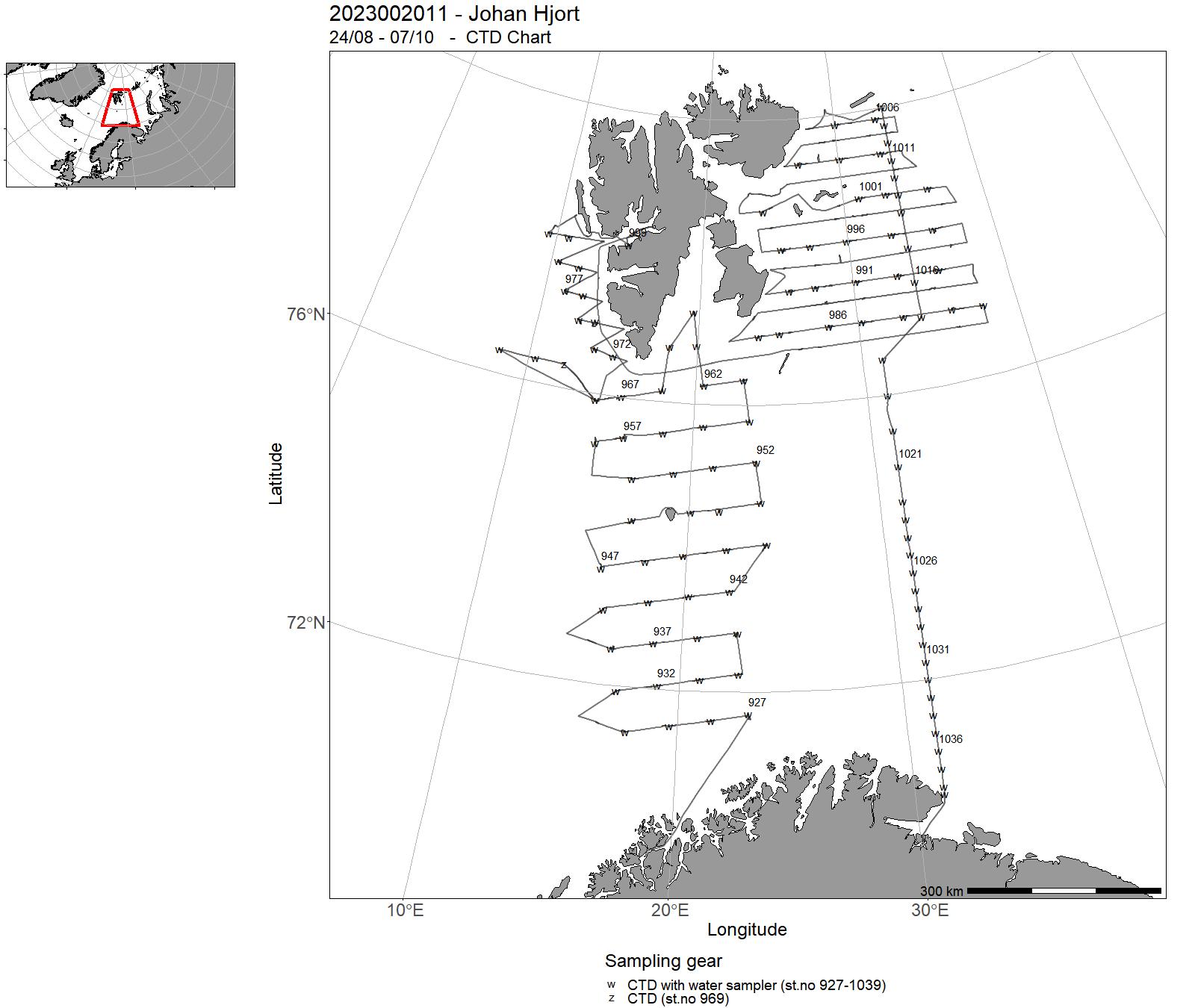
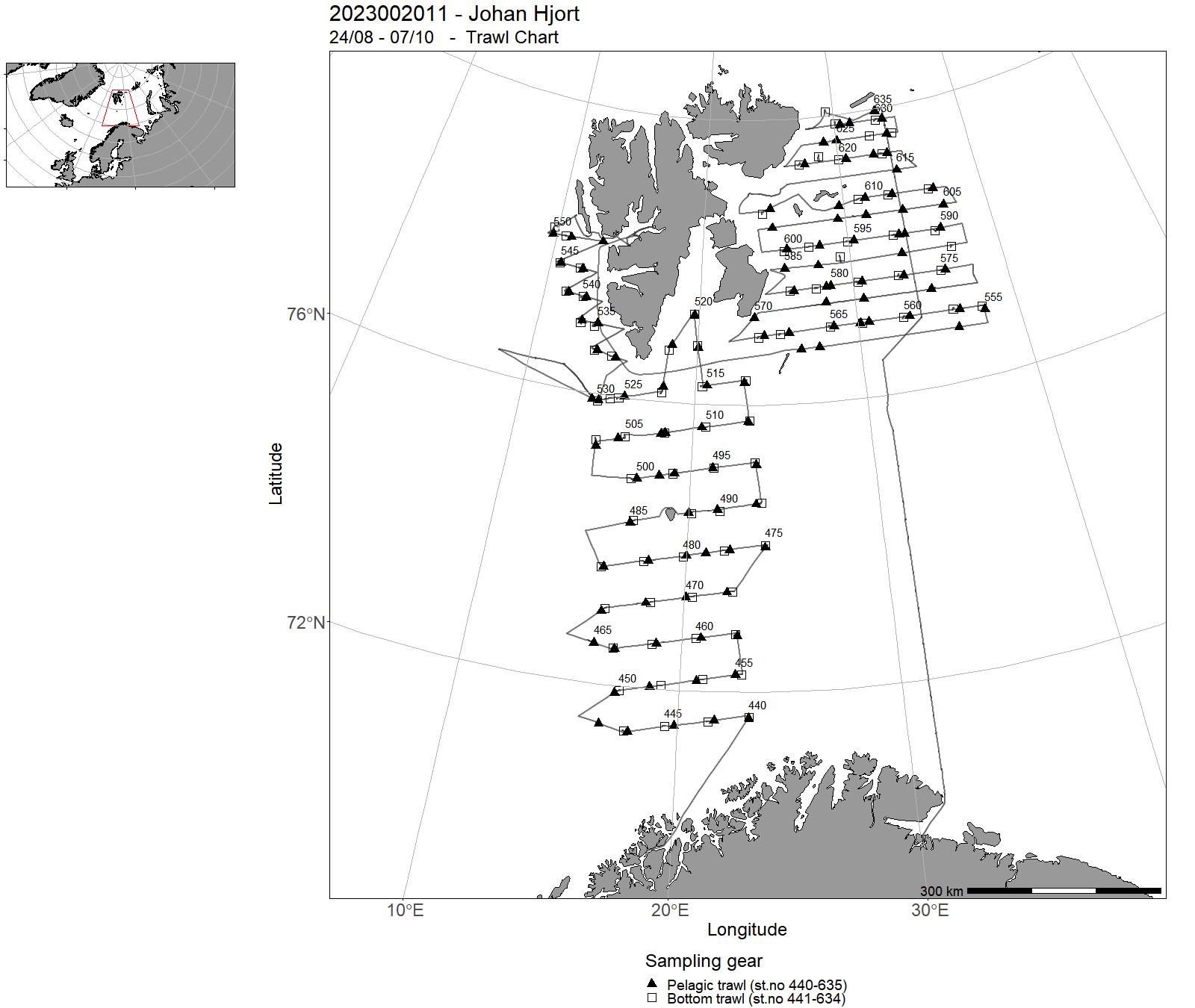
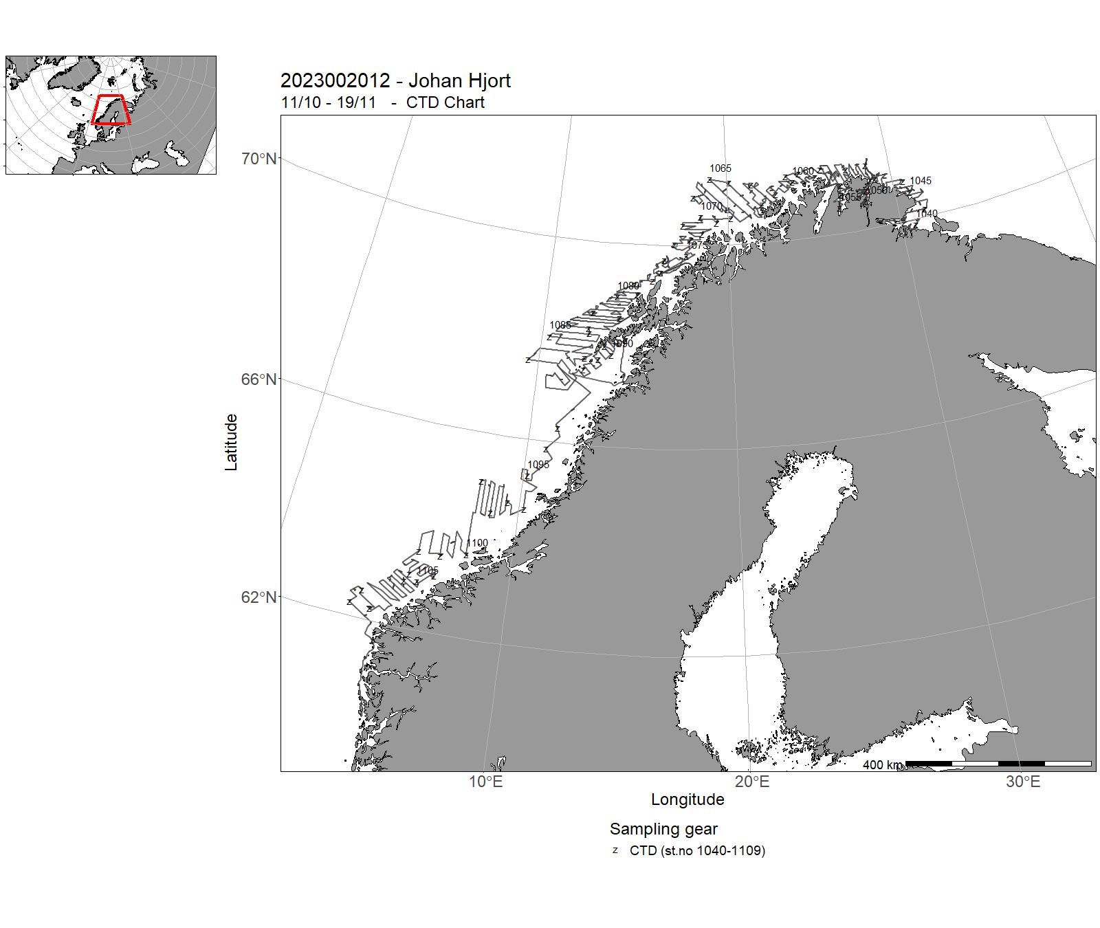
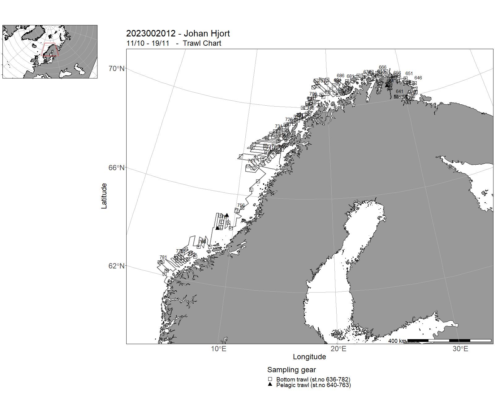
6 - "Kristine Bonnevie" – Cruises 2023
| Cruise no | Period | Purpose | Area | CTD st.no | Trawl st.no |
| 2023006001 | 07/01 - 27/01 | Årlig overvåking av rekebestanden i Norskerenna/Skagerrak (NSSK): biomasse, mengde, størrelses- og stadiefordeling og rekruttering. Toktet bidrar med fiskeriuavhengige data til bestandsmodellen og det årlige ICES-assessmentet på reke i NSSK. Registrering av vekt og lengdemålinger av all bunnfisk i fangsten. | Skagerrak | 1-116 | 1 - 127 |
| 2023006002 | 02/02 - 08/02 | The objective of the cruise was to understand the impact of salmon fish farms on the sea-pen Virgularia mirabilis. For this, we studied the distribution of sea-pens Virgularia mirabilis in the vicinity of two fish farms (Låva and Kjehaola) in the North of Ombo (Boknafjorden). | North Sea | 117-156 | - |
| 2023006003 | 09/02 - 10/02 | Training of students at University of Bergen, Course BIO356, in fishery acoustic and trawl methods. Echo sounder samplingTrawling with DeepVision camera system | North Sea | 157-158 | 128-130 |
| 2023006004 | 14/02 - 17/02 | This was a student cruise, with the purpose of teaching students in meteorology and physical oceanography how oceanographic fieldwork is conducted. Data (physical and biogeochemical oceanography) were collected within Masfjorden, Fensfjorden and Lurefjorden and the data will be used by the students in semester reports. | North Sea | 159-218 | - |
| 2023006005 | 19/02 - 05/03 | The objective of the cruise was to collect data and samples on standard sections: Svinøy-NW, Gimsøy-NW, Bjørnøya-W and Fugløya-Bjørnøya and "Station M". Project name: Monitoring of environmental parameters and plankton in the Norwegian SeaCoordinating body: Institute of Marine Research | Norwegian Sea | 219-254 | - |
| 2023006006 | 04/04 - 15/04 | Acoustic mapping of NEA spawning grounds north of the traditional survey area. Indices of abundance are to be comared with the survey results covering spawning grounds further south. | Norwegian Sea | 282-342 | 131-157 |
| 2023006007 | 18/03 - 27/03 | The goal of the cruise is to collect fish eggs for mapping spawning areas in the project «National program for mapping of marine nature types». The primary targets for the mapping are local stock of coastal cod. The secondary goal is to visually determine all eggs and preserve these for further genetic studies. All eggs are photographed. Stations are located primarily in the inner fjord areas, with less emphasis on the outer coastal areas. | Northeast Atlantic Ocean (40W) | 262 | - |
| 2023006008 | 30/03 - 03/04 | Monitoring of the environment and plankton at the Fugløya-Bjørnøya sections in april. Measuring physical, chemical and biological parameters. | Barents Sea | 263-281 | - |
| 2023006009 | 25/04 - 14/05 | Measuring the abundance, distribution and age composition of lesser sandeel Dredge sampling for burrowed sandeelsBottom trawlsPelagic trawlsEcho sounder samplingZooplankton samplingMapping of hydrographical conditions | North Sea | 343-369 | 158 - 237 |
| 2023006010 | 17/06 - 21/06 | Opplæringstokt for AUV operatører ved seksjon Fartøyinstrument. Toktet kombineres med uttesting av AUV for å samle inn data på krabbe. | Barentshavet | 385-391 | - |
| 2023006011 | 01/06 - 17/06 | The aim of the cruise was to study the spreading and collect density data on the snow crab in the Svalbard Fishery Protection Zone by using a research vessel. Our main study area was in the present area for commercial fishing. Also testing of different traps were performed during the cruise. | Barents Sea | 370-384 | 101-605 |
| 2023006013 | 08/07 - 11/08 | Objectives : To collect data and samples on pre-selected stations. During the first leg, to sample standard transects for physical oceanographic parameters (CTD casts, nutrients and chlorphyll), fish eggs and larvae, and zooplankton in the North Sea. Utsira-V transect Scotland East Coast Pentland - Fair Isle Utsira - Start Point. The second part of the cruise corresponds to the International Bottom Trawl Survey (IBTS), coordinated by the ICES International Bottom Trawl Survey Working Group (IBTSWG). IBTS targets the following commercial fish species: herring, cod, haddock, whiting, saithe, Norway pout, mackerel, sprat. The main objective of the IBTS quarter 3 survey is to monitor changes in these stocks independently of commercial fisheries data, and to collect data for the determination of biological parameters relevant to stock assessments. | North Sea | 393 - 518 | 238 - 291 |
| 2023006014 | 12/08 - 25/08 | Acoustic trawl survey for monitoring sprat and herring, zooplankton and hydrography in western Norwegian fjords. Provide abundance indices for sprat for giving quota advice. The survey covered Nordfjord, Sognefjorden and Hardangerfjord. 21.-25. August : Experiments comparing acoustic data retrieved from three different platforms: RV Kristine Bonnevie, kayak drone, USV drone borrowed from Kongsberg Discovery. | North Sea | 519 - 544 | 292-313 |
| 2023006015 | 28/08 - 30/08 | Collection of marine materials and data for BIO 102 course at University of Bergen. | North Sea | 545 - 551 | 314 - 325 |
| 2023006016 | 04/09 - 28/09 | Stock assessment study for red king crab in quota regulated area in East Finnmark, Norway. | Barents Sea | 552-585 | 103 - 547 |
| 2023006017 | 10/10 - 31/10 | Annual combined acoustic and bottom trawl survey along the Norwegian coast north of 62 N Map the distribution and estimate acoustic abundances indices, length, weight and maturity at age of cod, saithe and haddockImprove data basis, by allocating additional bottom trawls, for the assessment of golden redfishMap the general hydrographical regime by using a CTD-sonde to monitor the temperature and salinity at bottom trawl stations and/or at fixed intervals (about 30 NM). | Norwegian Sea | 586-648 | 326 - 420 |
7 - "Kristine Bonnevie" – Charts for 2023
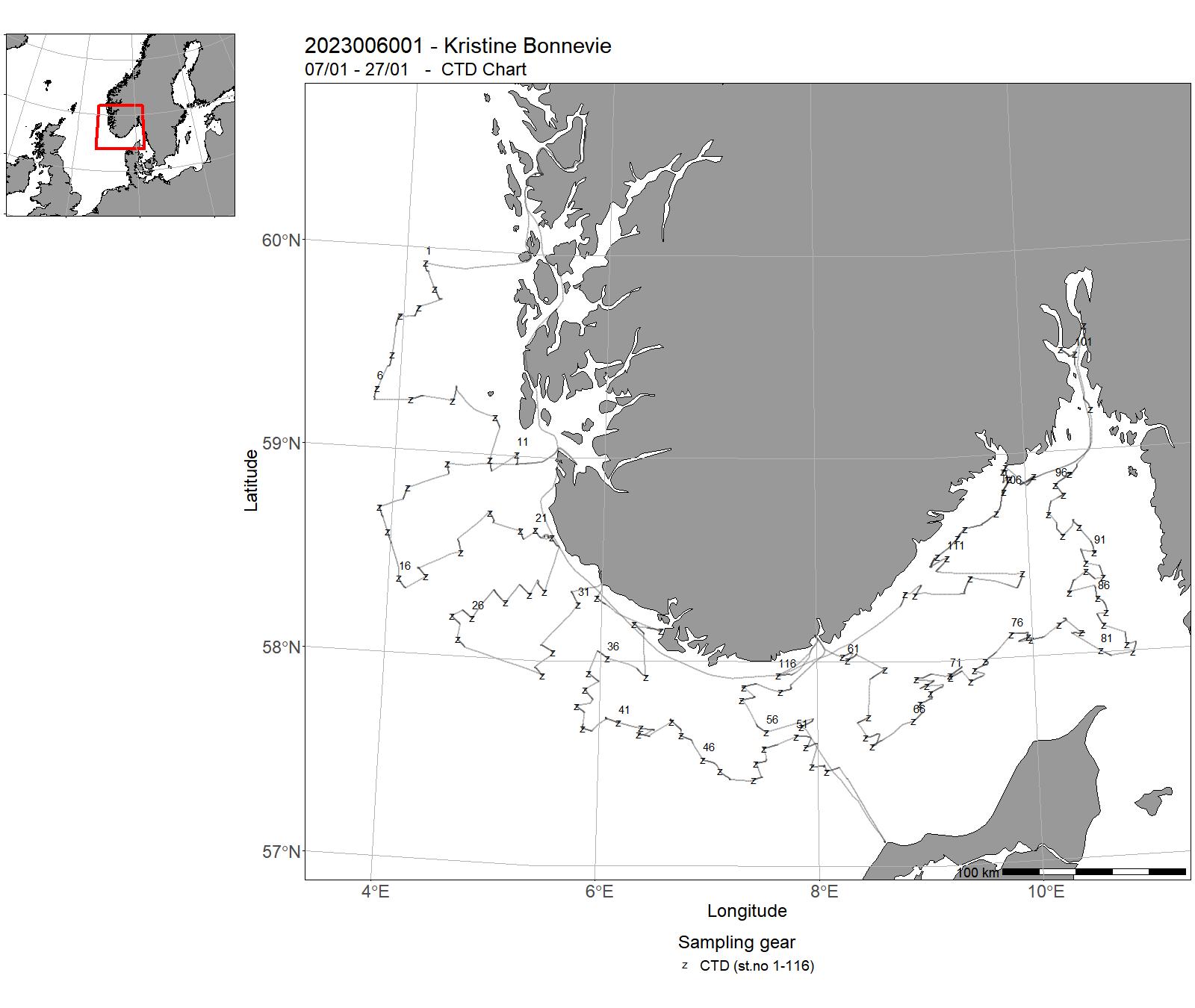
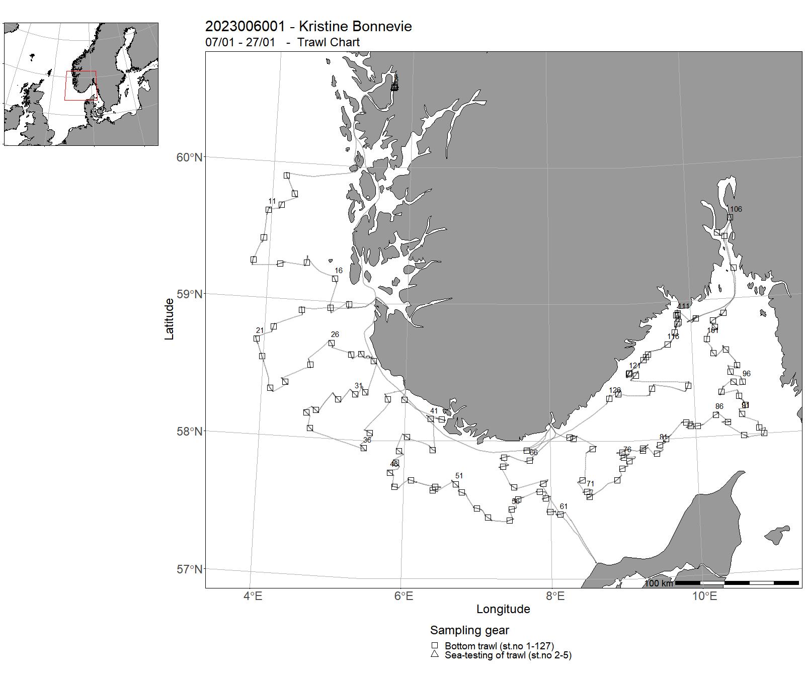
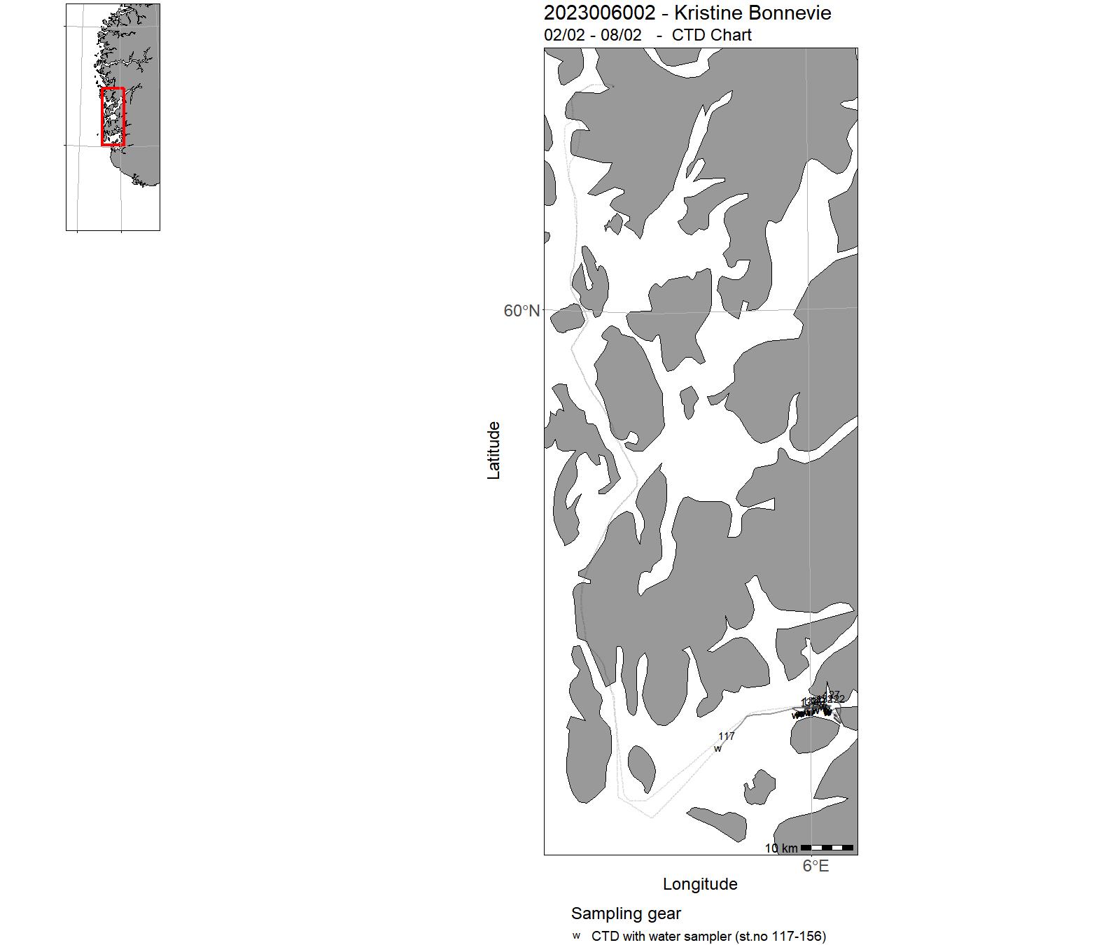
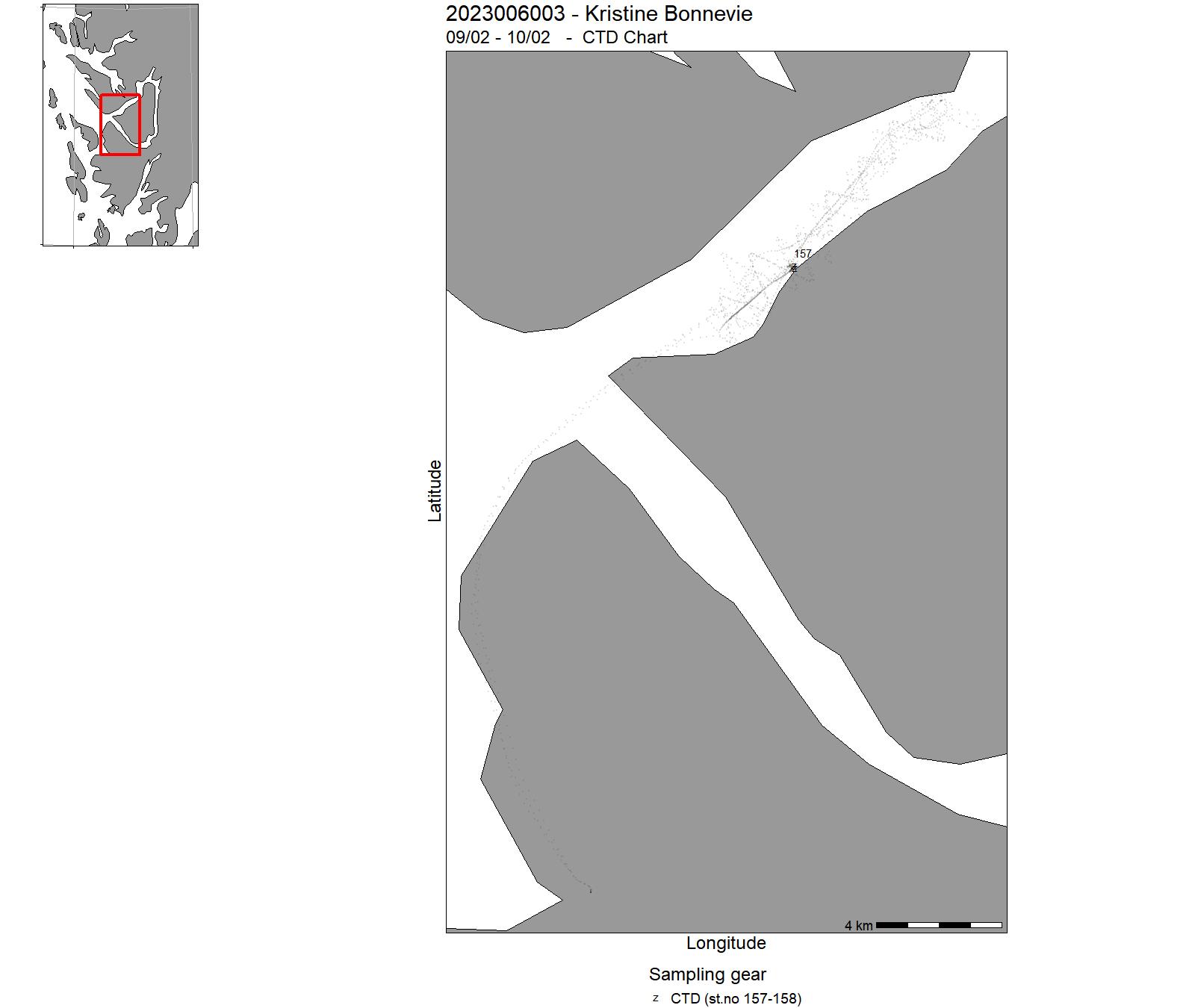
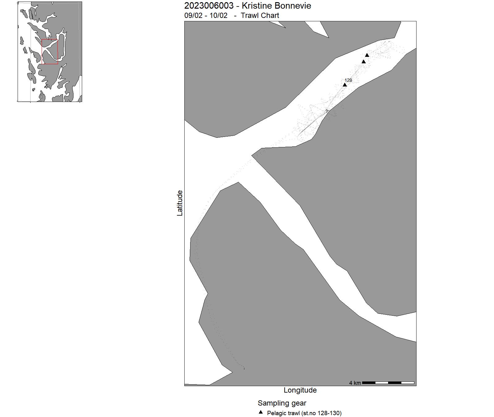
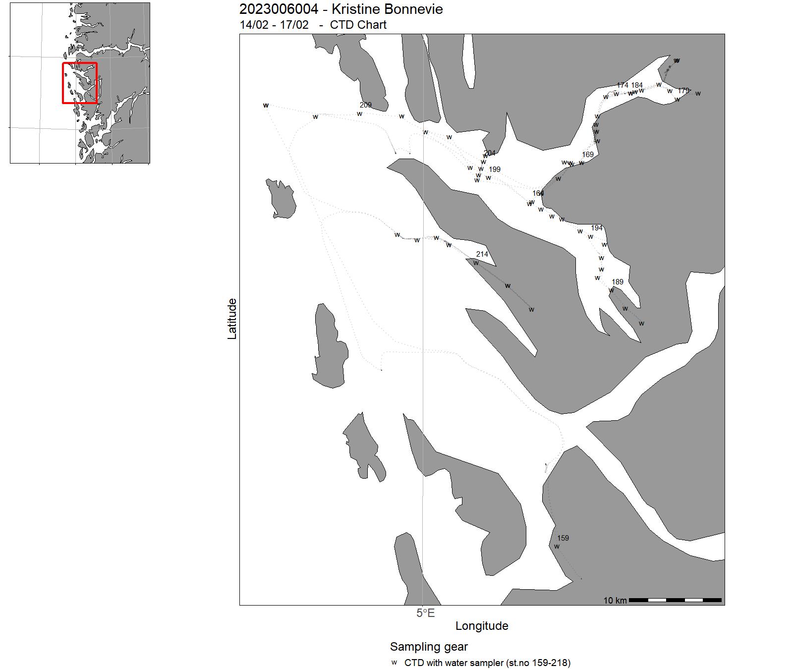
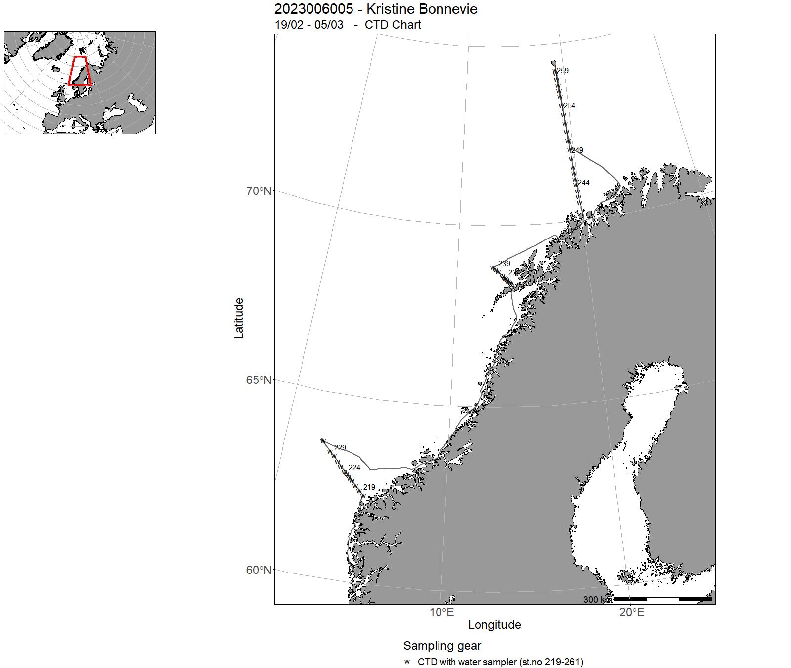
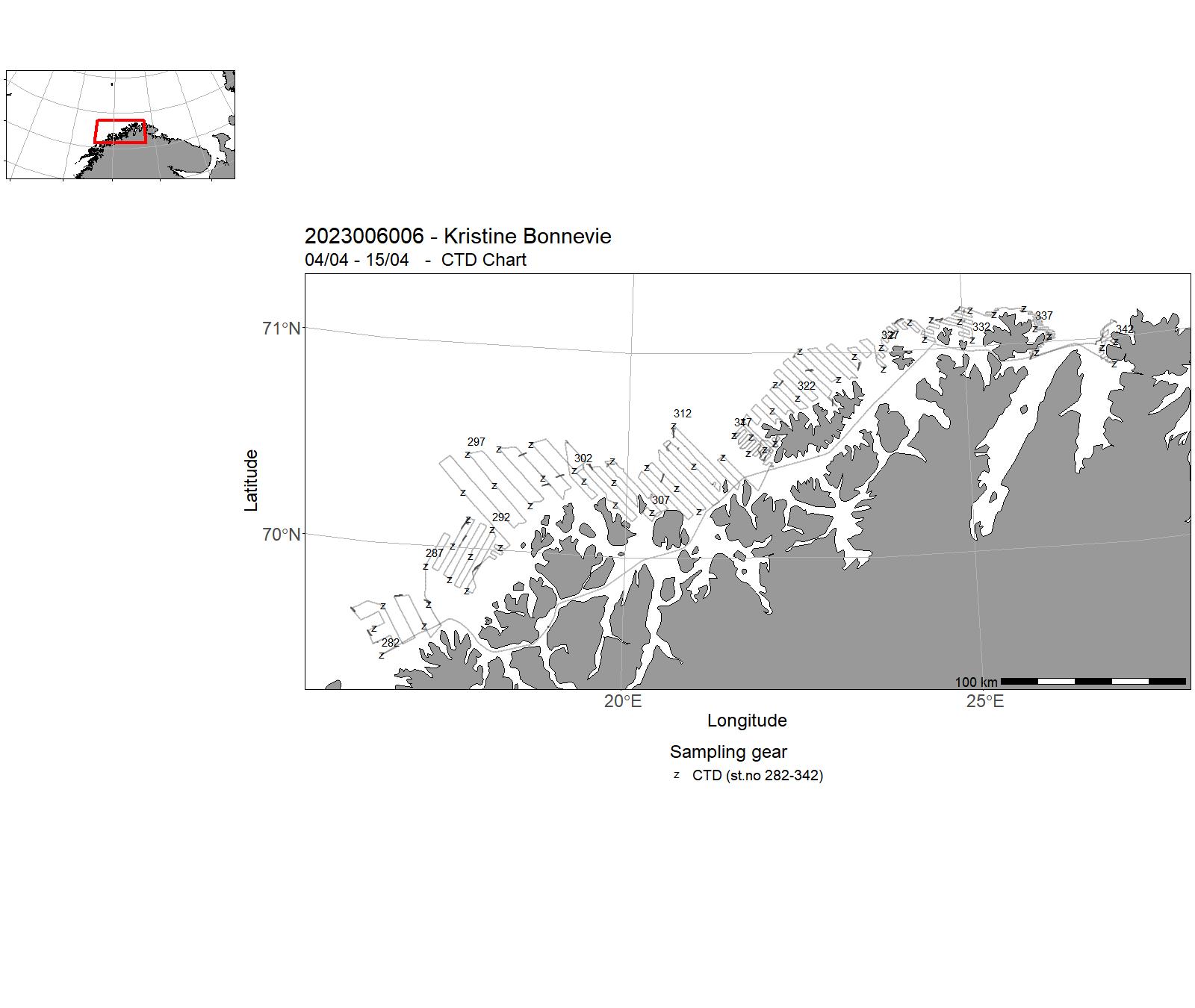
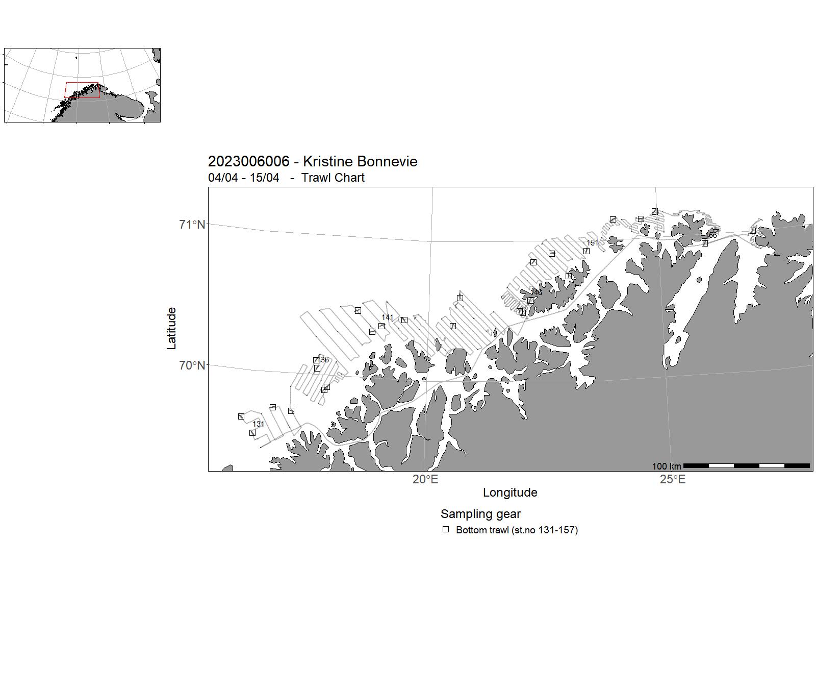
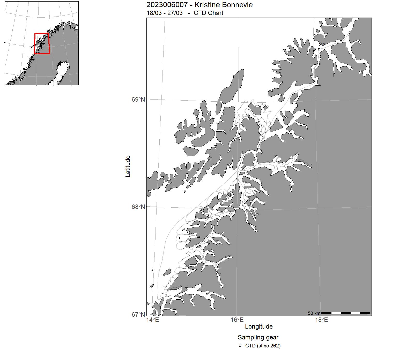
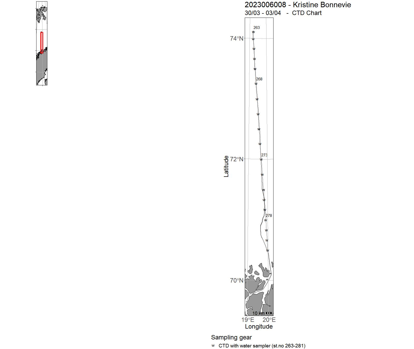
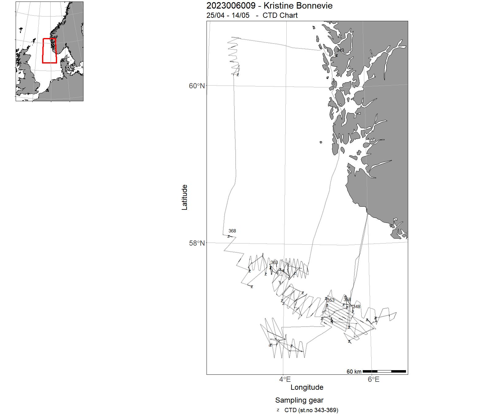
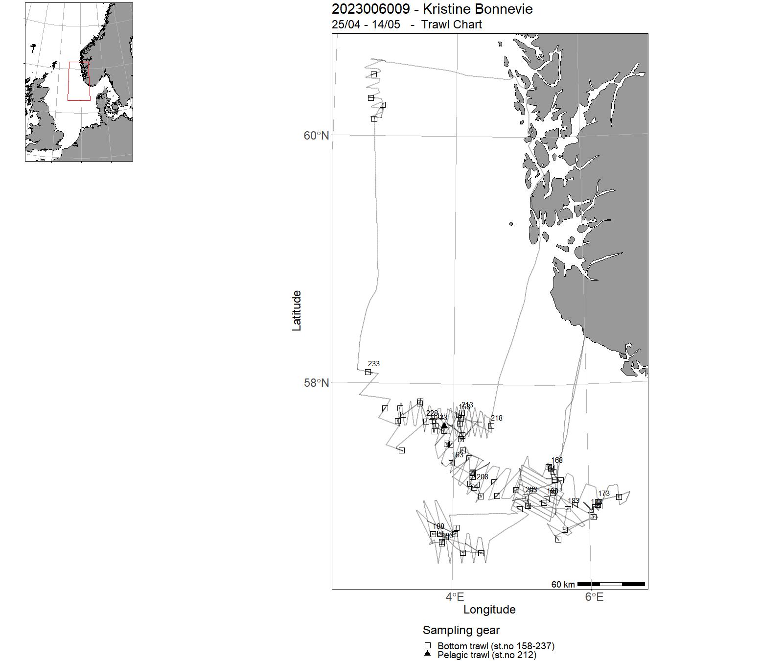
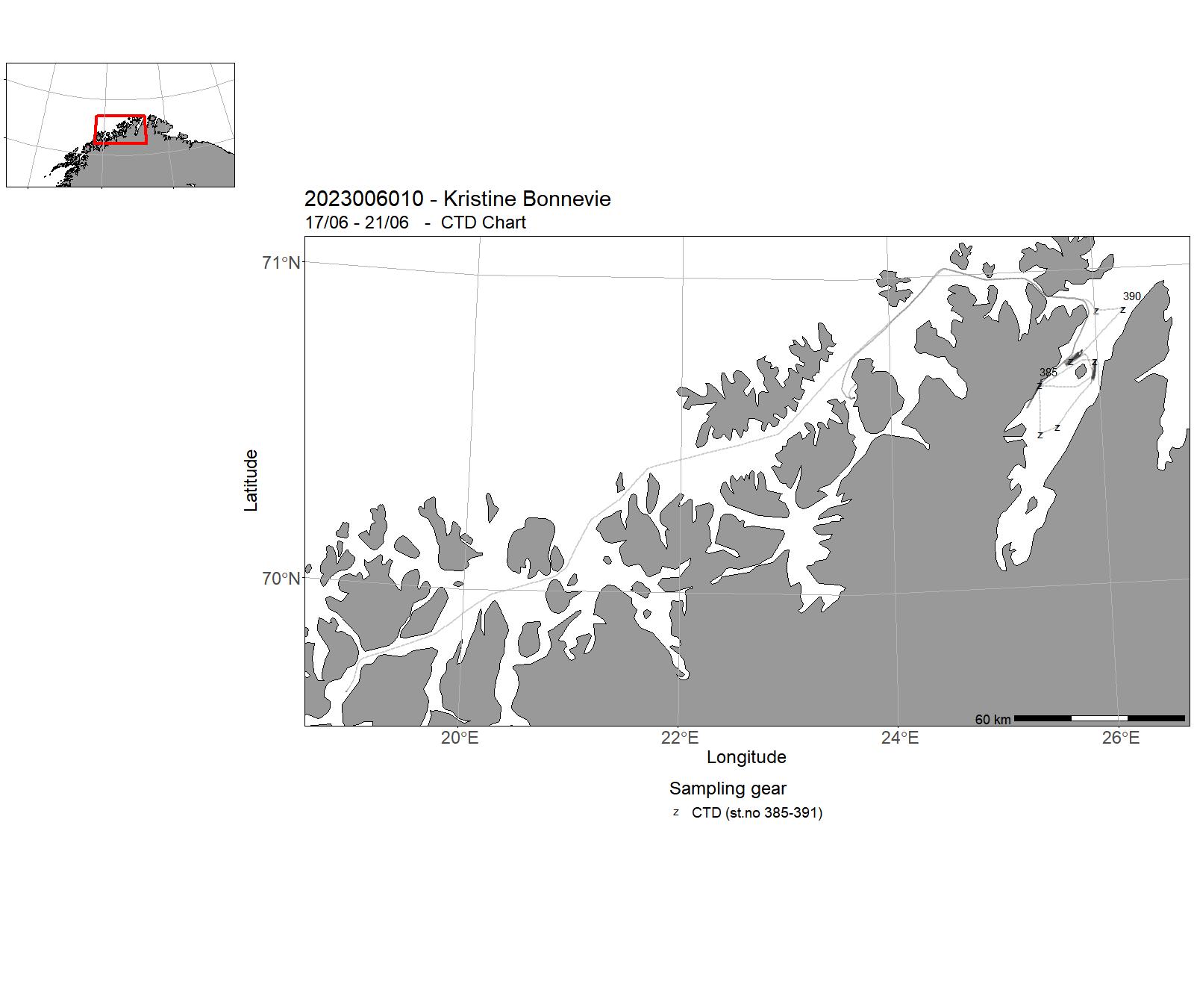
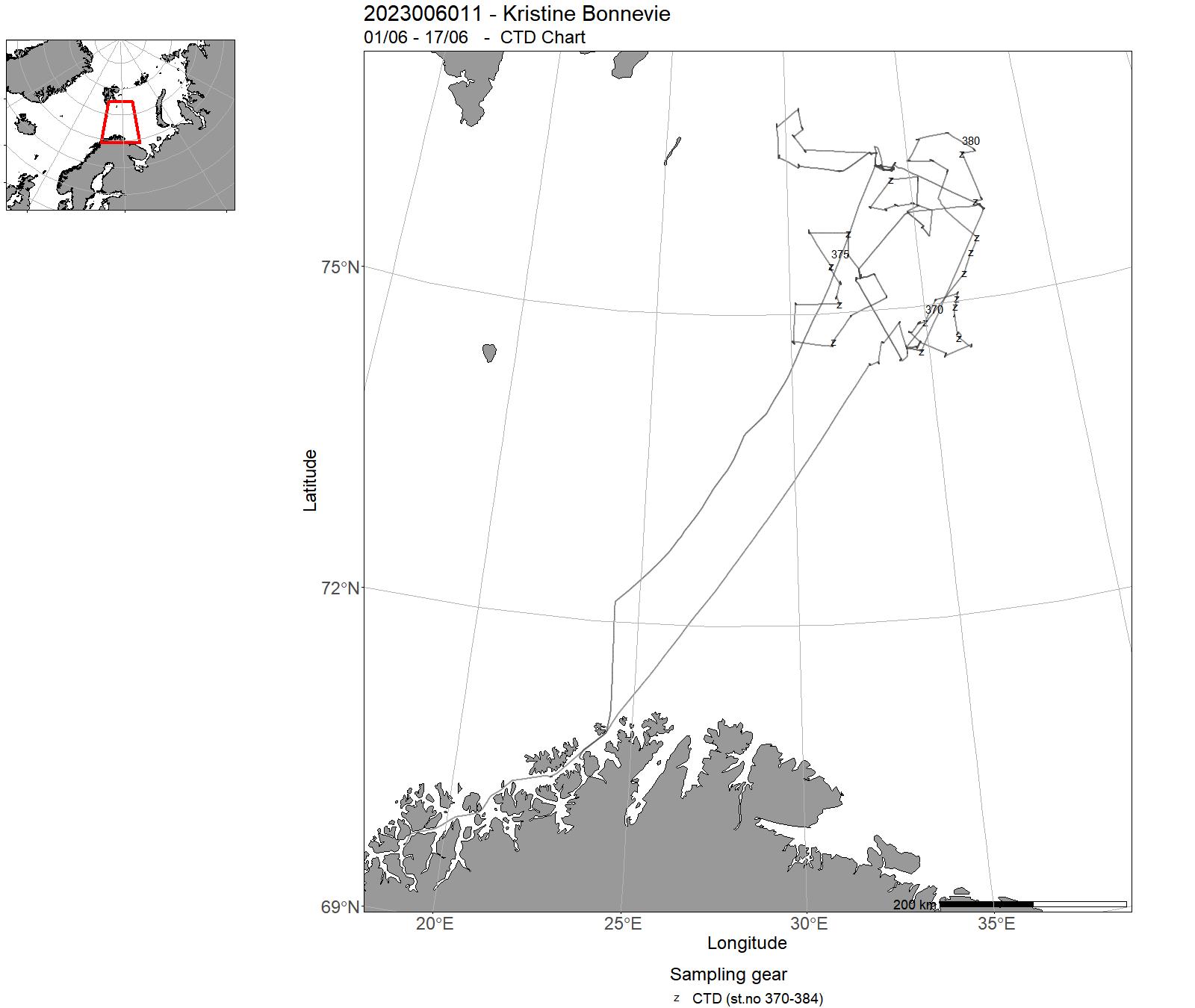
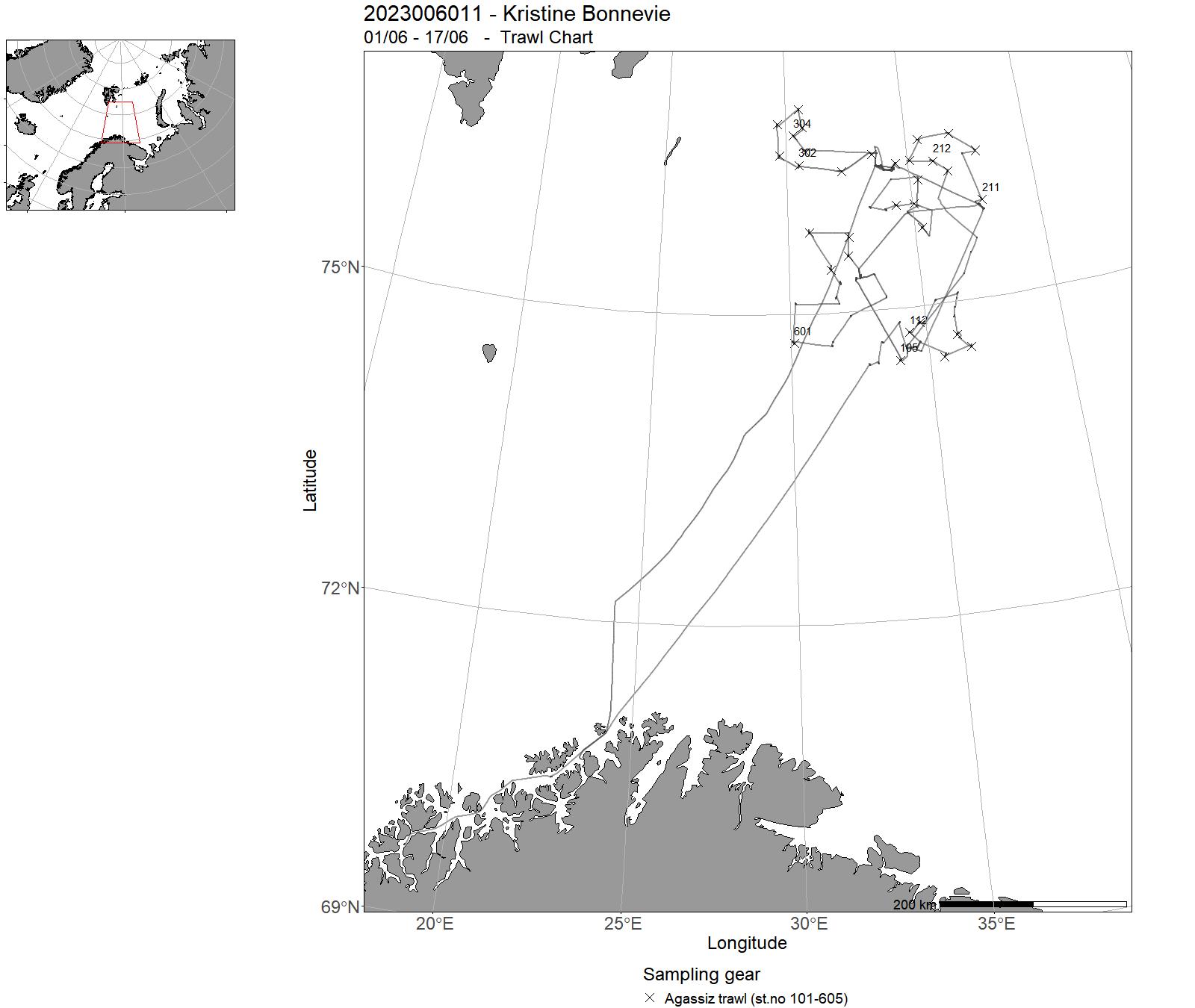
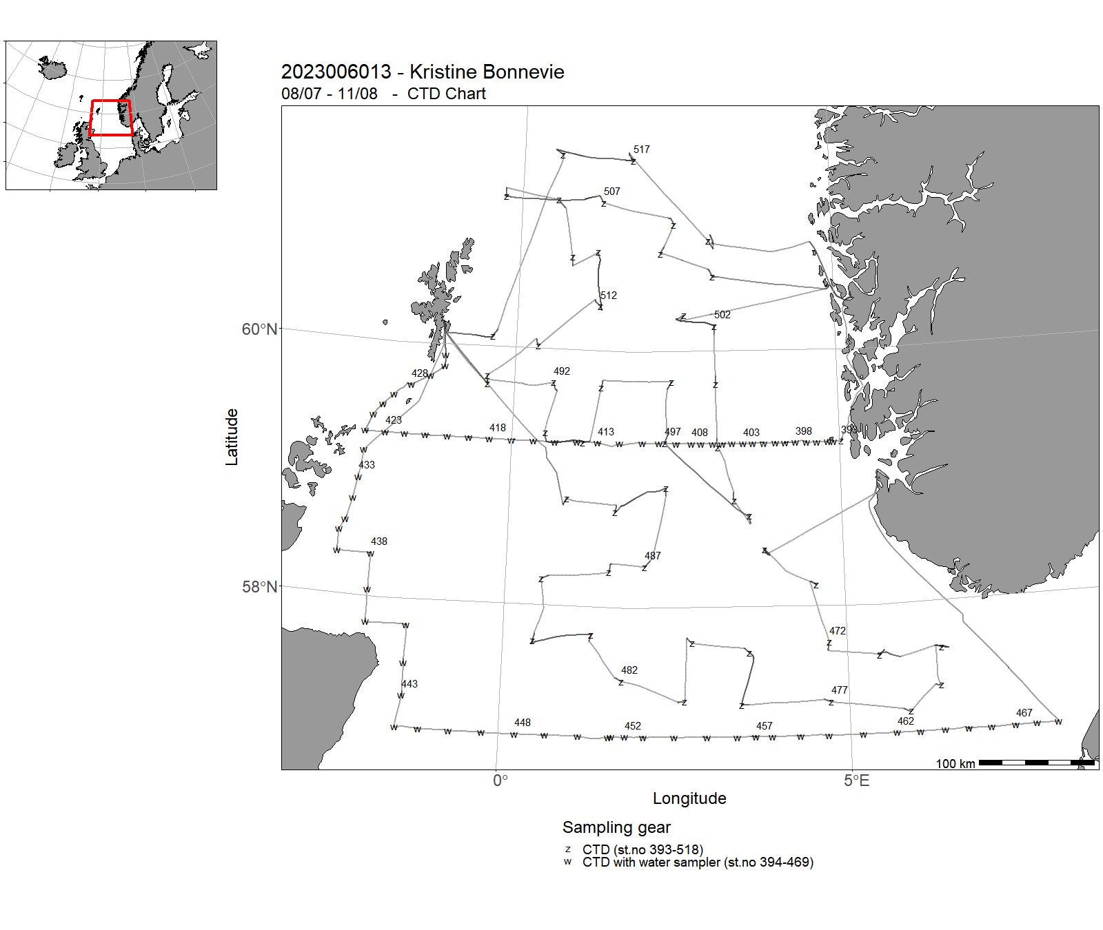
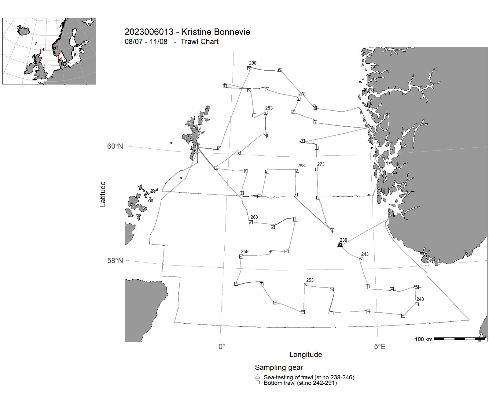
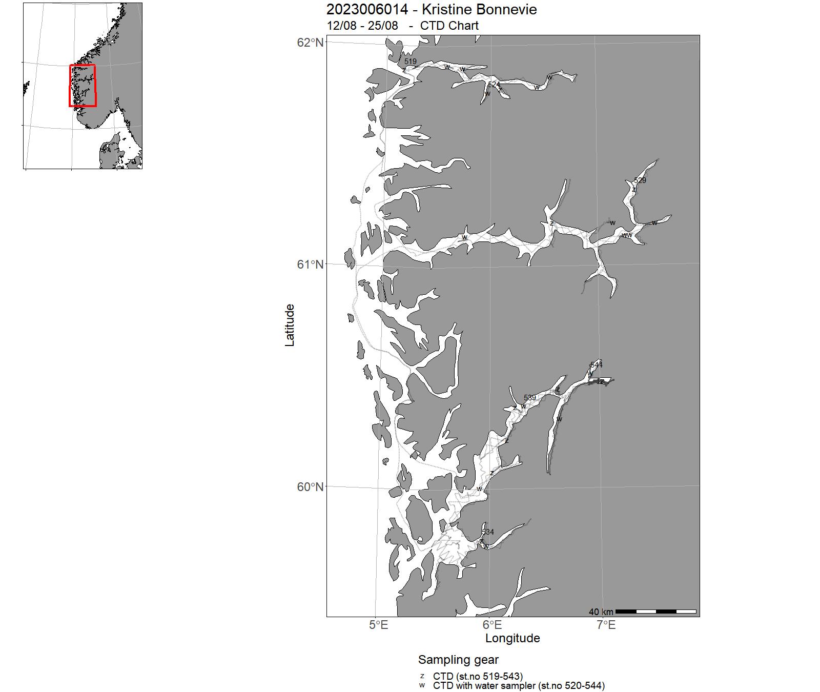
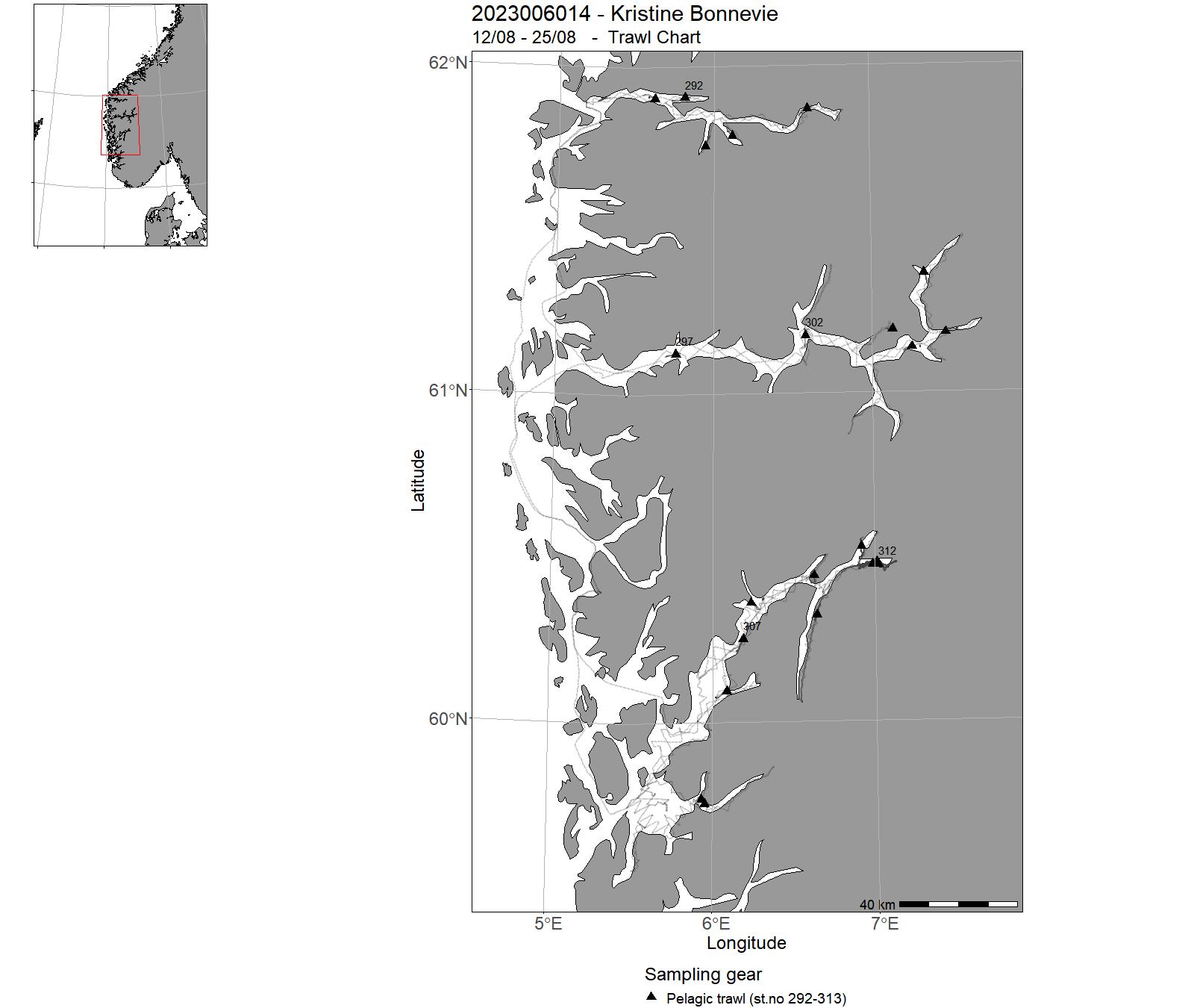
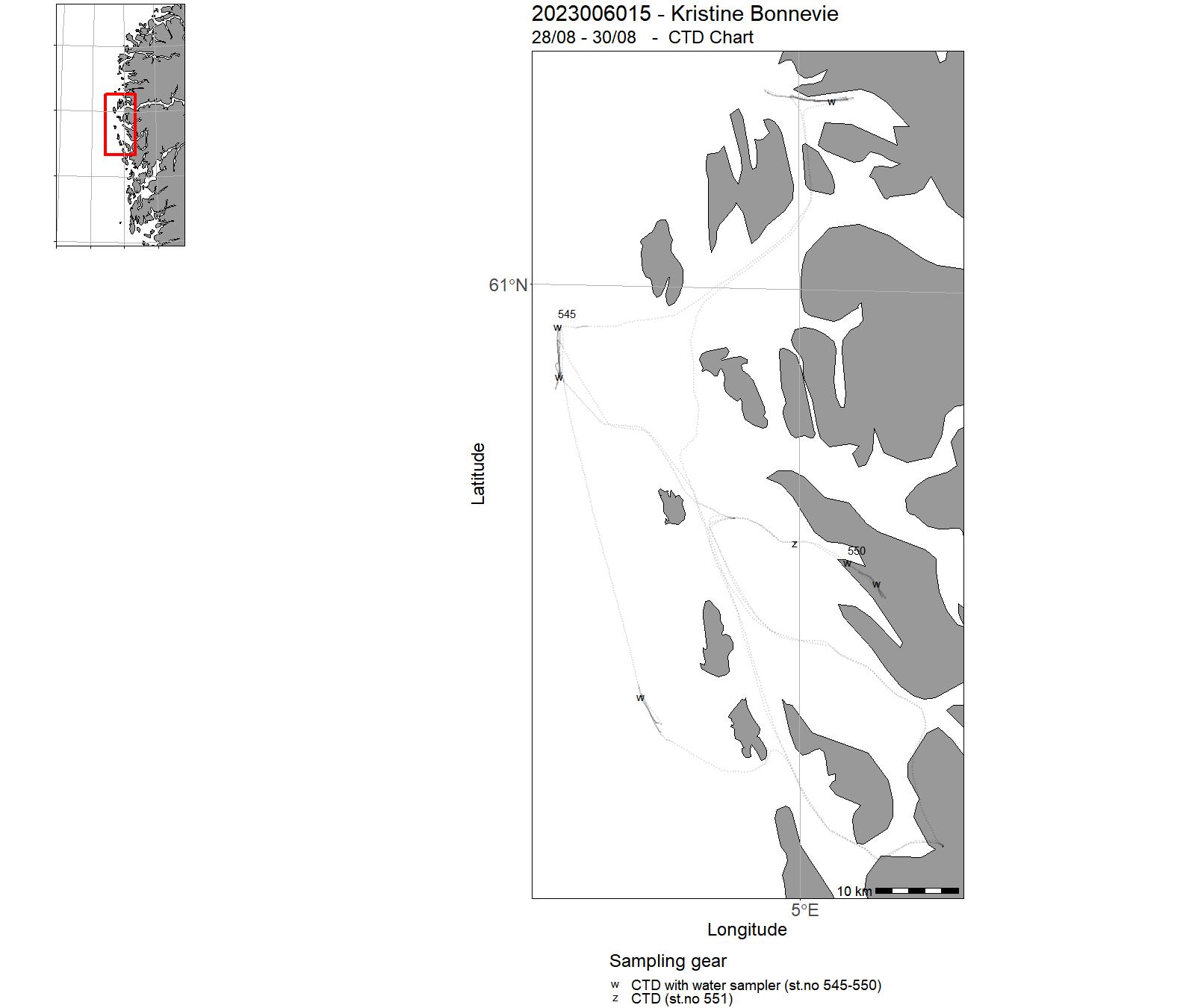
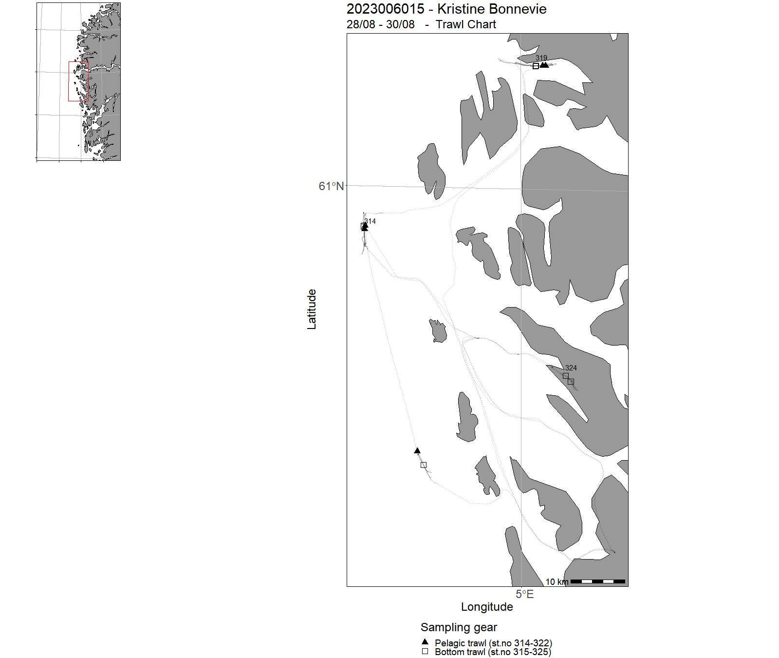
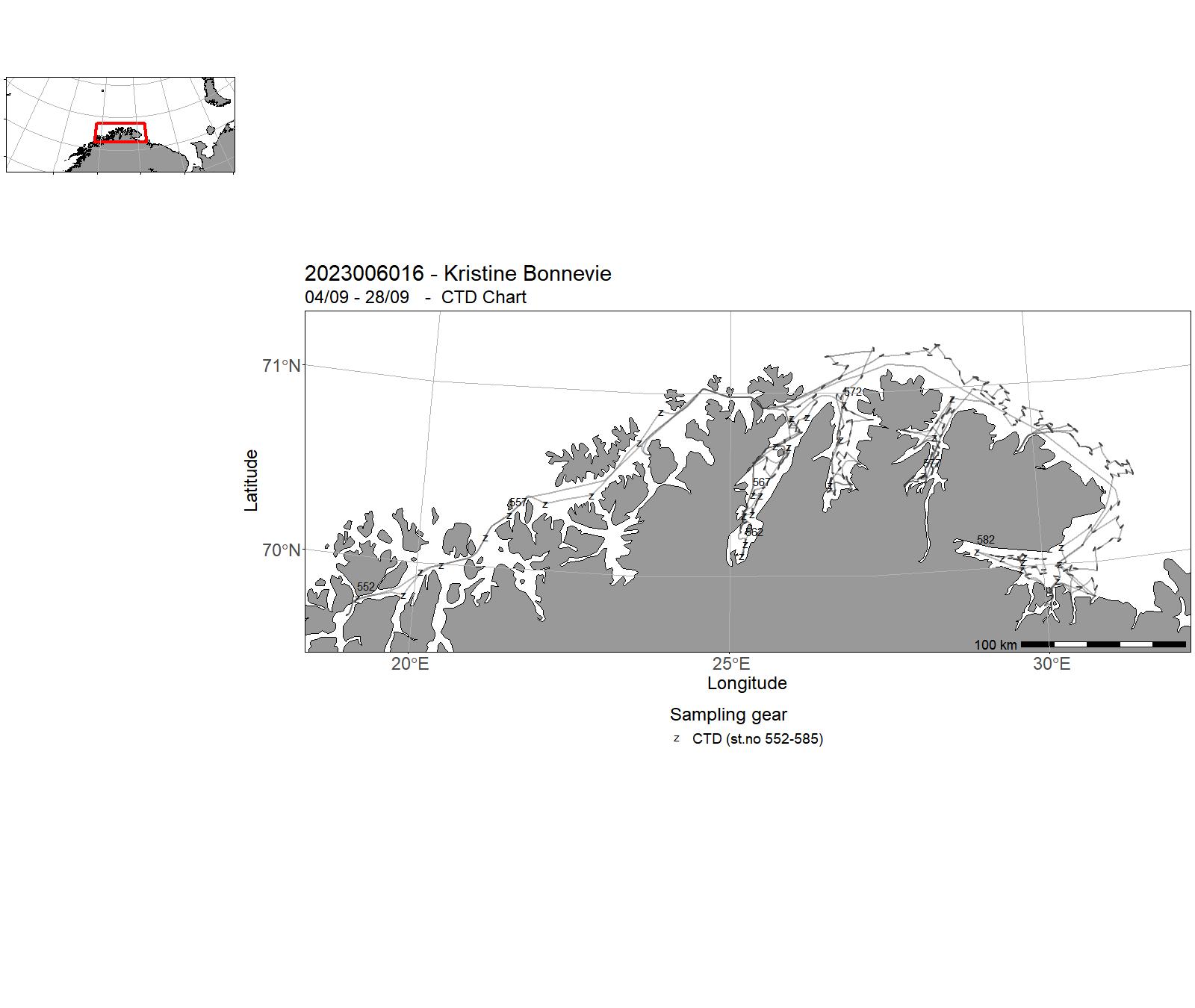
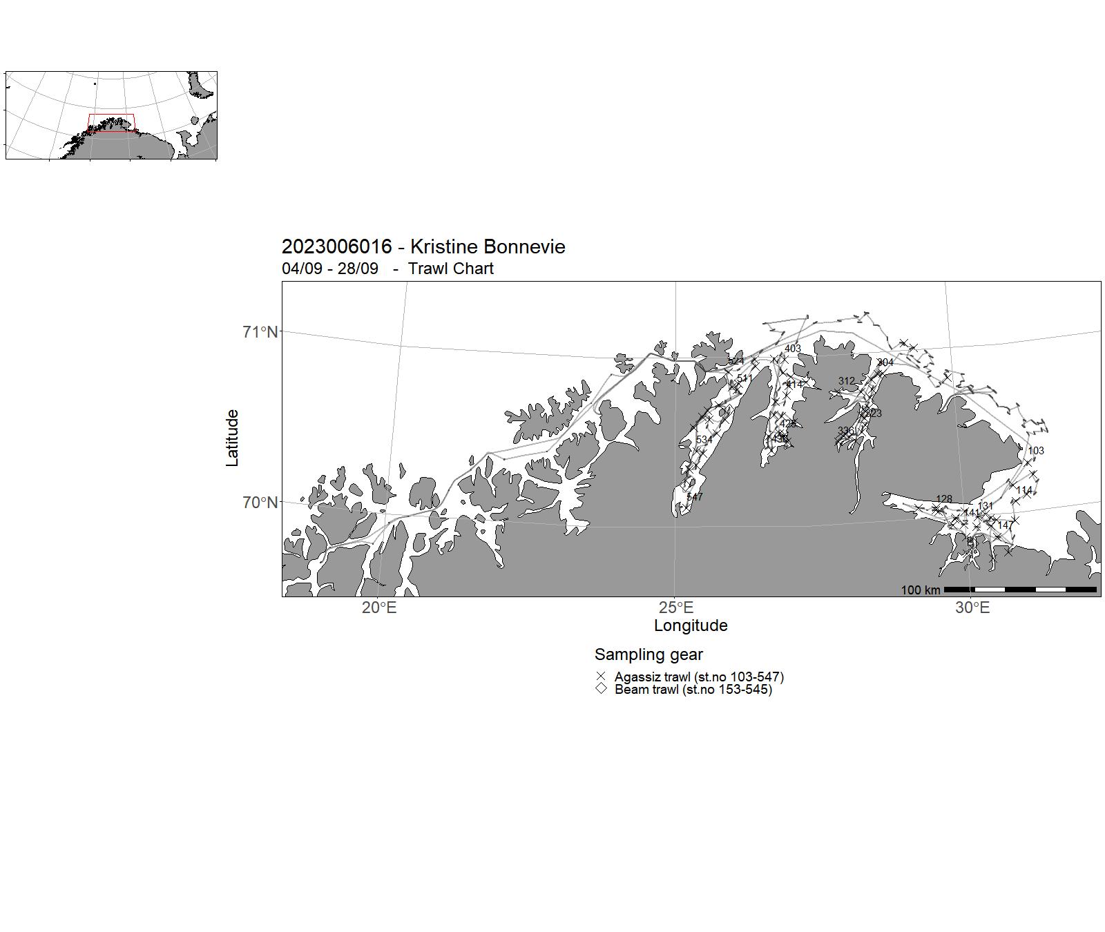
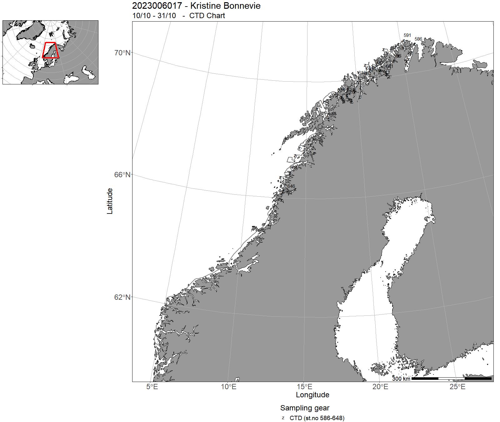
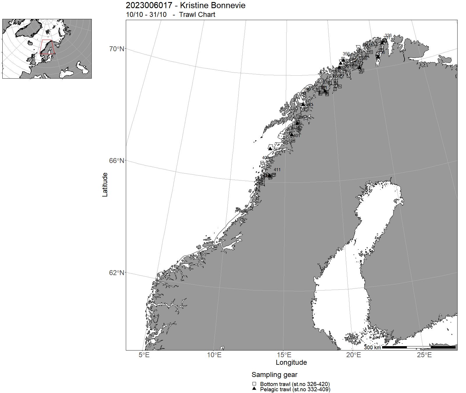
8 - "Kronprins Haakon" – Cruises 2023
| Cruise no | Period | Purpose | Area | CTD st.no | Trawl st.no |
| 2023007001 | 30/01 - 02/02 | Styringsgruppen Kronprins Haakon had bedt om at KH ligger til kai i Tromsø mens Arctic Frontiers pågår, så lenge de vitenskapelige konsekvensene av dette er overkommelige. UiT og NP vil sørge for bemanning om bord mens hendelsen pågår. | Norskekysten: Troms og Finnmark | - | - |
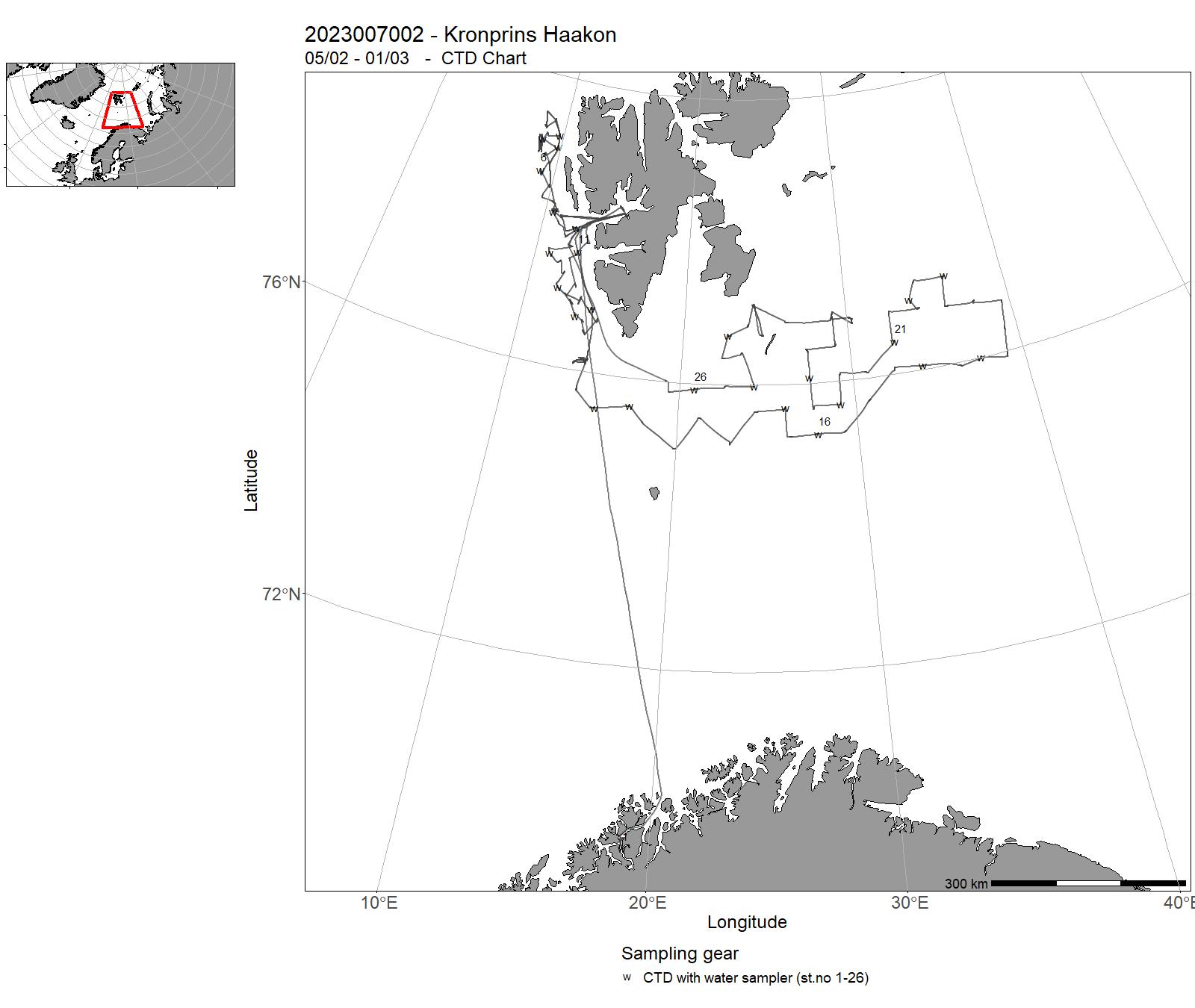
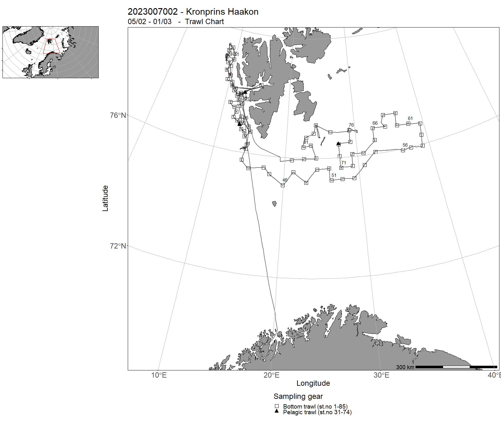
| 2023007002 | 05/02 - 01/03 | Abundance and distribution of cod and haddock.Cruise name: Vintertokt | Barents Sea | 1-26 | 3 - 85 |
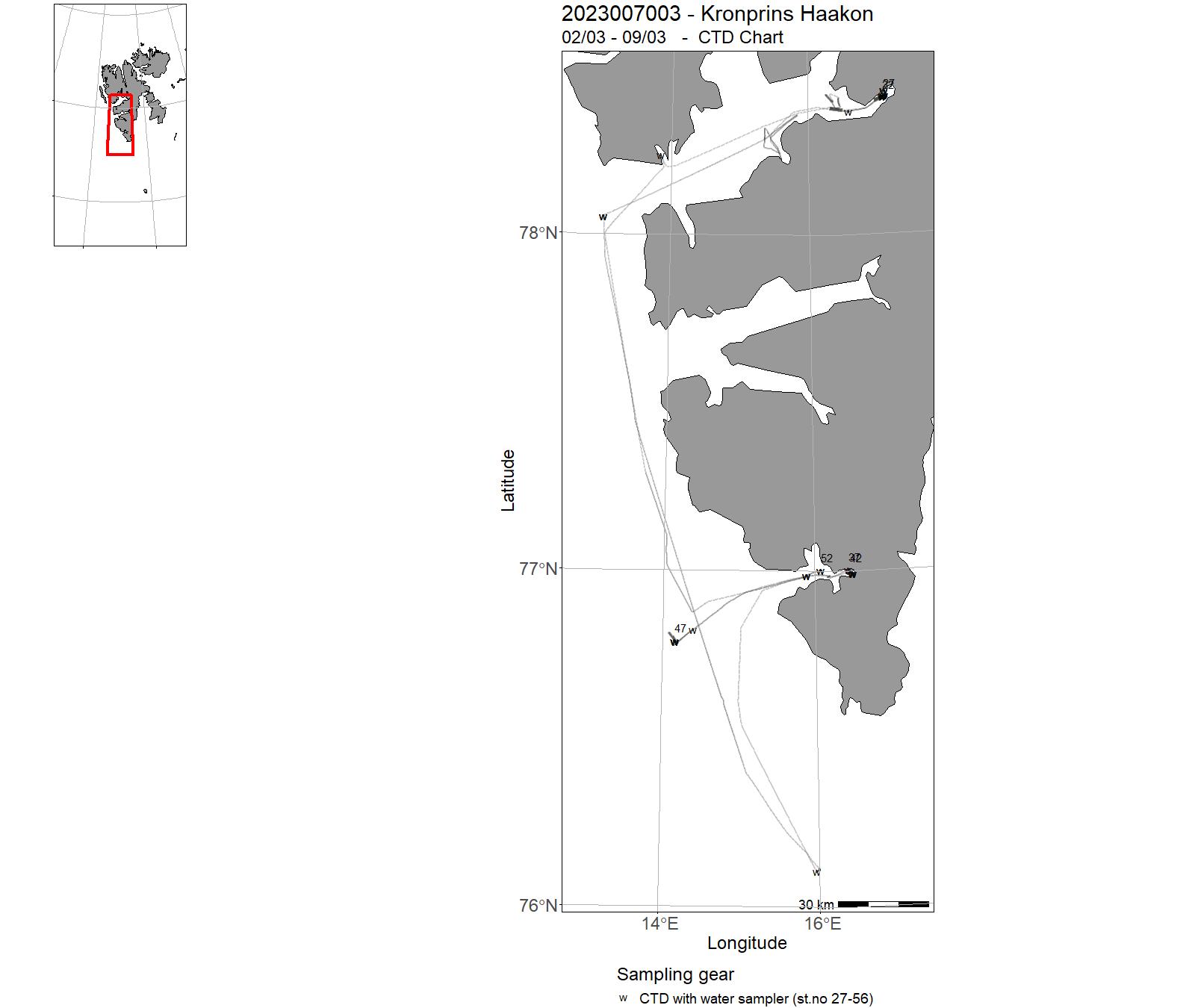
| 2023007003 | 02/03 - 09/03 | The cruise to the Svalbards fjords (Isfjorden, Hornsund) is organized and funded through the Polish-Norwegian research co-operation under the EEA and Norway grants. The project ArcSD Arctic Submarine Groundwater discharge focus on studies of submarine groundwater discharge on various cold seep sites in the Norwegian-Svalbard-Barents Sea with the overall aim to improve the understanding of fluid flow systems including its sources and to constrain the timing of leakage. | Atlantic Ocean | 27-56 | - |
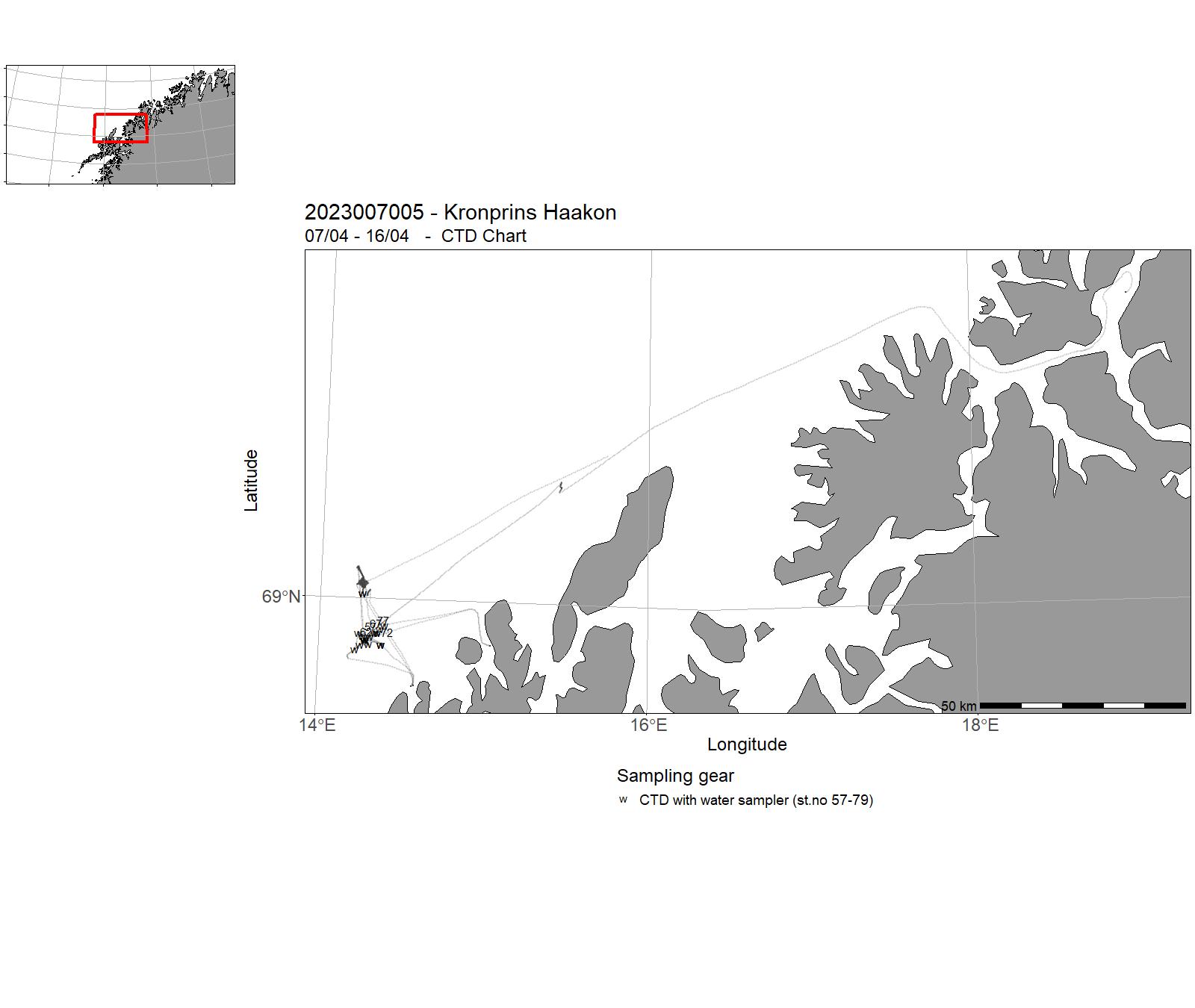
| 2023007005 | 07/04 - 16/04 | Marine operations including observatory maintainence and installationSubmarine cable installation Project name: LoVe - Lofoten Vesterålen cabled observatory - Infrastruktur prosjekt | Norwegian Sea | 57-79 | - |
| 2023007006 | 17/04 - 25/04 | Main tasks: 1. Recover the lander deployed in April 20222. Recover the mooring deployed in March 20233. Do one CTD cast with water samples at the location of the deploy ents4. Perform a single and multi-beam surveys near the locations of deployment. | Norwegian Sea | 80-81 | - |
| 2023007007 | 29/04 - 10/05 | The AKMA3 oceanographic expedition is part of the Advancing Knowledge of Methane in the Arctic. The main aim of AKMA is to develop a long-term, multidisciplinary education, and research collaboration focused on Arctic methane sources, processes, ecosystems, and geological history to provide exceptional training for the next generation of experts in Arctic marine sciences and greenhouse gas phenomena. | Barents Sea | 82-86 | - |
| 2023007008 | 11/05 - 30/05 | The cruise combines scientific objectives of this research council of Norway BREATHE project with a field school outreach program that trains early career researchers on the multidisciplinary research of Arctic sea ice. | Fram Strait | 87-108 | - |
| 2023007009 | 01/06 - 21/06 | The original cruise objective was to do a transect in the Nansen basin between N 84 degrees 32 min, E018 degrees 46 min and N 78 degrees 55 min and E008 degrees 32 min. Due to heavy ice we were not able to conduct research in the Nansen basin and redirected the cruise to the Fram Strait between N 78 degrees 50 min W008 degrees and N 78 degrees 50 min E002. | Greenland Sea | 109-160 | - |
| 2023007010 | 22/06 - 02/07 | The cruise targeted the northern part of the Knipovitch Ridge. The main work area is the newly discovered 'black smoker' hydrothermal deposit "Jøtul", which protrudes partly from sediments between an axial volcanic ridge and the eastern flank of the ridge system, and is believed to lie on top of a 'detachment' fault, which partly exposes mantle rocks at the sea floor. The main goal of the expedition is to better understand the underground structure of »Jøtul», the thermal condition of the crust in the area, as well as the hydrothermal circulation system. | Greenland Sea | 161-162 | - |
| 2023007011 | 06/07 - 19/07 | Interdisciplinary geoscientific investigations under the lead of UiT scientists contributing to the GoNorth Expedition 2023. Fields of research include: Investigation of hydrothermal processes (mineralogy & geochemistry) along Gakkel Ridge, Petrology and isotope work on peridotites and any volcanic rocks from Gakkel Ridge, Geothermal heat flow related to hydrothermal systems, Biodiversity in extreme environments, e.g. foraminifera, Geochemistry of marine sediments affected by hydrothermal plumes, Proxy development and palaeo-environments in the Arctic Ocean. | Polhavet | 163-178 | - |
| 2023007012 | 20/07 - 02/08 | GoNorth har som formål å være et norsk flerfaglig og tverrinstitusjonelt program for utforsking av Polhavet. Motivasjonen er tilslutningen fra FNs kontinentalsokkelkommisjon i 2009 til det norske kravet om en utvidet sokkel nord for Svalbard. UD finansierte et forprosjekt hvor oppdraget var å ""utvikle et program for utforsking av Polhavet som er faglig fremragende, økonomisk realiserbart, og politisk og forvaltningsmessig nyttig"". GoNorth kom på statsbudsjettet fra 2020 og mottar årlige driftsbevilgninger fra NFD, KD og UD. Forskningsprogrammet vil bidra med kunnskap som er viktig for forvaltning av miljø og naturressurser i nord. Prosjektet vil bidra til ny kartlegging av norske havområder, og gi bedre grunnleggende og anvendt kunnskap av relevans for forvaltning og næringsliv. | Polhavet | 0164 - 0178 | - |
| 2023007013 | 03/08 - 09/08 | Dette toktet er et tokt under GoNorth konsortiet, som som tar sikte på å styrke kunnskapen om geologisk utvikling og historisk klima i den vestlige delen av det Eurasiske basseng i Polhavet. I tillegg skal det gjøres teknologisk utvikling (test av instrumenter) for overvåking av havis under toktet og innsamles oseanografiske og biologiske data. | Polhavet | - | - |
| 2023007014 | 10/08 - 29/08 | Multidisiplinært tokt inn i det dype Polhavet nord for Svalbard | Polhavet | 179-221 | 86 - 99 |
| 2023007015 | 30/08 - 13/09 | Annual service and monitoring at the Fram Strait Arctic Outflow Observatory from the Norwegian Polar Institute.The annual service encompasses the service of 7 ocean moorings measuring the freshwater and sea ice transport in the Fram Strait since 1997/1990 resp. | Fram Strait | 222-265 | - |
| 2023007016 | 15/09 - 06/10 | The aim of the cruise is to monitor the status and changes in the ecosystem and obtain the necessary data for advice and research. Arctic part of the BESS collects data and reports more than 50 time series to Norwegian-Russian fisheries and environment commissions, and to several ICES groups. | Barents Sea | 266-309 | 100 - 201 |
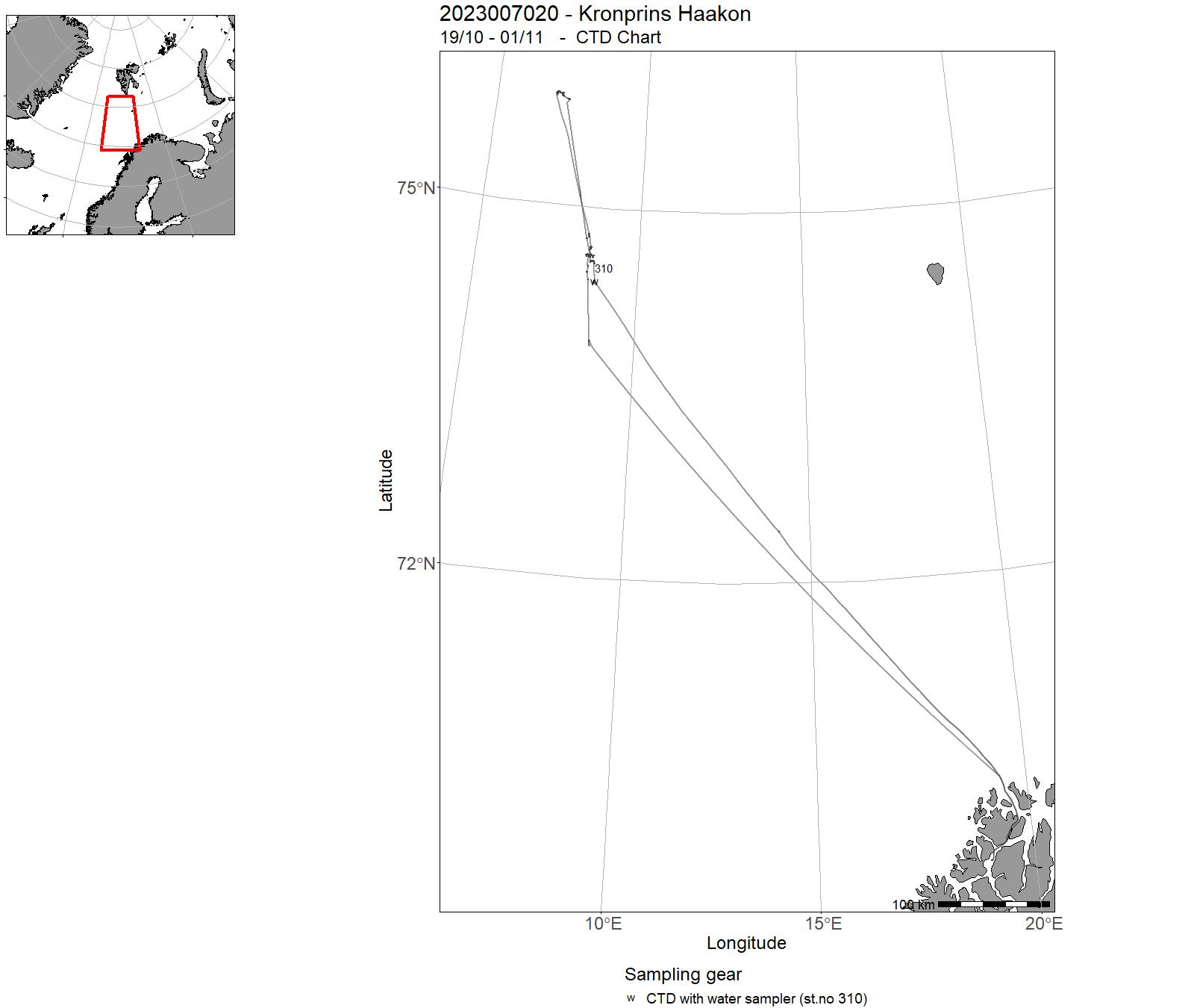
| 2023007019 | 06/11 - 30/11 | Opphenting av bøyer ved Jan Maien | Norskehavet | 311-318 | - |
| 2023007020 | 19/10 - 01/11 | Georessurser og hydrotermisk aktivitet i Norskehavet | Norskehavet | 310 | - |
9 - “ Kronprins Haakon” – Charts for cruises 2023
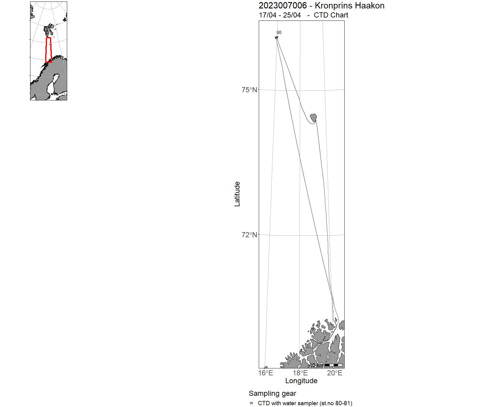
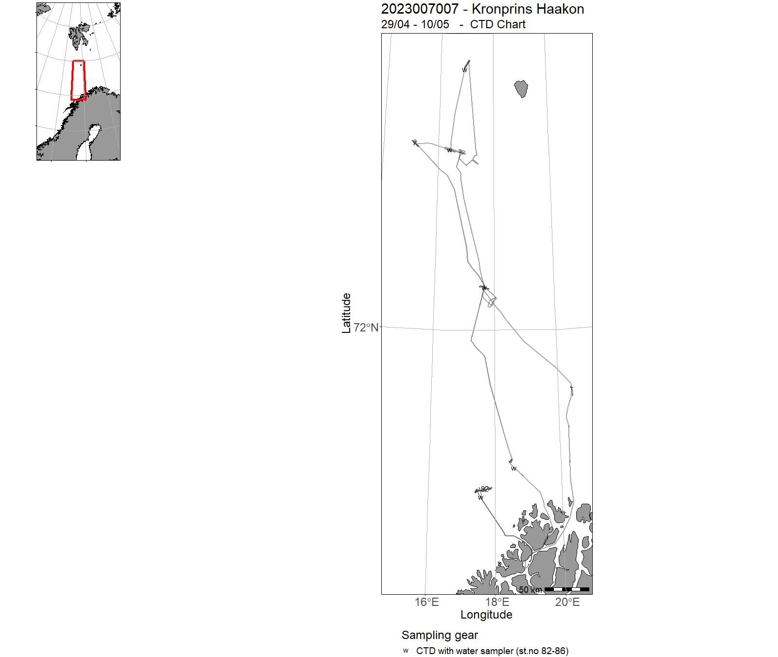
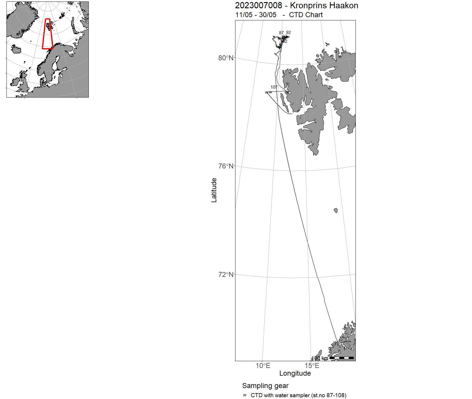
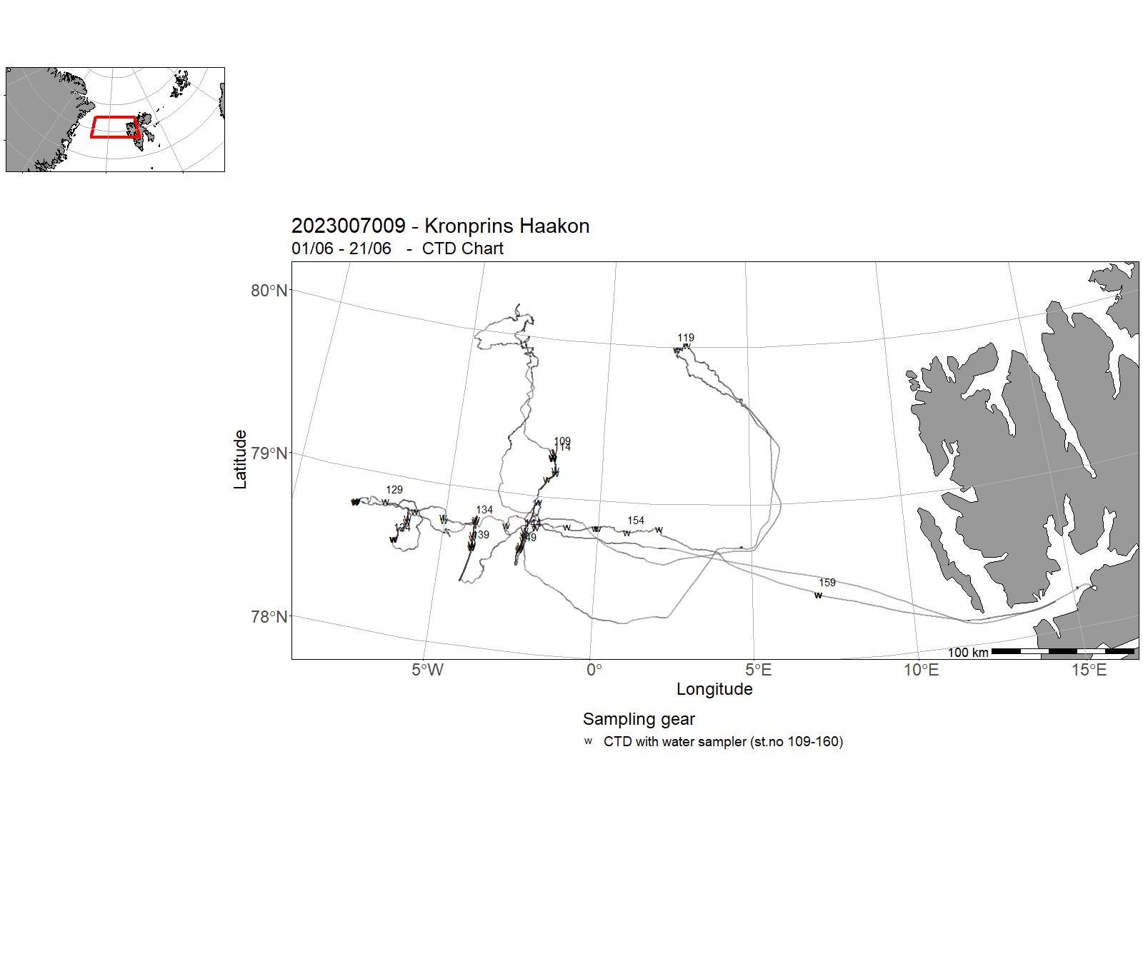
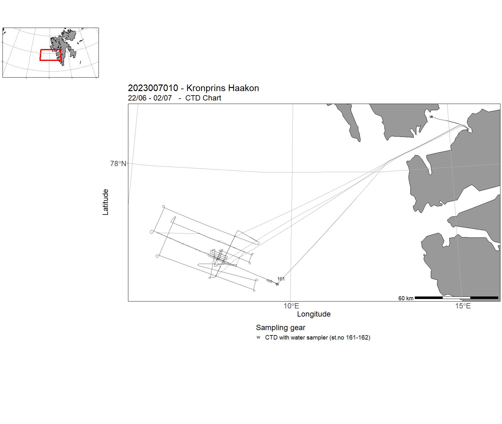
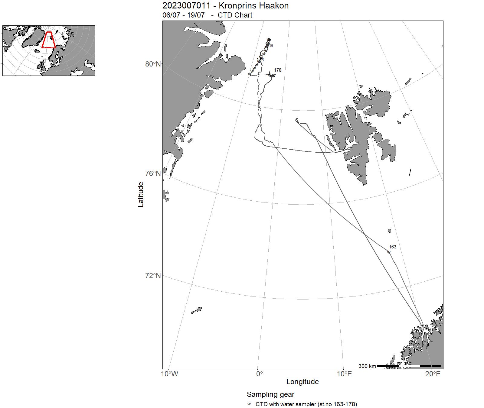
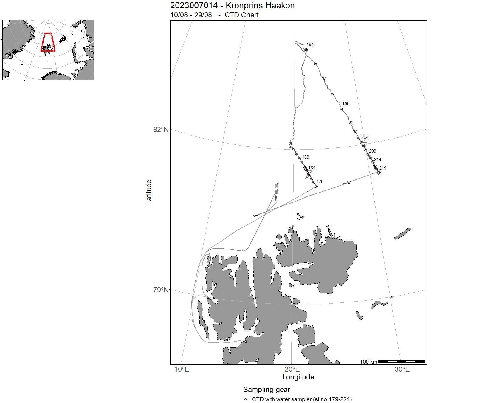
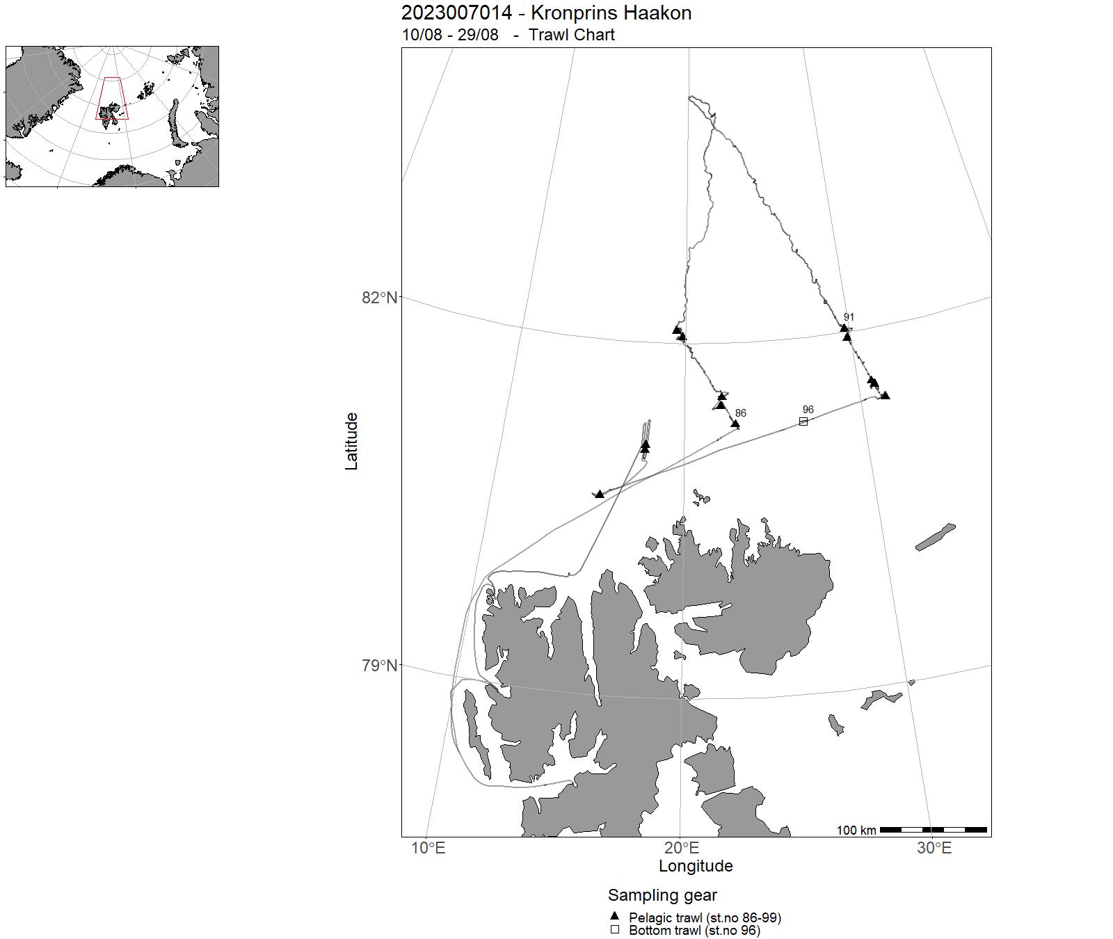
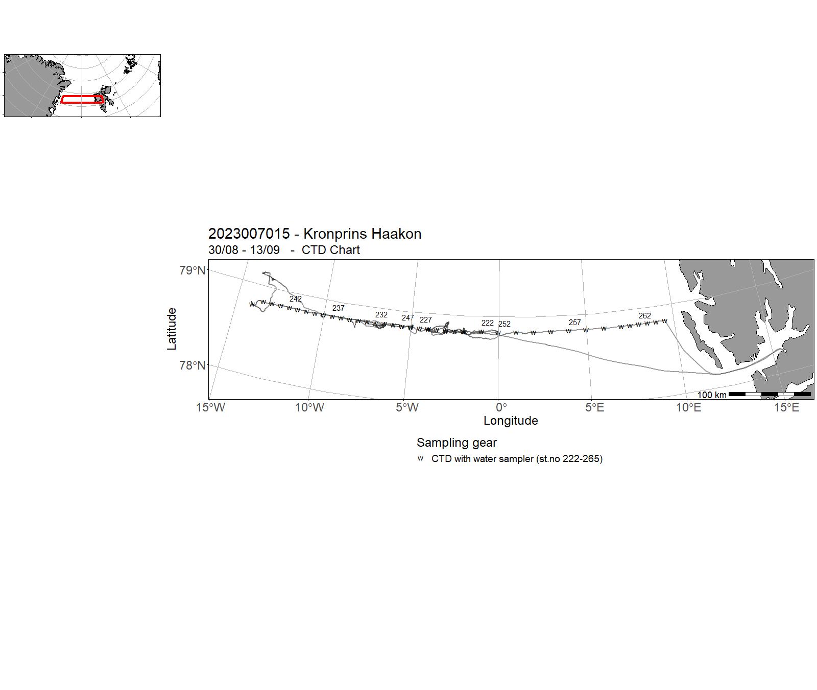
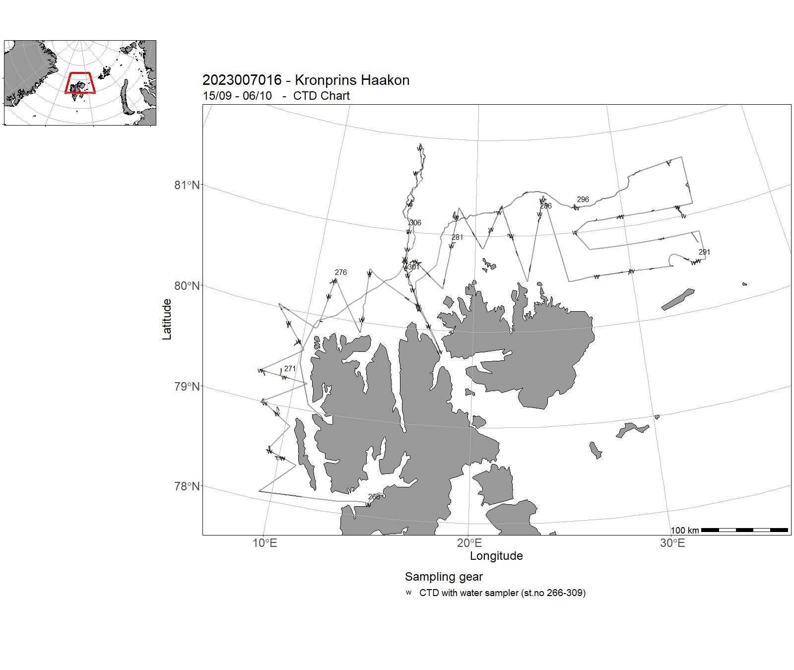
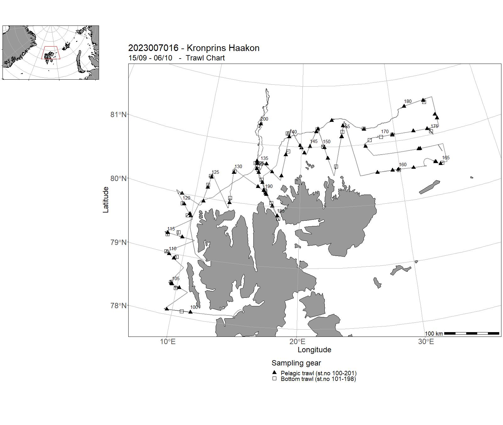
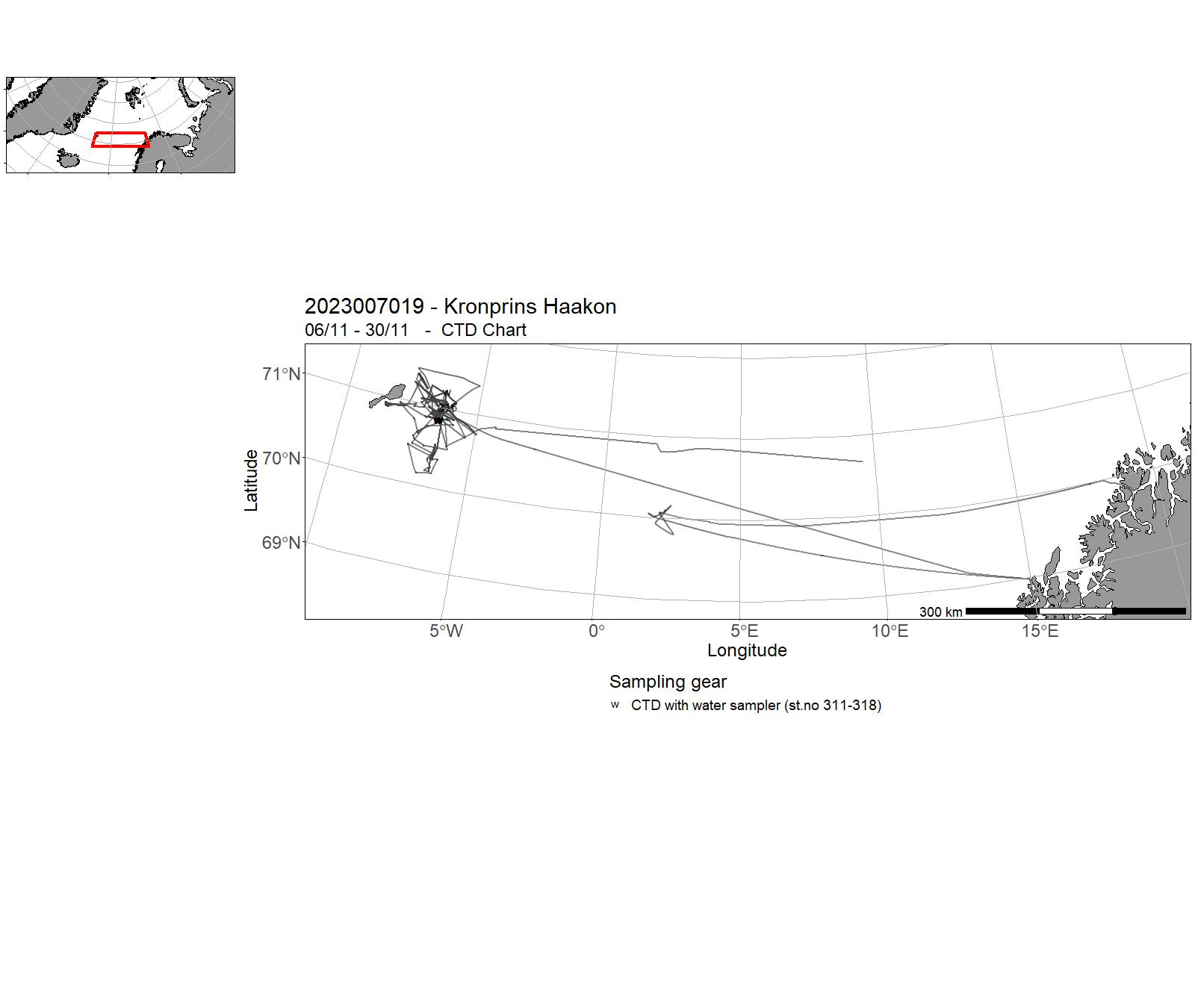
10 - "G. M. Dannevig" – Cruises 2023
| Cruise no | Period | Purpose | Area | CTD st.no | Trawl st.no |
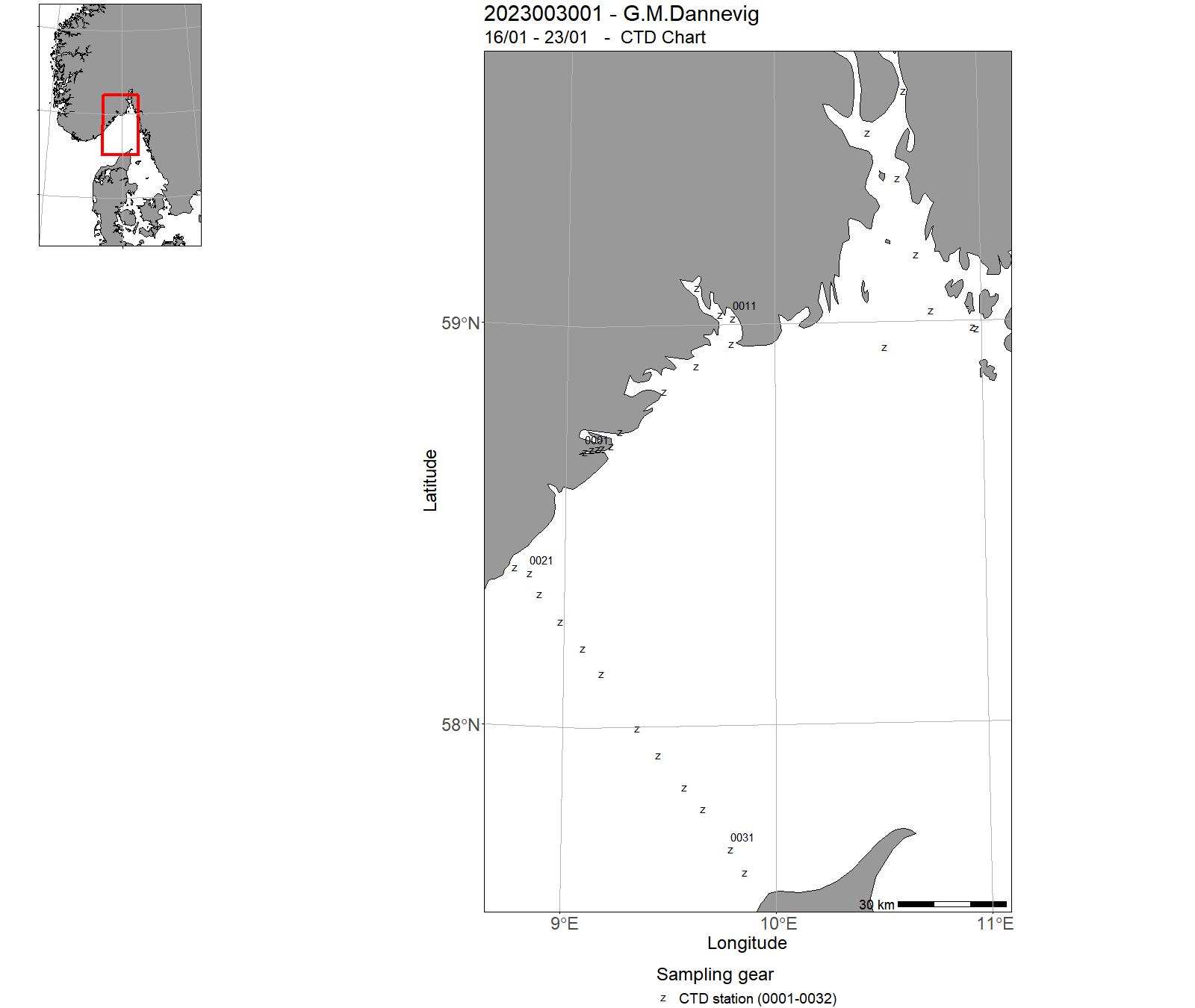
| 2023003001 | 16/01 - 23/01 | Skagerrak:Havforsurning,oseanografi,HAB,mikroplast,miljø,klima lavere trofiske nivå langs Skagerrakkysten og fast snitt Torungen-Hirtshals. Videreføring av 4 tidsserier (Torungen, Oslofjord, Grenland, Arendal) | Norskekysten: Sør- og Østlandet | 0001 - 0032 | - |
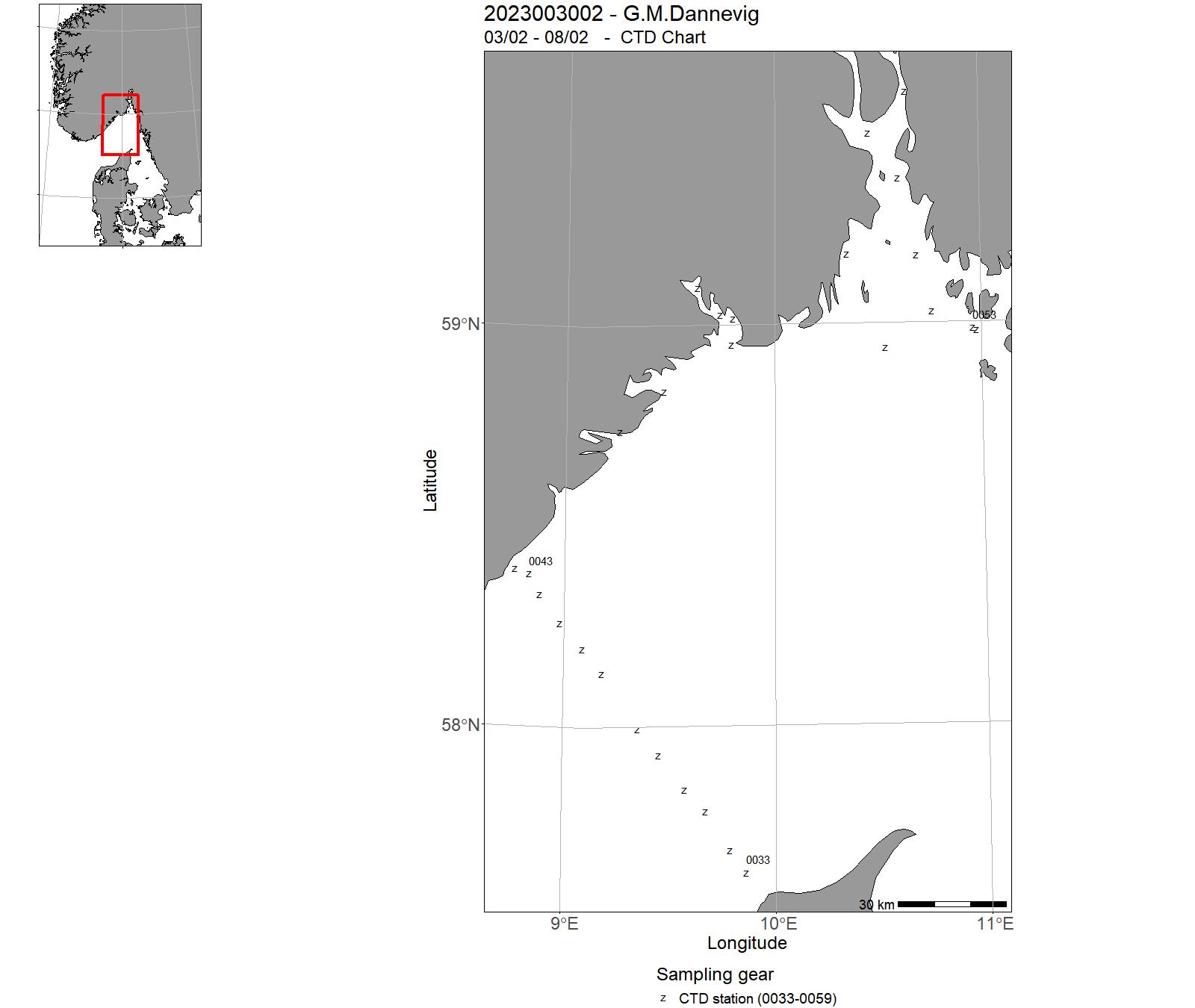
| 2023003002 | 03/02 - 08/02 | Skagerrak:Havforsurning,oseanografi,HAB,mikroplast,miljø,klima lavere trofiske nivå langs Skagerrakkysten og fast snitt Torungen-Hirtshals. Videreføring av 4 tidsserier (Torungen, Oslofjord, Grenland, Arendal) | Norskekysten: Sør- og Østlandet | 0033 - 0059 | - |
| 2023003004 | 12/03 - 22/03 | Gytefeltkartlegging - Sogn og fjordane | Norskekysten: Vestlandet | - | - |
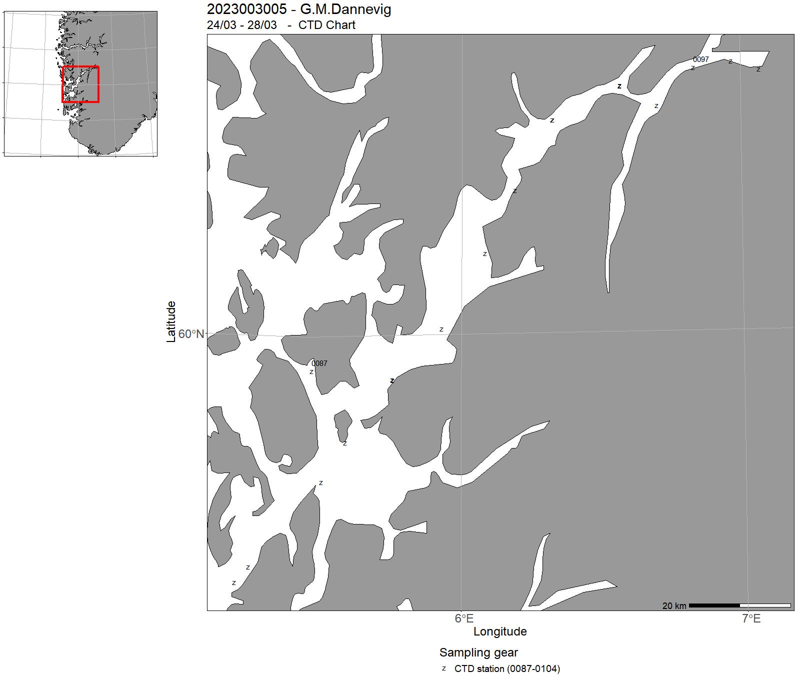
| 2023003005 | 24/03 - 28/03 | Langsiktig overvåkning av fjordoseanografi og strømmodellutvikling. | Norskekysten: Vestlandet | - | - |
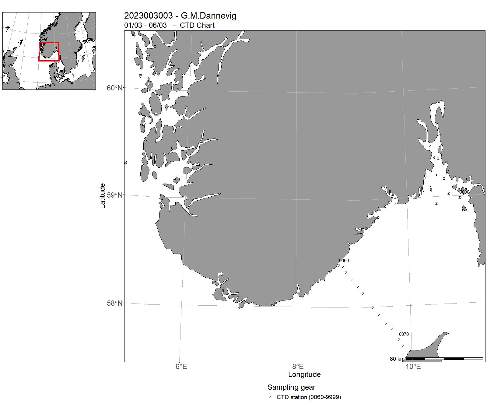
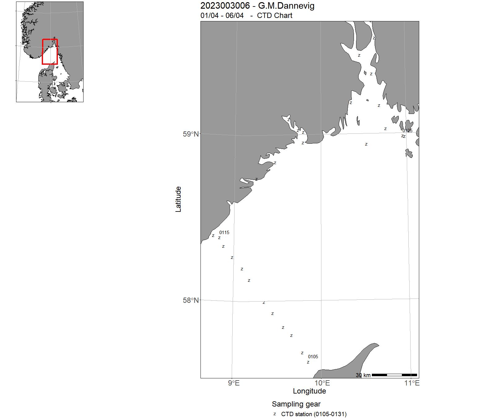
| 2023003006 | 01/04 - 06/04 | Skagerrak:Havforsurning,oseanografi,HAB,mikroplast,miljø,klima lavere trofiske nivå langs Skagerrakkysten og fast snitt Torungen-Hirtshals. Videreføring av 4 tidsserier (Torungen, Oslofjord, Grenland, Arendal) | Norskekysten: Sør- og Østlandet | 0105 - 0131 | - |
| 2023003007 | 09/05 - 05/06 | Toktet har som hensikt å fange utvandrende vill laksesmolt som en del av den nasjonale overvåkningen på vill laksefisk. Laksesmolt fanges i ytre deler av utvalgte fjordsystem med en spesialbygget pelagisk trål. | Norskekysten: Vestlandet | - | - |
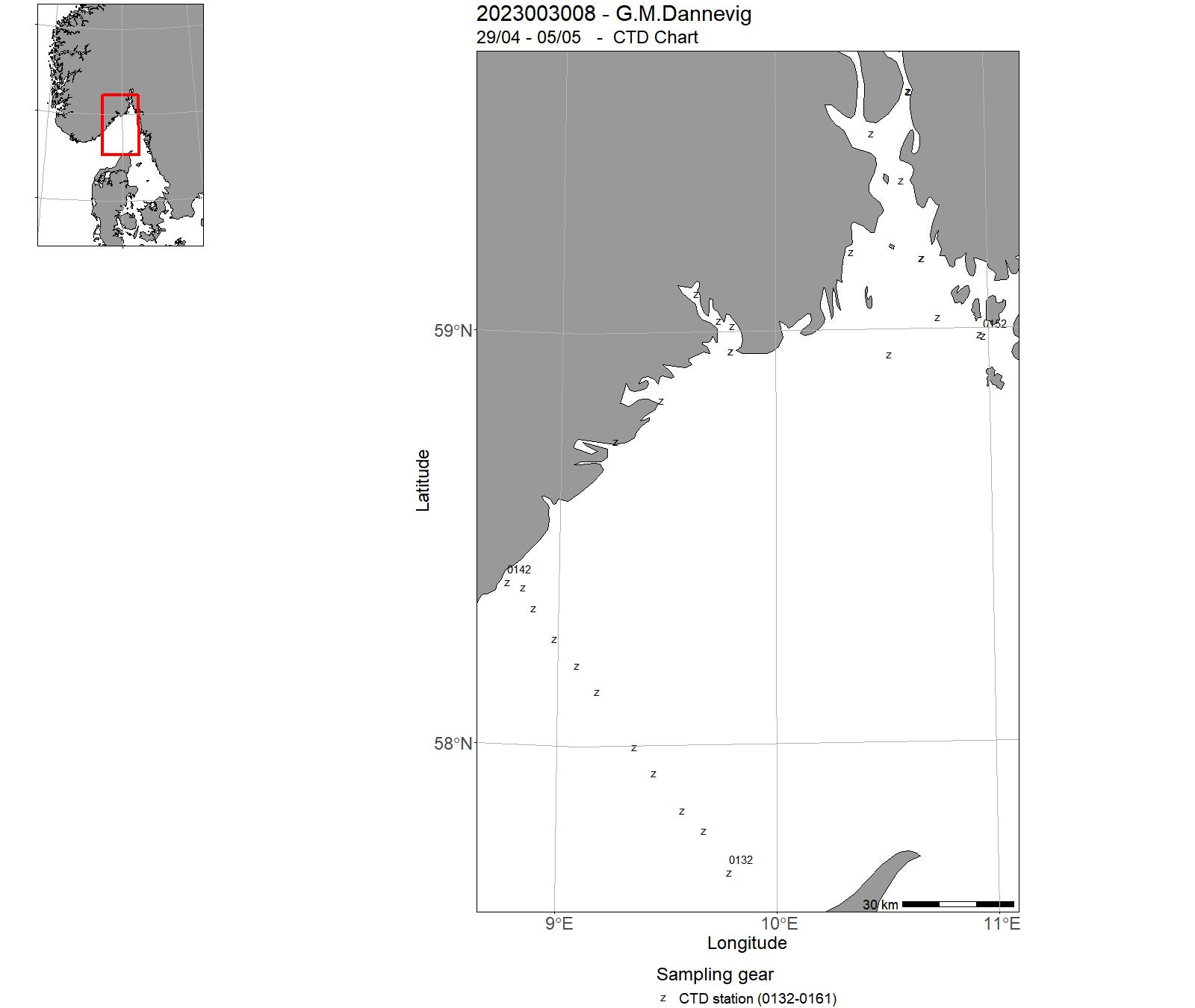
| 2023003008 | 29/04 - 05/05 | Skagerrak:Havforsurning,oseanografi,HAB,mikroplast,miljø,klima lavere trofiske nivå langs Skagerrakkysten og fast snitt Torungen-Hirtshals. Videreføring av 4 tidsserier (Torungen, Oslofjord, Grenland, Arendal) | Norskekysten: Sør- og Østlandet, Skagerrak | 0132 - 0161 | - |
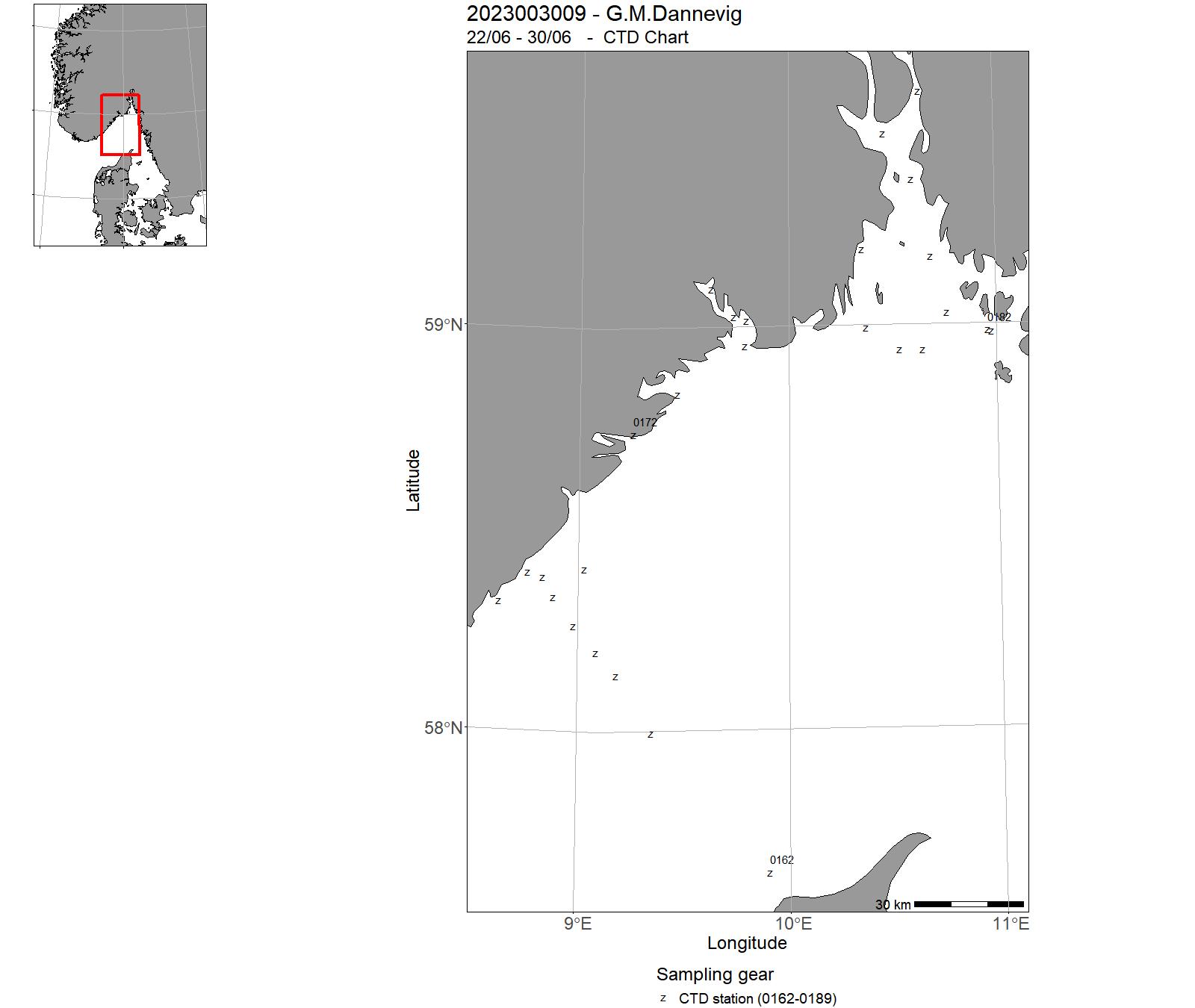
| 2023003009 | 22/06 - 30/06 | Skagerrak:Havforsurning,oseanografi,HAB,mikroplast,miljø,klima lavere trofiske nivå langs Skagerrakkysten og fast snitt Torungen-Hirtshals. Videreføring av 4 tidsserier (Torungen, Oslofjord, Grenland, Arendal) | Norskekysten: Sør- og Østlandet, Skagerrak | 0162 - 0189 | - |
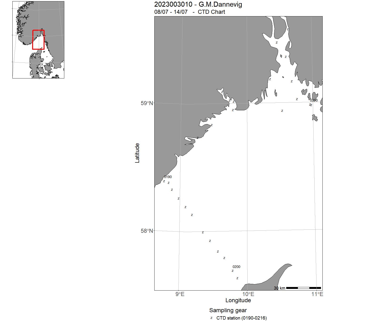
| 2023003010 | 08/07 - 14/07 | Skagerrak:Havforsurning,oseanografi,HAB,mikroplast,miljø,klima lavere trofiske nivå langs Skagerrakkysten og fast snitt Torungen-Hirtshals. Videreføring av 4 tidsserier (Torungen, Oslofjord, Grenland, Arendal) | Norskekysten: Sør- og Østlandet, Skagerrak | 0190 - 0216 | - |
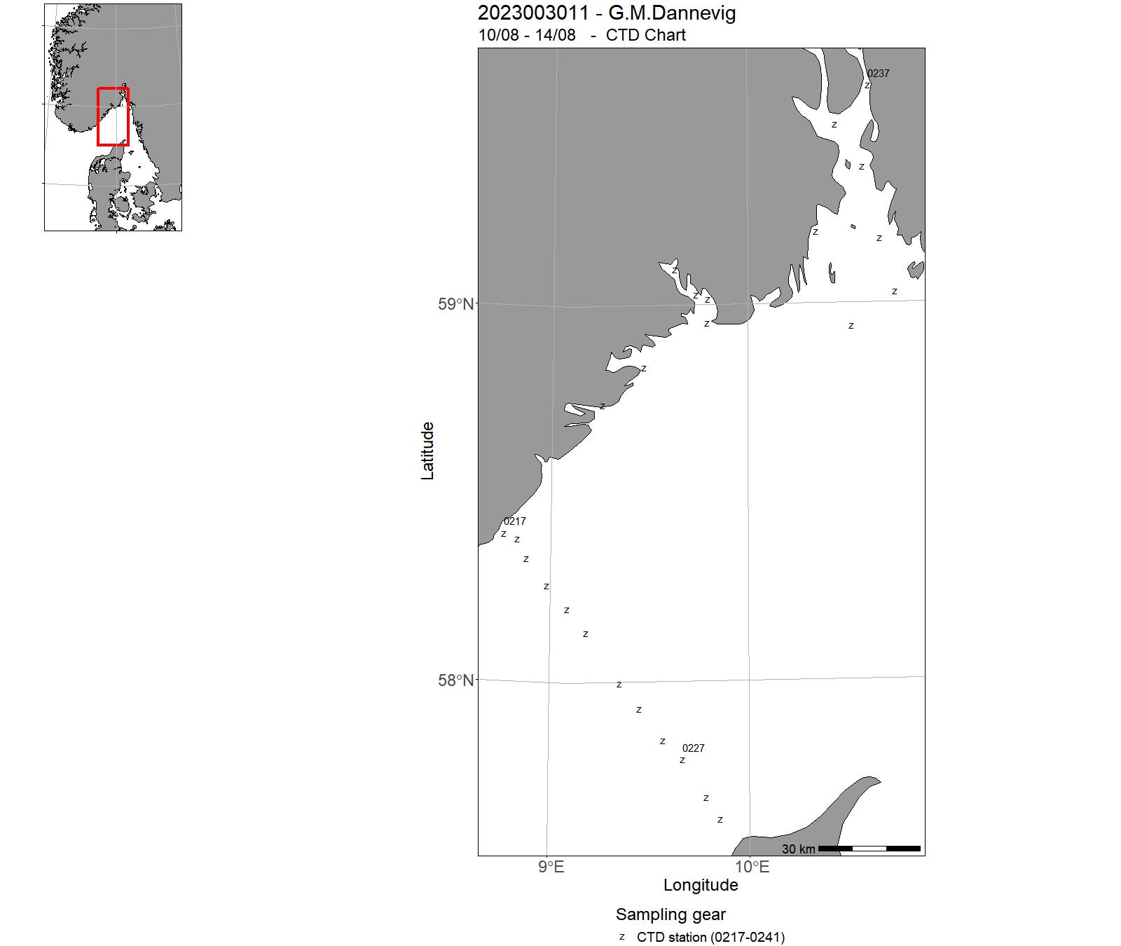
| 2023003011 | 10/08 - 14/08 | Skagerrak:Havforsurning,oseanografi,HAB,mikroplast,miljø,klima lavere trofiske nivå langs Skagerrakkysten og fast snitt Torungen-Hirtshals. Videreføring av 4 tidsserier (Torungen, Oslofjord, Grenland, Arendal) | Norskekysten: Sør- og Østlandet, Skagerrak | 0217 - 0241 | - |
| 2023003012 | 15/08 - 22/08 | Overvåking av bestander og utvikling innenfor og utenfor hummerreservater ved Bolærne (Færder Nasjonalpark) og Kvernskjær (Ytre Hvaler Nasjonalpark). | Norskekysten: Sør- og Østlandet | - | - |
| 2023003013 | 23/08 - 25/08 | HI ved kystprogrammet arrangerer hver høst et feltkurs i kystsoneøkologi i samarbeid med UiA. En del av feltkurset består i et undervisningstokt ombord på G.M. Dannevig | Norskekysten: Sør- og Østlandet | 0242 - 0243 | - |
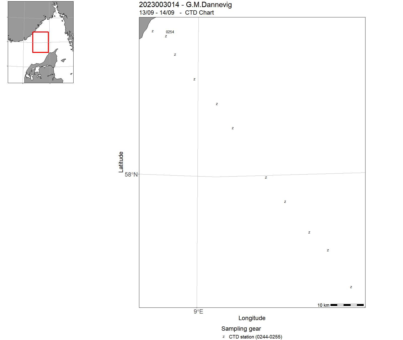
| 2023003014 | 13/09 - 14/09 | Skagerrak:Havforsurning,oseanografi,HAB,mikroplast,miljø,klima lavere trofiske nivå langs Skagerrakkysten og fast snitt Torungen-Hirtshals. Videreføring av 4 tidsserier (Torungen, Oslofjord, Grenland, Arendal) | Norskekysten: Sør- og Østlandet, Skagerrak | 0244 - 0255 | - |
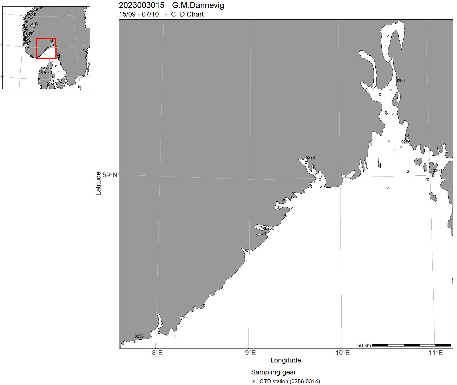
| 2023003015 | 15/09 - 07/10 | Strandnotundersøkelser er en av verdens eldste marine tidsserier, har som mål å måle rekrutteringen av torskefisk og andre kystarter i strandsonen. (Beach seine studies to measure recruitment of cod and coastal species in the litoral zone). Hydrografiske undersøkelser på utvalgte lokaliteter. Undersøkelsen er del av en serie som har gått siden 1919. | Skagerrak | 0256 - 0314 | - |
| 2023003016 | 08/10 - 13/10 | Skagerrak:Havforsurning,oseanografi,HAB,mikroplast,miljø,klima lavere trofiske nivå langs Skagerrakkysten og fast snitt Torungen-Hirtshals. Videreføring av 4 tidsserier (Torungen, Oslofjord, Grenland, Arendal) | Norskekysten: Sør- og Østlandet, Skagerrak | 0315 - 0330 | - |
| 2023003017 | 09/11 - 15/11 | Skagerrak:Havforsurning,oseanografi,HAB,mikroplast,miljø,klima lavere trofiske nivå langs Skagerrakkysten og fast snitt Torungen-Hirtshals. Videreføring av 4 tidsserier (Torungen, Oslofjord, Grenland, Arendal) | Norskekysten: Sør- og Østlandet, Skagerrak | 0331 - 0357 | - |
| 2023003018 | 16/11 - 03/12 | Vinterfiske er en tidsserie med fokus på overvåkning av kysttorsk (bruk av garnfiske, trollgarn) som startet 1980 tallet, hadde et opphold på 1990 tallet og startet opp igjen på 2000 tallet, og har nå over 30 år med data. Det er den eneste overvåkningsaktiviteten på kystnær voksen torsk i Skagerrak. Siden 2000 tallet er også alle andre arter målt, veid og registrert. Trollgarn fagger i et beget bredt størrelsesregister, og en får dermed et overblikk i hva slags fisk som står ute, samt trender over tid. | Skagerrak | - | - |
| 2023003019 | 04/12 - 11/12 | Skagerrak:Havforsurning,oseanografi,HAB,mikroplast,miljø,klima lavere trofiske nivå langs Skagerrakkysten og fast snitt Torungen-Hirtshals. Videreføring av 4 tidsserier (Torungen, Oslofjord, Grenland, Arendal) | Norskekysten: Sør- og Østlandet, Skagerrak | 0358 - 0384 | - |
11 - "G. M. Dannevig" – Charts for cruises 2023
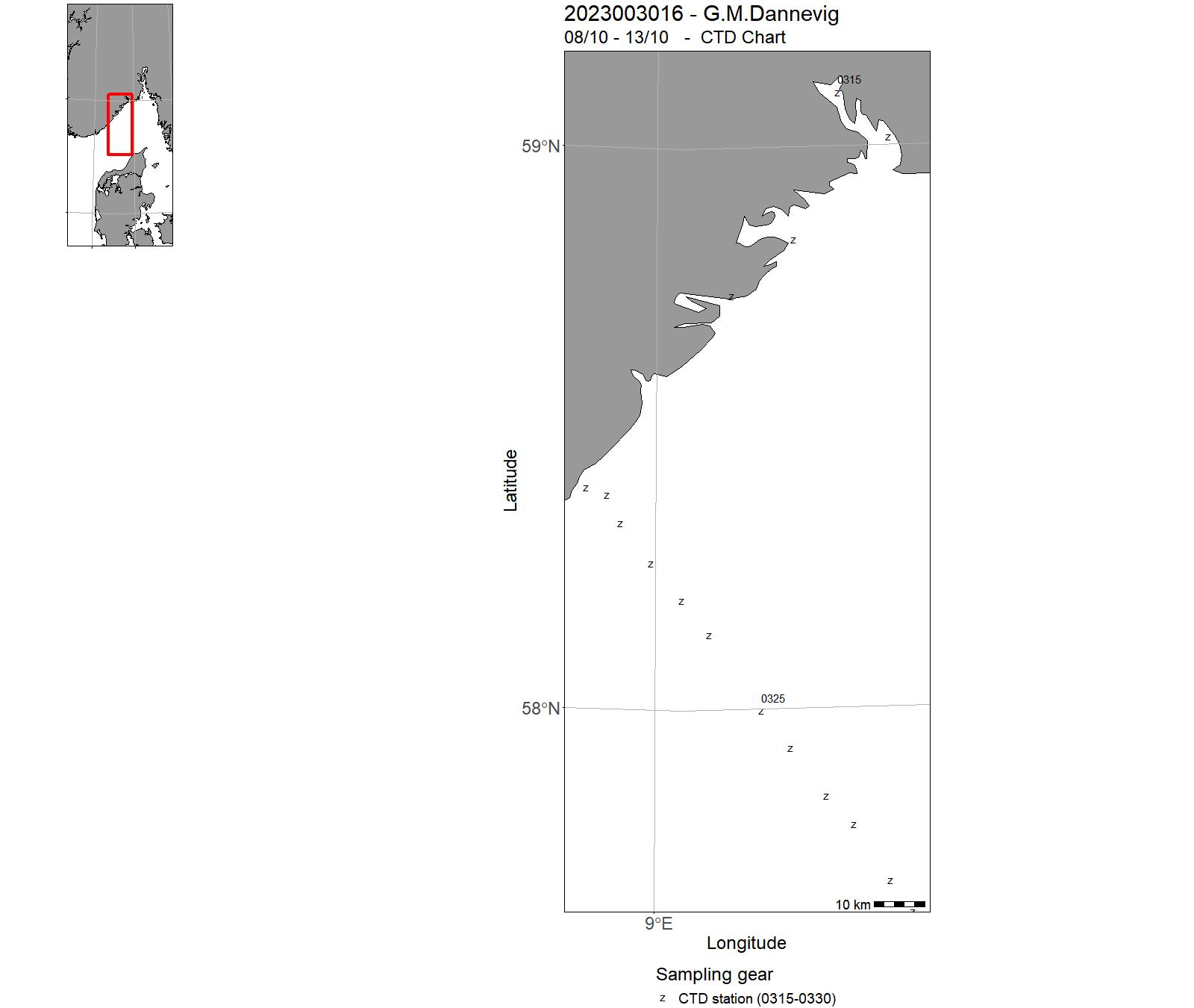
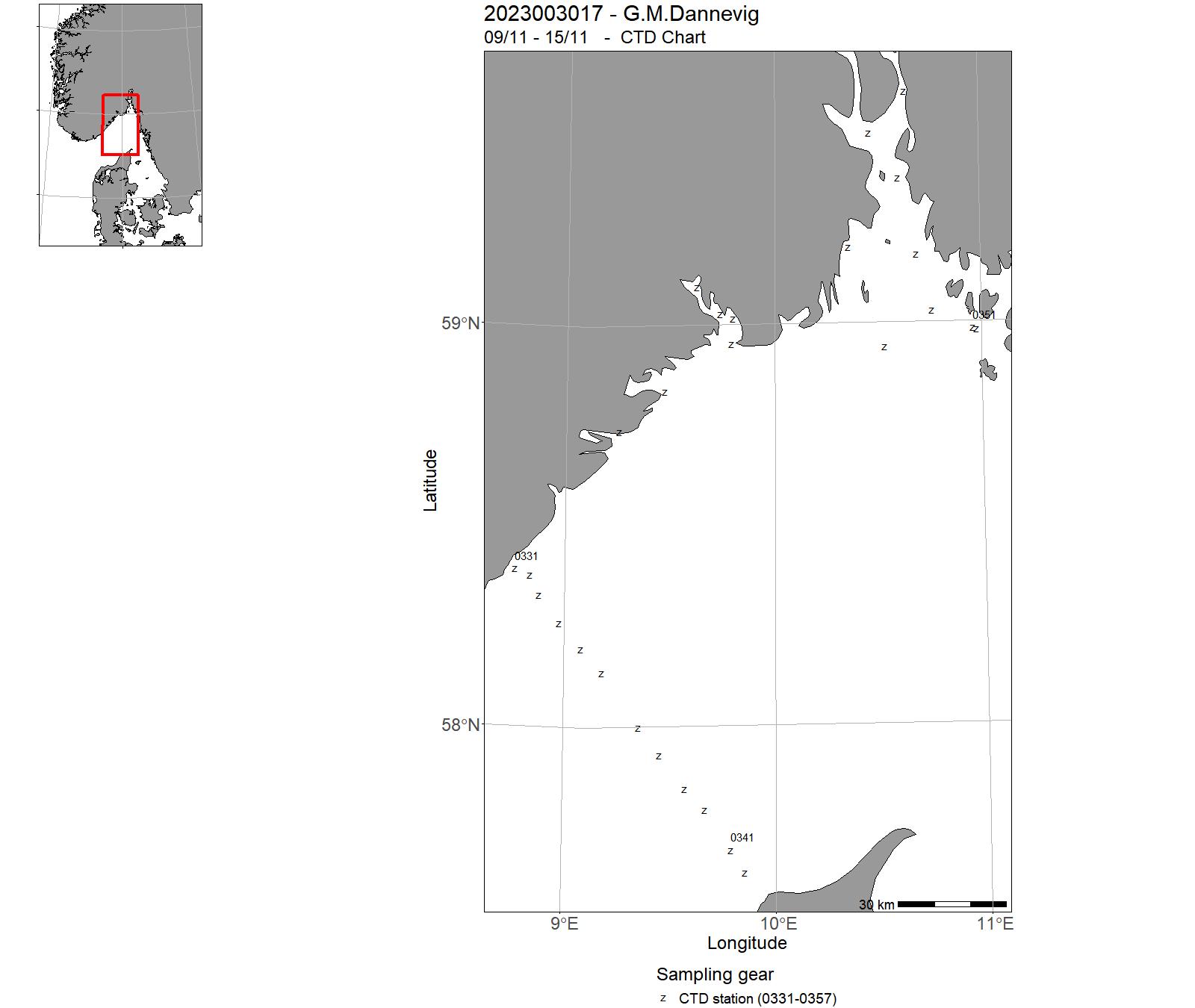
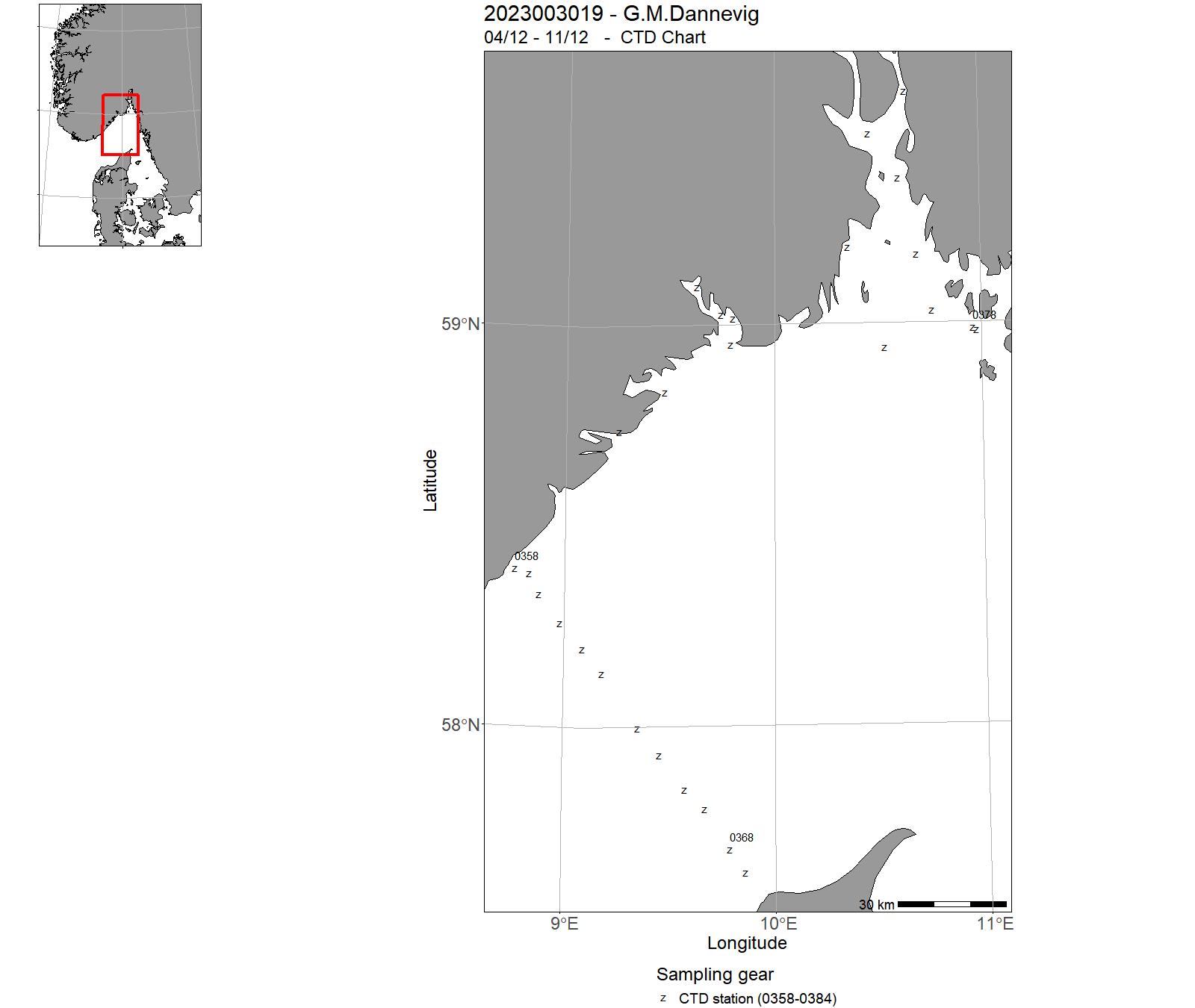
12 - "Statsraad Lehmkuhl" - Cruises 2023
| Cruise no | Period | Purpose | Area | CTD st.no | Trawl st.no |
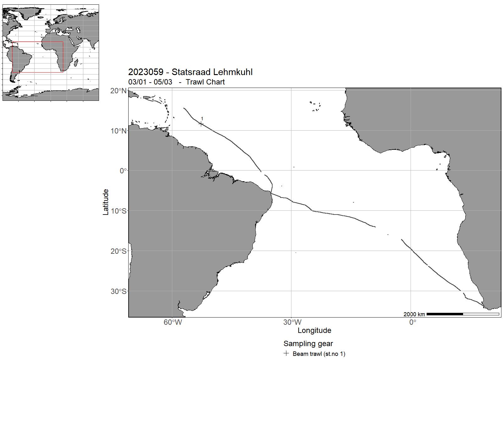
| 2023059 | 03/01 - 05/03 | One Ocean Expedition Leg 9 | Atlantic Ocean | - | - |
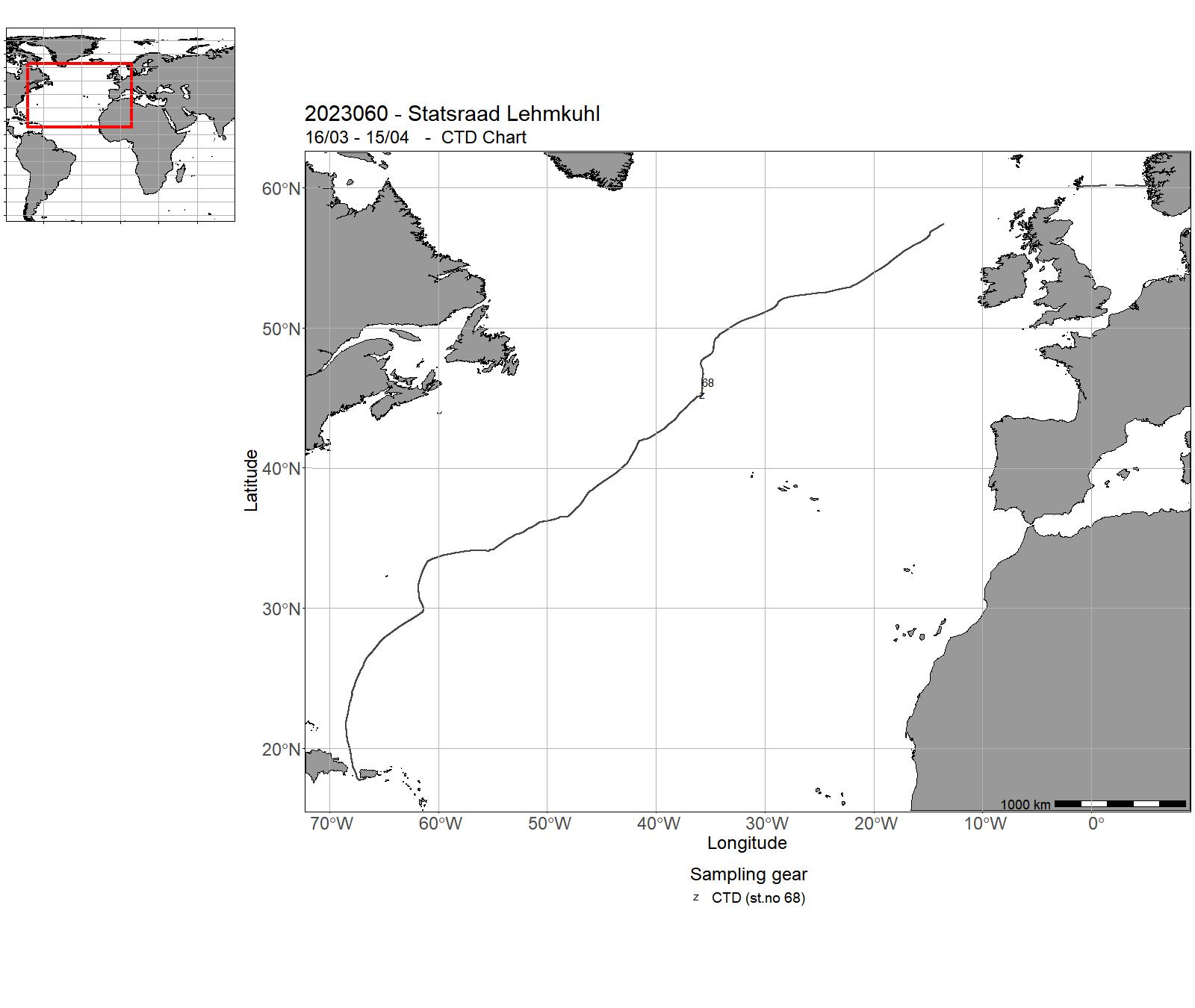
| 2023060 | 16/03 - 15/04 | One Ocean Expedition Leg 10 | Atlantic Ocean | 68 | - |
13 - "Statsraad Lehmkuhl" Charts for 2023
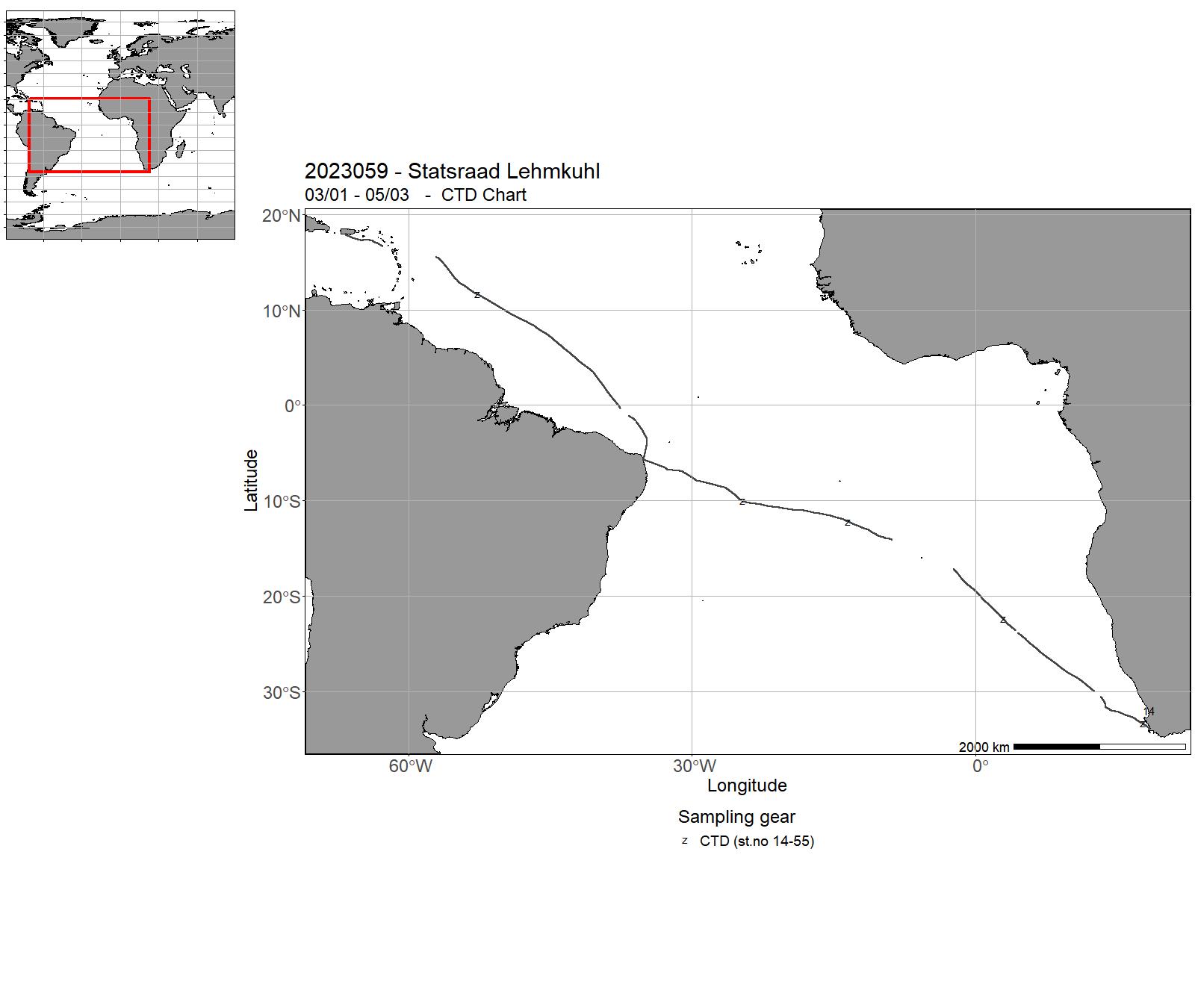
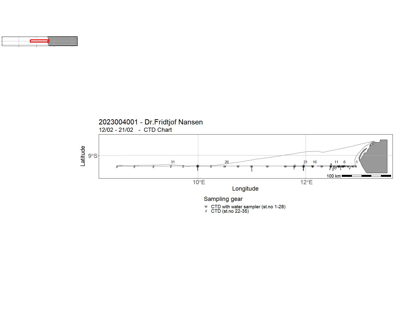
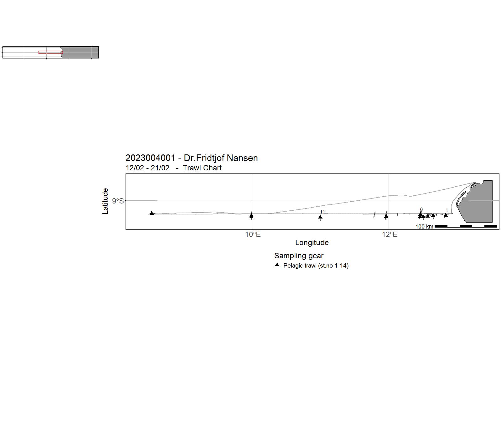
14 - "Dr. Fridtjof Nansen" – Cruises 2023
| Cruise no | Period | Purpose | Area | CTD st.no | Trawl st.no |
| 2023004001 | 12/02 - 21/02 | General objective: To study the biological composition and acoustic properties of the mesopelagic community along a transect spanning from the high-productive waters on the shelf through oligotrophic oceanic waters offshore, monitor vertical movements of scattering layers or their components using pelagic sampling trawls and a camera system, and to obtain biological samples of mesopelagic organisms. | Atlantic Ocean | 1 - 35 | 1-14 |
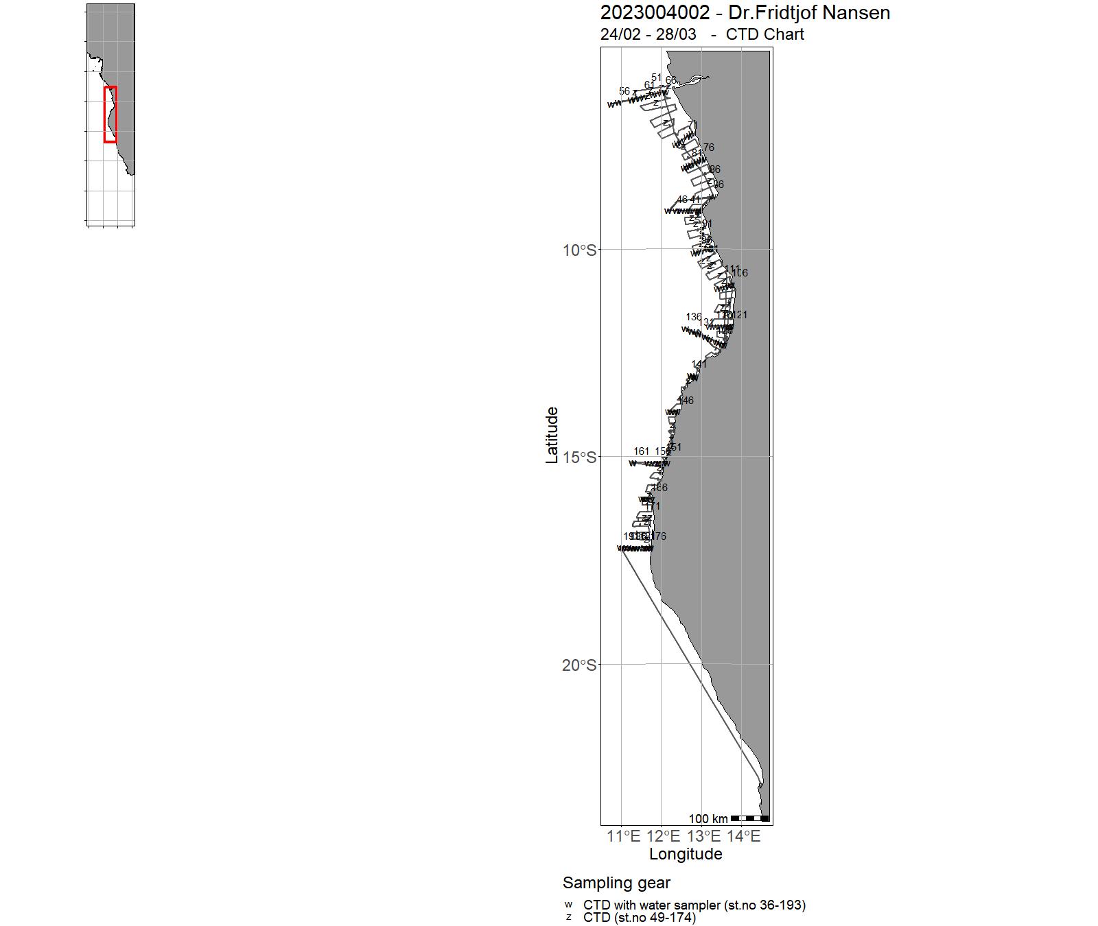
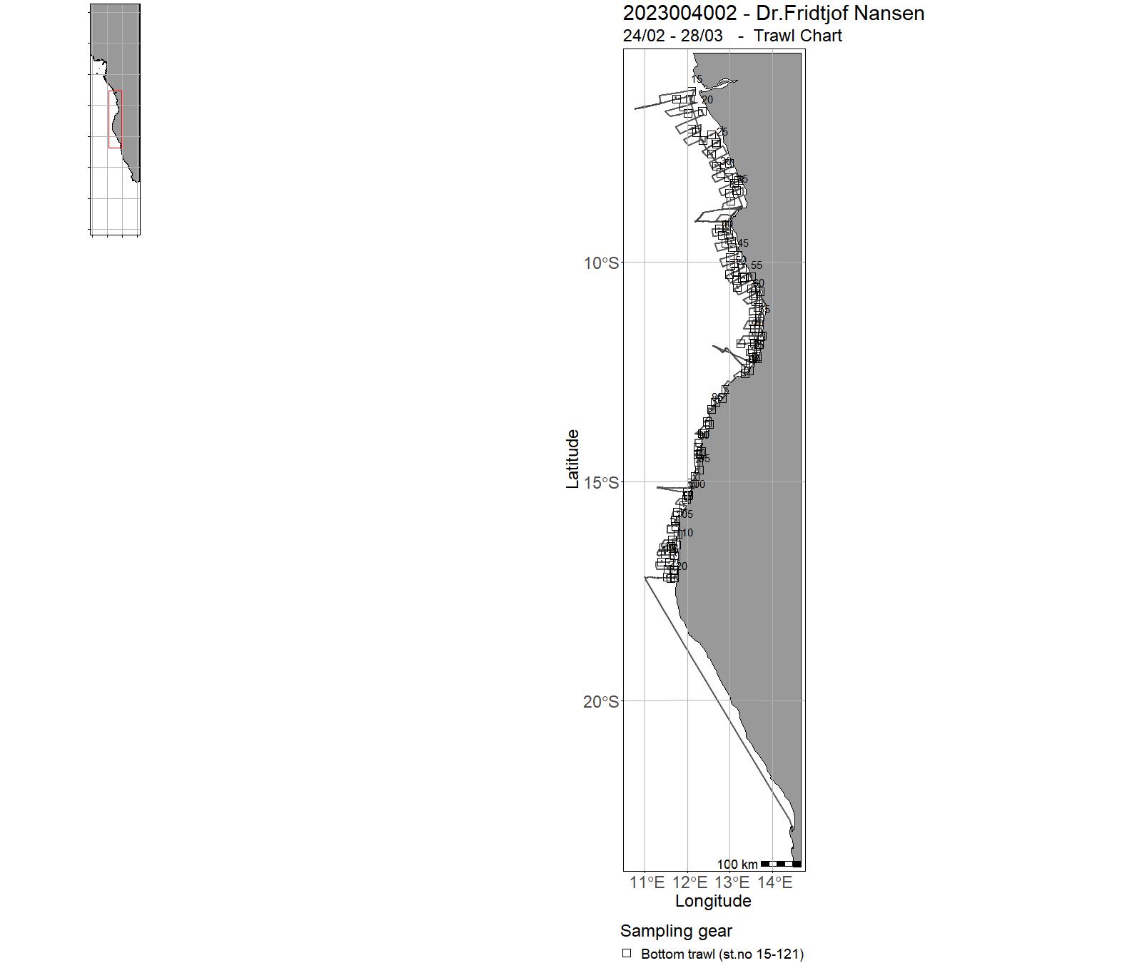
| 2023004002 | 24/02 - 28/03 | The general objectives: Obtain information on key pelagic fish species abundance, their distribution and size structure, as well as the species composition of the pelagic fish assemblage.. | Atlantic Ocean | 36 - 193 | 15-121 |
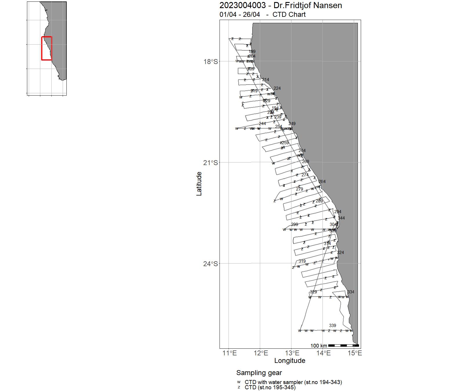
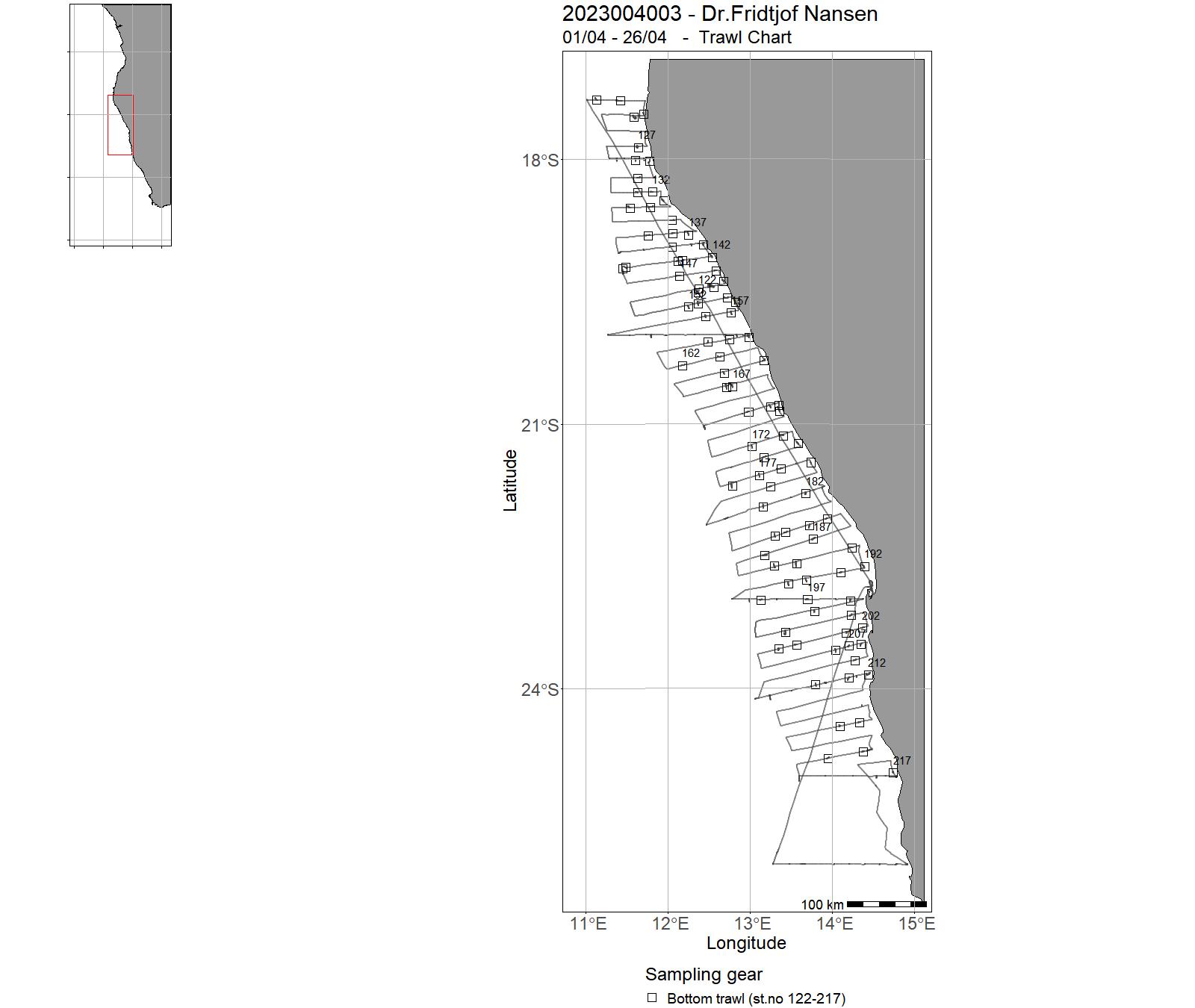
| 2023004003 | 01/04 - 26/04 | The general objectives of Leg 4.2 and 4.3 surveys are: Obtaining information on pelagic fish species abundance, their distribution and size structure, as well as the species composition of the pelagic fish assemblage. | Northeast Atlantic Ocean (40W) | 194 - 345 | 122-217 |
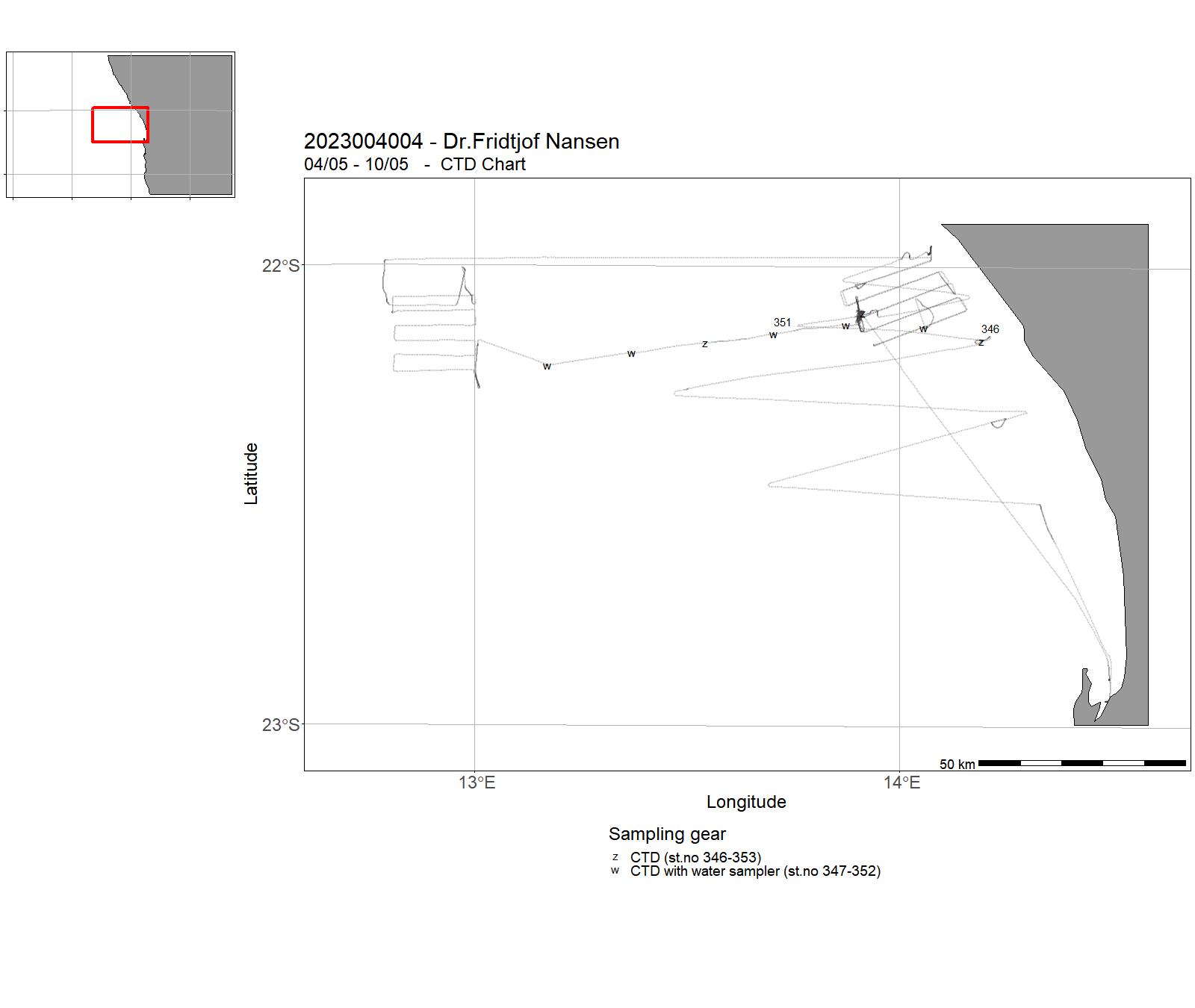
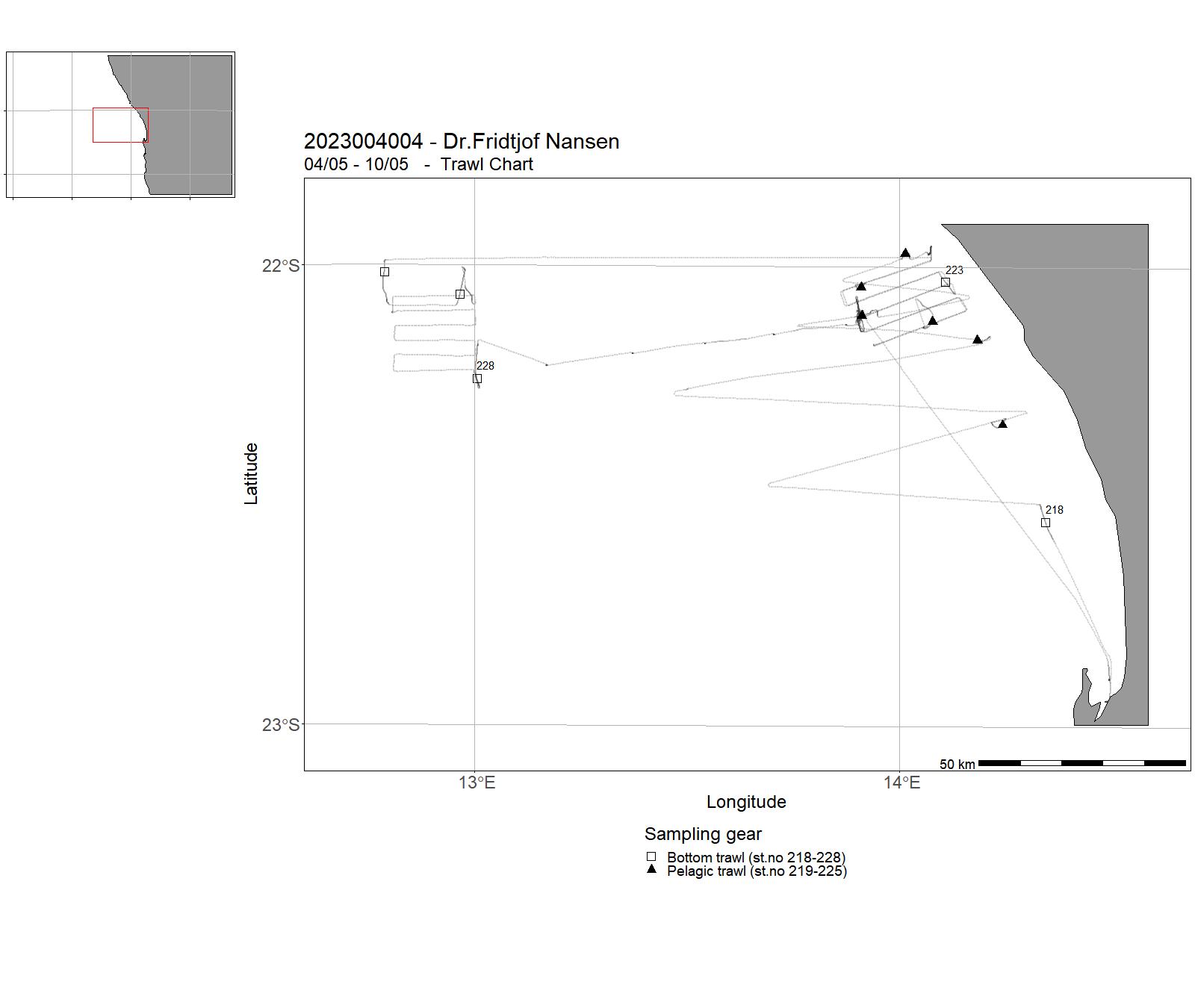
| 2023004004 | 04/05 - 10/05 | The general objectives of Leg 4.2 and 4.3 surveys are: The primary objective of this training survey is to train students, engineers and fisheries biologists from EAF-Nansen Programme partner countries to learn tools and methods for the interpretation of acoustics in fisheries science and marine biology. | Northeast Atlantic Ocean (40W) | 346 - 353 | 218 - 228 |
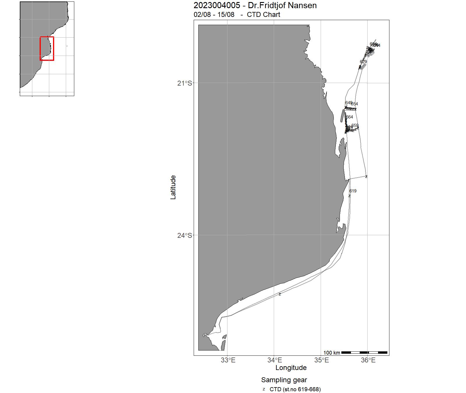
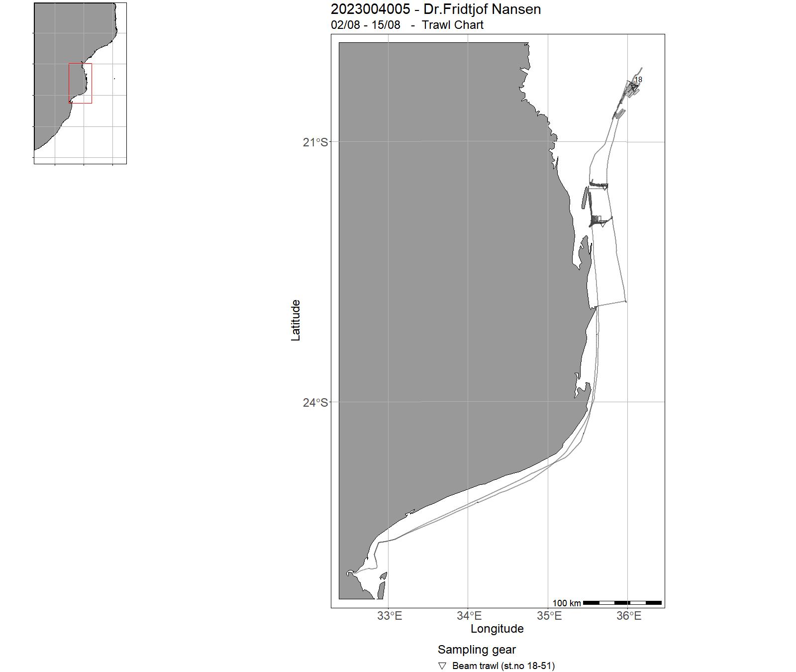
| 2023004005 | 02/08 - 15/08 | Bottom habitat mapping in Mozambique | Indiske hav | 619-668 | 18-51 |
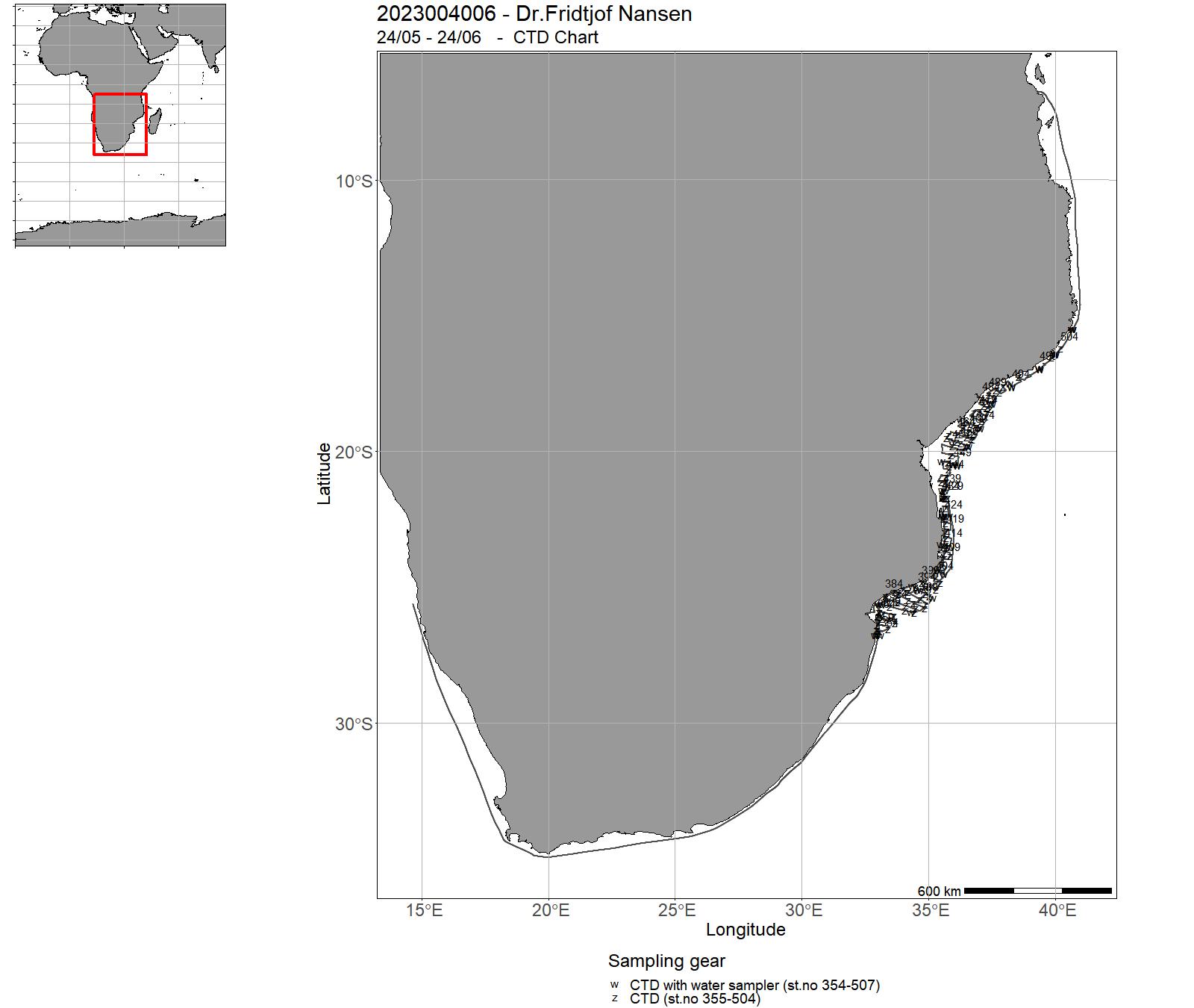
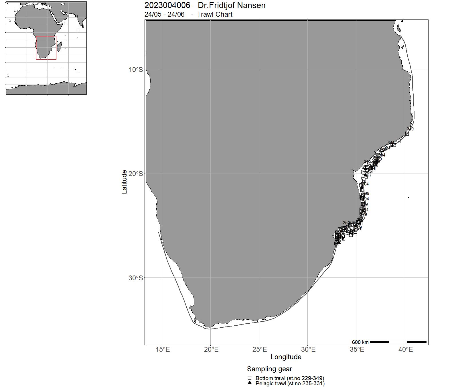
| 2023004006 | 24/05 - 24/06 | The objective of the survey was to assess the pelagic and demersal resources of Mozambique.Additionally, biological data for selected shrimp and fish species was collected from bottom and pelagic trawl catches, CTD and water samples analysed for oxygen, salinity, and chlorophyll, plankton and microplastic samples were collected with WP2, Bongo and Manta trawls. Detailed taxonomic identification was done for all species in the trawl catches. | Indian Ocean | 728 - 807 | 473 - 515 |
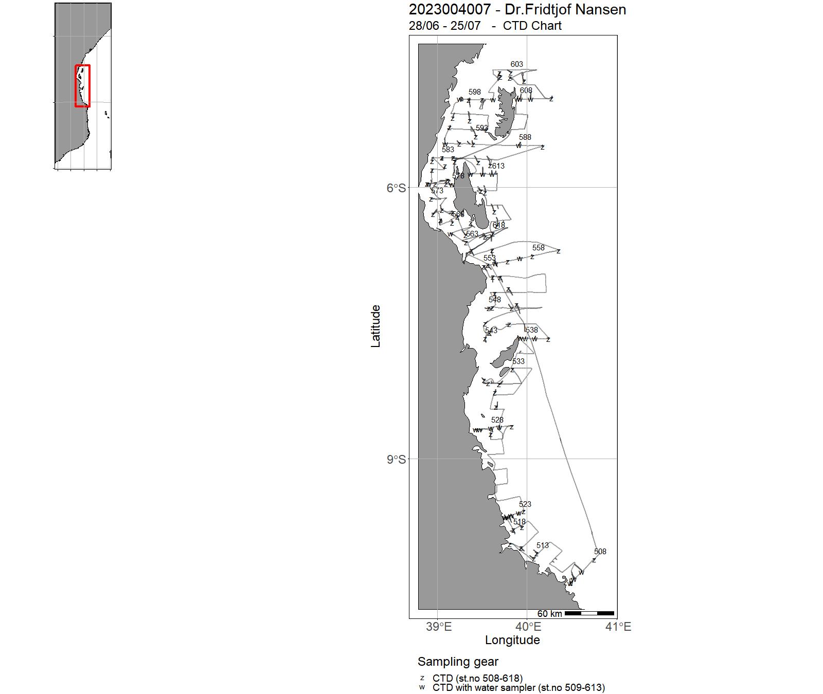
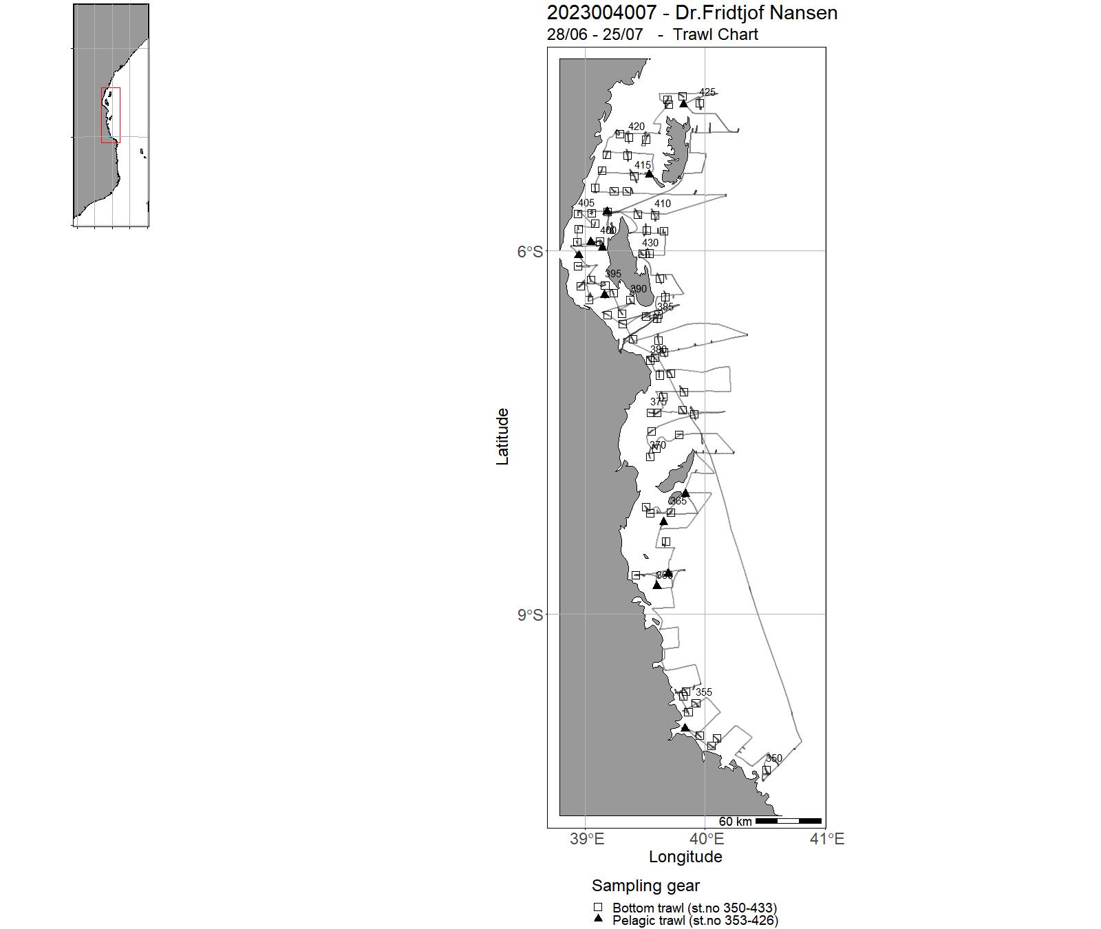
| 2023004007 | 28/06 - 25/07 | The general objectives of Leg 4.2 are:Obtaining information on demersal and pelagic fish species abundance, their distribution and size structure, as well as the species composition. | Indian Ocean | 508 - 618 | 350 - 433 |
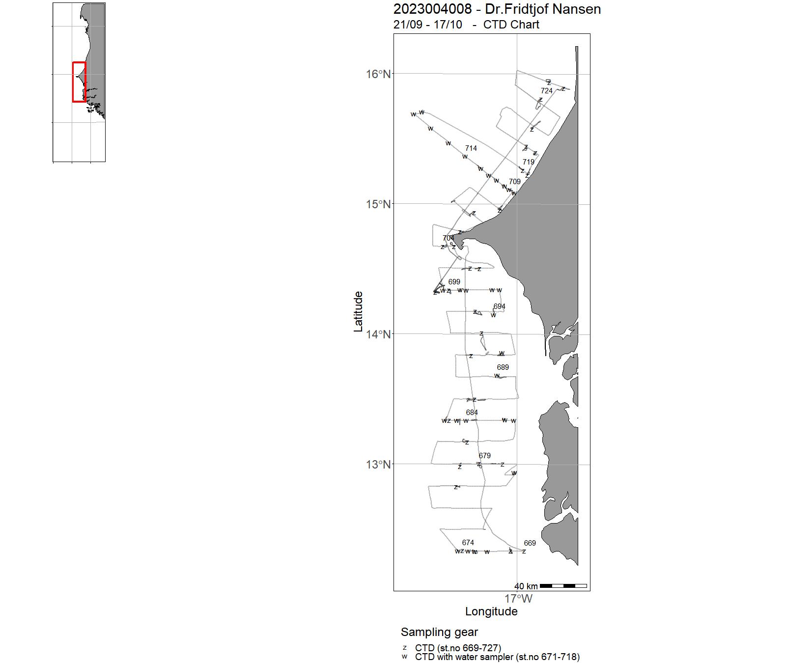
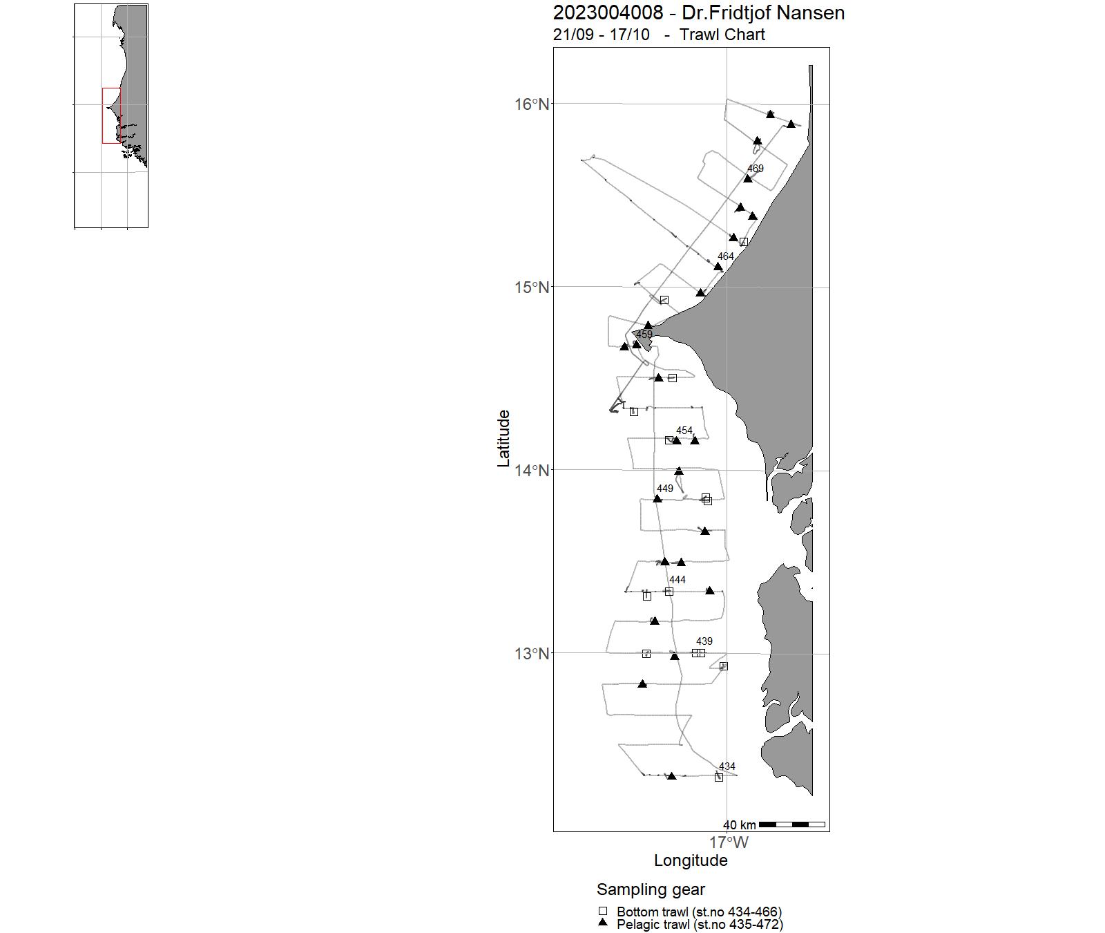
| 2023004008 | 21/09 - 17/10 | The survey objectives were: 1. Collect information on abundance, biomass, species composition, and distribution of pelagic fish species. 2. Measure standard biological parameters for priority pelagic fish species, including length, weight, sex, and maturity. 3. Measure physical and chemical properties of the water column including temperature, salinity, dissolved O2, chlorophyll, nutrients, pH, alkalinity, light penetration, and water currents. 4. Collect information on mesozooplankton and ichthyoplankton biomass, diversity and distribution. 5. Sample for the presence of microplastic particles in surface waters, in the water column, and in selected fish resources, and document the presence of litter registered in trawl hauls. 6. Conduct a dense CTD coverage at the Dakhla master section. 7. Collect information on food safety and nutrition of selected species. | Atlantic Ocean | 669 - 727 | 434 - 472 |
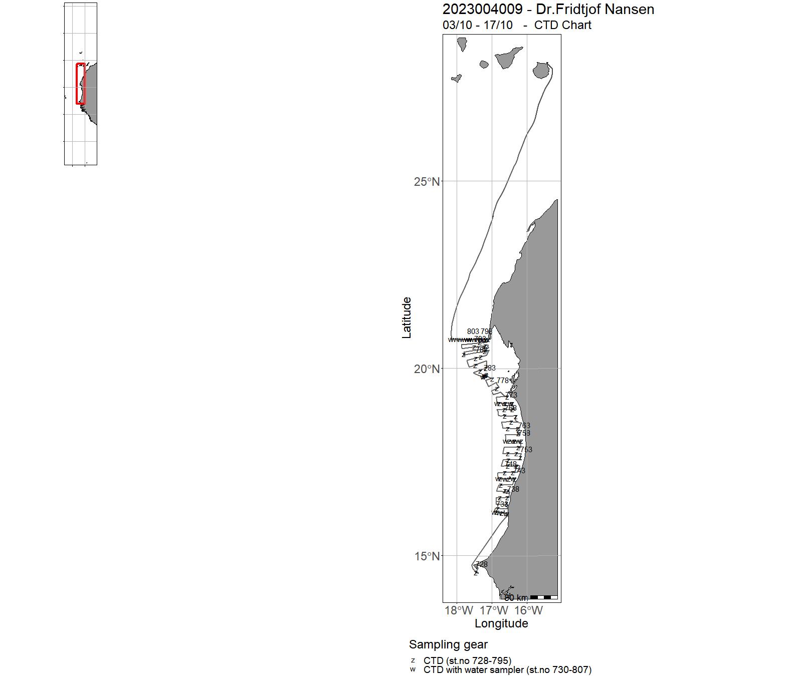
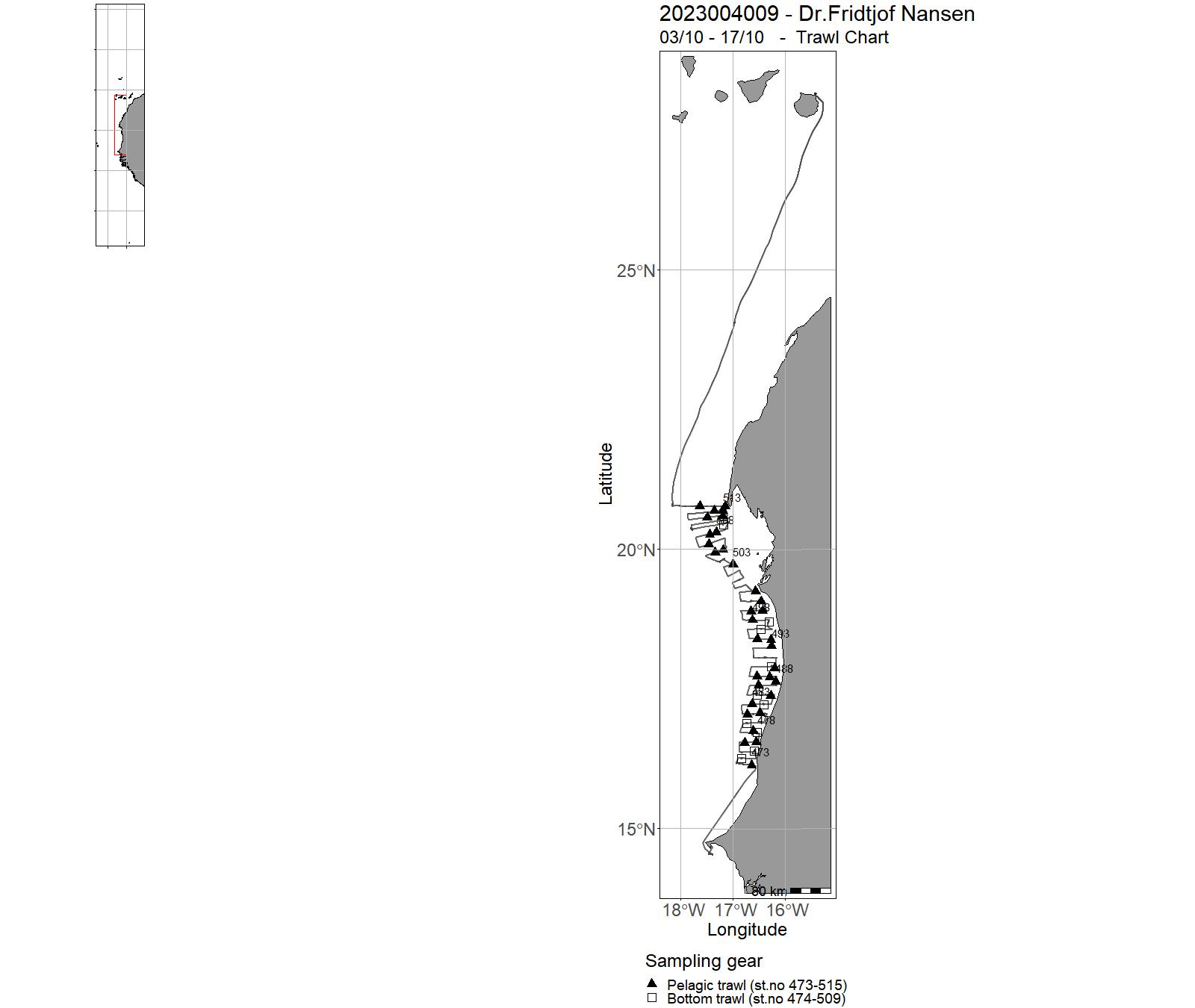
| 2023004009 | 03/10 - 17/10 | The survey objectives were: Collect information on abundance, biomass, species composition, and distribution of pelagic fish species. | Atlantic Ocean | 728 - 807 | 473 - 515 |
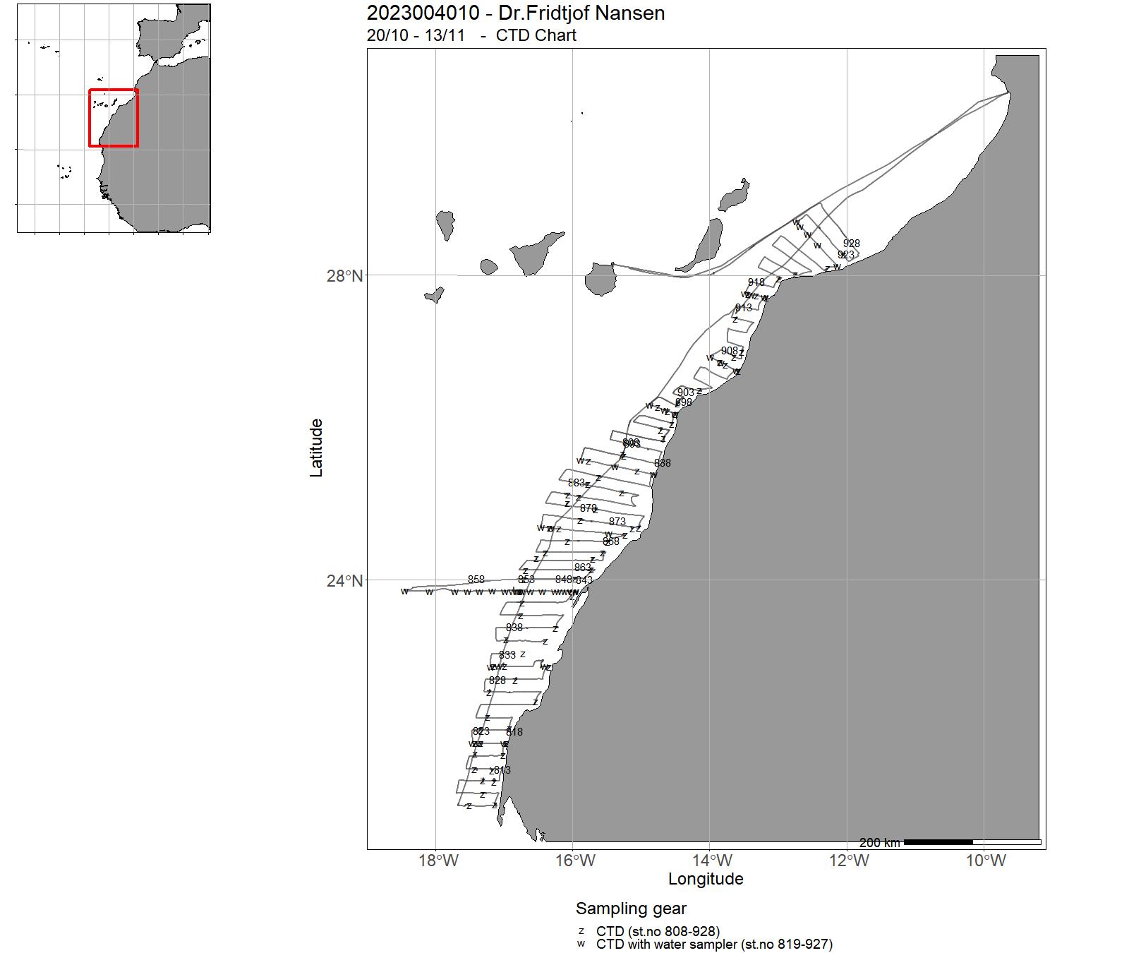
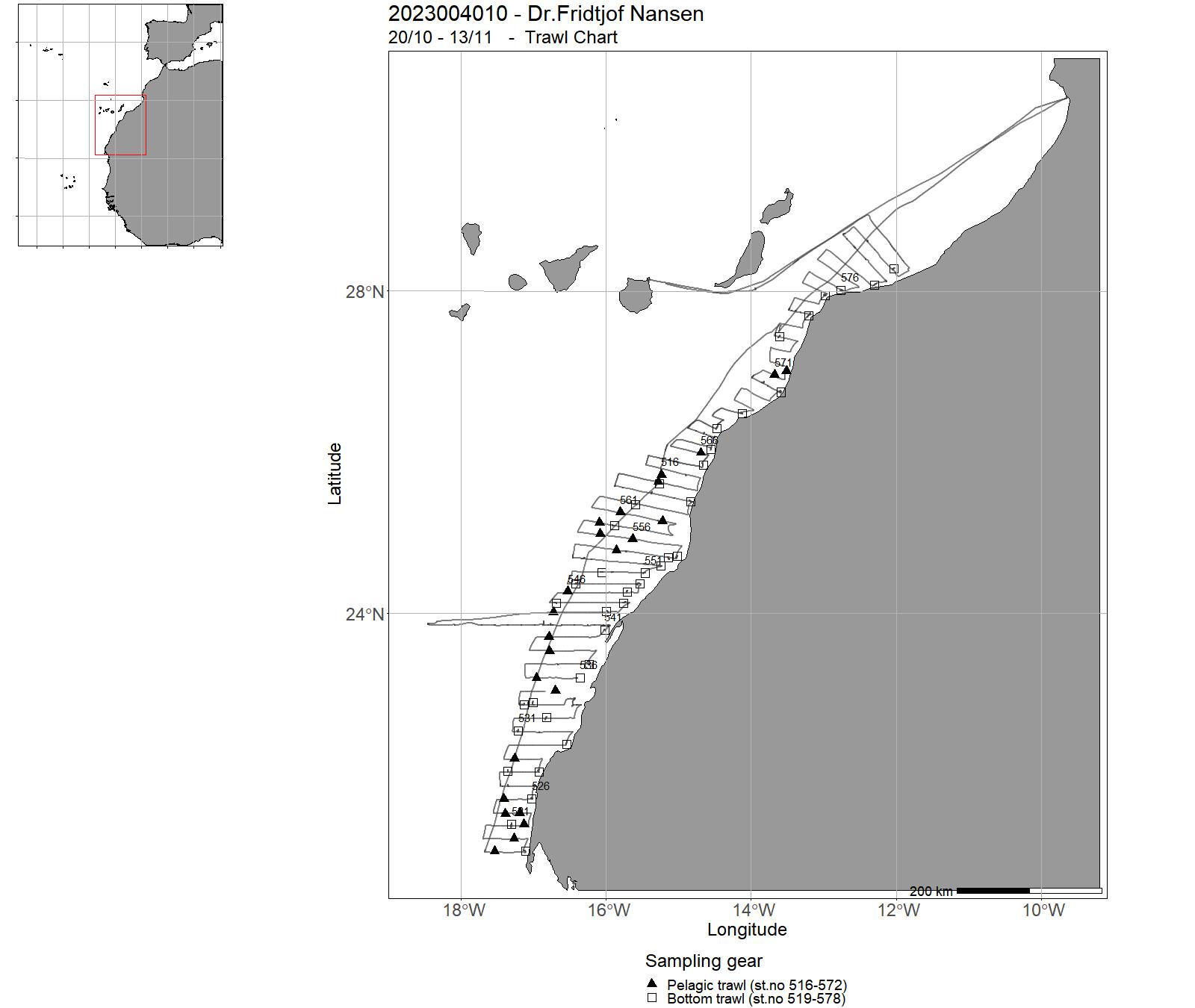
| 2023004010 | 20/10 - 13/11 | Collect information on abundance, biomass, species composition, and distribution of pelagic fish species. | Atlantic Ocean | 808 - 928 | 516 - 578 |
| 2023004011 | 01/09 - 19/09 | Study the physical and chemical properties of surface waters during steaming from south to north. Sensor data were registered through the termosalinograph system mounted on the ships seawater intake at 4-meter depth, measuring temperature, conductivity, fluorescence and pCO2. Validating the pCO2 sensor with measurements of pH and total alkalinity. | Atlantic Ocean | - | - |
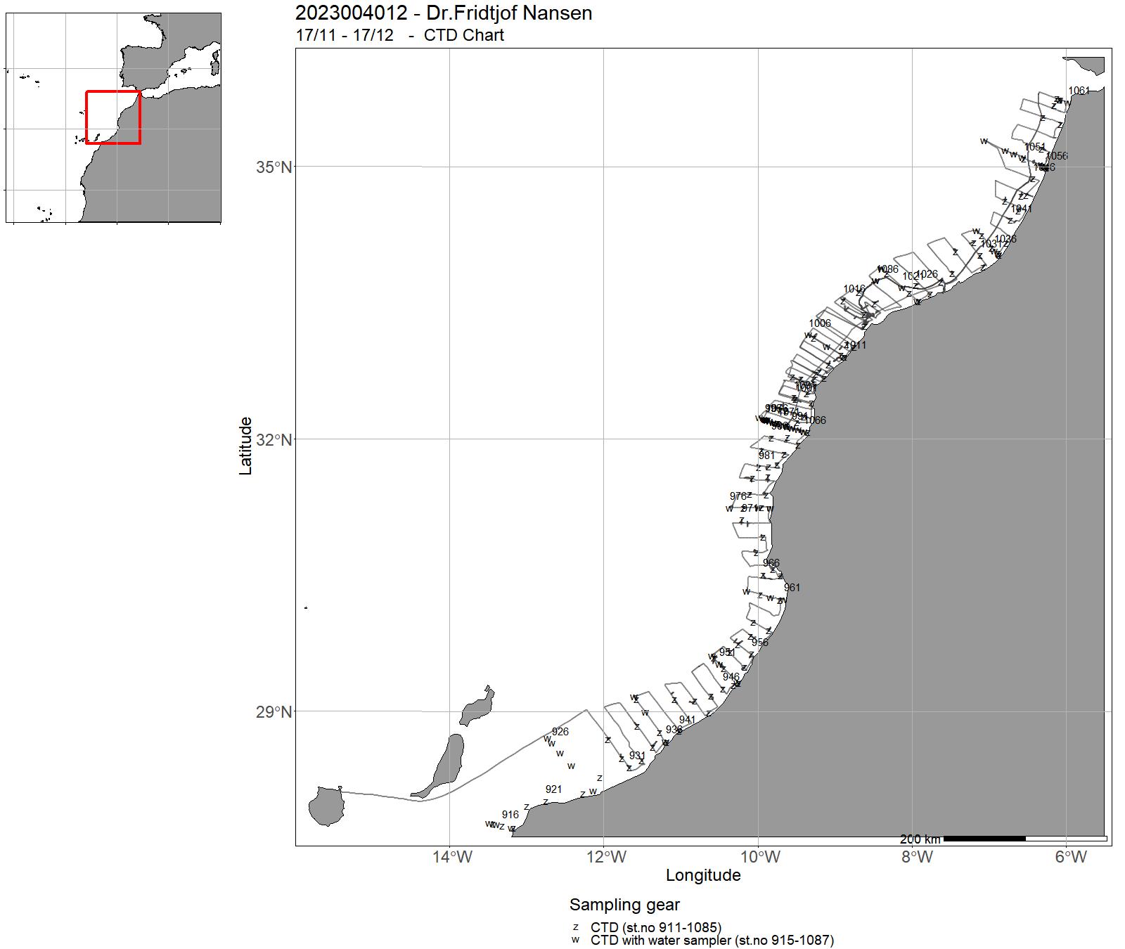
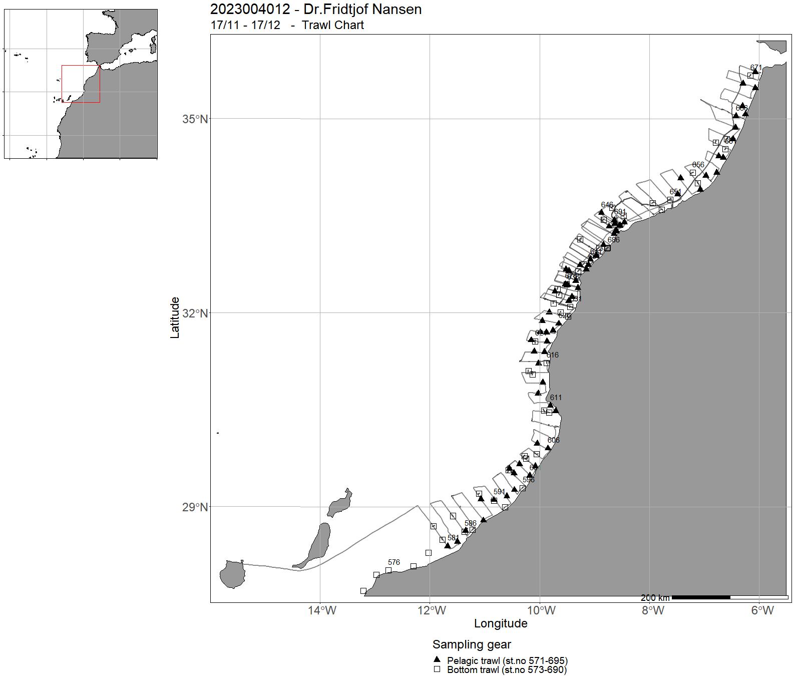
| 2023004012 | 17/11 - 17/12 | Leg 5.3 Cap Cantin - Tanger | Vest-Afrika | 911 - 1087 | 571 - 695 |
15 - "Dr. Fridtjof Nansen" Charts for 2023
16 - "Hans Brattstrøm" Cruises 2023
| Cruise no | Period | Purpose | Area | CTD st.no | Trawl st.no |
| 2023009001 | 10/01 - 10/01 | Innsamling av Appendicularia til kultivering og forskning. | Norskekysten: Vestlandet | - | - |
| 2023009002 | 11/01 - 11/01 | This research project is a collaboration between projects ParaZoo (PI Luis Martell, funded by Artsdatabanken) and Pole2Pole (PI Joan Soto, funded by EU). We will study zooplankton parasites and their gelatinous hosts. | Norskekysten: Vestlandet | - | - |
| 2023009003 | 12/01 - 12/01 | Undersøke hvordan havforsuring varierer over tid i fjorder sør for Bergen. Vi ønsker å forlenge tidsserier av havforsuringsmålinger i Korsfjorden og Hardangerfjorden. Tidsseriene ble starta i 2007. I 2023 vil vi ta vannprøver annenhver måned fra disse to stasjonene. | Norskekysten: Vestlandet | - | - |
| 2023009004 | 13/01 - 13/01 | To survey the hidden diversity of parasitic crustaceans in Norwegian fjord habitats, fjord systems in the vicinity of Bergen will be used as the study area. With a focus on Copepoda, Thecostraca and Isopoda, classical marine biological collection methods, complemented with molecular methods (ddPCR), will be employed in the search for rare and overlooked species. | Norskekysten: Vestlandet | - | - |
| 2023009005 | 14/02 - 17/02 | During the cruise we will retrieve three moorings in Masfjorden and one in Lurefjorden. | Norskekysten: Vestlandet | - | - |
| 2023009006 | 23/01 - 23/01 | Innsamling av Appendicularia til kultivering og forskning. | Norskekysten: Vestlandet | - | - |
| 2023009007 | 30/01 - 03/02 | Langsiktig overvåkning av fjordoseanografi og strømmodellutvikling. | Norskekysten: Vestlandet | - | - |
| 2023009008 | 06/02 - 06/02 | Appendicularia | Norskekysten: Vestlandet | - | - |
| 2023009009 | 07/02 - 12/02 | Mål: å skaffe kunnskap som kan gi bedre grunnlag for risikovurdering av utlekking av Cu fra akvakulturanlegg. | Norskekysten: Vestlandet | - | - |
| 2023009010 | 22/02 - 23/02 | SFI Smart Ocean er et 8 årig prosjekt (NFR, ledet av UiB). HI skal i denne perioden bygge opp og drifte testfasiliteter på og rundt Austevoll havbruksstasjon. Partnere skal kunnes sette ut sensorer og sensorhuber for uttesting, samt referansesystem. | Norskekysten: Vestlandet | - | - |
| 2023009011 | 24/02 - 24/02 | This research project is a collaboration between projects ParaZoo (PI Luis Martell, funded by Artsdatabanken) and Pole2Pole (PI Joan Soto, funded by EU). We will study zooplankton parasites and their gelatinous hosts. | Norskekysten: Vestlandet | - | - |
| 2023009012 | 21/02 - 21/02 | Innsamling av Appendicularia til kultivering og forskning. | Norskekysten: Vestlandet | - | - |
| 2023009013 | 20/02 - 20/02 | To survey the hidden diversity of parasitic crustaceans in Norwegian fjord habitats, fjord systems in the vicinity of Bergen will be used as the study area. With a focus on Copepoda, Thecostraca and Isopoda, classical marine biological collection methods, complemented with molecular methods (ddPCR), will be employed in the search for rare and overlooked species. | Norskekysten: Vestlandet | - | - |
| 2023009014 | 27/02 - 03/03 | Langsiktig overvåkning av fjordoseanografi og strømmodellutvikling. | Norskekysten: Vestlandet | - | - |
| 2023009015 | 07/03 - 07/03 | The main goal is collection of Meara Stichopi from the gut of Parastichopus (sea cucumber) at around 250 m debt. We might also collect other marine invertebrates such as Novocrania anomala and Lineus longissimus. | Norskekysten: Vestlandet | - | - |
| 2023009016 | 06/03 - 06/03 | Innsamling av Appendicularia til kultivering og forskning. | Norskekysten: Vestlandet | - | - |
| 2023009017 | 13/03 - 13/03 | Undersøke hvordan havforsuring varierer over tid i fjorder sør for Bergen Vi ønsker å forlenge tidsserier av havforsuringsmålinger i Korsfjorden og Hardangerfjorden. Tidsseriene ble starta i 2007. I 2023 vil vi ta vannprøver annenhver måned fra disse to stasjonene. Dette bidrar til prosjektet "Overvåking av havforsuring 2021-2025" i regi av Miljødirektoratet. | Norskekysten: Vestlandet | - | - |
| 2023009018 | 14/03 - 14/03 | This research project is a collaboration between projects ParaZoo (PI Luis Martell, funded by Artsdatabanken) and Pole2Pole (PI Joan Soto, funded by EU). We will study zooplankton parasites and their gelatinous hosts. | Norskekysten: Vestlandet | - | - |
| 2023009019 | 15/03 - 15/03 | To survey the hidden diversity of parasitic crustaceans in Norwegian fjord habitats, fjord systems in the vicinity of Bergen will be used as the study area. With a focus on Copepoda, Thecostraca and Isopoda, classical marine biological collection methods, complemented with molecular methods (ddPCR), will be employed in the search for rare and overlooked species. | Norskekysten: Vestlandet | - | - |
| 2023009020 | 12/04 - 12/04 | To survey the hidden diversity of parasitic crustaceans in Norwegian fjord habitats, fjord systems in the vicinity of Bergen will be used as the study area. With a focus on Copepoda, Thecostraca and Isopoda, classical marine biological collection methods, complemented with molecular methods (ddPCR), will be employed in the search for rare and overlooked species. | Norskekysten: Vestlandet | - | - |
| 2023009021 | 17/04 - 17/04 | This research project is a collaboration between projects ParaZoo (PI Luis Martell, funded by Artsdatabanken) and Pole2Pole (PI Joan Soto, funded by EU). We will study zooplankton parasites and their gelatinous hosts. | Norskekysten: Vestlandet | - | - |
| 2023009022 | 11/04 - 11/04 | Innsamling av Appendicularia til kultivering og forskning. | Norskekysten: Vestlandet | - | - |
| 2023009023 | 18/04 - 20/04 | Sampling intertidal at a wave exposed site and dredging in the sublittioral | Norskekysten | - | - |
| 2023009024 | 21/04 - 21/04 | Innsamling av Appendicularia til kultivering og forskning. | Norskekysten: Vestlandet | - | - |
| 2023009025 | 24/04 - 28/04 | Langsiktig overvåkning av fjordoseanografi og strømmodellutvikling. Utsett av smoltburforankringer knyttet til lakselusovervåkning. | Norskekysten: Vestlandet | - | - |
| 2023009034 | 30/05 - 01/06 | Langsiktig overvåkning av fjordoseanografi og strømmodellutvikling. | Norskekysten: Vestlandet | - | - |
| 2023009035 | 02/06 - 02/06 | This research project is a collaboration between projects ParaZoo (PI Luis Martell, funded by Artsdatabanken) and Pole2Pole (PI Joan Soto, funded by EU). We will study zooplankton parasites and their gelatinous hosts. | Norskekysten: Vestlandet | - | - |
| 2023009036 | 05/06 - 05/06 | Innsamling av Appendicularia til kultivering og forskning. | Norskekysten: Vestlandet | - | - |
| 2023009037 | 06/06 - 12/06 | Toktet inngår i et 3-årig artsprosjekt finanisiert av Artsdatabanken. Formålet med toktet er å kartlegge artsmangfold av bunnfauna i Romsdal fjorder. Spesiell fokus på Mysider (pungreker), og ellers andre krepsdyr. | Norskekysten: Trøndelag/Møre | - | - |
| 2023009038 | 13/06 - 14/06 | Enkelte liggedager gjennom året. Helst to dager annenhver mnd. | Ukjent | - | - |
| 2023009039 | 15/06 - 15/06 | To survey the hidden diversity of parasitic crustaceans in Norwegian fjord habitats, fjord systems in the vicinity of Bergen will be used as the study area. With a focus on Copepoda, Thecostraca and Isopoda, classical marine biological collection methods, complemented with molecular methods (ddPCR), will be employed in the search for rare and overlooked species. | Norskekysten: Vestlandet | - | - |
| 2023009040 | 19/06 - 23/06 | Langsiktig overvåkning av fjordoseanografi og strømmodellutvikling. Opptak av smoltburforankringer. | Norskekysten: Vestlandet | - | - |
| 2023009041 | 26/06 - 26/06 | Innsamling av Appendicularia til kultivering og forskning. | Norskekysten: Vestlandet | - | - |
| 2023009042 | 27/06 - 27/06 | This research project is a collaboration between projects ParaZoo (PI Luis Martell, funded by Artsdatabanken) and Pole2Pole (PI Joan Soto, funded by EU). We will study zooplankton parasites and their gelatinous hosts. | Norskekysten: Vestlandet | - | - |
| 2023009043 | 03/08 - 03/08 | Undersøke hvordan havforsuring varierer over tid i fjorder sør for Bergen Vi ønsker å forlenge tidsserier av havforsuringsmålinger i Korsfjorden og Hardangerfjorden. Tidsseriene ble starta i 2007. I 2023 vil vi ta vannprøver annenhver måned fra disse to stasjonene. Dette bidrar til prosjektet ""Overvåking av havforsuring 2021-2025"" i regi av Miljødirektoratet. | Norskekysten: Vestlandet | - | - |
| 2023009044 | 02/08 - 02/08 | Innsamling av Appendicularia til kultivering og forskning. | Norskekysten: Vestlandet | - | - |
| 2023009045 | 04/08 - 04/08 | This research project is a collaboration between projects ParaZoo (PI Luis Martell, funded by Artsdatabanken) and Pole2Pole (PI Joan Soto, funded by EU). We will study zooplankton parasites and their gelatinous hosts. | Norskekysten: Vestlandet | - | - |
| 2023009046 | 07/08 - 11/08 | Hardanger 7 | Langsiktig overvåkning av fjordoseanografi og strømmodellutvikling. | - | - |
| 2023009047 | 29/08 - 30/08 | SFI Smart Ocean er et 8 årig prosjekt (NFR, ledet av UiB). HI skal i denne perioden bygge opp og drifte testfasiliteter på og rundt Austevoll havbruksstasjon. Partnere skal kunnes sette ut sensorer og sensorhuber for uttesting, samt referansesystem. | Norskekysten: Vestlandet | - | - |
| 2023009048 | 28/08 - 28/08 | The main goal is collection of Meara Stichopi from the gut of Parastichopus (sea cucumber) at around 250 m debt. We might also collect other marine invertebrates such as Novocrania anomala and Lineus longissimus. | Norskekysten: Vestlandet | - | - |
| 2023009049 | 14/08 - 23/08 | 2 weeks (2x8 single-day cruises) for the marine faunistics course (Faunestikk kurs unner Bio325). | Norskekysten: Vestlandet | - | - |
| 2023009050 | 04/09 - 04/09 | Innsamling av Appendicularia til kultivering og forskning. | Norskekysten: Vestlandet | - | - |
| 2023009051 | 05/09 - 05/09 | This research project is a collaboration between projects ParaZoo (PI Luis Martell, funded by Artsdatabanken) and Pole2Pole (PI Joan Soto, funded by EU). We will study zooplankton parasites and their gelatinous hosts. | Norskekysten: Vestlandet | - | - |
| 2023009052 | 06/09 - 06/09 | The main goal is collection of Meara Stichopi from the gut of Parastichopus (sea cucumber) at around 250 m debt. We might also collect other marine invertebrates such as Novocrania anomala and Lineus longissimus. | Norskekysten: Vestlandet | - | - |
| 2023009053 | 07/09 - 07/09 | Undersøke hvordan havforsuring varierer over tid i fjorder sør for Bergen Vi ønsker å forlenge tidsserier av havforsuringsmålinger i Korsfjorden og Hardangerfjorden. Tidsseriene ble starta i 2007. I 2023 vil vi ta vannprøver annenhver måned fra disse to stasjonene. Dette bidrar til prosjektet ""Overvåking av havforsuring 2021-2025"" i regi av Miljødirektoratet. Finansieringen vil komme via Norce | Norskekysten: Vestlandet | - | - |
| 2023009054 | 08/09 - 08/09 | To survey the hidden diversity of parasitic crustaceans in Norwegian fjord habitats, fjord systems in the vicinity of Bergen will be used as the study area. With a focus on Copepoda, Thecostraca and Isopoda, classical marine biological collection methods, complemented with molecular methods (ddPCR), will be employed in the search for rare and overlooked species. | Norskekysten: Vestlandet | - | - |
| 2023009055 | 25/09 - 29/09 | GEOV110 is an introductory course for bachelor students at GEO (UiB) that includes an introduction to field methods and data. During this cruise week, we will do daily student cruises in the area around Bergen, with a sub-set of students on each day, taking seismic profiles (Chirp), sediment cores, CTD measurements and water samples. | Norskekysten: Vestlandet | - | - |
| 2023009056 | 02/10 - 06/10 | Langsiktig overvåkning av fjordoseanografi og strømmodellutvikling. | Norskekysten: Vestlandet | - | - |
| 2023009057 | 09/10 - 09/10 | Innsamling av Appendicularia til kultivering og forskning. | Norskekysten: Vestlandet | - | - |
| 2023009058 | 10/10 - 10/10 | This research project is a collaboration between projects ParaZoo (PI Luis Martell, funded by Artsdatabanken) and Pole2Pole (PI Joan Soto, funded by EU). We will study zooplankton parasites and their gelatinous hosts. | Norskekysten: Vestlandet | - | - |
| 2023009059 | 16/10 - 20/10 | This was a student cruise (four day trips) with the purpose of teaching students how oceanographic and meteorological fieldwork is conducted. Data (physical oceanography, such as CTD stations and GPS locations from surface drifters, as well as meteorological data from a weather station onboard) were collected in the city fjord of Bergen. | North Sea | - | - |
| 2023009060 | 23/10 - 24/10 | To survey the hidden diversity of parasitic crustaceans in Norwegian fjord habitats, fjord systems in the vicinity of Bergen will be used as the study area. With a focus on Copepoda, Thecostraca and Isopoda, classical marine biological collection methods, complemented with molecular methods (ddPCR), will be employed in the search for rare and overlooked species. | Norskekysten: Vestlandet | - | - |
| 2023009061 | 10/11 - 10/11 | Innsamling av Appendicularia til kultivering og forskning. | Norskekysten: Vestlandet | - | - |
| 2023009062 | 07/11 - 07/11 | This research project is a collaboration between projects ParaZoo (PI Luis Martell, funded by Artsdatabanken) and Pole2Pole (PI Joan Soto, funded by EU). We will study zooplankton parasites and their gelatinous hosts. | Norskekysten: Vestlandet | - | - |
| 2023009063 | 06/11 - 06/11 | Undersøke hvordan havforsuring varierer over tid i fjorder sør for Bergen Vi ønsker å forlenge tidsserier av havforsuringsmålinger i Korsfjorden og Hardangerfjorden. Tidsseriene ble starta i 2007. I 2023 vil vi ta vannprøver annenhver måned fra disse to stasjonene. | Norskekysten: Vestlandet | - | - |
| 2023009064 | 13/11 - 14/11 | SFI Smart Ocean er et 8 årig prosjekt (NFR, ledet av UiB). HI skal i denne perioden bygge opp og drifte testfasiliteter på og rundt Austevoll havbruksstasjon. Partnere skal kunnes sette ut sensorer og sensorhuber for uttesting, samt referansesystem. | Norskekysten: Vestlandet | - | - |
| 2023009065 | 15/11 - 15/11 | Innsamling av Appendicularia til kultivering og forskning. | Norskekysten: Vestlandet | - | - |
| 2023009066 | 16/11 - 16/11 | To survey the hidden diversity of parasitic crustaceans in Norwegian fjord habitats, fjord systems in the vicinity of Bergen will be used as the study area. With a focus on Copepoda, Thecostraca and Isopoda, classical marine biological collection methods, complemented with molecular methods (ddPCR), will be employed in the search for rare and overlooked species. | Norskekysten: Vestlandet | - | - |
| 2023009067 | 04/12 - 04/12 | Innsamling av Appendicularia til kultivering og forskning. | Norskekysten: Vestlandet | - | - |
| 2023009068 | 05/12 - 05/12 | This research project is a collaboration between projects ParaZoo (PI Luis Martell, funded by Artsdatabanken) and Pole2Pole (PI Joan Soto, funded by EU). We will study zooplankton parasites and their gelatinous hosts. | Norskekysten: Vestlandet | - | - |
| 2023009069 | 06/12 - 06/12 | To survey the hidden diversity of parasitic crustaceans in Norwegian fjord habitats, fjord systems in the vicinity of Bergen will be used as the study area. With a focus on Copepoda, Thecostraca and Isopoda, classical marine biological collection methods, complemented with molecular methods (ddPCR), will be employed in the search for rare and overlooked species. | Norskekysten: Vestlandet | - | - |
| 2023009070 | 11/12 - 15/12 | Langsiktig overvåkning av fjordoseanografi og strømmodellutvikling. | Norskekysten: Vestlandet | - | - |
| 2023009071 | 02/05 - 29/05 | Toktet har som hensikt å fange utvandrende vill laksesmolt som en del av den nasjonale overvåkningen på vill laksefisk. Laksesmolt fanges i ytre deler av utvalgte fjordsystem med en spesialbygget pelagisk trål. | Norskekysten: Vestlandet | - | - |
17 - "Prinsesse Ingrid Alexandra" Cruises 2023
| Cruise no | Period | Purpose | Area | CTD st.no | Trawl st.no |
| 2023005001 | 08/03 - 14/03 | Kartlegging og overvåkning av sil på Vestlandet | Norskekysten: Vestlandet | - | - |
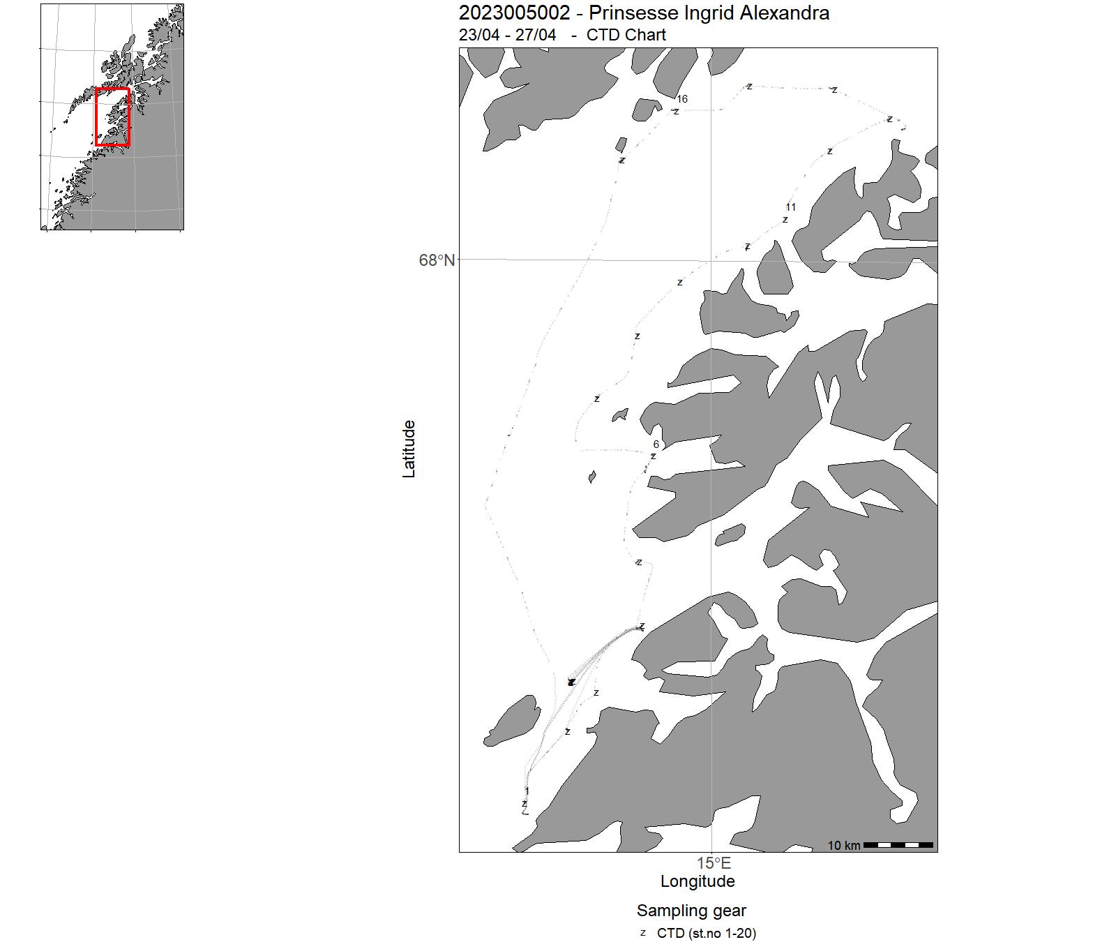
| 2023005002 | 23/04 - 27/04 |
1. Teaching leg Sampling as part of the course BI206F Marine Biology at Nord University. Teaching aimed to show the use of water collection with a Niskin rosette and the accompanying CTD. To illustrate the placement of zooplankton in the water column, the depth intervals chosen for the multinet were based on the CTD cast. 2. MarFiLD project leg In this project we investigate the composition of meroplankton in sub-Arctic fjords and test the hypothesis that meroplankton can be an alternative food source for early fish larvae. Therefore, this cruise was used as a first exploration of the region and testing the sampling scheme for the project by collecting fish larvae and zooplankton in Vestfjorden using different sampling methods (WP3, WP2 and Bongo-nets, down to 50 m depth). |
Norskekysten: Nordland | 1-20 | - |
| 2023005004 | 31/05 - 06/06 | This project aims at developing new knowledge on the impacts of waste released from fish farms on long lived and sensitive deep water species. In particular this survey aim to collect visual data and physical samples of the bamboo coral (Isidella Lofotensis) around 2 farms in Hardangerfjorden that have been requested to monitor the impact of their farming activity on bamboo coral populations. | Norskekysten: Vestlandet | - | - |
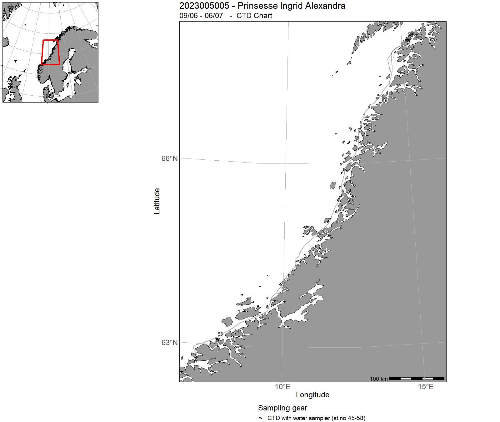
| 2023005005 | 09/06 - 06/07 | Collection of fauna specimens from around coastal salmon farms using ROV. Conducting respirometry experiments in wetlab on board. Also sampling seabed using SIBS and deploying and retrieving sediment traps. | Norskekysten: Trøndelag/Møre, Norskekysten: Vestlandet, Norskekysten: Nordland | 45-58 | - |
| 2023005007 | 14/08 - 20/08 | This project aims at developing new knowledge on the impacts of waste released from fish farms on long lived and sensitive deep water species. In particular this survey aim to collect visual data and physical samples of the bamboo coral (Isidella Lofotensis) around 2-4 farms in Sagfjorden Nordland. | Norskekysten: Nordland | - | - |
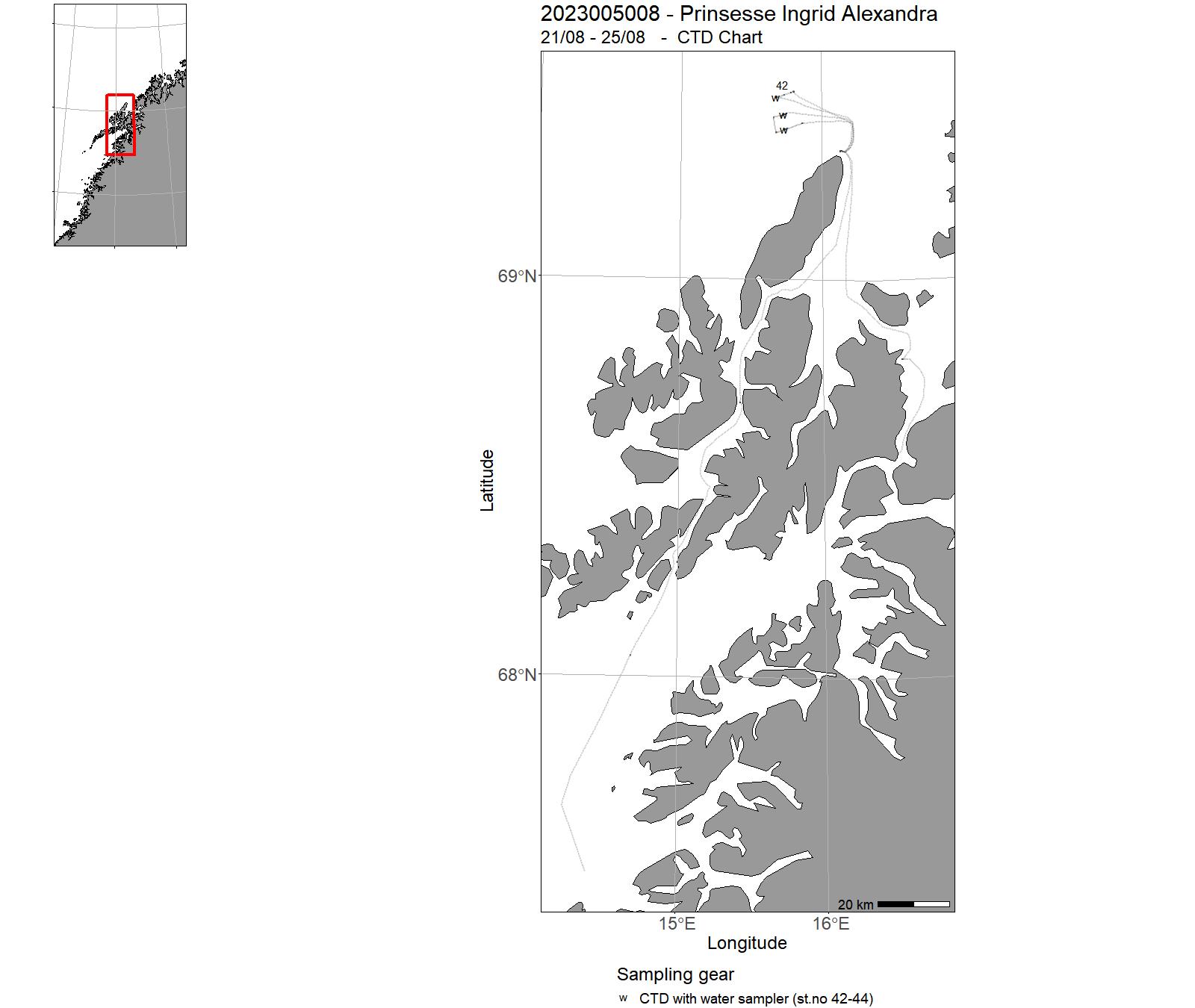
| 2023005008 | 21/08 - 25/08 | To characterize the north Atlantic sperm whales exposure to and interactions with pathogens, but also to advance the study of wild cetaceans health through the use of new non-lethal and minimally invasive methods (blow sampling, microRNAs and in vitro studies). | Norskekysten: Nordland | 42-44 | - |
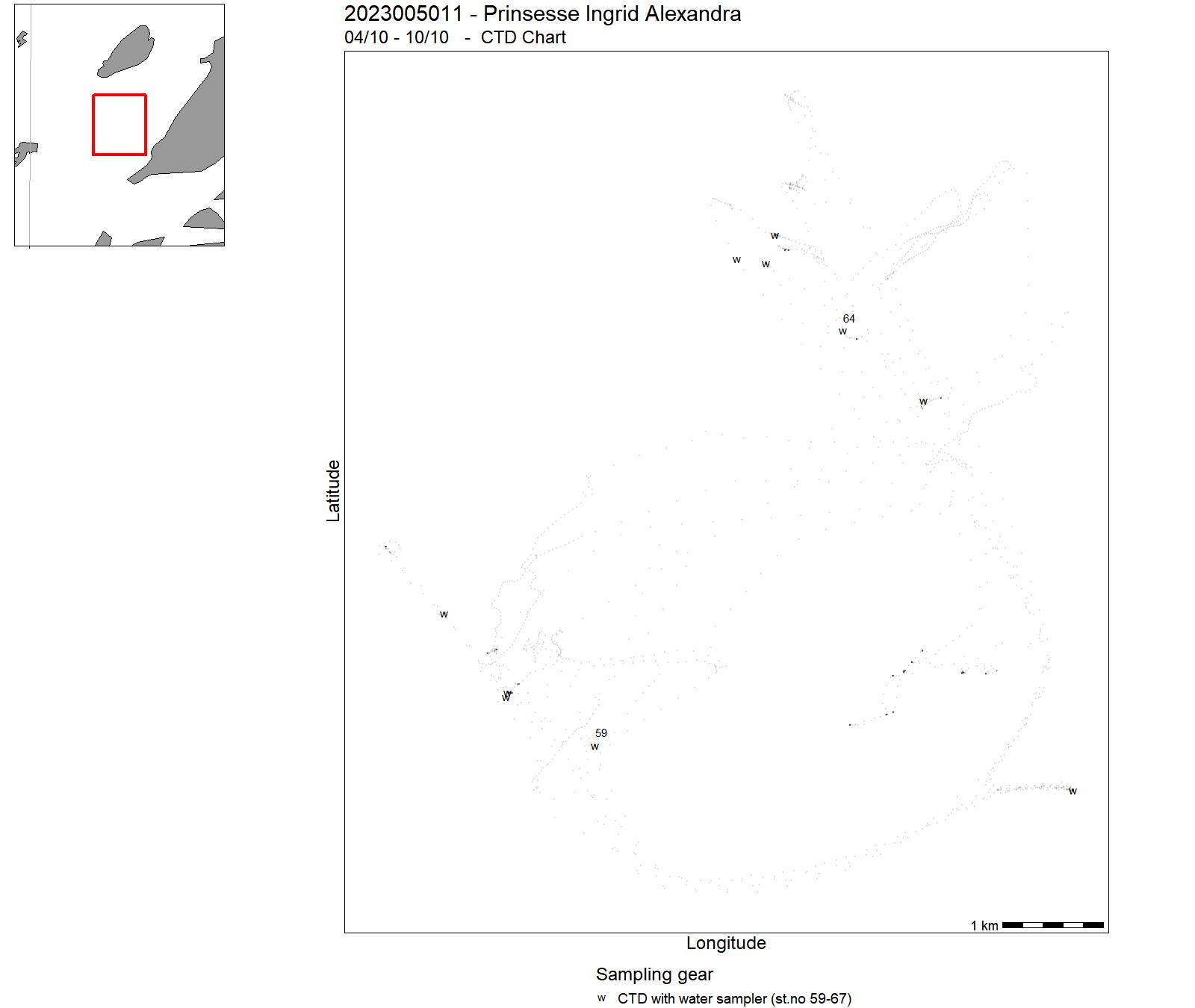
| 2023005011 | 04/10 - 10/10 | The bachelor master course 'Research Methods at Sea' is part of the Bachelor in Biology and Master in Bioscience programmes at Nord University. The course will teach fundamental sampling techniques and sample processing in marine biology and oceanography. It includes sampling of nekton, plankton, and benthos as well as measuring oceanographic parameters with different methods. | Norskekysten: Nordland | 59-66 | 39-40 |
| 2023005012 | 10/10 - 14/10 | Student excursion in the course BI222F: CTD transect Saltfjorden grid, CTD + Van Veen grab in two stations in Mistfjorden, WP2-net plankton sample in Saltfjorden. | Norwegian Sea | 68-89 | - |
| 2023005013 | 17/10 - 01/11 | The objectives of the survey was to improve the knowledge about the distribution, densities and stock composition of brown crab and Nephrops in Western Norway. The survey was conducted with crab and Nephrops pots set at randomly selected positions. In addition, video transects were performed to collect video data of Nephrops burrows and test image analysis as a technique to monitor the species in Norwegian waters. | North Sea | 90-140 | 1-16 |
| 2023005014 | 03/11 - 07/11 | Langsiktig overvåkning av fjordoseanografi og strømmodellutvikling. | Norskekysten: Vestlandet | - | - |
| 2023005015 | 28/11 - 09/12 | I dette prosjektet, effekter av lakseoppdrett på torsk, skal vi på en helhetlig måte skaffe til veie kunnskap for å avklare om dette er korrekt, samt hvordan lakseoppdrett eventuelt påvirker torsken. Vi skal derfor undersøke en fjord, sannsynligvis Frakfjorden på grensen mellom Troms og Finnmark, både før, under og etter etablering av et lakseoppdrettsanlegg. I tillegg skal vi undersøke en nabofjord med oppdrett, og en fjord som vil forbli uten oppdrett. | Norskekysten: Troms og Finnmark | - | - |
| 2023005016 | 08/11 - 27/11 | Annually conducted acoustic survey combined with fixed bottom trawl stations covering the shelf banks, coastal areas and fjords between Varangerfjord and Stadt. The survey collects additional data for analysis of deep sea shrimps, redfish, plankton, water chemistry, and sediment. Survey indices for NEA saithe and coastal cod north-north are used in assessment as tuning series. | Atlanterhavet NØ, Norskekysten, Norskekysten: Nordland, Norskekysten: Trøndelag/Møre | - | - |
| 2023005017 | 08/05 - 08/05 | Innsamling av Appendicularia til kultivering og forskning. | Norskekysten: Vestlandet | 21 | - |
| 2023005018 | 19/05 - 19/05 | To survey the hidden diversity of parasitic crustaceans in Norwegian fjord habitats, fjord systems in the vicinity of Bergen will be used as the study area. With a focus on Copepoda, Thecostraca and Isopoda, classical marine biological collection methods, complemented with molecular methods (ddPCR), will be employed in the search for rare and overlooked species. | Norskekysten: Vestlandet | - | - |
| 2023005019 | 07/06 - 08/06 | SFI Smart Ocean er et 8 årig prosjekt (NFR, ledet av UiB). HI skal i denne perioden bygge opp og drifte testfasiliteter på og rundt Austevoll havbruksstasjon. Aktiviteter: Utsetting av utstyr, innhenting av utstyr, kartlegging av hydrografi, akustikk og havkjemi. | Norskekysten: Vestlandet | 33-41 | - |
| 2023005020 | 09/05 - 09/05 | The object of the cruise was to collect/sample red sea cucumber (Parastichopus tremulus) to obtain specimens of the marine invertebrate Meara stichopi (nemertodermatid flatworm) that resides inside the foregut of the sea cucumber.The obtain specimens will be used in various research project focusing on the development and evolution of animals. | Norwegian Sea | - | 37 |
| 2023005021 | 10/05 - 10/05 | The primary aim was to collect water samples for Ocean Acidification studies at two stations along the westcoast of Norway. This represents extension of two long time series in the area. The secondary aim was to collect material for environmental DNA analyses. | North Sea | 22-24 | - |
| 2023005022 | 11/05 - 12/05 | Two 1-day cruises in the fjords around Bergen to collect zooplankton. This cruises were done in the framework of the 10th International Workshop of the Hydrozoan Society.Target biological group : pelagic hydrozoa (siphonophores and hydromedusae). | North Sea | - | - |
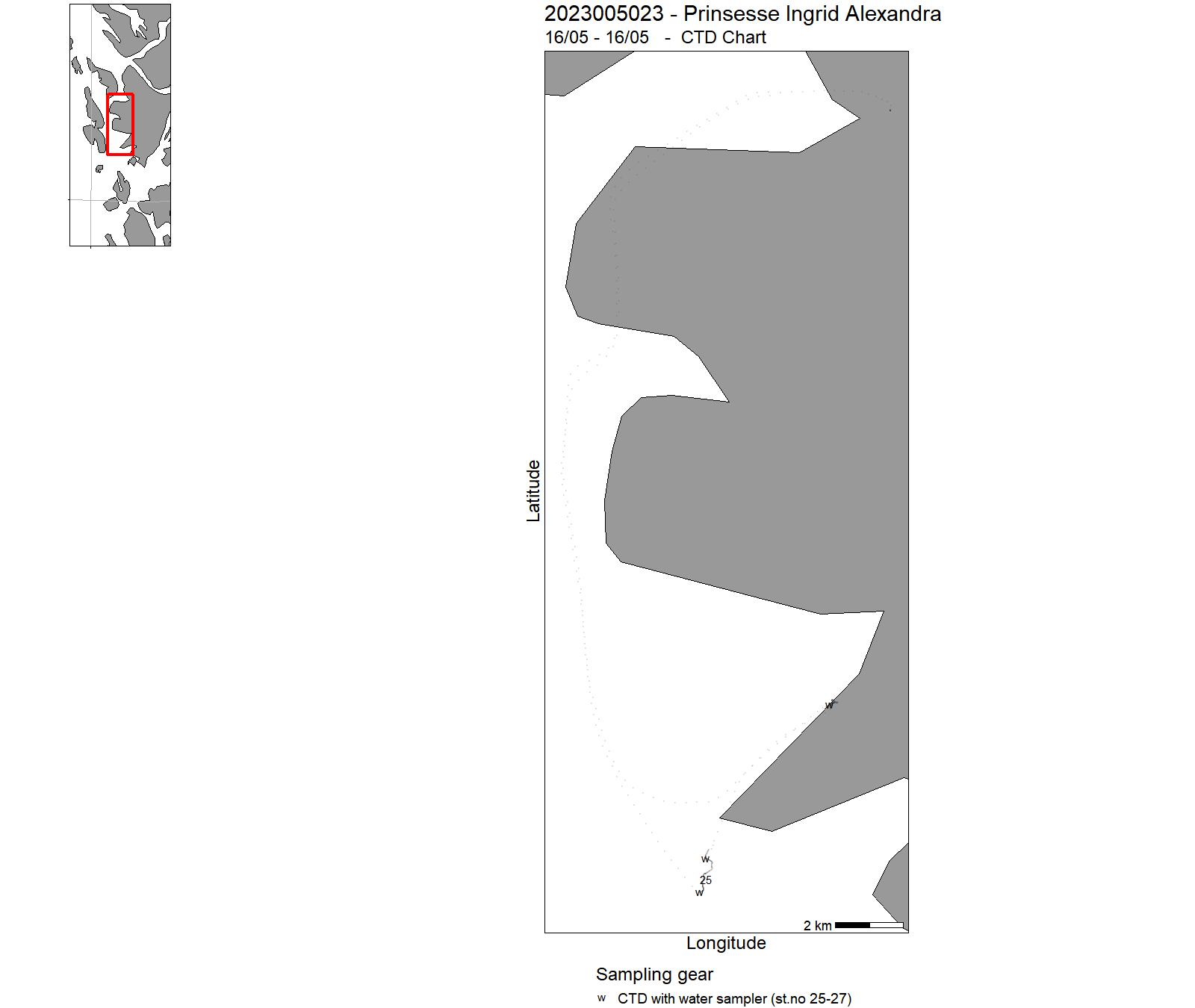
| 2023005023 | 16/05 - 16/05 | One 1-day cruise in the fjords around Bergen to collect zooplankton and water samples. Target biological group : pelagic hydrozoa (siphonophores and hydromedusae). | North Sea | 25-27 | - |
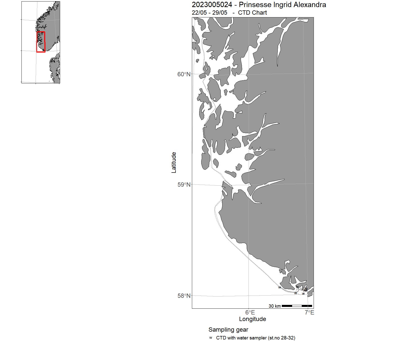
| 2023005024 | 22/05 - 29/05 | Providing collections and samples for the project Mapping and DNA barcoding the brown algal diversity within the orders Ectocarpales, Ralfsiales and Sphacelariales in Norway, funded by the Norwegian Biodicverity Centre. | North Sea | 28-32 | - |
| 2023005025 | 27/07 - 31/07 | Garn-Ruse uttesting - bestandsundersøkelser av kysttorsk | Norskekysten | - | - |
18 - "Prinsesse Ingrid Alexandra" Charts for 2023
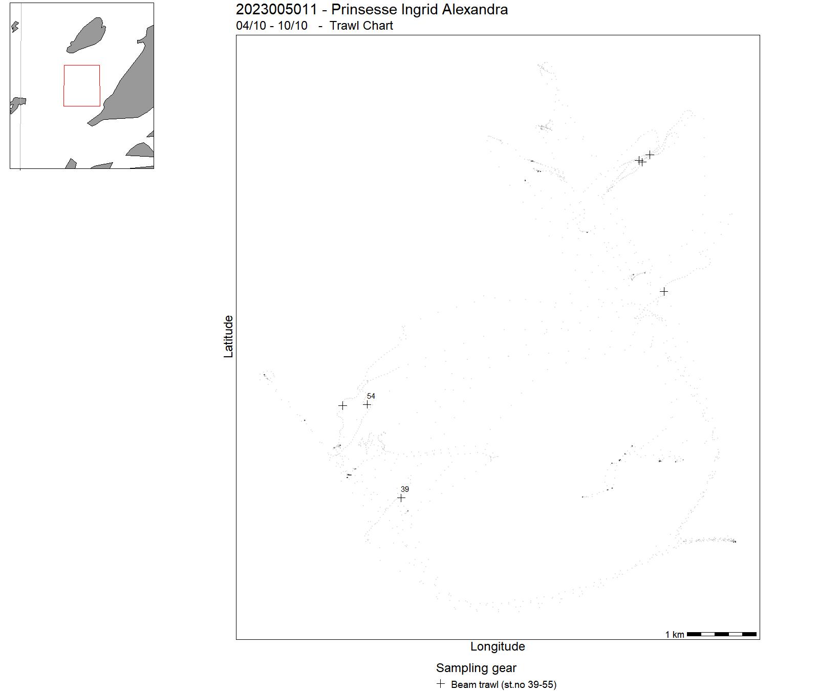
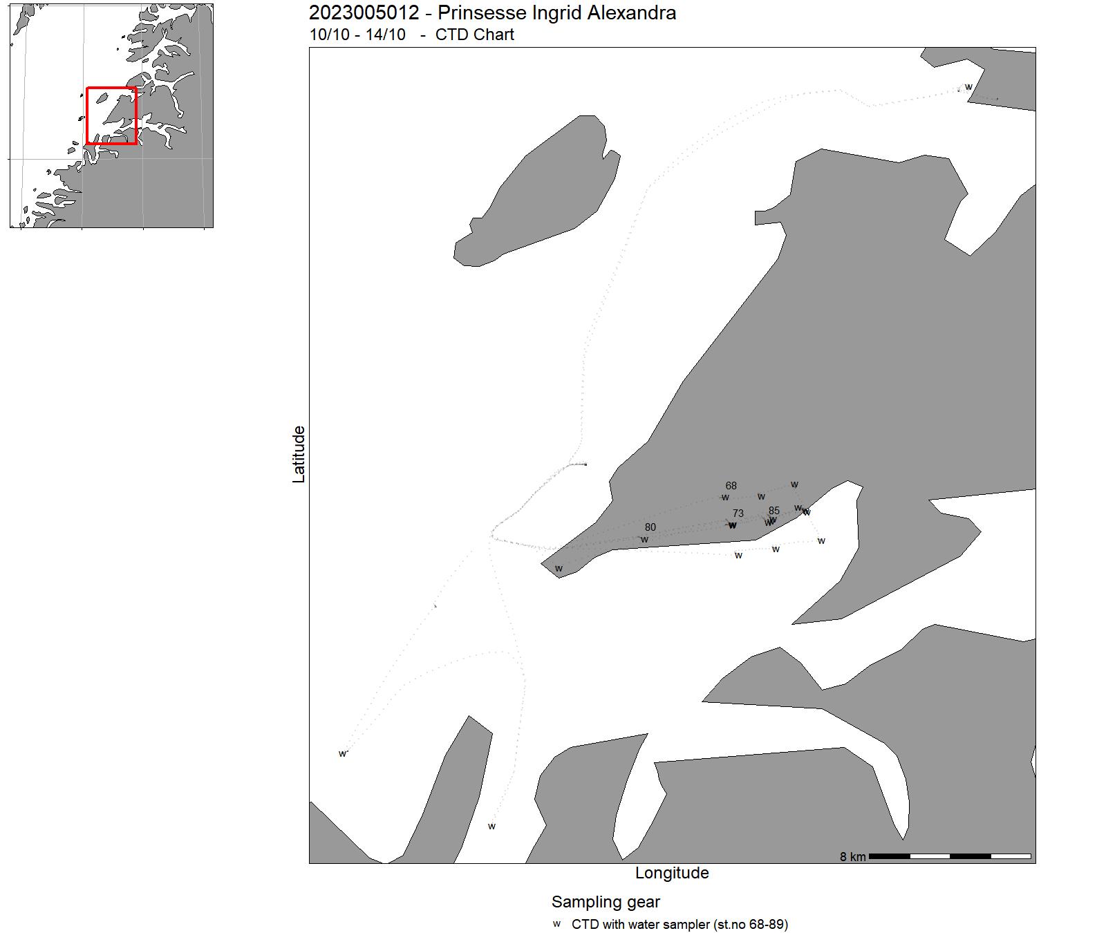
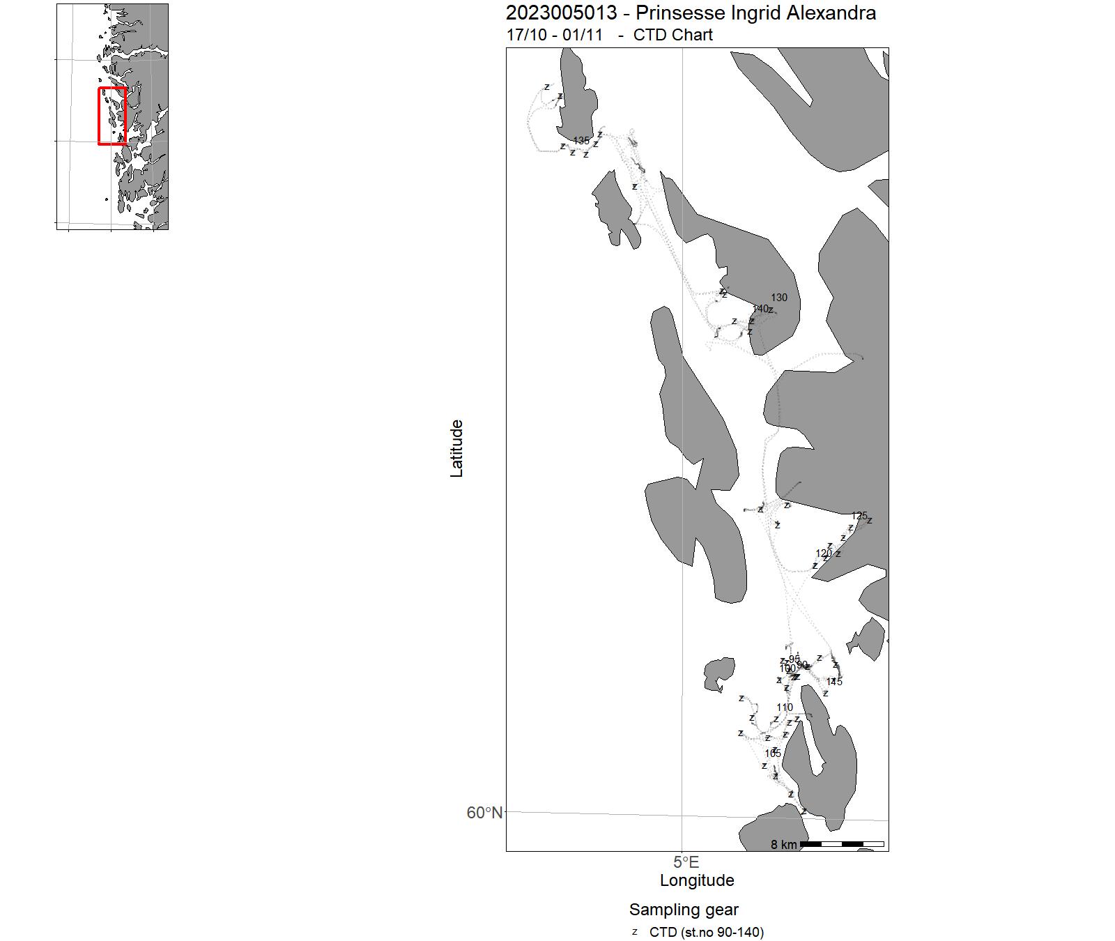
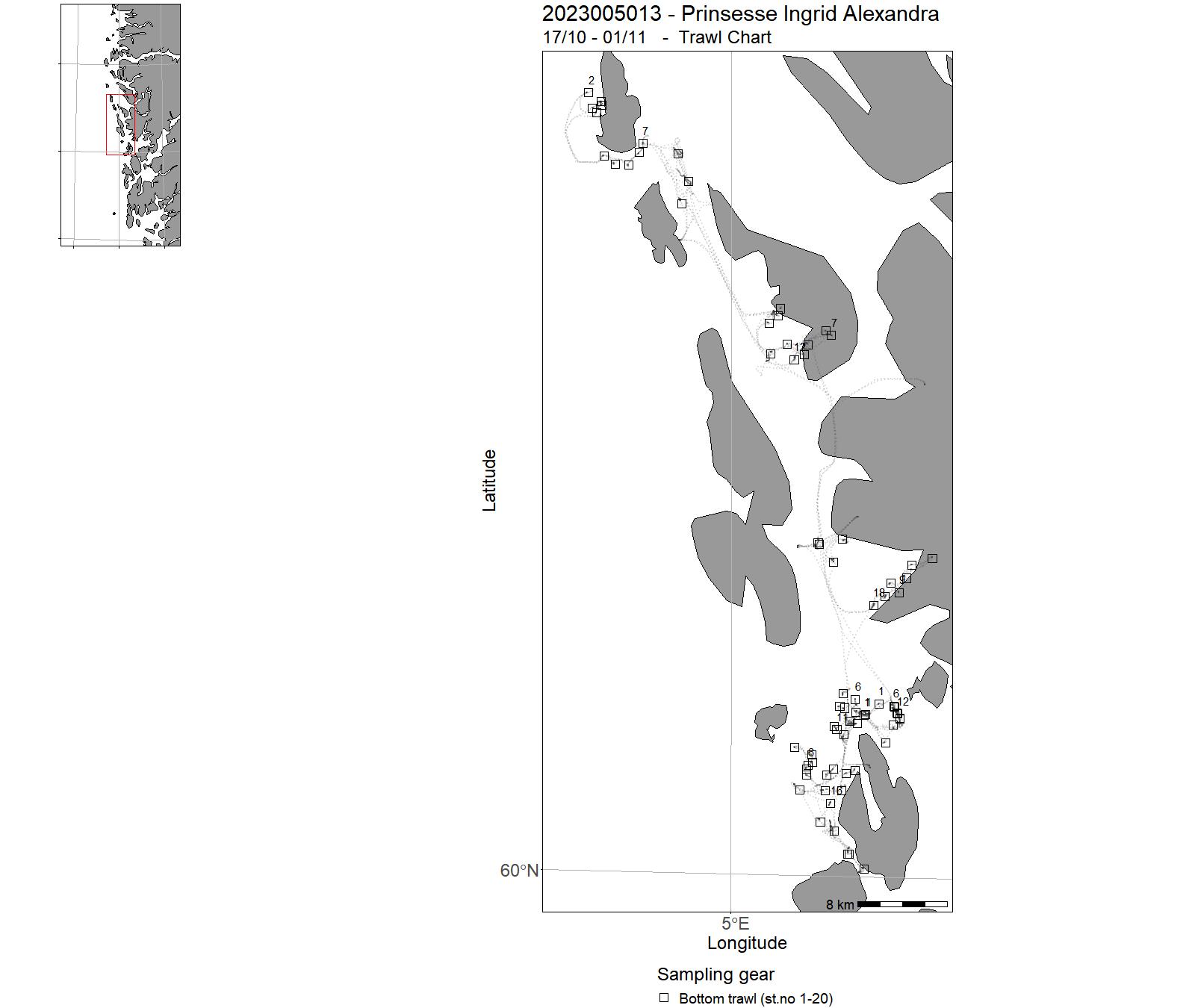
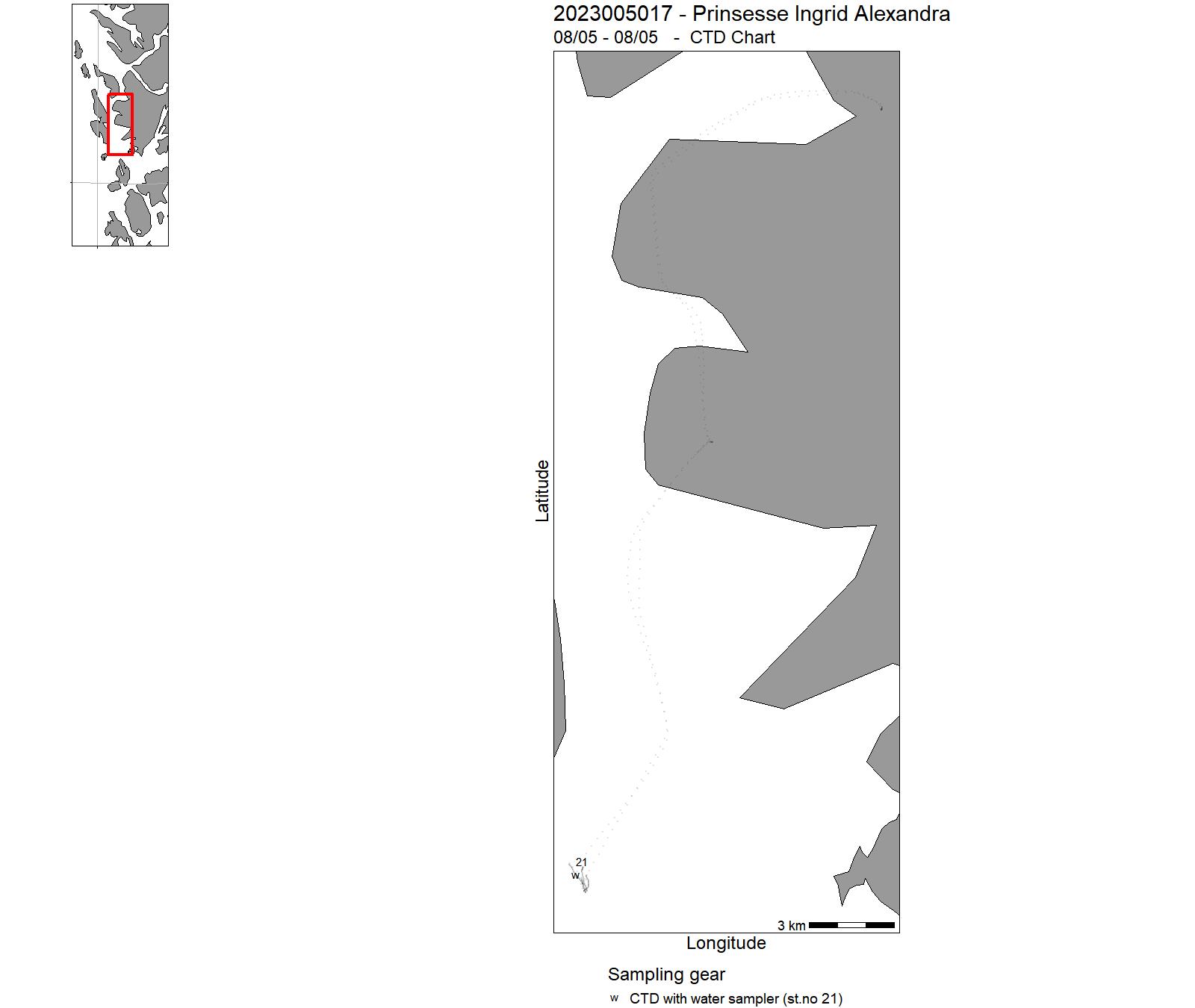
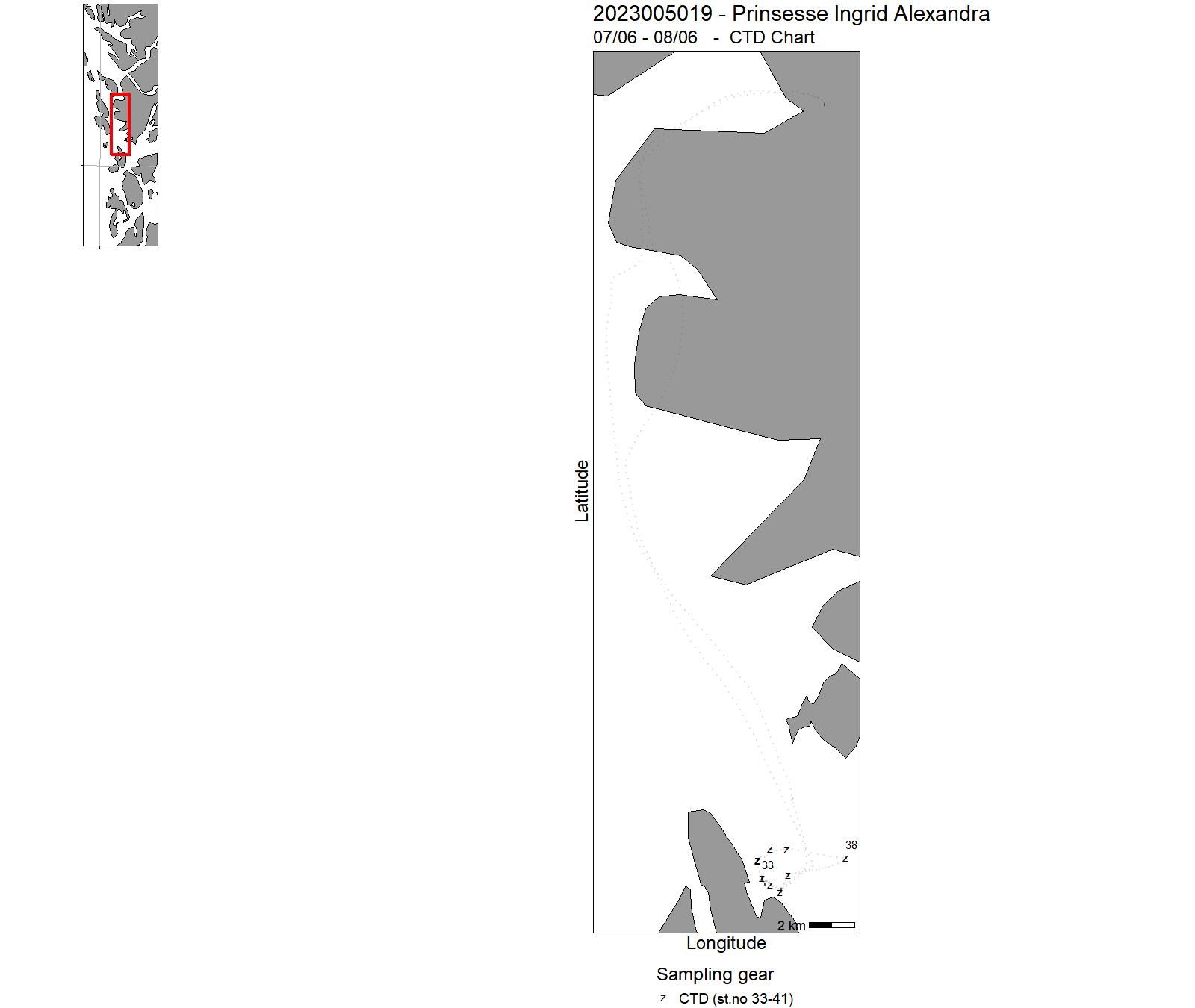
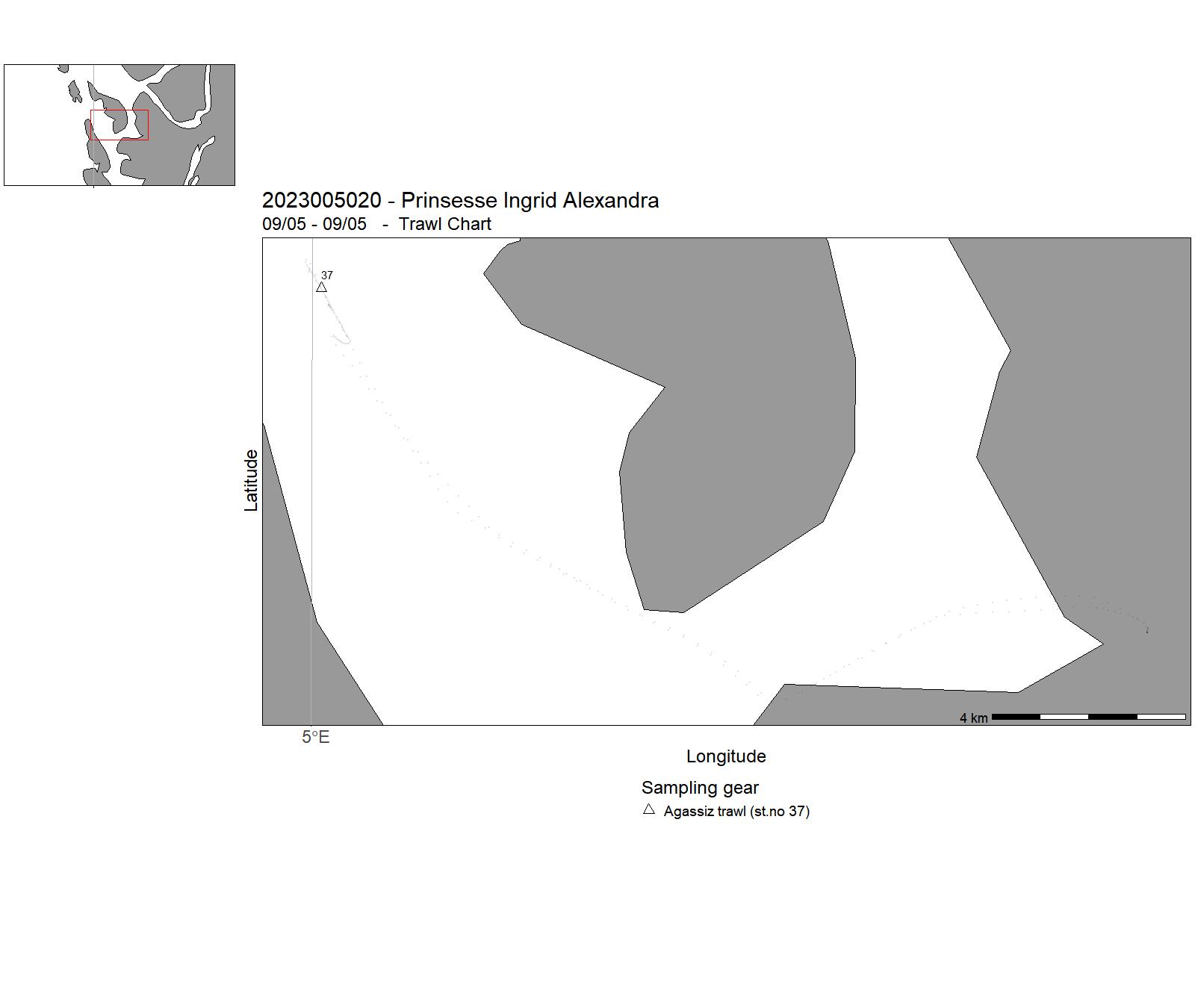
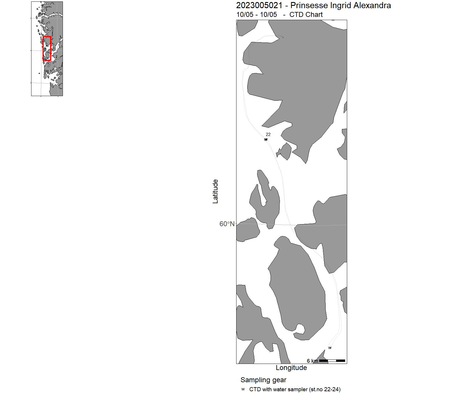
19 - Hired vessels – Cruises 2023
| Cruise no | Period | Purpose | Area | CTD st.no | Trawl st.no |
| 2023200002 | 23/01 - 24/02 | Gjennomføre årlige tokt (siden 2011) for å samle inn akustiske og biologiske data på krill, annen macrozooplankton samt data om krillpredatorer fra CCAMLR subarea 48.2 i Sørishavet. | Sørishavet | - | - |
| 2023200003 | 22/01 - 02/04 | Prøvetaking av kommersielle fangstar av bunnfisk (særleg torsk, sei, hyse, blåkveite, uer) landa på strekninga Helgeland-Varanger. Prøvetaking 180 døgn per år fordelt på alle kvartal, men med hovudvekt på 1 og 2 kvartal. | Norskekysten | - | - |
| 2023200005 | 20/03 - 27/03 | Oppfølgingsstudie av forundersøkelsene av fiskefordeling og fangstrater ved Hywind Tampen som ble gjennomført i mars 2022 før utbygging av vindkraftverket var påbegynt. Dette toktet blir en tilsvarende studie av forholdene i området under konstruksjon av anlegget. For å få sammenlignbare data er det viktig at vi bruker samme metode (gradient studie med garn og akustikk) som i forundersøkelsene i 2022 . | - | - | - |
| 2023200006 | 25/04 - 07/05 | This survey supports activities in CRIMAC that aim to develop improved sampling tools and methods for scientific surveys and commercial fisheries. Scantrol Deep Vision AS (partner in CRIMAC) is developing a version of the DV camera system for commercial fisheries. The long-term aim is to develop a system that identifies catches entering the trawl and when needed unwanted fish can be released by opening and closing the codend. | Norskekysten: Troms og Finnmark | - | - |
| 2023200007 | 11/04 - 14/05 | Prøvetaking av kommersielle fangstar av bunnfisk (særleg torsk, sei, hyse, blåkveite, uer) landa på strekninga Helgeland-Varanger. Prøvetaking 180 døgn per år fordelt på alle kvartal, men med hovudvekt på 1 og 2 kvartal. | Norskekysten | - | - |
| 2023200009 | 02/05 - 14/05 | Estimering av totalseleksjon, seleksjon på bunn og seleksjon i overflaten med konvensjonell snurrevadsekk. Det tas tre hal etter hverandre i samme område: 1. Hal med småmasket sekk slik at det ikke foregår noen seleksjon, hverken på fiskedyp eller i overflate (kontroll). 2. Hal med kvadratmaskesekk, uten bruk av utløser (seleksjon vil foregå både på fiskedyp og i overflate). 3. Hal med kvadratmaskesekk (testsekk) med utløser og småmasket pose bak, utløsing på 30 m dyp (seleksjon vil kun kunne foregå på fiskedypet, ikke i overflaten). | Barentshavet | - | - |
| 2023200013 | 02/06 - 15/06 | This research project is a collaboration between projects ParaZoo (PI Luis Martell, funded by Artsdatabanken) and Pole2Pole (PI Joan Soto, funded by EU). We will study zooplankton parasites and their gelatinous hosts. | Norskekysten | - | - |
| 2023200016 | 10/08 - 31/08 | Årlige bestandstellinger av steinkobber langs norskekysten. Undersøkelsene gjøres i steinkobbenes årlige hårfellingsperiode (august), som er den perioden steinkobbene bruker mest tid på land og derfor er tilgjengelig for telling. HI startet en ny tellesyklus langs norskekysten i august 2022, hvor vi dekket steinkobbelokalitetene i Viken, Vestfold /Telemark og Agder. | Norskekysten: Vestlandet | - | - |
| 2023200018 | 04/09 - 24/09 | Prøvetaking av kommersielle fangstar av bunnfisk (særleg torsk, sei, hyse, blåkveite, uer) landa på strekninga Helgeland-Varanger. Prøvetaking 180 døgn per år fordelt på alle kvartal, men med hovudvekt på 1 og 2 kvartal. | Norskekysten: Troms og Finnmark | - | - |
| 2023200019 | 04/09 - 30/09 | Formål: Prøvetaking av pigghå i norske kystfarvann, etablering av datagrunnlag for bestandsanalyse. Toktet inngår i HI's satsing på databegrenset bestandsanalyse. Det er et samarbeidstokt mellom Måløy videregående skole og Havforskningsinstituttet. | Norskekysten | - | - |
| 2023200023 | 05/10 - 31/10 | Estimere havertens ungeproduksjon i Nordland og Trøndelag | Norskekysten: Nordland | - | - |
| 2023200024 | 16/10 - 26/11 | Prøvetaking av kommersielle fangstar av bunnfisk (særleg torsk, sei, hyse, blåkveite, uer) landa på strekninga Helgeland-Varanger. Prøvetaking 180 døgn per år fordelt på alle kvartal, men med hovudvekt på 1 og 2 kvartal. | Norskekysten | - | - |
| 2023200028 | 06/01 - 10/01 | This survey supports the projects "By-catch of seabirds in coastal purse seine fisheries" (15590-05) and "Mitigation measures for whale - fishery interactions" (15590-04), both financed by FHF. | Norskekysten: Troms og Finnmark | - | - |
| 2023200030 | 21/08 - 03/09 | Taskekrabbe har spred seg nordover i Troms, men utbredelse og bestandstetthet har så langt ikke blitt kartlagt. Det er ukjent om taskekrabbe overlapper med kongekrabbe, som fortsetter å spre seg vestover og har sannsynligvis etablert lokale bestander i deler av Troms. Vi planlegger derfor å kartlegge krabbebestandene i Troms for å 1) undersøke utbredelse og tetthet av taskekrabbebestanden i forhold til fysikalske parametere, sammenligne resultatene med bestående data fra kystområder på Vestlandet til Trøndelag og bruke dataene i artsutbredelsesmodellering: 2) kartlegge lokale forekomster av kongekrabbe i sørvestlige deler av Troms: 3) bestemme mulig overlapp mellom de to artene: 4) etablere et datagrunnlag for å lage bestandsindikatorer for krabber i et viktig område for fiske- og havbruksnæringen. | Norskekysten: Troms og Finnmark | - | - |
| 2023200031 | 11/04 - 15/04 | Fritids- og turistfiske i Andfjorden. Del 1. | Norskekysten: Nordland | - | - |
| 2023200032 | 22/05 - 26/05 | Fritids- og turistfiske i Andfjorden. Del 2. | Norskekysten: Nordland | - | - |
| 2023200033 | 18/07 - 23/07 | Fritids- og turistfiske i Andfjorden. Del 3. | Norskekysten: Nordland | - | - |
| 2023200034 | 25/09 - 30/09 | Fritids- og turistfiske i Andfjorden. Del 4. | Norskekysten: Nordland | - | - |
| 2023200035 | 27/05 - 30/05 | SpawnSeis SPARKER | Norskekysten | - | - |
| 2023200036 | 08/08 - 19/08 | Årlig Miljøovervåking av hardbunn i programmet ""Økokyst"" på oppdrag fra Miljødirektoratet for rapportering etter vannforskriften. Registrering av alger og dyr på 10 dykkestasjoner i 2023 med minimum 2 dykk per stasjon langs kysten fra Grimstad til Moss til Hvaler. | Norskekysten: Sør- og Østlandet | - | - |
| 2023200037 | 25/09 - 28/09 | Garn serie indre kyst | - | - | - |
| 2023200038 | 02/10 - 05/10 | Bestandsundersøkelser av kysttorsk m.m. ved hjelp av garn/ ruse | - | - | - |
| 2023201001 | 23/03 - 05/04 | Fish and tag Atlantic cod with acoustic telemetry tags in Langfjord and Frakkfjord in Loppa for SalCod project. | Norwegian Sea | - | - |
| 2023201002 | 18/04 - 07/05 | The goal of the cruise is to monitor kelp forest conditions and effects of kelp harvesting along the west coast of Norway (from Rogaland to Vestland) in the project «Ressurovervåking - tare». | Northeast Atlantic Ocean (40W) | - | - |
| 2023201003 | 02/06 - 11/06 | The goal of the cruise is to monitor kelp forest conditions along the southwest coast of Nordland county (from the Trøndelag border in the south to the Vega island in the north) in the project «Ressursovervåking - tare». | Northeast Atlantic Ocean (40W) | - | - |
| 2023201004 | 19/06 - 28/06 | The objective of the cruise was to test the performance a modified salmon trap (trap-net, pound net) to catch pink salmon in the sea. | Northeast Atlantic Ocean (40W) | - | - |
| 2023201005 | 05/08 - 01/09 | Coverage of groth areas for costal cod. | Norwegian Sea | - | - |
| 2023201006 | 08/07 - 15/07 | Benthic sampling around Bergsfjord area in conjunction with WP4 of SalCod project | Norskekysten: Troms og Finnmark | - | - |
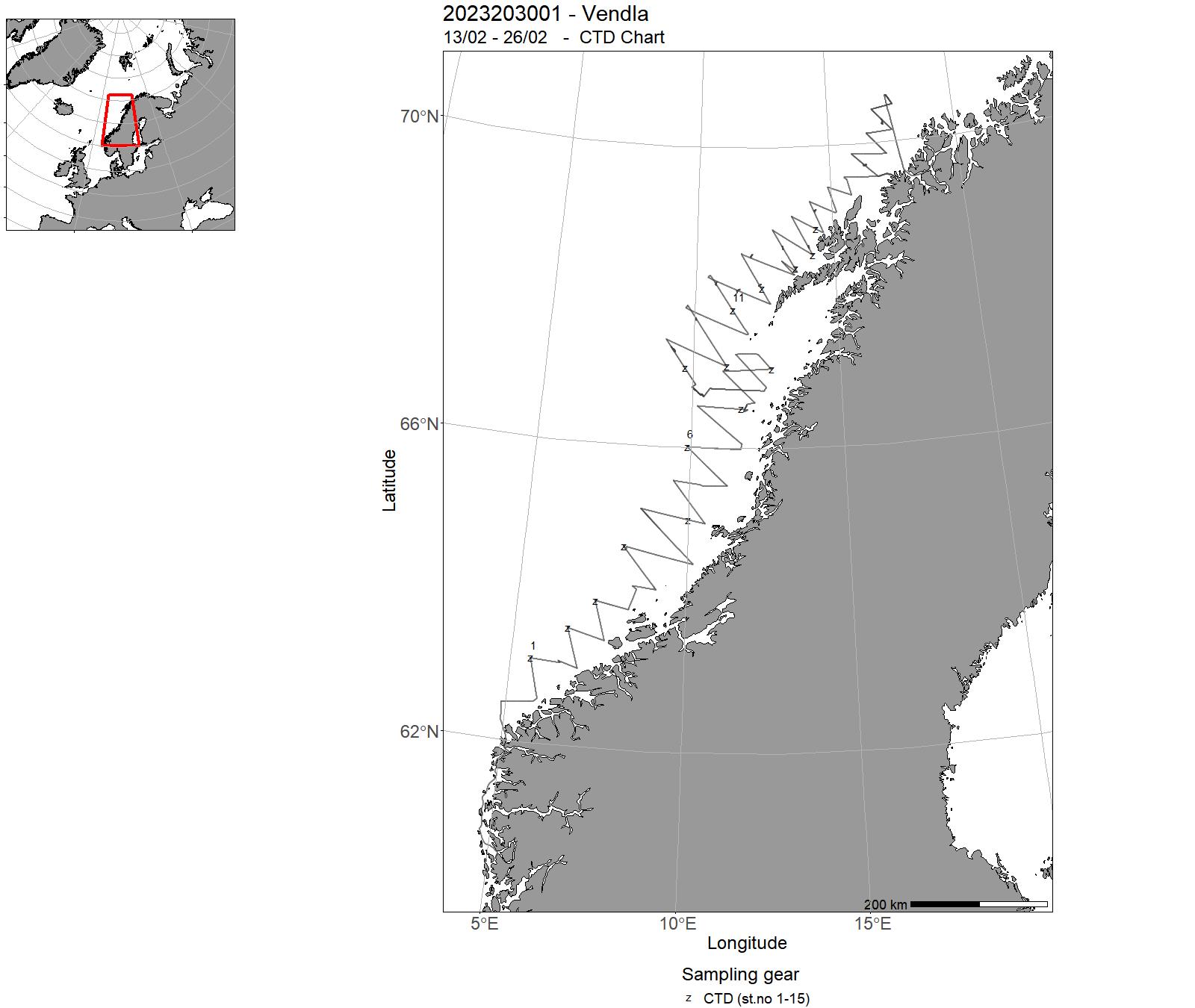
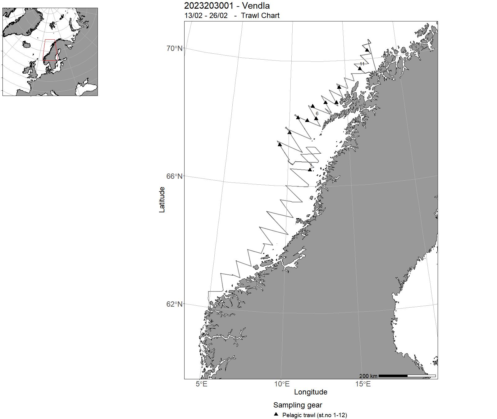
| 2023203001 | 13/02 - 26/02 | Collection of acoustic data from echo sounder for biomass estimation of herringCollection of biological samples for estimation of species and size composistion in the acoustic observations Collection of hydrographic data (CTD) | Norwegian Sea | 1-15 | 1-12 |
| 2023203002 | 17/03 - 03/04 | International blue whiting spawning stock survey. Acoustic survey to monitor the spawning stock of blue whiting on the spawning grounds west of the British Isles. | Northeast Atlantic Ocean (40W) | 16-46 | 31-48 |
| 2023203003 | 04/07 - 04/08 | Trawl survey to monitor the stock of Atlantic mackerel using swept area methodology. Acoustic survey to monitor the spawning stock of Norwegian spring spawning herring and the stock of blue whiting in the Nordic Seas. Ecological studies (temperature, plankton, whale observations) in relation to pelagic fish. | Norwegian Sea | 47-103 | 49-114 |
| 2023203029 | 26/02 - 09/03 | Testing of trawl-acoustic stock estimation of spawning capelin 2023 | Norskekysten: Troms og Finnmark | - | 13-30 |
| 2023204001 | 13/02 - 26/02 | Provide acoustic estimates of abundance and distribution of Norwegian spring spawning herring during the spawning migration along the Norwegian coast. | Norwegian Sea | 1-14 | 1-8 |
| 2023204002 | 04/07 - 04/08 | Swept-area pelagic trawl survey to monitor and produce annual abundance index for the stock of Atlantic mackerel using swept area methodology. Acoustic survey to monitor the spawning stock of Norwegian spring spawning herring and the stock of blue whiting in the Nordic Seas. Ecological studies (temperature, plankton, whale observations) in relation to pelagic fish. | Norwegian Sea | - | 14-70 |
| 2023205001 | 19/04 - 16/05 | Tagging with RFID technology and biological sampling of mackerel in the spawning areas west of Shetland and west of the Hebrides. | North Atlantic Ocean | - | - |
| 2023208001 | 21/11 - 08/12 | Catch and release tagging of Norwegian Spring Spawning herring with RFID tags on their wintering grounds. Herring are caught with a purse seine, pumped into holding tanks on the boat via a vacuum pump system. The fish are then measured for length and tagged with a RFID chip and released after tagging. | Norwegian Sea | - | - |
| 2023209001 | 21/06 - 11/08 | Telling av hval i perioden 2020-2025 med vågehval som målart, slik at vi i 2026 kan presentere et totalestimat for vågehval for Nordøstatlanteren til bruk i RMP. I 2023 skal Nordsjøen, forvaltningsområde EN, dekkes. | Nordsjøen | - | - |
| 2023211010 | 15/05 - 11/06 | Toktet har som hensikt å fange utvandrende vill laksesmolt som en del av den nasjonale overvåkningen på vill laksefisk. Laksesmolt fanges i ytre deler av utvalgte fjordsystem med en spesialbygget pelagisk trål | Norskekysten: Vestlandet | - | - |
| 2023212008 | 01/05 - 28/05 | Toktet har som hensikt å fange utvandrende vill laksesmolt som en del av den nasjonale overvåkningen på vill laksefisk. Laksesmolt fanges i ytre deler av utvalgte fjordsystem med en spesialbygget pelagisk trål | Norskekysten: Vestlandet | - | - |
| 2023213011 | 15/05 - 11/06 | Toktet har som hensikt å fange utvandrende vill laksesmolt som en del av den nasjonale overvåkningen på vill laksefisk. Laksesmolt fanges i ytre deler av utvalgte fjordsystem med en spesialbygget pelagisk trål | Norskekysten: Vestlandet | - | - |
| 2023213014 | 19/06 - 16/07 | Toktet har som hensikt å fange utvandrende vill laksesmolt som en del av den nasjonale overvåkningen på vill laksefisk. Laksesmolt fanges i ytre deler av utvalgte fjordsystem med en spesialbygget pelagisk trål | Norskekysten: Troms og Finnmark | - | - |
| 2023216026 | 24/04 - 05/05 | Teineundersøkelsene av sjøkreps i Frohavet startet som en del av prosjektet Aktiv Forvaltning, med mål om å følge bestandsutviklingen i og utenfor et verneområde. Et slikt verneområde er ennå ikke etablert. | Norskekysten: Trøndelag/Møre | - | - |
| 2023219001 | 14/03 - 22/03 | Når kolmulestimene som det fiskes på er tette, hender det at hundredvis av tonn kommer inn i trålen i løpet av kun få minutter. Det er derfor behov for å kunne regulere fangstmengde på en mer effektiv måte enn bare ved bruk av sensorer (tråløye ogfangstsensorer på pose). Dette fordi det ofte står mye fisk igjen fremover i trålen når en begynner å hive, samt at en fortsetter å fiske under første del av hivingen når det er store, tette stimer. | Atlanterhavet NØ | - | - |
| 2023220001 | 03/03 - 19/03 | Når kolmulestimene som det fiskes på er tette, hender det at hundredvis av tonn kommer inn i trålen i løpet av kun få minutter. Det er derfor behov for å kunne regulere fangstmengde på en mer effektiv måte enn bare ved bruk av sensorer (tråløye ogfangstsensorer på pose). Dette fordi det ofte står mye fisk igjen fremover i trålen når en begynner å hive, samt at en fortsetter å fiske under første del av hivingen når det er store, tette stimer. | Atlanterhavet NØ | - | - |
| 2023222001 | 09/10 - 23/10 | Føremålet med toktet er å undersøke forekomst av kysttorsk og andre arter på gruntvatn langs Norskekysten frå Nordland til Ryfylke. Vidareføring av tidsserie. Fisket foregår med finmaska trollgarn og åleruser. Er spesielt viktig for å kartlegga rekruttering av kysttorsk m.m. | Norskekysten: Vestlandet | - | - |
20 - Hired vessels – Charts for 2023
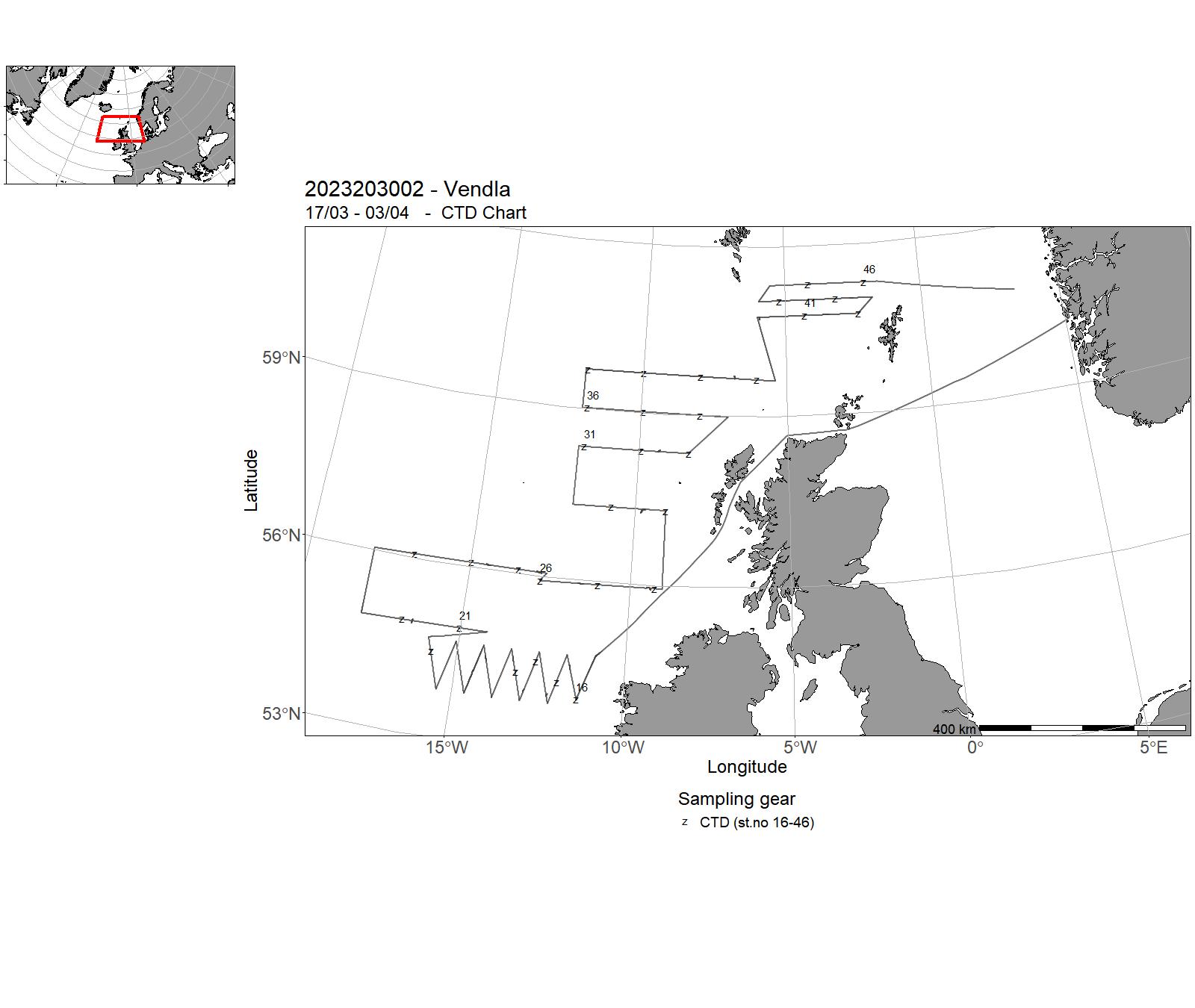
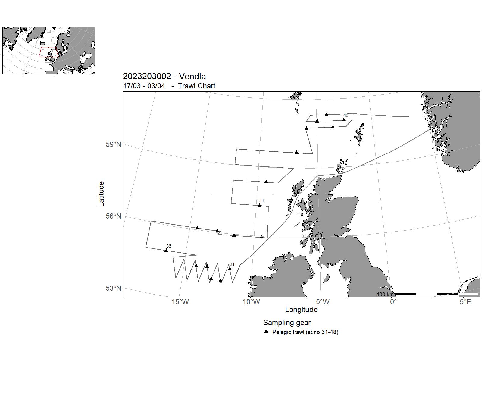
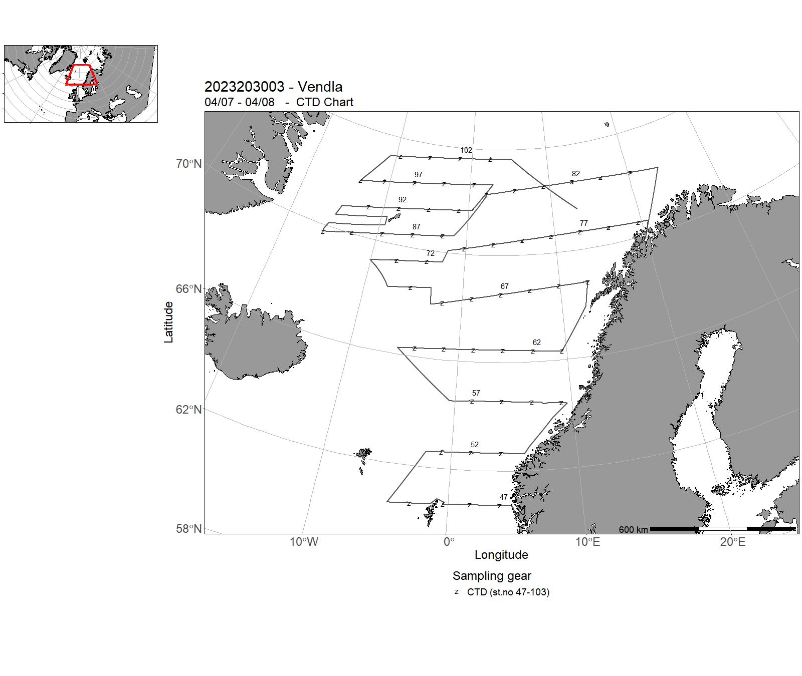
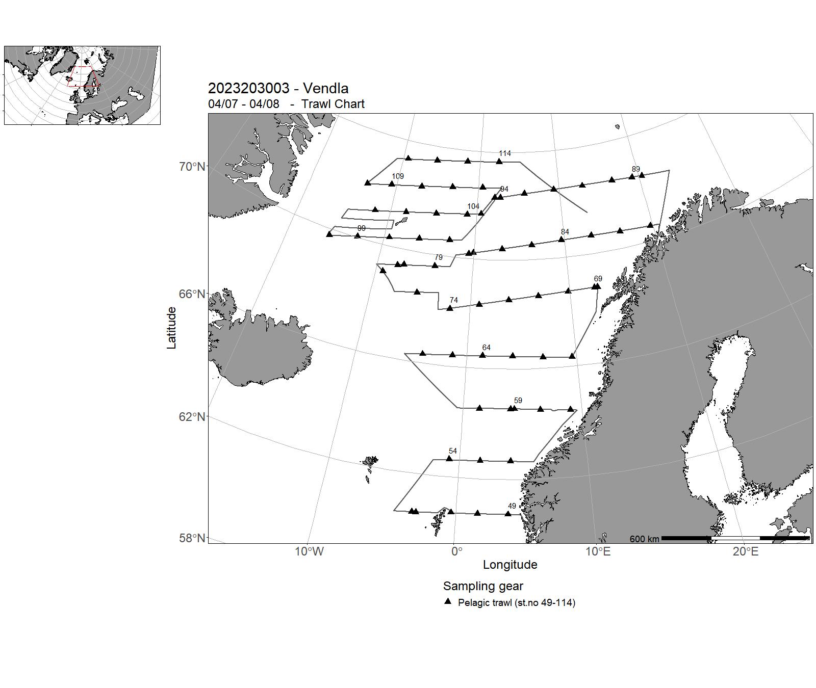
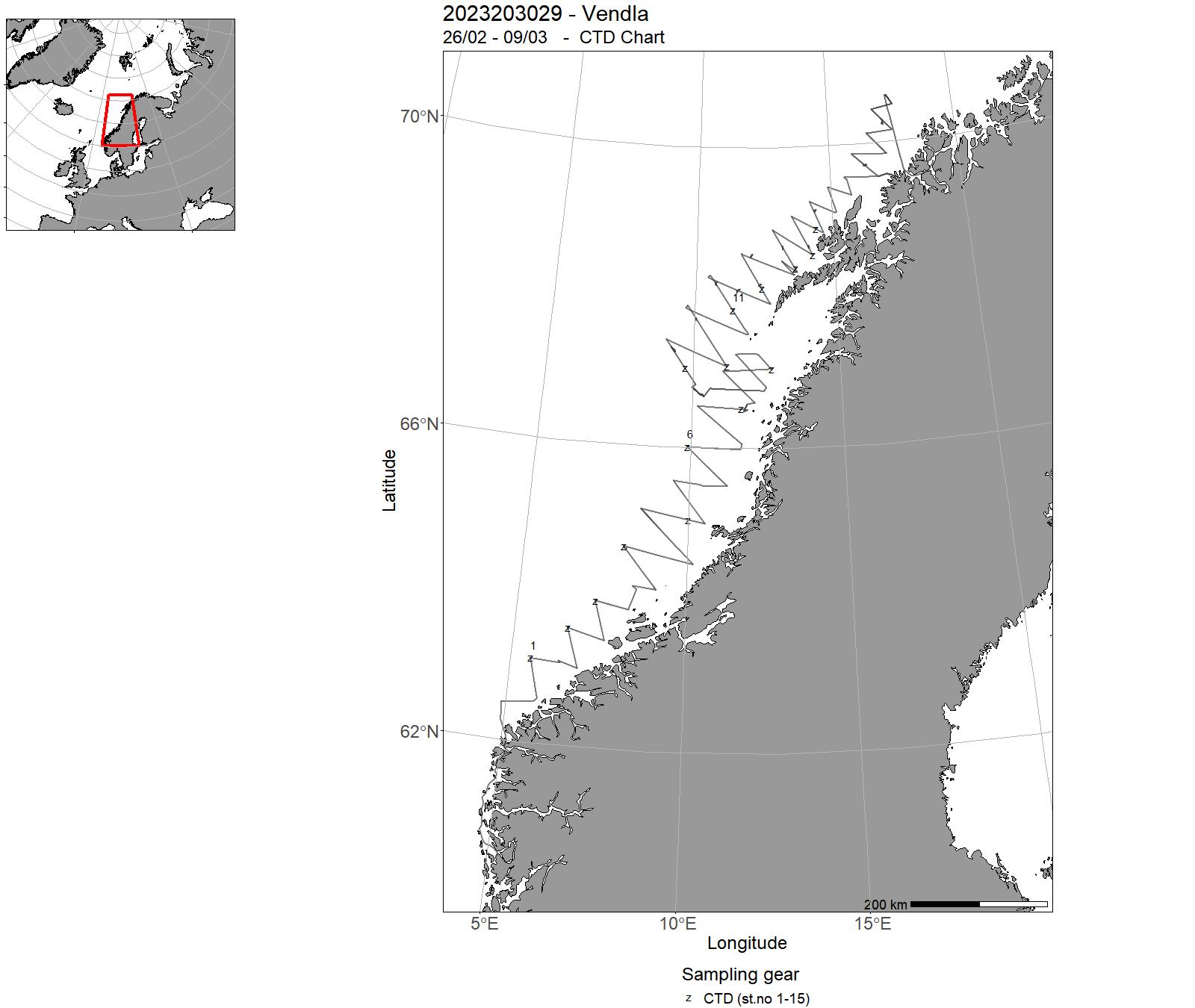
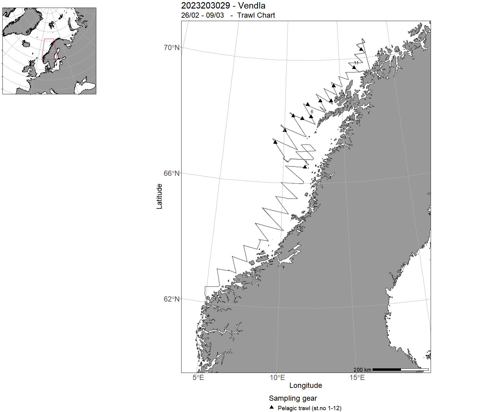
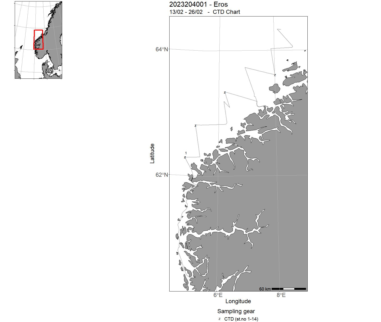
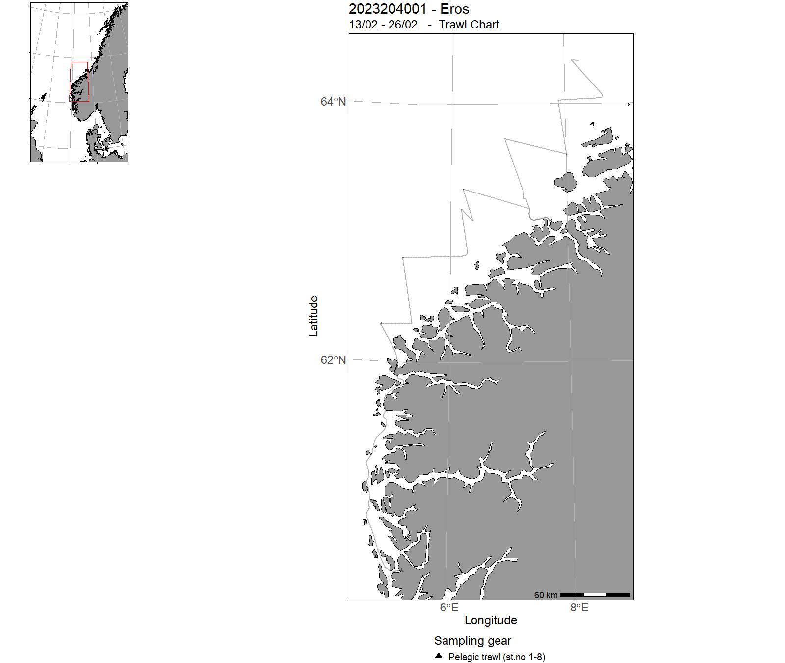
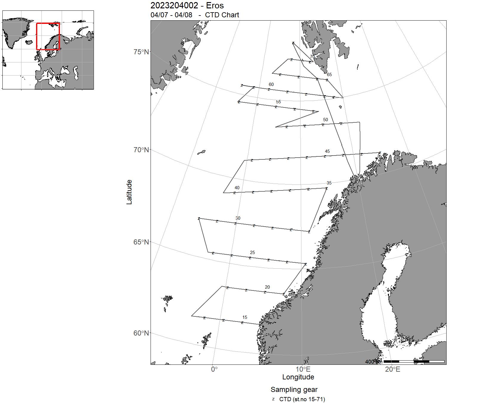
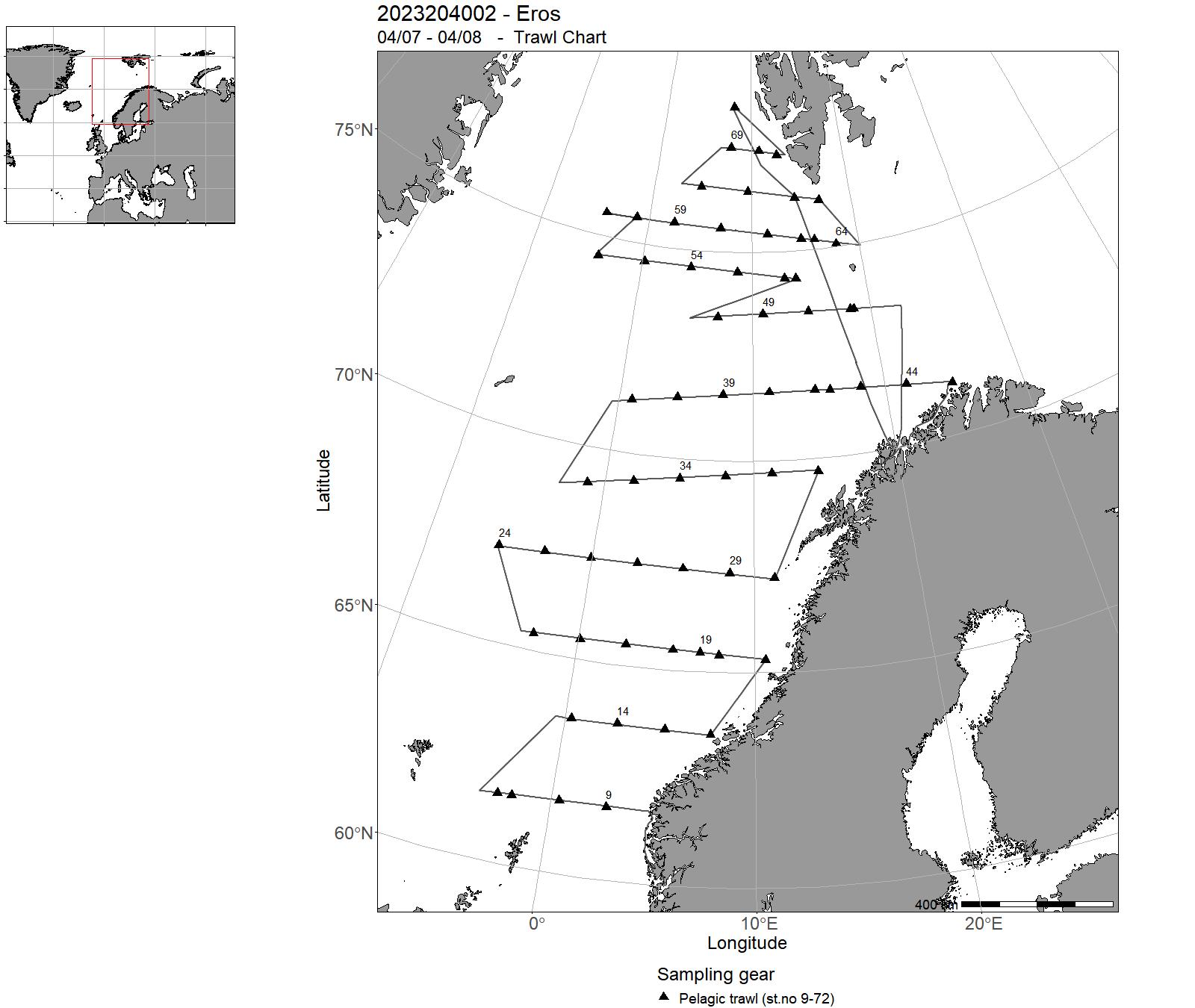
21 - USV – Cruises 2023
| Cruise no | Period | Purpose | Area | CTD st.no | Trawl st.no |
| 2023000001 | 21/08 - 25/08 | Gjennomføre akustiske-trål brilsingtokt i Hardangerfjorden der EK80 data samles inn med USV Sounder, USV Kajakk Drone og FF Kristine Bonnevie (KB). Biologisk prøvetaking vil skje fra KB. Det er også en målsetning å undersøke om det er plattformavhengige forskjeller i akustiske tettheter og vertikalfordelinger av brisling. I tillegg vil det gjennomføres kursing av HI-personell for navigering av Sounder samt gjennomføre rekkeviddetester av MBR. | Norskekysten: Vestlandet | - | - |
| 2023000002 | 21/08 - 25/08 | Gjennomføre akustiske-trål brilsingtokt i Hardangerfjorden der EK80 data samles inn med USV Sounder, USV Kajakk Drone og FF Kristine Bonnevie (KB). Biologisk prøvetaking vil skje fra KB. Det er også en målsetning å undersøke om det er plattformavhengige forskjeller i akustiske tettheter og vertikalfordelinger av brisling. I tillegg vil det gjennomføres kursing av HI-personell for navigering av Sounder samt gjennomføre rekkeviddetester av MBR. | Norskekysten: Vestlandet | - | - |
| 2023301001 | 24/10 - 24/10 | Frigg USV | - | - | - |
| 2023301002 | 16/11 - 21/11 | Frigg USV | - | - | - |
22 - Oceanographic sections and Fixed oceanographic stations map
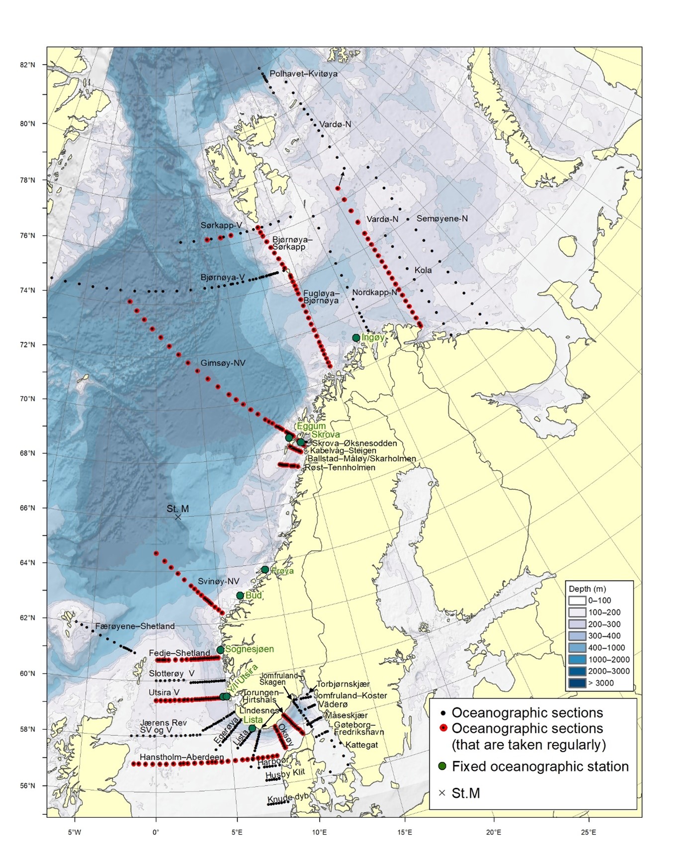
23 - Tables – Observations in 2023. Oceanographic sections and fixed oceanographic stations
| Oceanogr. sec. | Jan | Feb | Mar | Apr | May | Jun | Jul | Aug | Sep | Oct | Nov | Dec |
| North Sea | ||||||||||||
| Fedje–Shetland | 2023002006 | |||||||||||
| Slotterøy-West | 2023002006 | |||||||||||
| Utsira-West | 2023002001 | 2023002006 | 2023006013 | |||||||||
| Jærens Rev-SW and W | 2023002006 | |||||||||||
| Egerøya-SW | 2023002006 | |||||||||||
| Lista-SW | 2023002006 | |||||||||||
| Lindesnes-SSW | 2023002006 | |||||||||||
| Hanstholm–Aberdeen | 2023002001 | 2023002006 | 2023006013 | |||||||||
| Harboør | 2023002006 | |||||||||||
| Hysby Klit | 2023002006 | |||||||||||
| Knude-Dyb | 2023002006 | |||||||||||
| Oceanogr. sec. | Jan | Feb | Mar | Apr | May | Jun | Jul | Aug | Sep | Oct | Nov | Dec |
| Skagerrak and Kattegat | ||||||||||||
| Torungen–Hirtshals | 2023003001 | 2023003002 | 2023003003 | 2023003006 | 2023002006,2023003008 | 2023003009 | 2023003010 | 2023003011 | 2023003014 | 2023003016 | 2023003017 | 2023003019 |
| Oksøy–Hanstholm | 2023002006 | |||||||||||
| Jomfruland–Skagen | 2023002006 | |||||||||||
| Jomfruland–Koster | 2023002006 | |||||||||||
| Torbjørnskjær | ||||||||||||
| Väderø | 2023002006 | |||||||||||
| Måseskjær | 2023002006 | |||||||||||
| Gøteborg–Fredrikshavn | 2023002006 | |||||||||||
| Kattegat | ||||||||||||
| Oceanogr. sec. | Jan | Feb | Mar | Apr | May | Jun | Jul | Aug | Sep | Oct | Nov | Dec |
| The Norwegian Sea and Vestfjorden | ||||||||||||
| Svinøy-North/West | 2023002002 | 2023006005 | 2023002007 | 2023002010 | ||||||||
| Gimsøy-North/West | 2023006005 | 2023002007 | 2023002010 | |||||||||
| Bjørnøya-West | 2023002007 | 2023002010 | ||||||||||
| Sørkapp-West | ||||||||||||
| Færøyene–Shetland | ||||||||||||
| Skrova–Øksnesodden | ||||||||||||
| Kabelvåg–Steigen | ||||||||||||
| Ballstad– Måløy/Skarholmen | ||||||||||||
| Røst–Tennholmen | ||||||||||||
| Oceanogr. sec. | Jan | Feb | Mar | Apr | May | Jun | Jul | Aug | Sep | Oct | Nov | Dec | Nov | Dec |
| The Barents Sea | ||||||||||||||
| Fugløya–Bjørnøya | 2023002002 | 2023006005 | 2023006008 | 2023002007 | 2023002010 | |||||||||
| Vardø-North | 2023002011 | |||||||||||||
| Semøyene-North | ||||||||||||||
| Bjørnøya–Sørkapp | ||||||||||||||
| Nordkapp-North | ||||||||||||||
| Polhavet–Kvitøya | ||||||||||||||
| Kola | ||||||||||||||
| Fair Isle-Pentland | ||||||||||||||
| Fixed stations | Jan | Feb | Mar | Apr | May | Jun | Jul | Aug | Sep | Oct | Nov | Dec | Total |
| LISTA N58º 05,1' E06º 32,5' | 3 | 3 | 3 | 3 | 3 | 3 | 3 | 2 | 2 | 3 | 3 | 3 | 34 |
| UTSIRA Y N59º 19' E04º 44' | 4 | 3 | 5 | 4 | 3 | 4 | 4 | 3 | 3 | 5 | 4 | 4 | 46 |
| UTSIRA I N59º 19'E04º 59' | 4 | 3 | 5 | 4 | 5 | 4 | 4 | 3 | 3 | 5 | 4 | 4 | 48 |
| SOGNESJØEN N61º 01' E04º 50' | 1 | 1 | 1 | 2 | 2 | 2 | 2 | 4 | 1 | 3 | 1 | 20 | |
| BUD N62º 56' E06º 47' | 3 | 3 | 2 | 4 | 4 | 3 | 3 | 4 | 3 | 3 | 4 | 2 | 38 |
| SKROVA N68º 07' E14º 39' | 3 | 4 | 3 | 5 | 3 | 3 | 4 | 2 | 4 | 4 | 3 | 38 | |
| EGGUM N68º 23' E13º 38' | 4 | 1 | 4 | 3 | 5 | 4 | 5 | 4 | 3 | 5 | 4 | 4 | 46 |
| INGØY N71º 08' E24º 01' | 1 | 1 | 1 | 1 | 2 | 1 | 4 | 1 | 12 |
